There’s a very welcome north-south path being completed that runs beside the O-train tracks. I had to get to Brewer Arena for my sons game so I decided to test out the new path on the way there. Here’s how:
This is where the new path meets the Ottawa River Pathway, just before the old train bridge across the river.
New path splitting off to the left from the old path
A bit further on looking north one can see a coming together of three paths for different modes of transportation – train tracks leading to the steel bridge, the parkway overpass, and our brand new bike path. Now that’s progress!
Intersecting paths
As this next image taken from the path suggests, there is access between City Centre and Somerset St. by gonig under this City Centre concrete ramp.
Access between Somerset and City Centre
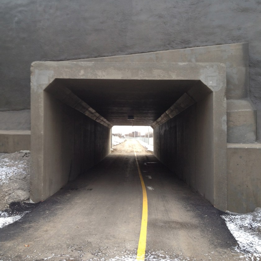
Then it’s under Somerset.
Tunnel under Somerset St
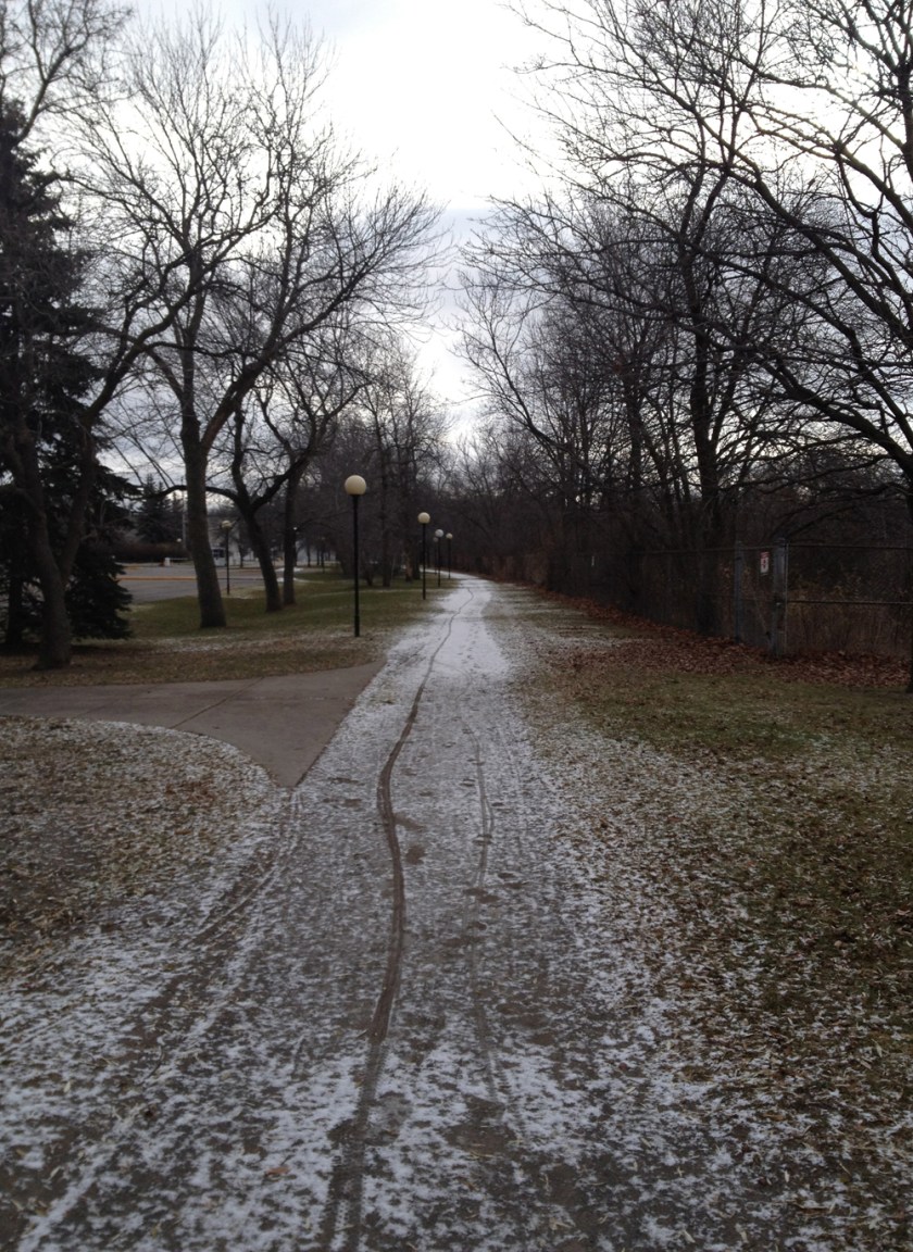
Just beyond the Queensway the new path joins one that has been there for a long time, and it looks like they are going to leave it in its original crushed gravel form, which would be fine. it’s always been a safe pleasant section of path.
Path south of the Queensway
Don’t know if they have any plans on dealing with how the path crosses Carling, but a crosswalk signal would be great.
Where the path meets Carling
Along Prince of Wales Drive you can see the man made chasm along which the O-train travels before dipping down under Dow’s Lake.
O-train tracks
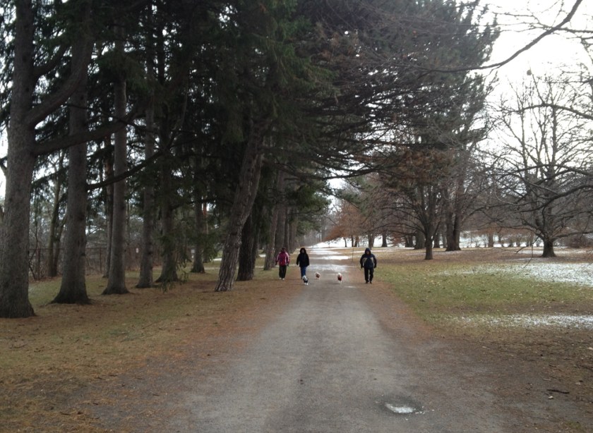
Here is the path through the Arboretum just off Prince of Wales. The train tracks are now to the left.
The arboretum looks great any time of the year. This last view is along the stream that feeds into the canal just beyond the small bridge in the distance.
My son had a hockey game out in Vanier last night, so I biked there. Here’s how.
Sandy Hill is full of big old beautiful houses. That’s because Louis Besserer, who owned most of it when Queen Victoria chose Ottawa as the capital in 1857, decided to develop Sandy Hill into THE place to live for rich folk like lumber barons, diplomats and politicians. And it worked. Laurier, MacDonald, Pearson and Mackenzie King each set up residence there at one time. Now a bunch of embassies have settled into a number of these old gems scattered throughout the area, like Poland, at 443 Daly Street, which looks great at night. They light their ornate front porch with its panelled copper ceiling to great effect.
Polish Embassy
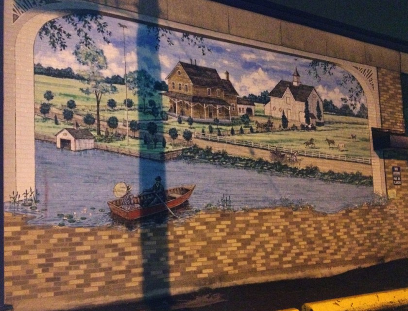
Biking along Montgomery Street in Vanier I noticed a mural on the side of this building, depicting how a Dr Harris’ property along the Rideau River might have looked like back in 1870.
Mural along Montgomery St
Then I noticed this very funky 60’s style canopy and decorative detail on the same side of the building that have survived the test of time.
Modernist details along Montgomery St
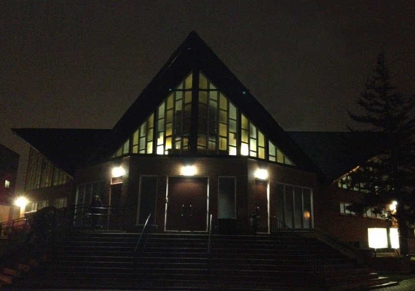
Just before I got to the arena I passed this modernist church on Cyr Avenue, graced with big panels of stained glass.
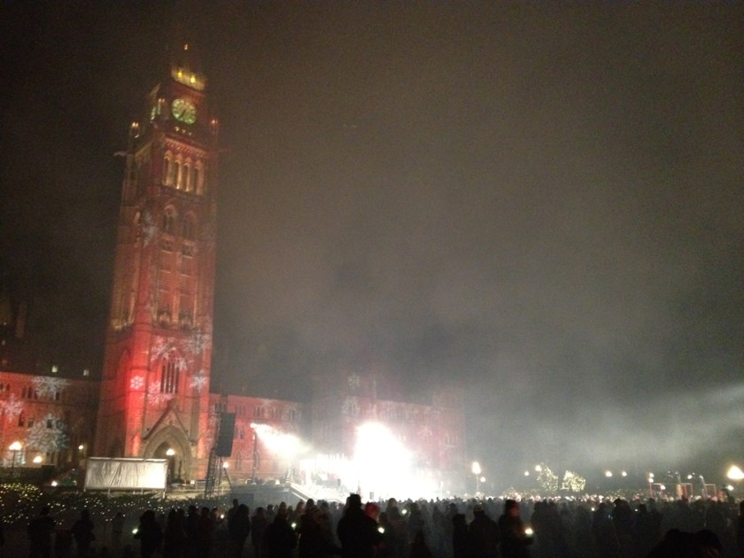
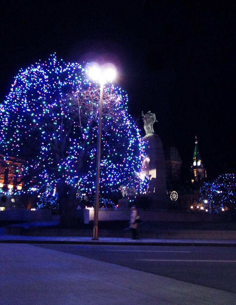
They turned on the annual Christmas lights display along Confederation Boulevard last night, so I checked them out! They will be on every night until January 7th.
Orange line is how I biked to Parliament Hill for the launch. Blue is the route I followed to see most of the official sites.
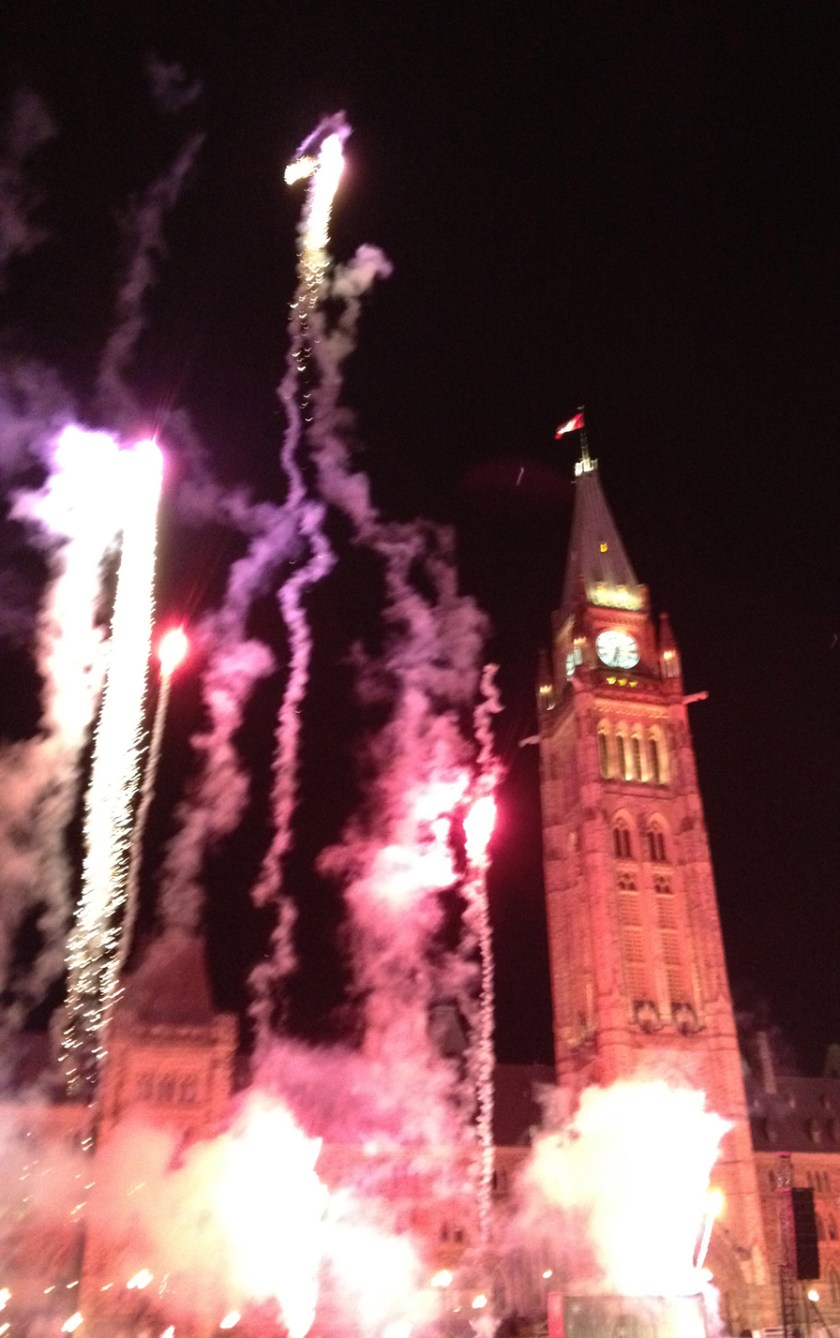
The flipping of the switch was launched with an explosion of mini fireworks.
BOOM!… as the smoke settles.
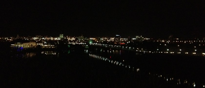
Now the route I’m proposing is full of splendid night time sceneries, with or without Christmas lights. The view from behind the Centre Block across the Ottawa River to Gatineau is one such example. Looking out across the river also gave me my first indication that they’ve considerably scaled back on the number of Christmas lights from previous years.
View across the Ottawa River to Gatineau
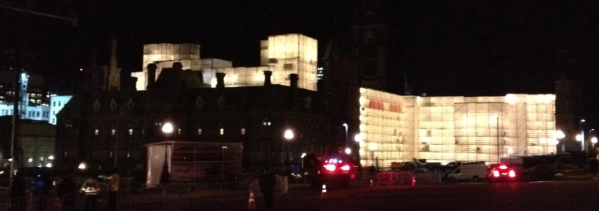
Major renovations are happening on the West Block. Whole sections are wrapped in scaffolding and tarp, creating these internally lit glowing cube structures.
West Block
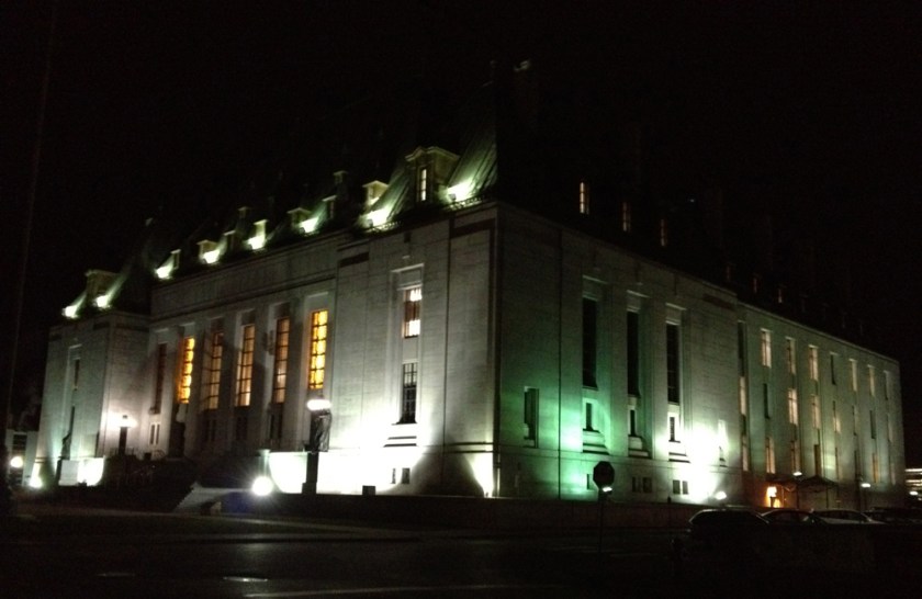
One used to be able to bike in front of the West Block, avoiding having to ride along Wellington, which is not a very bike friendly section of road. Hopefully once the the West Block renovations are completed they will lighten up with the crazy security and once again allow folks to access the hill from the west gate. Otherwise, the first opportunity to get off Wellington is opposite Bank Street, just beyond the closed off gates and line up of parked police cars. First left and a bit further along brings you alongside the wonderfully lit Supreme Court of Canada.
Supreme Court
Continuing straight ahead leads to these stairs down behind the Library and Archives building.
Behind the National Library
Riding around behind the archives building brings you to Wellington right where the designated bike lane begins. Now that’s the way to go!
On the other side of Portage Bridge dip down the bike path to the right where there are some great unimpeded views of the Hill.
View of Hill from Gatineau
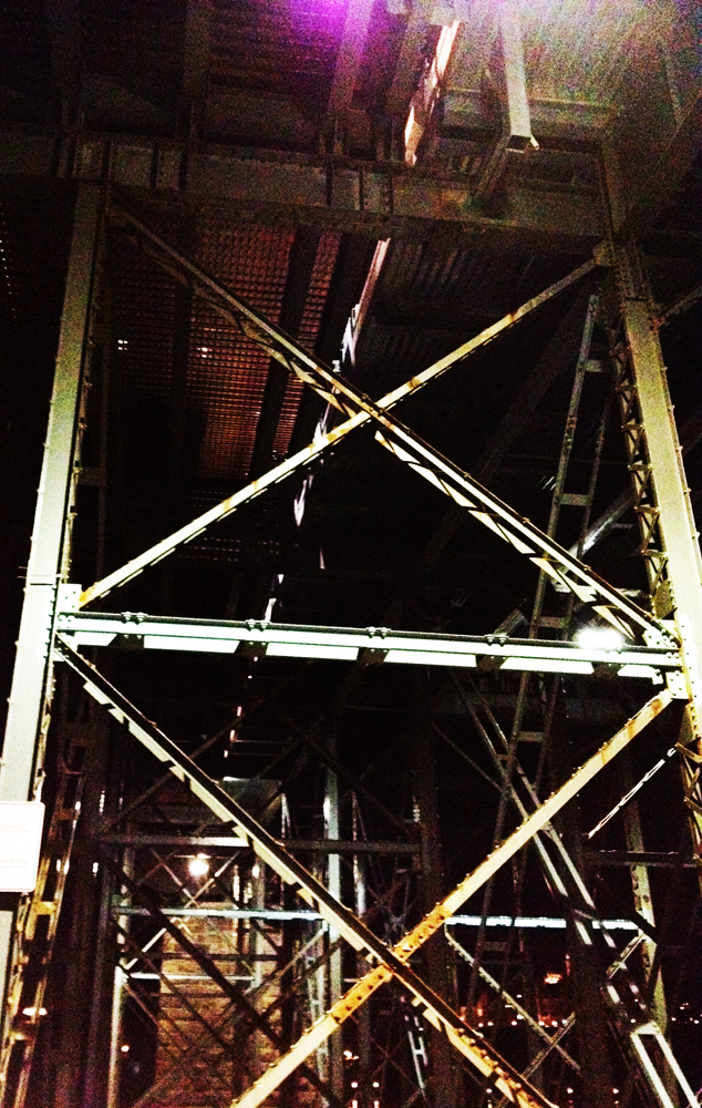
It’s pretty thrilling where the path crosses under the Alexandria Bridge. The whirring sound of the cars on the metal mesh road way above resonates all around you, while the beams from the headlights flash and flicker down through the steel girders.
Under Alexandria Bridge
Out in Jacques Cartier Park there are a few arrangements of lights, including this droopy bunch of red ones hanging way up in a couple of trees.
JCP
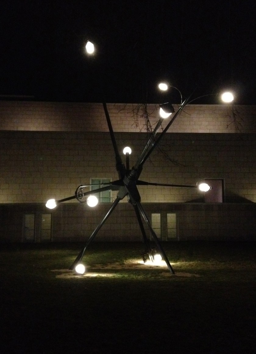
After crossing back over the Alexandria Bridge I turned up behind the National Gallery to re-visit this piece of outdoor sculpture, made up of a number of streetlights blown over by hurricane Katrina. Love it!
Majestic at night
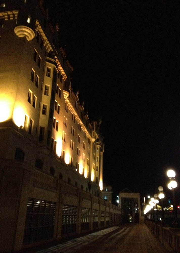
In previous years the trees of Majors Hill Park were filled with lights, but this year, nil. S’okay, still a nice ride along the edge of the cliff. Very pleased to discover the terrace above the canal was still accessible from the park to Wellington, affording this dramatic night time view of the Chateau Laurier. The terrace has been previously closed for the winter.
Look up, look way up…
The Cenotaph has lots of cool lights all around it.
Lights at the Cenotaph
Opposite the Cenotaph there is this arrangement of warm lights set against the Conference Centre.
Conference Centrte
The city has added Christmas lights to compliment the exuberantly lit walls of their outdoor rink in front of City Hall.
Rink of Dreams
I end the tour with this photo from Confederation Park looking towards the Lord Elgin Hotel.
Lights in Confederation Park
The only official Christmas Lights site I didn’t get to was the one out near the Governor Generals Residence. I will have to figure out a safe night time route that avoids the dangerous stretch of Sussex between the National Gallery and the External Affairs building.
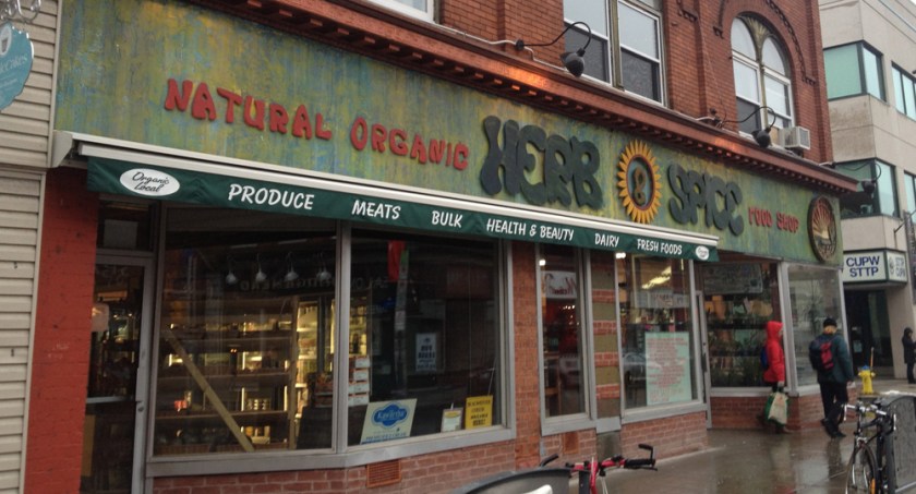
So, it’s Sunday morning, freezing rain, super slippery, and I’m out of rosemary to prepare a marinade. Got to get to Herb & Spice over on Bank, but how? Solution – studs! Whereas last week I was a convert to the concept of studded tires, today I am a full on Preacher Man! The only danger, as a fellow member of the Church-of-Holy-Studded-Rollers explained to me, is over confidence. He described people slipping and falling only after getting off their bikes upon arriving at their destination.
Here’s the safe route I followed to get across Centretown from Bronson to Bank. Blue line to get there, red to get back.
Heading east-west is safest along any street other than Somerset or Gladstone, providing you choose the proper one way direction. Heading south is best along the Percy Street bike lane.
Percy Street bike lane
Shiraz food store, located where Percy crosses Somerset, is fantastic for assorted nuts and other Iranian goodies. Their chicken is really good too.
Shiraz!
But I was on a hunt for rosemary and I knew I could count on Herb and Spice on Bank to have some. I was not disappointed.
Herb&Spice
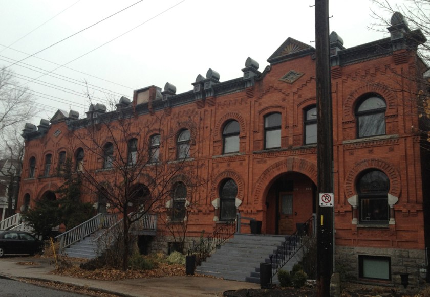
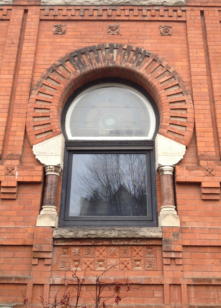
On the way back along James St there are a couple of architectural delights to take in. At Lyon and James is this wonderful row house called Hollywood Parade, built in 1892. Fantastic brickwork, and big round arches.
Hollywood Parade
At James and Bay sits the Power House, an example of the Prairie Style, from 1915.
Power House
I then followed the bike path along Bay and made my way home. Mission accomplished!
My friend John and I biked to the opening of The Number 14 at the GCTC on Wednesday night. If you are considering seeing this fun show about a bunch of eccentric characters riding the Number 14 bus through Vancouver, and are looking for a safe bike route to the theatre from Centretown, here you go!
We biked down Armstrong Street rather than ride along Wellington. That’s because the bike lane along Somerset over the O-train bridge disappears and is replaced with sharrows where Somerset becomed Wellington. I’m not a big fan of sharrows. They are those double V’s painted on the road that are supposed to tell drivers that bikes…. actually I’m not sure what they are for. I fear they are being adopted as ineffective substitutes to bike lanes. This section of Wellington Street is full of character, but it is narrow and full of traffic too. Armstrong is much quieter.
What a hoot to see this great big old OC Transpo bus from the 50’s sitting outside the theatre! As a tie-in to the theme of the play, GCTC and OC Transpo are doing a cross promotion called ‘From Their Seat to Our Seat’, hi-liting the various bus routes one can take to get you to the theatre on time. Great idea – taking the bus is a fine mode of transpo, after biking of course.
BUS!
There are a number of bike stands along Wellington just to the right of where the bus is parked, beyond the frame of the picture.
Over the course of my local velo adventures I’ve happened upon a number of old architectural ruins selectively placed throughout the city. On Saturday I re-visited three of them. Here’s how the grand tour panned out.
The first, located behind the Royal Ottawa Mental Health Centre, is this handsome entrance to what was once the E.C. Whitney Building. I can’t find a description of the original building, or who E.C. Whitney was, however there was a successful general manager of a wood mill in the township of South Algonquin community of Whitney by that name who appeared on the scene way back in 1895.
What’s left of the E.C. Whitney Building
Next stop brought me to the edge of the Rideau River near Bank St where this commemorative wall is located. It is constructed of stones that formed part of a blacksmith’s fireplace dating back to 1814, which was disassembled in 1960 to make room for road construction. Two interpretive plaques are mounted on the wall, one facing the bike path which includes a rendering of the original fireplace. The other plaque is attached to the other side, and describes Braddish Billings on whose estate the blacksmith shop was situated.
Commemorative wall
The last bunch of ruins on this tour can be found in Rockcliffe Park just east of Acacia Avenue. They are my favorite.
This fountain is actually a faux ruin. It was designed by the sculptor René Bertrand Bouté 1912 to look like one. But who’s splitting hairs? I love it.
Soper’s Fountain in Rockcliffe Park
These columns come from the Carnegie Public Library, which was located at the corner of Laurier and Metcalfe from 1906 to the early 1970’s.
Carnegie columns
I think this tumbled column and the scattered capitals near the fountain come from the same building.
Tumbled columns and scattered capitals
This variation of a Corinthian capital, located away from the other ruins near Acacia Avenue, reminds me of the sad legend describing how this architectural order came to be. I’ve included Vitruvius‘ telling of the story below the photo.
Corinthian capital
“Now the first invention of that capital is related to have happened thus. A girl, a native of Corinth, already of age to be married, was attacked by disease and died. After her funeral, the goblets which delighted her when living, were put together in a basket by her nurse, carried to the monument, and placed on the top. That they might remain longer, exposed as they were to the weather, she covered the basket with a tile. As it happened the basket was placed upon the root of an acanthus. Meanwhile about spring time, the root of the acanthus, being pressed down in the middle by the weight, put forth leaves and shoots. The shoots grew up the sides of the basket, and, being pressed down at the angles by the force of the weight of the tile, were compelled to form the curves of volutes at the extreme parts. then Callimachus, who for the elegance and refinement of his marble carving was nick-named catatechnos by the Athenians, was passing the monument, perceived the basket and the young leaves growing up. Pleased with the style and novelty of the grouping, he made columns for the Corinthians on this model and fixed the proportions. thence he distributed the details of the Corinthian order throughout the work.”
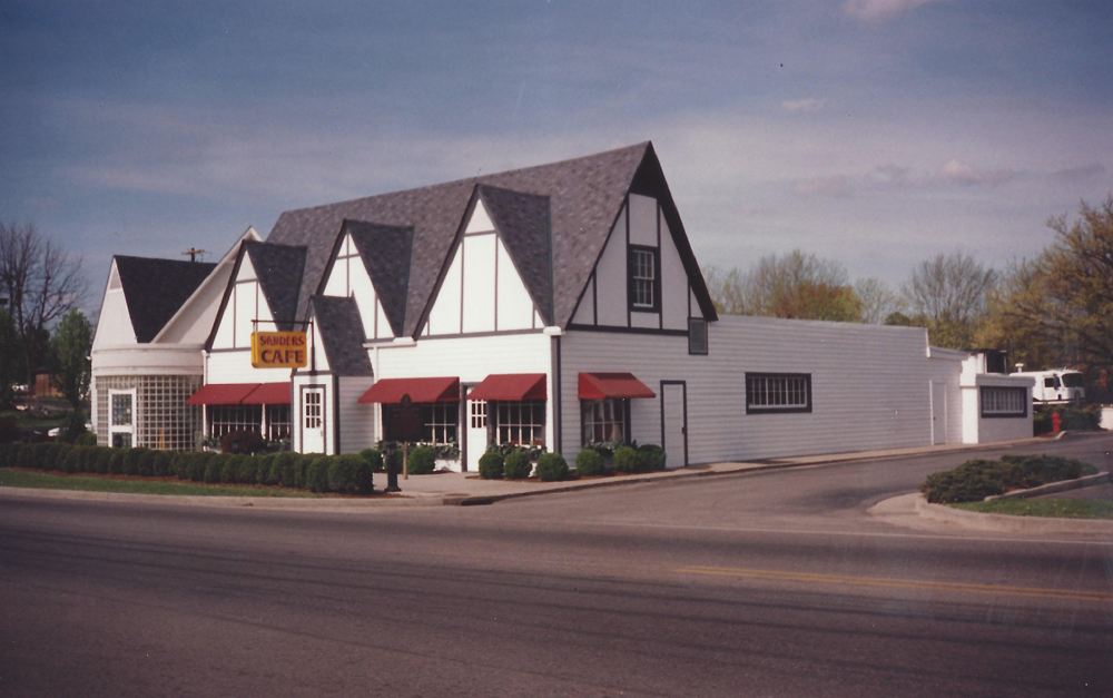
Years ago a friend and I drove to Vancouver, then down the west coast as far as Tijuana, and back home to Montreal across the midwestern states, which is how we wound up in Corbin Kentucky. That’s right, the birthplace of Kentucky Fried Chicken! Although I’d only sampled KFC’s finger lickin’ goodness once or twice before, we couldn’t just drive past without checking it out. Expecting a glorified shrine of sorts (we had just visited Graceland) I was pleasantly surprised at how low key and homey they had kept Harland Sanders original wood clad restaurant, like so:
KFC’s birthplace in Corbin, Kentucky.
As this interpretive plaque explains, Harland tried various careers with little success before catching his groove cooking chicken, and the rest is history.
The Colonel’s story cast in bronze.
Now of course KFC is a gargantuan fast food enterprise, but in one of its transitional phases from monstrous to gargantuan, it unloaded many of it’s trademark outlets that looked like this.
Older KFC outlet
Over the course of my local bike ride adventures I’ve noticed three outlets have been converted into small, one off restaurants, just like the Colonel’s first digs so many years ago. SO, I decided to visit all three, with a couple of extra stops along the way.
First stop, Ottawa U’s Academic Hall. Built in 1901, it is the oldest theatre in the National Capital Region.
Academic Hall
On my way to the first ex-KFC, I paused to photo this panorama from the centre of Parc Jules Morin. This is also Angel Square, popularized by Brian Doyle in his story of the same name, and adapted to the stage by Jan Irwin.
Angel Square
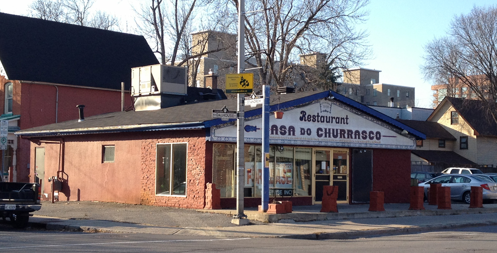
Casa do Churrasco, at the corner of St Andrew and Dalhousie, once served up yummy Portuguese food. Unfortunately it didn’t survive. In its KFC conversion they removed the big bucket sign but kept the sign post to use as a planter holder.
Casa do Churrasco
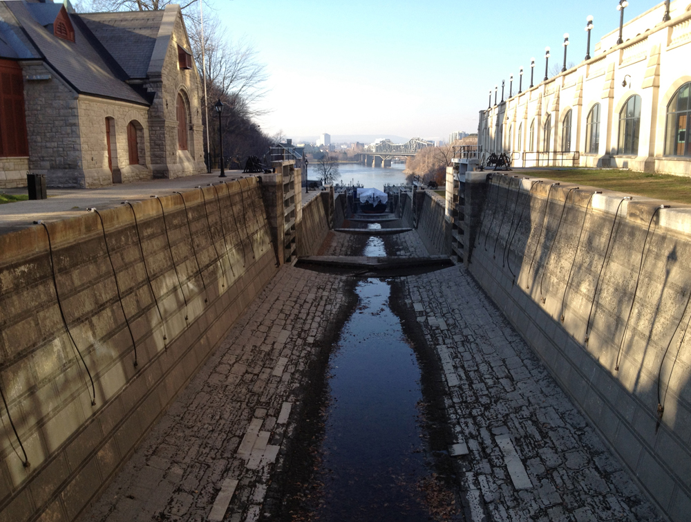
I headed down the path behind Majors Hill Park, but someone left all the canal locks open, except the top most one near Sappers Bridge. Usually one of the two lower ones are closed, providing access to the other side. No problem. It just meant climbing all the way up to the top of the locks, affording me this wonderful view back down to the river.
Canal locks
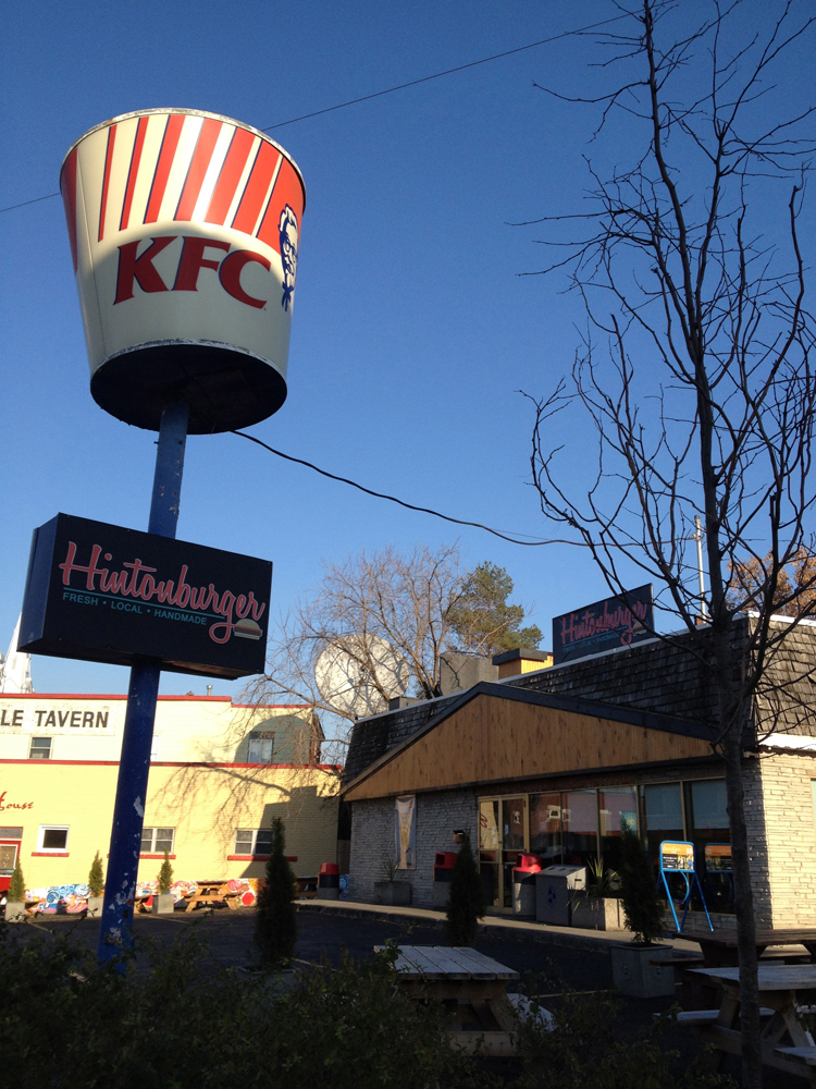
Next stop: Hintonburger. Lots has been written about this new kid on the block. They haven’t even taken down the big bucket yet. (Update, August 6, 2013 – They took the bucket down).
Hintonburger!
My final ex-KFC destination was Mia’s Indian Cuisine further west on Richmond Road near Woodroffe. Richmond hasn’t much of a shoulder on the north side to ride on and traffic can be pretty speedy in this area so I followed the winding path straddling Richmond and Byron.
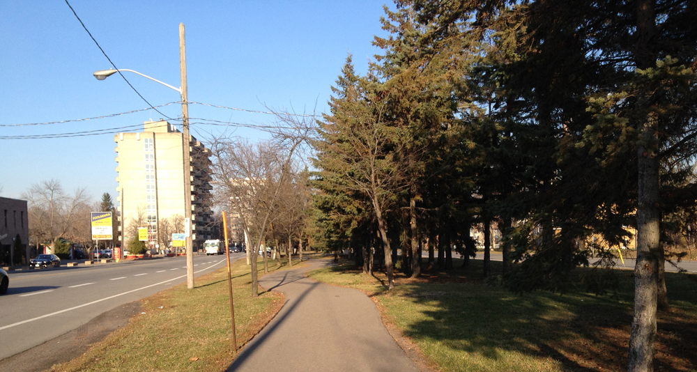
Winding path between Richmond and Byron
Samsu Mia is a refugee from Bangladesh. His story, and how he and his family managed to start up Mia’s Indian Cuisine restaurant in another converted KFC outlet, can be found in this CBC report by clicking here. There’s even a bonus photo of the original KFC included in the article to compare to how it looks now.
Mia’s
I ordered a couple of vegetable samosa’s and onion bhaji from the take out menu to share with Carla and the kids. It’s all I could fit in my handle bar bag.
Interior of Mia’s
So there you go. Two out of three successful Kentucky Fried Phoenixes risen from their ashes!
The last time I biked through the Greenbelt Stony Swamp Sector, many of the trails were closed due to wildfires in the area during this summer’s prolonged dry spell. I promised myself I would return once some of the trails were re-opened, so today I did. The blue line on the map is the route I followed to get there. Red line is how I got back.
I joined the Greenbelt trail network after crossing over highway 416. The ecological diversity in this area is remarkable.
Along the section of trail between Highway 416 and Moodie Drive I noticed this old stone pit someone had recently used to have a campfire.
Stone pit
I followed Moodie Drive to get to the trails west of Moodie. This wide gravel shoulder wasn’t too bad for the short distance I had to travel.
There are a couple of board walks along the trail that look out onto beaver ponds. This particular spot must be popular for feeding chickadees. I had only to pause for a moment before these bold little guys were all around me.
Incoming!
I happened upon lots of people holding out their hands onto which the birds would land, pluck a seed and then fly off.
Unfortunately not ALL the trails are open yet. I guess they are still cleaning up after the fire.
Trail closed
On the way back I biked through the residential area called Bells Corners East which appears to have been built up in the 50’s and 60’s. This house has retained much of it’s original detailing. I’ve seen similar big stars on houses through out the country, particularly in New Brunswick. They may symbolise something in particular, like the star in the Acadian flag, or they may also be a popular detail from the period. Not sure.
Monday I had to bike to Ikea. Strong westerly winds made me hesitate. The challenge was to find a route that avoided speedy traffic AND Aeolus. Success! The blue line shows how I got there, red is how I got back. The short pink lines are where I could have gone to avoid the wind just a little bit more.
First, head towards the Experimental Farm Pathway via Dow’s Lake and Prince of Wales Drive. UPDATE 2019: If you are getting to Dow’s Lake via the O-Train path there is a detour under the Queensway while they do major construction on the overpass. This safe detour is indicated on the map (Gladstone-Preston-Young St E).
Bike along the National Capital Commission Scenic Driveway with tall trees on either side.
NCC Scenic Driveway
This takes you to a path through what’s popularly known at as the Enchanted Forest that runs along Fisher.
The Enchanted Forest
Beyond Fisher the pathway continues along the edge of the farm. A less windy option would be to follow Kingston Avenue that heads the same way, as shown in pink.
Between Merivale and Maitland the path snakes through a wooded area. All good.
winding path
Now the most exposed area along this path comes next – the stretch between Maitland and Woodroffe. On a blustery day I suggest biking along the residential streets hi-lited in pink past this area. But you’d miss this type of view along the pathway.
Path between Maitland & Woodroffe
Beyond Woodroffe, the path follows a little valley along a stream.
Mini river valley
Then ride down Iris Street, which is protected from the wind by houses and trees on either side. That gets you to Ikea. UPDATE – August 2019: Iris street has been repaved since this post was originally written. In the process a bike lane heading east between Cobden Road and the Transitway was included, which is good, but that’s all there is in the way of added safe bike infrastructure. Sharrows have been painted in the centre of the roads in other locations however sharrows are a useless form of bike infrastructure or, as some research has show, more dangerous than no infrastructure at all.
Iris St, 2019: Sharrows on most sections except (photo 1)… except heading east from Cobden St where there is a bike lane (photo 2).
On the way back I re-joined the bike path where it crosses Iris and headed north towards the Ottawa River. Now the wind became my best friend! I sailed home. After dark, the oncoming headlights along the driveway are really bright, especially on a moonless night such as it was, but if you don’t let them bother you they make for an interesting contrast between the rush of the river flowing by on the left, while glaring lights rush by the opposite way on your right.
My son had an afternoon game out at the Jim Durrell Recreation Centre. I’ve biked there before and wound up going through the intersection of Bank and Walkley which is terrible, awful and terrifying. But today I discovered two ways to avoid it! Red line’s how I got there, blue line’s how I got back, with a stop off at La Salle Académique at Ottawa U to help install the latest set I’ve designed for the play Unity by Kevin Kerr.
Someone carved this great little chair out of a stump sitting on the edge of Dow’s lake. The surrounding saw dust suggests a chainsaw was the sculptors tool of choice.
Chair
There’s much less water flowing under Hog’s Back bridge these days, exposing the stone river bed. A bunch of seagulls looked like they were having a great time playing in what little water was there.
Seagull party
The secret to avoiding the corner of Bank and Walkley when following the Hogs Back route is this section of unmarked path to the south of Ridgemount High School.
Unmarked shortcut to avoid corner of Bank & Walkley
I was so excited with this discovery that I over shot my mark and had to circle back to get to the Recreation Centre on Walkley.
The route I followed back towards the centre of the city after my son’s game (win!) took me along Alta Vista Drive. I was anxious at first, because even though Google Maps said there was a bike lane, Alta Vista has always been a pretty busy street. But ya know, it wasn’t bad! Folks were driving at a safe pace. Maybe the bike lanes help keep things calm.
Looking back down Alta Vista Drive
Today’s ride reminded me it’s the crisp air of November and how it holds up rich smells to sample, like burning wood or freshly fallen leaves, that helps make biking at this time of year special. And the rich smells were in abundance biking along the Rideau River.