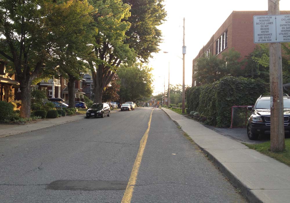
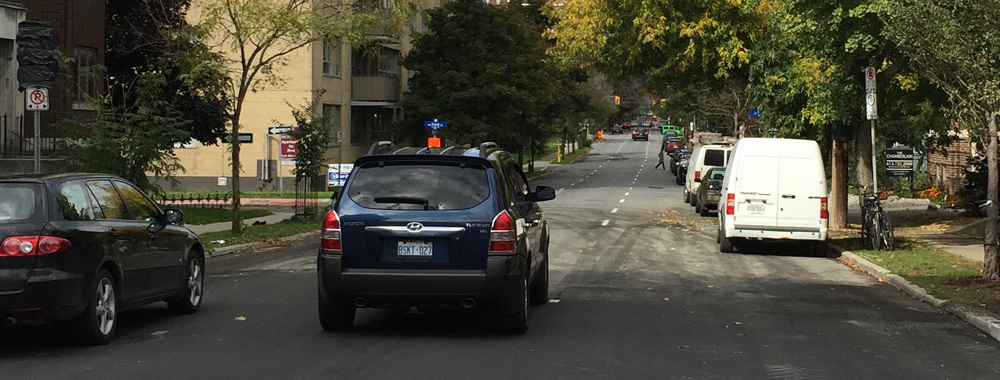
Many Centretown and Hintonburburg residents shop at Produce Depot on Carling. Here’s a safe way to get there by bike. This route begins on the border of both neighbourhoods, on the crest of the Somerset Bridge heading over the O-Train tracks.
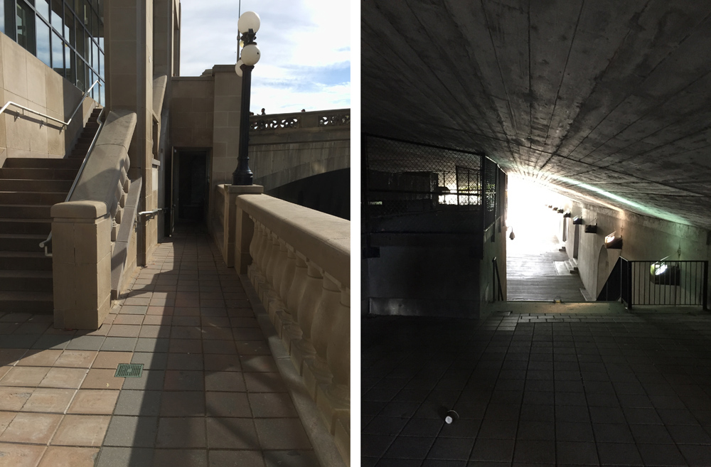
There’s a bike lane over the Somerset bridge but it disappears once traversed. To avoid having to merge into busy traffic, especially dangerous a bit further on when Somerset turns into Wellington, I walked down a short set of stairs to the right that takes you to quiet Breezehill Ave. It has a ramp to avoid having to carry your bike.
Ramp at Breezehill
Breezehill crosses Bayswater then continues for a short quiet stretch as Wellington. Just before it reaches the aforementioned dangerous section along Wellington I turned right on Garland, then left on Armstrong. This is my favourite safe-bet way to cut through Hintonburg.
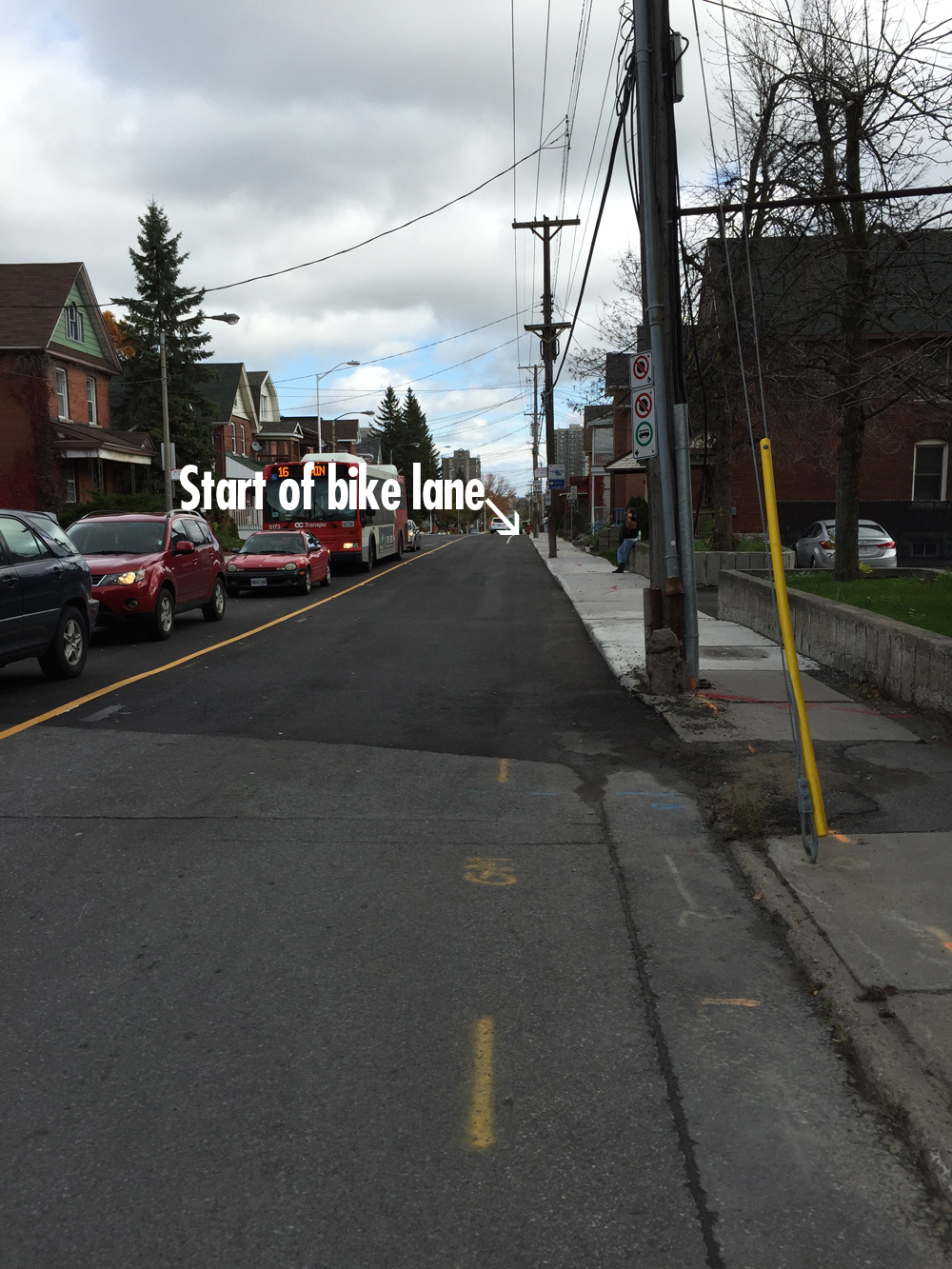
I continued west along calm streets as shown on the above map, as far as Carleton St.. I turned north on Carleton and crossed Scott St at the lights. Riding along Scott St one can choose from a bike path along the north side of the street separated by a grassy meridian, or a bike lane on the edge of the road. I feel comfortable riding either, although the bike path is a safer bet. Here is a photo taken earlier this Spring describing the options.
Choice of Scott St bike path vs bike lane heading west
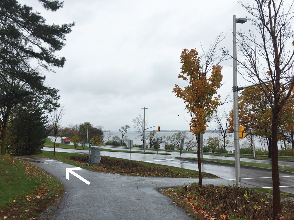
I rode to the end of Scott, crossed Churchill Ave, and continued straight along the bike path that runs parallel to the transit way. This path intersects another path that runs along the south side of the Sir JAM parkway. I turned left and continued west.
Bike path along the south side of the parkway
I turned off the paved path onto a short dirt path that took me to Fraser Street.
Exit onto dirt path to Fraser St
The dirt path isn’t signed, so if you miss it there’s another paved connection just a bit further with a sign that points to Mansfield St, which you can take instead and ride back a block to Fraser.
Signed exit to Mansfield St
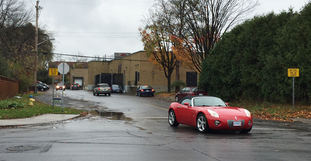
I then rode south along quiet Fraser St to where it ends at Sherbourne Road. I approached Produce Depot from the back by turning onto Bromley Road from Sherbourne. The signs onto Bromley say no exit, but many drivers were entirely oblivious to this and cut through so watch out for them. Produce Depot shares the parking with a Beer Store.
Bromley to get to the Produce Depot parkingProduce Depot on Carling
I followed the same route on the way back except for a short section in Hintonburg as indicated by the green line on the above map. I avoided Breezehill because it’s hard to see cars coming when crossing Bayswater heading east, as the two streets meet on the inside of a curve. Crossing Somerset at the top of the Breezehill stairs to get to the bike lane heading east is a bit tricky as well, as it’s hard to see cars coming over the crest of the bridge.
One of the finest places in the city to get your skates sharpened is at Figure 8, or Hockey One, on Industrial Avenue. They do a great job and keep track of how you like them done. Hockey season has started up for hundreds of kids around town and my sons skates needed sharpening. Blue line on the map is the bike route I took to get there from Centretown. Purple lines an alterations I took on my way back.
.
I rode along the Laurier Bike Lane which extends east of Elgin in front of the Provincial court house and City Hall.
Laurier Bike Lane extension from Elgin St
There’s a short bike lane just beyond City Hall to the right along the exit from Laurier to the Queen Elizabeth Driveway, as shown in the photo below, however there’s a sign at the opposite end suggesting the lane is for cyclists riding towards oncoming traffic. All a bit confusing, so if you do take this bike lane watch out for cyclists heading your way along with cars exiting off Laurier. A safer bet would be to cut through the plaza in front of City Hall (See green line on above map that I followed on my winter ride, crossing the Driveway at Somerset). UPDATE – Summer 2018: There is presently a bi-directional multi-use path on the right side of this exit (not shown on the photo) making this exit much safer.
Exit to the right off Laurier towards the canal
I rode along the canal, crossed over the pedestrian/bike bridge at the end of Somerset, and continued along the canal until I turned off at the exit up to Pretoria Bridge.
Turn off towards Pretoria Bridge
That took me to the intersection of Hawthorne Avenue and Colonel By, on the east side of the bridge. Things get a little tricky at this spot. If traffic is bad I recommend crossing to the opposite corner and walking your bike for a short distance along the sidewalk to where it veers left along Echo Drive, like so.
Making your way over to Echo Drive
I then turned down the first street on the left which is Graham Avenue. It has a bike lane.
Graham Ave
Graham ends at Main Street, and continues as Lees Avenue across the intersection. There is a bike lane along Lees heading east, but it doesn’t start for a hundred yards or so east of Main. Depending on the amount of traffic, it may be safest to walk your bike along the sidewalk to where the bike lane starts. UPDATE – Summer 2018: The east bound bike lane now starts at Main St.
Lees Avenue bike lane
The Lees bike lane abruptly ends at Chestnut Street. Drivers always speed along Lees Avenue. Without a bike lane it’s extremely dangerous. The ‘Share the Road’ sign partially obstructed by trees does nothing to alleviate this danger. I turned right onto Chestnut. UPDATE – Summer 2018: The east bound bike lane now extends to the bridge over the Queensway.
UPDATE January 8: Bike lane wasn’t cleared so I took the first opportunity to get off Lees and turned on to Rosemere Avenue.
Corner of Lees & Chestnut where the Lees bike path ends
This took me to Springhurst Ave where I turned left and followed it to the path that brought me to the Rideau River Nature Trail.
Path at the end of Springhurst
UPDATE – January 8: The Rideau River Nature Trail is not cleared in the winter, but it is packed down by pedestrians. I managed to ride along the path for half the distance and pushed my bike the rest of the way. A day or more without a snowfall and it most likely would be entirely bikeable.
Rideau River Nature Trail in the winter
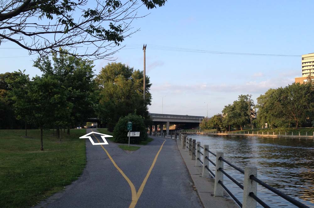
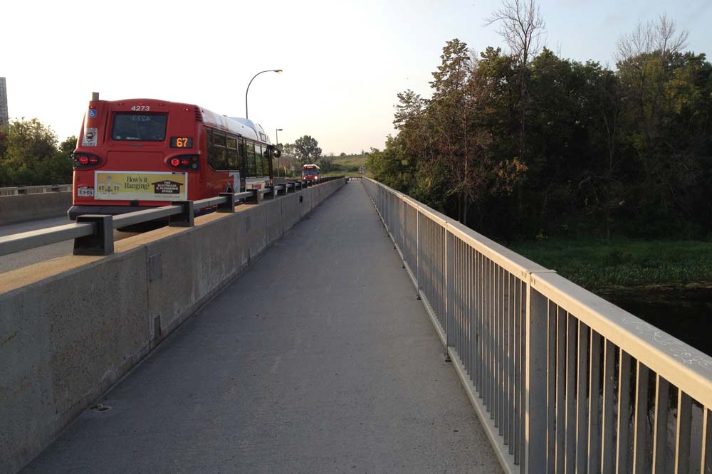
I took the path along the transitway bridge over the river, like so.
Bridge over the Rideau River
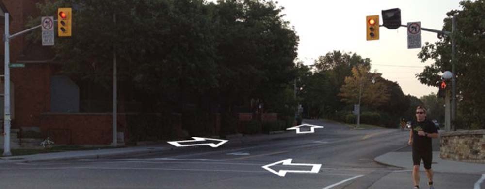
I continued past the OC Transpo hub to the intersection at Riverside Drive. I won’t deny this is a spooky major intersection, however don’t let it intimidate you. There are usually many other pedestrians and cyclists crossing at this spot and the path does continue on the other side of Riverside Drive along Industrial Avenue.
Path continues in the distance on the other side of Riverside Drive
Hockey One / Figure 8 is a bit further down Industrial Avenue, however the bike path veers away diagonally at Alta Vista Drive. True to it’s name, Industrial avenue has industrial quantities of cars and trucks desperately jockeying amongst themselves for lane position, so I followed the path off to the righ at the south east corner of Alta Vista and Industrial, and circled back behind Hockey one via neighbourhood Way. This adds just a few seconds to the ride and is definitely worth the safety factor.
Bike path turn off at Industrial and Alta Vista
Et voila!
UPDATE: Fall 2015 – They have installed a bike rack just to the right of the front door under the overhang and told me they would leave it there throughout the year. A fine and encouraging initiative.
On the way back, rather than get back on to Lees, which hasn’t any bike lane heading west, I rode up Evelyn Avenue where I crossed Main. I then cut through the school parking lot to Graham Avenue.
N.b. – Insulbrick has become a popular generic term to describe the tar impregnated exterior covering first patented in 1932 as Inselbrick and includes Inselstone, Inselwood and a few other imitations. Lots more on Insulbrick to be found on links at the bottom of this post.
.
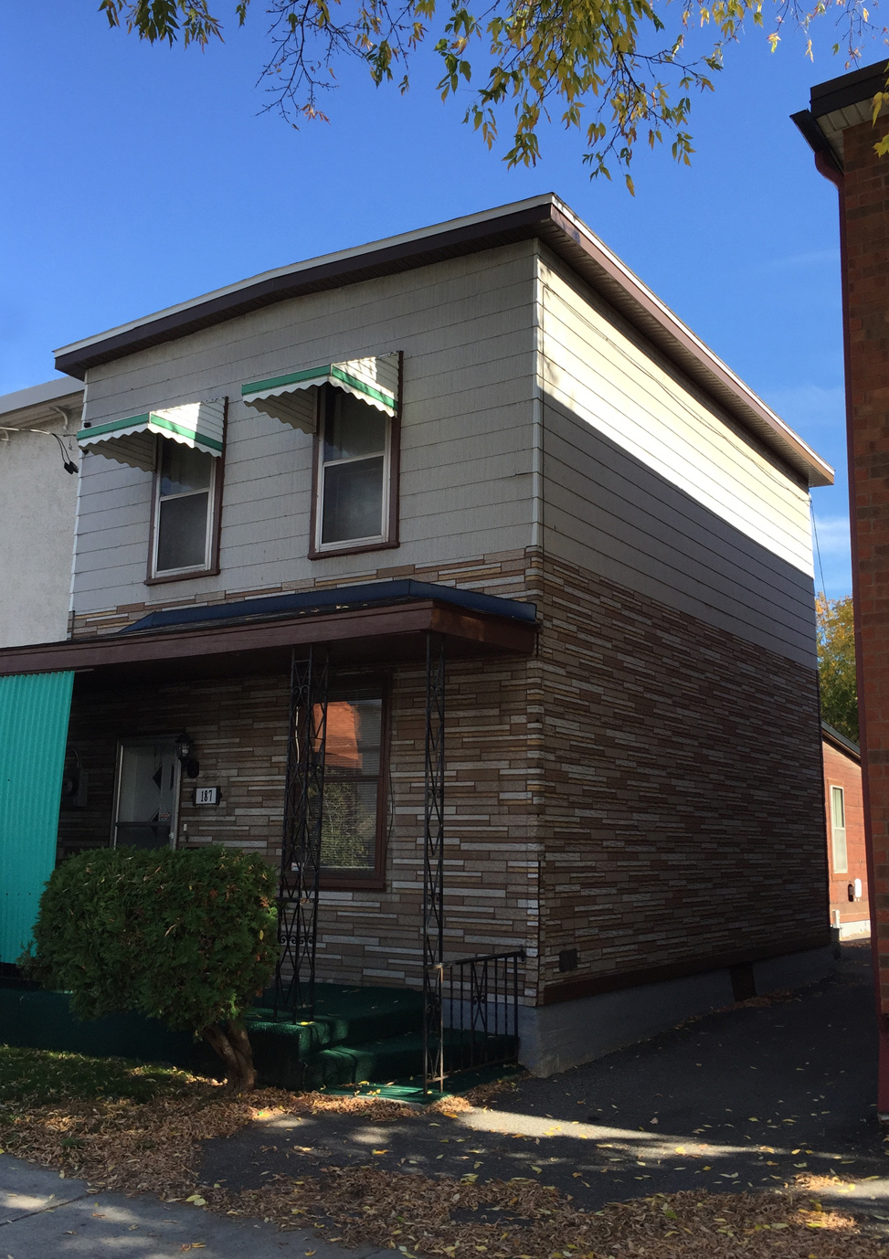
First stop – 187 Rochester, where you’ll find this interesting multicoloured extended brick pattern. Note the top portion is covered with fiberglass siding. Because Insulbrick is flat, stable, and easy to nail through, much of it has been covered up with whatever subsequent siding was fashionable. I’m guessing there is a lot of Insulbrick covered up in this manner all over the region. UPDATE March 2021 – The Insulbrick has been ripped off and the whole exterior is undergoing a big reno.
187 Rochester St
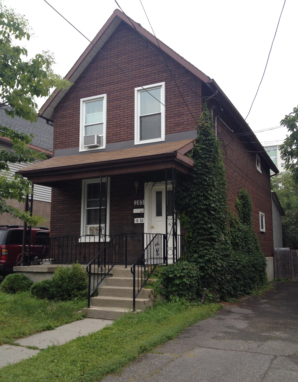
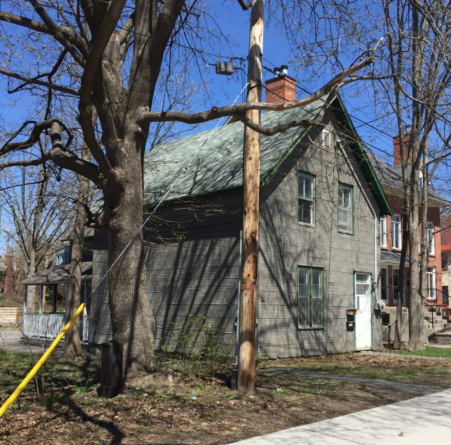
Carla and I rode south on Rochester St towards our next stop at 28 Breezehill South, which could very easily be mistaken for a brick house, but it’s Insulbrick! The clearest indication is how the pattern does not reproduce the 2 to 1 overlapping stacked brick pattern on the corner where the walls meet. Ivy helps. Very clever.
283 Breezehill South
The next two stops are located on the Gatineau side of the river. To get there we rode along the O-Train path to the Ottawa River Pathway, then along the path over the Portage Bridge. This example is located along Rue de l’Hôtel-de-Ville at the corner of Rue Helene-Duval. The Insulbrick was applied to the side of the building only. The original brick structure pre-dates the invention of Insulbrick which, in this case, is really showing it’s age.
Rue de l’Hôtel-de-Ville
We wove our way eastwardly along paths and quiet roads to get to 289 Rue de Notre-Dame-de-l’Ile where we found another example of the red Inselbrick pattern. The owners are in the process of adding an addition at the back, It will be interesting to see whether they preserve the Insulbrick covering on the front, or cover it all with whatever siding they put on the back extension.
289 Rue de Notre-Dame-de-l’Ile
On our way back to Ottawa we rode along the boardwalk over the Alexandra Bridge. We then cut through Majors Hill Park where there’s a little known passageway at the end of the park that accesses the patio overlooking the canal and continues under Sappers Bridge beside the Chateau Laurier. It isn’t always open, so worst case scenario would require carrying ones bike up the stairs beside the Chateau BUT if you can access the passageway it’s worth it! It includes a couple of short flights of stairs that are equipped with bike ramps wide enough for your tires to push your bike along. My Grandmother used to describe riding the train into Ottawa along the canal and taking an elevator up to the Chateau Laurier lobby. I’m guessing this is where she would disembark.
Access to passage way under Sappers Bridge beside the Chateau Laurier
Further south at the corner of Grenfield and Havelstock sits our next stop but it may not be there for long. At the time of our visit (April 2017) there was a plywood panel describing how the lot is up for zoning review with plans to build a new condo in its place. UPDATE – 2020 It’s gone, replaced with the condo.
Corner of Greenfield Avenue and Havelock Street
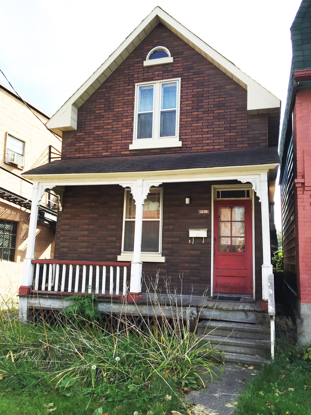
Next it’s over the Pretoria bridge and along quiet streets to our following stop – 28 Florence St. Love it.
28 Florence St
Florence turns into a one way heading east halfway between Bank and Kent. To get to James St which is one way heading west, we cut through the service alley behind the businesses that front on to Bank Street.
Alleyway between Florence & James St
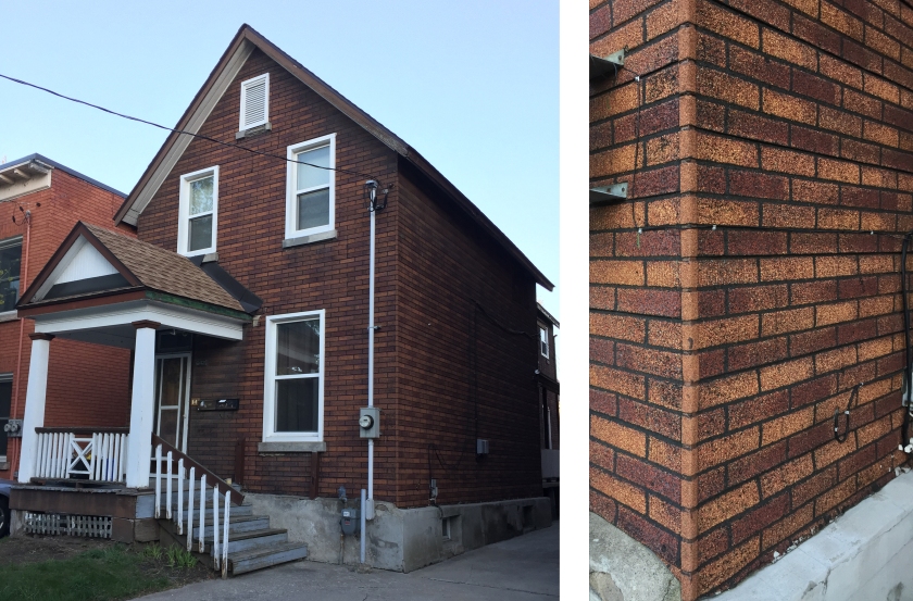
Our final destination is 642 MacLaren Street, and what a beauty it is! So well preserved, one has to take a really close look to see that it is in fact Insulbrick. As mentioned at the Breezehill stop, corners are where the truth is told. To hide how Insulbrick patterns don’t correspond to real brick at corner junctions, a corner strip is often applied, as was in this case.
642 MacLaren
There are two other buildings located in Centretown that I didn’t include in this tour as it would have required some convoluted navigating to avoid biking down busy streets, however I have included photos. The first is this abandoned leaning house on Somerset between Lyon and Kent. Probably won’t be there for long as it and the lot it is sitting on is up for sale. UPDATEApril 2017 – It’s been knocked down.
Leaning house of Somerset
Another example is located two blocks north on Lisgar also between Lyon and Kent St. The Insulbrick was added to the front portion of an already existing building. It is really showing it’s age, especially in contrast to the original brick still visible on the back portion of the building.
Insulbrick on Lisgar
Here are a few links to stories involving Insulbrick:
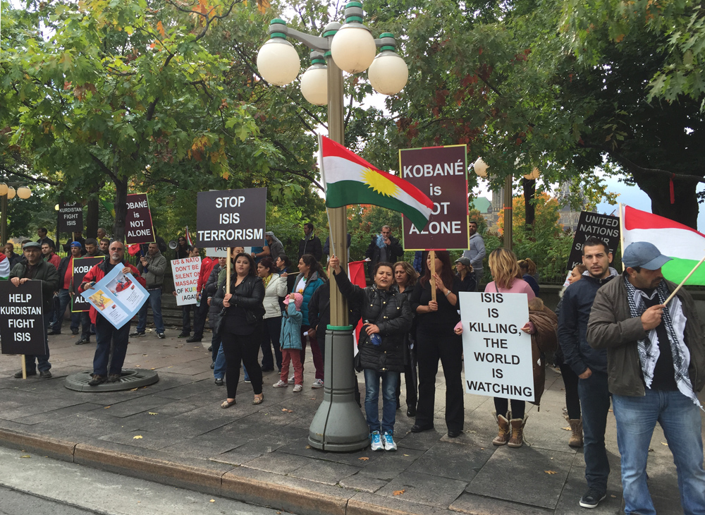
Kurdistan is a geo-cultural region spanning a number of countries in the middle-east in areas where Kurds form the majority or significant portion of the population. This tour visits the embassies of those countries.
We begin at the Embassy of the Republic of Armenia at 7 Delaware Avenue, a Spanish Colonial Revival style mansion built in 1908. The monument ‘Armenia Immortal’, located in front of the embassy, was sculpted by Levon Tokmadjian and unveiled in 2002. The Kurdish population within Armenia is primarily located in the Western portion of the country.
Embassy of Armenia
Next stop – the Embassy of Iraq at 215 McLeod across from the Museum of Nature. Built in 1957 in the modernist style, It has fallen into disrepair. A 2012 Ottawa Business Journal article describes plans for it to be demolished and replaced by a four storey building that would continue to house the embassy.
A large number of the Kurdish diaspora that settled in Canada were escaping purges in northern Iraq by Sadam Hussein, as described in this story by Kurdish-Canadian Susan Mohammad (click).
Embassy of Iraq
The Embassy of Iran is located just a few blocks away up Metcalfe St, a one-way heading north. It’s not a great street to bike down at rush hour (7-9am & 3:30-5:30pm) when there’s no parking on the east side of the street as it becomes a three lane speedway. During the rest of the day it isn’t so bad, as the remaining lane beside the parked cars is ample, however watch out for drivers who still tend to go crazy fast in the two remaining lanes. Many of them must be on a lingering reckless Queensway adrenaline rush.
The Kurdish population of Iran are located in the north-west part of the country in an area known as Iranian Kurdistan along the borders of Iraq and Turkey.
Embassy of Iran
Next stop – The Syrian Embassy on Cartier St. It too remains quiet, as all Syrian diplomats were asked to leave in May of 2012 as a result of war atrocities committed by the government in the ongoing civil war.
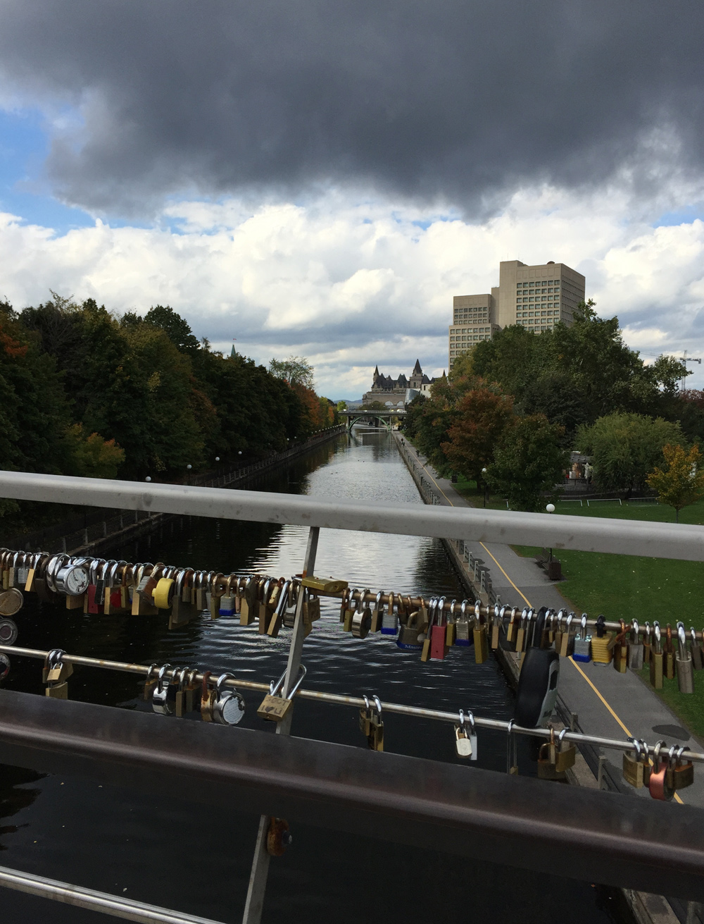
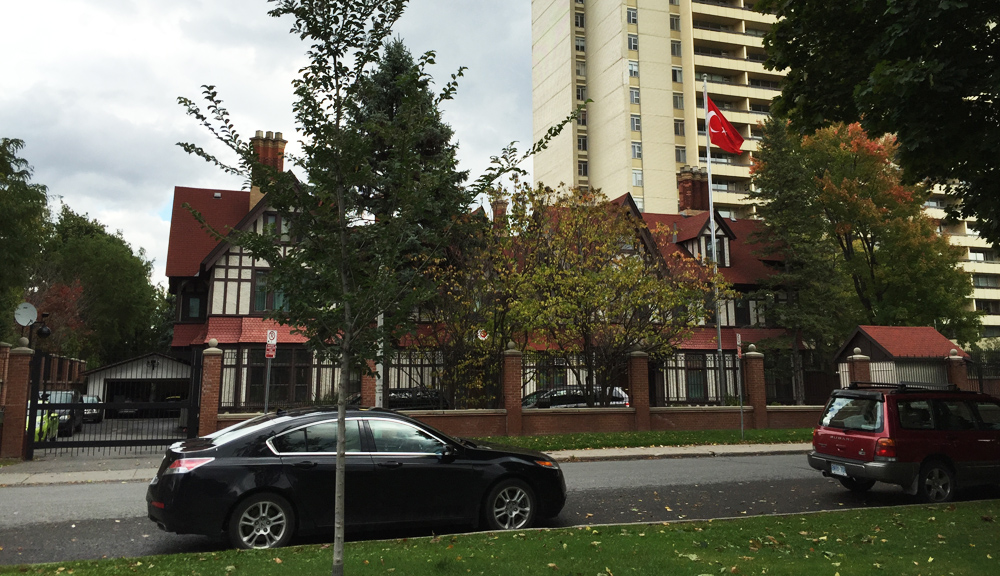
Final stop – the Embassy of Turkey at 197 Wurtemburg St. To get there I rode over the bike/pedestrian bridge across from Ottawa U. Hundreds of love locks are attached to the bridge railing overlooking the Rideau Canal. I then cut through Sandy Hill.
Love Locks over the Rideau Canal
While the other four embassies are located in Centretown, the Embassy of Turkey finds itself on the edge of Sandy Hill overlooking the Rideau River in a sprawling Tudor style manor constructed in 1869.
Last Fall’s inaugural Great Canadian Theatre Company Bike-A-Thon was such a huge success that it has become an annual fundraising event. This time riders had a choice of two routes. Both groups started off from the theatre on Wellington St W and followed bike paths along either side of the Ottawa River. We crossed the Island Park Dive bridge to Quebec, then back over the Alexandria Bridge, before returning along the Ottawa River Pathway towards the theatre. The red line on the following map is the 18km ride I led and describe below. An alternative 37km route branched off to Aylmer and back along the Voyageurs Pathway before completing the red loop. Both options are spectacular early morning rides. I forgot to snap photos on the day of the event, so the following images were taken when I went back and re-visited a couple of days later.
And away we go!
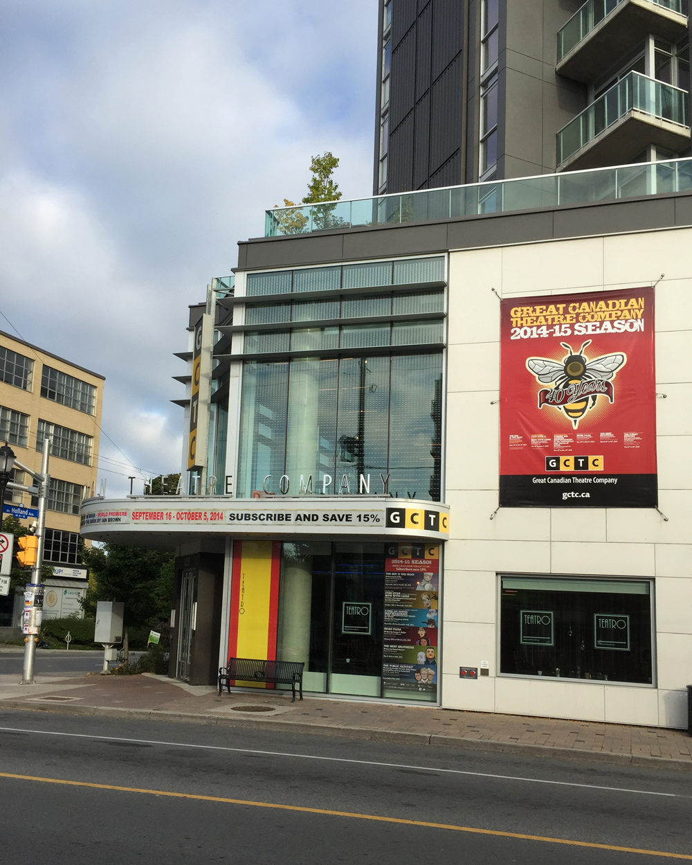
The theatre, corner of Wellington and Holland
To get to the Ottawa River Pathway we headed north along Holland Avenue, through Tunney’s Pasture (which isn’t actually a pasture, but an expanse of government buildings where Anthony Tunney’s cows once grazed a long time ago), then joined the link just off Parkdale to the Ottawa River Pathway. Holland and Parkdale aren’t choice roads to ride along during weekdays as they are popular commuter links, but they are OK early on weekend mornings.
Biking through Tunney’s pasture
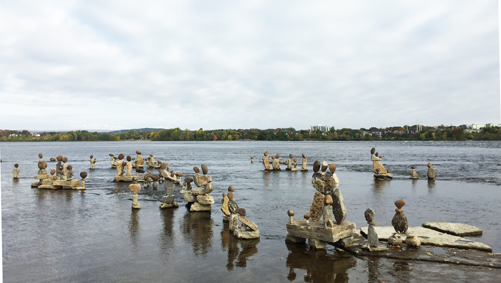
We passed this collection of balanced rocks along the edge of the river which John Ceprano has been back to stack every summer since 1987.
River rocks
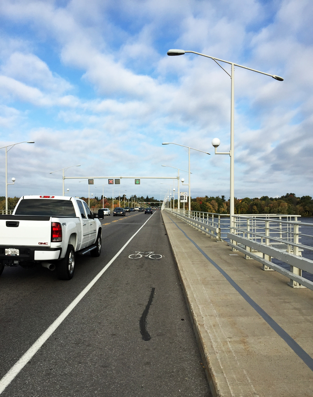
The Island Park Bridge over the Ottawa River has generous bike lanes heading both ways.
Bridge over to Québec!
On the other side of the river we headed downstream along the Voyageurs Pathway, sections of which follow the canoe portage the Coureurs des bois and Voyageurs trudged to avoid the Chaudières rapids.
We paused in Brébeuf Park, named after Jean de Brébeuf, a Jesuit missionary who passed through on his was up stream. Here he is commemorated in bronze just off the pathway, one hand clasping a cross, the other a paddle.
Jean de Brébeuf monument
The route get’s a little hilly just east of Brébeuf Park, with a number of tight turns through wooded areas like so.
Voyageurs Pathway
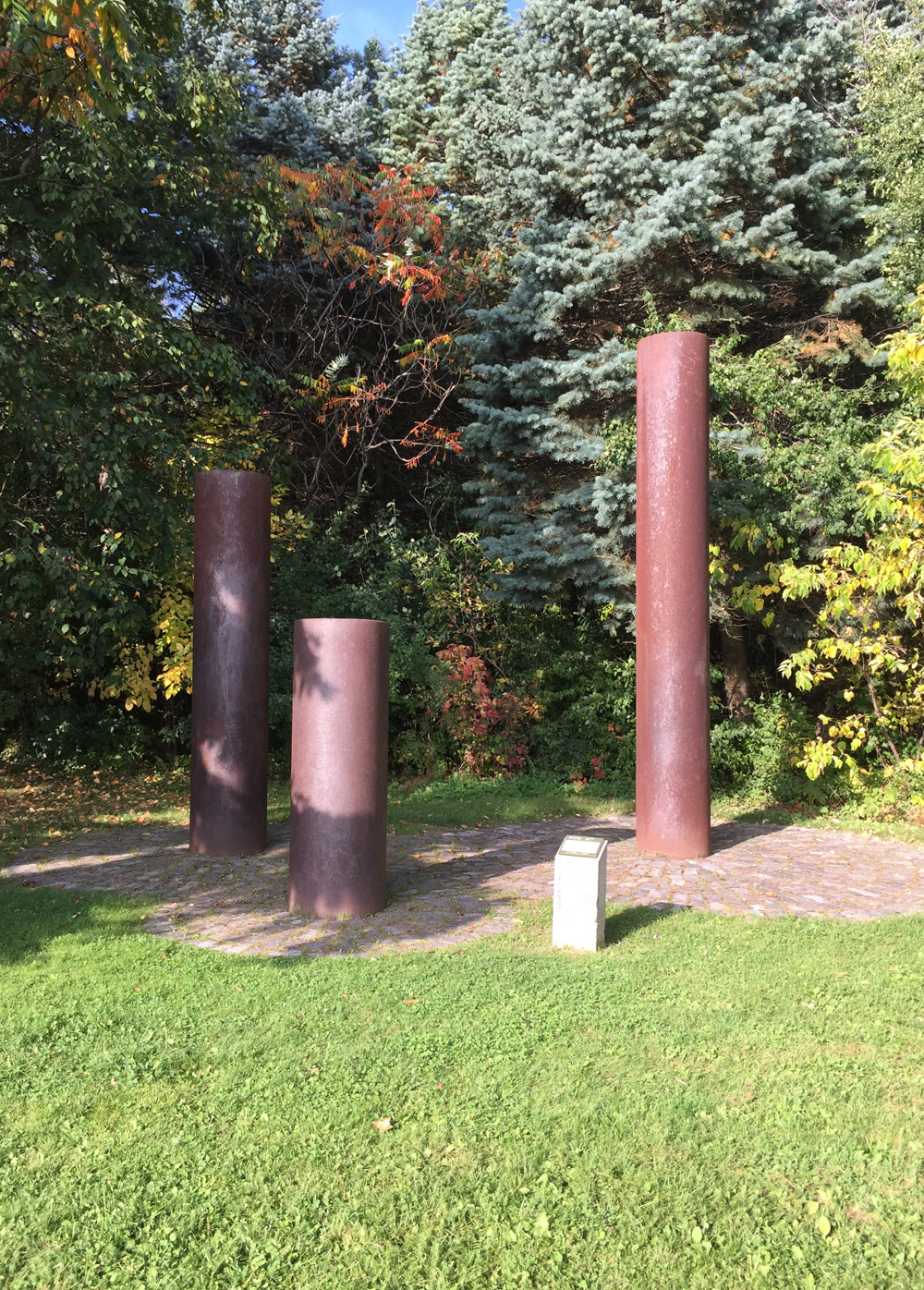
Things flatten out again in Parc des Portageurs, a fine spot to pause and admire this installation consisting of pipes from the EB Eddy wood mill that once dominated the area along the river.
EB Eddy pipes
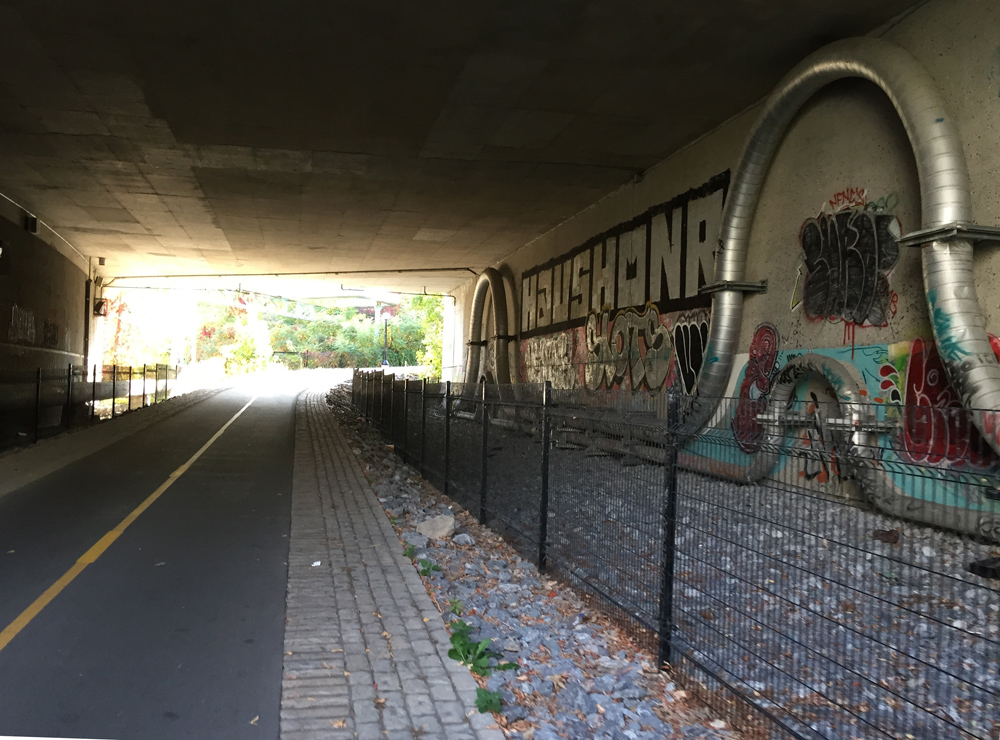
There still is a paper mill in operation off the path between Rue Eddy and the Portage Bridge. That’s who owns these huge steam pipes on either side of the path heading under the Portage Bridge. Throughout the winter they hiss and pop in rapid intervals, echoing all around as you pass by.
Pipes under Portage Bridge
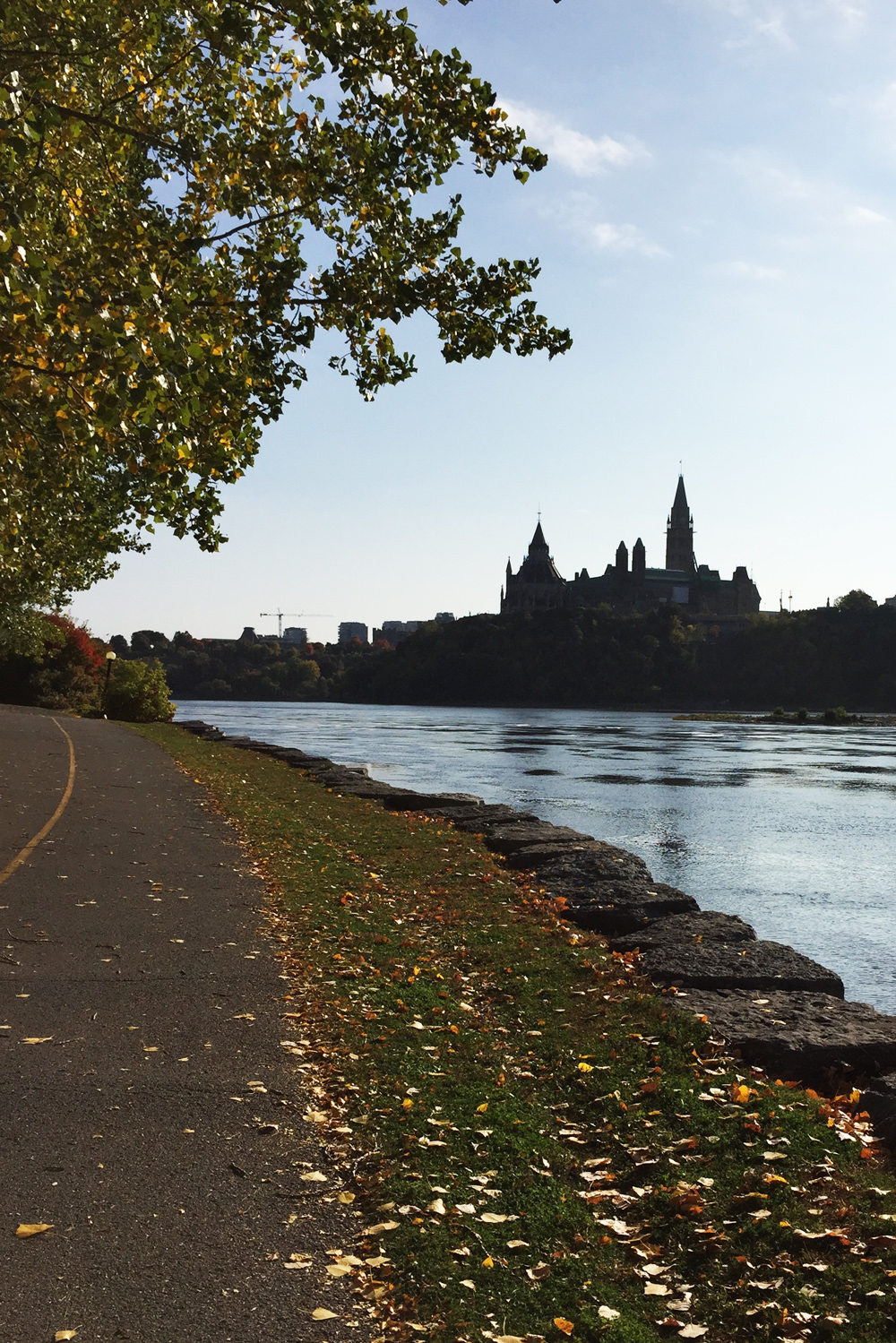
One of the most spectacular views of Parliament Hill can be had just beyond the Portage Bridge as the path heads down along the river’s edge.
Parliament Hill as seen from the Voyageurs Pathway
We wove our way up behind the Museum of History and crossed the Alexandra Bridge.
Pedaling over the Alexandra Bridge
On the Ottawa side of the bridge there’s a steep lane off to the right which brought us down to the Rideau Canal Locks. We pushed our bikes across the second set of locks.
Up and over across the Rideau Canal locks
On the other side we had a break and were treated to snacks and refreshments! This is the only photo I managed to take on the day of.
Bike-A-Thoners!
Then it was back along the path along the river towards the theatre. A fine outing indeed!