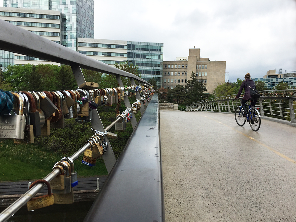
Here is a bike ride with a Victoria Day theme! This route begins at the base of the statue of Queen Victoria on Parliament Hill and heads up to the small Chelsea Pioneers Cemetery where Private Richard Rowland Thompson lies buried. Private Thompson was the sole Canadian recipient of a Queen’s Scarf of Honour, one of eight scarves crocheted by Queen Victoria in her final year of life.
The statue of Queen Victoria is located just to the west of the Centre Block on Parliament Hill.
Statue of old Queen Vic
Exit Parliament Hill heading west and turn right after passing through the RCMP bollards. Then take Vittoria Street that passes behind the Confederation building and infront of the Supreme Court, before turning left to get to Wellington St .
Leaving the Hill, turn right just beyond the RCMP bollards
There’s a bike lane along Wellington that starts infront of the National Archives. Follow this lane across Portage Bridge to the Quebec side of the Ottawa River. Once across the bridge get on the Voyageurs Pathway by circling under the Portage Bridge. Follow Voyageurs Pathway all the way to a fork just in front of a hydro site. Head right at the fork.
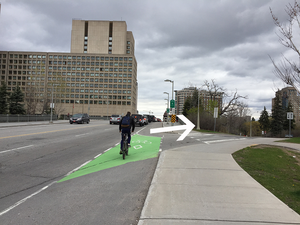
Exit off Voyageurs Pathway towards Gatineau Park
This leads to Rue Belleau, a quiet street with bike lanes leading to the intersection at Boulevard Alexander-Taché. The start of the Gatineau Park Pathway is immediately across this intersection.
Follow the beautiful Gatineau Park Pathway up through the park all the way to Chemin de la Mine.
Heading up the Gatineau Park Pathway
Access Chemin de la Mine from the pathway and head north along the bike lane on the shoulder of the road.
Chemin de la mine bike lane
Turn right onto Notch Road which also has bike lanes.
Turn right onto Chemin de Kingsmere then right onto the bike lane along Chemin Old Chelsea east heading over the Gatineau Autoroute, all the way to Route 105.
Turn left up the 105 and ride along the abutting bike lane all the way to the small sign indicating the entrance to the Chelsea Pioneer Cemetery .
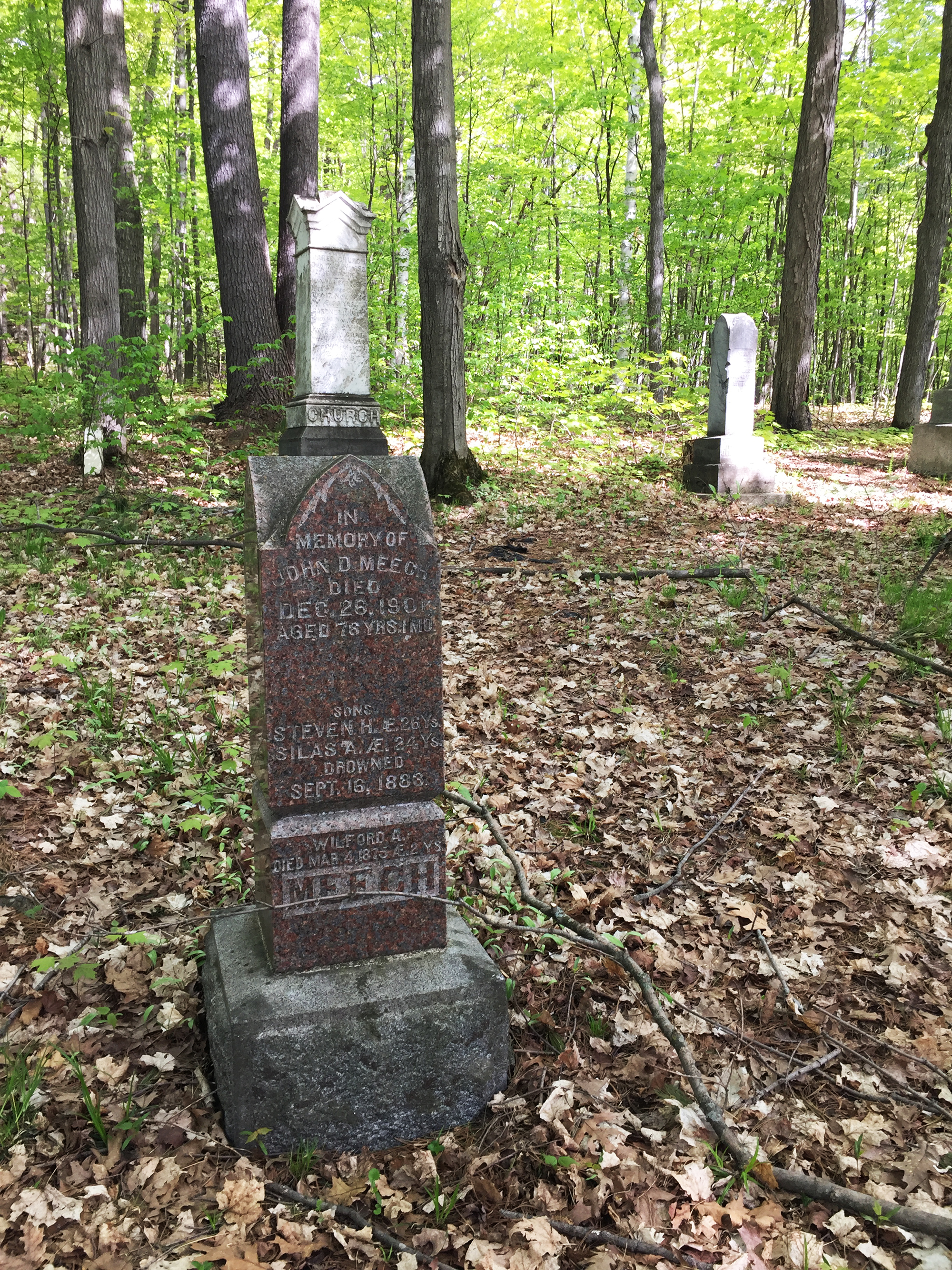
At the end of this short dirt road you will arrive at the small cemetery and the resting place of Private Richard Rowland Thompson. He was awarded the Queen’s Scarf of Honour for saving the life of a wounded colleague and staying with him throughout the Boer War Battle of Paardeberg. He also attempted to save another as the fighting raged about him.
Grave of Richard R. Thompson
The graveyard itself is very simple and serene, a quiet place to rest before heading back to Ottawa.
Chelsea Pioneer Cemetery
Exiting the cemetery continue north along the 105 before turning onto Chemin Scott which also has bike lanes heading into Old Chelsea.
Chemin Scott intersects Chemin Old Chelsea which you can hop back onto and retrace your route back to Ottawa. The approximate total distance is 44km.
Earlier this year I happened upon a story of a group of Gatineau citizens trying to convince the city to preserve a section of forest located in the Deschênes neighbourhood that was destined to be sold for development. One of the group’s compelling arguments, amongst many, was to preserve a rare stand of white oaks. Good news – they succeeded!
Knowing little about white oaks or their status within the region I decided to track a few down. Here is a route linking three specimens that are relatively easy to access by bike.
We begin in the Dominion Arboretum where sits this white oak planted in 1996. This one was easy to identify as it has an aluminum plaque attached to it with all the identifying info, as is typical with most of the trees in the arboretum.
Young white oak in the Arboretum
After leaving the arboretum and riding over to the Ottawa River Pathway one has two choices; continue westwardly on the Ontario side as far as the Britannia Park neighbourhood, or cross the Island Park Bridge and ride along the Voyageurs Pathway as far as Deschênes.
I first visited the white oak in Britannia Park which is situated just within the chain link fence that designates the edge of the Britannia Conservation Area. Bikes aren’t allowed beyond the fence so I locked mine up and walked the short distance. I was able to locate this tree with the help of the iNaturalist app/website.
Britannia Conservation Area
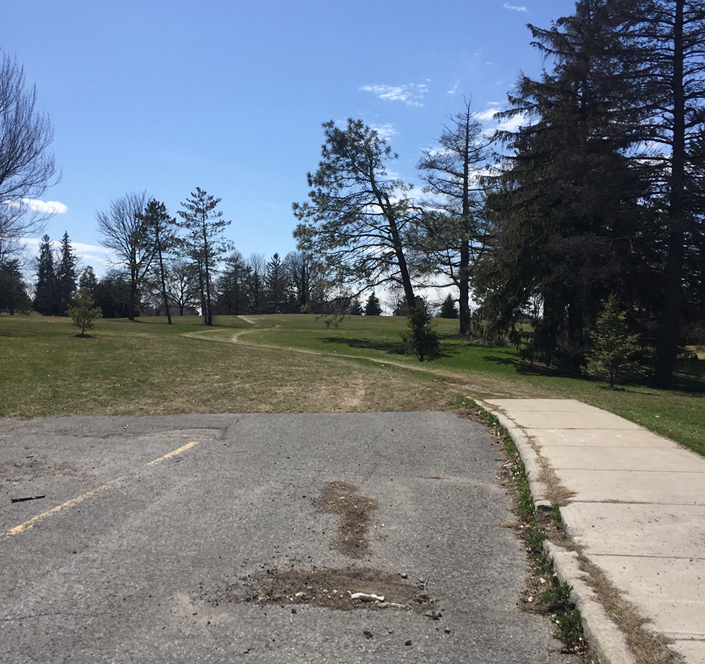
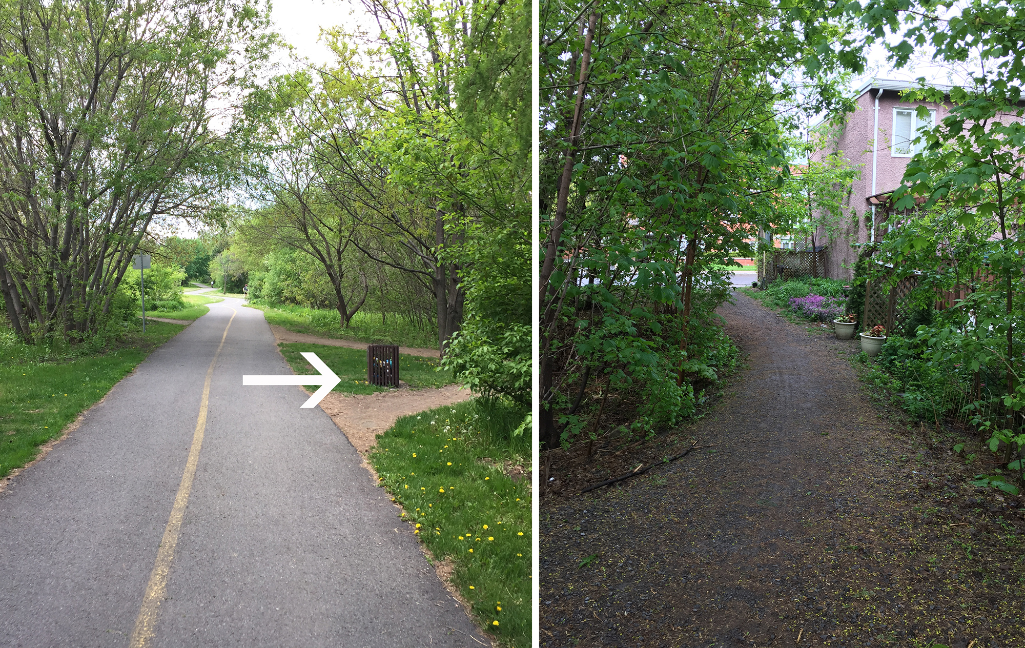
The white oak I was able to find in Deschênes Forest is a short distance off the Voyageurs Pathway. There is a path through the woods one can follow to get there, the entrance to which is just before you reach Chemin Fraser.
James Strutt (1924 – 2008) was one of Ottawa’s most successful Modernist architects. He was called upon to design many innovative buildings for clients throughout the National Capital Region. Along with office towers, private residences and public facilities he also designed a number of churches throughout the 1950’s and 60’s for Ottawa’s expanding mid-century suburbs . This bike tour visits these churches, identified by the red markers on the attached map. The blue markers show the location of other buildings he designed including The Strutt House his family home he built on the edge of Gatineau Park. It has recently been restored to it’s original design and has been preserved as an interpretive centre dedicated to the study of his works. A bike route to the Strutt House from Ottawa can found here. Clicking on a blue marker will bring up an image of each building.
The orange markers are buildings that unfortunately are not visible from points accessible by bike. The grey markers are those I have yet to visit but I will update the map with photos once I do.
We begin at the Bells Corners United Church. In 1960 the decision was made to build a new church to replace its predecessor on Robertson Road (now a spa) as it could no longer accomodate the growing number of parishioners. It was completed in 1965.
Bells Corners United Church
Our second stop is St Paul’s Presbyterian Church on Woodroffe Avenue. This smaller, more intimate house of worship, was an earlier design, completed in 1958. The wooden boxes on the roofs were not part of the original design nor obviously were the solar panels.
St. Paul’s Presbyterian church
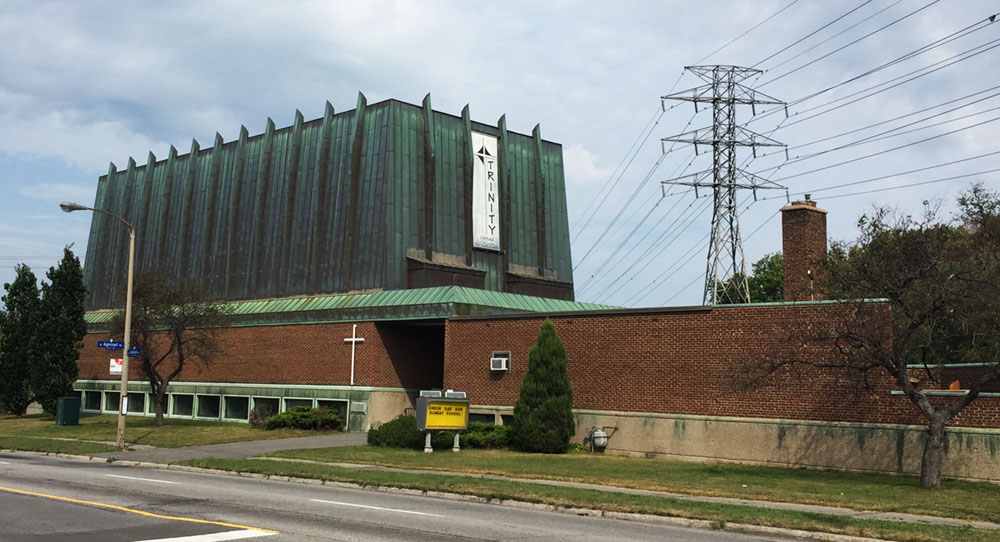
Cyclists riding along the Experimental Farm Pathway will have noticed the distinct copper clad building just off the path at Mailand Avenue. This is the Trinity United Church designed by Strutt in 1963. The form was supposedly inspired by Noah’s ark.
Trinity United Church
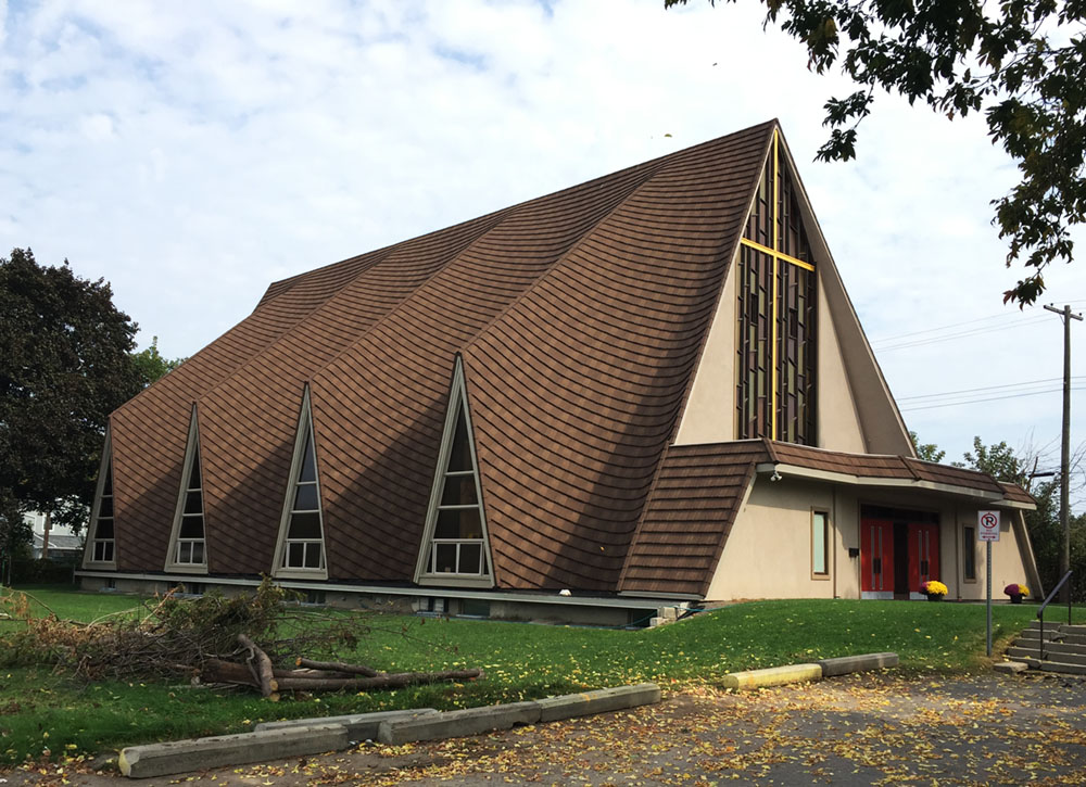
The dominating wavy form Strutt designed for St Peters Anglican Church on Merivale Road (now the St. Teklehaimanot Ethiopian Orthodox Church) was achieved by using a modern concrete spray. It was then clad in cedar shingles, similar to the one in Bells Corners, but since replaced with metal cladding.
St. Peter’s Anglican Church
St Marks Anglican Church on Fisher Avenue is from 1954. A number of modifications have been made to the original building but there is a great slide show with sketches and descriptions of the original design along with pictures of the church in construction that you can view by clicking here.
St Marks Anglican Church
St Paul’s Anglican Church (now the Ottawa East Seventh-Day Adventist Church) in Overbrook is tucked in between Presland and Prince Albert Street. Strutt designed this one in 1963. Originally there was a small cross at the peak of the taller roof.
St. Paul’s Anglican Church
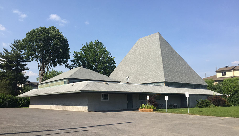
Our final stop is the Rothwell United Church in Cardinal Heights. Completed in 1961, it has changed little from Strutt’s original design.
Rothwell United Church
A few more details on the design of these churches can be found here.
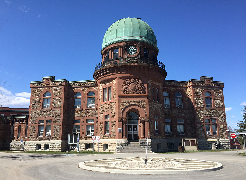
David Ewart was Canada’s Chief Dominion Architect from 1896 to 1914. During his prolific career he designed numerous buildings across the country, four of which are still standing here in Ottawa – the Royal Canadian Mint on Sussex Drive, the Connaught Building on Mackenzie Street, the Victoria Memorial Museum (now the Museum of Nature), and the Dominion Observatory on the grounds on the Central Experimental Farm. This bike tour visits all four.
We begin at the Royal Canadian Mint located just beside the National Gallery of Canada. The Mint was built to function as a centre of the country’s wealth at a time when Canada was flexing its growing monetary independance. Ewart applied details reminscent of medieval castles and late gothic styling over a Beaux-Arts-inspired design.
Royal Canadian Mint
To get to our next stop, follow the bike lane along Sussex Drive past the National Gallery. The bike lane gets pretty tight at the corner of St Patrick and Sussex so I cut across the broad plaza infront of the giant spider to get to the bike crossing .
Cutting across the plaza in front of Maman
Double cross the intersection to eventually get over to the bi-directional bike path that runs along Mackenzie Avenue infront of the American embassy.
Double cross over to path infront of U.S. embassy
You will need to weave between two sets of huge bollards set in the middle of the path that are meant to protect the embassy. They are a bit tricky to negotiate. Just beyond the second set of bollards is our next stop – The Connaught Building.
The Connaught Building was designed to house the first Canadian archives, reflecting the nation’s growing sense of Canadian identity. It was designed in part to meet Prime Minister Laurier’s vision for an architecturally coherent image for the capital. Ewart again used Beaux-Arts inspired principles as seen in its symmetrically organized facade and central main entry. To this he applied a combination of detailing from the Victorian Gothic style, as seen in the Parliament buildings, and large manors built during the Tudor period.
Connaught Building
The interpretive panel visible in the bottom right of the above photo describes David Ewart and his work within the context of this incredibly productive period of building design in the capital. Definitely worth a quick read.
Continue along the bike lane to where it ends at Wellington Street. There is an advance bike signal at this intersection that allows cyclists to cut diagonally across Wellington to the ramp that leads down to Colonel By Drive. At the next set of lights hop onto the Rideau Canal Eastern Pathway.
Diagonal crossing with signal across Wellington
Transition from the bike lane where it ends at Colonel By Drive to the Rideau Canal Pathway
Ride under the Corkstown pedestrian/bike bridge, then circle up and over the bridge to get to the other side of the canal.
Corkstown Bridge.
Once across Queen Elizabeth Drive access MacLaren Street via a short jog along Somerset and The Driveway. MacLaren is a quiet street that you can follow west as far as O’Connor Street. Turn left onto the bi-directional segregated bike path along O’Connor and follow it to McLeod Street where on the left you will see our next stop – the Museum of Nature. McLeod Street is a one way heading west so to get to the front of the museum get on the path at the corner of O’Connor and McLeod that goes through the park past the wooly mammoth.
The Museum of Nature was originally called the Victoria Memorial Museum in honour of Queen Victoria who’s reign ended in 1901. This was Ewart’s most ambitious building for the capital, once again using the Tudor Gothic style. Unfortunately the instability of the soil on which it was built required that the original central tower be reduced by one level to keep it from sinking in to the ground. The glass tower now occupying the space was added in a more recent major renovation to the building. The fascinating history of the museum is explained in extensive detail here and here.
Museum of Nature view of the west face
Next get back on the O’Connor bike lane and follow it under the Queensway and on through the Glebe where it switches sides of the street and disappears/reappears in a few spots.
O’Connor bike path north of Queensway
O’Connor bike lane south of Queensway
O’Connor ends at Fifth Avenue so turn left onto the bike lane that brings you the signalised intersection across Queen Elizabeth Driveway. Once across, turn right onto the Rideau Canal Western Pathway and follow it all the way to Dow’s Lake where it ends at Preston Street.
Rideau Canal Western Pathway
At Preston cross over to the opposite corner of the intersection to the path that continues up along Prince of Wales Drive.
At the next set of lights, which is a pedestrian crosswalk towards the arboretum, turn right along a short paved driveway that becomes a worn path leading up a hill towards Birch Drive.
Path up to Birch Drive
Continue straight along Birch Drive, then right on Maple Drive to our final destination the Dominion Observatory.
Designed in a Romanesque Revival style, the Observatory was used to establish coordinates for timekeeping that at the time could only come from an observatory. Fortunately this beautiful heritage building has survived any threats of demolition even though it ceased serving as an observatory in 1970.
More about the history of the Observatory including pictures of it during construction can be found here and here.
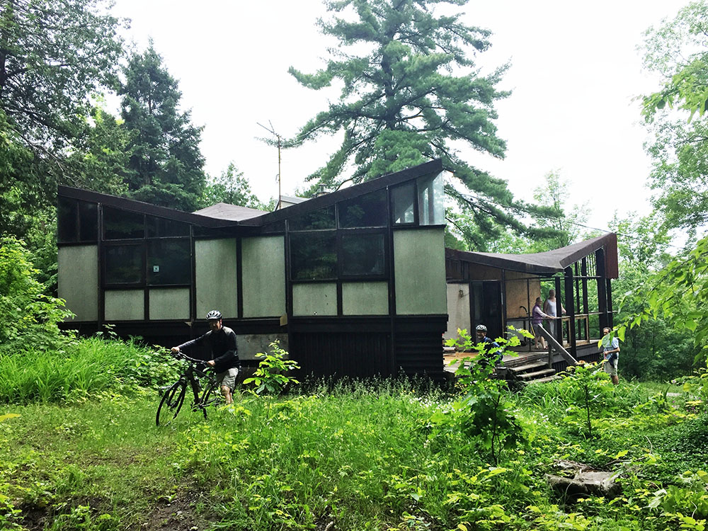
James Strutt was a Canadian Modernist architect who designed many innovative buldings throughout the National Capital Region. In 1956 he designed and built his family home along Chemin de la Montagne on the western edge of Gatineau Park. Lauded for it’s ingenious use of modular components and the introduction of hyperbolic paraboloids to form the ceiling and roof, the house has won a number of accolades such as the Prix du vingtième siècle by the Royal Architectural Institue of Canada. In the summer of 2015 I visited the The Strutt House for the first time. Little did I know it had just been saved from demolition. The National Capital Commission and the Strutt Foundation, an incredibly dedicated and passionate group of volunteers, had only recently come to an agreement to rehabilitate and preserve this very important modern piece of architecture after it had been vacant for a number of years and fallen into disrepair . The Strutt House has been included in the NCC Confederation Pavillions program and opened to visitors in time for Canada’s 150th birthday celebration. As part of this program you can book a tour of the house with the Strutt Foundation, which I highly recommend.
The following is an update to the initial 2015 ride and includes a vastly improved approach to the site that avoids having to travel along Notch Road and Chemin de la Montagne.
.
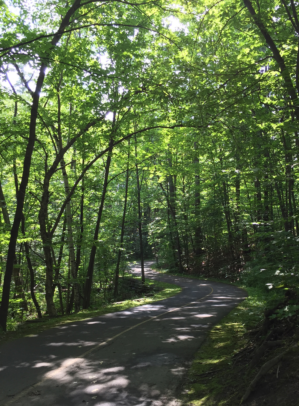
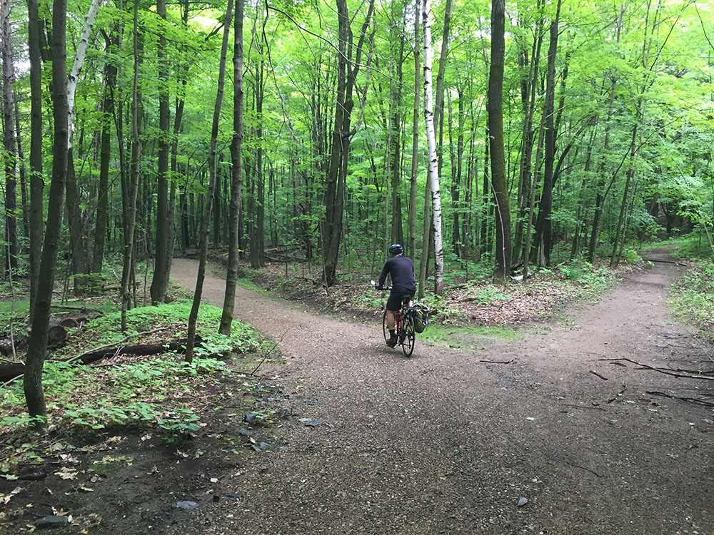
Early Saturday morning four of us met up on the Quebec side of the Portage Bridge where we set out on our adventure. We followed multi-use-paths along the Ottawa River before cutting up along more paths through the southern section of Gatineau Park.
Multi-Use Path heading up through Gatineau Park
Once arrived at the park info kiosk, indicated by the red marker on the above map, we rode along the Gatineau Parkway, which is always in great condition because they close the Parkway in late Fall every year. Subsequently the Parkway doesn’t have to be plowed and salted which, along with the freezing and thawing cycles throughout the winter, wreak havoc on all our other roads. On Saturday mornings there are lots and lots of cyclists riding along the Parkway so drivers tend to be quite well behaved.
Great road surface along the Gatineau Parkway
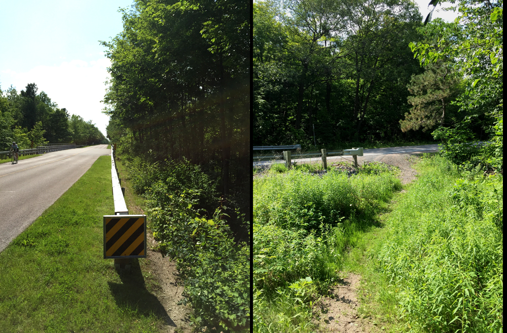
After a healthy climb up past the Pink Lake lookout and beyond we arrived at the top of the Notch Road overpass. There’s a short dirt path off to the right just before the overpass that we followed down to access Notch Road.
Path from the Gatineau Parkway …. to Notch Road
Notch Road is a steep narrow incline down to Chemin de la Montagne, however a short distance down from the Parkway there is a an old dirt road with a wide enough opening to push our bikes past the gate.
Turn onto old dirt road off of Notch Road
We rode through the woods along the dirt road until we came to a more recently upgraded section of dirt road that veered off to the left down towards the Strutt House.
Left turn down dirt road to the Strutt House
Once arrived we were treated to a great tour of the house by Titania and Brian of the Strutt Foundation.
The Strutt House
A great ride to a fantastic destination. Can’t get better than that.
Architects on Bikes Checking Out Buildings is a series whereby I invite an architect to suggest a few buildings they admire in the region, then we ride around and check them out! I am very grateful to Mark Glassford for generously accepting my invitation. Joining us was another architect Susan Smith.
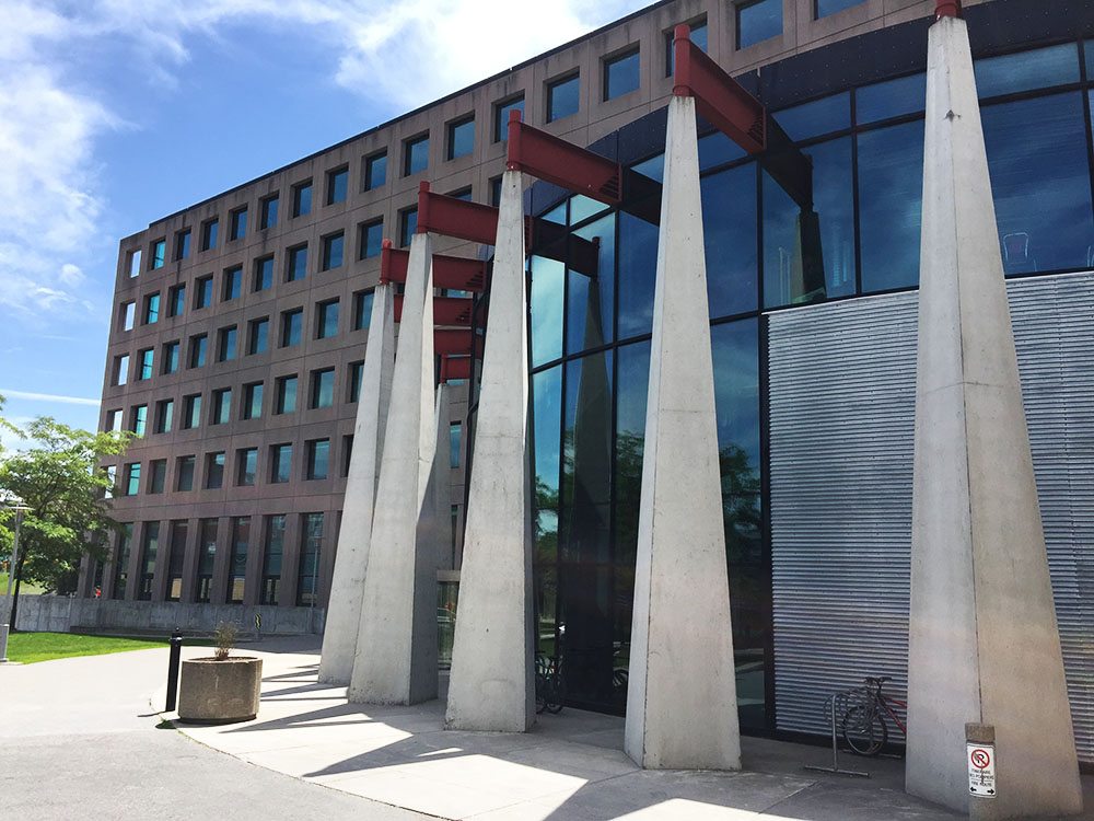
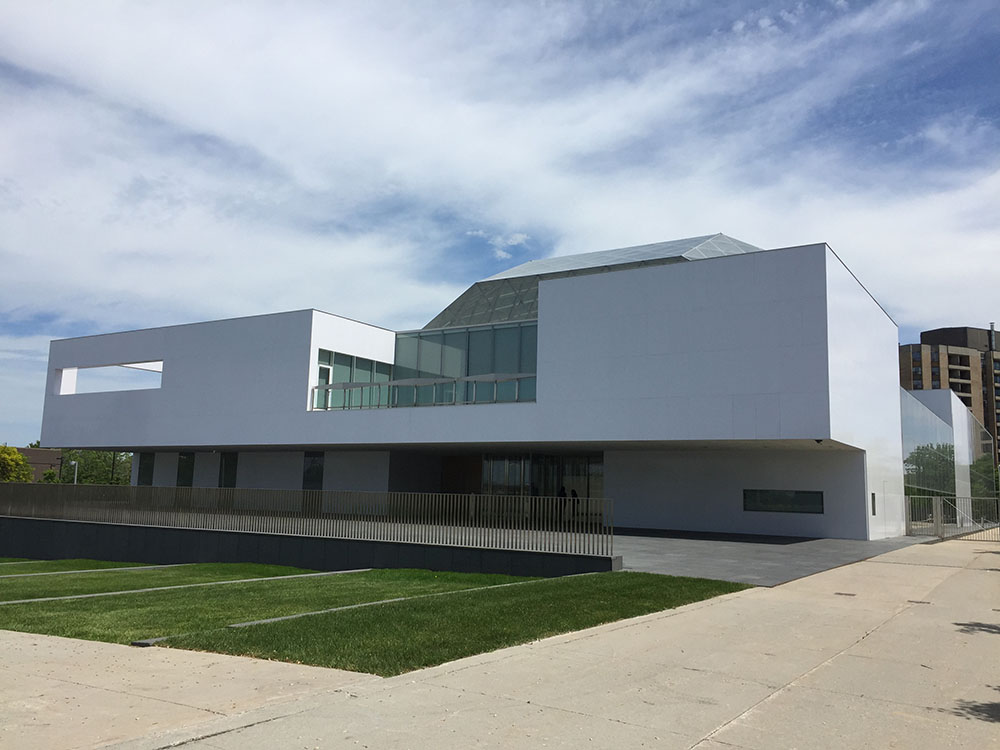
Our first building and starting point was the SITE building designed by Ronald Keenberg, located on the southernmost point of the University of Ottawa main campus. It is a located in a tight and unconventional foot print, whose design sympathetically considers all varied approaches, perspectives and vistas. These images are from King Edward Avenue near the main entrance, the approach most accessible by bike.
SITE as seen from King Edward Ave & Mann Ave
SITE entrance on King Edward Ave
We headed to the lights across King Edward Ave to Templeton, and then wove our way along quiet streets through Sandy Hill and Lowertown to get to the Delegation of the Ismaili Imamat, headquarters of the Aga Khan Foundation Canada on Sussex Drive, designed by Fumihiko Maki.
headquarters of the Aga Khan Foundation Canada on Sussex Drive
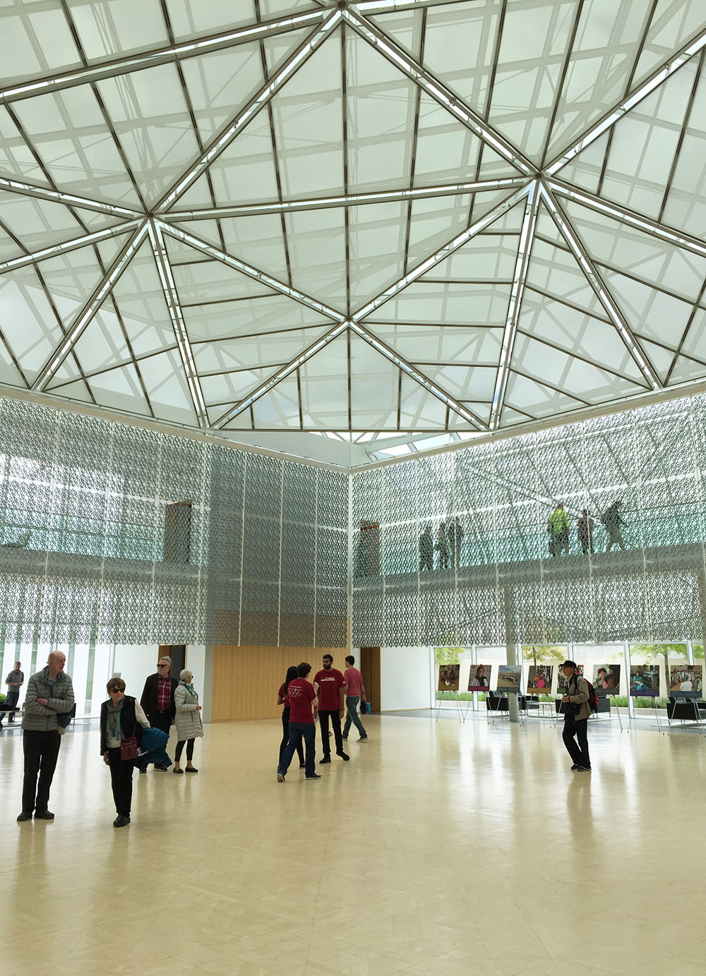
I managed to check out the interior of the building during this years Doors Open event.
Interior views
We then took the bike path along the MacDonald Cartier Bridge over the Ottawa River to Gatineau, then followed the Voyageurs Pathway east. Once across the Lady Aberdeen Bridge over the Gatineau River we turned right along the path that runs between Rue Jacques Cartier and the waters edge, along which there are multiple opportunities to pause and take in some great views of the Ottawa River.
One of many rest stops along Rue Jacques Cartier
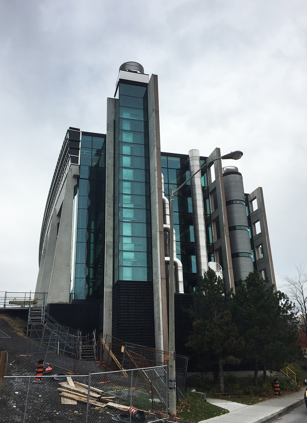
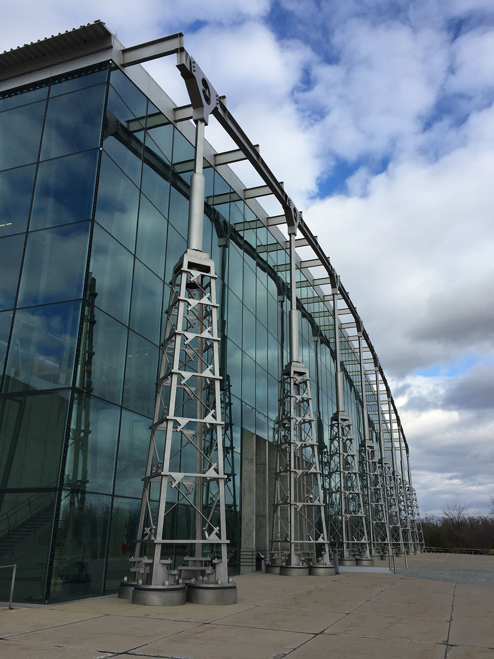
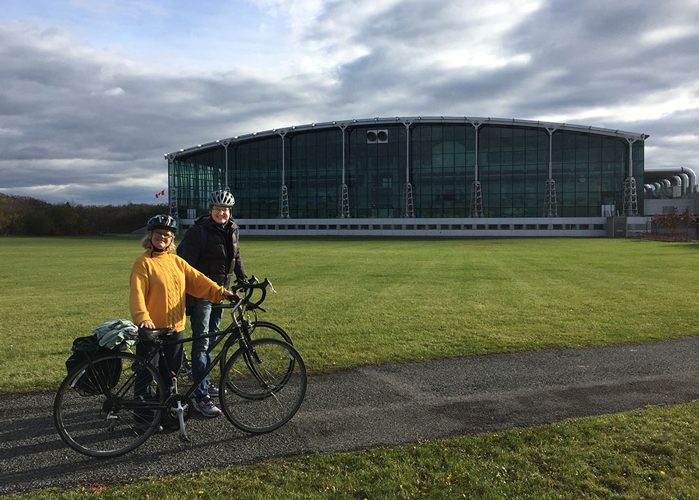
At the northern tip of Rue Jacques Cartier we headed inland and rode along the bike path beside Montée Paiement, which brought us to our third stop, The Library and Archives Canada Preservation Centre. Also designed by architect Ronald Keenberg, this is an incredible climate controlled facility. There is a bike path that rings the building allowing one to admire it from multiple perspectives.
Cast iron bells can become unifying symbols for a community. Their distinct clarion call draws together those within earshot towards a shared experience. The Nepean Bell became such a symbol when it was first hung and rung back in 1896 from the old town hall in Westboro. As the seat of government of Nepean Township moved south-west, then east, the bell went with it. This bike tour visits the three locations the Nepean Bell has occupied since its arrival in our region. It is also a ride along a number of wonderful bike paths in the western end of town through varied terrain. The purple line is a return shortcut to get to the starting point.
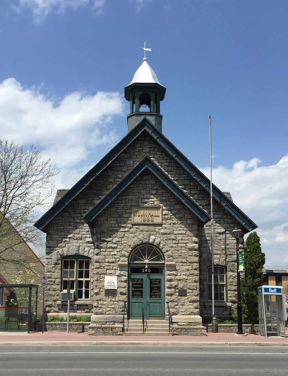
Our tour begins in front of the old Town Hall building in Westboro located at 345 Richmond Road where the Nepean Bell began its public life. The building was designed by architect Moses Chamberlain Edey and opened in 1896 as the Town Hall building for the Township of Nepean.
Old Town Hall in Westboro. Note the empty bell tower.
The eastern portion of Nepean Township was annexed by the city of Ottawa in 1950, however the old town hall continued to serve as Nepean Township’s headquarters until 1966. Once the construction of new headquarters were completed further west in Bells Corners the township authorities took the beloved bell with them. There they installed the bell on the front lawn in a sculpted tripod base. Each leg was a different height, meant to represent a member of the traditional nuclear family, i.e. mother, father and child. The image of this sculpture became the logo for the City of Nepean until The Great Ottawa Amalgamation of 2001. The logo is still evident on street signs, park signs, etc throughout the former city of Nepean. Note – the name Bells Corners far predates the arrival of the Nepean Bell.
City of Nepean logo
To get to the Nepean Bell’s second home at the intersection of Old Richmond Road and Robertson Road in Bells Corners I headed over to the path that runs along the south side of the Sir John A Macdonald Parkway and followed it as far as the intersection that passes under the parkway and onto the Ottawa River Pathway.
Path along Sir John A. MacDonald Driveway…. and underpass to get to the Ottawa River Pathway.
I followed the Ottawa River Pathway all the way to Britannia Bay. There I crossed Carling at the lights and got on to the Watts Creek Pathway. Where Watts Creek Pathway crosses Holly Acres Road is a bit tricky, as the path continues a short ways up quiet Aero Drive. This link is barely visible from Holly Acres Road.
White arrow shows where Watts Creek Pathway pathway continues a short way Aero Drive, as seen from Holly Acres Road
Watts Creek Pathway meanders through a wooded area before crossing Corkstown Road. Once across Corkstown Road the path follows a new paved section that goes along the edge of some baseball fields to get to lights across Moodie Drive. This new section of path is a great improvement on the previously poorly maintained path that was regularly flooded.
Section of Watts Creek Pathway from Corkstown to Moodie
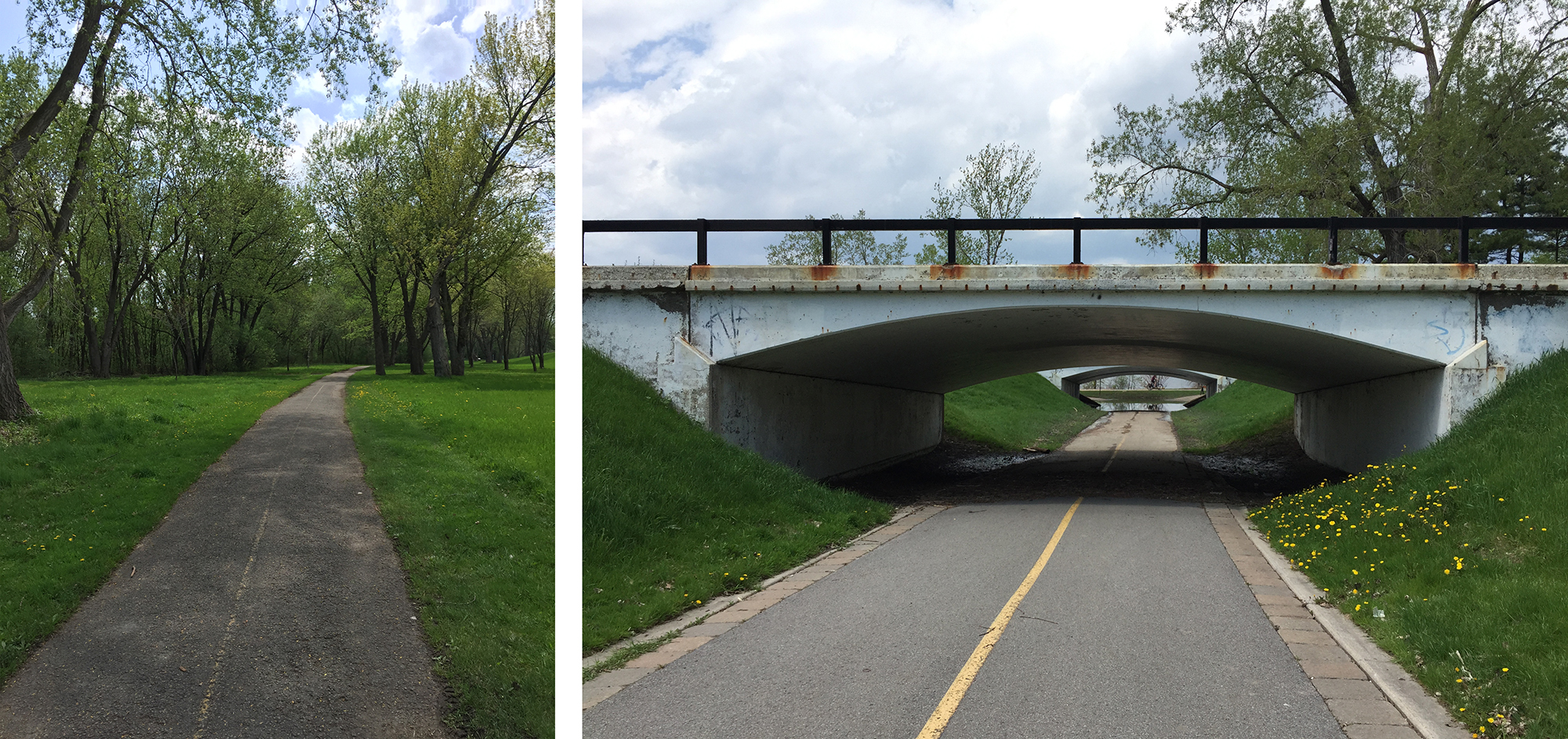
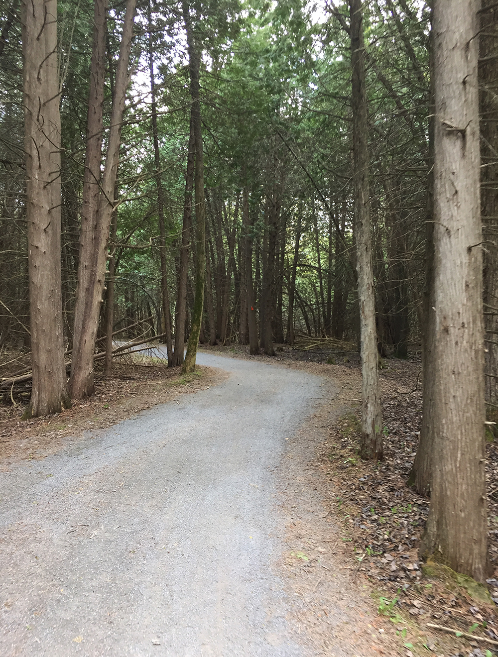
I continued along Watts Creek Pathway for a spell before turning on to the Greenbelt Pathway West. The Greenbelt Pathway is a packed gravel surface that rolls through a wonderful assortment of woods and fields before and after it crosses Corkstown Road and goes under the Queensway.
Greenbelt Pathway just south of the QueenswayGreenbelt Pathway meandering through cedars
The Greenbelt Pathway West meets up with the Trans-Canada Trail which I followed to Fitzgerald Road. I turned right onto Fitzgerald, then left on to Robertson Road at the lights. Robertson Road is a busy street with lots of traffic. It also has a bike lane between Fitzgerald and Moodie Drive.
Bike lane along Robertson Road
I turned right onto Moodie which also has a bike lane that goes only as far as Hadley Crescent. I rode along Hadley Crescent, then Tanglewood Drive, then Old Richmond Road to get to the second stop of the Nepean Bell at the corner of Robertson Road and Richmond Road. The building which was built to serve as the township headquarters in 1966 only lasted until 1988 when it was demolished and replaced it with a mini-mall. They had already moved to the Nepean City Hall at 101 Centrepointe Drive. Here’s a rendering of the building as it appeared before being torn down.
Rendering of Nepean City Hall located in Bells Corners
And here’s what the site looks like now.
Second stop of the Nepean Bell – 3825 Old Richmond Rd
I then wove my way through residential streets of the Lyndwood Village neighbourhood, which has a fine selection of mid-century-modern home designs.
Lovely Lyndwood Village
This brought me to Bruin Road beside Bell High School. Bruin Road gets you over highway 416 to the Bruce Pit. I took the path around the northern perimeter of Bruce Pit.
Path around Bruce Pit
Next I dipsy-do’d along a combination of paths and residential streets to get to the bike path that cuts diagonally along a hydro pole right-of-way to Centrepoint Drive.
Centrepoint Pathway
Once arrived at Centrepoint Drive, I rode around to the front of the old Nepean city hall to discover the Nepean Bell installed in the middle of a mini round-a-bout. I gave it a ring and it sounded great!
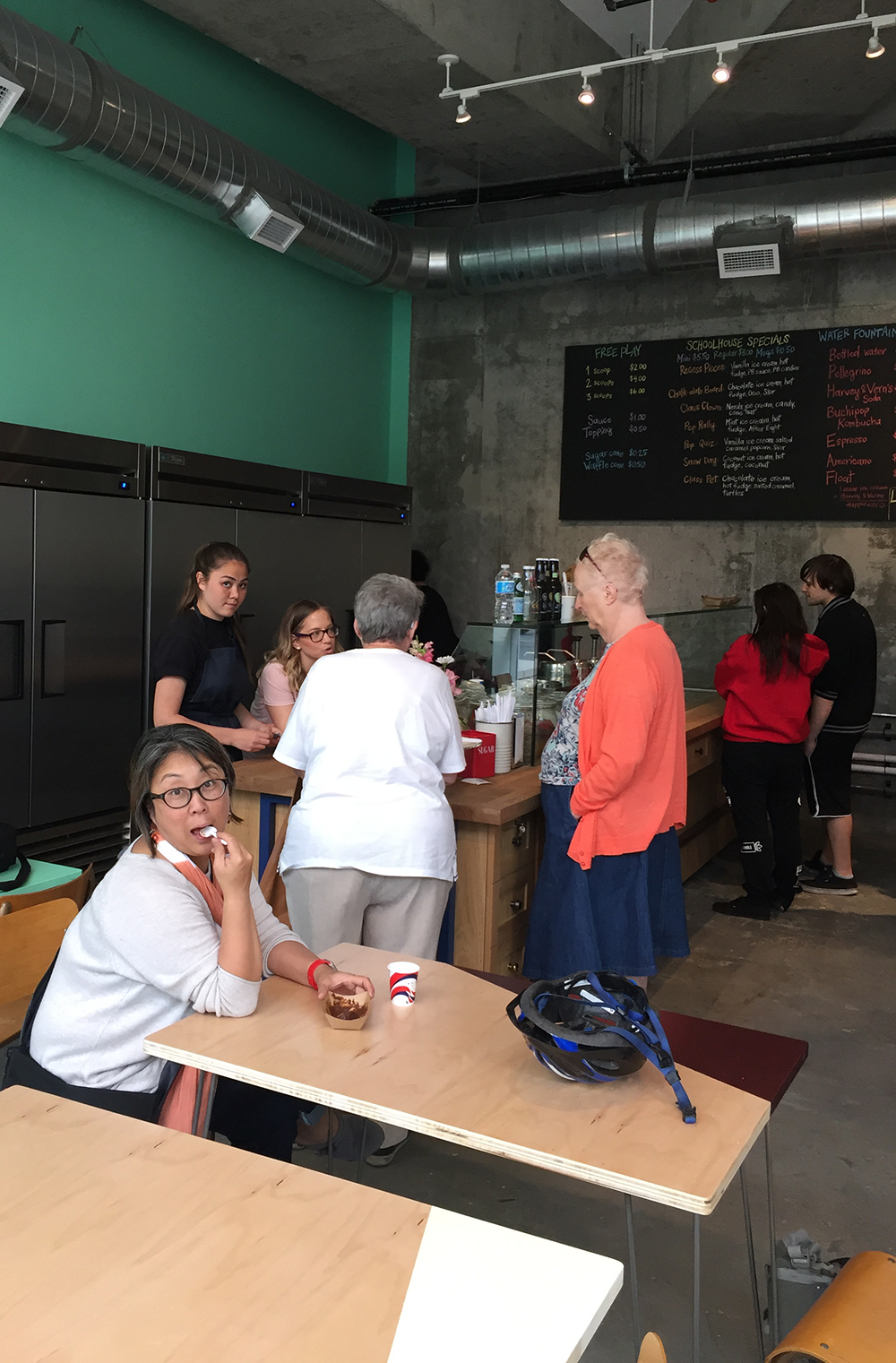
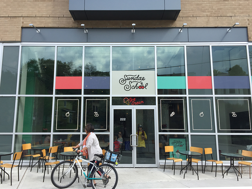
Sundae School is a brand new ice cream parlour on Beechwood Avenue. A couple of Chinatown residents are in need of a bike commute route to get there. The rest of us need a consume route because the ice cream is super delicious!
The blue line on the following map is the route Carla and I rode to get there. The short purple line is a slight variations heading back.
UPDATE – Summer 2018:Sundae School moved a couple of blocks south along Beechwood, on the west side of the street. Their new location is indicated on the map. Bike lanes have also since been added along Beechwood from when this route was originally posted, as indicated by the green line on the map below.
We begin at the corner of Primrose and Empress, right in front of the Dominican University College.
Dominican University College at the corner of Primrose and Empress
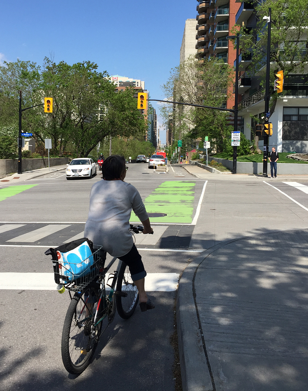
We rode east along quiet Primrose Avenue, then turned left on to Cambridge St North. This took us to Laurier Street. The segregated bike lane along Laurier starts on the other side of Bronson Avenue. We followed the Laurier Bike Lane all the way to City Hall.
Start of Laurier Bike Lane at Bronson
We then turned off Laurier at the exit ramp just before heading over the bridge, which took us down to Queen Elizabeth Drive. There isn’t a bike lane along the short exit ramp, but the lane is quite wide. That said, some do feel safer taking to the very wide sidewalk, while others cut through Marion Dewar Plaza infront of City Hall to Queen Elizabeth Drive to avoid having to ride along the exit ramp. If I was taking kids for an ice cream outing I would do the same. There are three way stop signs to facilitate cyclists and pedestrians wanting to cross Queen Elizabeth Drive to get on to the Rideau Canal Western pathway.
Riding along the Rideau Canal Western Pathway
Ww rode over the Rideau Canal via the Corktown Bridge.
Up and over the Rideau Canal along the Corktown Bridge
We crossed Nicholas Street at the lights and rode through the Ottawa U campus to King Edward Avenue. After crossing King Edward we sailed down Somerset East all the way to the Adawe bike & pedestrian bridge. This section of Somerset has a potpourri of vanishing and re-appearing painted bike lanes. It usually has lots of other cyclists too, as it serves as a well travelled bike link between the two non-car bridges.
Crossing the Adawe Bridge
Once over the Adawe Bridge we turned north along the Rideau River Eastern Pathway.
Rideau Rideau River Eastern Pathway
The pathway crosses Montreal Road. Many drivers tend to be extra antsy and aggressive at this intersection. Advance cross lights for pedestrians and cyclists would be helpful.
Crossing Montreal Road heading north along the Rideau River Pathway
We continued along the pathway, eventually arriving at St Patrick St where we could have turned up onto Beechwood but chose not to. That’s because the section along Beechwood for a couple of blocks immediately north of the river is attrocious for biking – very tight space with parked cars offering lots of dooring potential, and impatient drivers roaring up behind you on adrenaline rushes after flying along the St Patrick Street speedway. UPDATE- Fall 2017:This has all changed! as mentioned in the intro, there are now bike lanes along Beechwood (see green line on the above map). That said, the original route described below is still legit. We continued along the Rideau River Pathway under St Patrick before turning onto a short gravel path that took us to Crichton Street.
Path continuing under St Patrick St
Gravel path off Rideau River Pathway to Crichton St
We rode east half a block along Crichton to get to Vaughan Street – a quiet residential street heading north.
Vaughan St
This brings you to Putman Avenue. Their new 2018 location is at the corner of Putnam and Beechwood.
Sundae School (in their original 2017 location) !
Yummy!
Once we had finished our well deserved treat (I highly reccomend the chocolate flavour) it was time to head back.
The only variation on the route back was getting from the Rideau Canal Pathway to the segregated section of the Laurier Bike Lane that starts west of Elgin street. To get to the inersection of Laurier and Elgin we rode under the Laurier Bridge, then cut through Confederation Park.
The Ottawa Train Station is located a few kilometers outside of downtown. Here is a bike route to get there from Centretown.
I started off from the intersection of Laurier & Bronson avenues and headed east along the Laurier Bike Lane.
Laurier Bike Lane starting at Bronson Avenue
After passing in front of City Hall I took the exit towards Queen Elizabeth Drive and got on to the Rideau Canal Western Pathway.
UPDATE – July 2018:They’ve installed bi-directional multi-use lanes on the sidewalk just after you exit off Laurier.
Exit ramp off Laurier just beyond City Hall
Crossing Queen Elizabeth Drive to the Rideau Canal Western Pathway
I rode south along the Rideau Canal Western Pathway before crossing the canal over the Corktown bridge.
Up and over the Corktown Bridge
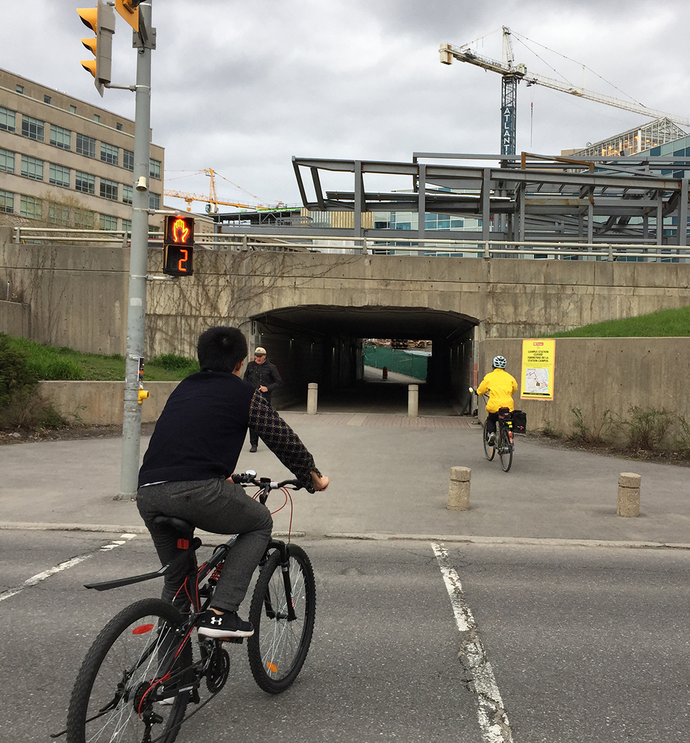
I traversed Colonel By Drive at the pedestrian lights and rode under the Nicholas Street tunnel, then up through the University of Ottawa campus.
Crossing Colonel By Drive towards the tunnel under Nicholas Street
After crossing King Edward Avenue at the traffic lights I rode straight down Somerset East before heading up and over the Rideau River on the Adawe Bridge.
Heading down Somerset Street East
Riding over the Adawe Bridge
On the opposite side of the river I turned right onto the Rideau River Easten Pathway.
Rideau River Easten Pathway
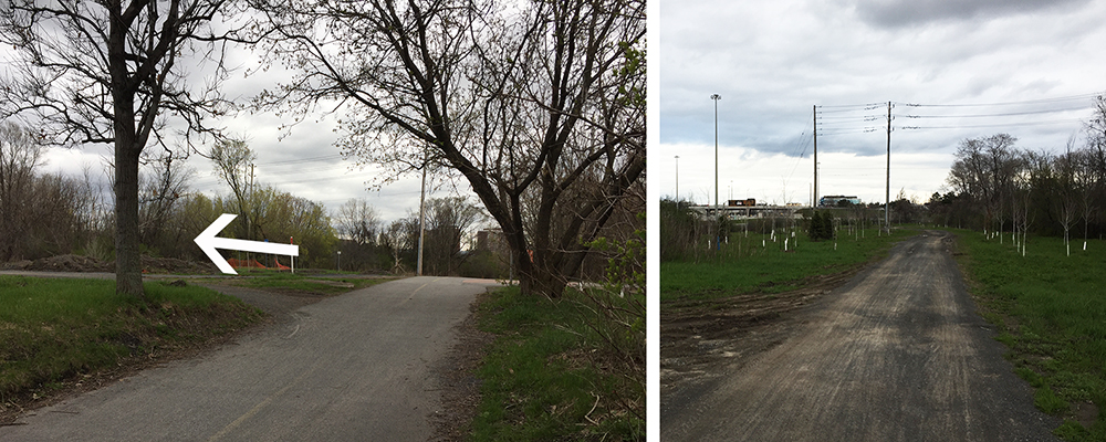
Just after riding under the Queensway along the Rideau River Easten Pathway I turned left onto a packed gravel path that leads to the intersection of Riverside Drive and Tremblay Road.
Gravel path off the Rideau River Eastern Pathway
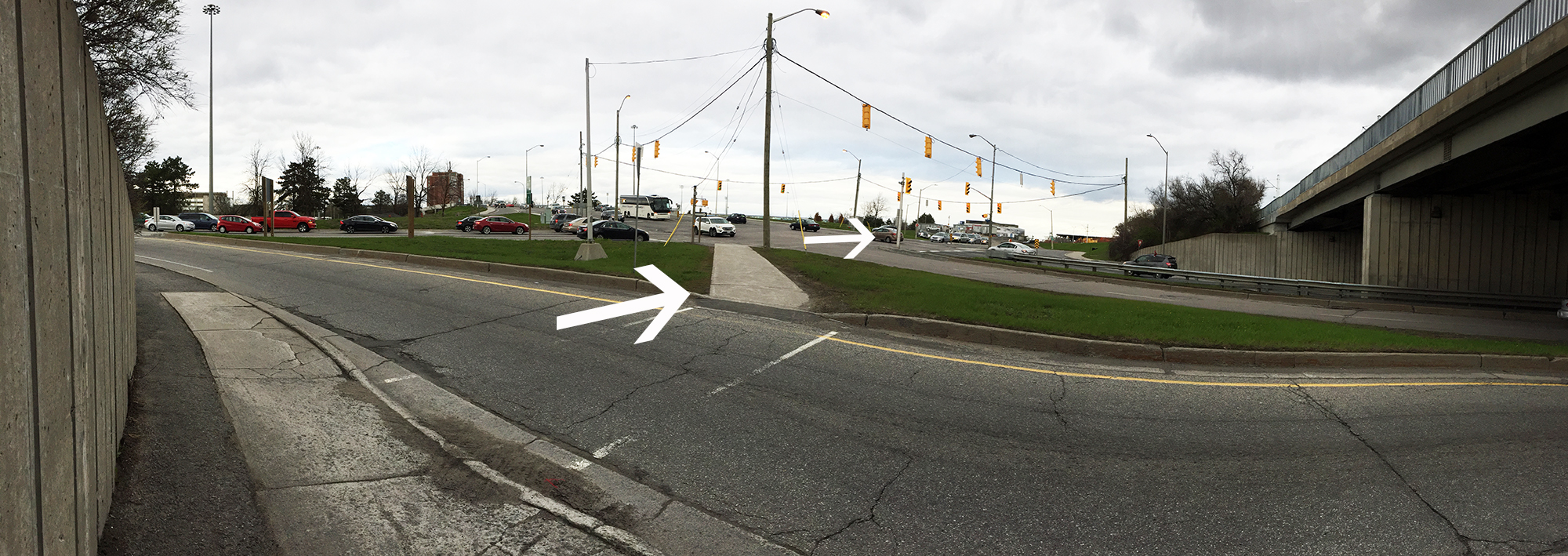
Crossing the Riverside Drive and Tremblay Road intersection is the least pleasant spot along this route. Something about Riverside Drive seems to compel drivers to become impatient speedsters. The oncoming left lane is also a Queensway off ramp with a yield sign to compel drivers to let you cross. There used to be a path that went over Riverside Drive, thus avoiding this intersection, but it is blocked off (temporarily I hope) as the new transit line is being constructed.
Approach to Riverside Drive and Tremblay Road intersection
Crossing Riverside Drive and Tremblay Road intersection
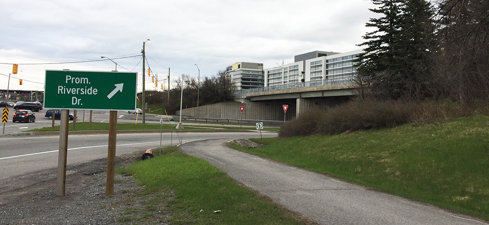
Once through the intersection I continued along the sidewalk that runs parallel to Tremblay before it becomes a paved path leading up to the train station.
Path along Tremblay up to the train station
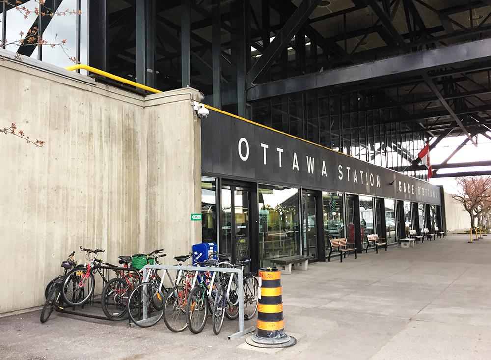
I passed all the taxis lining the circular approach to the front of the station to get to where there is a bike rack just to the left of the main doors. This location, along with the security camera hanging right above it, provides me with the confidence to leave my bike locked up to the rack when I go away on a train trip for a few days. It’s a huge improvement from a long time ago when the only option was to lock your bike to a post near the poorly lit car parking lot. That’s where I discovered my bike was stolen after returning from a weekend trip to Montreal. The bike rack out front is much better.
Bike parking at the train station
On the way back I retraced my route, except for the section along Laurier in front of City Hall. That’s because when heading west along the Laurier Bike Lane, the safe segregated section only starts at Elgin and Laurier. To get there I cut through Confederation Park as indicated by the purple line on the above map.
If anyone needs a bike route to the station from another area of town, send me a starting reference point by email or via the ‘Leave a comment’ tag.
April 28th is The Day of Mourning honouring workers in Canada who were killed, injured or disabled on the job. The following bike tour visits a number of sites throughout the region that allude to the Day of Mourning. The route is entirely along bike paths.
Our tour begins in Vincent Massey Park where sits a carved stone memorial chosen for it’s proximity to the Heron Road Workers Memorial Bridge, completed in 1967, a year after a previous bridge at the same site collapsed killing nine workers in the worst construction accident in Ottawa’s history.
Memorial in Vincent Massey Park commemorating the Day of Mourning
Ride along the Rideau River Eastern Pathway, then traverse Hogs Back Falls before turning onto the Rideau Canal Eastern Pathway. Cross the canal over the Hartwell Locks opposite Carleton University.
Continue down along the Rideau Canal Western Pathway through the Arboretum and around Dows Lake. A short distance away from the northern edge of Dows Lake on Preston Street a construction site accident occurred on March 23, 2015 – the tragic death of Olivier Bruno who was struck by a falling chunk of ice while inspecting the construction pit.
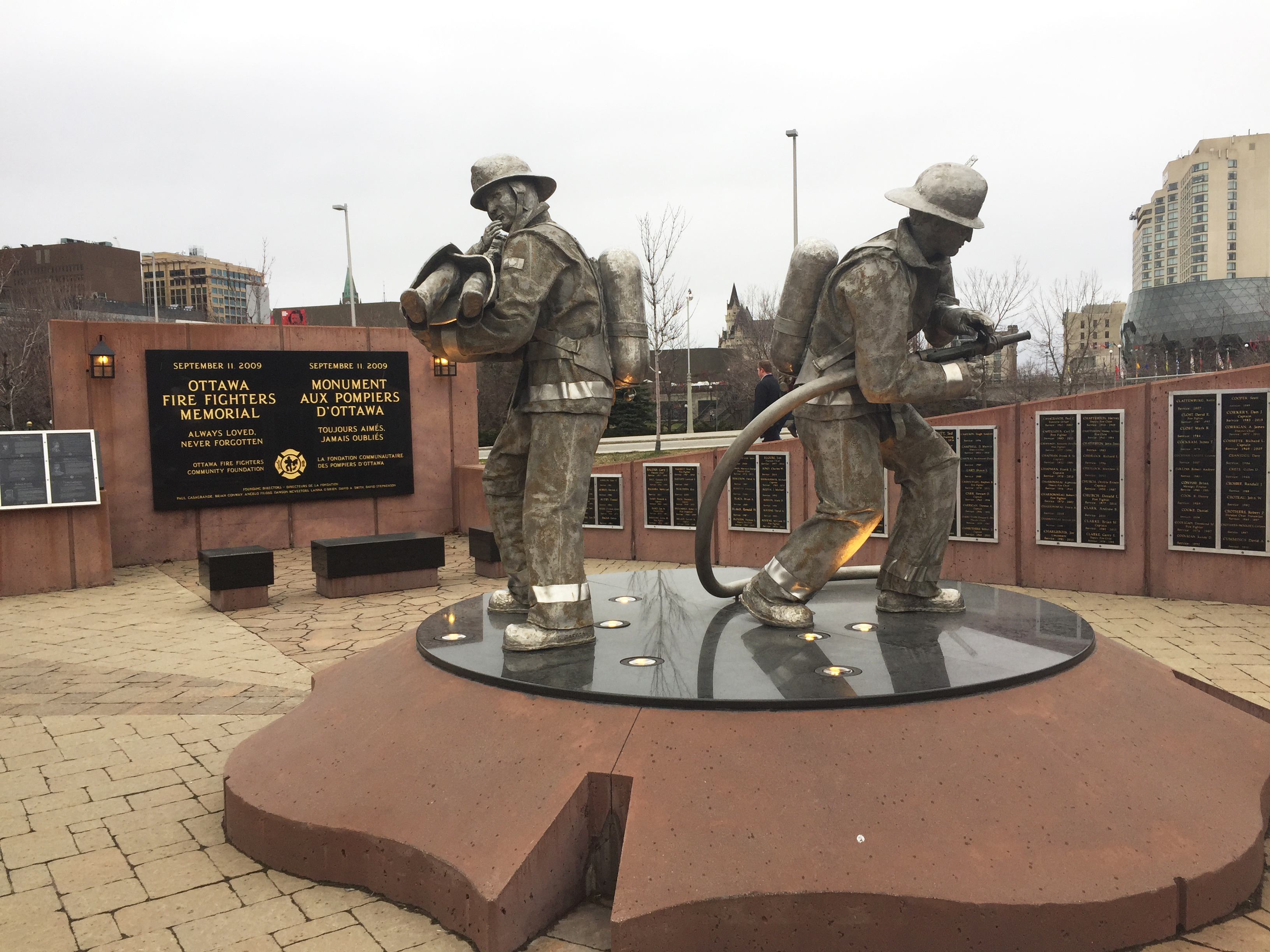
Continue along the canal as far as City Hall where, at the north east corner of the plaza in front of City Hall, you will find the Ottawa Firefighters Memorial. This memorial includes a number of marble plaques commemorating firefighters who have perished in the line of duty, some dating back to the mid 1800’s.
Ottawa Fire Fighters Memorial
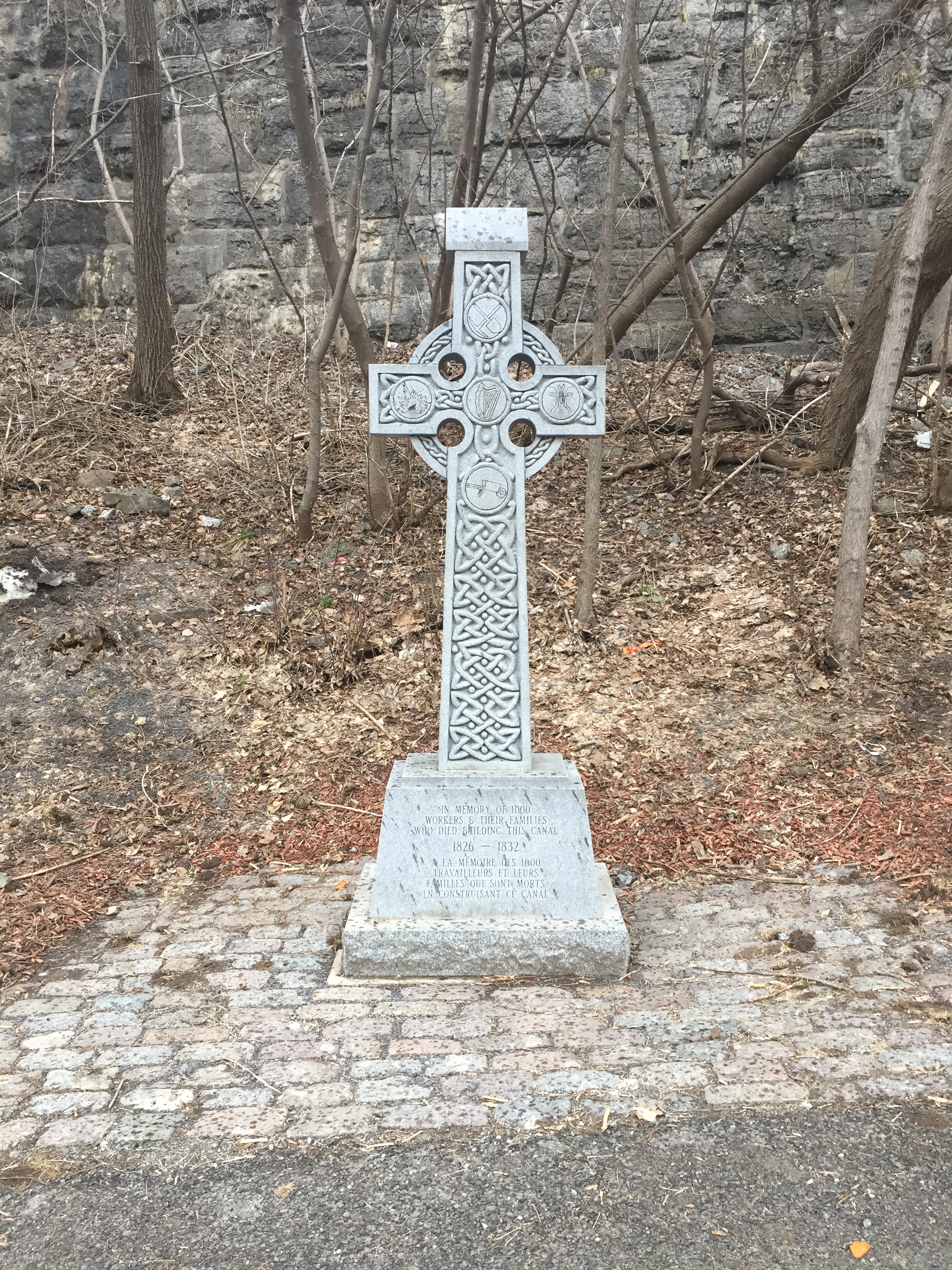
Head back to the Rideau Canal Pathway and continue north along the edge of the canal. Just before reaching Sappers Bridge that passes under Wellington Street, you will encounter two short sets of stairs. These have metal troughs along which you can push your bike to avoid having to carry it up the stairs. Ride under the bridge, then down the hill. The canal locks wil be to your right and Parliament Hill high up above to your left. Cross over to the other side of the canal across the second to last set of locks closest to the Ottawa River. Once on the opposite side of the canal you will notice a celtic cross. The engraving in the base of the cross reads,’In memory of 1000 workers and their families who died building this canal’. An accompanying interpretive panel helps to explain the context in which these workers found themselves and the hardships they endured. UPDATE, August 2017 – Unfortunately the cross was knocked over and has yet to be replaced. UPDATE, April 2018 – The cross has been replaced.
Commemorative Cross dedicated to Rideau Canal workers & family members who perished
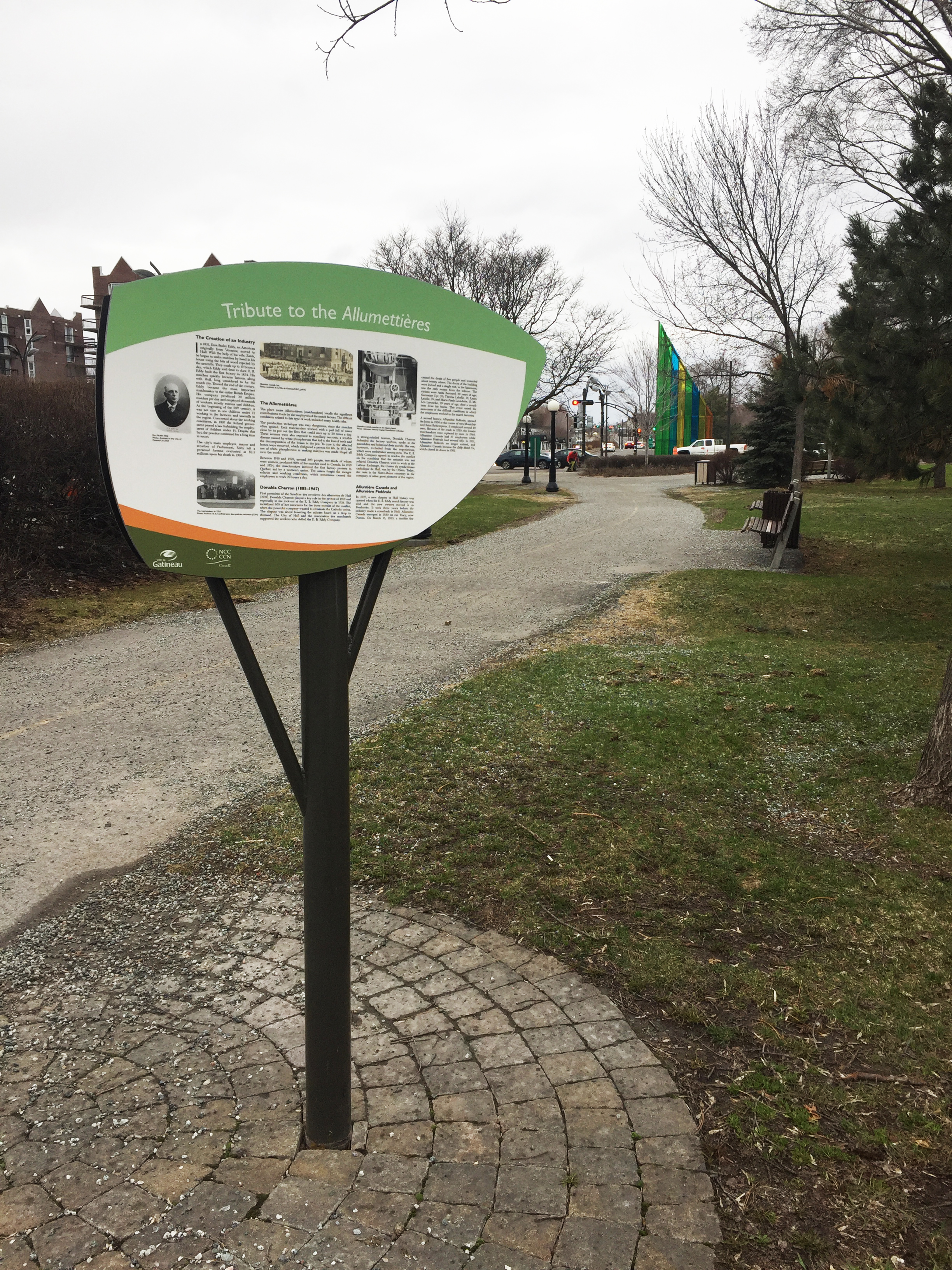
The bike tour continues up the hill to the left of the cross. At the top of the hill, turn left onto the bike path and cross the Alexandra Bridge over the Ottawa River along the wooden boardwalk. Once arrived on the Quebec side of the bridge, cross the intersection to the opposite corner where the Sentier de l’Île pathway begins. This path heads inland along Boulevard des Allumettières. Les Allumettières were female workers in the local EB Eddy plant who fabricated wooden matches from the 1800’s up until 1928 when the plant closed. The working conditions they endured were extremely dangerous and unhealthy. An interpretive panel along the path goes into more detail on the incredible challenges Les allumettières encountered.
Tribute to Les Allumettières
Thus completes The Day of Mourning bike tour. For those interested in further exploring the path along Sentier de l’ile check out this ride.