Earlier this year I happened upon a story of a group of Gatineau citizens trying to convince the city to preserve a section of forest located in the Deschênes neighbourhood that was destined to be sold for development. One of the group’s compelling arguments, amongst many, was to preserve a rare stand of white oaks. Good news – they succeeded!
Knowing little about white oaks or their status within the region I decided to track a few down. Here is a route linking three specimens that are relatively easy to access by bike.
We begin in the Dominion Arboretum where sits this white oak planted in 1996. This one was easy to identify as it has an aluminum plaque attached to it with all the identifying info, as is typical with most of the trees in the arboretum.
Young white oak in the Arboretum
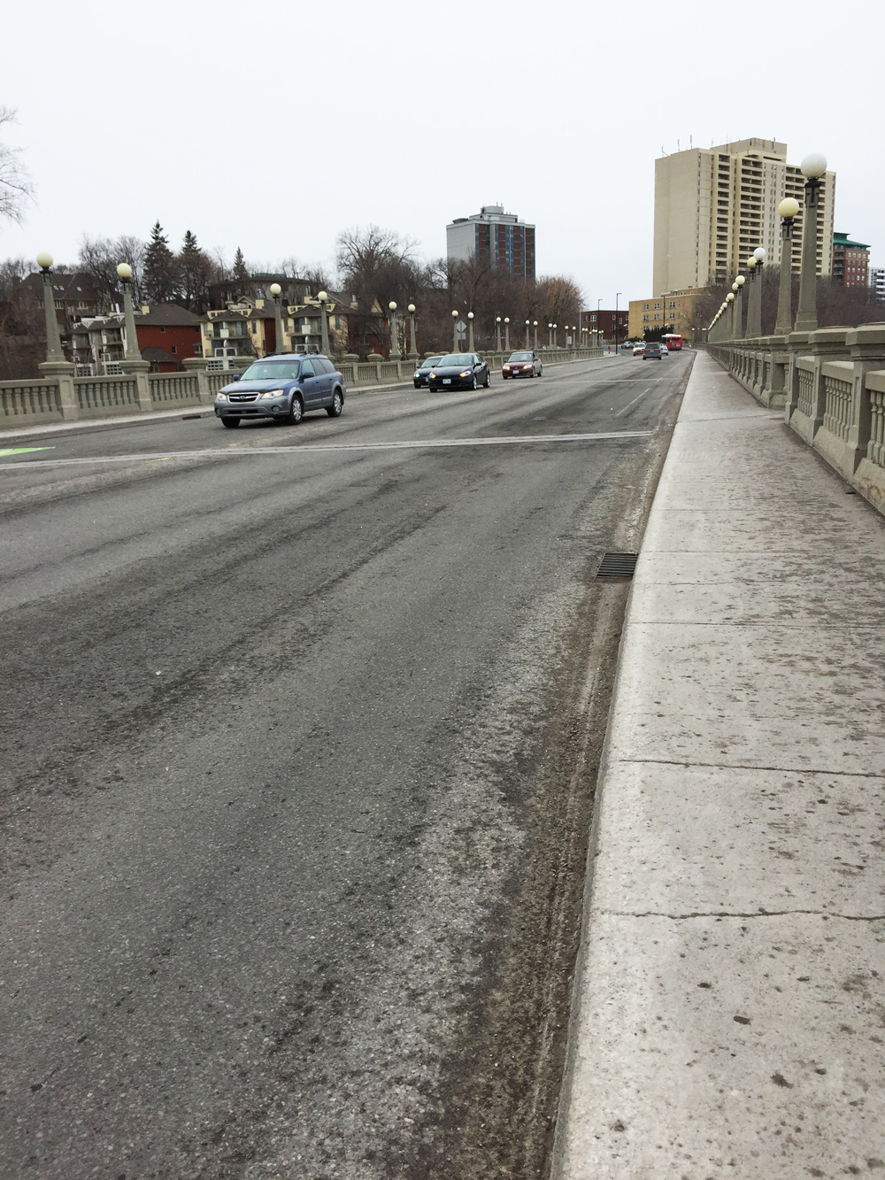
After leaving the arboretum and riding over to the Ottawa River Pathway one has two choices; continue westwardly on the Ontario side as far as the Britannia Park neighbourhood, or cross the Island Park Bridge and ride along the Voyageurs Pathway as far as Deschênes.
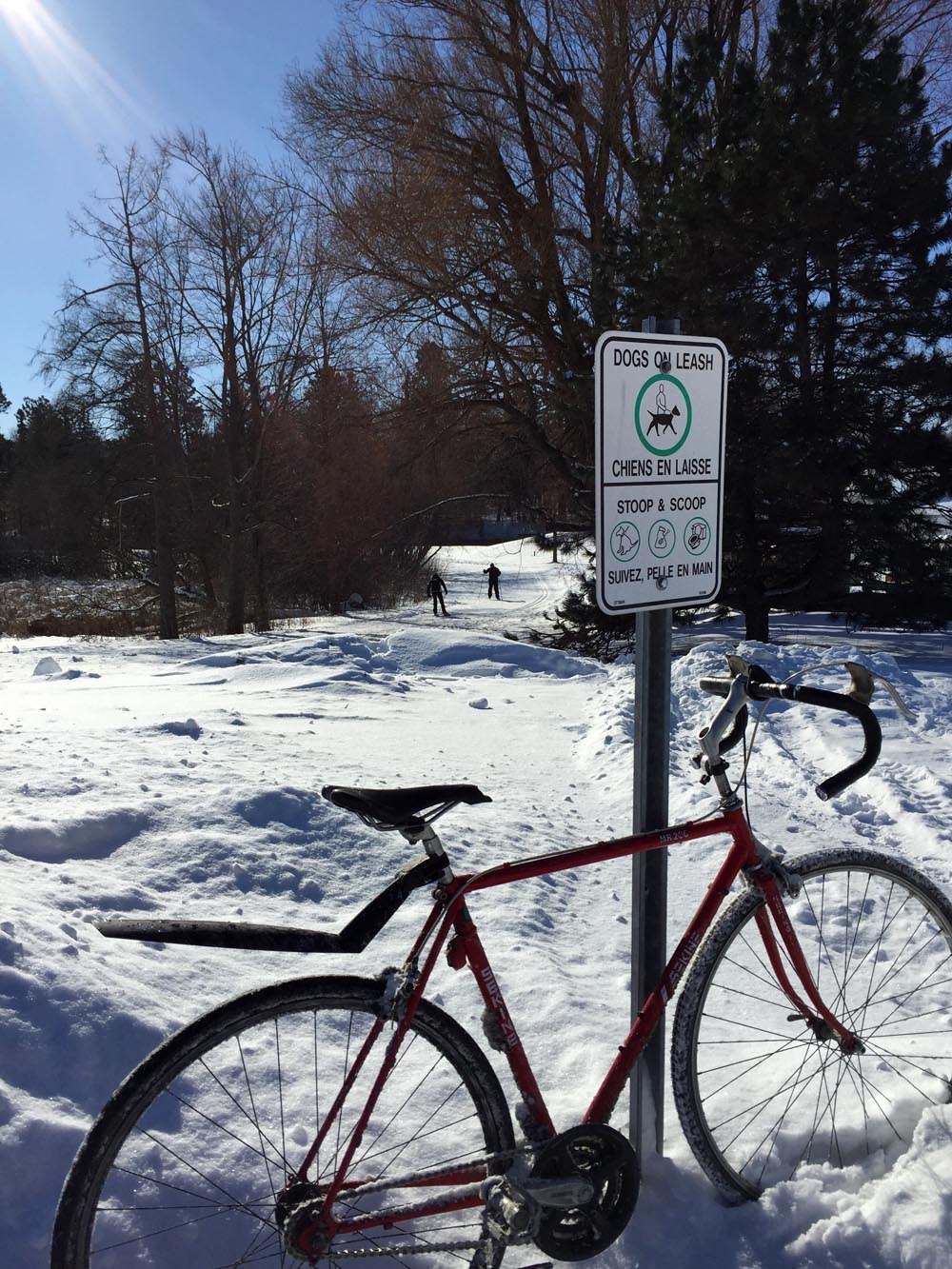
I first visited the white oak in Britannia Park which is situated just within the chain link fence that designates the edge of the Britannia Conservation Area. Bikes aren’t allowed beyond the fence so I locked mine up and walked the short distance. I was able to locate this tree with the help of the iNaturalist app/website.
Britannia Conservation Area
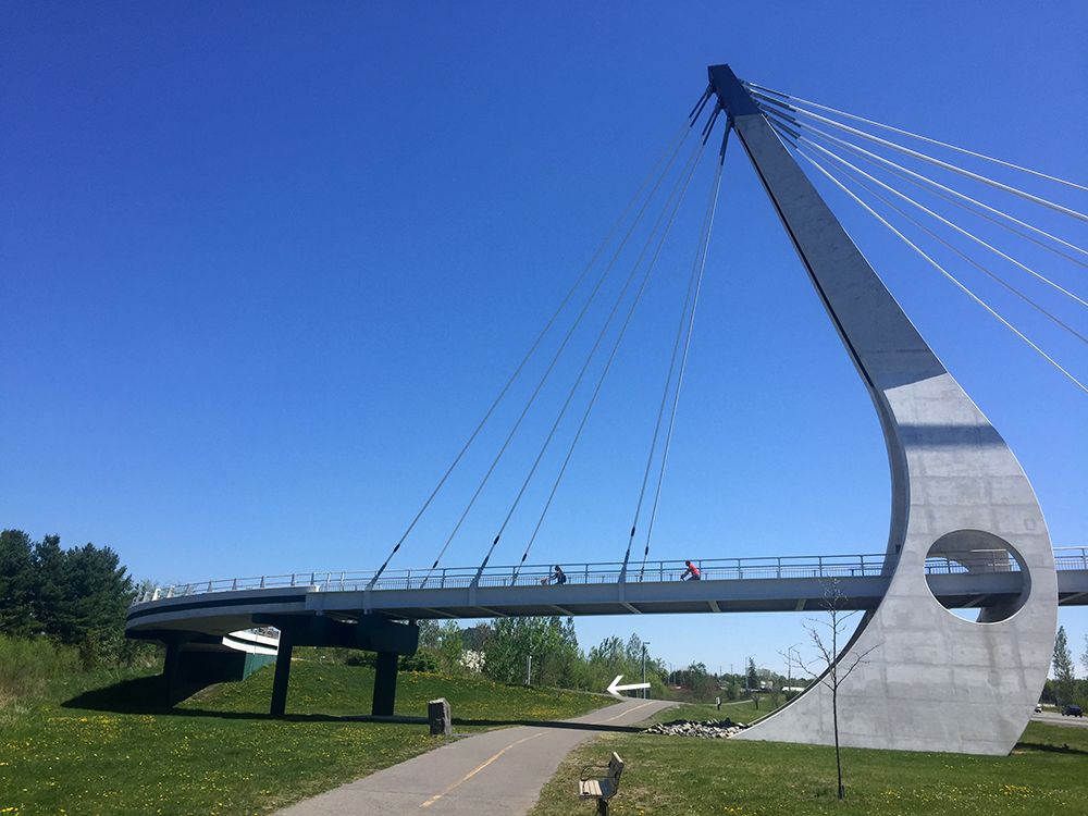
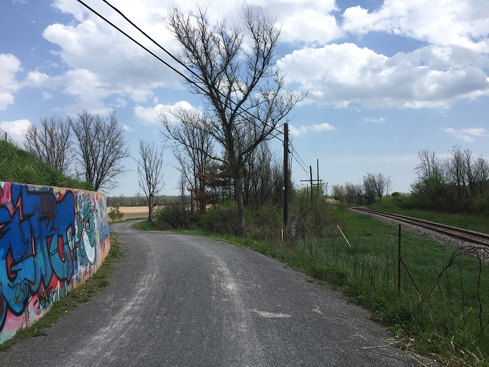
The white oak I was able to find in Deschênes Forest is a short distance off the Voyageurs Pathway. There is a path through the woods one can follow to get there, the entrance to which is just before you reach Chemin Fraser.
The O-Train Trillium Line is closed until some time in 2022 as they lengthen the tracks. Here is a bike route that visits each of the original stops, starting from Bayview Station at the northern end of the line. The route is indicated by the blue line on the following map.
Follow the Trillium Pathway heading south under the Bayview Station.
Trillium Path heading south under the Bayview Station
This path continues beside the O-Train tracks.
Trillium Pathway running alongside O-Train tracks
There is a slight detour one block over along Preston heading under the Queensway.
Short detour along Preston St
Beyond the Queensway the path continues beside the tracks. A bit further along is the second O-Train stop, Carling Station.
Carling Station
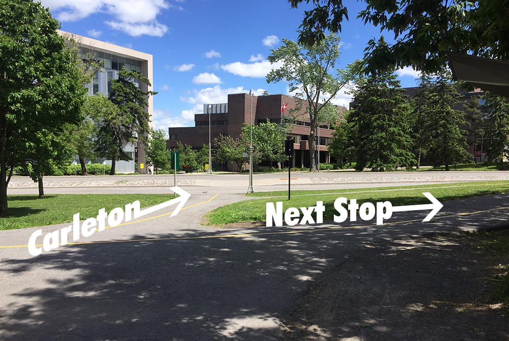
Next stop – Carleton University.
Cross Carling Avenue at the lights and continue straight along the Trillium Pathway to where it ends at Prince of Wales Drive. Turn left along the path that runs parallel to Prince of Wales Drive, then cross at the lights at Dows Lake.
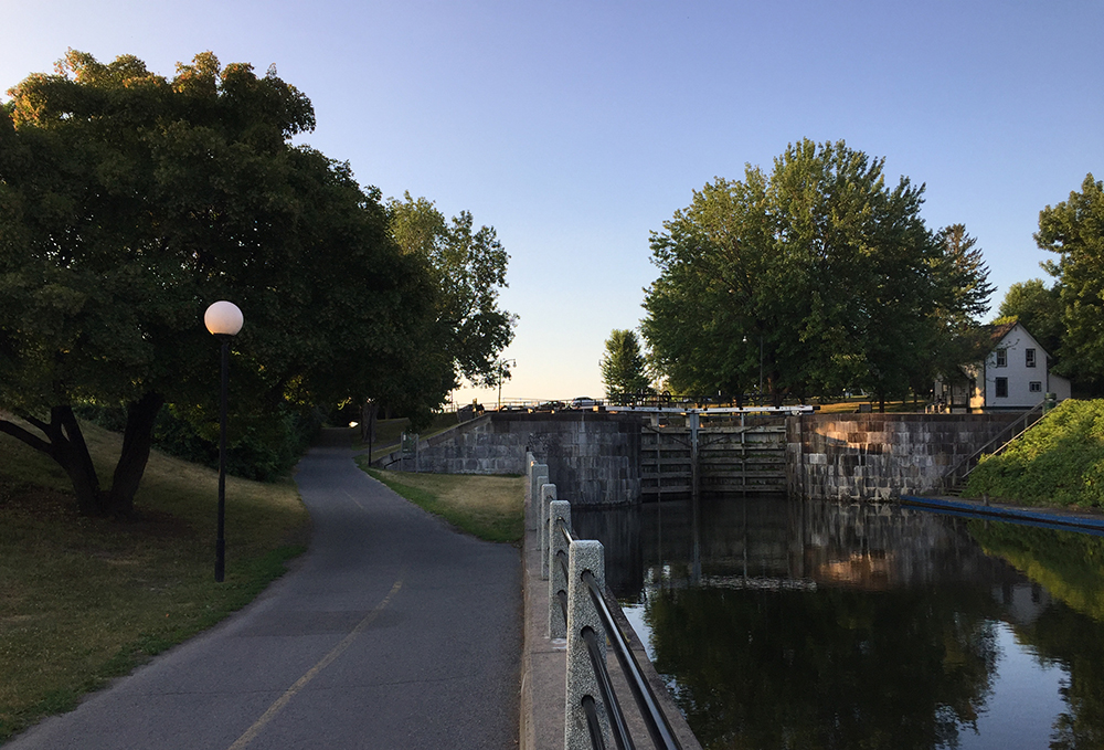
Follow the bike path that runs through the Arboretum. This path eventually runs parallel to the Rideau Canal and up to the Hartwell Locks across from Carleton University. Cross the canal at the locks.
Bike path through the Arboretum
Crossing the Hartwell Locks
If Carleton University is your destination then cross Colonel By Drive and you’re on campus. Left on Library Road brings you down to the Carleton Station.
Carleton Station
If your destination is a stop further down the line don’t cross Colonel By Drive. Instead turn right and ride along the Rideau Canal Eastern Pathway.
Rideau Canal Eastern Pathway
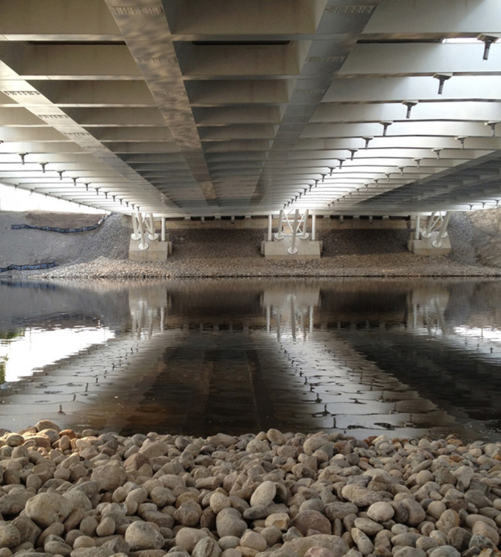
The path goes under Hogs Back Road, then curls up to Mooney’s Bay.
Heading up past the locks and under Hog’s Back Road
First sight of Mooney’s Bay
Turn right onto Hog’s Back Road. The Hog’s Back Road bridge over the Rideau River is presently being rebuilt however there is a detour that runs along the side of this short bridge. Bonus – this affords a spectacular view down onto the falls.
Hogs Back Falls
Once over the bridge and back onto Hogs Back Road you can ride along either path on both sides of the street although I would suggest crossing onto the south side so it’s easier to cross busy Riverside Drive at the next lights.
View down Hogs Back Road
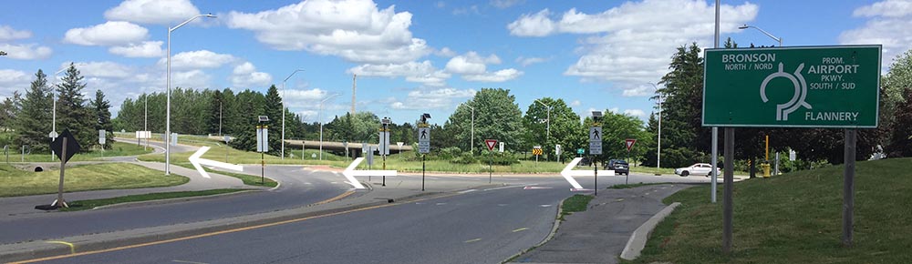
Crossing Riverside Drive brings you to Brookfield Road which has a bi-directional bike path on the south side of the road. Follow this path all the way to the round-about. Once arrived at the round-about take the first crosswalk to the other side of Brookfield Road.
Crossing Brookfield Road at the round-about
If your destination is the Mooney’s Bay Station turn left onto the path that meanders for a short distance down to the station.
Left to Mooney’s Bay Station or right to next station
Mooney’s Bay Station
If your destination is the next stop, Greenboro Station, then turn right onto the Brookfield Pathway that skirts the edge of the round-about before curving under the Airport Parkway and up over a set of train tracks.
Brookfield Pathway heading over the train tracks
Just beyond the train tracks turn right onto the Sawmill Creek Pathway. This path runs mostly alongside the Airport Parkway. It veers off a bit and follows the transitway for a short spell before continuing along the Parkway. You will ride past the Sawmill Creek Wetland, a fantastic series of ponds and a natural habitat for all sorts of birds.
Exit off the Brookfield Pathway onto the Sawmill Creek PathwaySawmill Creek Pathway running alongside the Airport Parkway
Continue under the distinct pedestrian/bike bridge, then take the second exit left off the pathway (the first exit is the ramp up over the bridge. Don’t take that) .
Heading under the bridge towards the second exit off the Sawmill Creek Pathway
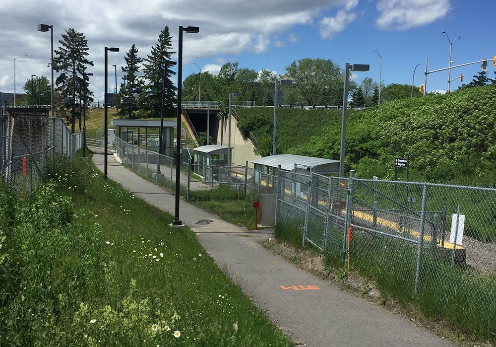
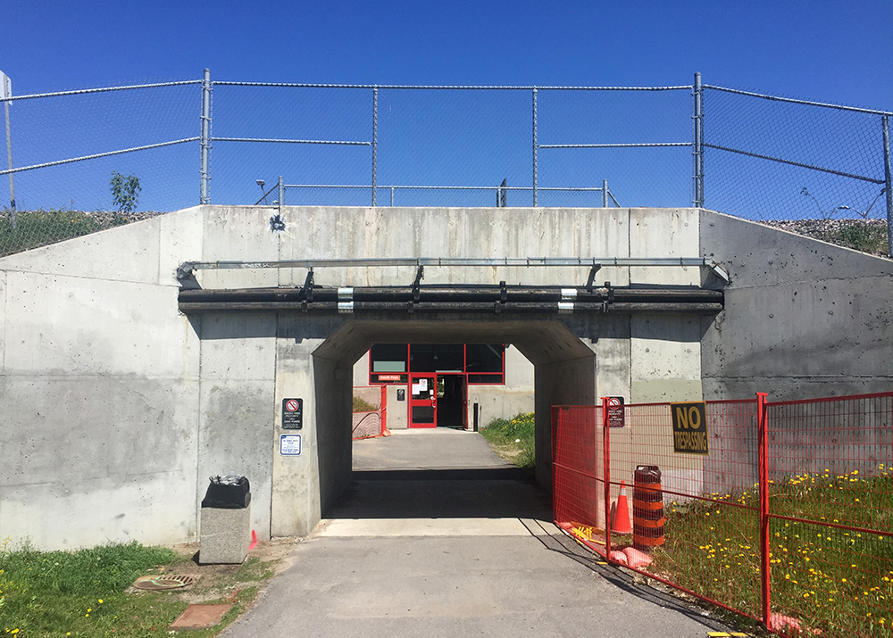
This short section of path will take you to a tunnel that leads under the O-Train tracks, then through an enclosed passageway that goes under the transitway. The confusing sign at the entrance of the enclosed section says no bikes allowed, but OC Transpo confirmed you can walk your bike through.
Tunnel & passageway
On the other side you will find yourself at the southern back corner of South Keys Shopping Centre. Turning left onto the service road that runs behind the shopping centre will bring you to our final stop, Greenboro station.
Greenboro Station
Et voila!
Biking is a great alternative to taking the train.
Cast iron bells can become unifying symbols for a community. Their distinct clarion call draws together those within earshot towards a shared experience. The Nepean Bell became such a symbol when it was first hung and rung back in 1896 from the old town hall in Westboro. As the seat of government of Nepean Township moved south-west, then east, the bell went with it. This bike tour visits the three locations the Nepean Bell has occupied since its arrival in our region. It is also a ride along a number of wonderful bike paths in the western end of town through varied terrain. The purple line is a return shortcut to get to the starting point.
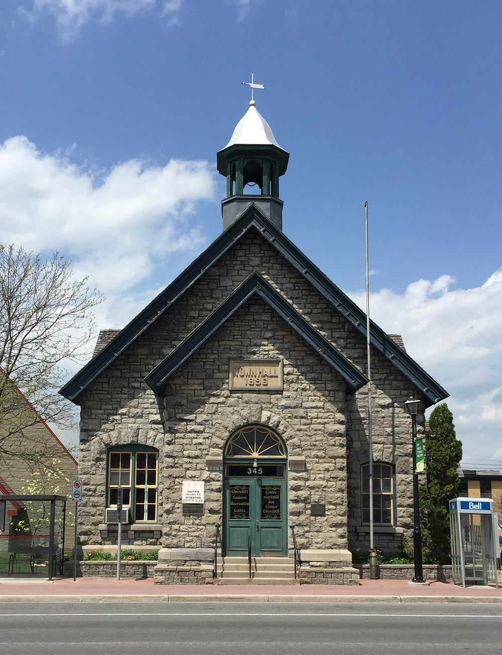
Our tour begins in front of the old Town Hall building in Westboro located at 345 Richmond Road where the Nepean Bell began its public life. The building was designed by architect Moses Chamberlain Edey and opened in 1896 as the Town Hall building for the Township of Nepean.
Old Town Hall in Westboro. Note the empty bell tower.
The eastern portion of Nepean Township was annexed by the city of Ottawa in 1950, however the old town hall continued to serve as Nepean Township’s headquarters until 1966. Once the construction of new headquarters were completed further west in Bells Corners the township authorities took the beloved bell with them. There they installed the bell on the front lawn in a sculpted tripod base. Each leg was a different height, meant to represent a member of the traditional nuclear family, i.e. mother, father and child. The image of this sculpture became the logo for the City of Nepean until The Great Ottawa Amalgamation of 2001. The logo is still evident on street signs, park signs, etc throughout the former city of Nepean. Note – the name Bells Corners far predates the arrival of the Nepean Bell.
City of Nepean logo
To get to the Nepean Bell’s second home at the intersection of Old Richmond Road and Robertson Road in Bells Corners I headed over to the path that runs along the south side of the Sir John A Macdonald Parkway and followed it as far as the intersection that passes under the parkway and onto the Ottawa River Pathway.
Path along Sir John A. MacDonald Driveway…. and underpass to get to the Ottawa River Pathway.
I followed the Ottawa River Pathway all the way to Britannia Bay. There I crossed Carling at the lights and got on to the Watts Creek Pathway. Where Watts Creek Pathway crosses Holly Acres Road is a bit tricky, as the path continues a short ways up quiet Aero Drive. This link is barely visible from Holly Acres Road.
White arrow shows where Watts Creek Pathway pathway continues a short way Aero Drive, as seen from Holly Acres Road
Watts Creek Pathway meanders through a wooded area before crossing Corkstown Road. Once across Corkstown Road the path follows a new paved section that goes along the edge of some baseball fields to get to lights across Moodie Drive. This new section of path is a great improvement on the previously poorly maintained path that was regularly flooded.
Section of Watts Creek Pathway from Corkstown to Moodie
I continued along Watts Creek Pathway for a spell before turning on to the Greenbelt Pathway West. The Greenbelt Pathway is a packed gravel surface that rolls through a wonderful assortment of woods and fields before and after it crosses Corkstown Road and goes under the Queensway.
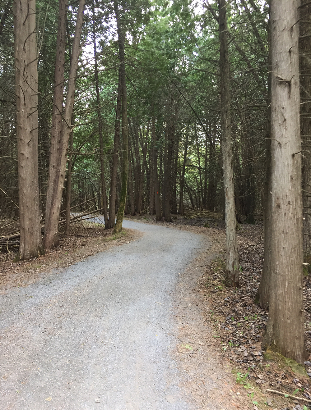
Greenbelt Pathway just south of the QueenswayGreenbelt Pathway meandering through cedars
The Greenbelt Pathway West meets up with the Trans-Canada Trail which I followed to Fitzgerald Road. I turned right onto Fitzgerald, then left on to Robertson Road at the lights. Robertson Road is a busy street with lots of traffic. It also has a bike lane between Fitzgerald and Moodie Drive.
Bike lane along Robertson Road
I turned right onto Moodie which also has a bike lane that goes only as far as Hadley Crescent. I rode along Hadley Crescent, then Tanglewood Drive, then Old Richmond Road to get to the second stop of the Nepean Bell at the corner of Robertson Road and Richmond Road. The building which was built to serve as the township headquarters in 1966 only lasted until 1988 when it was demolished and replaced it with a mini-mall. They had already moved to the Nepean City Hall at 101 Centrepointe Drive. Here’s a rendering of the building as it appeared before being torn down.
Rendering of Nepean City Hall located in Bells Corners
And here’s what the site looks like now.
Second stop of the Nepean Bell – 3825 Old Richmond Rd
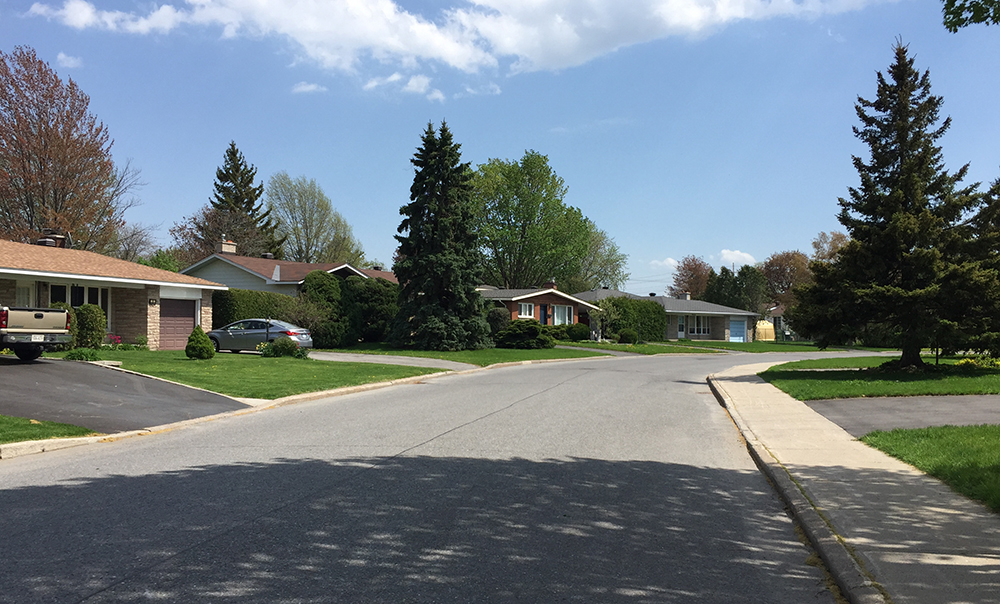
I then wove my way through residential streets of the Lyndwood Village neighbourhood, which has a fine selection of mid-century-modern home designs.
Lovely Lyndwood Village
This brought me to Bruin Road beside Bell High School. Bruin Road gets you over highway 416 to the Bruce Pit. I took the path around the northern perimeter of Bruce Pit.
Path around Bruce Pit
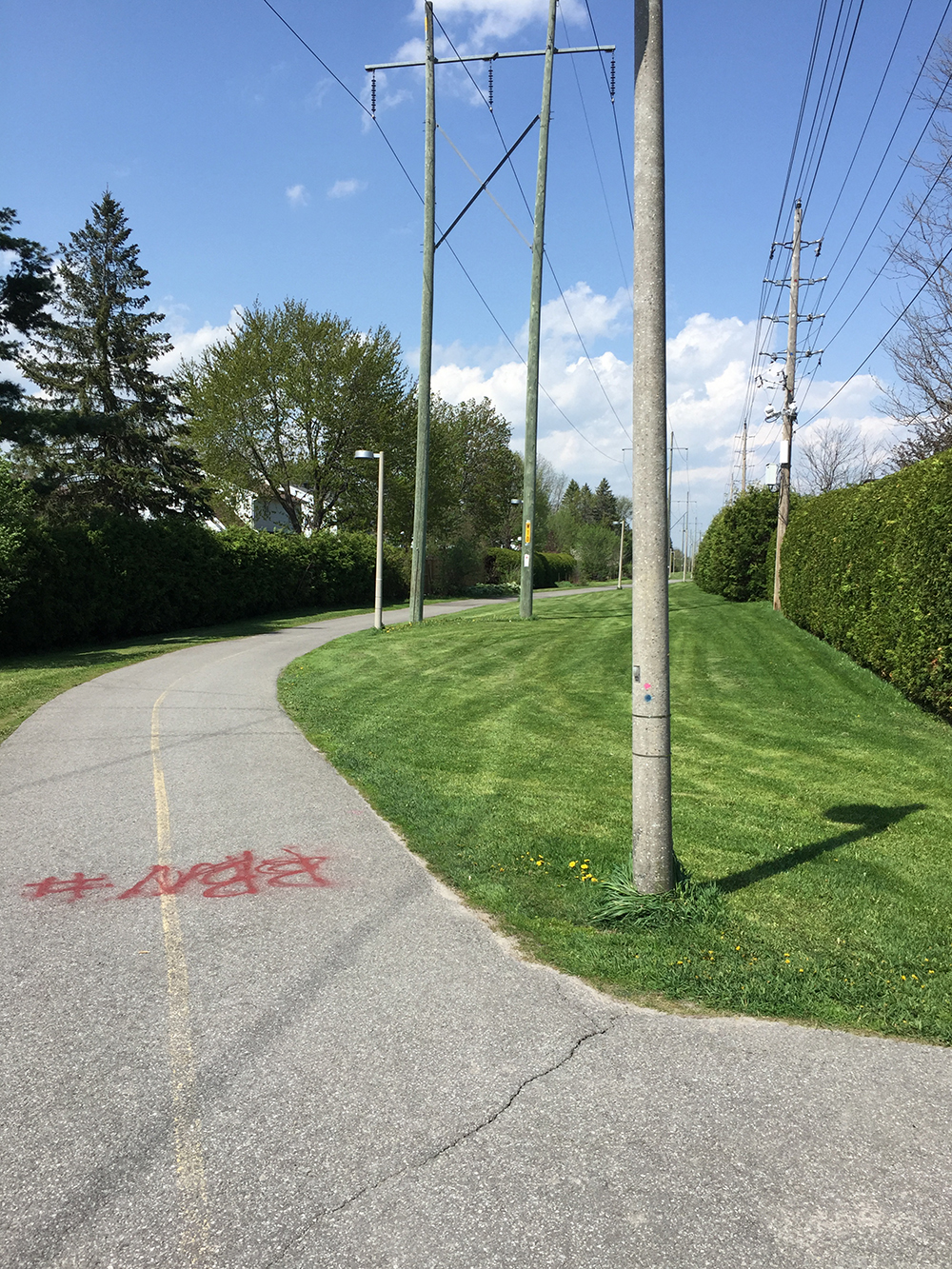
Next I dipsy-do’d along a combination of paths and residential streets to get to the bike path that cuts diagonally along a hydro pole right-of-way to Centrepoint Drive.
Centrepoint Pathway
Once arrived at Centrepoint Drive, I rode around to the front of the old Nepean city hall to discover the Nepean Bell installed in the middle of a mini round-a-bout. I gave it a ring and it sounded great!
All sorts of midsummer flowers are in bloom! There are a number of wonderful gardens throughout the National Capital Region that are open to the public and maintained with lots of tender loving care. Here’s a ride I took to visit a few of them that , starting along the O-Train path between Carling and Scott.
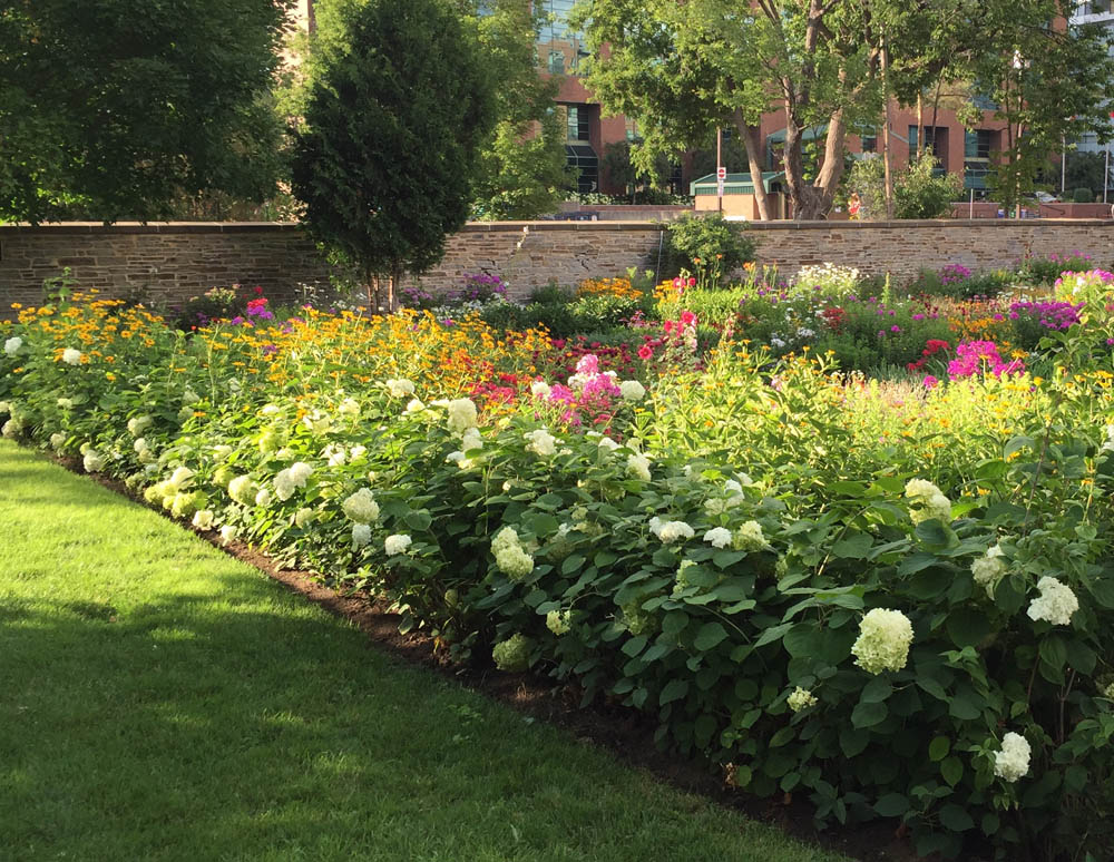
Second stop – the First Unitarian Meditation Garden, located at 30 Cleary Ave beside the very cool looking modern church. As the name implies, this horticultural gem has a more organic groove to it with lots of wonderful discoveries to be made along its meandering paths. It is also maintained by a volunteer group of garden enthusiasts.
First Unitarian Meditation Garden
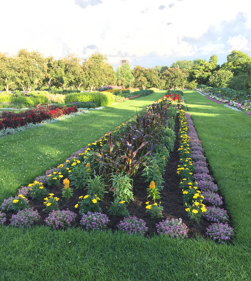
Third Stop – The Central Experimental Farm Ornamental Gardens, just off Prince of Wales Drive south of the round-about. Here’s a link to a detailed map that shows it’s location, along with a number of other gardens on the Farm. The layout of this garden is strict but the flora is fantastic! Another volunteer group plays a big role in maintaining the garden.
Central Experimental Farm Ornamental Garden
Fourth stop – Beyond the Edge: Artists’ Gardens, located across the street and a short distance further south along Prince of Wales Drive. The three art garden installations are located along a path that circles around a big Agriculture Canada research plot. This annual display is organized by the Candenses Botanical Garden Society.
Engelina Schmitz: Bee Haven
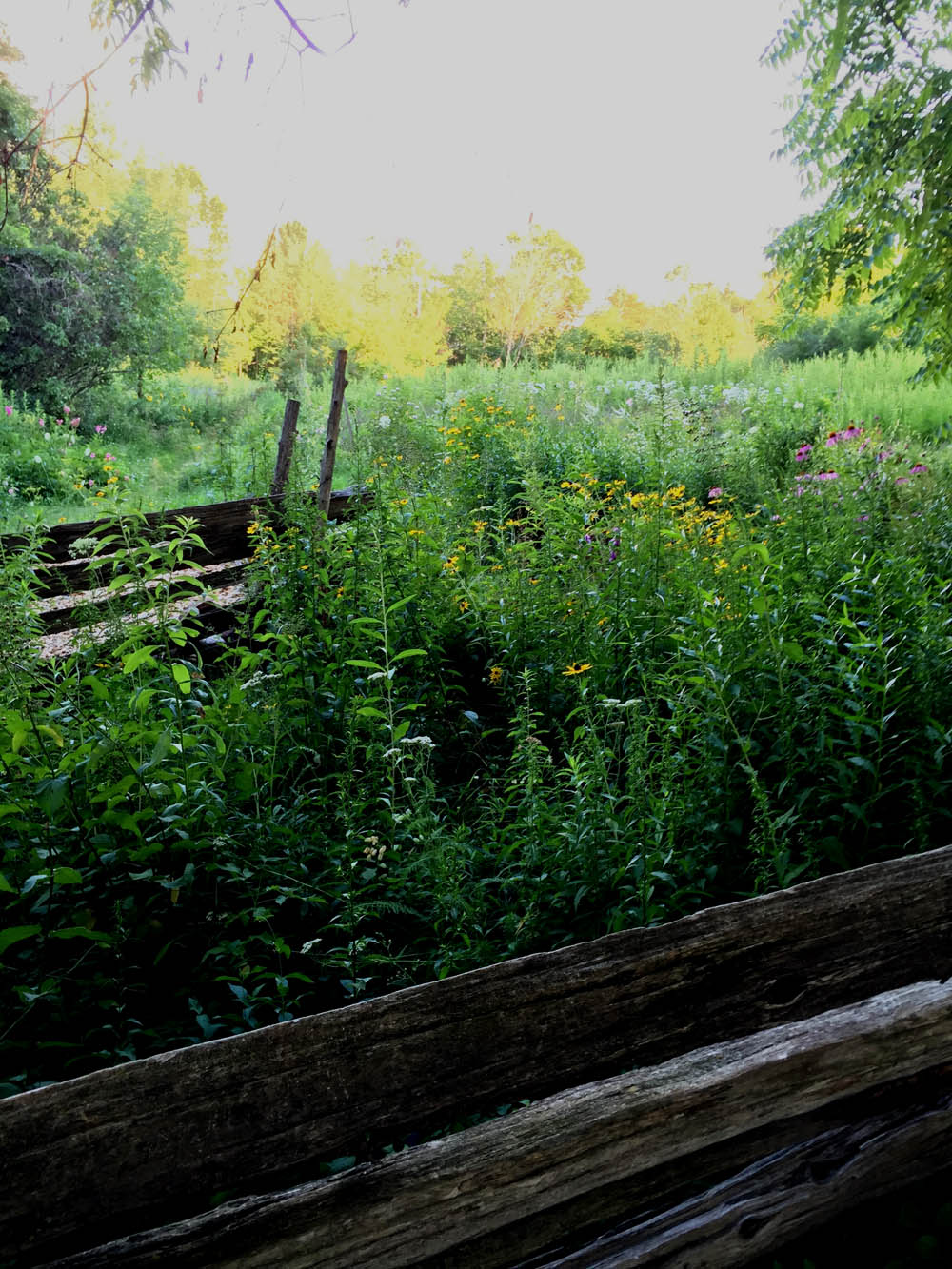
Final stop – Fletcher Wildlife Garden, accessible by path just to the east of our previous stop. Lots of volunteers help maintain this magical network of paths that run through a mixture of natural habitats and gardens. Well worth a visit any time of the year.
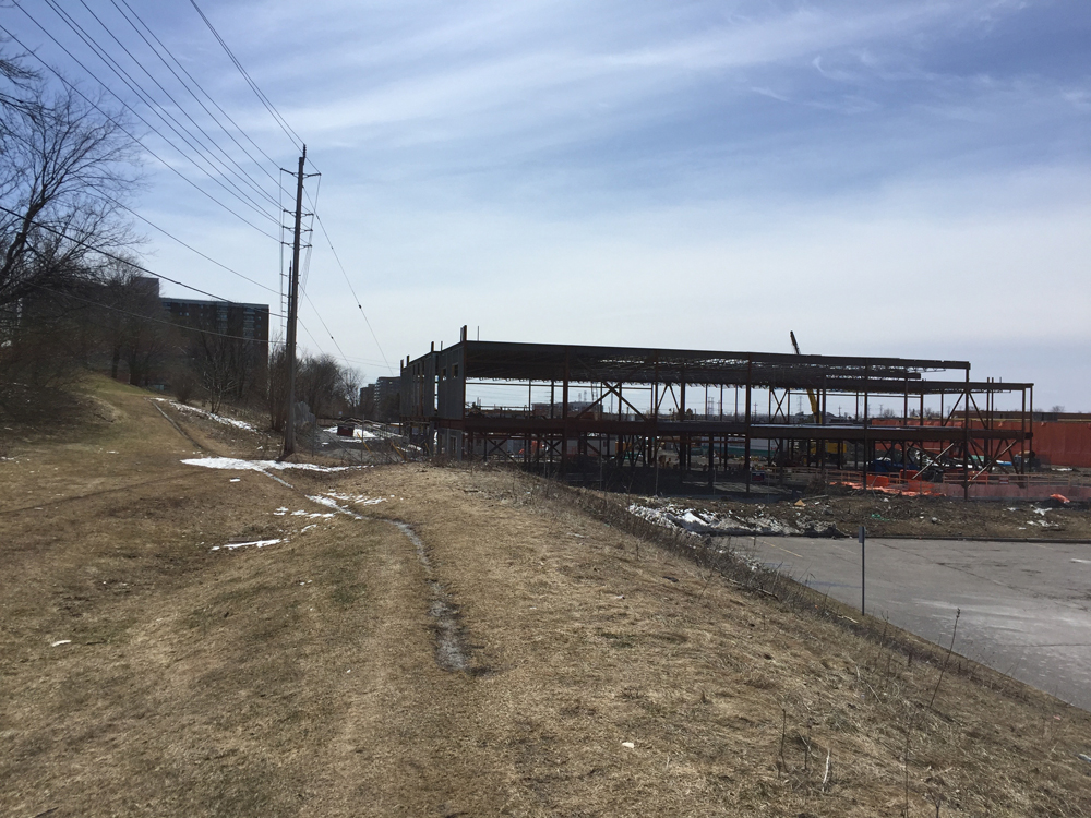
Back in 1871 during the glory days of Canadian railway building, a bunch of businessmen decided it was time to lay down some tracks starting from Kingston to gain access to lumber and mineral resources in the north. The plan was to go as far as Pembroke, thus the Kingston and Pembroke (K&P) Railway was born. Built between 1872 and 1883, it got as far as Renfrew for a total of 103 miles.
As the country’s reliance on railways fell into decline so did the K&P, eventually succumbing to stages of disuse and dismantlement between 1962 and 1986. Since then there have been a number of efforts to convert sections of the old railway bed into recreational trails. A popular multi-use path heads 15km north from Kingston. Another maintained section of the old railway extends south from Barryvale on Calabogie Lake, a portion of which I biked along over the Labour Day weekend. Here’s how it went.
.
Barryvale was a flag stop named after the Barry family who lived here. It is now home to the Calabogie Highlands Golf Resort. There’s a sign on the edge of the trail that reads, ‘Fiddler’s Green. Off Roaders Welcomed‘. Fiddler’s Green is the resort’s restaurant. The Off Roaders being welcomed no doubt include cyclists, but, based on the majority trail users I encountered, it’s primarily targeted towards All Terrain Vehicule (ATV) enthusiasts and, in the winter, snowmobilers.
K&P Trail heading into Barryvale
The trail also doubles as an access road to cottages, particularly along the section between Barryvale and Tatty Hill Road along Calabogie Lake.
Between Barryvale and Tatty Hill Road
The trail narrows slightly south of Tatty Hill Road and becomes a bit rougher, but nothing my regular hybrid bike couldn’t handle.
Typical width and condition of trail south of Tatty Hill Road
My bike
The trail meandered past hills and lakes without any noticeable inclines, as dictated by the needs of the original trains. Signs along the route mentioned logging trucks as another user of the trail, although I didn’t happen upon any over the course of my ride.
Truck signs
There was plenty of space on the trail to share with the ATV’s I occasionally encountered, however I would stop on the edge of the path and let them pass to allow the dust to settle before I carried on. I was always greeted with a friendly wave as they passed by.
ATV’s going by
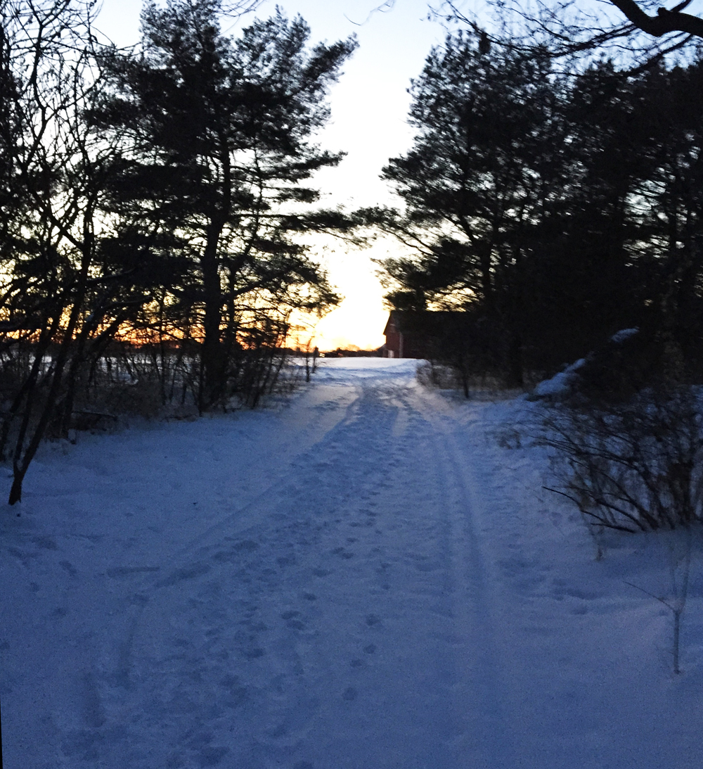
I did happen upon a few other cyclists. The roughest sections of the trail were those that passed through swampy areas. I’m guessing, the stones have to be larger for draining purposes. All were bike-able except the last section before Flower Station where the fist sized rocks required that I dismount and push my bike a hundred meters or so. Mountain bikes could handle it. This was also, conveniently, the point where I had to turn around and head back.
Where I turned around at Flower Station
Google Maps suggests the maintained path continues as far south as Wilbur.
So, overall I would say it was a fine ride. Excellent in terms of scenery. I have ridden another section of the K&P trail north of the 401 to Clarendon Station but it was in much rougher shape than the one described in this post.
For those interested in a bike route from Ottawa to Calabogie check out this post.
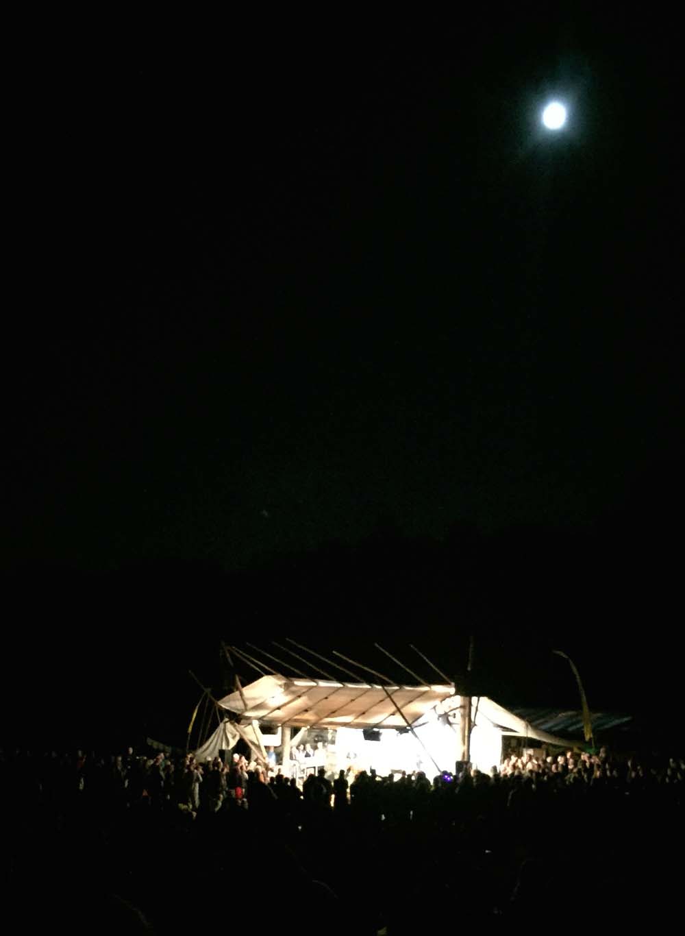
Blue Skies Music Festival is a wonderful three day event that takes place on the first weekend of August in Clarendon Station. For the third consecutive year I’ve biked down to the site, exploring different routes each time (click here for route #2, and click here for route #1). This year I cheated a bit on the way out of town. I’ve been wanting to try the OC Transpo Rack&Roll for quite some time, whereby you mount your bike on a rack attached to the front grill of the bus. So, at 5:25 a.m. I caught the 96 at Lebretton Flats and bussed it out to Kanata. I was nervous using the Rack&Roll for the first time however after studying an online video the night before, as well as following instructions printed on the rack itself, it was relieved to find it all very clear and straightforward.
The blue line on the following map is the route I rode to Blue Skies. The purple lines are alterations followed on the way back.
.
After the bus driver dropped me of at the Kanata Centrum Shopping Centre I rode along Terry Fox Drive which has bike lanes.
Bike lane along Terry Fox Drive
I turned west onto Richardson Side Road – two narrow straightaways of crazy speeding truck traffic and soft gravel shoulders.
UPDATE – August 2018: Very pleased to discover that generous paved shoulders have been added along Richardson Side Road between Terry Fox Drive and David Manchester Road, narrowing to about 1 meter along the bridge over the Trans-Canada Highway.
Richardson Side Road 2018
Once across the bridge over the Trans-Canada Highway I was very pleased to turn off onto David Manchester Road.
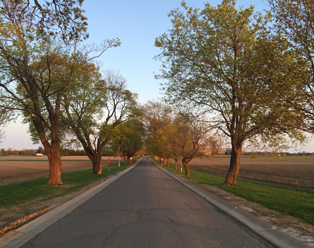
I then headed west along Old Almonte Road, which alternated between packed gravel and paved surfacing. It was very pleasant ride all the way to Ramsay Concession 12.
Next time I would continue all the way along Almonte Road to Mississippi Mills, rather than via March Road, as suggested by the purple line on the above map which I followed on the way back from the festival.
Old Almonte Road
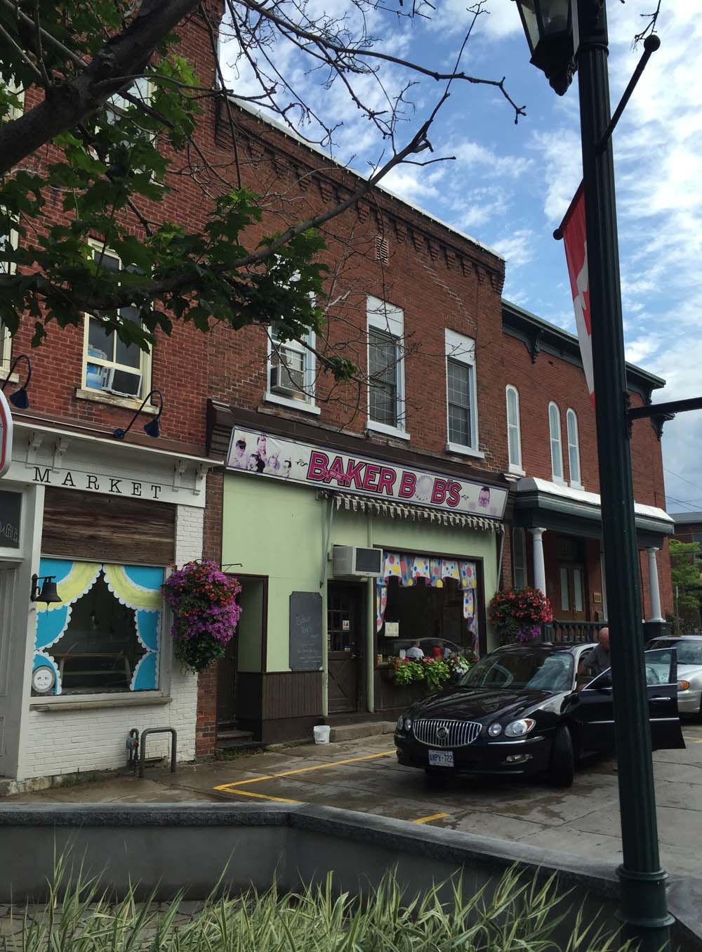
I took the advice of a theatre colleague who lives in Almonte and popped in to Baker Bob’s just off Mill Street for a tasty snack & coffee.
Baker Bob’s in Almonte
I headed west out of Almonte along Wolf Grove Road. This was a another extended white knuckle riding stretch of road, i.e. two lanes of fast moving traffic with minimal or no paved shoulder. I had to ride off onto the gravel shoulder a couple of times, like when the big ass Winnebego roared up behind me as a cement truck flew by in the opposite direction. On such occasions I use my trusted rear view mirror to assess what’s coming up fast, and whether they look like they have time and room to safely get around me.
Wolf Grove Road
I exited off Wolf Grove Road onto quiet Purdy Road.
Purdy Road
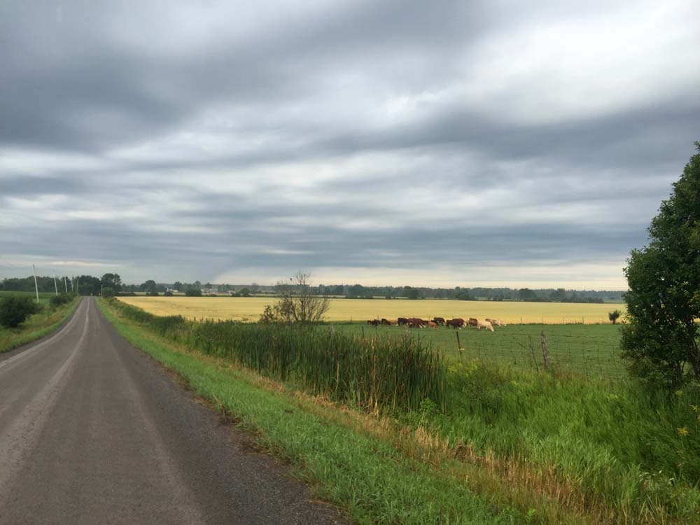
The roads to Herrons Mills and the 511 were a combination of paved and gravel surfaces along farms and woodland.
North on 511 took me to Watson’s Corners Road, another paved two laner but with much less frantic traffic. Everyone slowed down as they drove up behind me and passed only when they were sure there was lots of room to do so. Why do driving behaviours change on various rural roads, even though their physical arrangements are similar? I don’t know.
Watson’s Corners Road just west of the 511
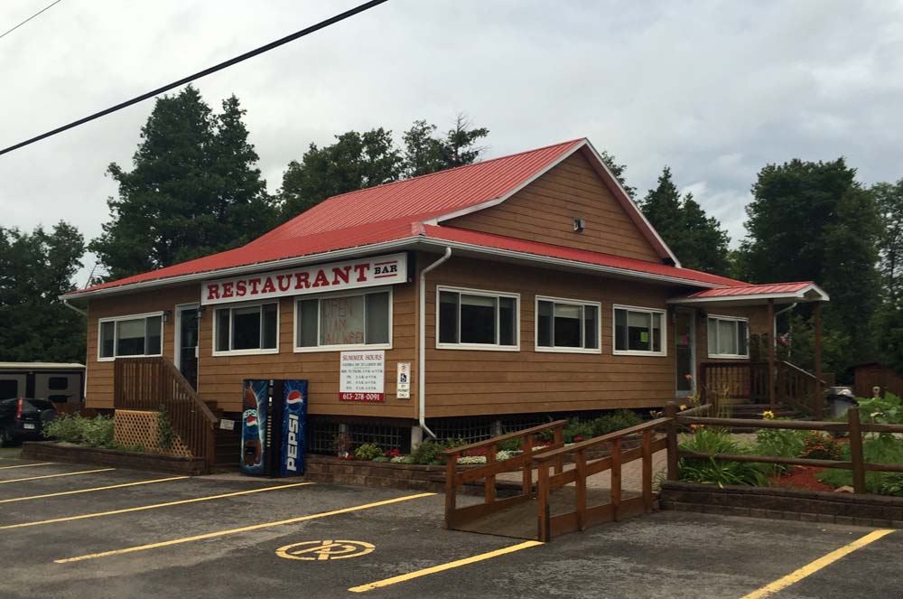
I was soon in need of a big lunch break. The sun was beating down, the hills were mostly up hilly, and the strong easterly wind had been in my face for quite some time. Fortunately the Dalhousie Lake Restaurant down the road at the eastern edge of Dalhousie Lake was open and very hospitable. Even offered to fill my water bottle without my having to ask.
Dalhousie Lake Restaurant
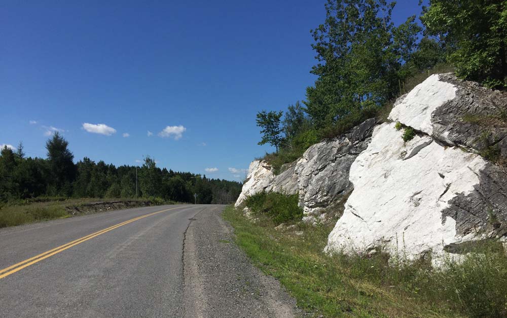
After a yummy lunch I worked my way over to McDonalds Corner Road and continued west. McDonalds Corner Road was another two laner which became the Elphin-Maberly Road. Parts of this section were freshly paved. The white stone gravel along the shoulder created a very dense surface, more so than most typical gravel or sand shoulders. The harder the shoulder, the safer the bail-out.
White stone gravel shoulder
I turned off Elphin Maberly onto Robertsville Road, a packed gravel road that went up and down all the way to the 509.
Robertsville Road
I turned south onto the 509, which is another two lanes of very speedy intermittent traffic.
Riding down the 509
I made it to Clarendon Station by 2:45.
Exit off the 509 to Clarendon Station
I followed the same route back to Ottawa early Monday morning, apart from a short cut to the 509 from Clarendon along School House Road, the short section along Old Almonte Road as previously mentioned, and the portion covered by my bus ride to Kanata. I made very good time on the return trip because the wind was at my back, and Ottawa is at a lower elevation by 162m, so mostly downhill.
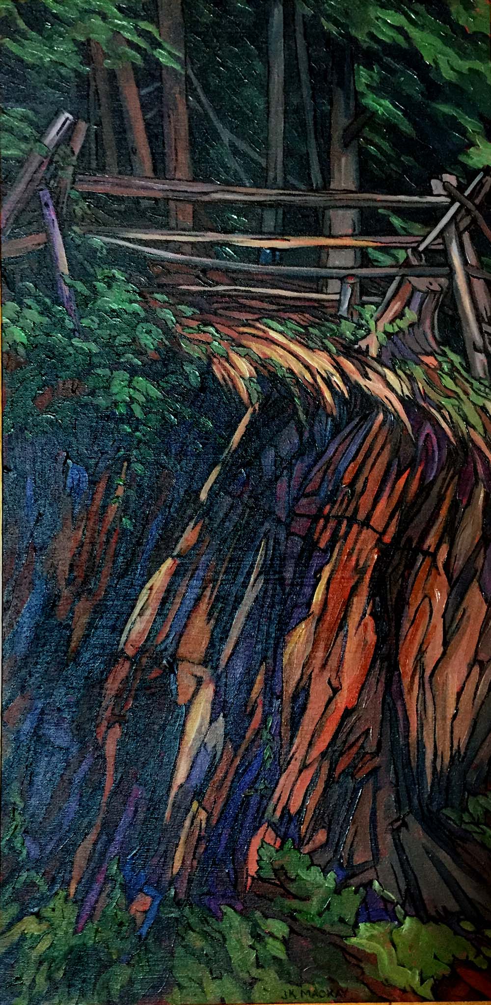
Here’s a painting by artist Janet MacKay, inspired by an image I included in last years post. Many of Janet’s works draw upon and capture the rich contrasts evident in the landscape of Frontenac County where the festival takes place. She spends much of the year painting at her cottage nearby on Sharbot Lake.
A while ago I joined a walking tour of Parliament Hill with Jaime Koebel. Jaime runs Indigenous Walks which she describes as, ‘A guided walk & talk through downtown Ottawa that presents participants with social, political, cultural & artistic spaces from an Indigenous perspective‘. As we looked out across the Ottawa (or Kitchissippi) River towards the Museum of History, Jaime mentioned the totem poles displayed within the museum, as well as a number of others carved by indigenous sculptors located outdoors within the area. Here’s a 33km loop that visits those sites. This bike tour is almost entirely along NCC multi-use paths. UPDATE 2018:I’ve added an optional detour to Rideau Hall where stands another totem pole (see purple line on map). More on this piece further down in the post.
.
Our ride begins near the eastern tip of Victoria Island where stands this totem pole sculpted by Walter Harris of the Gitxsan First Nation in northern British Columbia.
Totem sculpted by Walter Harris
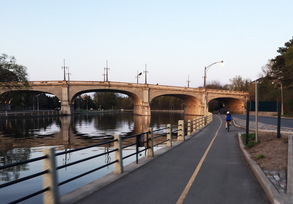
I rode west and accessed the Ottawa River Pathway behind the War Museum, and followed it along the river to where it connects to the Pinecrest Creek Pathway.
View from the Ottawa River Pathway
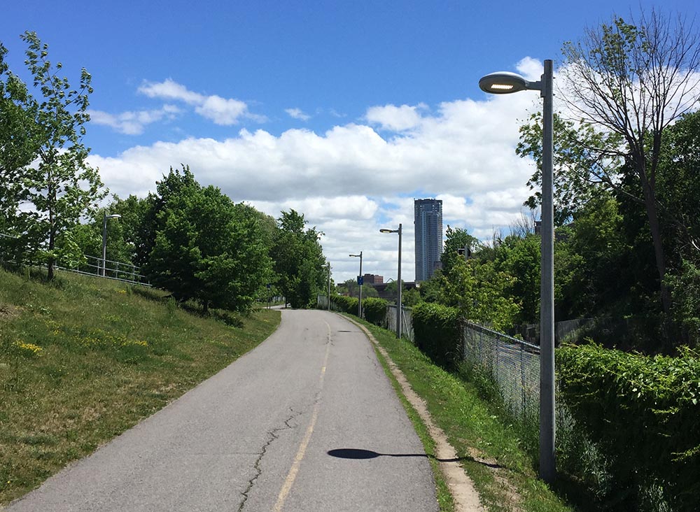
I rode the length of the Pinecrest Creek Pathway to Woodroffe Avenue.
Pinecrest Creek Pathway
On the south side of Woodroffe the path continues as the Experimental Farm Pathway.
North section of the Experimental Farm Pathway winding through open areas
On the south side of Maitland the path weaves it’s way up through a wooded area.
Wooded section of Experimental Farm Pathway between Maitland Avenue and Merivale Road
The second totem pole on our tour is located in front of the Scouts Canada National Office on Baseline Road. To get there I turned off the pathway and cut through a residential area along paths and quiet roads as shown on the above map.
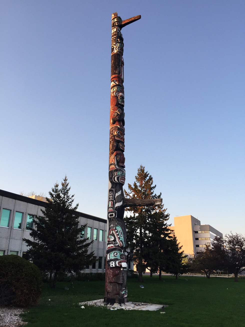
This totem was carved by Chief Mungo Martin, a Kwakwaka’wakw carver from British Columbia. It was acquired by the Boy Scouts in 1960. The totem pole has been along Baseline Road since 1961. According to Scouts Canada, it was a gift from the British Columbia government to celebrate the newly opened headquarters.
Totem sculpted by Chief Mungo Martin
I then headed back to the Experimental Farm Pathway which runs along farmed fields east of Merivale Road. Sections of the pathway east of Fisher follow along quiet roads through the farm.
Experimental Farm
I crossed Prince of Wales Drive at the signalized crosswalk and headed over to the Rideau Canal locks beside Carleton University. I crossed the locks and biked down the Rideau Canal Eastern Pathway towards downtown.
The Rideau Canal Eastern Pathway
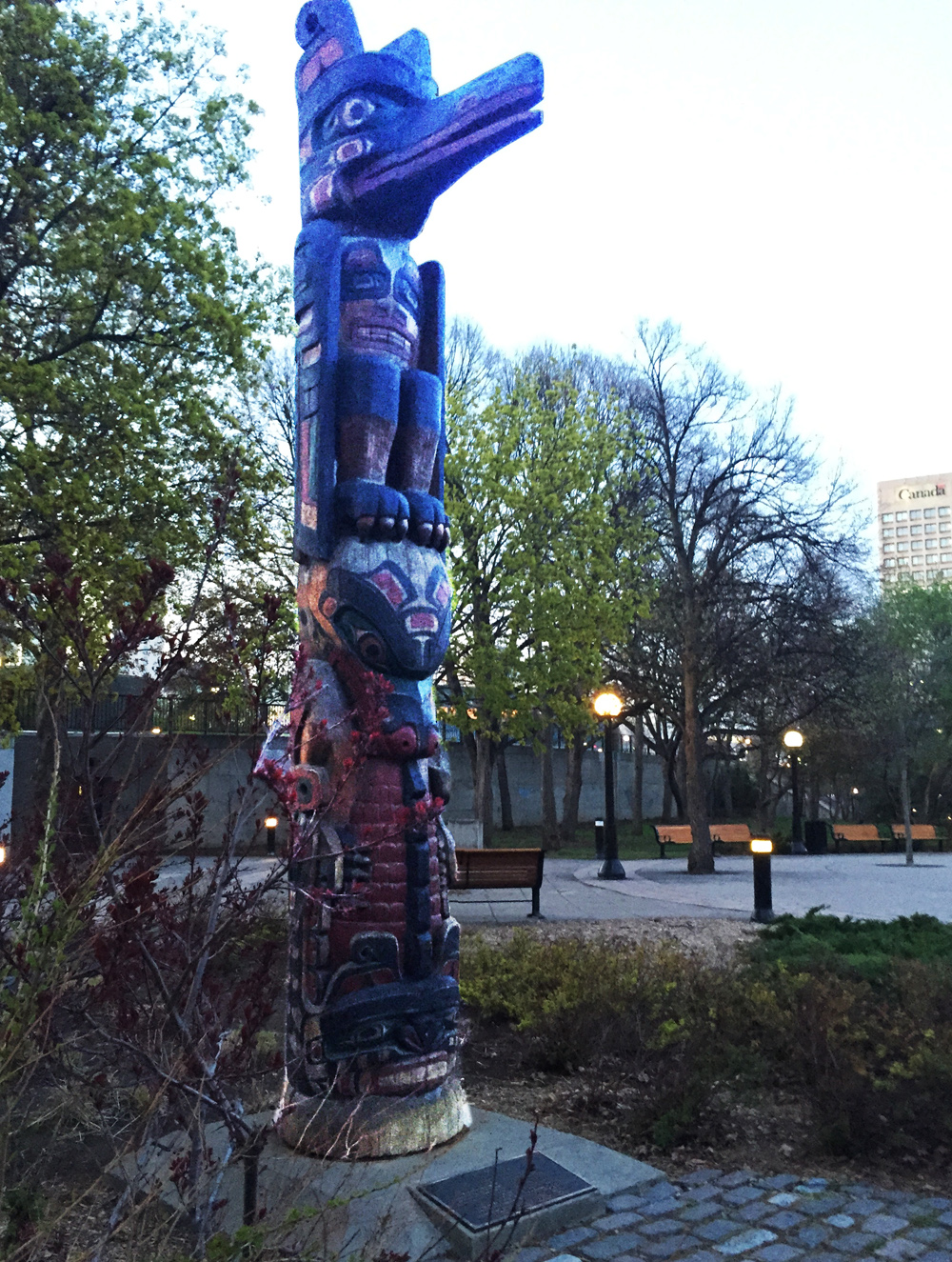
I re-traversed the canal at the Somerset pedestrian bridge and headed over to Confederation Park to visit the third totem pole along the tour, sculpted by Henry Hunt also of the Kwakwaka’wakw and apprentice of Mungo Martin.
Totem sculpted by Henry Hunt
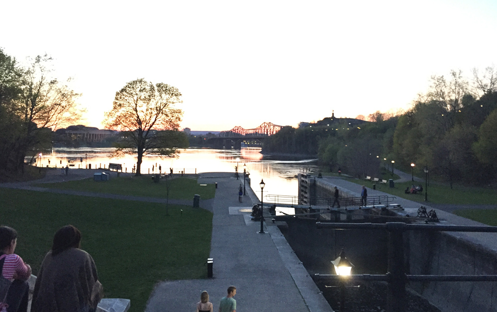
Next stop – the Grand Hall of the Museum of History. To get there I rode down beside the canal and across the second to last set of locks.
View down the last set of locks along the Rideau canal before it drains into the Ottawa River
I then rode up the paved path from the river and crossed the Alexandra Bridge to our final stop at the Museum of History in Gatineau.
Crossing the Alexandra Bridge
I UPDATE – August 2018: There is another totem pole sculpted by Mungo Martin located on the grounds of Rideau Hall. The purple line on the above map shows how to get there via the bike lane along Sussex Avenue , and then back, crossing the MacDonald-Cartier Bridge to the Quebec side of the river, versus the Alexandra Bridge. The grounds of Rideau Hall are open to the public up until 1 hour before sunset.
Totem pole by Mungo Martin on the grounds of Rideau Hall
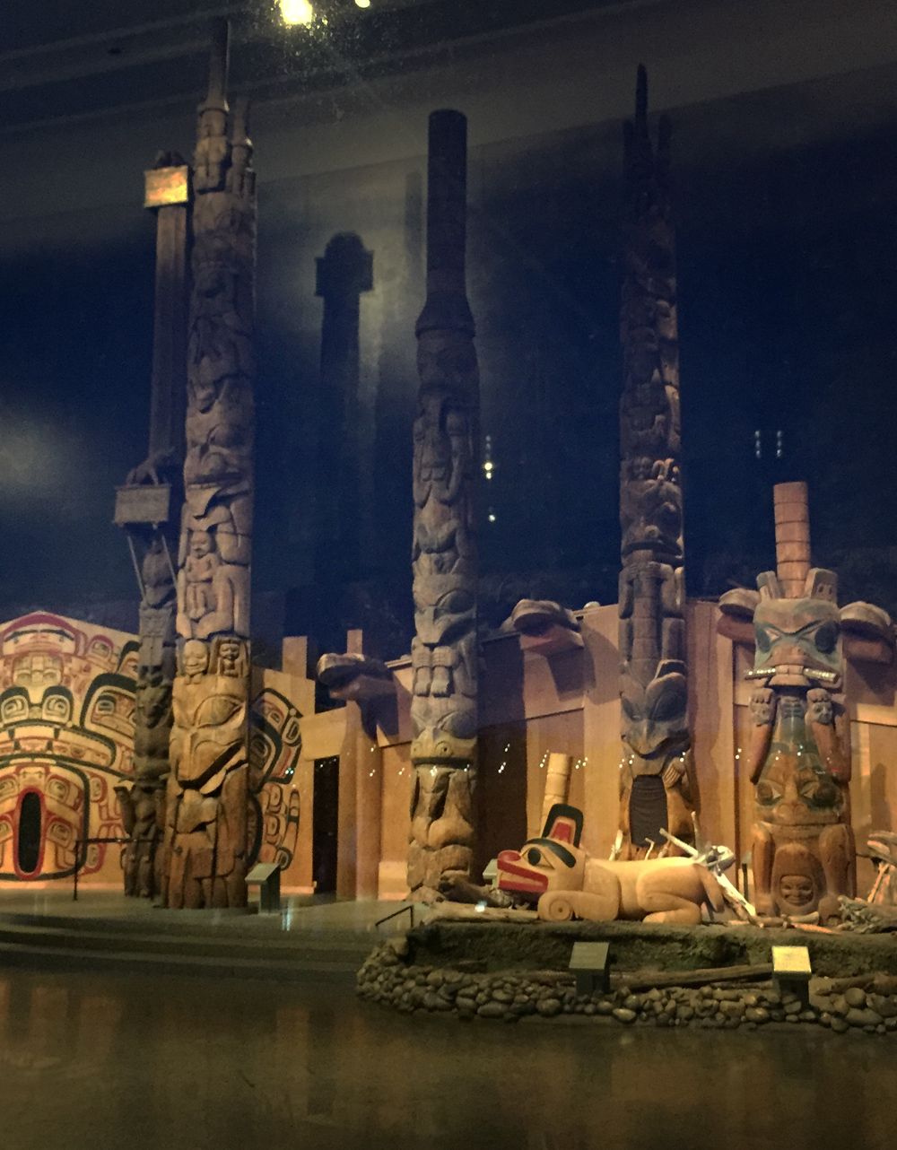
The best time to visit our final spot along the shore of the Ottawa River facing the Museum of History is in the evening as the sun is setting. That’s when the vista of totem poles within the Grand Hall of the museum are most visible from outside the large windows.
Exterior view of the totems within the Grand Hall
Here are views of these majestic sculptures as seen from outside as well.
Totems within the Grand Hall
To complete the loop I rode along the Voyageurs Pathway beside the river, then halfway across the Portages Bridge back to Victoria Island.
UPDATE 2018: The NCC has yet to complete repairs along the Voyageurs Pathway caused by the Spring flooding of 2017. The alternative route, as per the orange line on the above map, goes along the very wide Laurier Avenue sidewalk which is being used as an interim multi-use pathway.
Et voila!
Detail of totem on Victoria Island by Walter Harris
Manotick is a community first settled in the 1830’s located 30 km’s up the Rideau River. This past Sunday I and a group of fine people rode there. It was a great outing. Blue line on the following map shows how we got there. Green lines are variations we took on the return trip. Purple and orange lines are suggested minor deviations to the chosen routes.
JP and I started off at 8:30 am from the Chinatown Arch in Centretown.
Away we go!
We headed down Somerset to get on the O-Train Path, over to Prince of Wales Drive, and through the farm before joining the Experimental Farm Pathway where we met up with three more riders -Glenn, Heather and Chris. We cut south from the Experimental Farm Pathway through a series of paths and streets to Capilano Drive, a more detailed description of which can be found within a previous post, by clicking here.
We headed south down Birchwood off of Capilano and continued straight through back ends of mall parking lots, mostly empty on Sunday mornings.
Link at end of Birchwood to mall parking lots.
To avoid having to ride through the parking lot, there is also the option of taking the path up behind the parking lot, as suggested by the orange line on the above map. This path starts off as gravel before becoming a well trodden desire line that ends at Meadowlands Drive. A hundred meters to the right along Meadowlands takes you to the lights that leads across to Grant Carmen Drive.
Path behind Merivale malls (May 2017- building is completed)
We then kept heading south along Grant Carmen Drive which had very little traffic, all the while avoiding crazy dangerous strip-mall Merivale Road, one block west.
Grant Carmen Drive
South of Viewmount Drive the road morphs into a multi-use path that cuts through to Colonnade Road.
Grant Carmen Drive ends, path begins
We rode along Colonnade road to Merivale Road. UPDATE – Fall 2015: A bike lane has been installed along Colonnade Drive between Merivale and the path – a huge improvement to the shoulder less section it once was.
Colonnade Road approaching Merivale Road (new bike lane being installed to the right)
July 2015 update – Bike path going in along Colonnade
We rode along dreaded Merivale Road to get under the train tracks, however there fortunately is a paved portion between the curb and the sidewalk one may to choose to ride along to get to Woodfield Drive on the other side of the tracks.
Technically known as a ‘Service Strip’ or ‘Boulevard’, Legendarily called a ‘Kill Strip’ because nothing green is able to grow there, so it gets paved over
Just off Woodfield there’s a path that runs all the way west to the signalized Hunt Club Road crossing. It’s a shaded path that isn’t cleared in the winter, so we encountered a few patches of slush and ice. We decided to ride along quiet Benlea Drive that runs parallel to the path.
First encounter with slush & ice
The path continues behind the Nepean Sportsplex, then runs south along Woodroffe. The paths we followed all the way from the Sportsplex to and through Barrhaven were cleared all winter so no slush to worry about.
Woodsy portion of path along Woodroffe
We crossed Woodroffe and continued along the path on the north side of Fallowfield Road for a short distance before crossing Fallowfield at Via Park Place. We got on to the path that continues southwest then south beside the transit way all the way to Berrigan Drive.
Followed a road link between Berrigan and Strandherd Drive. Rode west on Strandherd, south on Greenbank, then east on Marketplace Avenue through the big box mall parking. East end of the parking there’s a short path link to roads that join up with the bike lane that runs along Longfields Drive.
In retrospect I would recommend turning off the path and onto Longfields further north as suggested by the purple line on the above map, thus avoiding busy Strandherd, Greenbank and the big box store parking lot.
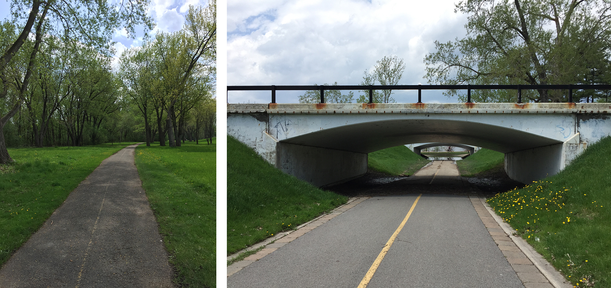
After riding down Longfields and crossing the Jock River we joined a gravel path that weaves it’s way in and through varied wooded areas along the shore the river. This path went under Prince Of Wales Drive and then continued along the Rideau River. We had to contend with a few remaining minor slushy and icy patches along the path but that just added to the sense of adventure.
Riding the gravel path beside the Jock River
Bit of a challenge crossing the stream in Beryl Gaffney Park, but nary a soaker was had!
Crossing the stream
We rode along quiet streets and paths the length of Long Island, then crossed back onto the west side to seek out the French Café, where a colleague and friend of mine, Judy deBoer is showing some of her paintings. JP had to head back after grabbing a snack, while the rest of us settled down for a yummy treat and the biggest cappuccinos I’ve ever seen.
French Café in Manotick
Heather plotted a great route for the return journey which included a short side trip that rode a local dam.
Checking out the dam
We had hoped to ford the stream that runs through Gaffney Park at another spot closer to the Rideau but the walking stones were completely submerged. It’s a great short portage in dryer seasons.
Downstream crossing, Spring flooded… but très Zen come summer
Our return journey also took us further down the Rideau River along a path that goes under the fabulous Vimy Memorial Bridge.
View from under the bridge
On the north side of the bridge the path turns into a wooden boardwalk that weaves it’s way through the Chapman Mills Conservation Area. Lots of pedestrians on the boardwalk so be prepared for a slow leisurely pace through this area.
Boardwalk through the Conservation Area
We pedalled along quiet Winding Way before cutting inland through quiet residential streets and parks before joining up with the bike path that runs along Woodroffe Avenue.
We parted company with Heather and Chris at West Hunt Club Road, which seems a fitting spot to sign off.
For an alternate route to Manotick that runs along Prince of Wales Drive heading out of Ottawa and back on the east side of the river, click here.
There’s a sugar shack in Ottawa, thanks to a group of intrepid monks who preserved and tapped the many trees found within Vanier’s Richelieu Park, once the property of their monastic order. The Brothers left in the 1970’s but maple syrup continues to be prepared on site each Spring. The sugar shack is open to the public on weekends throughout the months of March and April. It’s so close to Centretown you can easily bike there. So I did. The blue line on the map below is the route I rode, purple lines are slight alterations I took on the way back.
Our adventure begins at the western most point of the Laurier Bike Lane where Laurier crosses Bronson.
Laurier Bike Lane in the Spring
I followed the bike lane all the way downtown to City Hall. There I turned right on to the plaza and followed the path on the west side of City Hall through to Cartier St.
Path to the right of City Hall plaza through to Cartier St
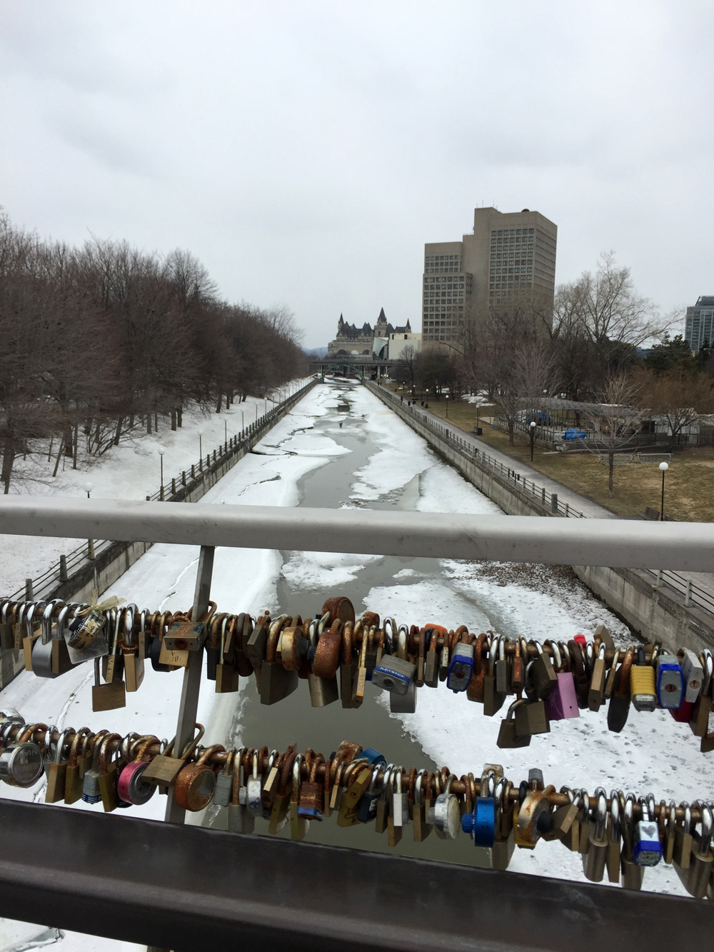
I followed Cartier St for a block, then turned left onto one-way Cooper St, and continued along until Somerset St. Immediately left on Somerset there’s a traffic light across Queen Elizabeth Drive to the pedestrian/bike bridge over the Rideau Canal.
View from the bridge through love locks down the melting Rideau Canal
Another signalized crosswalk at Colonel By Drive led me to the bike lanes under Nicholas St and up to the University of Ottawa campus.
Tunnel under Nicholas through to Ottawa U campus
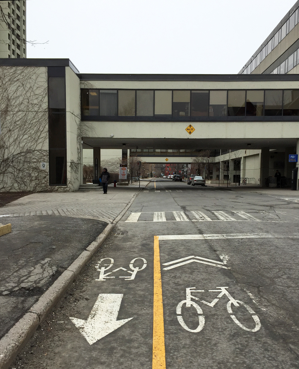
The first street on the left through the campus has a contra-flow bike lane combined with painted sharrow markings pointing in the direction of traffic, which directed me along a network of quiet streets northwardly through campus.
Ottawa U bike route through campus
I turned left on to University Private abandoning the lane+sharrow combo, and then turned right on Cumberland St. There’s a bike lane to follow along Cumberland once across the signalized Laurier Ave E intersection. I then turned right on to the bike lane along Wilbrod St, that heads east through Sandy Hill.
Left on Cobourg then right on Daly brought me to the intersection at Charlotte and Daly. Unfortunately there isn’t a cross signal to get across Charlotte, which can get busy as it’s a popular link between Rideau Street to get to Laurier Avenue. Fortunately I didn’t have to wait long for a opening to get across.
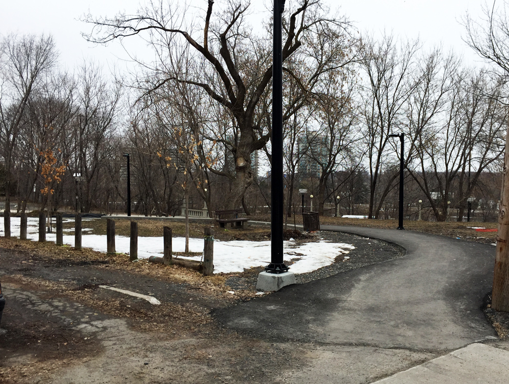
Straight through on Daly, left on Wurtemburg St then right on Besserer which brought me to a very nice recently introduced winding paved path through Besserer Park down to the Cummings Bridge.
Path through Besserer Park
Heading east across the bridge over the Rideau River, there are painted sharrows in green boxes along the inside lane. Traffic moves very fast across this bridge. Along busy traffic arteries such as this one, no matter how you dress them up, sharrows are the most useless form of bike accommodation imaginable. Worse than useless, they are dangerous, because they falsely suggest to riders that they are designated safe routes when drivers ignore them because they can. I walked my bike along the sidewalk.
Heading east over Cummings Bridge
Once arrived on the other side of the bridge I crossed at the intersection and headed north along North River Road.
Turned right onto Coupal where, at it’s eastern extremity, there is a short path to the Vanier Parkway. A few more yards along the sidewalk brings you to a crosswalk.
Short path at the end of Coupal…..& bit of sidewalk to lights across the Vanier Parkway
I then wove my way along calm streets through Vanier, as per the above map, to Pères-Blancs Avenue that leads up towards Richelieu Park.
Pères Blancs Avenue
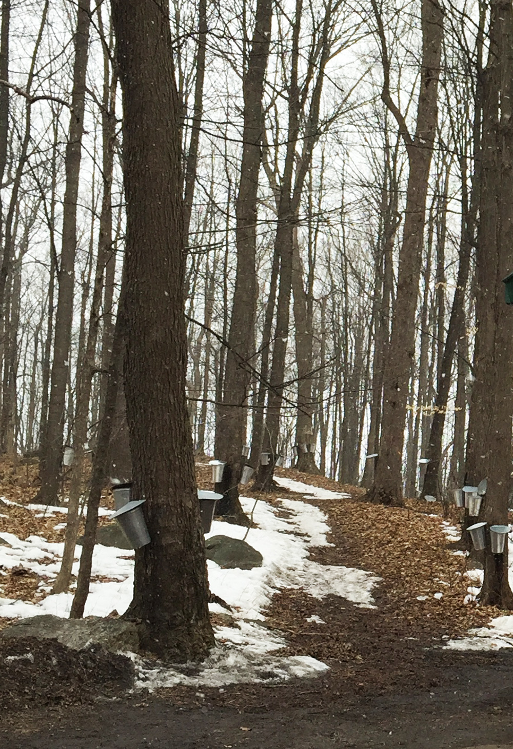
A short distance inside the old gates to the park there is a path to the left that leads to the sugar shack.
Path off Pères Blancs Avenue towards the sugar shack
This season I rode there on a quiet holiday Monday morning when the shack was closed, however in previous years I’ve visited on weekends when it is open to the public and the boilers are in full operation.
Sugar Shack
On the way back I re-traced my treads as far as Cummings Bridge. There is a bike lane heading west over this busy pont, however the lane marking is completely worn off at the eastern end of the bridge and barely visible the rest of the way across.
Missing bike lane heading west over the Cummings Bridge
The bike lane disappears completely once arrived on the other side of the bridge. That’s because Rideau St was paved late last season and the line has yet to be re-painted. Until then I recommend returning the same way I came by walking along the opposite side walk and riding up the nice new path to Besserer St. Once the westward bike lane is re-painted, there’s a nice new path link on the south side of Rideau St across the intersection that links to Wurtemburg St, like so.
Path linking Rideau St to Wurtemberg
Stewart St is a one way with a bike lane heading west through Sandy Hill with a number of old architectural gems like this.
Philomene Terrace constructed in 1874
I turned left on Cumberland and wove my way through back the Ottawa U campus. On the west side of the pedestrian bridge I turned right on to the Rideau Canal Western Pathway and cut through Confederation Park to get to the Laurier Bike Lane.
Ottawa is very fortunate to have a wonderful arboretum quite close to Centretown, located between the Rideau Canal to the east and Prince of Wales Drive to the west. A four kilometre machine groomed cross-country ski trail that runs through it has recently been prepared for the annual Winterlude Triathlon. Normally the breaking in of ski trails is left to intrepid skiers, as described in my first post on Biking to and Skiing Through the Arboretum. This modus operandi will most likely return once the next significant snow fall occurs, however until then it is definitely worth taking advantage of the groomed trail, identified by the purple line on the map below. Accessing the arboretum from the edge of Dows Lake is a fine way to get to the trail. The blue line on the map is a suggested bike route to get there from Centretown. Here’s how it goes.
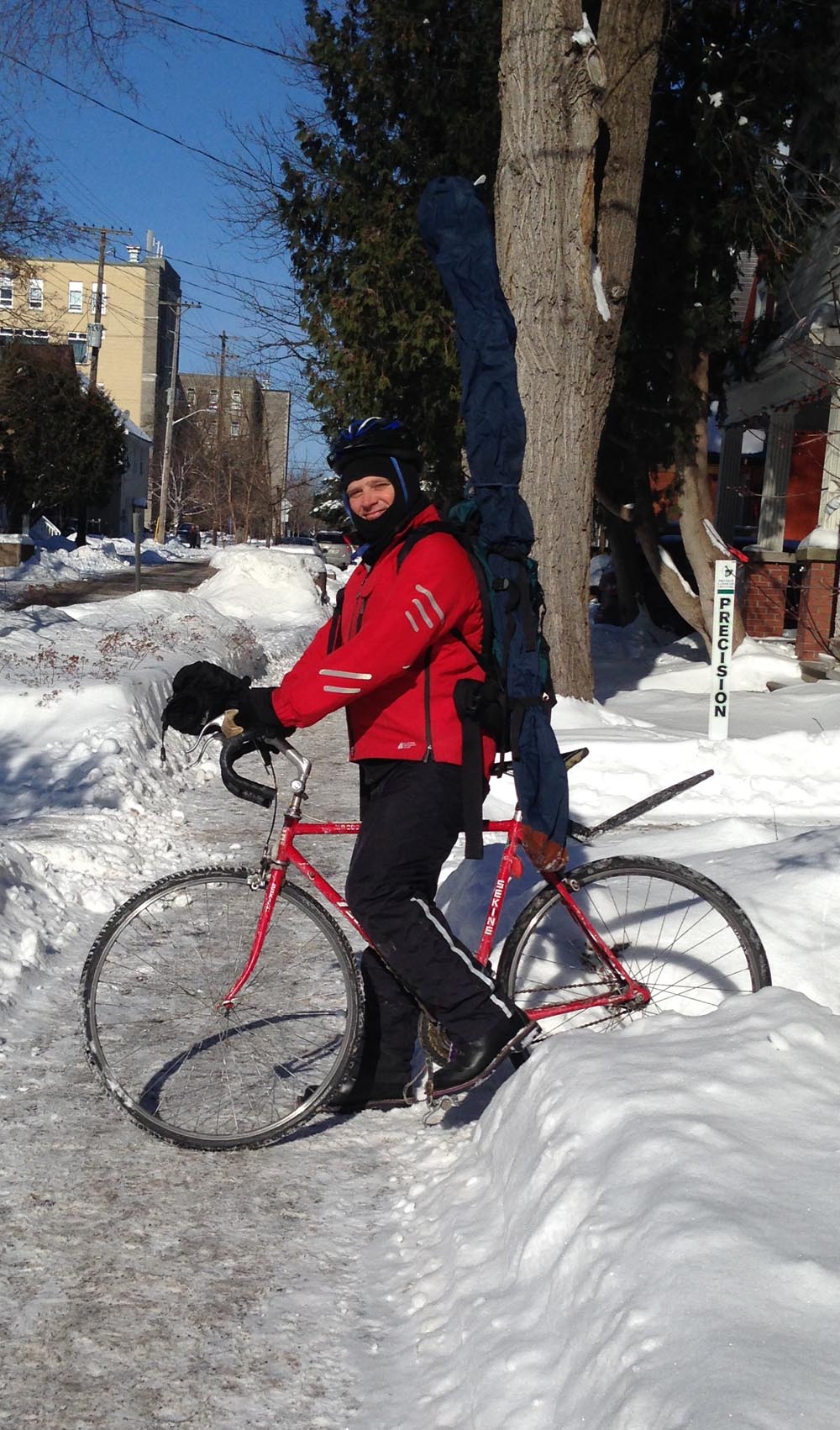
Our adventure begins near the corner of Somerset and Cambridge. I bundled my skis and poles into a ski bag, strapped them to the side of my hiking backpack, and headed out.
And we’re off!
I rode along quiet streets towards Dow’s Lake, crossing busy Gladstone at the traffic lights at Arthur Street. On the opposite side of Gladstone I continued down Arthur Lane.
View across Gladstone to Arthur Lane
To get beyond the Queensway I turned on to Booth Street from Arlington. As Booth is one of the few roads that goes under the Queensway it can get busy, particularly during the week. A meridian has recently been added to the middle of the road along Booth just north of the Queensway underpass, narrowing the lane at this pinch point. If traffic is heavy I may choose to take to the sidewalk along Booth between Arlington to Raymond Street. This Sunday it wasn’t so bad. Booth Street widens once again beyond the intersection at Raymond as it heads under the Queensway.
SQUEEZE! – Pinch point, intersection at Booth & Raymond
At the north end of Booth there are traffic lights to help get across busy Carling Avenue. On the other side of Carling there is a plowed path that cuts through Commissioner’s Park to the Queen Elizabeth Driveway.
Access to path through Commissioner’s Park on the other side of Carling
There aren’t any traffic signals to help get across the Driveway to the Rideau Canal Western Pathway so watch out as drivers tend to speed along this stretch. It’s a much calmer crossing on Winterlude weekends when they close the Driveway for all vehicles except OC Transpo shuttle buses.
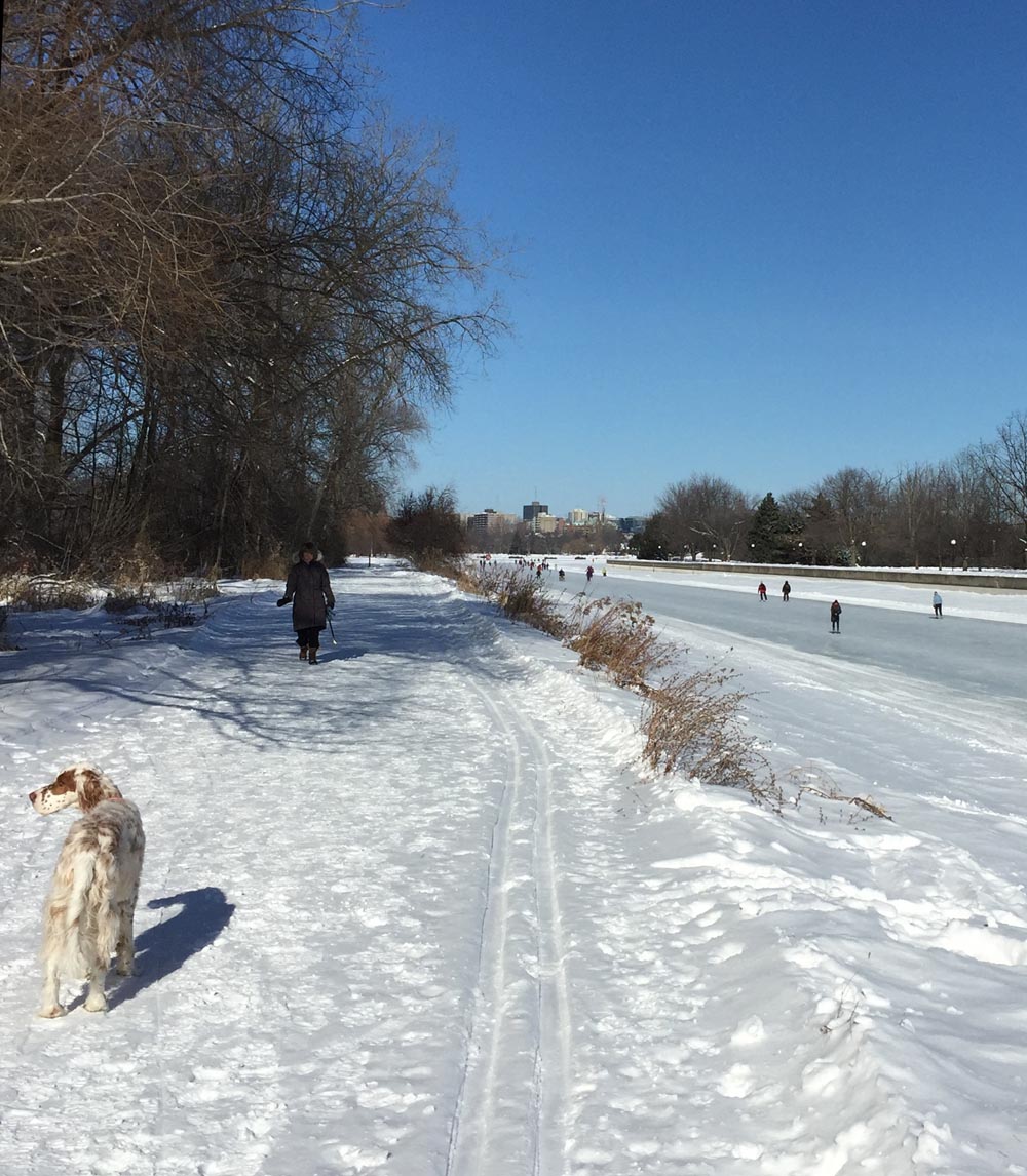
I then rode along the Rideau Canal Western Pathway, which is cleared throughout the winter, to the Dow’s Lake Pavilion.
Rideau Canal Western Pathway towards the Dows Lake Pavilion
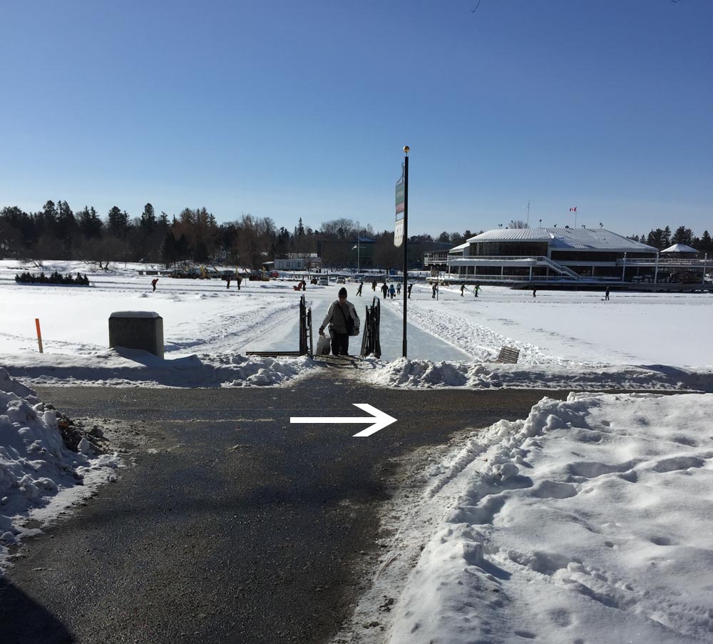
To get to the groomed ski trail I took the well travelled path just to the right of the Dow’s Lake service ramp. If this path proves to be inaccessible by bike, I would lock my bike to a post or canal railing near the pavilion and ski in from this location, however on this occaision I had no difficulty getting through.
Trail to the right of Dow’s Lake access ramp……that continues past the canons
I then locked my bike to this sign post a short distance further along the path, right where the groomed trail passes by. I’ve found this to be a fine spot to access the Arboretum to go skiing, even without a machine groomed trail as most often another skier has already arrived ahead of me, although early one morning after a big snowfall my daughter and I took the lead and broke trail, which can be exciting too.
Trailhead
The trail winds through the arboretum like so.
Trail
One of the joys of the arboretum in the winter is seeing the varied mix of users, making it a veritable winter playground. On a typical outing one may expect to come across snow shoers, skiers, tobogganers, skaters along the canal, fellow cyclists and dog walkers.
Happy trails!
UPDATE– February 2nd: It snowed a few centimetres last night, making the trail less groomed but discernible. Someone had ridden a Fat Bike along the packed skate ski portion of the trail which must have been fun. Portions of the trail run along paths popular with dog walkers, but the classic ski tracks are off to the side. I hope to revisit the route throughout the winter. Definitely worth it.


 Crossing the Hartwell Locks