Architects on Bikes Checking out Buildings: Episode 1 – Susan Smith

Jerry Seinfeld has a popular online series called Comedians in Cars Getting Coffee whereby he invites other famous comedians to ride around town (mostly L.A.) in a fancy automobile très à propos for his guest. Then they stop and have coffee. While this region does have it’s fair share of fine comedians, we also have a great collection of architects with an appreciation for various buildings within our metropolis, so I came up with this mini series called Architects on Bikes Checking out Buildings. I will be asking various members of the profession to choose three edifices within the region that they admire, then I’ll plot a safe bike route to each one and go check them out.

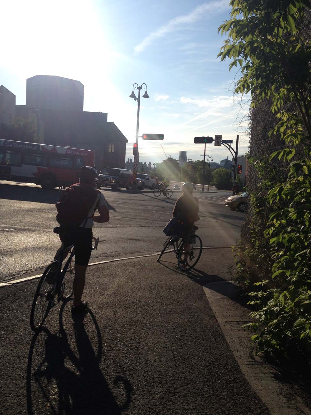
My first guest is Susan Smith Architect, who designed our third floor studio addition. Not only is she a fine architect, she has also spent her entire career in Ottawa sans automobile(!), using her bike and public transportation since graduating from Carleton University School of Architecture many moons ago. She’s also a stellar older sister. We headed off early Saturday morning and checked out her picks.

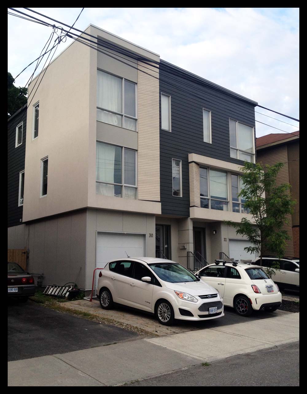
First stop: 30 Sims Avenue in Hintonburg, where sits this new house. Sue noticed it while biking to her office nearby on Gladstone. She appreciates it’s elegant simplicity and detailing.

New house on Sims Ave.

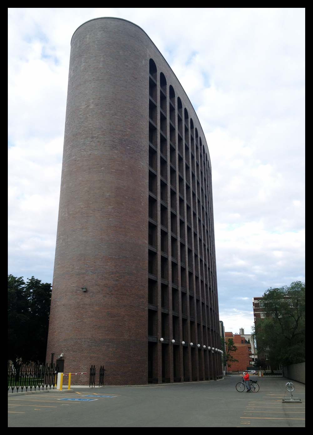
After admiring this little gem of a dwelling, we bicycled over to Dows Lake and along the Rideau Canal Western Pathway, then cut across the Golden Triangle to get to Sue’s second choice: The elliptical Public Service Alliance of Canada Building, completed in 1968 and designed by architect Paul Schoeler. In 2000 the Royal Architectural Institute chose it as one of the top 500 buildings built in Canada over the last millennium. The curved forms of the outer walls are so seemingly perfect that we double checked with a folded piece of paper to make sure the brown bricks were actually flat – and they are.

Sue 2

Public Service Alliance of Canada Building

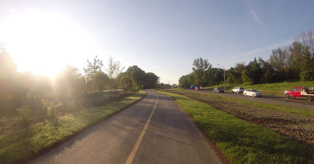
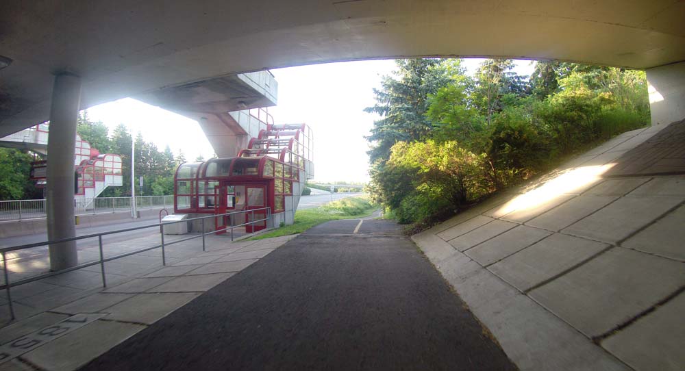
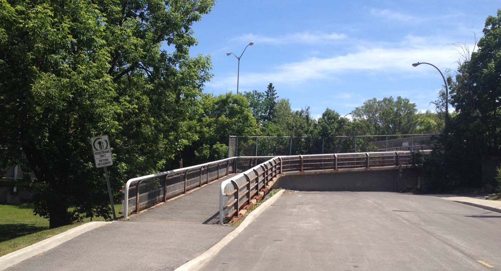
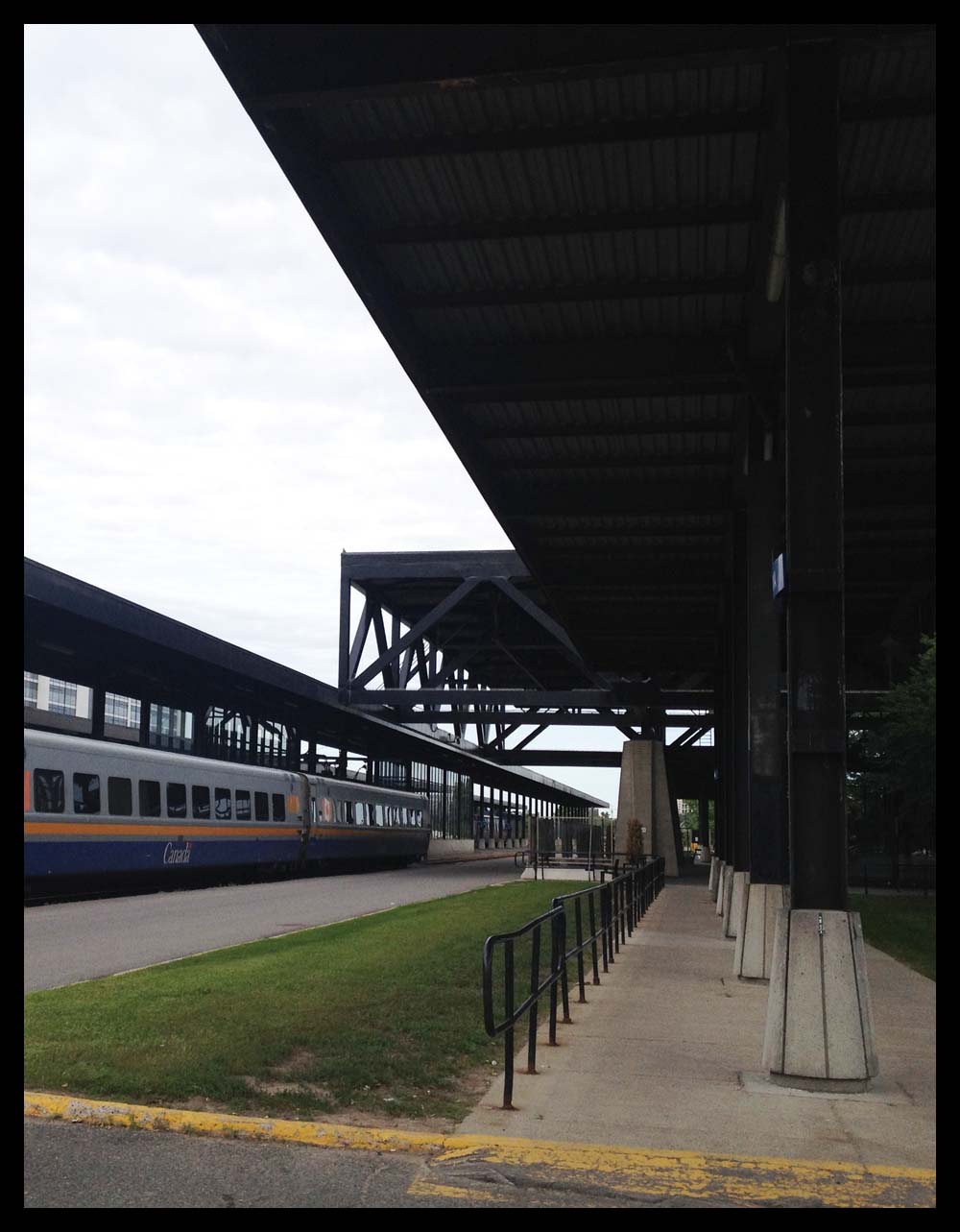
We then rode through Sandy Hill and crossed the Rideau River over the old train bridge before heading towards our final building, the Ottawa Train Station. Designed by John P Parkin & Associates in 1966, it too was chosen by the Royal Architectural Institute as one of the top 500 buildings built in Canada over the last millennium. Sue likes how the dominanting truss roof structure extends right through the building, allowing for a great open space inside, as well as an extended covering at the entrance and at the opposite end between the terminal and the trains.

Sue 3

Ottawa Train Station

So there you go – a fine first architect inspired bike adventure!

Biking along the Sawmill Creek Pathway

The Sawmill Creek Pathway extension is completed and it’s fantastic! It now connects to the Brookfield Path at it’s northern end and runs south as far as Hunt Club Road. I’ve hi-lited the pathway in green. The blue line is the route I followed to get to and from Centretown.

Here’s where the Sawmill Creek Pathway begins along the Overbrook Path, just east of the train tracks.

Northern end of the Sawmill Creek Pathway

Below are a few images of the pathway.

Fresh pavement and fresh planting!
Alongside Airport Parkway for a short spell.
Under Walkley beside the Transitway Station, where the pathway used to end.
Under Walkley beside the Transitway Station, which was the northern end of the path before the extension.

The path runs through the Sawmill Creek Constructed Wetland, described extensively on this Quadracycling in Ottawa blog page

The path ends at Hunt Club. Unfortunately the transition from here to anywhere else is pretty rough.

On a previous occasion I turned east on Hunt Club to get to South Keys mall. To do so I stayed on the sidewalk for a short distance before cutting left through the parking lot just beyond the train bridge.

UPDATE, Summer 2015 –  The Airport Parkway Bridge opposite South Key Mall opened in 2014. See this post for more. An access to South Keys Mall has been created via a short pedestrian tunnel under the O-Train tracks a bit south of the pedestrian bridge. Signs are confusing but I checked with OC Transpo – bikes are allowed through the tunnel but walked, not ridden.

On this occasion, I chose to head west along Hunt Club. the transition across the transit way and Aviation Parkway off ramps was rough. Once beyond these spots there is a bike lane, however it doesn’t start for a few hundred yards. All very complex, so I prepared this little video to help explain. The video starts where the Sawmill Creek Pathway ends.

So apart from this nasty little section, the extension of the Sawmill Creek Pathway and the bike lane further along Hunt Club allows for a fine link over to Uplands Drive and areas south of the city.

Artistic Renderings of Canines in the Capital: The Unofficial Tour, or, Places Around Town That Are Going to the Dogs!

The recent solo exhibit at the Ottawa Art Gallery titled ‘Entre le chien et le loup’ by David R. Harper included two enormous stuffed wolves perched up on plinths, one all black, the other white. The title of the exhibit ‘Entre le chien et le loup’ describes the light just before nightfall, when it is difficult to distinguish a dog from a wolf. The depiction of the wolves (or were they dogs?) reminded me of other works of art throughout the national capital region that incorporate members of the canid genus, so I came up with this bike tour that visits their various locations.

Our tour begins in Confederation Park across from City Hall where there is not one, but two pieces to discover. The first is a wolf incorporated into the monument commemorating aboriginal veterans, sculpted by Noel Lloyd Pinay.

Aboriginal War Veterans Monument

The second sculpture is part of the Animals in War Dedication that includes a bronze sculpture of a medical service dog. It is located at the base of the memorial to soldiers from Ottawa who died in the Boer War.

Monument dedicated to Animals in War

The next piece is located in Gatineau outside the Canadian Museum of History. This forlorn fellow is supposed to be sitting in a copper boat surrounded by water. It’s a sculpture called ‘Namaxsala (To Travel in a Boat Together) by sculptor Anne Barkhouse. The piece is based on a story of the artist’s grandfather bringing a wolf across a treacherous river in his boat, as described on this CMH web page. I’m guessing the boat’s being repaired for leaks, so hopefully our friend won’t be landlocked for too long.

To Travel in a Boat Together

The next sculpture, titled Boat Sight by artist John McEwen, is located up river along the Voyageurs Pathway. The wolf silhouettes are cut from thick steel plate. According to the accompanying interpretive plaque, the animals represent nature reacting with fear and curiosity to the presence of a large, minimalist boat frame, representing culture.

Boat Sight
Boat Sight

Riding along the Voyageurs Pathway reminded me of one outing last year when I took this photo of a fox trotting towards me along the path, before it nonchalantly turned and wandered into the woods.

Fox!
Fox!

The last stop on the tour is in Westboro, where there’s a painting of a dalmation included in a mural commemorating fire fighting.

Dalmation
Dalmation

There are a couple of other works located further afield that incorporate canines. Both are by artist Erin Robertson in collaboration with Anna Williams. One is located at the Bellwether Longfields Transit Station, which I visited and describe in this post. Another titled Chase includes foxes, installed at the Richcraft Recreation Complex in Kanata, that I hope to ride out to visit very soon.

Et voila! Happy trails….

Biking from Hintonburg to Merivale Road

Evan enquired about a safe bike route he could take from the corner of Hamilton Ave North & Spencer Street in Hintonburg, to Merivale Road & Capilano Drive. No problemo! Here’s how.

UPDATE – July 2015: Pink line is a more direct shortcut behind the Food Basics to Capilano Drive, as described at the bottom of the post.

Headed east on Spencer
And away we go….

I rode east on Spencer, crossed Holland at the lights, then turned left on Caroline and headed up the hill towards Wellington. There are lights across to Harmer, which doesn’t line up precisely with Caroline, so I walked my bike 10 feet or so along the sidewalk to the lights.

Slight jog to the lights across Wellington to Harmer Ave

I rode up Harmer to this pedestrian bridge over the Queensway. No stairs.

UPDATE July 29, 2018: The Harmer pedestrian bridge is no more! They ripped it down this weekend and are building a new one that won’t be ready for 2 years. The city has installed a very controversial detour along Holland that will be fixed before the school year starts. I have adjusted the route on the above map accordingly.

Path up & over the Queensway
Path up & over…
.... the Queensway.
…. the Queensway.

Continued along Harmer and turned left onto Island Park Drive, which has bike lanes, and followed it to the lights across Carling.

Lights at Island Park Drive & Carling Ave

I was pleased as punch to discover the path continue on the other side of Carling. I believe this link between Carling and Holland is recent. Last time I rode across I had to contend with sharing this mini-off-ramp with cars.

New bike path link from between Carling and Holland Ave

The path continues along the National Capital Commission Scenic Driveway on the other side of Holland. There’s a split in the path just as the Scenic Driveway veers east. I turned to the right which took me along a path through the patch of woods beside Fisher Avenue.

Right turn through the patch of woods

The woodsy section of path ends where it intersects the Experimental Farm Pathway. I turned right.

Turn right onto the Experimental Farm Pathway

The path follows along Fisher for a bit before coming to lights across Fisher. Things get a little convoluted here. The continuation of the Experimental Pathway on the other side of Fisher is a short distance north along Fisher. It’s barely noticeable from the lights.

White arrow shows where the path continues on the other side of Fisher

I continued along the Experimental Farm Pathway and took the left exit just before the path veers right a short distance beyond Merivale, like so.

Left tine off the Experimental Farm Pathway

The path crosses Whtestone Drive right through to Madison Park.

Path across to madison

Once the path reaches Central park Drive it does a dipsy-do over to Celebration Park, like so.

Path link from Madison park to Celebration Park

I stayed right on the path through Celebration Park which brought me to the other side of Central Park Drive. I then turned on to Scout Street and followed it to a path that cuts through to the Supercentre mall parking lot.

Path off Scout St.
Path off Scout St.

This path eventually merges into the mall entrance street that I followed to the traffic lights across Baseline.

Riding along mall entrance towards traffic lights across Baseline

Immediately across the intersection on the north side of Baseline, there’s a short ‘desire line’ path that links to the Loblaws mall parking lot.

Well trodden desire line path to the Loblaw's parking lot.
Well trodden desire line path to the Loblaw’s parking lot.

I followed a lane that goes behind the Loblaws to avoid having to ride amongst folks frantically parking their cars. This brought me around to the lights at Merivale. Once through the lights there’s a path just a short distance along that turns off to the left.

Entrance to path off of parking lot

This path took me to Eleanor Drive. I then worked my way up Leaver Ave to the turn off through Gilbey Park.

Entrance to Gilbey Park

I turned left onto Gilbey Drive on the other side of Gilbey Park which brought me to Capilano Drive. Right on Cailano brought me to Merivale. Don’t know why, but my camera switched to an old-photo filter for this shot of our final destination, the corner of Merivale and Capilano.

Corner of Merivale & Capilano

UPDATE – July 2015: There’s a more direct shortcut from behind the Food Basics to Capilano Drive, that was recommended by a cyclist who regularly rides through the neighbourhood. I’ve hi-lited it in pink on the above map.

Shortcut from road behind Food Basics

Et voila!

Biking from Gatineau Park to Ottawa

Alexandre wrote, “Just moved into Gattawa from Montreal and biking routes will be a challenge. For one thing, what’s the best way to safely bike from Gatineau Park to Ottawa? Or to Aylmer?”.

Thanks for asking! Here’s a safe route from the park to Ottawa.

.
Our adventure begins at the P3 parking lot along the Gatineau Parkway, also referred to as the Gatineau Park Welcome Area. There one can find a big interpretive map panel showing paths that lead into the rest of the park. There is also an interpretive kiosk with helpful information officers. I joined the Gatineau Park Pathway just to the left of these very well designed interpretive panels.

Gatineau Park Pathway heading south

A hundred yards or so further along, the path crosses another path that runs east-west (it used to be Rue Gamelin). I continued south.

Gatineau Park Pathway continuing along Gatineau Park Driveway
Gatineau Park Pathway continuing along Boulevard du Parc de la Gatineau

The path follows the road for a bit before dipping left through a beautiful wooded area.

Woods
Woods

It The path continues alongside the road over Boulevard des Allumetières before heading back through the woods.

Heading over Boulevard des Allumettières

The path ends at the southernmost tip of the park, at Boulevard Alexandre-Taché. I continued across the intersection down quiet Rue Belleau.

Across Alexandre-Taché down Belleau

At the end of Belleau there’s a path that turns off to the left.

Path at the end of Belleau

A bit further on there’s a fork in the road. This is the Voyageurs Pathway. By turning right you’d be heading west, which will take you all the way to Aylmer. It’s a great ride, described in more detail in this post.

I turned left and headed towards Ottawa.

Sign a the intersection of the Voyageurs Pathway

The path eventually meets up with Boulevard Alexandre Taché once again, just beyond some train tracks, and turns right alongside Boulevard Alexandre Taché.

Over the tracks, and right

The only spooky bit along this route is at the corner of Boulevard Alexandre-Taché and Rue Eddy. I keep further back and closer to the wall while waiting for the light to change than these fine cyclists ahead of me because I’ve witnessed cars and trucks clip the corner of the sidewalk in their rush to turn onto Eddy and over into Ottawa. I’ve also seen cyclists turn on to Eddy, which I would never have the guts to do as that bridge is very narrow with afore mentioned impatient car & truck drivers. Instead I cross through the intersection and continue along the path on the opposite side.

Corner of Eddy and Alexandre-Taché

The path continues east, eventually going under the Portage Bridge before popping out in front of this sculpture by Phyllis Kurtz Fine. Turning left takes you behind the Museum of History and the opportunity to cross over to Ottawa on the Alexandra Bridge. I turned right and made my way along the bike path over the Portage Bridge.

Alexandra Bridge towards the left..... Portage Bridge to the right.
Alexandra Bridge towards the left….. Portage Bridge to the right.

Once on the other side of the bridge there are a myriad of options, depending on your final destination. I went left, just like this guy, and headed west along the Ottawa River Pathway. Et voila!

Ottawa

In search of a safe north-south bike route across Carling, the Queensway and Baseline

This week I learnt that finding a safe route across the three busy east-west arteries of Carling Avenue, the Queensway and Baseline Road, anywhere between Prince of Wales Drive and Pinecrest Road is a tricky endeavour.

My search was spurred on by a request for suggestions on biking from Notre Dame High School in Highland Park over to Parkwood Hills. The blue line on the map below is a route with some rough spots I am comfortable biking through, however the request also needed to accommodate three travellers: one adult, one child passenger, and another child on their own bike. With two kids of my own, I would not recommend this route with bambinos in tow. But, that’s a judgement call, so I’ve included it below, with a description of the tricky spots. It’s identified by the blue line on the map. I’d suggest an adult solo dry run first.

I also tried a much safer route that I would feel comfortable taking my kids, however it’s more circuitous. See red line on map below.

And away we go.

Notre Dame High School on Broadview.
Starting point – Notre Dame High School on Broadview.

There is a crosswalk at Broadview and Carling. One major artery down.

Crossing Carling
Crossing Carling

The area east of Broadview between Carling and the Queensway appears to be zoned as light industrial. The streets I followed through this area (Kerr, Boyd and Dobbie) didn’t have a lot of traffic, but there are trucks and big potholes that go with them. This is the first zone I would hesitate to ride through with my kids.

Things get a little scarier passing under the Queensway along Clyde Avenue as it is a funnel through to another industrial zone on the other side. No designated shoulder and more trucks. The sidewalk might be an option to consider.

Under the Queensway along Clyde

I then cut through Carlington Park by riding along the stone dust path that goes around the perimeter of the baseball field.

path around Carlington park baseball field

The area east of Calington Park is mostly residential with a few small industries hugging the edge of the park. Edgecliffe Avenue is a gradual climb up to Morisset Avenue. There is a link to the Experimental Farm Pathway halfway down Morisset.

Bike path link along Morisset Avenue

I turned left onto the Experimental Farm Pathway and followed it for a short distance through a wooded area before taking a right along a path link that goes into a residential area called Central Park.

Left turn onto the Experimental Farm Pathway...... then a right turn off of the Experimental Farm Pathway
Left turn onto the Experimental Farm Pathway…… then a right turn off of the Experimental Farm Pathway

There is a bike path that cuts through from Whitestone Drive to Central park Drive, and then through Celebration Park to Central Park drive which loops around. One could also just stay on Central Park Drive. I then turned on to Scout Street and followed it to a path that cuts through to the Supercentre mall parking lot.

Path off Scout St.
Path off Scout St.

This path eventually merges into the mall entrance street that I followed to the traffic lights across Baseline. This is another area I would hesitate riding through with my kids, as drivers tend to be much less predictable in mall parking lots.

Riding along mall entrance towards traffic lights across Baseline

Immediately across the intersection on the north side of Baseline, there’s a short ‘desire line’ path that links to the Loblaws mall parking lot.

Well trodden desire line path to the Loblaw's parking lot.
Well trodden desire line path to the Loblaw’s parking lot.

I followed a lane that goes behind the Loblaws to avoid having to ride amongst folks frantically parking their cars. This brought me around to the lights at Merivale. Once through the lights there’s a path just a short distance along that turns off to the left.

Entrance to path off of parking lot

This path took me to Eleanor Drive. I then worked my way up Leaver Ave and Beaver Ridge. The request was from Notre Dame High School to Parkwood Hills, which I’ve taken the liberty to mean Parkwood Hills Public School. At the top of Beaver Ridge just beyond Capilano there’s a dirt path through to the small streets around Huron Towers. I followed this to avoid having to ride along Meadowlands Drive, a busy street that’s always felt dangerous to ride along, especially while it’s presently under construction.

Path off Beaver Ridge towards Huron Towers

The path came to the entrance lane to the Huron Towers. I followed it to Meadowlands where there is a cross signal to Tiverton Drive, and our destination, Parkwood Hills School.

parkwood

Et voila!