Yesterday was a wonderful day for a trip to the Museum of Nature.
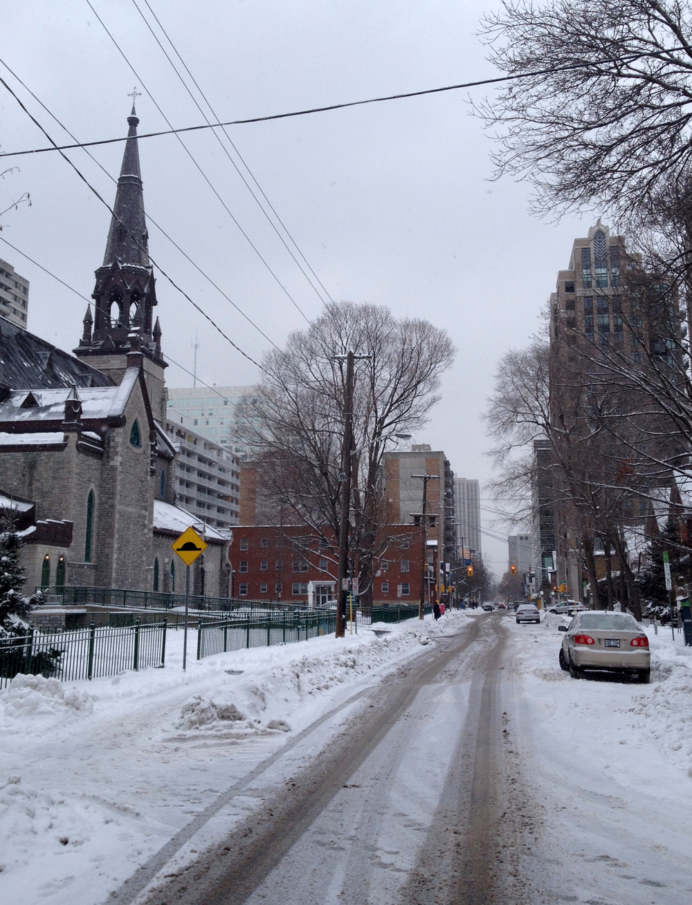
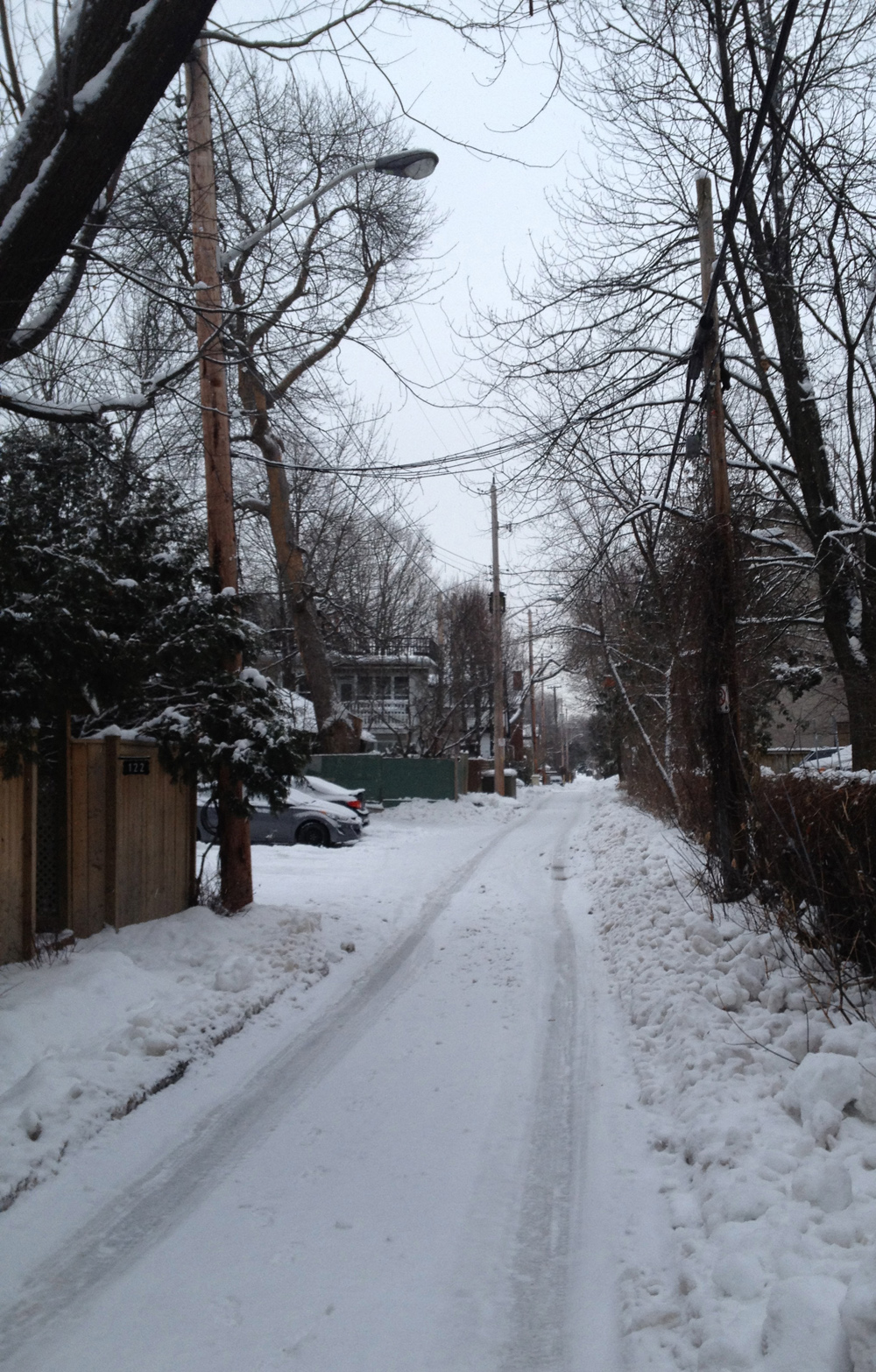
After dropping off some books at the downtown library I biked along O’Connor to meet Carla and the kids at the museum. Now O’Connor is a street I would normally avoid as many drivers tend to zip down this one way street or impatiently jostle each other in their rush to get to the Queensway, but there isn’t much Ottawa traffic on Sunday mornings so I wasn’t too worried.
This view down O’Connor makes it appear as if bland mid-rise buildings dominate the street. This Urbsite post describes the boom in Centretown apartment building in the sixties that contributed to this image.
O’Connor Street
But tucked in in amongst these mid-risers are a number of jewels, such the City of Ottawa Public School Board’s old administrative building at the corner of Gilmour Street. Urbsite once again comes through with this post which not only describes the building, but the two big blue spruce flanking the entrance as well, and how this same entrance was incorporated into a logo used on Ottawa elementary school report cards in the’50’s.
Ottawa School Board building
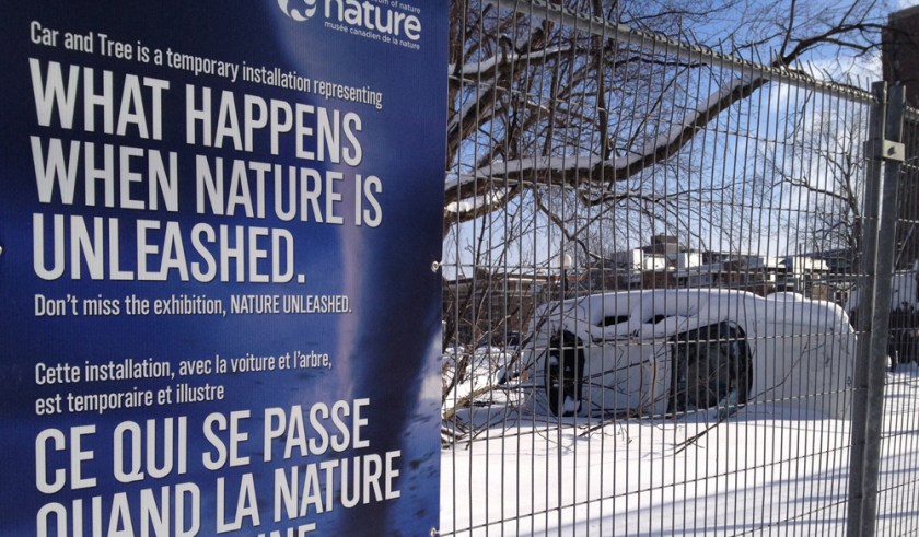
As I closed in on my destination, Pleased with my safe journey along O’Connor, I was shocked to see this smashed up car at the corner of McLeod and O’Connor!
Fooled me. Very clever.
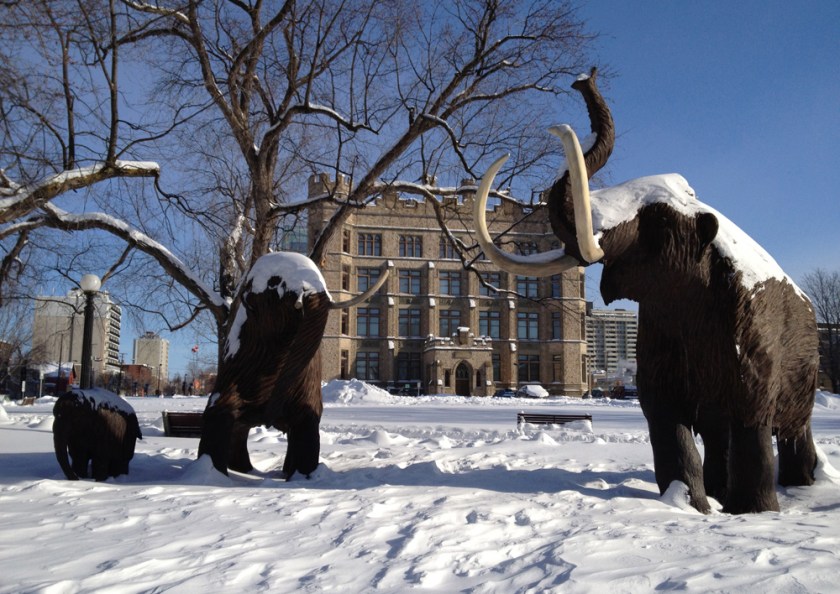
Right beside the faux crash site stand our faithful family of wooly mammoths that have been foraging on the grounds of the museum for as long as I can remember.
Wooly mammoths
On the opposite side of the street sits this great sculpture called Paso Doble by Bruce Garner.
Paso Doble
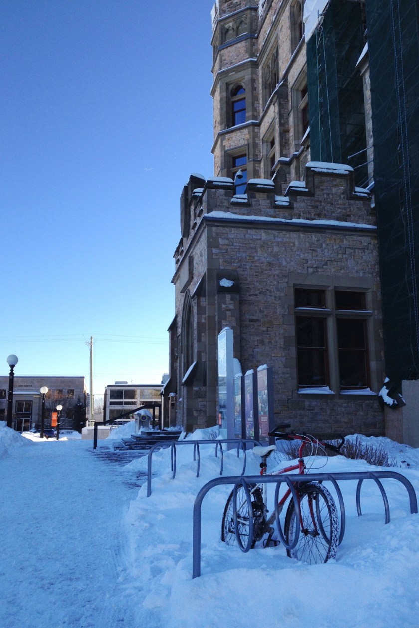
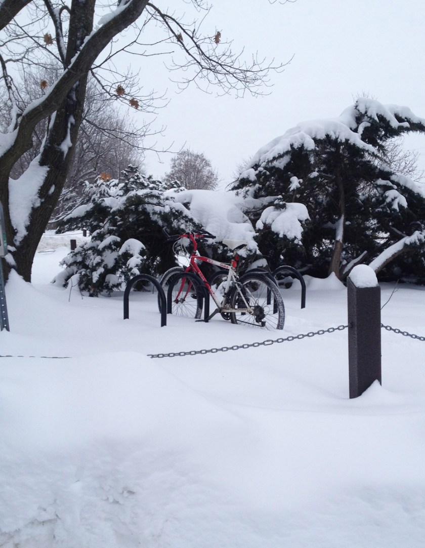
On the east side of the museum there are BIKE RACKS!
Yeah bike racks!
They’ve done a great job with the renovations to the museum. Here’s a view looking up from the old space into the new, of the gang looking down from the new into the old.
Old & New
Rode home safely along Metcalfe and Somerset. A fine outing.
OK, I’m going to go a little off script on this post. With all the great snow we’ve been having I decided to go cross country skiing in the Arboretum yesterday, and what better way to get there than by bike? Here’s how.
The biggest challenge of course is how to transport skis and poles while riding. I stuffed mine into a ski bag and strapped them to the side of my big backpack like so. It worked well, but I’m going to try to attach them a little lower next time.
All bundled up, and away we go!
I biked down Booth Street which is normally quite busy especially during the week as it proceeds north to Gatineau over the Chaudière Bridge, but it isn’t so bad early Saturday morning. There are a great mix of buildings along Booth. This facade just south of Somerset, with all of it’s various doors and openings, some bricked up, others introduced as required over time, suggests many narratives that must have played out within it’s walls.
Facade along Booth near Somerset
This small brick house a bit further south has survived the test of time nicely.
I’ll be your brick …. house!
This interesting building is a recent addition to the street.
New kid on the block
St Anthony’s maintains a commanding presence at the corner of Gladstone because of its size and orientation to Gladstone facing down the hill towards Little Italy on Preston Street.
This one on the opposite side of Booth was built in the mid ’50’s and also has FHBRO heritage designation.
Chemical Radioactive Ores Building
I biked to the parking at the top of Prince of Wales Drive, as the bike lane on the shoulder was partially cleared and the traffic was light. You can also bike up the path hi-lited in purple beside Prince of Wales which is plowed, as I discovered on the way home. I found the snow covered bike rack and locked up my trusty steed. Time to ski!
Bike rack
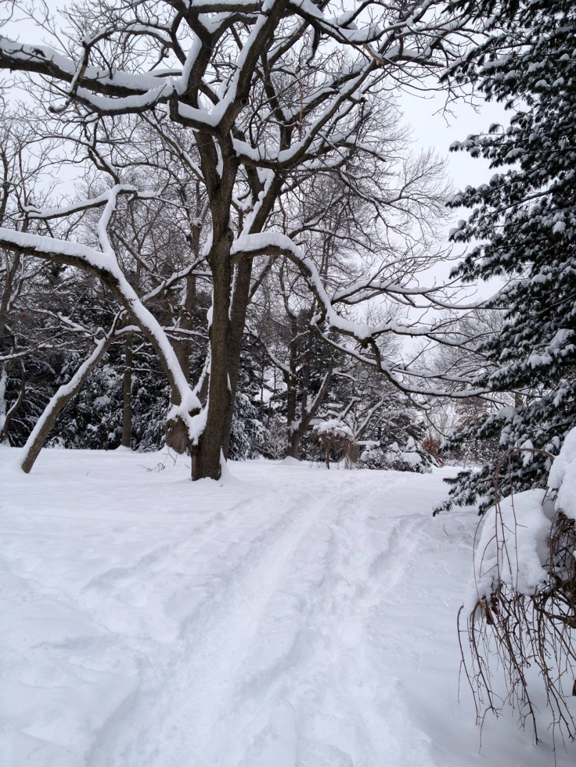
The Arboretum is a very popular spot for dog walking, resulting in many well worn paths such as these that can accommodate any width of skis and bindings.
Winter path through the Arboretum
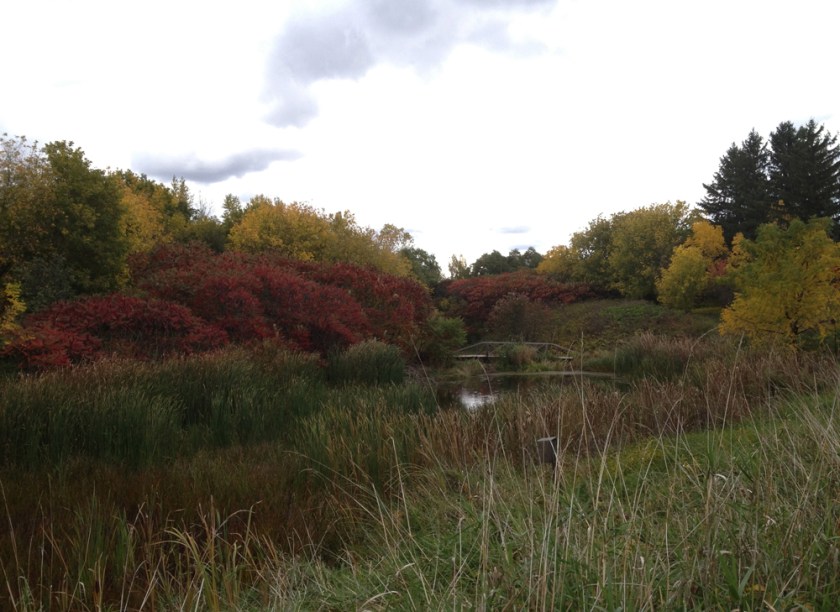
I also skid through Fletcher Wildlife Garden which I first discovered back in October and wrote about in this post. I even took this photo from the same spot – sheer coincidence, believe it or not.
Fletcher Wildlife GardenSame spot in October
Along with the network of dog walker paths throughout the Arboretum, there are usually a number of trails broken by other skiers or snowshoers, pretty much guaranteeing a fine ski outing.
After a wonderful Boxing Day brunch with friends and family it was time for a quick ride through old Hull.
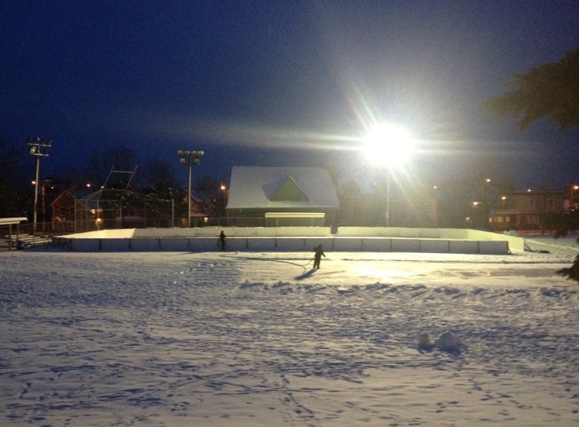
Rink flooding in the park off Ruelle Langelier
This church situated on Rue Ste Bernadette was built in 1938.
Église Portugaise Saint-Esprit
The Sentier des Voyageurs isn’t cleared, but it is well travelled and lit along the section through Parc des Portageurs, making it more than bike able.
It’s starting to look a lot like Narnia, ’round here!Another beautiful heritage building on Promenade du Portage
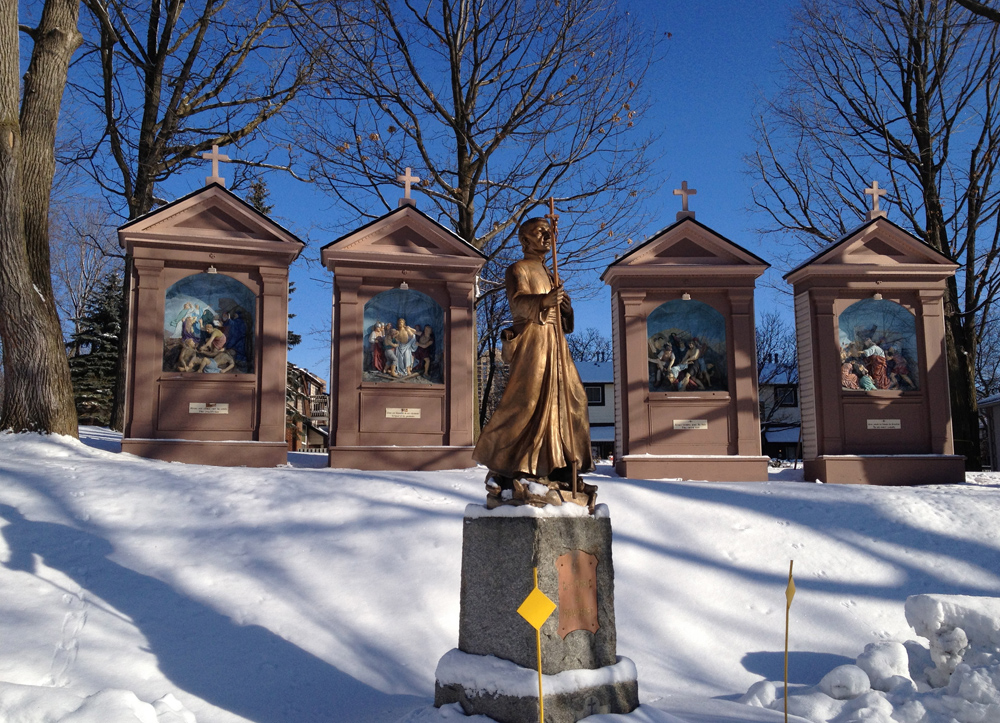
The true heroes on birth days are mothers, a status all the more enhanced when the magical moment occurs in less than ideal conditions, like in a manger surrounded by livestock. So in recognition of this I toured a few depictions of Mother Mary throughout the city. Here’s the route I followed, purple line going one way, blue line coming back.
First stop was just inside the gates of St Vincent Hospital overlooking Lebretton Flats towards the Gatineau Hills. That’s where this statue of Mary stands in a small grotto.
Mary at St Vincent Hospital
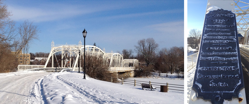
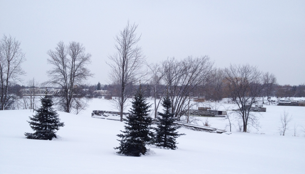
in my last post I lamented not being able to cross over the pretty white bridge leading to New Edinburgh. I took a closer look at the map and discovered there was another way to gain access by following a path off Sussex Drive as shown on the above map. The plaque mounted on one of the steel supports tells us it’s the Minto Bridge, installed in 1900.
White Minto Bridge
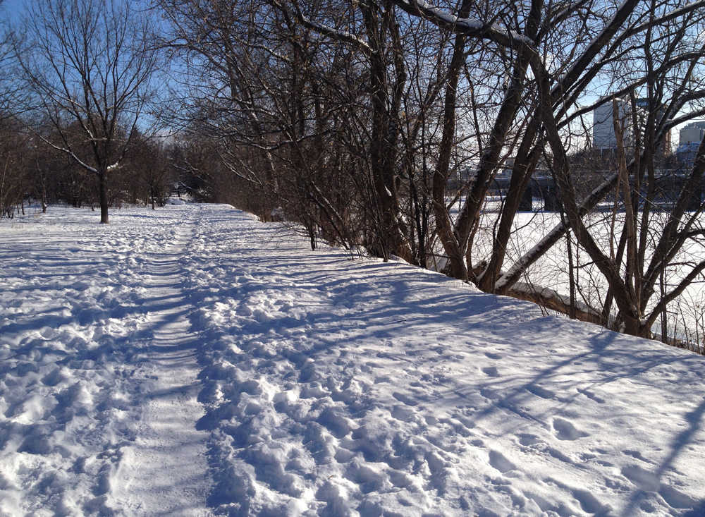
I was also able to ride along the well travelled and packed down Rideau River Trail as far as Beechwood Avenue. A little bumpy but well worth it.
Rideau River Trail in winter
The second depiction of Mary on our tour is this statue at the end of Avenue des Pères Blancs. The Pères Blancs is a Catholic Society of Missionairies of Africa whose scholasticate occupied the site of Parc Richelieu. They were expropriated by the city of Vanier when the province ordered the city to acquire more park land. This statue of the Virgin Mary left by the missionaries greets visitors as they enter the park.
Mary sporting a crown
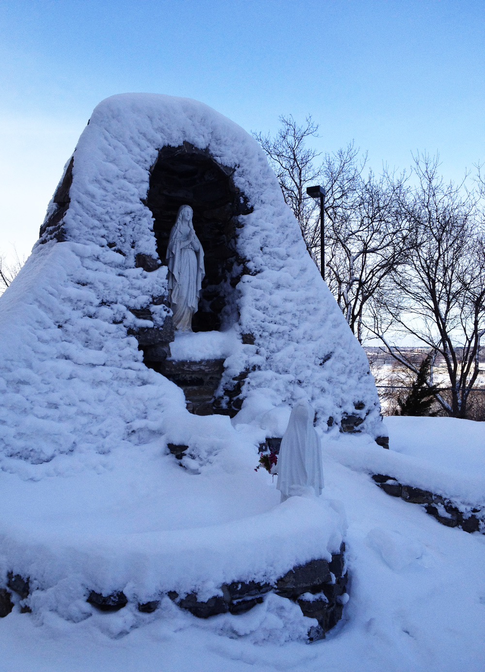
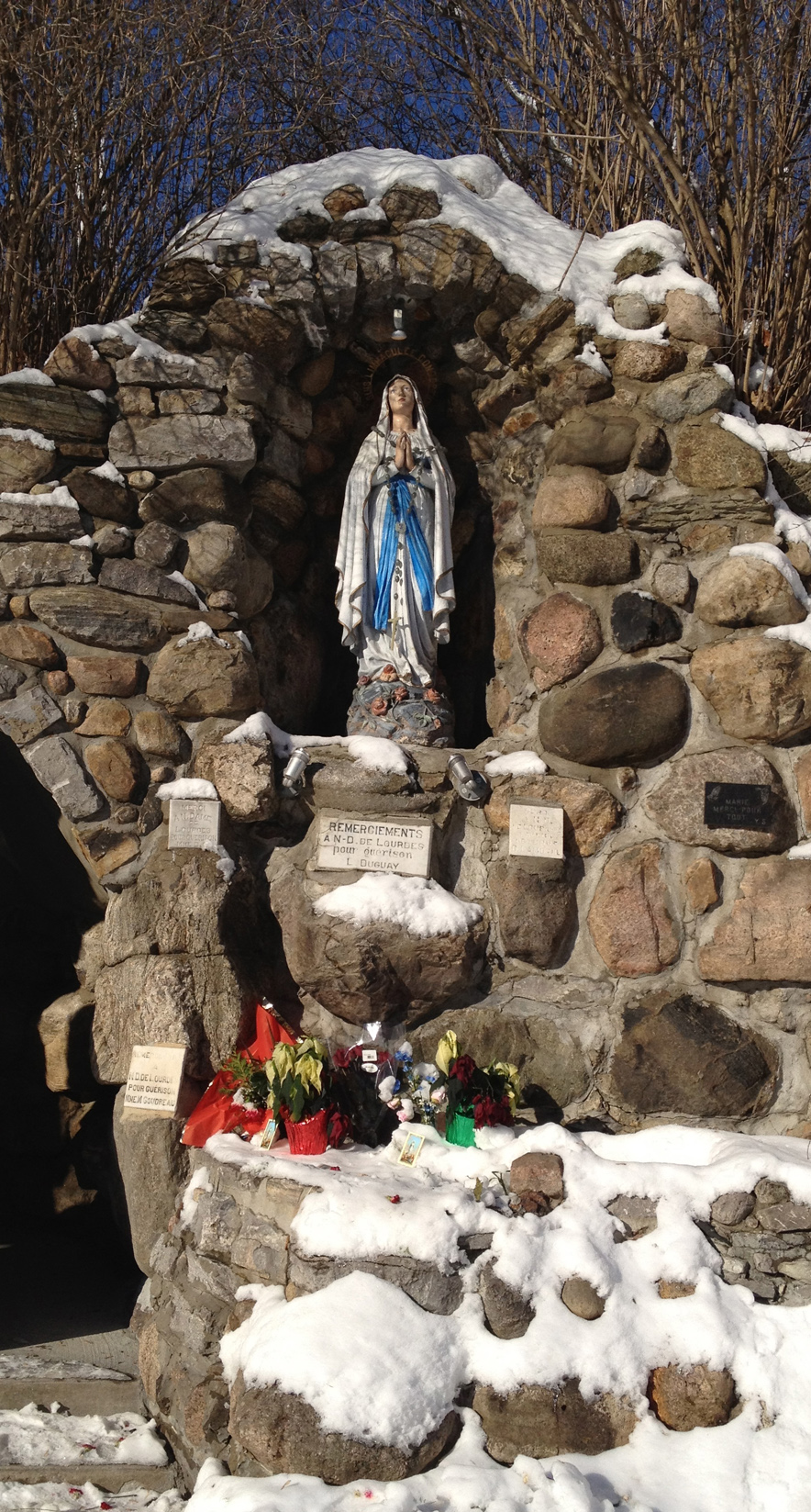
Next stop – Notre Dame de Lourdes Grotto.
Statue of Mary at the Notre Dame de Lourdes grotto
The surrounding context is quite a sight to behold. All around there are miniature shrines depicting the stations of the cross such as these.
A few stations of the cross
Near the entrance to the site is this assemblage of miniature plaques giving thanks for various divine interventions. It is interesting to note the evolution of mini-plaque designs over the years.
Plaques
UPDATE – Christmas 2019 – The original tour included a final stop back in Chinatown, where this painted icon of Mary and child was mounted outside the Annunciation Orthodox Cathedral. Hélas, it is no longer there.
Icon of Mother Mary and Child originally outside the Annunciation Orthodox Cathedral at the time of the original post (December 2012), since removed.
I wanted to figure out a safe bike route to New Edinburgh, so yesterday I chose the old Fraser School House on John Street as my destination and set out. Along the way I happened upon a few other old teaching facilities. Here’s how.
The Laurier Street bike lanes are indeed a fine way to travel east-west through downtown, but another less busy option heading east is along Nepean Street. Google Maps shows it cut in two by Centennial Public School between Percy and Bay, but you can bike through the school parking lot and a paved lane on the south side of the school. Here’s the view down Nepean Street.
Nepean Street
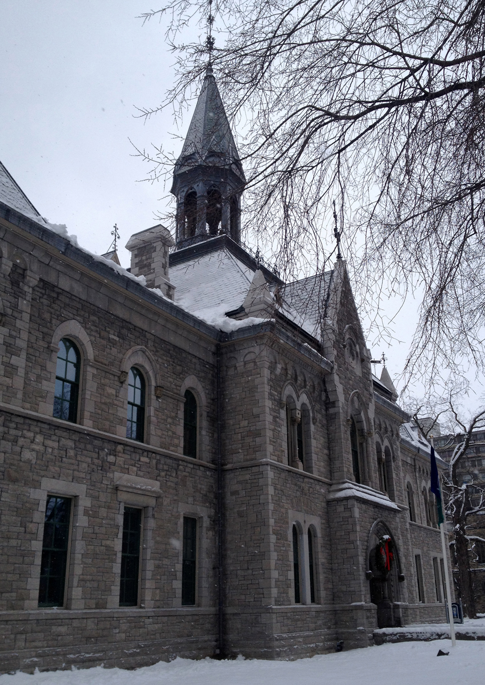
At the eastern end of Nepean Street where it intersects Elgin Street, sits the old Teachers College. Built in 1875, it was originally called the Normal School. Now it’s owned by the city and has been renamed The Heritage Building. Although it is connected to City Hall at the back, it remains true to it’s original character and detailing.
Normal School – Teachers College – Heritage Building
You can avoid riding along Elgin by continuing down the lane to the north of the Heritage Building, and then along this plowed and salted path between the court house and City Hall.
Shortcut
The only nasty part of this ride is along Laurier over the bridge. The bike lane was mostly snowed in, and cars always love to fly crazy like along this section of Laurier. But once off Laurier at Ottawa U, all is calm.
New Edinburgh is north, so I turned and headed that direction along Friel Street, which ends just north of Rideau, then continues as Beausoleil Drive. At the corner of York Street and Beausoliel Drive sits York Street Public School with wonderful ornately carved front and side entrances.Built in 1922, this school figures prominently in Brian Doyle’s popular book Angel Square.
York St Public School – front & side entances
There is a crosswalk where Beausoleil reaches busy St Patrick Street. Biking further north through residential streets, one arrives at Bordeleau Park on the edge of the Rideau River. There’s a path through the park, but it needs a few more days of trampling before it is firm enough to bike along.
Path through Bordeleau Park
Worth the short hike though, as there are great views to be had along this park such as this one looking out towards the old footings of the B&P Rideau River Bridge.
B&P Rideau River Bridge footings
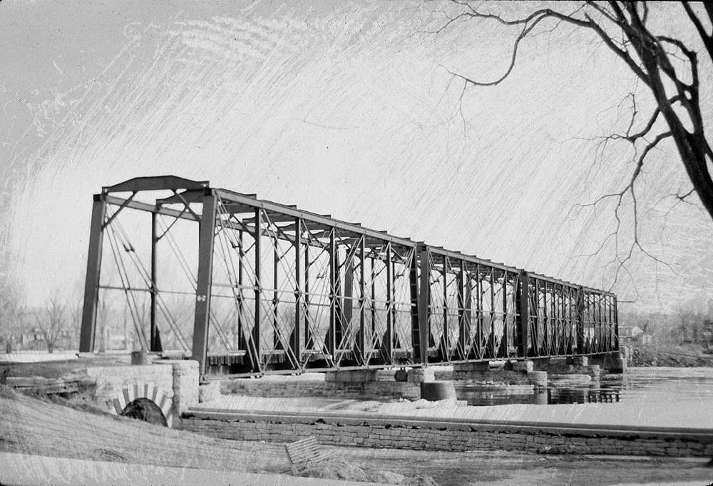
Opened in 1855, here’s a photo showing what the bridge looked like right around when it was removed in the mid 60’s.
B&P Rideau River Bridge
The path between the park and Sussex Drive, on the other hand is plowed AND salted. I had hoped to cross the little white steel bridges along Union Street to avoid Sussex but the first bridge to Green Island is completely engulfed in plastic tarp and blocked off. Renovations I’m guessing.
Here are the pretty white bridges as seen from Sussex Drive. I also love the details on the building on the right and how close the windows come to the waters surface.
A great way to get across New Edinburgh heading west is along River Lane.
River Lane
I walked my bike along the sidewalk over the St Patrick Street bridge so as to be able to access Charlotte Street on the other side. At the opposite end of Charlotte Street there is a path that winds through Macdonald Gardens Park. A gazebo sits atop the hill in the park which seems very popular with tobogganers.
Gazebo & toboggan run
A fine winters ride. Oh, I hear Santa! Better get to bed and pretend I’m asleep.
I learnt via the Twitter-sphere that the recreational paths along the canal had been plowed after Friday’s storm, so yesterday I set out to confirm the rumour.
Now I’ll admit to feeling a little discouraged from the day before when I attempted to ride through the storm. There was little room to manoeuvre on busy streets like Somerset with all the piled up snow, and visibility was lousy, for myself and the drivers squeezing around me. Along side streets, which had yet to be cleared, my tires intermittently planed and sunk all over, making me twitter aloud whether skinnier tires were the way to go. One fellow even flew past on cross country skis. BUT by yesterday, only one day after the storm, biking conditions had improved drastically.
The route I chose to follow was pretty much icy all the way, as shown in red, code for studded tire zone. However most streets I ventured along, as shown in blue, were sufficiently cleared that I would have felt comfortable riding down them sans studs.
I headed down to City Centre to see if the new bike path beside the O-Train was navigable. On the way I stopped to ponder this little old building sitting in the City Centre parking lot. More on this little gem from Eric Darwin’s blog here. This past summer some folks taking a smoking break at the front door told me it was still operational, with the inside set up with office spaces. Yesterday it unfortunately appeared closed for business.
Diamond in the rough
The O-Train path was not bike-able.
O-Train path in the winter
So I headed up over Somerset to cross under the Queensway along Bayswater Avenue, because it’s one of the most pleasant, safest roads to get to the other side of the highway, Bayswater being a residential street with very little traffic. Just on the southern side of the Queensway sits St Mary’s Parrish.
St Mary’s Parrish
This image on their website confirmed how great I imagined the stained glass above the entrance must look when properly lit.
The path between Carling Avenue and Dows Lake looked promising, as a number of folks had packed it down, but not quite enough. Just a couple more days of foot traffic and it should be fine to ride along. I pushed my bike most of the way to Prince of Wales Drive.
Path between Carling and Prince of Wales Drive
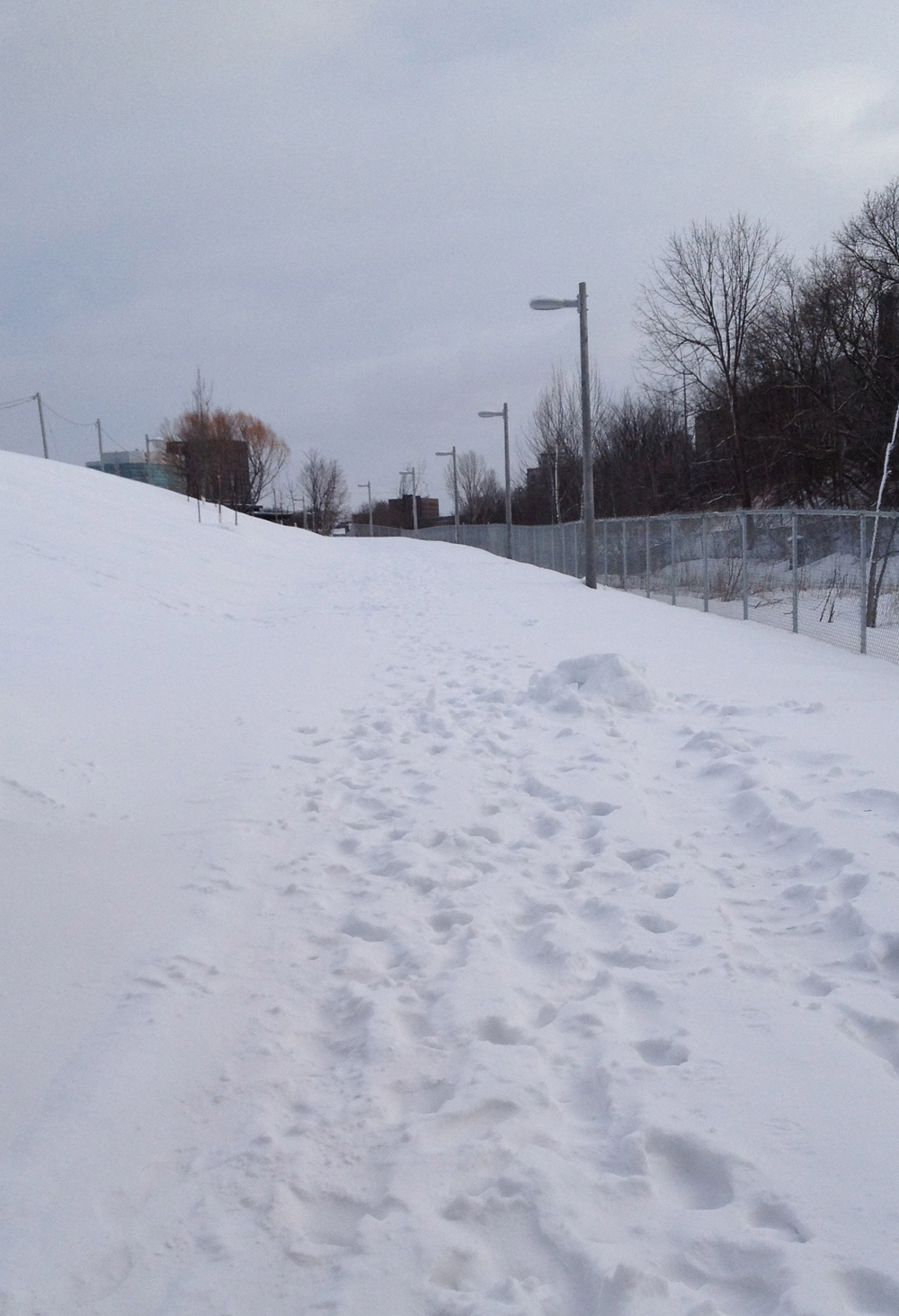
They plow the path in the Arboretum all the way to the foot of the toboggan hill.
Arboretum path to the toboggan hill
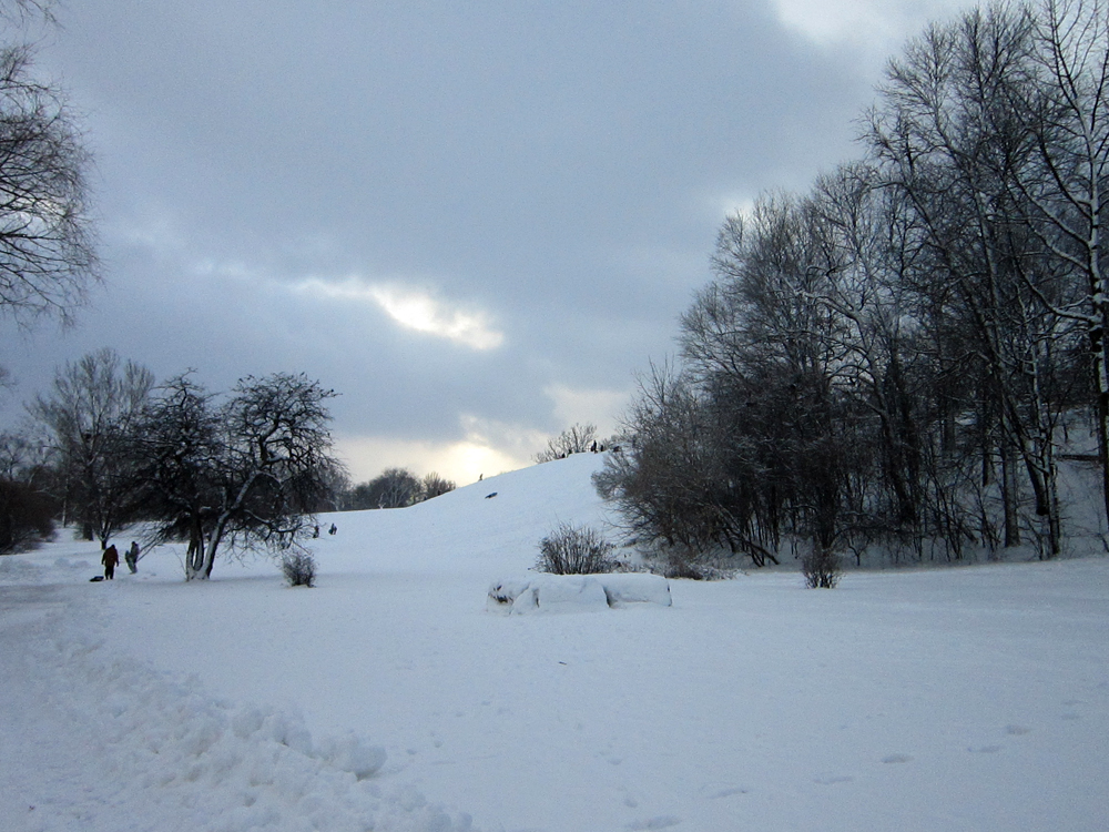
Excellent toboggan hill
The path from the hill to the canal locks at Carleton University was packed down from all the dogs out walking their humans, so most of it was indeed bike able.
Frosty encouraging me on
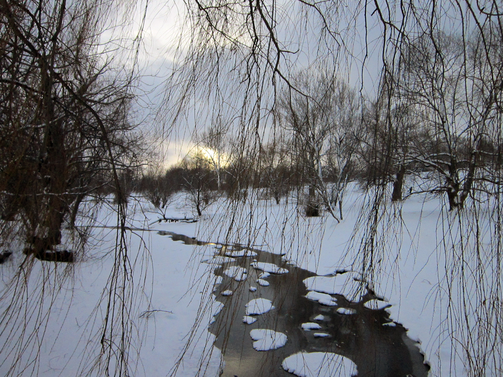
Creek through willow branches
But then the big question was – is the bike path along the canal cleared…. ?
YES! Icy all the way, but YES!
Rideau Canal Pathway in the winter
Bank St bridge
That’s St Paul’s University in the distance
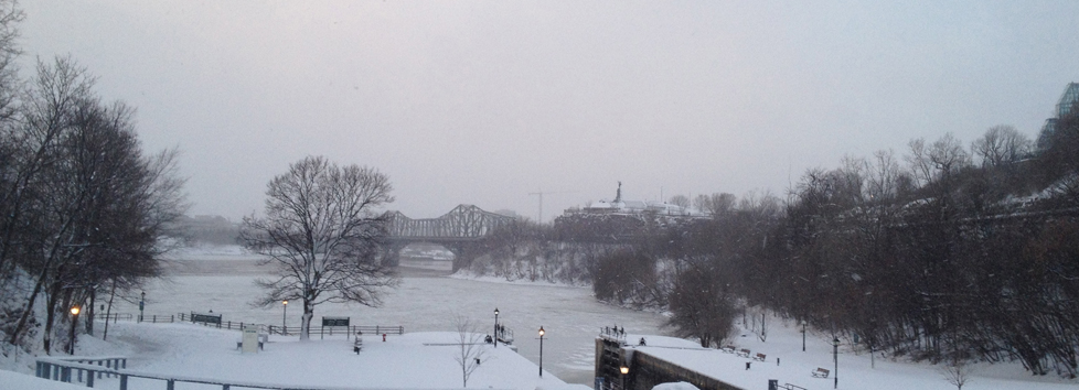
I stopped at the top of the locks leading down to the Ottawa River to take a shot of the Parliament Buildings, when I noticed these guys filming themselves for an Ottawa tourism promo video. They were more interesting. Click.
Shhh… quiet on the set!
The path is cleared all the way to the bottom of the locks.
View towards Ottawa River
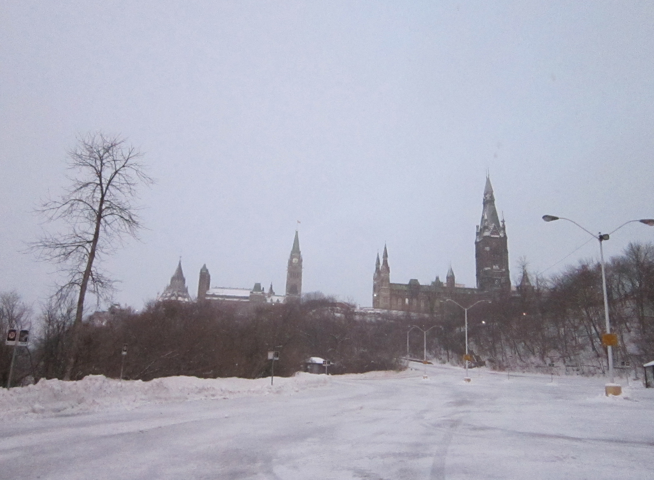
Now why the path below Parliament Hill along the river isn’t cleared remains a mystery to me, especially considering how beautiful it is along the river.
Ottawa River in winter
It wasn’t sufficiently packed to ride along either, which is why I turned up where a parking lot West of the West Block extends halfway down the hill. I knew it would be meticulously plowed and salted.
Today I biked to a meeting at Les Ateliers du Théâtre de l’Île on Rue Garneau. Some sections of my route were sufficiently icy that I would not have ventured down them sans studded front tire, so on the map I’ve hi-lited those sections in red. As you can see these sections are intermittent and avoidable. It was great to see many people out biking throughout this blustery day.
There was some slick ice lurking beneath the dusting of snow along this off shoot of the Ottawa River Pathway, just west of the Portage Bridge, up the hill from where the kayakers big storage containers are located.
Studs required
A bit further on, just west of where the path goes under the Portage Bridge, one section is cleared and salted. I came from the left.
Paths in winter
It was a windy day, as suggested by the tufts of snow clinging onto this frozen section of the Ottawa river.
Wind swept river
Where the path turns back under the Portage Bridge on the Gatineau side, there is a surreal soundscape of industrial steam pipes hissing and popping away intermittently all around. This wasn’t happening in the summer when I biked past on numerous occasions, so maybe it’s only a winter thing.
On the way back from my meeting I biked through Le parc Fontaine. It’s standardized modern facilities and layout belie the importance it held within the community over the years, as described on this interpretive panel situated on the southern edge of the park.
Parc Fontaine
There are a number of beautiful old buildings along Rue Laval and Promenade du Portage, such as these.
Good looking Gatineau buildings
There is also this well preserved 60’s building where the two streets cross, suitably adapted as a modern furniture store.
My goal is to pedal down every Ottawa/Outaouais street at least once. For some streets, once is enough. Like Slater Street and Queen Street, which I rode along yesterday morning. They are not very bike friendly, regardless of the green bike ROUTE signs fastened to the occasional telephone pole. But they ought to be safe to bike down for folks who work there, live there or need to ride down them for whatever reason.
My destination was the old post office at Sparks and Elgin to mail off Christmas gifts. Blue line’s how I got there. Red line’s how I got back.
At the corner of Bronson and Slater there is a very wide graffiti wall. Here’s how it appeared through the frost covered chain link fence.
Graffiti wall along Slater
Slater is three lanes heading east one way. The south side is pretty much a transit way, forcing bicyclists to hug the shoulder-less curb on the opposite side. Drivers instinctively consider this outside lane to be the passing/speeding lane. Pretty nasty.
Slater St
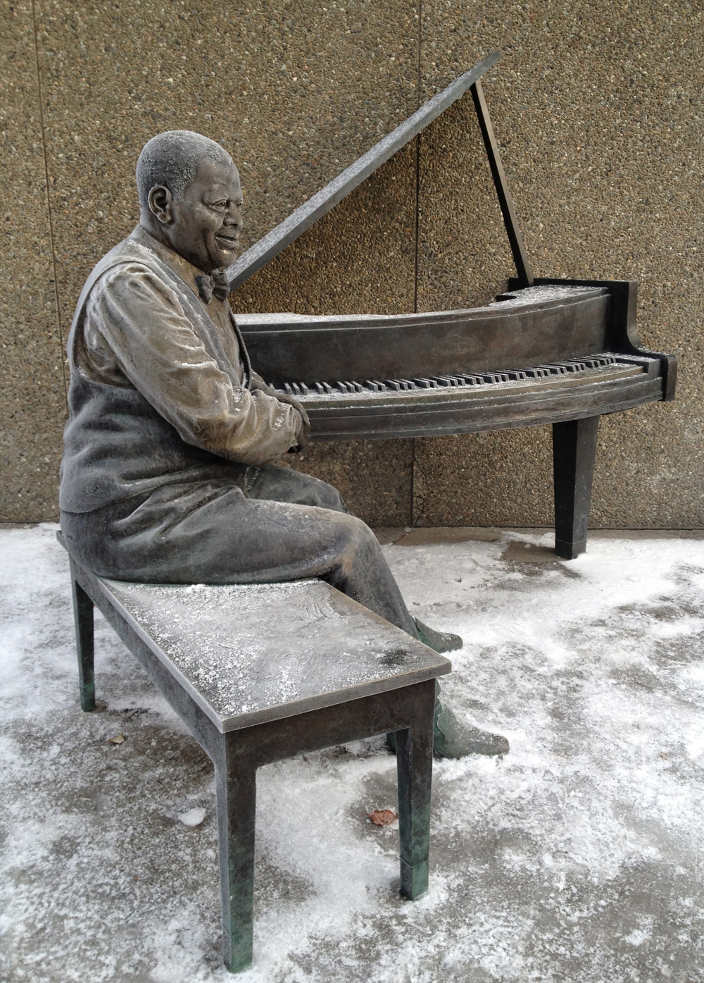
I was pleased to turn up Elgin Street and see Oscar sitting outside the NAC covered in a frosty layer. This wonderful commemorative statue by Ruth Abernethy is extremely welcoming. I often see folks sitting on the piano bench beside Oscar, listening to his music coming from speakers placed up above.
Oscar Peterson
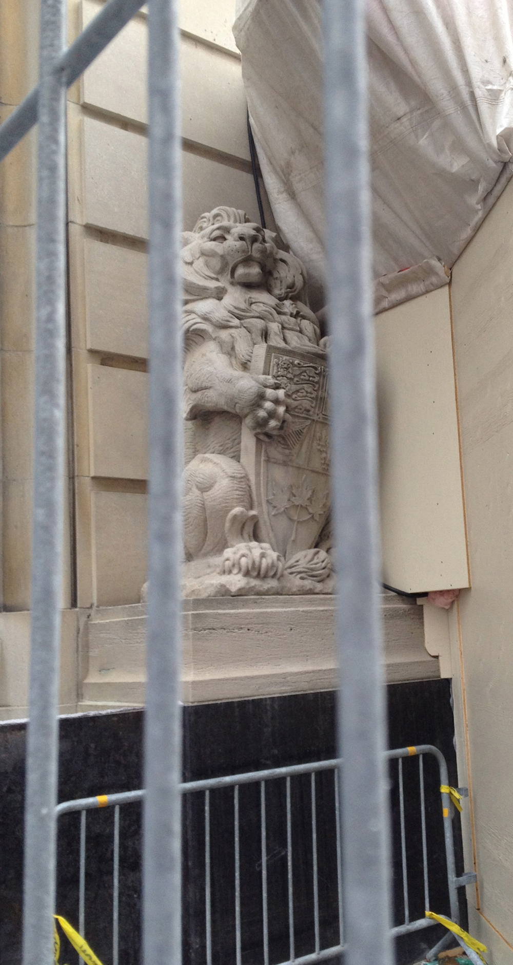
Construction scaffolding and plywood presently surrounds the main entrance of the post office at Sparks and Elgin, caging in this noble sentry.
Caged Lion
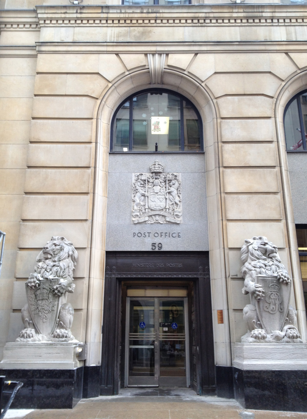
Fortunately these two proud beasts remain on duty at the side door on Sparks St.
Lions on duty
I travelled down Queen Street on the way home. It felt safer than Slater, perhaps because there was only one lane keeping the traffic calm.
Queen St
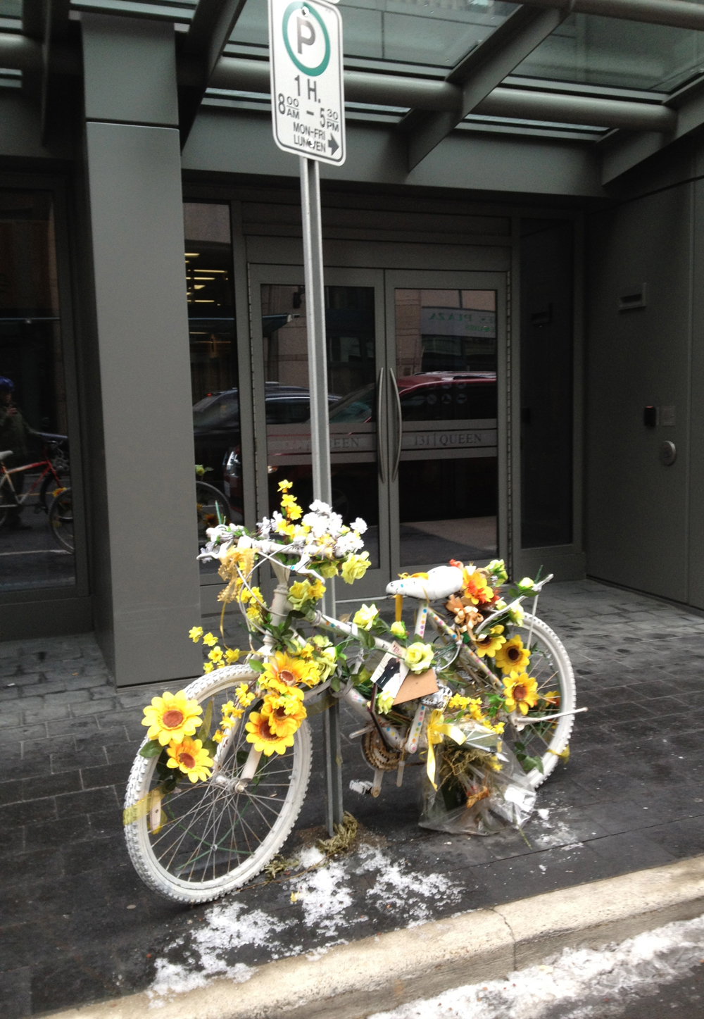
The narrow space between the parked cars and the traffic presents another very real danger of being doored, i.e. when a passenger of a parked car opens their door without checking to see if any bicyclists are coming, forcing a collision. This is what lead to the senseless death of Danielle Naçu in October 2011. Here is the ghost bike along Queen Street commemorating this tragic event.
Commemorative ghost bike
They knocked down part of Christ Church Cathedral awhile ago along with a few other old dwellings to build condo’s, but retained these facades to be incorporated into the new building. I am often fascinated by the juxtaposition of temporary structures used to retain or protect old structures as shown in this image.
Bracing
And finally, a shot of Jack Frost’s handiwork, looking out towards the park at the western end of Queen St.
I biked to Yarn Forward in the Glebe late in the afternoon to buy some sewing supplies. Here’s how I managed to get there and back, avoiding traffic as much as possible along the way.
I set out following the north-south bike path along Percy Street. Once on the other side of the Queensway I turned east on Glendale Avenue. This led me to the edge of Ottawa’s very own Central Park. The path through the park isn’t cleared, as you can see in the image below, but it’s extremely well travelled, so I’m guessing it will be navigate-able throughout the winter. Yes, that’s ice all over the path. My studded front tire was an absolute necessity through this section.
Path through Central Park
Most of the houses in the Glebe were constructed in the early part of the 1900’s. It was one of Ottawa’s first suburbs. The sturdy dwellings which have survived the test of time have adapted over many generations of residents and taken on their own personal character, like this house along Roseberry Avenue with its interesting porch detailing.
Glebe porch detail
Yarn Forward on Bank Street is a great mid-sized store for all kinds of sewing and knitting supplies.
Yarn Forward
I decided to take a more circuitous route home that took me along the Rideau Canal and the Laurier Avenue bike lane.
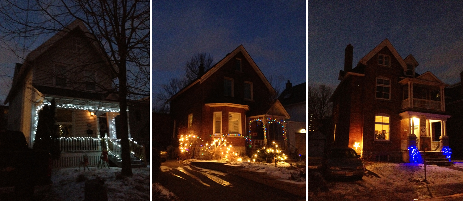
Here are a few other examples of early Glebe dwellings along Strathcona Avenue decked out in Christmas lights, all set for the festive season.
Some lit up houses in the Glebe
The path along the west side of the canal is cleared making it a great ride all year round, with the Pretoria Bridge and Laurier Bridge to be admired along the way.
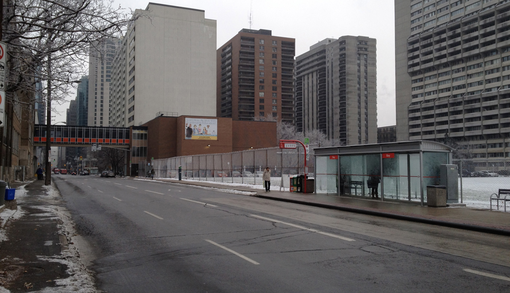
There’s a very welcome north-south path being completed that runs beside the O-train tracks. I had to get to Brewer Arena for my sons game so I decided to test out the new path on the way there. Here’s how:
This is where the new path meets the Ottawa River Pathway, just before the old train bridge across the river.
New path splitting off to the left from the old path
A bit further on looking north one can see a coming together of three paths for different modes of transportation – train tracks leading to the steel bridge, the parkway overpass, and our brand new bike path. Now that’s progress!
Intersecting paths
As this next image taken from the path suggests, there is access between City Centre and Somerset St. by gonig under this City Centre concrete ramp.
Access between Somerset and City Centre
Then it’s under Somerset.
Tunnel under Somerset St
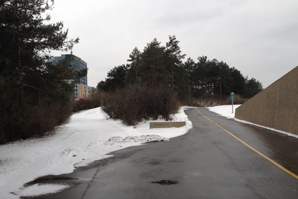
Just beyond the Queensway the new path joins one that has been there for a long time, and it looks like they are going to leave it in its original crushed gravel form, which would be fine. it’s always been a safe pleasant section of path.
Path south of the Queensway
Don’t know if they have any plans on dealing with how the path crosses Carling, but a crosswalk signal would be great.
Where the path meets Carling
Along Prince of Wales Drive you can see the man made chasm along which the O-train travels before dipping down under Dow’s Lake.
O-train tracks
Here is the path through the Arboretum just off Prince of Wales. The train tracks are now to the left.
The arboretum looks great any time of the year. This last view is along the stream that feeds into the canal just beyond the small bridge in the distance.