Discovery ride through Gatineau

Here’s a bike ride that works it’s way westwardly through the centre of Gatineau, starting from Jacques Cartier Park on the edge of the Ottawa River to just within the southern tip of Gatineau Park. The route follows a series of connecting paths along which there are a number of interesting sculptural installations and interpretive panels that describe the history of the area.


.

Our adventure begins just to the east of Maison Charon facing a trio of bronze and stone interpretive displays. These describe, in turn, the entrepreneur Philemon Wright who settled in the area during the 1800’s and developed the logging industry; the importance of the Ottawa River as a trading route and meeting place throughout time; and the history of Maison Charon.

Maison Charon
Maison Charon

Interpretive displays at Maison Charon
The Voyageurs Pathway runs behind Maison Charon. I followed it south a short distance to another grouping of panels that describe the Ottawa as a ‘River of many Stories’, including those of the First Peoples, the coureurs de bois, loggers and log drivers.

River of Many Stories

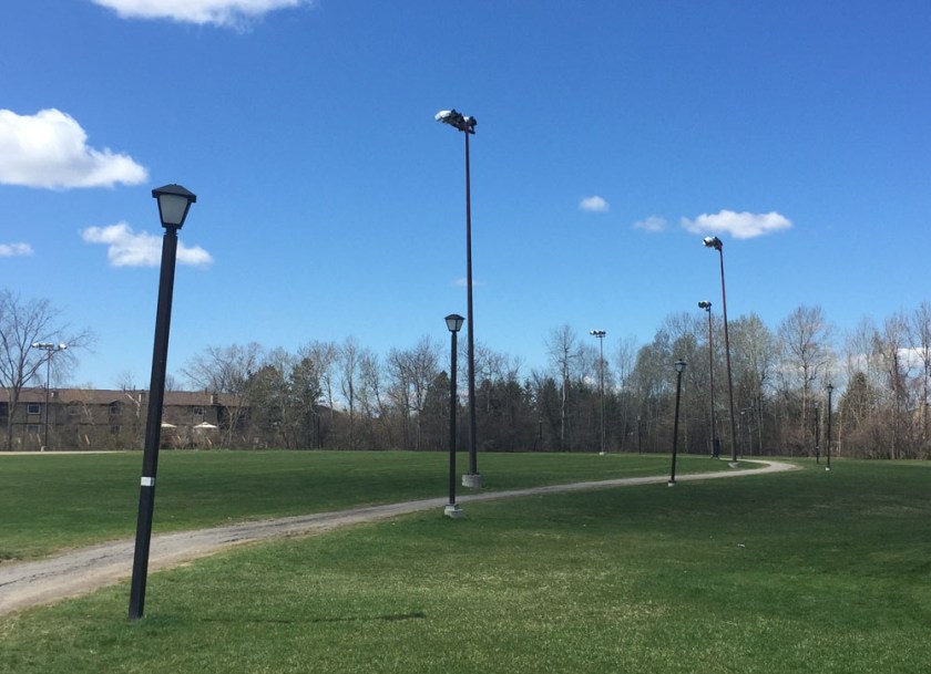
I followed the path that circles away from the river, up towards a landing overlooking Jacques Cartier Park and a series of panels that describe how the area has transformed from an industrial site in the 1930’s to the public space that it is now.

View overlooking JCP park
Jacques Cartier Park interpretive panel with view towards the Alexandra Bridge and the National Gallery

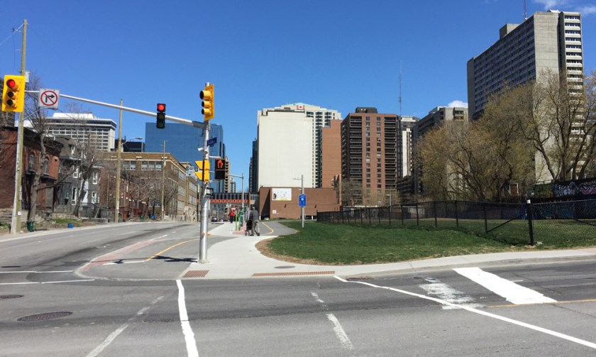
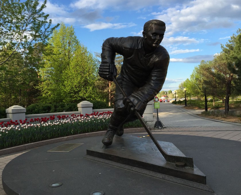
I spun around and headed straight out of the park to the corner of Boulevard des Allumettières and Rue Laurier, where there’s huge bronze sculpture of Montreal Canadiens hockey legend Maurice Richard.

The Rocket
The Rocket

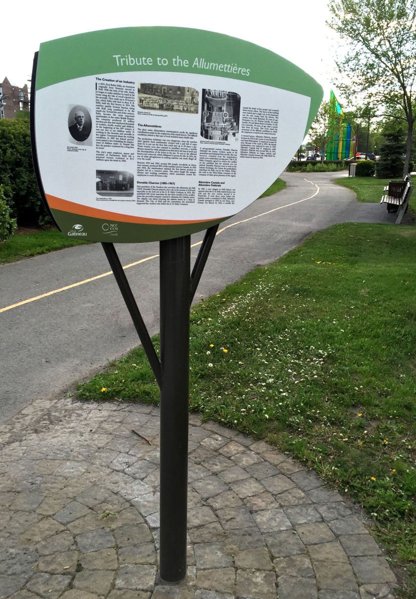
The De l’ile pathway starts on the other side of Rue Laurier and winds it’s way west. Just before reaching the intersection of Boulevard Maissoneuve and Boulevard des Allumettières there is an interpretive panel describing who the Allumettières were: female labourers who worked in the local EB Eddy factories making matches, and their struggles for workers rights.

Les Allumettières
Les Allumettières

In the above photo one can see the huge stained glass installation by Montreal artist Hal Ingberg that allows for some spectacular shadows, depending on how sunny it is.

Inberg shadows
Inberg shadows

At the corner of Rue Laval and Boulevard des Allumettières sits a metal sculpture inspired by origami. Created by a group of local artists from the Tripode Group, it was commissioned to celebrate the International Year of the Family in 1994.

Monument to the Family

The next section of the De l’ile pathway is a pleasant meander through the local community as far as Rue Saint Rédempteur.

De'l'ile Pathway
De’l’ile Pathway

There is a signalized crosswalk to get across Rue St Rédempteur before the path continues between a high school and the Robert Guertin arena where the Gatineau junior hockey team Les Olympiques play.

Robert Guertin Arena

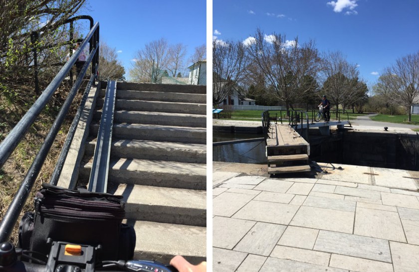
The path eventually meets up with the Ruisseau de la Brasserie Pathway. Turning left where the two paths meet leads to a bridge with some fine views overlooking the stream (or ruisseau).

View from the bridge over the Ruisseau de la Brasserie looking north

The path continues alongside the ruisseau. Part way down the path there is a french interpretive panel describing the biodiversity found in this area.

Interpretive panel along the pathway

I turned off the Ruisseau de la Brasserie Pathway just before it continued under the Boulevard des Allumettières, and followed the path that goes alongside les Allumettières.

Exit up to Boulevard des Allumettières

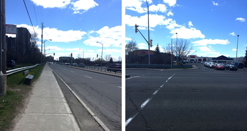
The path along Boulevard des Allumettières is generous and physically separated from the busy boulevard, however a few intersections along the way can be a bit nerve wracking. These include on & off ramps to highway 50, and a couple of round-abouts.

Path along Allumettières at seen from under highway 50

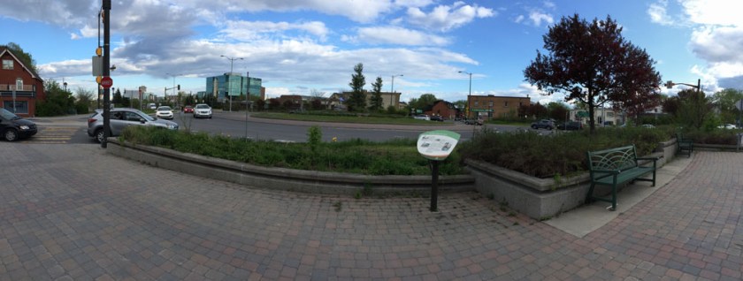
At the first round-about there is a french interpretive panel that describes the struggles and efforts members of the local population undertook to minimize the impact Boulevard des Allumettières would have on their community. The Boulevard was eventually completed in 2007.

Round-about panorama. Left side of image is where I came from. Right side is where I'm heading.
Round-about panorama. Left side of image is where I came from. Right side is where I’m heading.

The path continues west with sound dampening walls separating it from Boulevard des Allumettières. This stretch of path is interrupted only by a second round-about intersection before reaching the exit ramp to the Lac-des-Fées Parkway.

Path along Boulevard des Allumetteèrres

The route gets a tad wonky once arrived at the exit ramp. The end goal is to continue west along Boulevard des Allumettières, however to do so one must follow a distorted figure 8 by first riding down alongside the Lac-des-Fées exit ramp, then winding your way back up on the other side of the ramp. Wouldn’t be too confusing it was uninterrupted, but it intersects the Lac-des-Fées pathway heading north-south at two spots. Best rule to maintain is to stay right.

Riding down alongside Lac-des-Fées down ramp, before first of two right turns back up to Promenade des Allumettières

Once back up beside Promenade des Allumettières there’s another french interpretive panel describing the history and surroundings of the viaduct over which the path continues.

Le viaduc Oscar-Duquette
View north from the viaduct

Crossing over the viaduct brings you into Gatineau Park. A short hill once across the viaduct leads to the Gatineau Park Pathway where our discovery ride ends.

Intersection with the Gatineau Park Pathway. Arrivée!

For a fine alternative return route back towards the starting point, I would suggest one described in part on this post, Biking from Gatineau Park to Ottawa.

Et voila!

Bike route from Greenboro to Downtown

Greenboro is a residential community located just south of Johnston Road and west of Conroy Road. Here’s a route I tested out that’ll get you from Greenboro to downtown.

.
I started off from the Greenboro Community Centre and headed west towards Bank Street, following a selection of the many multi-use paths that weave their way through the community.

Path through Greenboro

After crossing Albion Road and cutting through Pushman Park, I turned right on Pebble Road then Left on South Keys Place to Clearwater Crescent. Across Clearwater Crescent there are a series of paths that cut through to Southgate Road.

Shortcuts
Shortcuts

I rode north on Southgate for half a block before turning into the lane heading into a housing complex called Southgate Square. This I followed a short distance to Bank Street.

Laneway into Southgate Square

The next section of the route is less than stellar. That’s because there is no clear safe way to bike across Bank Street to access the Sawmill Creek Pathway on the opposite side of the South Keys Shopping Mall.

Once at the end of the driveway there is a shortcut that I took up and on to the sidewalk along Bank.

Path to Bank St at the end of Southgate Square laneway

I followed the sidewalk south a short distance to the traffic lights across Bank Street into the South Keys Mall parking lot. The only crossing is on the south side of the intersection. I stayed along the sidewalk on the other side until I was able to access the parking lot.

Sidewalk along Bank to lights....crosswalk at the lights to South Keys Mall
Sidewalk along Bank to lights….crosswalk at the lights to South Keys Mall

Access to the Sawmill Creek Pathway is though a tunnel under the O-Train tracks at the south end of the mall, so I rode through the mall parking lot to get there. The sign at the entrance to the tunnel is confusing, however I have Tweeted confirmation from OC-Transpo that it is meant to be interpreted as ‘no riding your bike’, versus ‘no bikes allowed at all’.

Tunnel under Otrain to Sawmill Pathway..and it's confusing sign
Tunnel under Otrain to Sawmill Pathway..and it’s confusing sign

Beyond the tunnel is the Sawmill Creek Pathway, which is wonderful to ride along all the way to where it intersects the Brookfield Pathway.

Sawmill Creek Pathway - I stayed right
Sawmill Creek Pathway – I stayed right

I turned left at the Brookfield Path intersection which eventually brought me to the Brookfield Road round-about.

Brookfield path towards the round-about

UPDATE – 2020 : A separated bike path has been added to the south side of Brookfield Road which is fantastic! Continue along this path to Riverside Drive.

I then crossed Riverside Drive and Hog’s Back Road, then continued along the path on the north side of Hog’s Back Road, which is identified as a shared pathway. That said, the path on the south side is commonly used by riders heading west as it is also paved and twice as wide.

Path along Hog's Back Road
Path along Hog’s Back Road

Update, 2020They are rebuilding the bridge over Hog’ Back Falls which requires walking your bike along  a tiny detour, identified by the purple line on the above map. Bonus – it affords a spectacular view over the falls.

Hogs Back Falls
Hogs Back Falls

I then followed the path that  dips under Hog’s Back Road then down along the Rideau Canal.

Rideau Canal Eastern Pathway

I crossed the canal at the locks near Carleton University. There is a metal u-channel to push your bike up the flight of stairs that gets you to the locks.

Up the stairs...to the locks
Up the stairs…to the locks

I then rode down the hill and along the paved path that runs beside the canal all the way to the Dow’s Lake pavilion. I then crossed Prince of Wales Drive and turned left along the bike path for a short distance and then turned right onto the Trillium bike path that heads north beside the O-Train tracks.

Path along the O-Train just before it heads right up up to Scott St
Path along the O-Train just before it heads right up up to Albert St

I followed the path along Albert Street as far as the crosswalk that leads towards the Laurier Bike Lanes.

Crosswalk along Albert St

The path continues through the intersection at Bronson & Slater before eventually cutting through to the Laurier Bike Lanes.

Bronson & Slater intersection

The laurier Bike Lanes cut west to east across downtown as far as City Hall.

Laurier Bike Lane heading east

Et voila!

N.B. Here is another route I have ridden. I don’t recommend it as much as the route described above. That’s because while Conroy Road has bike lanes, it is still a major arterial road with lots of speedy traffic.