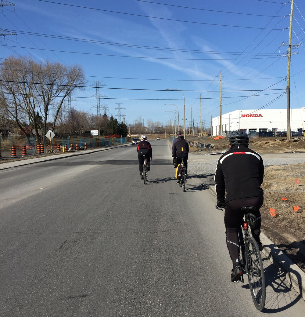
Earlier this year I happened upon a story of a group of Gatineau citizens trying to convince the city to preserve a section of forest located in the Deschênes neighbourhood that was destined to be sold for development. One of the group’s compelling arguments, amongst many, was to preserve a rare stand of white oaks. Good news – they succeeded!
Knowing little about white oaks or their status within the region I decided to track a few down. Here is a route linking three specimens that are relatively easy to access by bike.
We begin in the Dominion Arboretum where sits this white oak planted in 1996. This one was easy to identify as it has an aluminum plaque attached to it with all the identifying info, as is typical with most of the trees in the arboretum.
Young white oak in the Arboretum
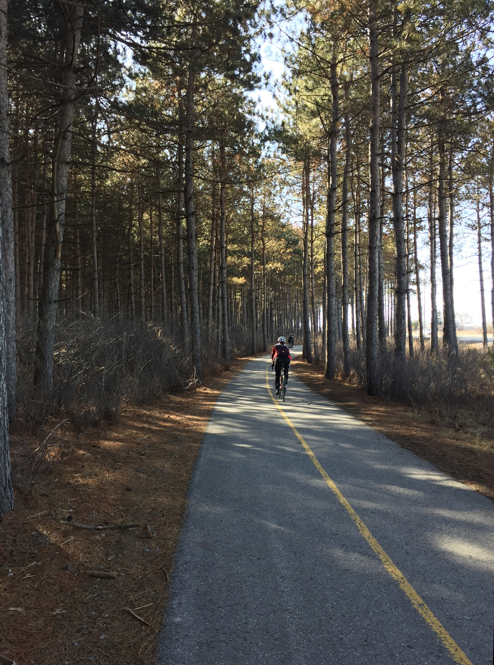
After leaving the arboretum and riding over to the Ottawa River Pathway one has two choices; continue westwardly on the Ontario side as far as the Britannia Park neighbourhood, or cross the Island Park Bridge and ride along the Voyageurs Pathway as far as Deschênes.
I first visited the white oak in Britannia Park which is situated just within the chain link fence that designates the edge of the Britannia Conservation Area. Bikes aren’t allowed beyond the fence so I locked mine up and walked the short distance. I was able to locate this tree with the help of the iNaturalist app/website.
Britannia Conservation Area
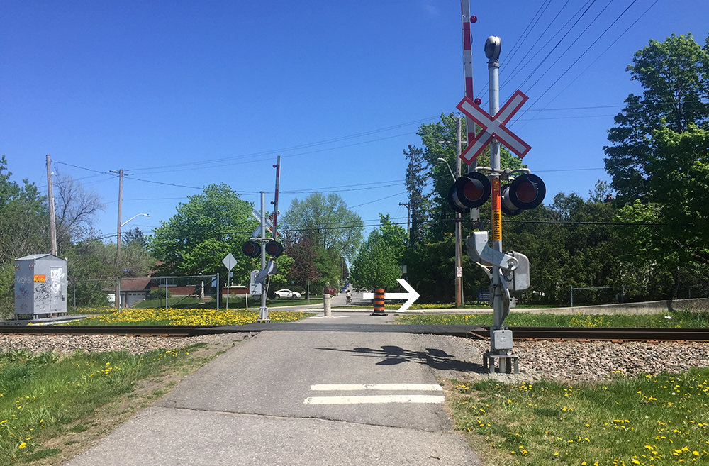
The white oak I was able to find in Deschênes Forest is a short distance off the Voyageurs Pathway. There is a path through the woods one can follow to get there, the entrance to which is just before you reach Chemin Fraser.
This is an update of a tour posted a few years ago as there have been a number of improvements to the route and the status of some of the walls has changed. The purple markers on the map identify legal walls, or those onto which artists can paint without the risk of being chased away or arrested. The red markers are a couple of non-legal graffiti walls along the route.
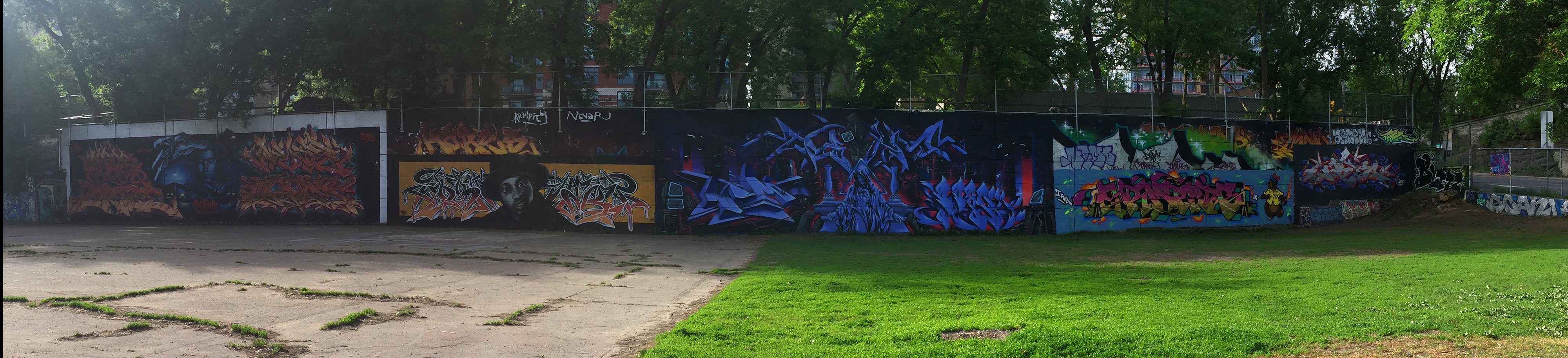
Our tour begins at the edge of the Rideau River underneath the Bronson Avenue bridge. You can access the site from Brewer park on the east side or along a dirt path from Carleton University campus. In this breathtaking setting you will discover two huge sets of walls facing each other across an expanse of packed earth. It’s also the site of the annual House of Paint Festival of Urban Arts and Culture .
Graffiti under the Bronson bridge
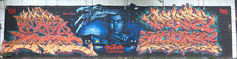
Our next stop is popularly known as the Tech Wall, located at the corner of Bronson and Slater. To get there cut through the Carleton campus, push your bike over the Rideau Canal locks, follow the bike path along the canal through the beautiful Arboretum, then follow the bike path along the O-Train tracks. After passing under Albert Street at the Bayview Station, turn right along the path that heads east along Albert. Cross Albert at the bike/pedestrian crossing and follow the path up to the intersection of Bronson and Slater. The path takes you across that intersection to where you will be facing the Tech Wall across a fenced in dog park. You can enter the dog park to get a closer look at the works of the various artists.
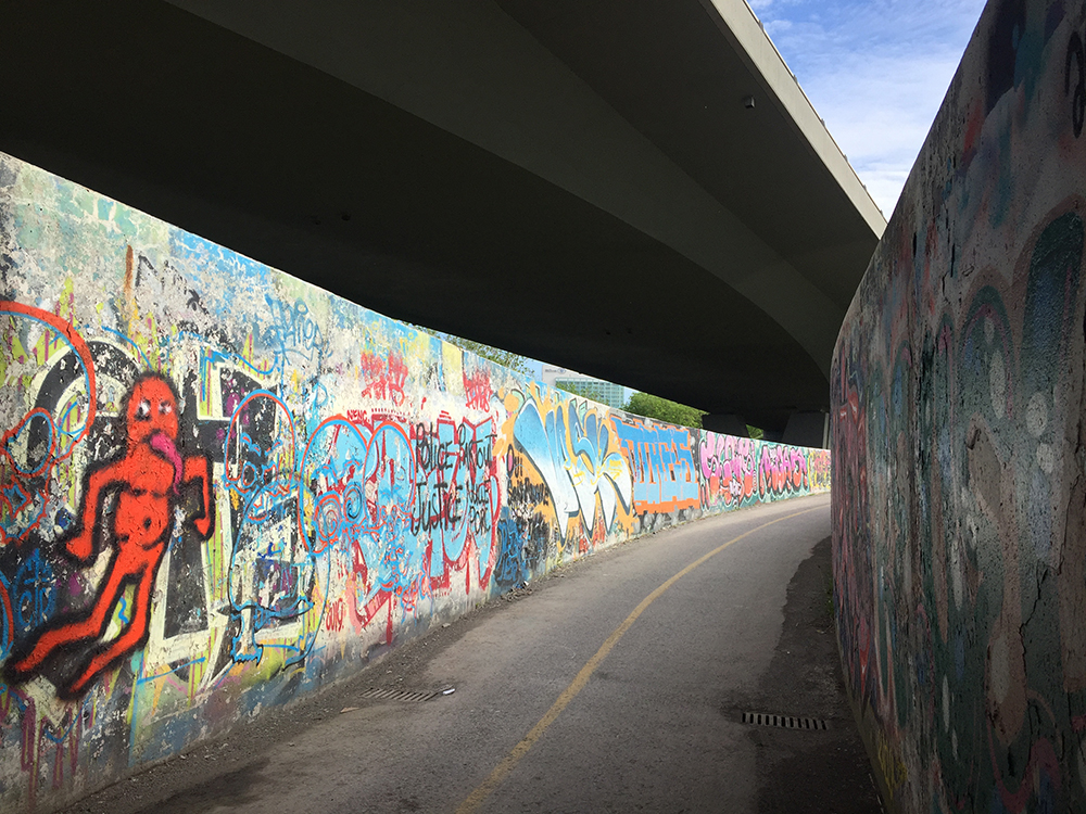
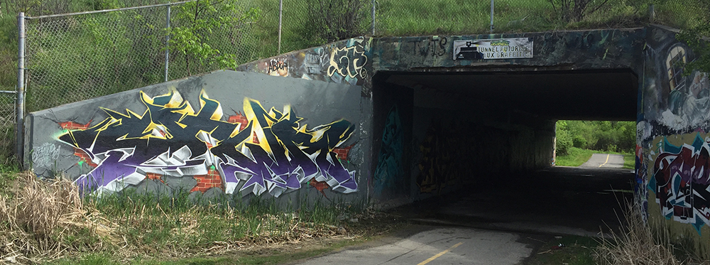
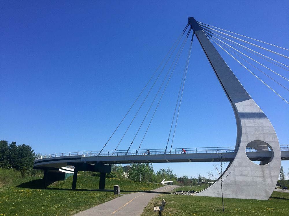
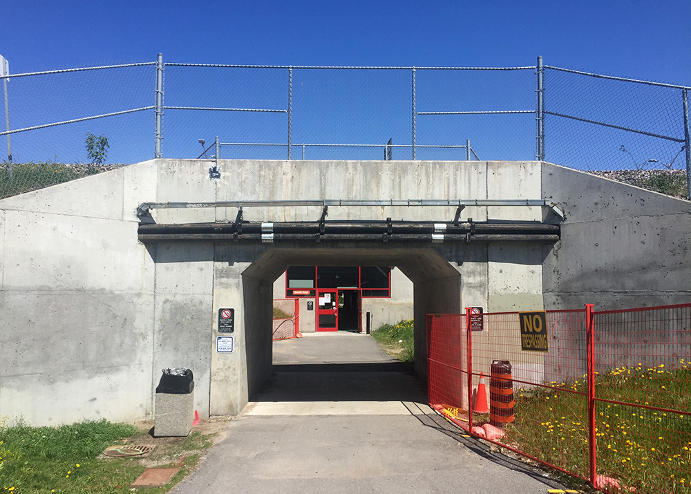
The next bunch of walls are in Gatineau. Continue along the Laurier bike lane to Bay St, follow Bay to Wellington, turn left onto the bike path that runs beside Wellinton and follow it over the Ottawa River along the Portage Bridge, then turn right onto the Voyageurs pathway. There’s usually some interesting graffiti on the Voyageurs pathway tunnel walls passing under the Portage Bridge.
Voyageurs Pathway tunnel under Potage Bridge
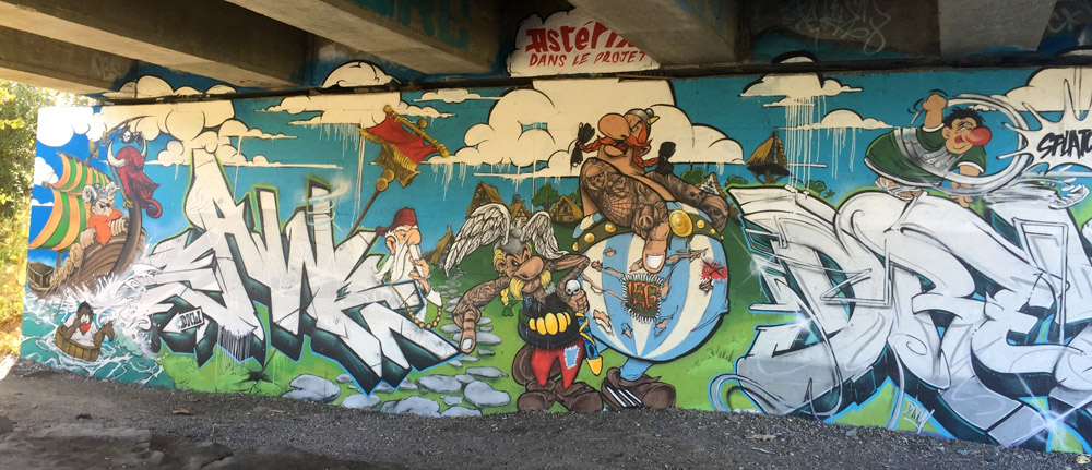
Continue along the Voyageurs Pathway and cross Alexandre-Taché Blvd at the lights. There’s a path that cuts through the small park, then over a small bridge. Turn right onto the road that eventually becomes the Ruisseau de la Brasserie Pathway. This pathway dips along and over the stream before heading under the Autoroute de la Gatineau. This fantastic immersive stretch pops up beneath a web of overpasses, made all the more sensational with graffiti filled walls. Occasionally the walls get re-painted a neutral grey in preparation for the next round of artists.
Ruisseau de la brasserie pathway
The path splits just beyond the underpass. Stay right (versus taking the small bridge over the stream) and continue a short distance along the path to check out the next series of walls. This spectacular spot is located beneath the interchange ramps of the two major highways that cut through Gatineau, the 5 and the 50. The legal walls are on both sides of the stream, accessible by a small wooden bridge. On my most recent visit they had recently been given the grey overcoat. Artists had started to paint but there wasn’t too much to photo so the following examples are from a previous visit.
Graffiti under highway 5 to 50 interchanges along Ruisseau de la brasserie
Retrace your route a short distance to the earlier exit that takes you across the samll bridge. This bike path continues around Leamy Lake then along the Gatineau River. Turn right off the path towards Gatineau Park where it goes under the transitway. At both entrances of this tunnel there is graffiti.
The path weaves its way up and under Highway 5 for a second time. This is where our final set of walls are located.
It was great having my nephew from Montreal along for the first version of this tour. He is well versed in the subtleties of graffiti art and he taught me lots!
Jeanne was asking about a bike route from Strathcona Park to the South Keys Shopping Centre. Here’s a map. Description and photo’s below.
Starting from the Strathcona Park side of the Adawe bridge River follow the path that runs along the Rideau River heading upstream.
START : Path through Strathcona Park heading upstream from the Adawe bridge
The path continues along the river, going under the Queensway and up behind the University of Ottawa football field, before reaching the Hurdman Bridge. Cross over the Hurdman Bridge bike path beside the O-Train tracks.
Approaching the Hurdman Bridge
Once over the bridge circle down to your left and continue heading upstream along the Rideau River Pathway.
Just after some big power line towers turn left onto a path which will bring you to a signalised crossing at Riverside Drive over to Frobisher Lane.
Rideau River Pathway. Arrow indicates exit path beyond the power line tower.
Crossing at Riverside to Frobisher Lane
Frobisher Lane gets you over the transitway. Once over the transitway turn right at the ‘T’ which continues as Frobisher Lane. Travel along to the end of the road where it transitions into a wide concrete walkway. Keep riding along this walkway to the lights across Smyth Road.
Cross Smyth Road and continue through the Riverside Hospital campus. At the south-west corner of the campus there is a path that allows you to continue straight.
Path at south corner of Riverside Hospital
This path then curls to the left over the train tracks. Once over the tracks turn right onto Rodney Crescent.
Sharp right onto Rodney Crescent after riding over the tracks
This brings you to Pleasant Park Drive. Cross Pleasant Park to the path starting slightly to the right on the opposite side. This path merges into Lamira Street.
Continue straight through the round-about along Lamira. The section of this route with the most traffic is the short section along Lamira between the round-about and Bank Street but it usually isn’t too bad.
Lamira St between the round-about and Bank St
Head straight through the intersection at Bank onto Belanger Ave which is a quiet residential street. So is Clementine Blvd onto which you will turn left where Belanger ends.
Biking along Clementine Blvd
Follow Clementine all the way to Brookfield Road. Turn right onto Brookfield. At the corner of Brookfield and Junction Ave head straight onto the Brookfield Path.
Accessing Brookfield Path from the corner of Brookfield Road and Junction Ave
Brookfield Path winds its way down a curving wooden boardwalk under the train tracks, then up the other side. It’s quite a lovely little section.
Start of Brookfield Path boardwalk
At the top of the hill turn left onto the Sawmill Creek Pathway.
Exit off Brookfield Path to Sawmill Creek Path
Sawmill Creek Pathway mostly runs alongside the Airport Parkway, occasionally veering further away, at one time following the transit way for a short spell.
Sawmill Creek Pathway running alongside the Airport Parkway
Continue under the distinct pedestrian/bike bridge that goes over the Airport Parkway. Once on the other side take the second exit left off the pathway (the first exit is the ramp up over the bridge. Don’t take that) .
Heading under the bridge towards the second exit off the Sawmill Creek Pathway
This short section of path will take you to a tunnel that goes under the O-Train tracks and an enclosed passageway that goes under the transitway. The confusing sign at the entrance of the enclosed section says no bikes allowed, but OC Transpo confirmed you can walk your bike through.
Tunnel & passageway
On the other side you will find yourself at the southern back corner of South Keys shopping centre. Follow the road around to the front.
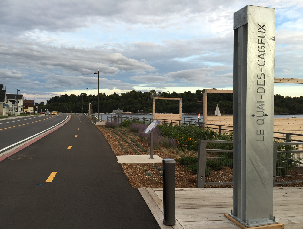
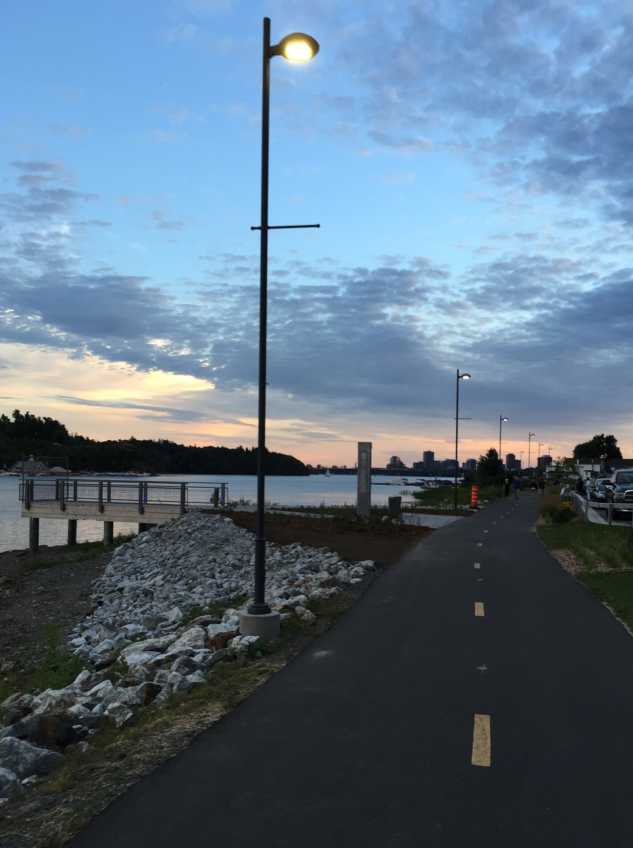
The recently completed section of bike path along the shoreline of the Ottawa River, just east of the confluence of the Gatineau and Ottawa rivers, allow for spectacular views across the water. Previously this stretch of Rue Jacques-Cartier consisted of two narrow lanes with lots of potholes and speeding traffic, making it a challenge for cyclists to concentrate on anything but survival. Now users of all ages visit and cycle along the shoreline, testament to the huge success of this new bike infrastructure.
The blue line on the following map shows how to get there entirely along bike paths starting from Centretown in Ottawa. The purple line is the new stretch of path along Rue Jacques-Cartier, described in more detail below.
.
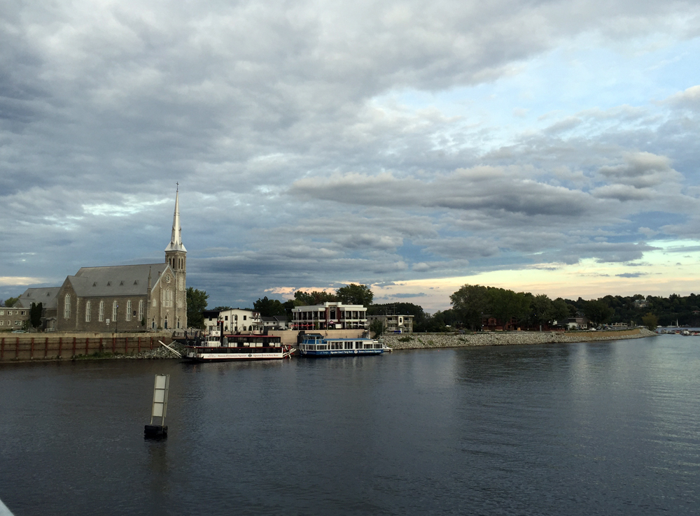
Upon crossing the Gatineau River over the steel truss Lady Aberdeen Bridge, one arrives in the old town of Pointe-Gatineau with the Saint-François-de-Sales church to your right. This is where the new section of path heading east along Rue Jacques-Cartier begins.
View of Pointe-Gatineau from the Lady-Aberdeen Bridge
New path along Rue Jacques-Cartier
The re-design of the shoreline has included gathering nodes for people to pause and take in the scenery. Many of the stops have interpretive panels that describe the history of the area.
Lookout over the river
The design of the various furnishings appear to have been inspired by the lumber industry so prevalent in Point-Gatineau’s past.
Pathway bench
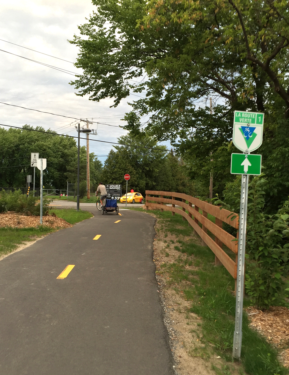
Not only has this new bike infrastructure created a fantastic destination well worth the visit, it also provides an important link to the Route Verte recreational path network that runs across Quebec. It also encourages bike commuting for hundreds of residents living in Pointe-Gatineau and beyond.
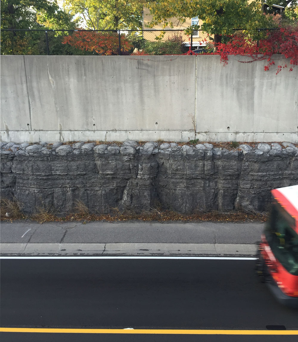
Stromatolites are eerily stunning fossils dating back to the emergence of life on earth. The Ottawa-Gatineau Geoheritage Project describes them as ‘biosedimentary structures built up during sedimentation by cyanobacteria and blue-green algae’. The following is a bike tour of a few examples of Stromatolites visible on both sides of the Ottawa River.
.
Choosing the Portage Bridge as our starting point, we crossed over the Ottawa River to Gatineau and rode upstream along the Voyageurs Pathway.
Our first stop is located just off the pathway immediately west of the Champlain Bridge. These stromatolites are visible when water levels are low in the summer and fall. It’s the most impressive display of these fossils in the region.
Stromatolites along the edge of the Ottawa River just west of the Champlain Bridge
Another example of a few local Stromatolites visible in cross section can be found on the Ottawa side of the river at the eastern tip of Westboro Beach. To get there we followed the bike lanes over the Champlain Bridge back to Ottawa, then continued upstream along the Ottawa River Pathway to Westboro Beach. There are bike racks in front of the beach pavilions if one prefers avoiding having to push their bike through the sand.
Section of Stromatolites at Westboro Beach
Our final stop is located along the bus transitway near Roosevelt Avenue. To get there we took the tunnel under the SJAM parkway at Westboro Beach, then followed Kirchoffer Avenue to the pedestrian bridge over the OC Transpo transitway. From the opposite side of the pedestrian bridge one can see a layered section of Stromatolites exposed at the top of the stone channel that was cut to create the transitway.
Section of Stromatolites at top of stone channel
To get back to our starting point we retraced our treads along Kirchoffer to Westboro Beach, then rode back along the Ottawa River Pathway to the Portage Bridge – a rock & roll tour almost entirely along pathways!
More on Stromatolites can be found by clicking here or on any of the Geoheritage Project links hi-lited in the above post.
UPDATE – September 2019: Here’s a recent CBC post about the Stromatolites on the Quebec side that includes a great interview between Giacomo Panico of the show In Time and Out and Allan Donaldson, a retired professor in the earth sciences department at Carleton University.
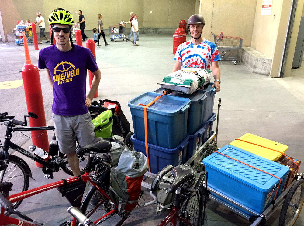
Of all the Costco’s in the region, the one in Gatineau is the most accessible by bike from neighbourhoods in and around downtown Ottawa. A couple of riders who regularly pedal out there were very kind to let me tag along on their latest shopping adventure. (Update – Biking to the Costco on Innes from areas closer to downtown is pretty good too since bike lanes were added along Cyrville Road. Click here for a route there from Overbrook).
Because everything is sold in bulk at Costco, I put out a request for suggestions on which bike trailers would best be able to handle a big load. The overwhelming favourite were those manufactured by Wike out of Guelph Ontario. Giacomo was very kind to lend me his Heavy Duty Flatbed Bike Trailer he uses to roast his Bike Hibachi Pigskin Pork Tenderloin. It performed extremely well on this Costco test ride.
Here’s how it all panned out. Blue line is the way we got there. Purple line is how we got back.
.
We started off from the Woonerf on Cambridge St North in Centretown.
Yes indeed. There are SIX big Rubbermaid bins on the back of that trailer.
We accessed the Ottawa River Pathway at the bottom of Nanny Goat Hill and followed multi-use paths all the way to Pointe-Gatineau on the east side of the Gatineau River.
Riding along the Voyageurs Pathway
UPDATE 2020 – Rue St-Antoine running parallel to Rue Greber is a relatively quite street with bike lanes that lead all the way to the back of the Costco. This route is depicted on the above map.
Entrance to the Gatineau Costco
I loaded as much as I would have on a typical car run and even had room for more, especially if I had brought rear rack panniers.
Packed with room to spare
Mr One Wheel Drive managed to load 237 lbs (!) on his custom made trailer, like so.
Loaded up & ready to head home
The bike path along Boulevard de la Gappe described in this post passes by the Costco one block north so we followed it on the way back.
I managed to click this final image as we headed over the Rapid-Transit bridge before it got dark.
Bridge over the Gatineau River
The path network gets a little labyrinthian from Lac Leamy to downtown Gatineau. I’ve heard all efforts at introducing directional signage through this maze have been covered up with spray paint, so a couple of dry runs with Google Maps in hand is highly recommended.
Et voila!
Update – Patrick filmed a subsequent trip we made to Costco following the purple route, which turned out like so!
Micro-brewing is taking off in and around Ottawa. On our First Annual Ottawa/Gatineau Microbrew Bike Tour we visited a number of breweries in the south, east and central areas of Ottawa and Gatineau. This year’s tour focussed on breweries in the east end of Ottawa and one in the Byward Market. Here’s how it went. Blue line on the map below is the route followed. Purple line is a section of route originally plotted, and one I would ride once the bike lanes along Innes Road have been returned to their former glory post road construction. The red line on the map is a section we should have taken.
.
Before heading out we (Robert, Glenn & I) met up at Raw Sugar for coffee beside the Chinatown arch.
Starting off from the Chinatown Arch
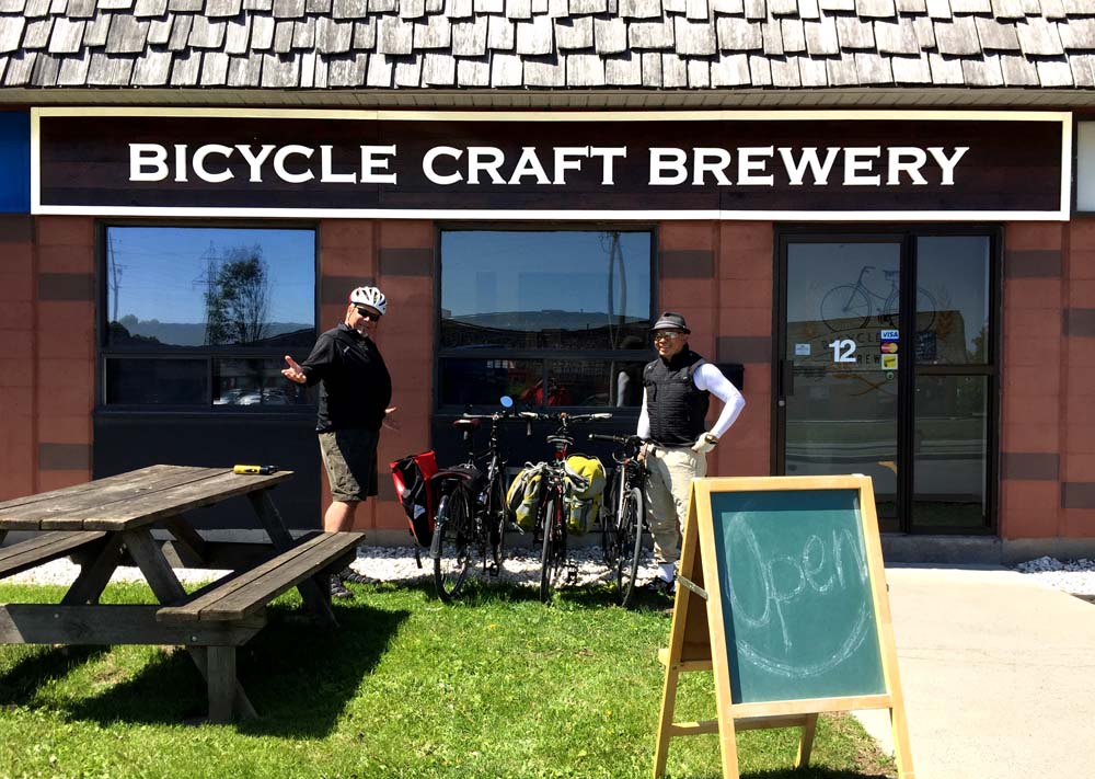
Off we rode to our first stop – Bicycle Craft Brewery on Industrial Road. Great name! The last bit of approach to the brewery along Industrial Road was treacherous. Not only is it filled with speeding trucks and cars, the little shoulder room available to avoid them speeding up behind us had pot holes and sewer grates with slots lined up in the direction of travel. Fortunately the person who greeted and served us is a cyclist, and she told on how to avoid Industrial Avenue. That’ll be the red line on the above map. ie, instead of turning left on Russell road from Coronation Avenue and riding along Industrial, it would have been better to go right on Russell then turn down the lane through the parking to the front of the brewery.
Bicycle Craft Brewery has a bike rack built for three located beside the front door.
Our first stop
The front of house space is very welcoming with various bike memorabilia adorning the walls. There are also chairs, a wood table to gather around, and a big cosy couch. We had small tastings of a few of their fine brews, my preference being the Crimson Cascade, so I bought a half-growler to enjoy back home. I wrapped it up in a small towel and stuffed it in my rear pannier.
A very relaxed bike tour indeed
On our way out, to avoid Industrial Road, we accessed Russell the way we should have on the way in, then cut through Everest which brought us to the sidewalk on St Laurent Boulevard. Looking across St Laurent we noticed a storefront sign for North of 7 Distillery, so we popped in and see what they were up to. Super friendly owner greeted us. He and another fellow working there shared stories on how the distillery came to be and offered taste sips of a couple their wares. The Triple Bean Gin was very tasty, so I bought a bottle top take home. Carla is very fussy about her gin and she really liked this one.
North of 7 Distillery (photo by Robert Batsch)
We rode through the parking lot to get to the bike path that runs along Innes Road as far as the Trans Canada Highway. There are no bike lanes or even sidewalks along the bridge that goes over the Trans-Canada and cars fly on and off the ramps to and from the highway. To avoid this terrible section we turned north on Star Top Road, then south east along Cyrville Road over the Trans Canada. Cyrville is not a great road to ride along either but is the least dangerous option of the two, with no highway on and off ramps to worry about. On the east side of the bridge there is a bike path that starts beside the entrance to the Home Depot to Innes Road.
Normally there is a bike lane on both sides of Innes east of the Trans Canada, however some serious road construction had the east bound bike lane all dug up, so rather than riding along Innes, as suggested by the purple line on the above map, we cut up the path that to the Transitway pedestrian bridge over the Queensway.
Path between Innes and Blair transitory pedestrian bridge
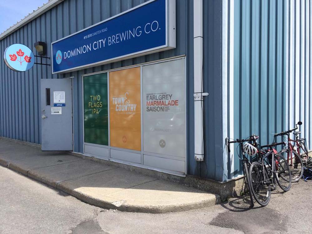
We then rode along Ogilvie Road, which has a bike lane as far as Blair Place. Sans bike lane, riding along Ogilvie is quite unpleasant. Fortunately Robert grew up in this part of town and was able to navigate a safe route along quiet streets from Jasmine Crescent to the Dominion City Brewing Co. on Canotek Road.
Some very friendly people at Dominion allowed us to sample a few small samplings of their brews, my favourite of which was the Two Flags IPA, so I bought a mini-growler. Dominion is also a supporter of the arts. They sponsored the opening of Brian Doyle’s Up To Low performing at Arts Court.
(photo by Glenn Gobuyan) Outside…
… and inside the Dominion City Brewing Co.
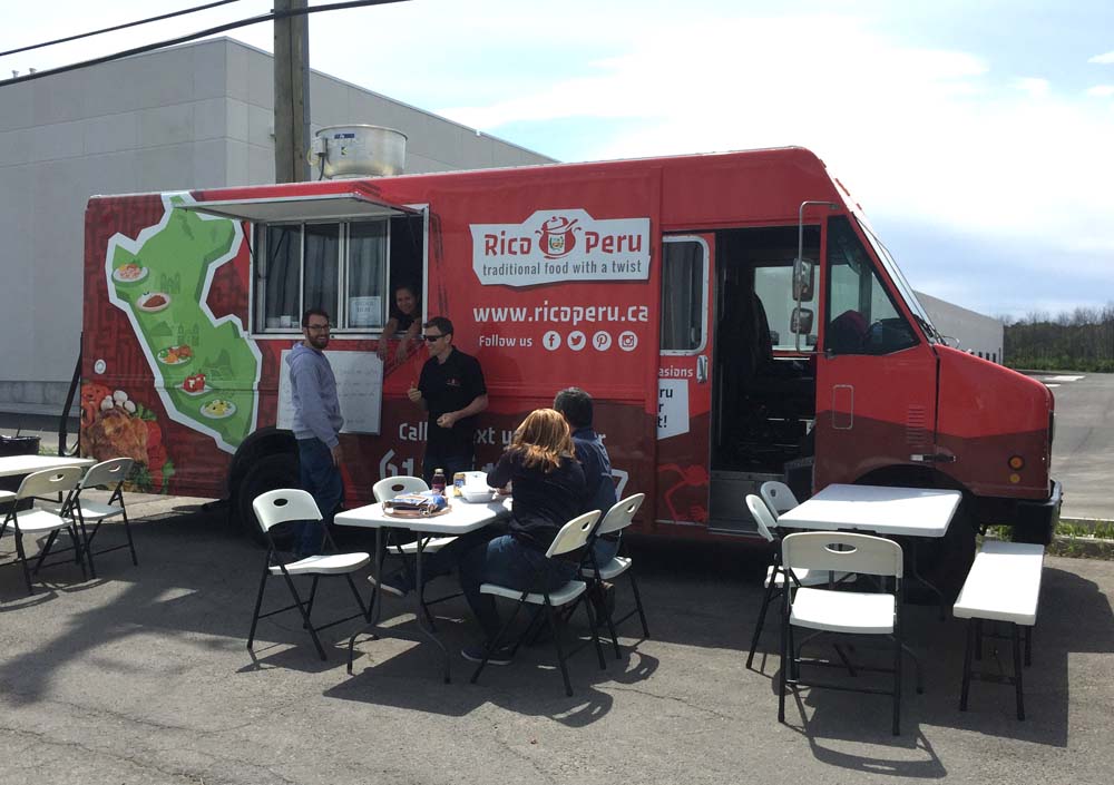
In the parking lot outside the brewery sat the recently Rico Peru food truck. Normally they are located on Montreal Road, but on this fine Saturday Dominion welcomed them to set up in their parking lot, so we sampled their tasty menu. I didn’t have the cerviché, but Glenn said it was really good.
Rico Peru!
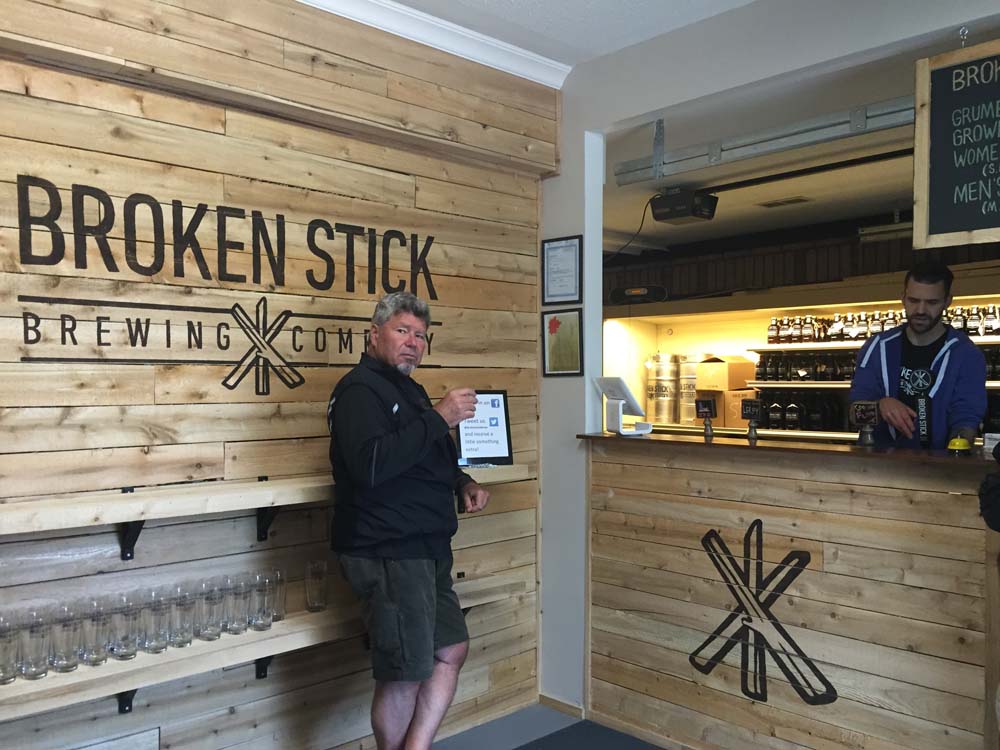
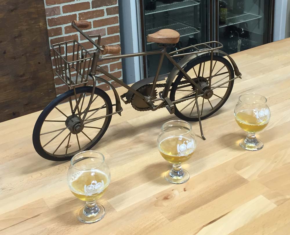
Our next stop was just around the corner at Broken Stick Brewing Company. After a couple of mini-samplings I chose the TPA as my favourite and stocked up on a small growler of the brew.
Inside the Broken Stick
Final destination – Lowertown Brewery in the Market. Right beside Broken Stick Brewery there is a path that leads on to my favourite local multi-use path, the Ottawa River Pathway.
Ottawa River Pathway (photo by Robert Batsch)
This we followed all the way to Rockcliffe and then wove our way through Lowertown to the brewery on York Street. This is a restaurant brewery that, at the time of our visit, were a couple of months away from meeting the qualifications to sell their brews to take home, so, it being our final destination of the day, we indulged and settled in for a pint on the patio.
A while ago I joined a walking tour of Parliament Hill with Jaime Koebel. Jaime runs Indigenous Walks which she describes as, ‘A guided walk & talk through downtown Ottawa that presents participants with social, political, cultural & artistic spaces from an Indigenous perspective‘. As we looked out across the Ottawa (or Kitchissippi) River towards the Museum of History, Jaime mentioned the totem poles displayed within the museum, as well as a number of others carved by indigenous sculptors located outdoors within the area. Here’s a 33km loop that visits those sites. This bike tour is almost entirely along NCC multi-use paths. UPDATE 2018:I’ve added an optional detour to Rideau Hall where stands another totem pole (see purple line on map). More on this piece further down in the post.
.
Our ride begins near the eastern tip of Victoria Island where stands this totem pole sculpted by Walter Harris of the Gitxsan First Nation in northern British Columbia.
Totem sculpted by Walter Harris
I rode west and accessed the Ottawa River Pathway behind the War Museum, and followed it along the river to where it connects to the Pinecrest Creek Pathway.
View from the Ottawa River Pathway
I rode the length of the Pinecrest Creek Pathway to Woodroffe Avenue.
Pinecrest Creek Pathway
On the south side of Woodroffe the path continues as the Experimental Farm Pathway.
North section of the Experimental Farm Pathway winding through open areas
On the south side of Maitland the path weaves it’s way up through a wooded area.
Wooded section of Experimental Farm Pathway between Maitland Avenue and Merivale Road
The second totem pole on our tour is located in front of the Scouts Canada National Office on Baseline Road. To get there I turned off the pathway and cut through a residential area along paths and quiet roads as shown on the above map.
This totem was carved by Chief Mungo Martin, a Kwakwaka’wakw carver from British Columbia. It was acquired by the Boy Scouts in 1960. The totem pole has been along Baseline Road since 1961. According to Scouts Canada, it was a gift from the British Columbia government to celebrate the newly opened headquarters.
Totem sculpted by Chief Mungo Martin
I then headed back to the Experimental Farm Pathway which runs along farmed fields east of Merivale Road. Sections of the pathway east of Fisher follow along quiet roads through the farm.
Experimental Farm
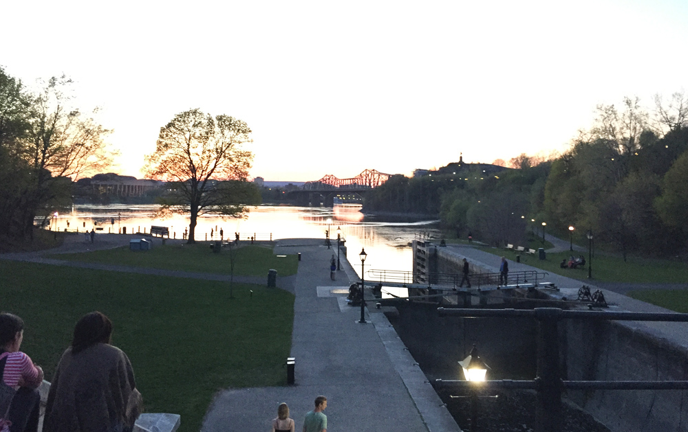
I crossed Prince of Wales Drive at the signalized crosswalk and headed over to the Rideau Canal locks beside Carleton University. I crossed the locks and biked down the Rideau Canal Eastern Pathway towards downtown.
The Rideau Canal Eastern Pathway
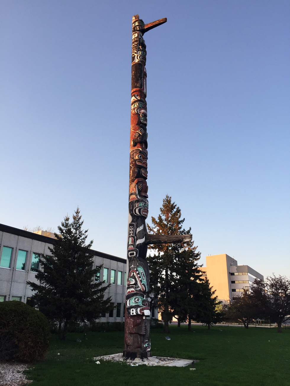
I re-traversed the canal at the Somerset pedestrian bridge and headed over to Confederation Park to visit the third totem pole along the tour, sculpted by Henry Hunt also of the Kwakwaka’wakw and apprentice of Mungo Martin.
Totem sculpted by Henry Hunt
Next stop – the Grand Hall of the Museum of History. To get there I rode down beside the canal and across the second to last set of locks.
View down the last set of locks along the Rideau canal before it drains into the Ottawa River
I then rode up the paved path from the river and crossed the Alexandra Bridge to our final stop at the Museum of History in Gatineau.
Crossing the Alexandra Bridge
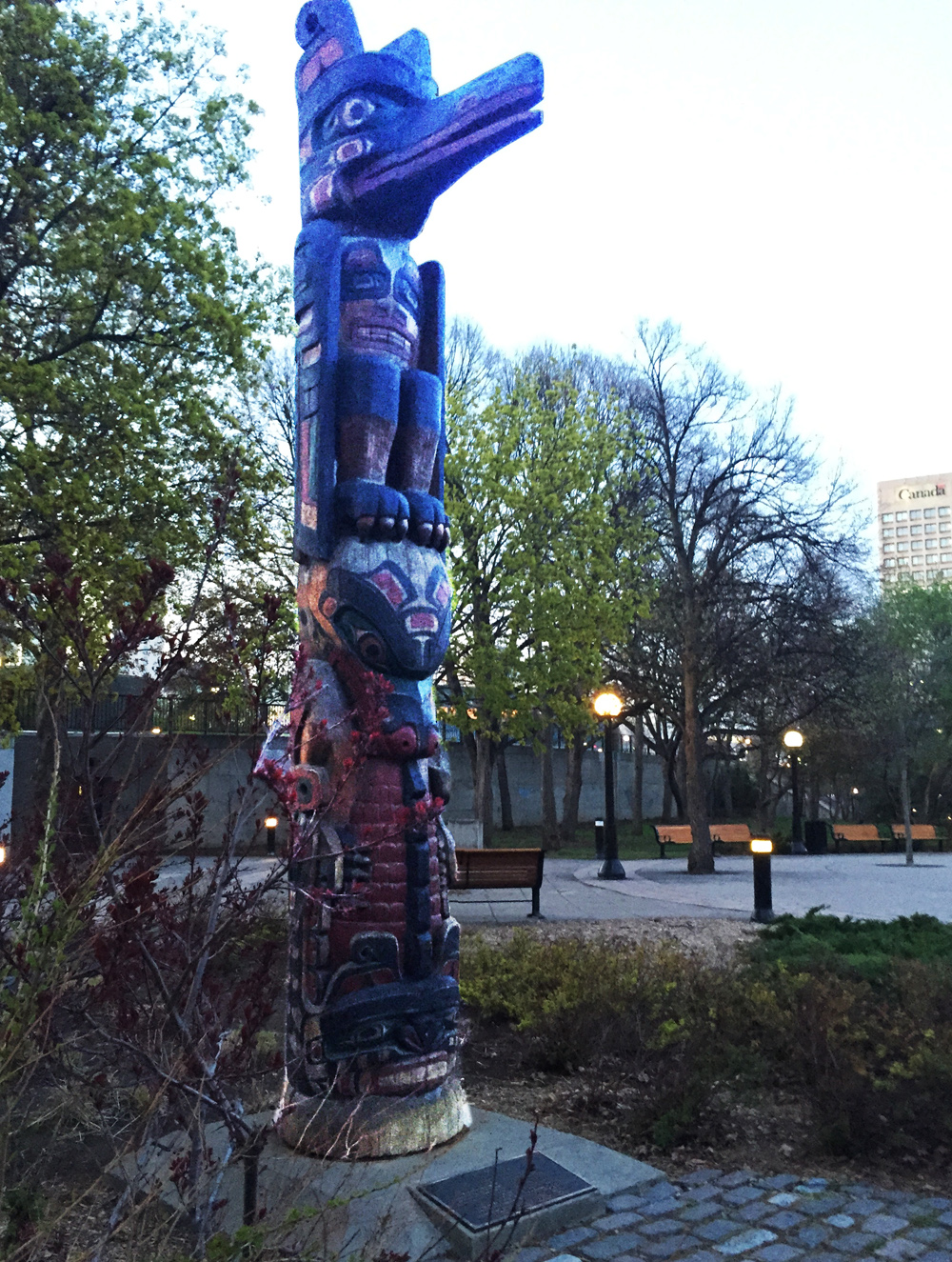
I UPDATE – August 2018: There is another totem pole sculpted by Mungo Martin located on the grounds of Rideau Hall. The purple line on the above map shows how to get there via the bike lane along Sussex Avenue , and then back, crossing the MacDonald-Cartier Bridge to the Quebec side of the river, versus the Alexandra Bridge. The grounds of Rideau Hall are open to the public up until 1 hour before sunset.
Totem pole by Mungo Martin on the grounds of Rideau Hall
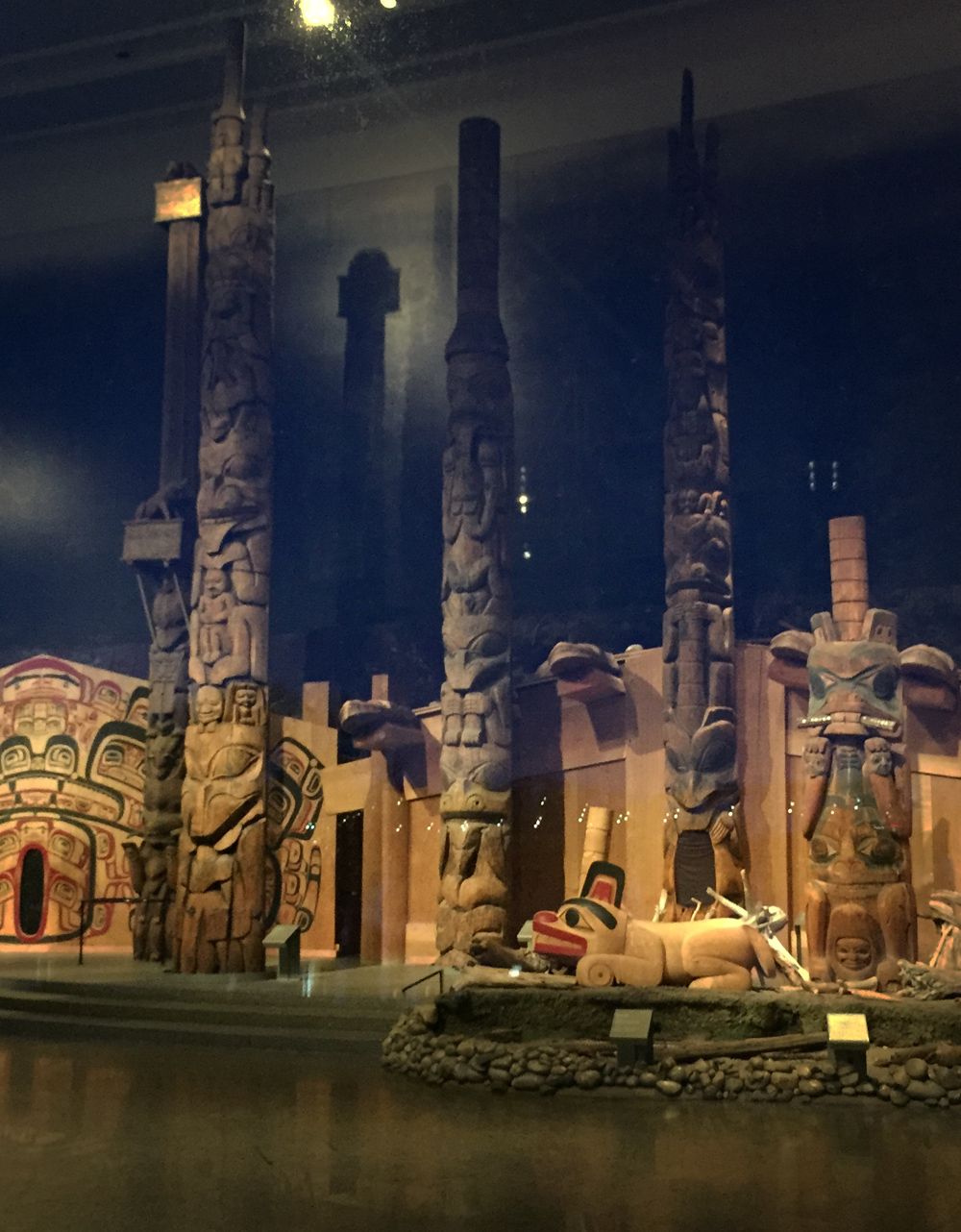
The best time to visit our final spot along the shore of the Ottawa River facing the Museum of History is in the evening as the sun is setting. That’s when the vista of totem poles within the Grand Hall of the museum are most visible from outside the large windows.
Exterior view of the totems within the Grand Hall
Here are views of these majestic sculptures as seen from outside as well.
Totems within the Grand Hall
To complete the loop I rode along the Voyageurs Pathway beside the river, then halfway across the Portages Bridge back to Victoria Island.
UPDATE 2018: The NCC has yet to complete repairs along the Voyageurs Pathway caused by the Spring flooding of 2017. The alternative route, as per the orange line on the above map, goes along the very wide Laurier Avenue sidewalk which is being used as an interim multi-use pathway.
Et voila!
Detail of totem on Victoria Island by Walter Harris
Manotick is a community first settled in the 1830’s located 30 km’s up the Rideau River. This past Sunday I and a group of fine people rode there. It was a great outing. Blue line on the following map shows how we got there. Green lines are variations we took on the return trip. Purple and orange lines are suggested minor deviations to the chosen routes.
JP and I started off at 8:30 am from the Chinatown Arch in Centretown.
Away we go!
We headed down Somerset to get on the O-Train Path, over to Prince of Wales Drive, and through the farm before joining the Experimental Farm Pathway where we met up with three more riders -Glenn, Heather and Chris. We cut south from the Experimental Farm Pathway through a series of paths and streets to Capilano Drive, a more detailed description of which can be found within a previous post, by clicking here.
We headed south down Birchwood off of Capilano and continued straight through back ends of mall parking lots, mostly empty on Sunday mornings.
Link at end of Birchwood to mall parking lots.
To avoid having to ride through the parking lot, there is also the option of taking the path up behind the parking lot, as suggested by the orange line on the above map. This path starts off as gravel before becoming a well trodden desire line that ends at Meadowlands Drive. A hundred meters to the right along Meadowlands takes you to the lights that leads across to Grant Carmen Drive.
Path behind Merivale malls (May 2017- building is completed)
We then kept heading south along Grant Carmen Drive which had very little traffic, all the while avoiding crazy dangerous strip-mall Merivale Road, one block west.
Grant Carmen Drive
South of Viewmount Drive the road morphs into a multi-use path that cuts through to Colonnade Road.
Grant Carmen Drive ends, path begins
We rode along Colonnade road to Merivale Road. UPDATE – Fall 2015: A bike lane has been installed along Colonnade Drive between Merivale and the path – a huge improvement to the shoulder less section it once was.
Colonnade Road approaching Merivale Road (new bike lane being installed to the right)
July 2015 update – Bike path going in along Colonnade
We rode along dreaded Merivale Road to get under the train tracks, however there fortunately is a paved portion between the curb and the sidewalk one may to choose to ride along to get to Woodfield Drive on the other side of the tracks.
Technically known as a ‘Service Strip’ or ‘Boulevard’, Legendarily called a ‘Kill Strip’ because nothing green is able to grow there, so it gets paved over
Just off Woodfield there’s a path that runs all the way west to the signalized Hunt Club Road crossing. It’s a shaded path that isn’t cleared in the winter, so we encountered a few patches of slush and ice. We decided to ride along quiet Benlea Drive that runs parallel to the path.
First encounter with slush & ice
The path continues behind the Nepean Sportsplex, then runs south along Woodroffe. The paths we followed all the way from the Sportsplex to and through Barrhaven were cleared all winter so no slush to worry about.
Woodsy portion of path along Woodroffe
We crossed Woodroffe and continued along the path on the north side of Fallowfield Road for a short distance before crossing Fallowfield at Via Park Place. We got on to the path that continues southwest then south beside the transit way all the way to Berrigan Drive.
Followed a road link between Berrigan and Strandherd Drive. Rode west on Strandherd, south on Greenbank, then east on Marketplace Avenue through the big box mall parking. East end of the parking there’s a short path link to roads that join up with the bike lane that runs along Longfields Drive.
In retrospect I would recommend turning off the path and onto Longfields further north as suggested by the purple line on the above map, thus avoiding busy Strandherd, Greenbank and the big box store parking lot.
After riding down Longfields and crossing the Jock River we joined a gravel path that weaves it’s way in and through varied wooded areas along the shore the river. This path went under Prince Of Wales Drive and then continued along the Rideau River. We had to contend with a few remaining minor slushy and icy patches along the path but that just added to the sense of adventure.
Riding the gravel path beside the Jock River
Bit of a challenge crossing the stream in Beryl Gaffney Park, but nary a soaker was had!
Crossing the stream
We rode along quiet streets and paths the length of Long Island, then crossed back onto the west side to seek out the French Café, where a colleague and friend of mine, Judy deBoer is showing some of her paintings. JP had to head back after grabbing a snack, while the rest of us settled down for a yummy treat and the biggest cappuccinos I’ve ever seen.
French Café in Manotick
Heather plotted a great route for the return journey which included a short side trip that rode a local dam.
Checking out the dam
We had hoped to ford the stream that runs through Gaffney Park at another spot closer to the Rideau but the walking stones were completely submerged. It’s a great short portage in dryer seasons.
Downstream crossing, Spring flooded… but très Zen come summer
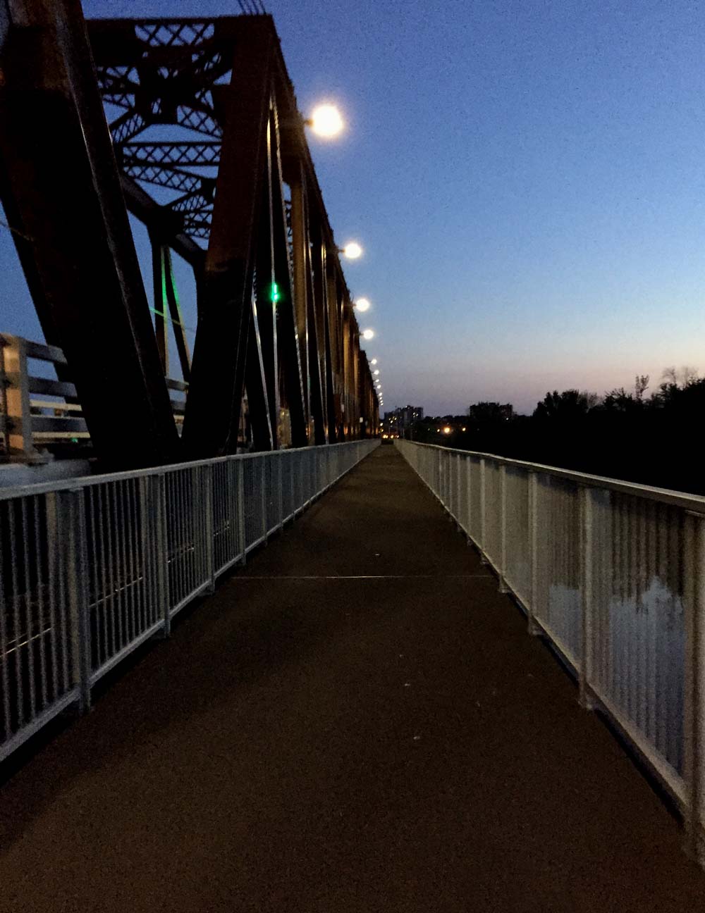
Our return journey also took us further down the Rideau River along a path that goes under the fabulous Vimy Memorial Bridge.
View from under the bridge
On the north side of the bridge the path turns into a wooden boardwalk that weaves it’s way through the Chapman Mills Conservation Area. Lots of pedestrians on the boardwalk so be prepared for a slow leisurely pace through this area.
Boardwalk through the Conservation Area
We pedalled along quiet Winding Way before cutting inland through quiet residential streets and parks before joining up with the bike path that runs along Woodroffe Avenue.
We parted company with Heather and Chris at West Hunt Club Road, which seems a fitting spot to sign off.
For an alternate route to Manotick that runs along Prince of Wales Drive heading out of Ottawa and back on the east side of the river, click here.
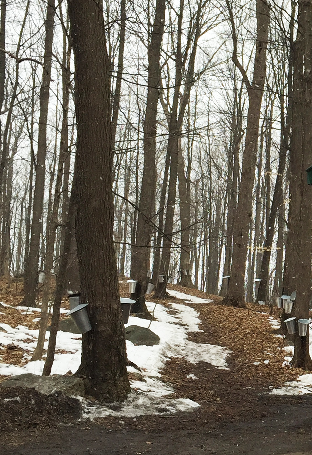
There’s a sugar shack in Ottawa, thanks to a group of intrepid monks who preserved and tapped the many trees found within Vanier’s Richelieu Park, once the property of their monastic order. The Brothers left in the 1970’s but maple syrup continues to be prepared on site each Spring. The sugar shack is open to the public on weekends throughout the months of March and April. It’s so close to Centretown you can easily bike there. So I did. The blue line on the map below is the route I rode, purple lines are slight alterations I took on the way back.
Our adventure begins at the western most point of the Laurier Bike Lane where Laurier crosses Bronson.
Laurier Bike Lane in the Spring
I followed the bike lane all the way downtown to City Hall. There I turned right on to the plaza and followed the path on the west side of City Hall through to Cartier St.
Path to the right of City Hall plaza through to Cartier St
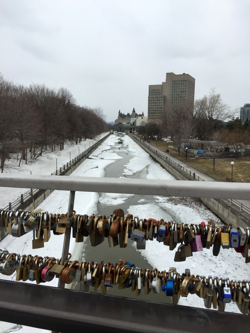
I followed Cartier St for a block, then turned left onto one-way Cooper St, and continued along until Somerset St. Immediately left on Somerset there’s a traffic light across Queen Elizabeth Drive to the pedestrian/bike bridge over the Rideau Canal.
View from the bridge through love locks down the melting Rideau Canal
Another signalized crosswalk at Colonel By Drive led me to the bike lanes under Nicholas St and up to the University of Ottawa campus.
Tunnel under Nicholas through to Ottawa U campus
The first street on the left through the campus has a contra-flow bike lane combined with painted sharrow markings pointing in the direction of traffic, which directed me along a network of quiet streets northwardly through campus.
Ottawa U bike route through campus
I turned left on to University Private abandoning the lane+sharrow combo, and then turned right on Cumberland St. There’s a bike lane to follow along Cumberland once across the signalized Laurier Ave E intersection. I then turned right on to the bike lane along Wilbrod St, that heads east through Sandy Hill.
Left on Cobourg then right on Daly brought me to the intersection at Charlotte and Daly. Unfortunately there isn’t a cross signal to get across Charlotte, which can get busy as it’s a popular link between Rideau Street to get to Laurier Avenue. Fortunately I didn’t have to wait long for a opening to get across.
Straight through on Daly, left on Wurtemburg St then right on Besserer which brought me to a very nice recently introduced winding paved path through Besserer Park down to the Cummings Bridge.
Path through Besserer Park
Heading east across the bridge over the Rideau River, there are painted sharrows in green boxes along the inside lane. Traffic moves very fast across this bridge. Along busy traffic arteries such as this one, no matter how you dress them up, sharrows are the most useless form of bike accommodation imaginable. Worse than useless, they are dangerous, because they falsely suggest to riders that they are designated safe routes when drivers ignore them because they can. I walked my bike along the sidewalk.
Heading east over Cummings Bridge
Once arrived on the other side of the bridge I crossed at the intersection and headed north along North River Road.
Turned right onto Coupal where, at it’s eastern extremity, there is a short path to the Vanier Parkway. A few more yards along the sidewalk brings you to a crosswalk.
Short path at the end of Coupal…..& bit of sidewalk to lights across the Vanier Parkway
I then wove my way along calm streets through Vanier, as per the above map, to Pères-Blancs Avenue that leads up towards Richelieu Park.
Pères Blancs Avenue
A short distance inside the old gates to the park there is a path to the left that leads to the sugar shack.
Path off Pères Blancs Avenue towards the sugar shack
This season I rode there on a quiet holiday Monday morning when the shack was closed, however in previous years I’ve visited on weekends when it is open to the public and the boilers are in full operation.
Sugar Shack
On the way back I re-traced my treads as far as Cummings Bridge. There is a bike lane heading west over this busy pont, however the lane marking is completely worn off at the eastern end of the bridge and barely visible the rest of the way across.
Missing bike lane heading west over the Cummings Bridge
The bike lane disappears completely once arrived on the other side of the bridge. That’s because Rideau St was paved late last season and the line has yet to be re-painted. Until then I recommend returning the same way I came by walking along the opposite side walk and riding up the nice new path to Besserer St. Once the westward bike lane is re-painted, there’s a nice new path link on the south side of Rideau St across the intersection that links to Wurtemburg St, like so.
Path linking Rideau St to Wurtemberg
Stewart St is a one way with a bike lane heading west through Sandy Hill with a number of old architectural gems like this.
Philomene Terrace constructed in 1874
I turned left on Cumberland and wove my way through back the Ottawa U campus. On the west side of the pedestrian bridge I turned right on to the Rideau Canal Western Pathway and cut through Confederation Park to get to the Laurier Bike Lane.