With recent threats from our southerly neighbour to absorb us, I thought it timely to re-visit a route that checks out examples of long barrelled artillery on display throughout our National Capital Region.
if you are interested in how we’ve evolved from the original Cannons in the Capital tour check it out here .
Our ride begins at the Canadian War Museum. Head over to the immense glass wall along Booth Street and peer in.
This’ll give you a great view of an assortment of big artillery and then some.
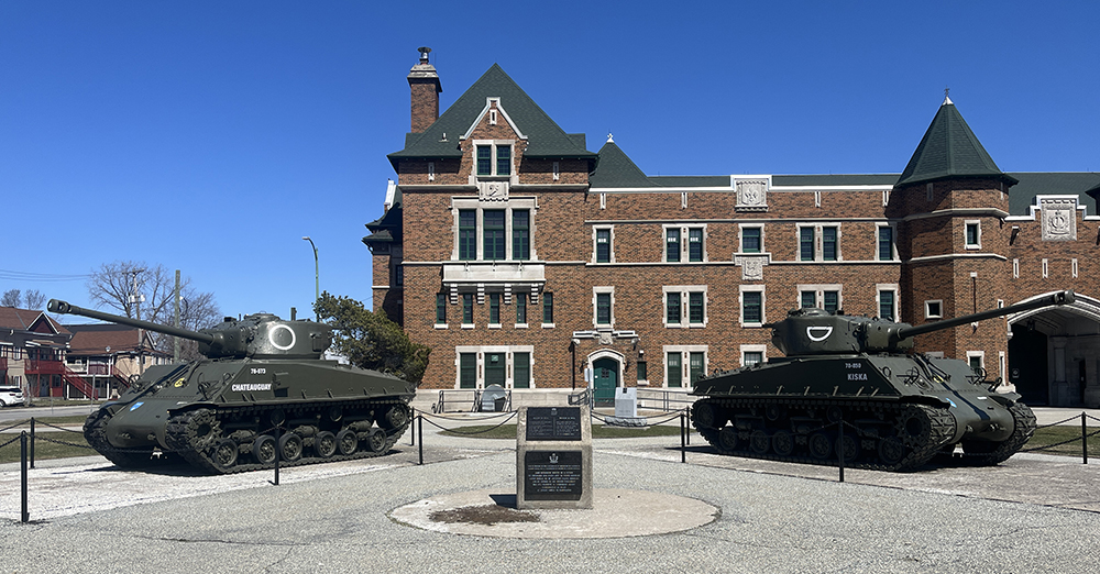
Follow the bike lane north over the Chaudiere Bridge to Gatineau, then turn left along Alexandre-Taché Boulevard. At the corner of Boulevard Alexandre-Taché and Boulevard St Joseph you will find these two tanks on display outside the Salaberry Armoury.
This armoury was named in memory of Lieutenant-Colonel Charles-Michel d’Irumberry de Salaberry. In 1812 Salaberry was put in command of a new corps of volunteers, the Canadian Voltigeurs (light infantry) and in November 1812 they turned away an American attack at La Colle Mill. In October 1813 he and 300 of his troops repulsed several thousand American troops threatening Montreal.
The armoury presently houses the Régiment de Hull.
Salaberry Armoury
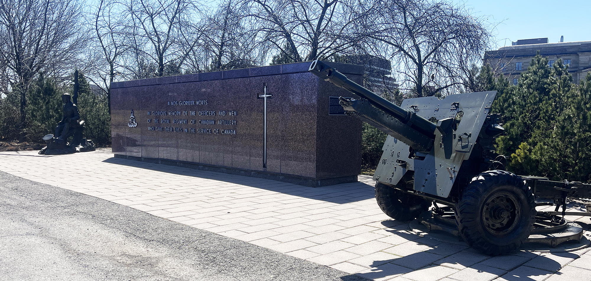
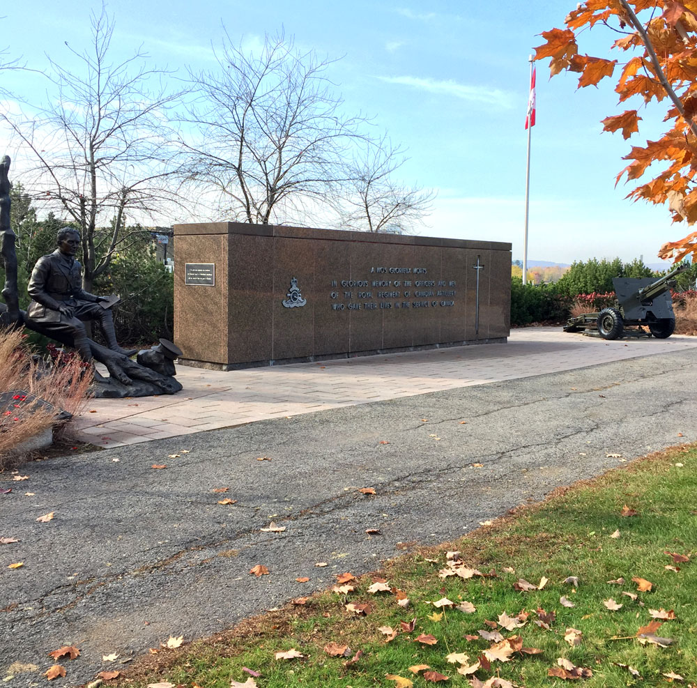
Continue along the route indicated on the map which crosses back over to Ottawa via the Macdonald-Cartier Bridge bike lane. Weave your way behind the National Research Council building and over the pedestrian bridge just above the Rideau Falls. To the right you will see the National Artillery Monument comprised of a memorial wall and 25-pounder artillery field gun, commemorating the Royal Regiment of Canadian Artillery and their members who gave their lives in the service of Canada.
National Artillery Monument
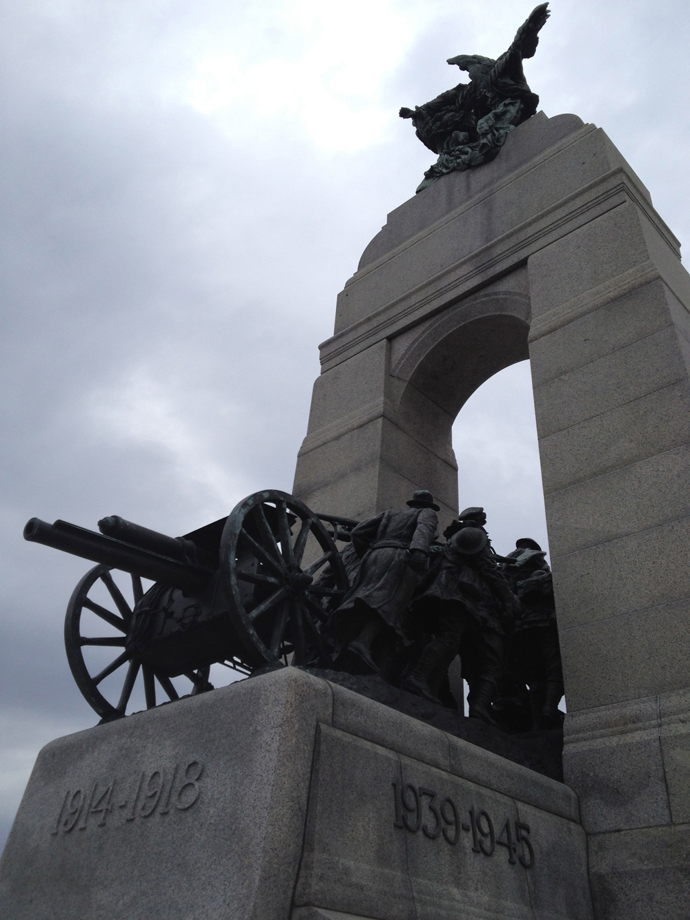
Our ride now heads downtown to the National War Memorial. The sculpture depicted in the memorial is titled The Response. It includes a field gun used in World War I, being pulled through a stone arch by Canadian combatants.
The Response
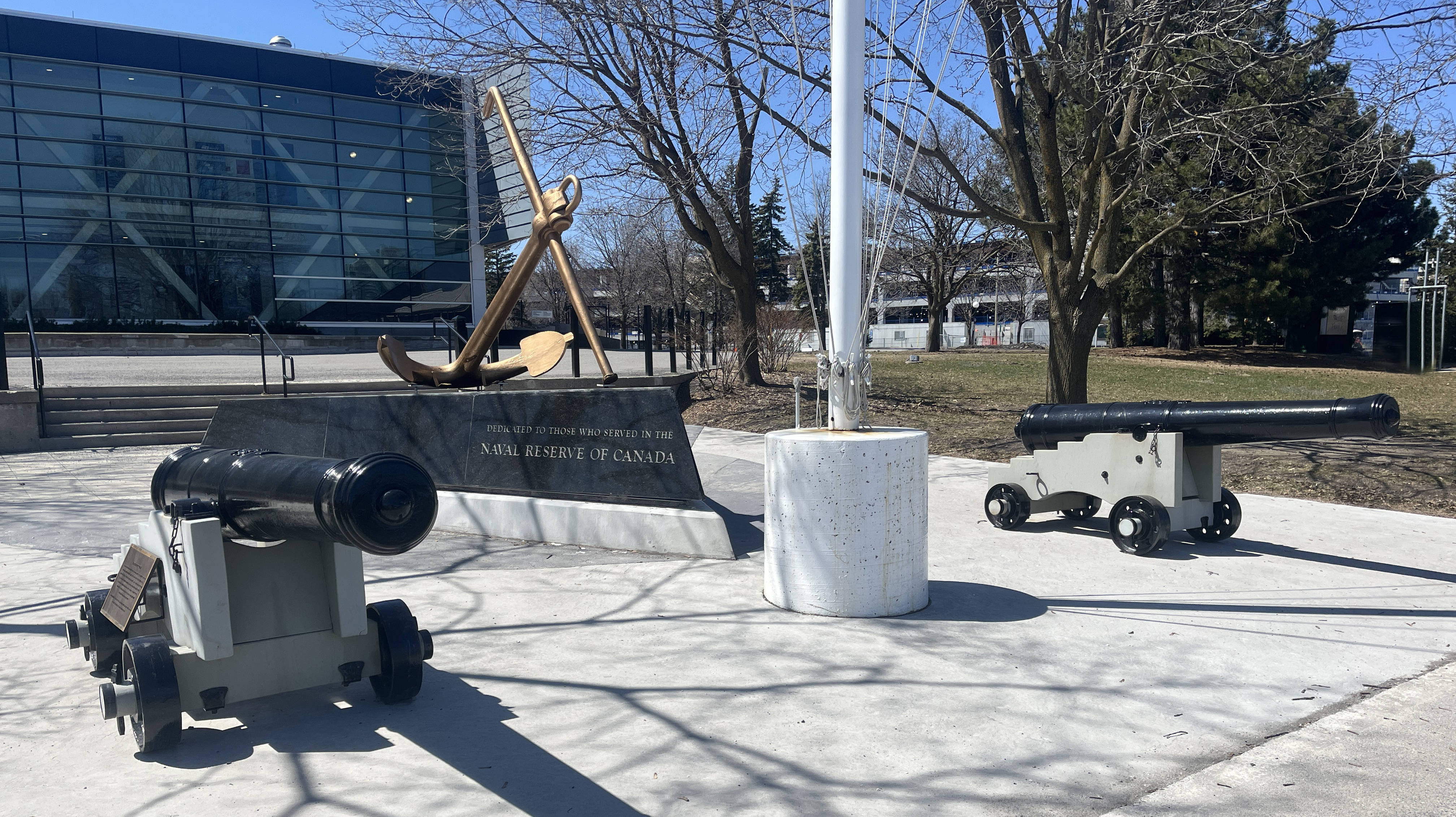
The final stretch of our ride goes along the Rideau Canal via the wonderful Rideau Canal Western Pathway, which takes us to these two replica 9-pounder cannons stationed on the edge of Dow’s Lake, right in front of HMCS Carleton naval reserves. They are part of the National Naval Reserve Monument.
9 Pounders
Just around the corner on Prince of Wales Drive, plopped on the lawn of the naval reserves sits a few more contemporary sorts of cannons, visible through some barricade fencing.
Outside CFRB Dow’s Lake
So there you have it – many depictions of local cannons to discover! Just wish we didn’t ever need them, but here we are.
The original version of this route was posted in 2014. In the wake of the present invasion of Ukraine I have revisited and updated the route in the hopes that it may be used by those who wish to to pay tribute to the incredible resilience of the Ukranian people, and to help better understand the Ukranian community amongst us.
Canada is home to one of the largest number of persons of Ukrainian descent outside of Ukraine. Most reside in the western provinces, however many have chosen Ottawa as their home. This bike tour visits edifices around town representing the Ukrainian diaspora within Canada’s capital.
We begin our ride at the Ukrainian Embassy located at the corner of Somerset and O’Connor. Ukraine purchased this building at 310 Somerset St from the federal NDP party in 1994. It’s been their embassy ever since.
Ukrainian Embassy
Our next stop is just a few blocks south east. On December 2nd, 1991 Canada recognized Ukraine’s independence. Suddenly in need of an embassy, this building on Metcalfe St was purchased with the help of funds gathered by Ukrainian-Canadians. This location has served as a consular building ever since the embassy moved to its present location.
Ukrainian Consular Building
Next stop – the Saint John the Baptist Ukrainian Catholic Shrine near the corner of Heron Road and Prince of Wales Drive. To get there I rode south along the O’Connor bike lane before turning left on Fifth Ave and crossing the canal over the Flora Foot Bridge. I then rode along the Rideau Canal Eastern Pathway all the way up to where Heron Road crosses overhead. I accessed Heron by pushing my bike up the mini bike ramp along the edge of the stairs.
There is a bike lane along Heron Road. Just over the bridge I took this well trodden path righ that leads to the back of the church.
The statue on the edge of the parking lot is a monument to Taras Shevchenko (1841-1861), artist and national hero for his promotion of Ukrainian independence.
Taras Shevchenko
The church (or Sobor, or Shrine) was completed in 1987. An annual Capital Ukraininan Festival is held at this site.
Saint John the Baptist Ukrainian Catholic Shrine
Next destination is the Ukrainian Orthodox Cathedral at 1000 Byron Avenue. To get there I cut through the Experimental Farm, along Island Park Drive, then west along Byron. There is serious disruptive construction for the new LRT extension along Byron, thus the slight detour as one approaches our final stop. The Cathedral opened in 1978. More on it’s history can be found here.
Cast iron bells can become unifying symbols for a community. Their distinct clarion call draws together those within earshot towards a shared experience. The Nepean Bell became such a symbol when it was first hung and rung back in 1896 from the old town hall in Westboro. As the seat of government of Nepean Township moved south-west, then east, the bell went with it. This bike tour visits the three locations the Nepean Bell has occupied since its arrival in our region. It is also a ride along a number of wonderful bike paths in the western end of town through varied terrain. The purple line is a return shortcut to get to the starting point.
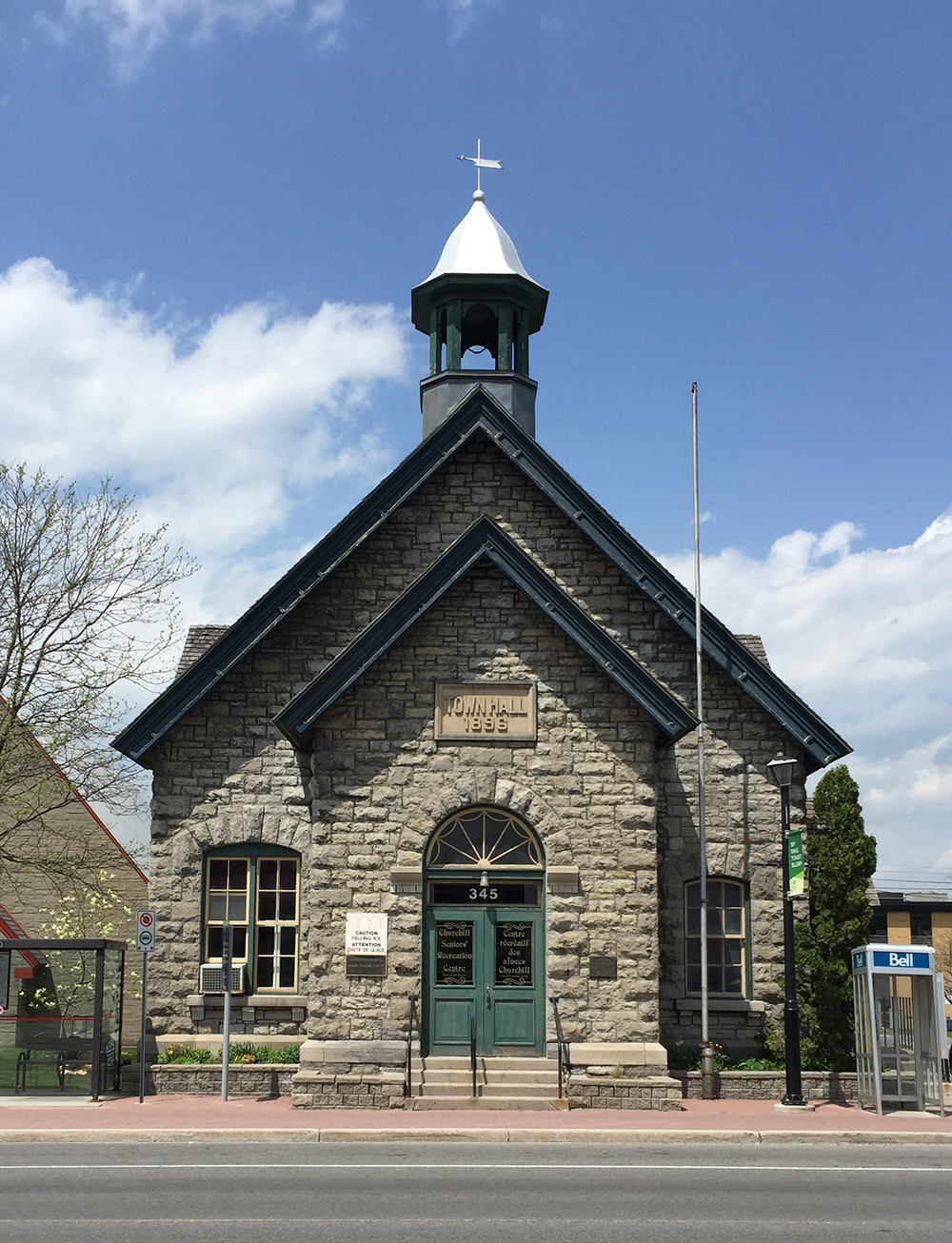
Our tour begins in front of the old Town Hall building in Westboro located at 345 Richmond Road where the Nepean Bell began its public life. The building was designed by architect Moses Chamberlain Edey and opened in 1896 as the Town Hall building for the Township of Nepean.
Old Town Hall in Westboro. Note the empty bell tower.
The eastern portion of Nepean Township was annexed by the city of Ottawa in 1950, however the old town hall continued to serve as Nepean Township’s headquarters until 1966. Once the construction of new headquarters were completed further west in Bells Corners the township authorities took the beloved bell with them. There they installed the bell on the front lawn in a sculpted tripod base. Each leg was a different height, meant to represent a member of the traditional nuclear family, i.e. mother, father and child. The image of this sculpture became the logo for the City of Nepean until The Great Ottawa Amalgamation of 2001. The logo is still evident on street signs, park signs, etc throughout the former city of Nepean. Note – the name Bells Corners far predates the arrival of the Nepean Bell.
City of Nepean logo
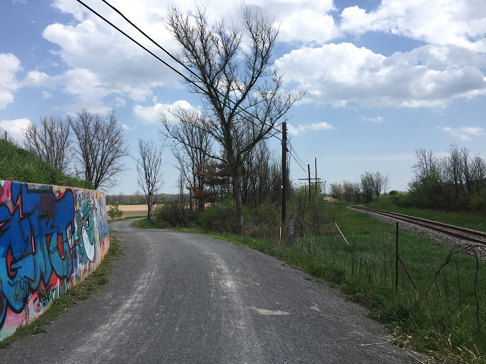
To get to the Nepean Bell’s second home at the intersection of Old Richmond Road and Robertson Road in Bells Corners I headed over to the path that runs along the south side of the Sir John A Macdonald Parkway and followed it as far as the intersection that passes under the parkway and onto the Ottawa River Pathway.
Path along Sir John A. MacDonald Driveway…. and underpass to get to the Ottawa River Pathway.
I followed the Ottawa River Pathway all the way to Britannia Bay. There I crossed Carling at the lights and got on to the Watts Creek Pathway. Where Watts Creek Pathway crosses Holly Acres Road is a bit tricky, as the path continues a short ways up quiet Aero Drive. This link is barely visible from Holly Acres Road.
White arrow shows where Watts Creek Pathway pathway continues a short way Aero Drive, as seen from Holly Acres Road
Watts Creek Pathway meanders through a wooded area before crossing Corkstown Road. Once across Corkstown Road the path follows a new paved section that goes along the edge of some baseball fields to get to lights across Moodie Drive. This new section of path is a great improvement on the previously poorly maintained path that was regularly flooded.
Section of Watts Creek Pathway from Corkstown to Moodie
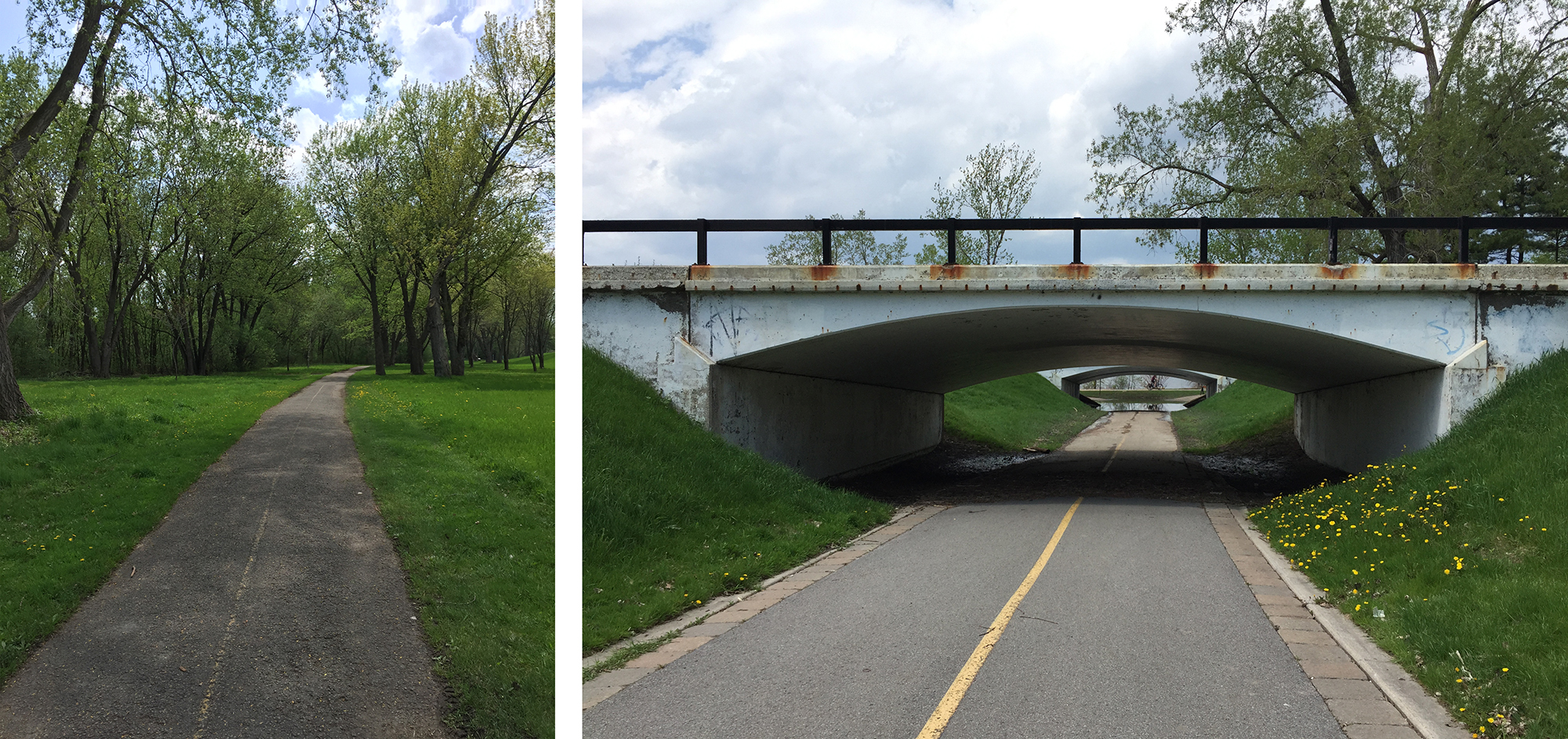
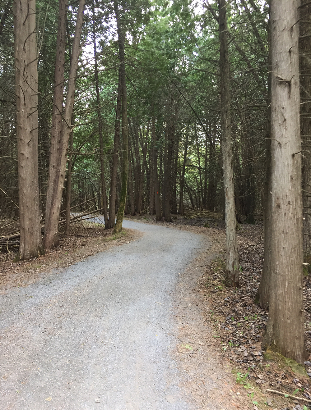
I continued along Watts Creek Pathway for a spell before turning on to the Greenbelt Pathway West. The Greenbelt Pathway is a packed gravel surface that rolls through a wonderful assortment of woods and fields before and after it crosses Corkstown Road and goes under the Queensway.
Greenbelt Pathway just south of the QueenswayGreenbelt Pathway meandering through cedars
The Greenbelt Pathway West meets up with the Trans-Canada Trail which I followed to Fitzgerald Road. I turned right onto Fitzgerald, then left on to Robertson Road at the lights. Robertson Road is a busy street with lots of traffic. It also has a bike lane between Fitzgerald and Moodie Drive.
Bike lane along Robertson Road
I turned right onto Moodie which also has a bike lane that goes only as far as Hadley Crescent. I rode along Hadley Crescent, then Tanglewood Drive, then Old Richmond Road to get to the second stop of the Nepean Bell at the corner of Robertson Road and Richmond Road. The building which was built to serve as the township headquarters in 1966 only lasted until 1988 when it was demolished and replaced it with a mini-mall. They had already moved to the Nepean City Hall at 101 Centrepointe Drive. Here’s a rendering of the building as it appeared before being torn down.
Rendering of Nepean City Hall located in Bells Corners
And here’s what the site looks like now.
Second stop of the Nepean Bell – 3825 Old Richmond Rd
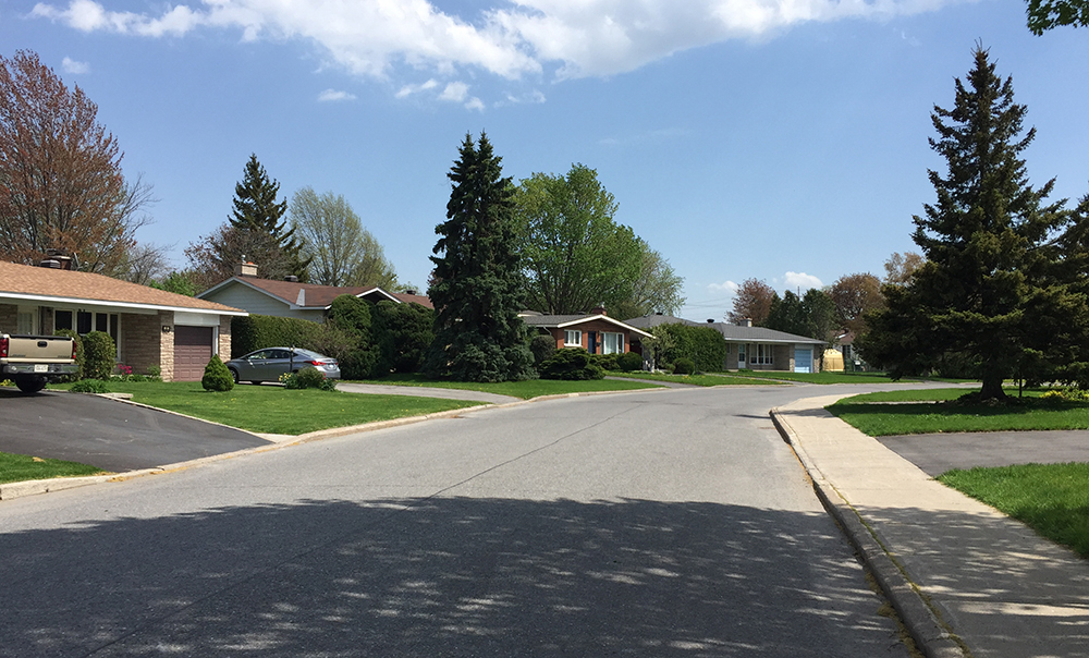
I then wove my way through residential streets of the Lyndwood Village neighbourhood, which has a fine selection of mid-century-modern home designs.
Lovely Lyndwood Village
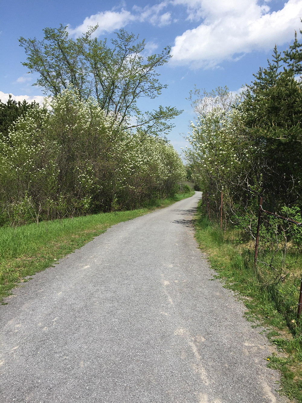
This brought me to Bruin Road beside Bell High School. Bruin Road gets you over highway 416 to the Bruce Pit. I took the path around the northern perimeter of Bruce Pit.
Path around Bruce Pit
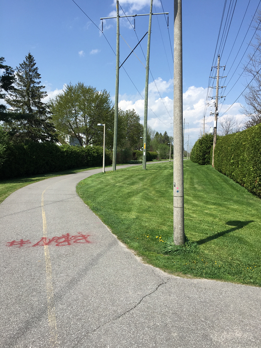
Next I dipsy-do’d along a combination of paths and residential streets to get to the bike path that cuts diagonally along a hydro pole right-of-way to Centrepoint Drive.
Centrepoint Pathway
Once arrived at Centrepoint Drive, I rode around to the front of the old Nepean city hall to discover the Nepean Bell installed in the middle of a mini round-a-bout. I gave it a ring and it sounded great!
April 28th is The Day of Mourning honouring workers in Canada who were killed, injured or disabled on the job. The following bike tour visits a number of sites throughout the region that allude to the Day of Mourning. The route is entirely along bike paths.
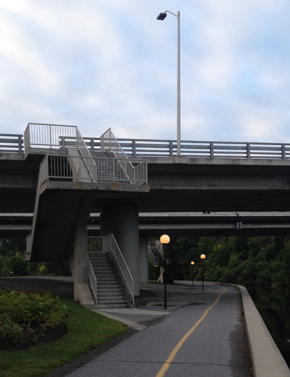
Our tour begins in Vincent Massey Park where sits a carved stone memorial chosen for it’s proximity to the Heron Road Workers Memorial Bridge, completed in 1967, a year after a previous bridge at the same site collapsed killing nine workers in the worst construction accident in Ottawa’s history.
Memorial in Vincent Massey Park commemorating the Day of Mourning
Ride along the Rideau River Eastern Pathway, then traverse Hogs Back Falls before turning onto the Rideau Canal Eastern Pathway. Cross the canal over the Hartwell Locks opposite Carleton University.
Continue down along the Rideau Canal Western Pathway through the Arboretum and around Dows Lake. A short distance away from the northern edge of Dows Lake on Preston Street a construction site accident occurred on March 23, 2015 – the tragic death of Olivier Bruno who was struck by a falling chunk of ice while inspecting the construction pit.
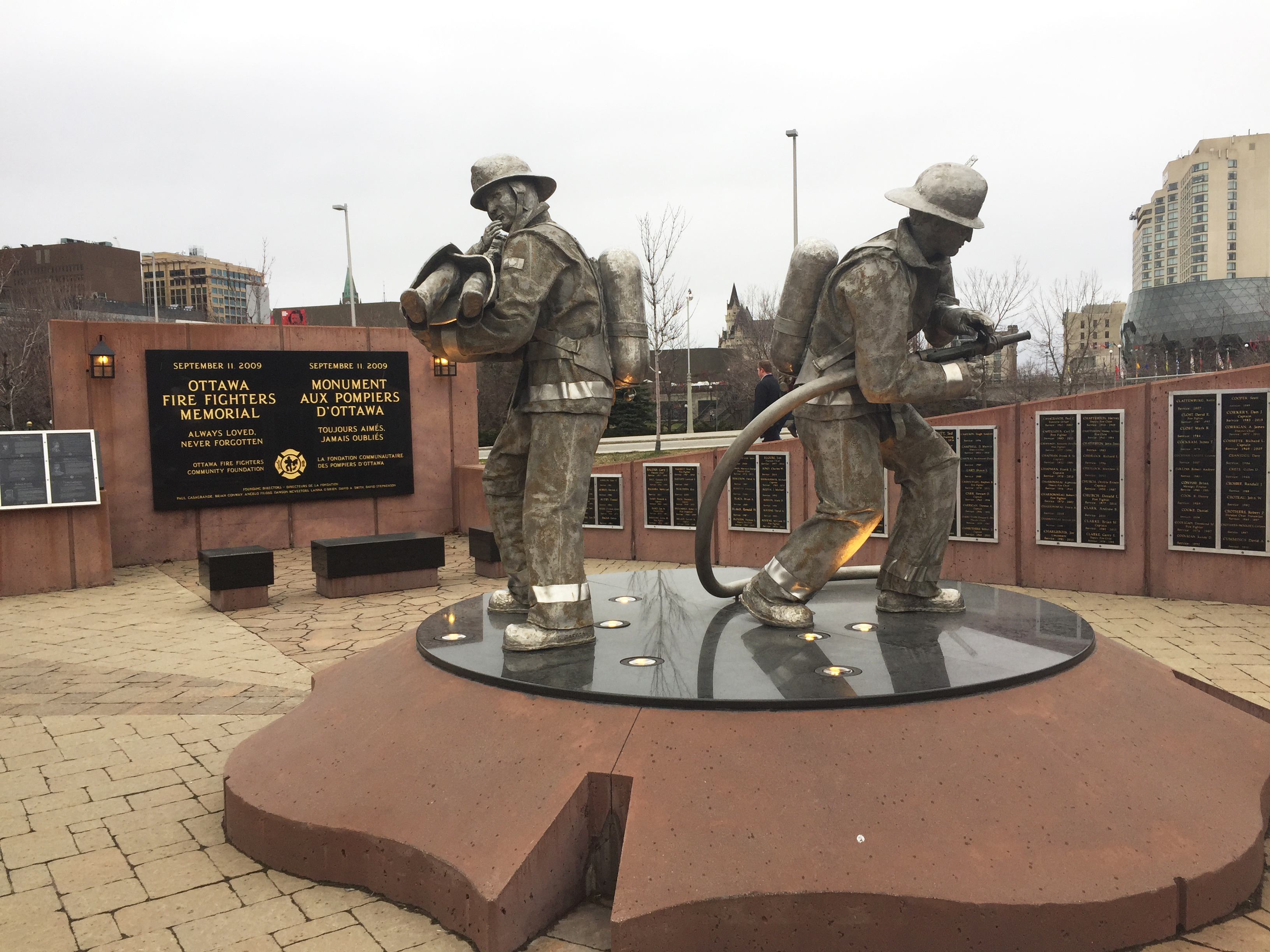
Continue along the canal as far as City Hall where, at the north east corner of the plaza in front of City Hall, you will find the Ottawa Firefighters Memorial. This memorial includes a number of marble plaques commemorating firefighters who have perished in the line of duty, some dating back to the mid 1800’s.
Ottawa Fire Fighters Memorial
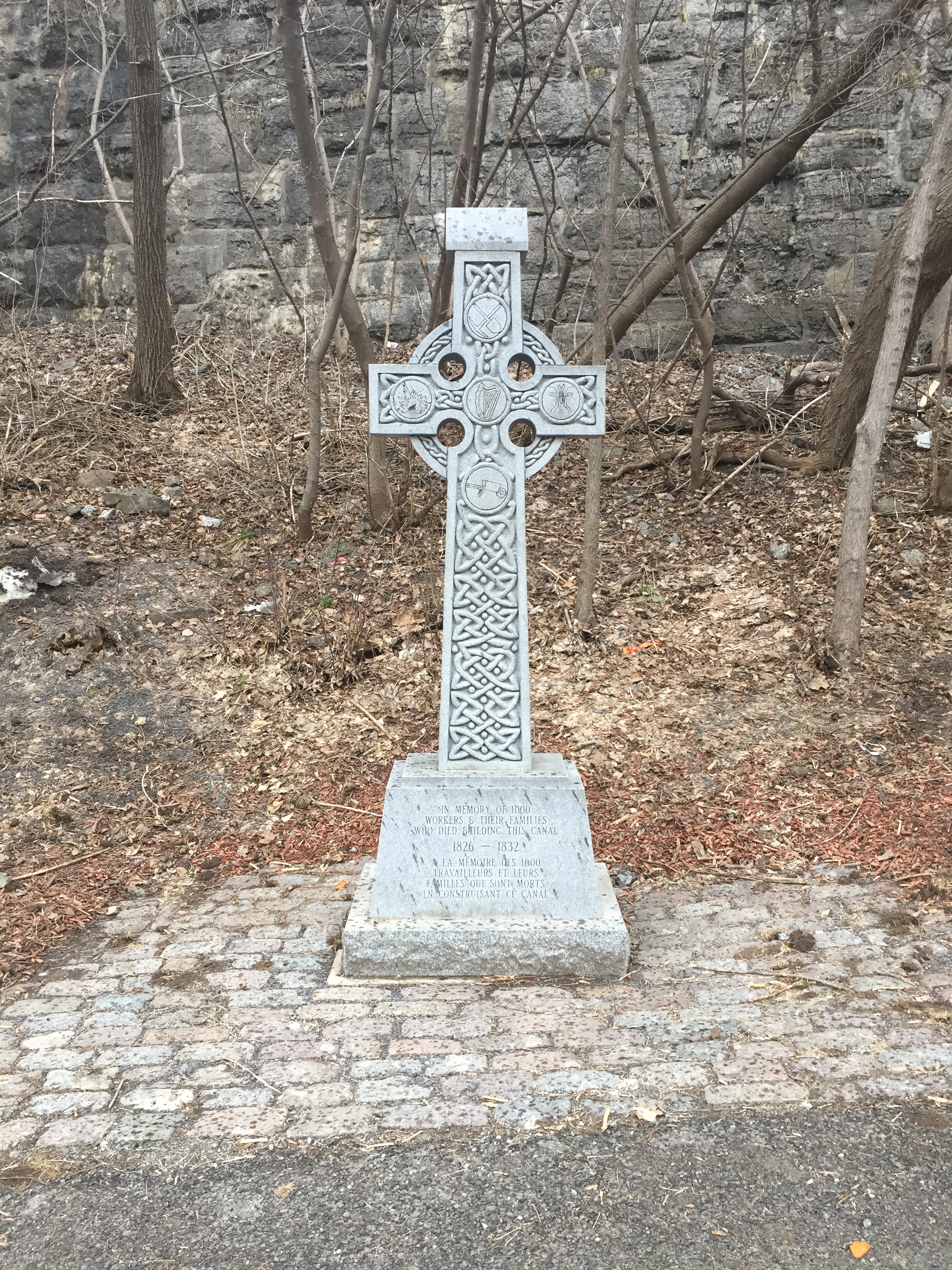
Head back to the Rideau Canal Pathway and continue north along the edge of the canal. Just before reaching Sappers Bridge that passes under Wellington Street, you will encounter two short sets of stairs. These have metal troughs along which you can push your bike to avoid having to carry it up the stairs. Ride under the bridge, then down the hill. The canal locks wil be to your right and Parliament Hill high up above to your left. Cross over to the other side of the canal across the second to last set of locks closest to the Ottawa River. Once on the opposite side of the canal you will notice a celtic cross. The engraving in the base of the cross reads,’In memory of 1000 workers and their families who died building this canal’. An accompanying interpretive panel helps to explain the context in which these workers found themselves and the hardships they endured. UPDATE, August 2017 – Unfortunately the cross was knocked over and has yet to be replaced. UPDATE, April 2018 – The cross has been replaced.
Commemorative Cross dedicated to Rideau Canal workers & family members who perished
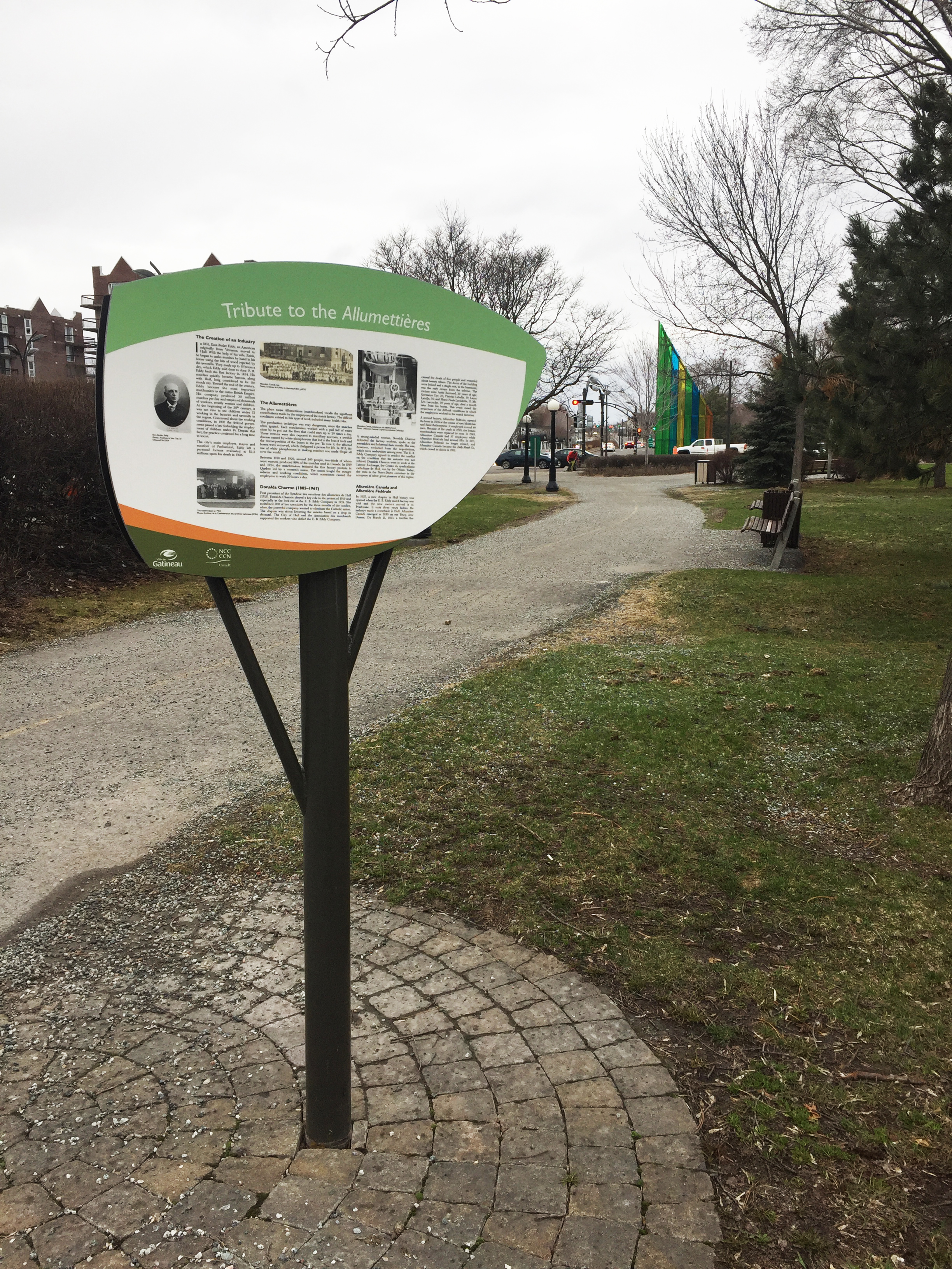
The bike tour continues up the hill to the left of the cross. At the top of the hill, turn left onto the bike path and cross the Alexandra Bridge over the Ottawa River along the wooden boardwalk. Once arrived on the Quebec side of the bridge, cross the intersection to the opposite corner where the Sentier de l’Île pathway begins. This path heads inland along Boulevard des Allumettières. Les Allumettières were female workers in the local EB Eddy plant who fabricated wooden matches from the 1800’s up until 1928 when the plant closed. The working conditions they endured were extremely dangerous and unhealthy. An interpretive panel along the path goes into more detail on the incredible challenges Les allumettières encountered.
Tribute to Les Allumettières
Thus completes The Day of Mourning bike tour. For those interested in further exploring the path along Sentier de l’ile check out this ride.
Many Canadians are drawn to the November 11th Remembrance Day Ceremonies held at the National War Memorial to pay tribute to those who have fought and given their lives in the service of our great country. There are also a number of lesser known Canadian war memorials throughout the capital commemorating groups within the Canadian military, or specific struggles in which Canadian soldiers have served. The following bike tour visits these memorials, starting from the National War Memorial and ending at the National Military Cemetery.
.
The National War Memorial was unveiled in 1939 to commemorate those who served in the armed forces during World War 1. Subsequently it has come to symbolize the sacrifice of all Canadian Armed Forces in times of war.
National War Memorial
Immediately in front of the Memorial is the Tomb of the Unknown Soldier. This tomb contains the remains of an unidentified Canadian soldier who died near Vimy Ridge during the First World War and represents the many Canadian soldiers who have no known grave.
Tomb of the Unknown Soldier
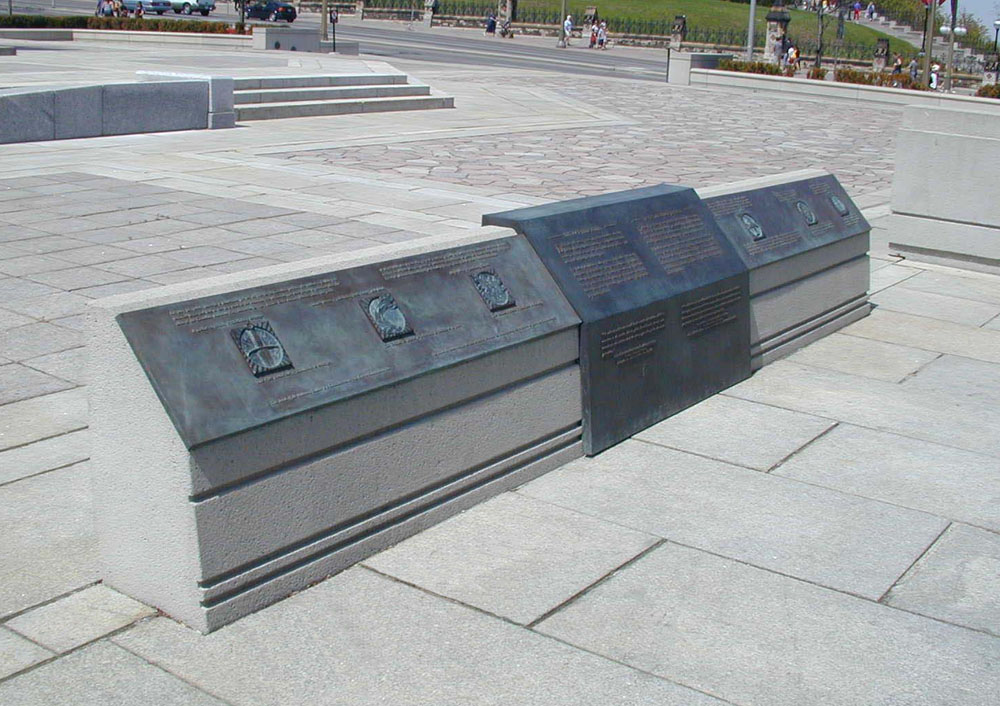
There are bronze panels on the east and west sides of the War Memorial that describe the significance of the Tomb of the Unknown Soldier and the main sculpture – The Response.
Bronze interpretive panels
Leaving the War Memorial, Head down to the Rideau Canal behind the National Arts Centre. Head south along the canal for a short distance until you are past the National Arts Centre and have crossed under the Mackenzie King Bridge. Turn in to Confederation Park to where the South African War Memorial is located.
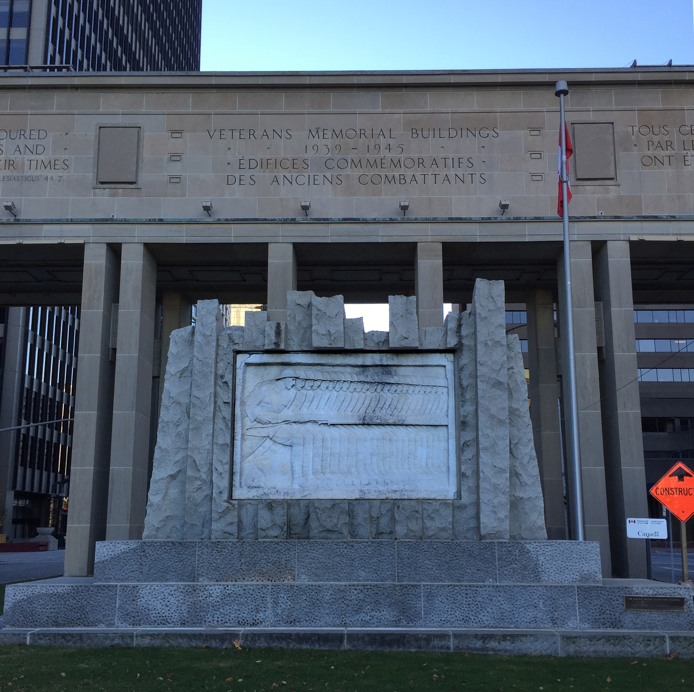
Cross Elgin Street at Laurier Street and follow the Laurier Bike Lane heading west before turning north along the bike lane that runs along Bay Street. After crossing Wellington at the northern end of Bay, head east for one block to Lyon St. There is a gravel path through the park just to the east of the National Archives building that leads to Lyon. Looking across Wellington up Lyon Street, one sees the Veteran Memorial Buildings and Arch. Beneath the arch connecting the two buildings across Lyon St there is a stone relief carved by Ivan Mestvovic called The Canadian Phalanx in honour of those Canadians who fought in the First World War.
Veterans Memorail Buildings
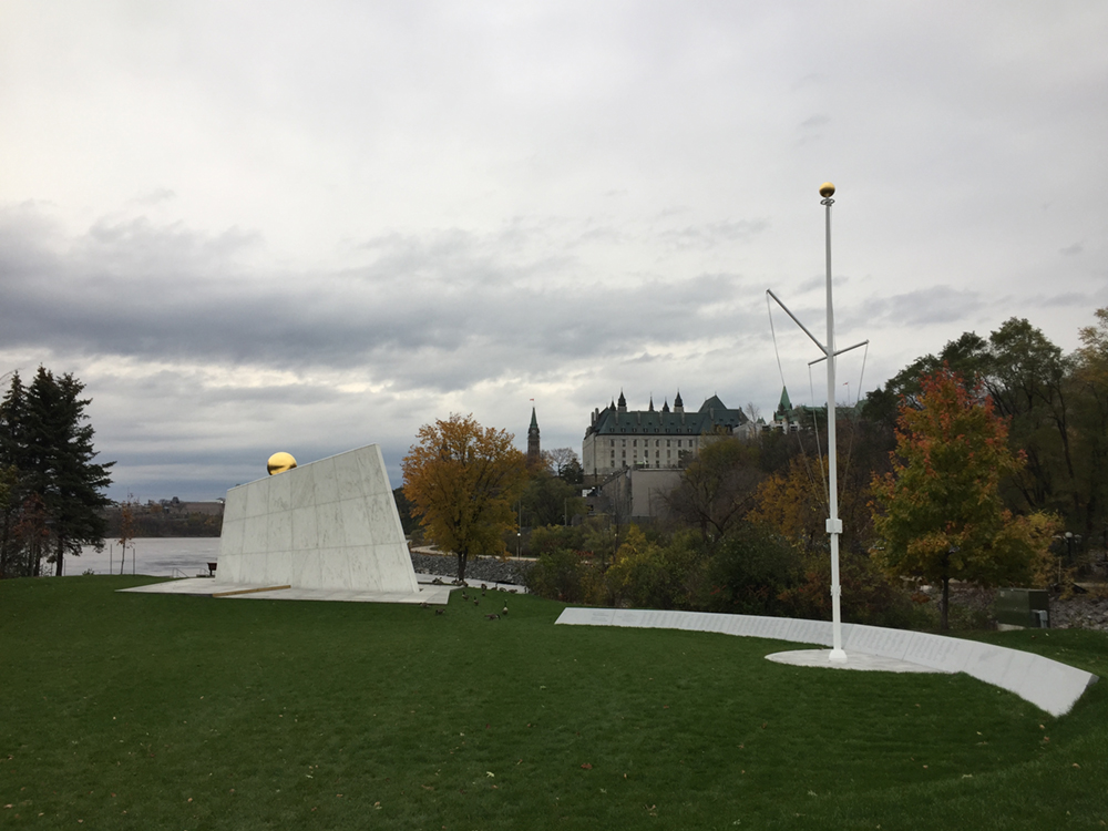
Head west along Wellington, which has a bike lane beginning at Lyon Street. This bike lane continues across the Portage Bridge. Just before heading over the Ottawa River there is a path off to the right that leads down to the Royal Canadian Navy Monument. UPDATE, November 2019. The path down to the Canadian Navy Monument is blocked off for some major re-landscaping but one can bike down along the Ottawa River Pathway and view the monument from the south shore of the river, as per the route on the above map.
Royal Canadian Navy Monument
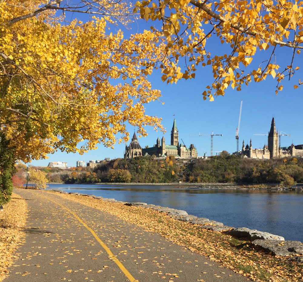
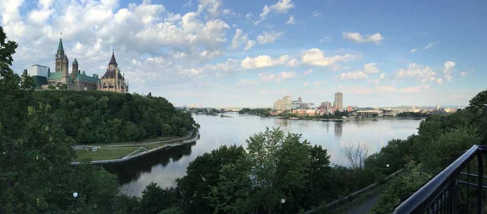
Head back up to the Portage Bridge and cross over to the Quebec side of the river, then turn east along the Voyageurs Pathway that hugs the shore of the Ottawa River. One of the finest views of Parliament Hill can be seen from this section of path. The Memorial Chamber, located inside the Peace Tower, contains the Books of Remembrance recording every Canadian killed in service from Canada’s first overseas campaign, the Nile Expedition, to the present.
View of Parliament Hill from the Voyageurs Pathway
Our route heads back to Ottawa over the Alexandra Bridge to our next stop, The Peacekeeping Monument, dedicated to Canadians who have served as peacekeepers around the world. It is located on a traffic island along Sussex Drive between the National Gallery and the American Embassy. You can meander through the centre of this monument.
Peacekeeping Monument
View through Peace Keeping Monument
The next section of the tour continues north along Sussex Drive which has a bike lane. The Defence of Hong Kong Memorial is located at the corner of Sussex and King Edward Avenue. This Memorial is dedicated to those Canadian Soldiers who served in the defence of Hong Kong during the Second World War.
Defence of Hong Kong Memorial
The first of the three memorial installations is dedicated to members of the Royal Regiment of Canadian Artillery who gave their lives in battle. A sculpture of Lieutenant-Colonel John McCrae, created by artist Ruth Abernethy. John McCrae was a doctor who participated in the First World War. He was moved to write the poem In Flanders Field in memory of fellow Canadian soldiers killed during the Second Battle of Ypres. It is from this poem that the red poppy was chosen to be the symbol of Remembrance Day.
Royal Regiment of Canadian Artillery
Lieutenant-Colonel John McCrae, sculpture by Ruth Abernethy
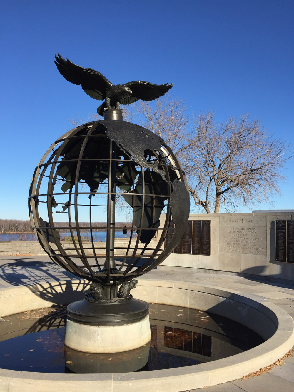
Across the park are the Commonwealth Air Forces Ottawa Memorial, and the Mackenzie-Papineau Battalion Memorial dedicated to Canadian volunteers of the Mackenzie–Papineau Battalion during the Spanish Civil War.
The Commonwealth Air Forces Ottawa Memorial
Mackenzie-Papineau Battalion Memorial
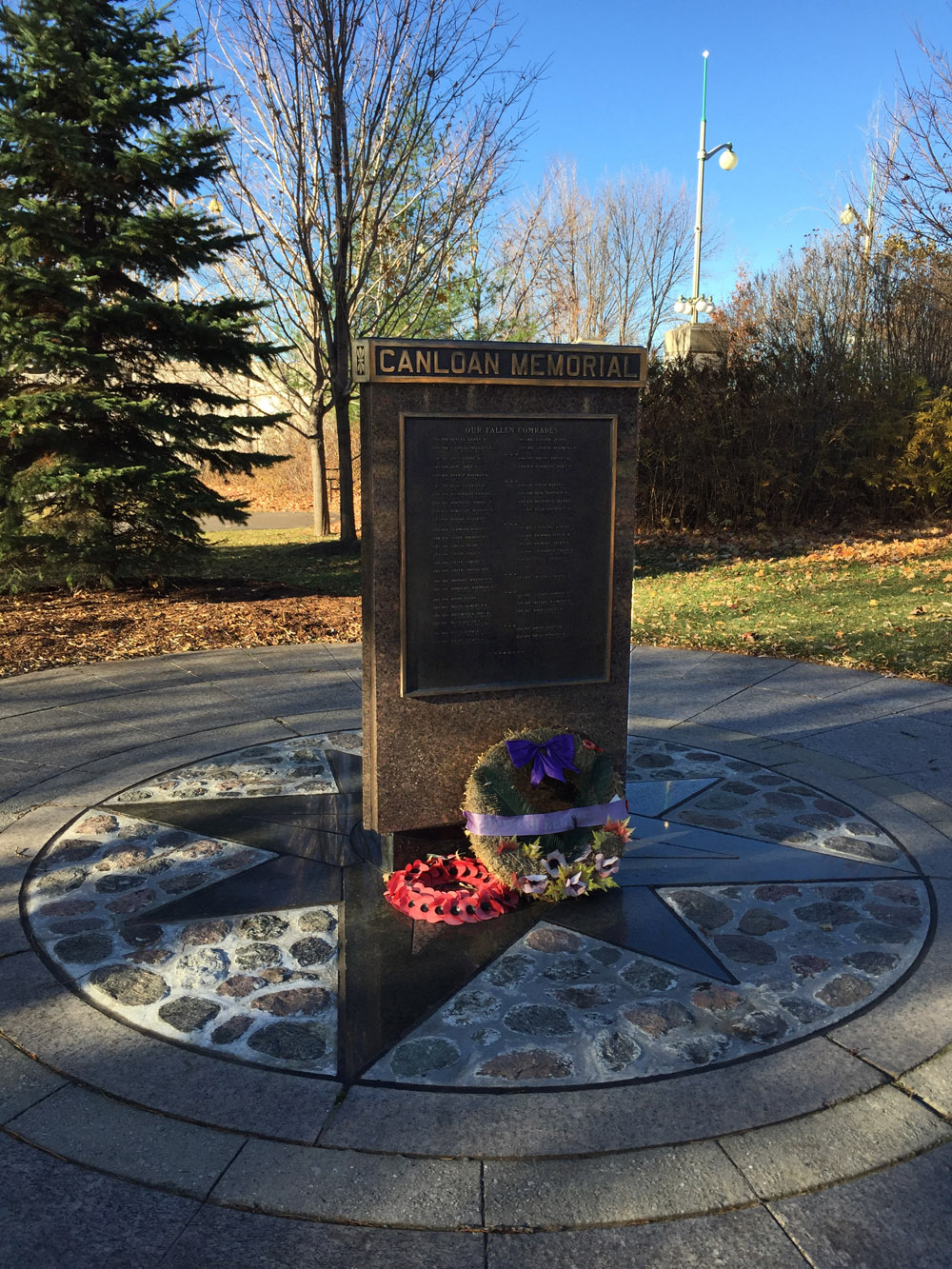
The tour continues along Sussex Drive. At the southern corner of Sussex Drive and Stanley Avenue is the CANLOAN Monument, dedicated to Canadian soldiers who died while volunteering with the British army during the Second World War.
Canloan Monument
Head east along Stanley Avenue and the Rideau River Eastern Pathway to Beechwood Avenue, then ride along the Beechwood Avenue bike lane to the entrance of Beechwood Cemetery. The National Military Cemetery is located within the grounds, as indicated on the above map.
National Military Cemetery
the poem In Flanders Fields is cast onto a bronze plaque and mounted on a simple elegant plinth facing the rows of white tombstones.
In Flanders fields the poppies blow
Between the crosses, row on row,
That mark our place; and in the sky
The larks, still bravely singing, fly
Scarce heard amid the guns below.
We are the Dead. Short days ago
We lived, felt dawn, saw sunset glow,
Loved and were loved, and now we lie
In Flanders fields.
Take up our quarrel with the foe:
To you from failing hands we throw
The torch; be yours to hold it high.
If ye break faith with us who die
We shall not sleep, though poppies grow
In Flanders fields.
Indigenous Walks is ‘A guided walk & talk through downtown Ottawa that presents participants with social, political, cultural & artistic spaces from an Indigenous perspective‘. I put together the following bike tour for Indigenous Walks with Alanis King. Alanis is a published playwright and theatre director, as well as past Artistic Director of Native Earth Performing Arts and Saskatchewan Native Theatre. If you are interested in taking this tour I suggest calling Indigenous Walks to see if they are planning any future group rides.
Here’s a map of the route, starting in front of the Totem Pole on Victoria Island, and ending in the plaza looking in to The Grand Hall of the Museum of History.
Many Canadians are drawn to the November 11th Remembrance Day Ceremonies held at the National War Memorial to pay tribute to those who have fought and given their lives in the service of our great country. The following is a commemorative bike tour starting from the National War Memorial, with visits to a number of lesser known Canadian War Memorials throughout the capital, and ending at the National Military Cemetery.
.
The National War Memorial was unveiled in 1939 to commemorate those who served in the armed forces during World War !. It has since come to symbolize the sacrifice of all Canadian Armed Forces in times of war.
National War Memorial
Immediately in front of the Memorial is the Tomb of the Unknown Soldier. It contains the remains of an unidentified Canadian soldier who died near Vimy Ridge during the First World War. This tomb represents the many Canadian soldiers who have no known grave.
Tomb of the Unknown Soldier
Leaving the War Memorial, Head down along the edge of the Rideau Canal beside the National Arts Centre to Confederation Park where the South African War Memorial is located.
The tour crosses Elgin street and follows the Laurier Bike Lane heading west before turning north along the Bay St bike lane. After crossing Wellington at the northern end of Bay, head east for one block to Lyon St. There is a gravel path through the park just to the east of the National Archives building that leads to Lyon. Looking across Wellington up Lyon Street, one sees the Veteran Memorial Buildings . Beneath the arch connection the two buildings across Lyon St there is a stone relief carving by Ivan Mestvovic in honour of those who fought in the First World War.
Veterans Memorail Buildings
The tour continues west along Wellington which has a bike lane beginning at Lyon St. This bike lane continues across the Portage Bridge. Just before heading over the Ottawa River there is a path off to the right that leads down to the waters edge and the Royal Canadian Navy Monument.
Royal Canadian Navy Monument
Head back up and over the Portage Bridge, then east along the Voyageurs Pathway that hugs the shore of the Ottawa River. One of the finest views of Parliament Hill can be seen from this section of path. The Memorial Chamber is located inside the Peace Tower. it contains the Books of Remembrance, recording every Canadian killed in service from Canada’s first overseas campaign, the Nile Expedition, to the present.
View of Parliament Hill from the Voyageurs Pathway
The tour heads back over the Ottawa River over the Alexandra Bridge. The Peacekeeping Monument, dedicated to Canadians who have served as peacekeepers around the world, is located on a traffic island along Sussex Drive between the national Gallery and the American Embassy.
Peacekeeping Monument
The next section of the tour continues north along Sussex Drive which has a bike lane. The Defence of Hong Kong Memorial is located at the corner of Sussex and King Edward Avenue. This Memorial is dedicated to those Canadian Soldiers who served in the defence of Hong Kong during the Second World War.
Defence of Hong Kong Memorial
Cross Sussex and follow the path overlooking the Rideau Falls. There are two memorials on Green Island located between the two sets of falls: The Commonwealth Air Forces Ottawa Memorial, and the Mackenzie-Papineau Battalion Memorial dedicated to Canadian volunteers of the Mackenzie–Papineau Battalion during the Spanish Civil War.
The Commonwealth Air Forces Ottawa Memorial
Mackenzie-Papineau Battalion Memorial
The tour continues along the path overlooking the second set of falls, then back across Sussex. On the opposite side of Sussex is the CANLOAN Monument, dedicated to Canadian soldiers who died while volunteering with the British army during the Second World War.
Canloan Monument
Head east along Stanley Avenue and the Rideau River Eastern Pathway. Then weave your way north along Barrette St to avoid the busy section of Beechwood, then get back on to Beechwood where the bike lane starts at Marier avenue. A bit further along one arrives at the entrance to Beechwood Cemetery. The National Military Cemetery is located within the grounds, as indicated on the above map.
National Military Cemetery
the poem In Flanders Fields is cast onto a bronze plaque and mounted on a simple elegant plinth.
It is from this poem that the red poppy was drawn to become the symbol of Remembrance Day.
In Flanders fields the poppies blow
Between the crosses, row on row,
That mark our place; and in the sky
The larks, still bravely singing, fly
Scarce heard amid the guns below.
We are the Dead. Short days ago
We lived, felt dawn, saw sunset glow,
Loved and were loved, and now we lie
In Flanders fields.
Take up our quarrel with the foe:
To you from failing hands we throw
The torch; be yours to hold it high.
If ye break faith with us who die
We shall not sleep, though poppies grow
In Flanders fields.
A while ago I joined a walking tour of Parliament Hill with Jaime Koebel. Jaime runs Indigenous Walks which she describes as, ‘A guided walk & talk through downtown Ottawa that presents participants with social, political, cultural & artistic spaces from an Indigenous perspective‘. As we looked out across the Ottawa (or Kitchissippi) River towards the Museum of History, Jaime mentioned the totem poles displayed within the museum, as well as a number of others carved by indigenous sculptors located outdoors within the area. Here’s a 33km loop that visits those sites. This bike tour is almost entirely along NCC multi-use paths. UPDATE 2018:I’ve added an optional detour to Rideau Hall where stands another totem pole (see purple line on map). More on this piece further down in the post.
.
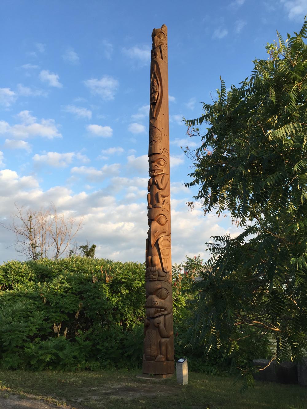
Our ride begins near the eastern tip of Victoria Island where stands this totem pole sculpted by Walter Harris of the Gitxsan First Nation in northern British Columbia.
Totem sculpted by Walter Harris
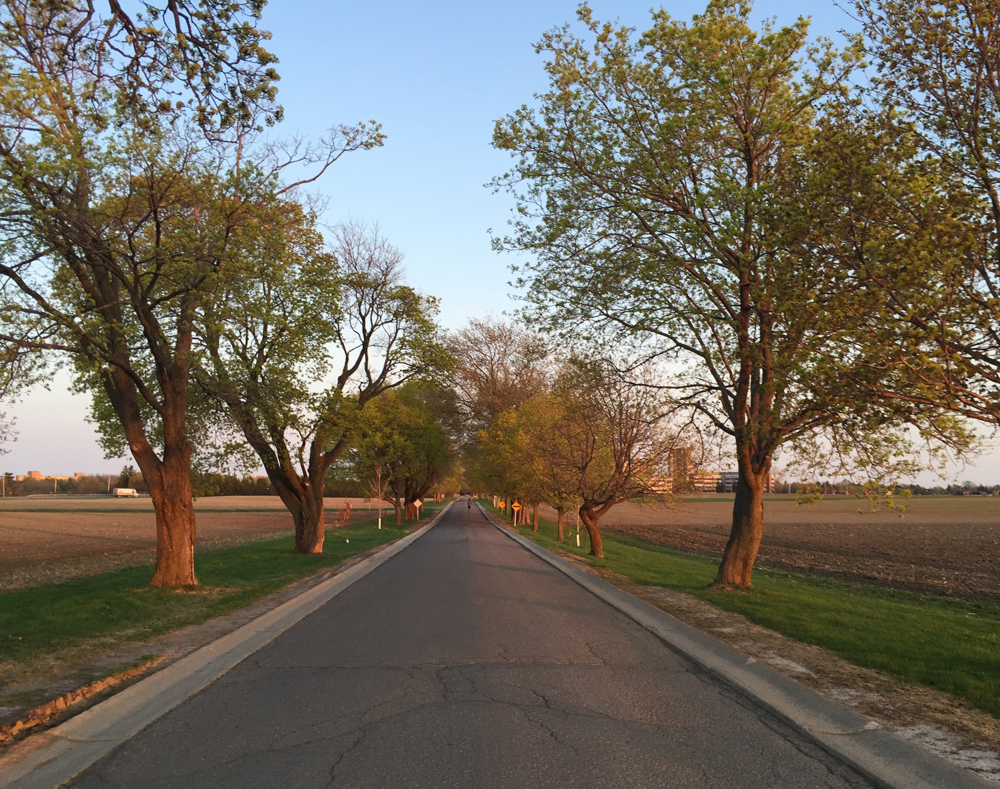
I rode west and accessed the Ottawa River Pathway behind the War Museum, and followed it along the river to where it connects to the Pinecrest Creek Pathway.
View from the Ottawa River Pathway
I rode the length of the Pinecrest Creek Pathway to Woodroffe Avenue.
Pinecrest Creek Pathway
On the south side of Woodroffe the path continues as the Experimental Farm Pathway.
North section of the Experimental Farm Pathway winding through open areas
On the south side of Maitland the path weaves it’s way up through a wooded area.
Wooded section of Experimental Farm Pathway between Maitland Avenue and Merivale Road
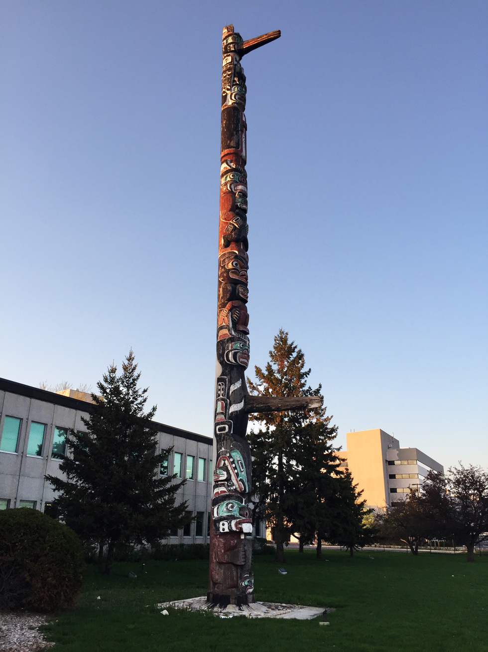
The second totem pole on our tour is located in front of the Scouts Canada National Office on Baseline Road. To get there I turned off the pathway and cut through a residential area along paths and quiet roads as shown on the above map.
This totem was carved by Chief Mungo Martin, a Kwakwaka’wakw carver from British Columbia. It was acquired by the Boy Scouts in 1960. The totem pole has been along Baseline Road since 1961. According to Scouts Canada, it was a gift from the British Columbia government to celebrate the newly opened headquarters.
Totem sculpted by Chief Mungo Martin
I then headed back to the Experimental Farm Pathway which runs along farmed fields east of Merivale Road. Sections of the pathway east of Fisher follow along quiet roads through the farm.
Experimental Farm
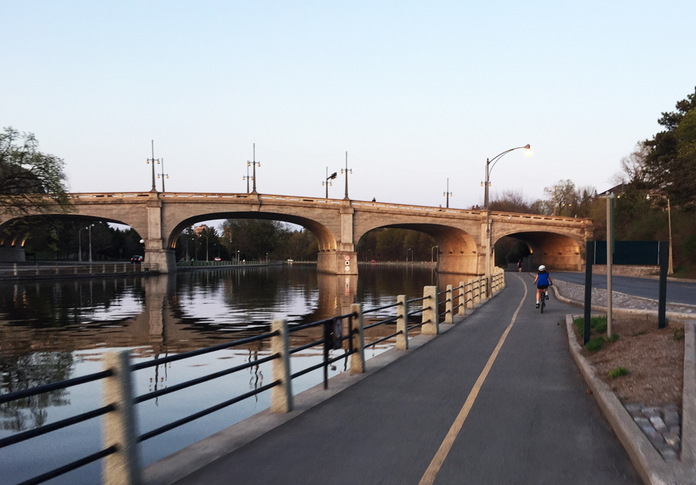
I crossed Prince of Wales Drive at the signalized crosswalk and headed over to the Rideau Canal locks beside Carleton University. I crossed the locks and biked down the Rideau Canal Eastern Pathway towards downtown.
The Rideau Canal Eastern Pathway
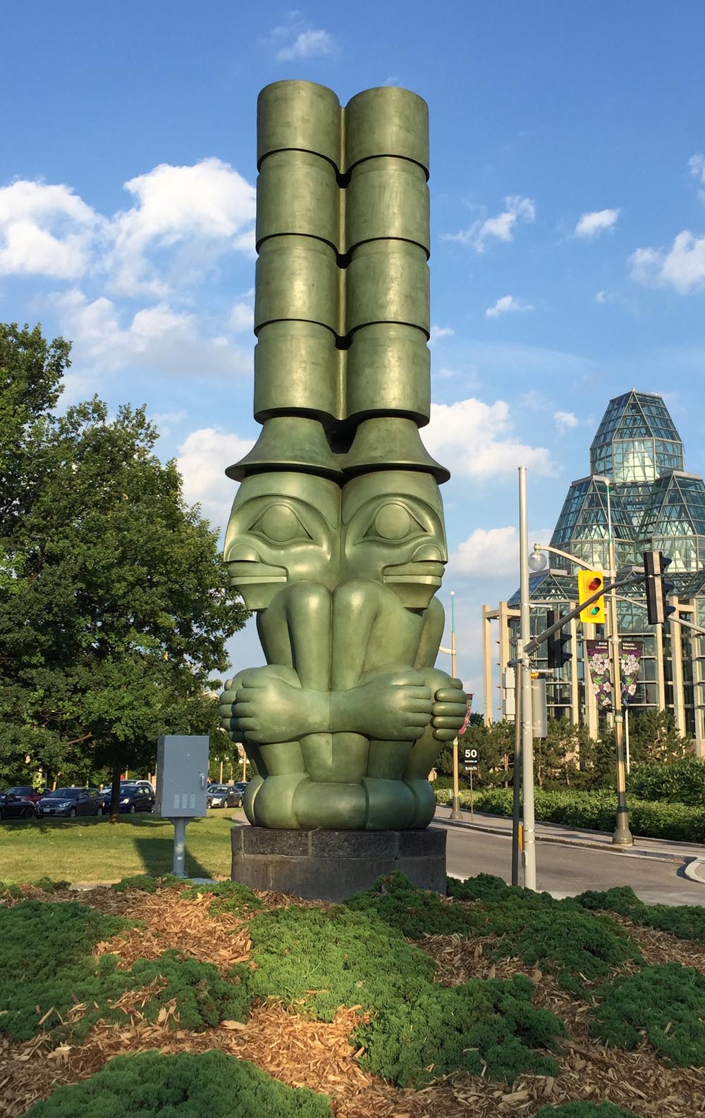
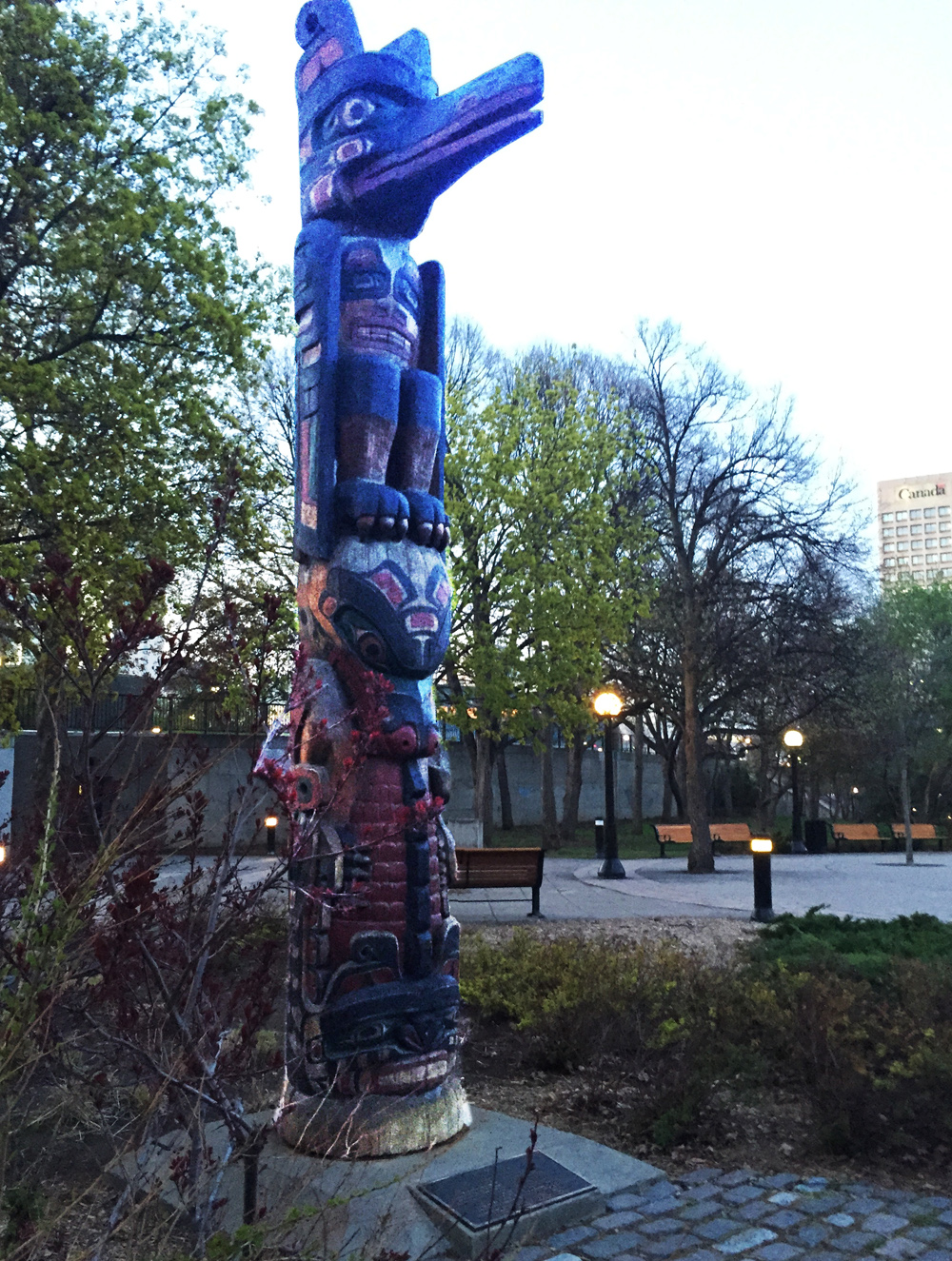
I re-traversed the canal at the Somerset pedestrian bridge and headed over to Confederation Park to visit the third totem pole along the tour, sculpted by Henry Hunt also of the Kwakwaka’wakw and apprentice of Mungo Martin.
Totem sculpted by Henry Hunt
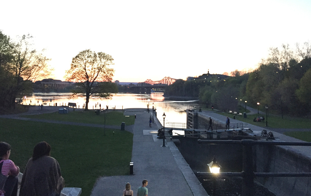
Next stop – the Grand Hall of the Museum of History. To get there I rode down beside the canal and across the second to last set of locks.
View down the last set of locks along the Rideau canal before it drains into the Ottawa River
I then rode up the paved path from the river and crossed the Alexandra Bridge to our final stop at the Museum of History in Gatineau.
Crossing the Alexandra Bridge
I UPDATE – August 2018: There is another totem pole sculpted by Mungo Martin located on the grounds of Rideau Hall. The purple line on the above map shows how to get there via the bike lane along Sussex Avenue , and then back, crossing the MacDonald-Cartier Bridge to the Quebec side of the river, versus the Alexandra Bridge. The grounds of Rideau Hall are open to the public up until 1 hour before sunset.
Totem pole by Mungo Martin on the grounds of Rideau Hall
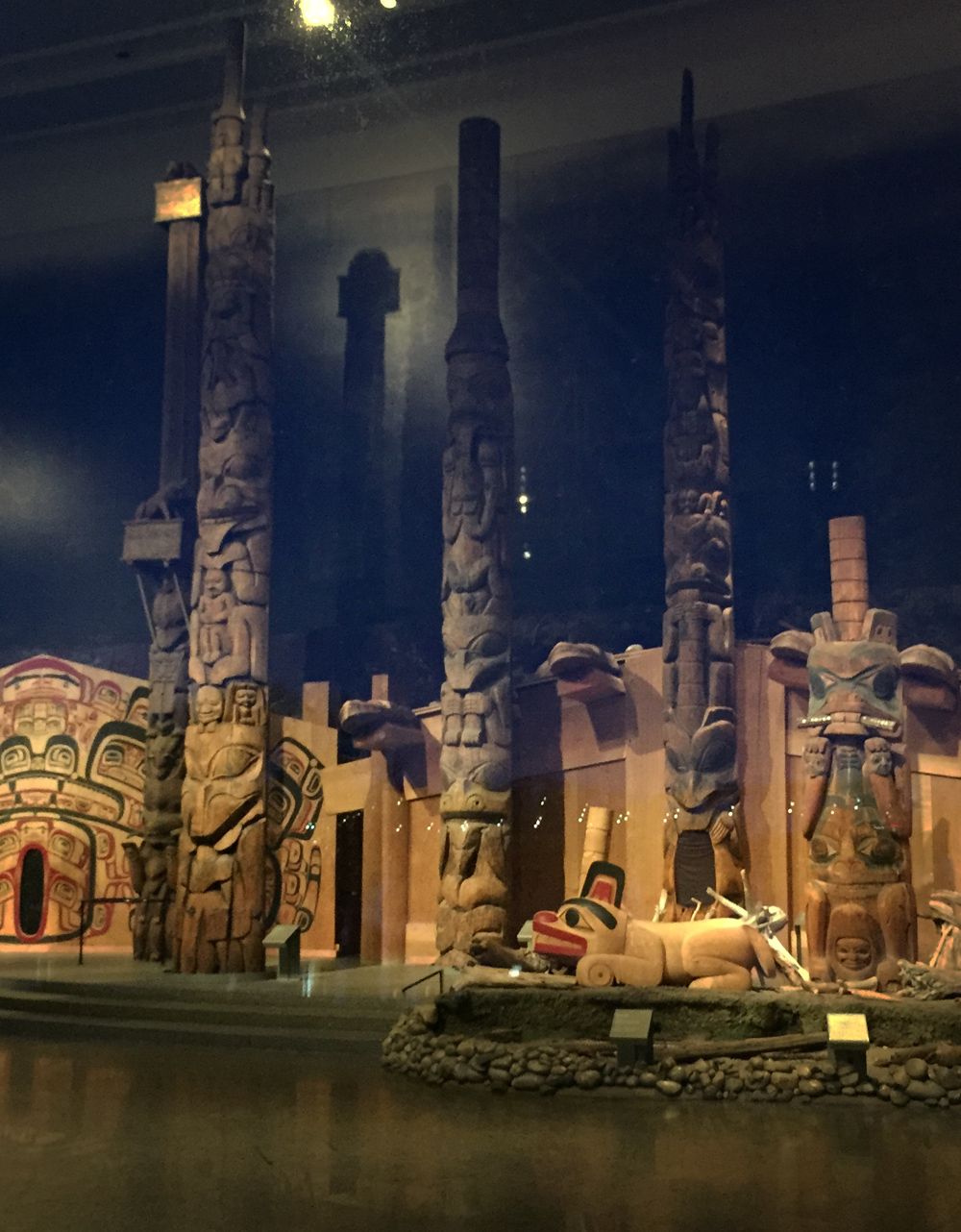
The best time to visit our final spot along the shore of the Ottawa River facing the Museum of History is in the evening as the sun is setting. That’s when the vista of totem poles within the Grand Hall of the museum are most visible from outside the large windows.
Exterior view of the totems within the Grand Hall
Here are views of these majestic sculptures as seen from outside as well.
Totems within the Grand Hall
To complete the loop I rode along the Voyageurs Pathway beside the river, then halfway across the Portages Bridge back to Victoria Island.
UPDATE 2018: The NCC has yet to complete repairs along the Voyageurs Pathway caused by the Spring flooding of 2017. The alternative route, as per the orange line on the above map, goes along the very wide Laurier Avenue sidewalk which is being used as an interim multi-use pathway.
Et voila!
Detail of totem on Victoria Island by Walter Harris
Canada is home to one of the largest populations of bears in the world. I have yet to come across one on my cycling exploits (like these guys) however there are some fine sculptural interpretations of members of the family Ursidae throughout the nation’s capital. So, if you are a lover of bears, or sculptures of bears, this tour is for you!
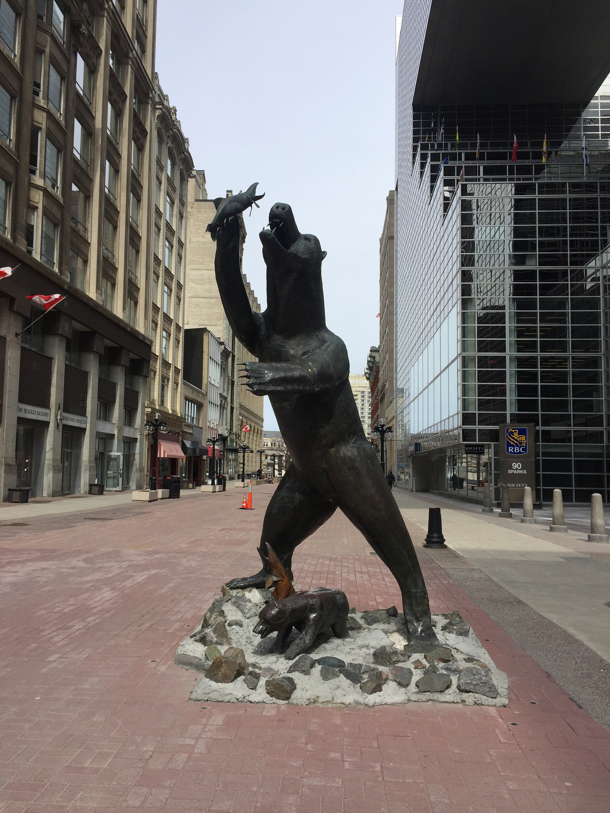
We begin at the intersection of Sparks Street and Metcalfe Street where stands this big bronze statue of a fishing grizzly by artist Bruce Garner (for tours of other sculptural works by Bruce throughout the capital, click here).
Territorial Perogative
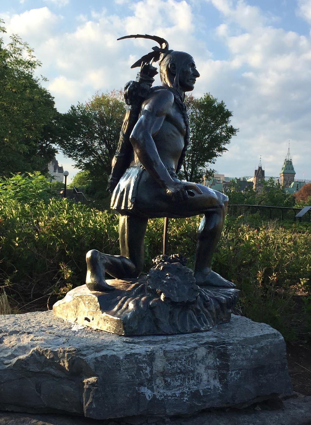
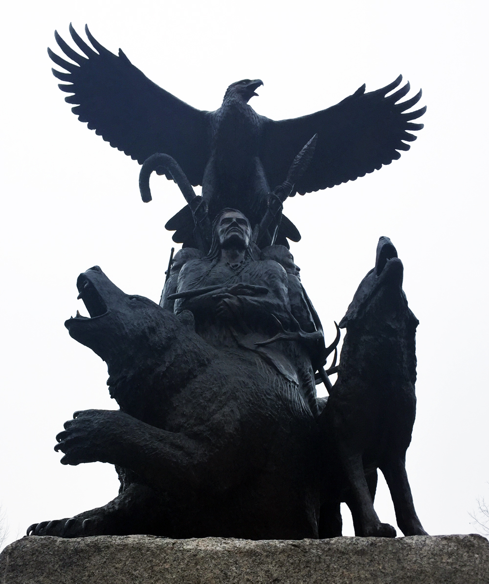
I then rode along Sparks to Elgin Street, then past the WarMemorial and down around the National Arts Centre via the ramp off Elgin Street. I then cut through Confederation Park to the National Aboriginal Veterans Monument, sculpted by Lloyd Pinay. A life sized bear is one of four animals depicted in the base of the bronze sculpture, each representing spirit guides. The bear symbolizes healing powers.
National Aboriginal Veterans Monument
Our next stop is located in the Jeanne d’Arc Courtyard in the Byward Market. To get there I cut through the plaza in front of City Hall, then along quiet residential streets to the bike & pedestrian bridge over the canal at Somerset Street. I then rode along the Rideau Canal, and crossed Colonel By Drive at Daly Avenue. The stretch of Colonel By/Sussex St between Daly and George where it intersects Rideau Street does not have a bike lane and most times of the week it is filled with cars, trucks and buses jostling their way through this busy intersection. The safest time to try this tour would be early Sunday morning when biking through this area isn’t so dangerous.
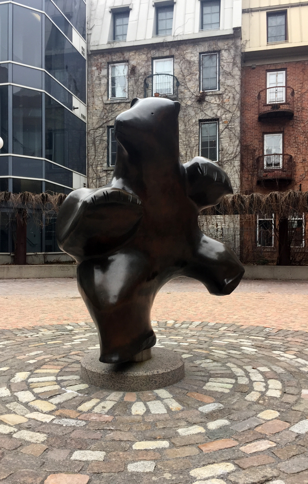
To access Jeanne d’Arc Courtyard from the south requires walking along the York Street sidewalk just off Sussex for a short distance. Within the courtyard you’ll find Dancing Bear by Inuit sculptor Pauta Salia.
Dancing Bear
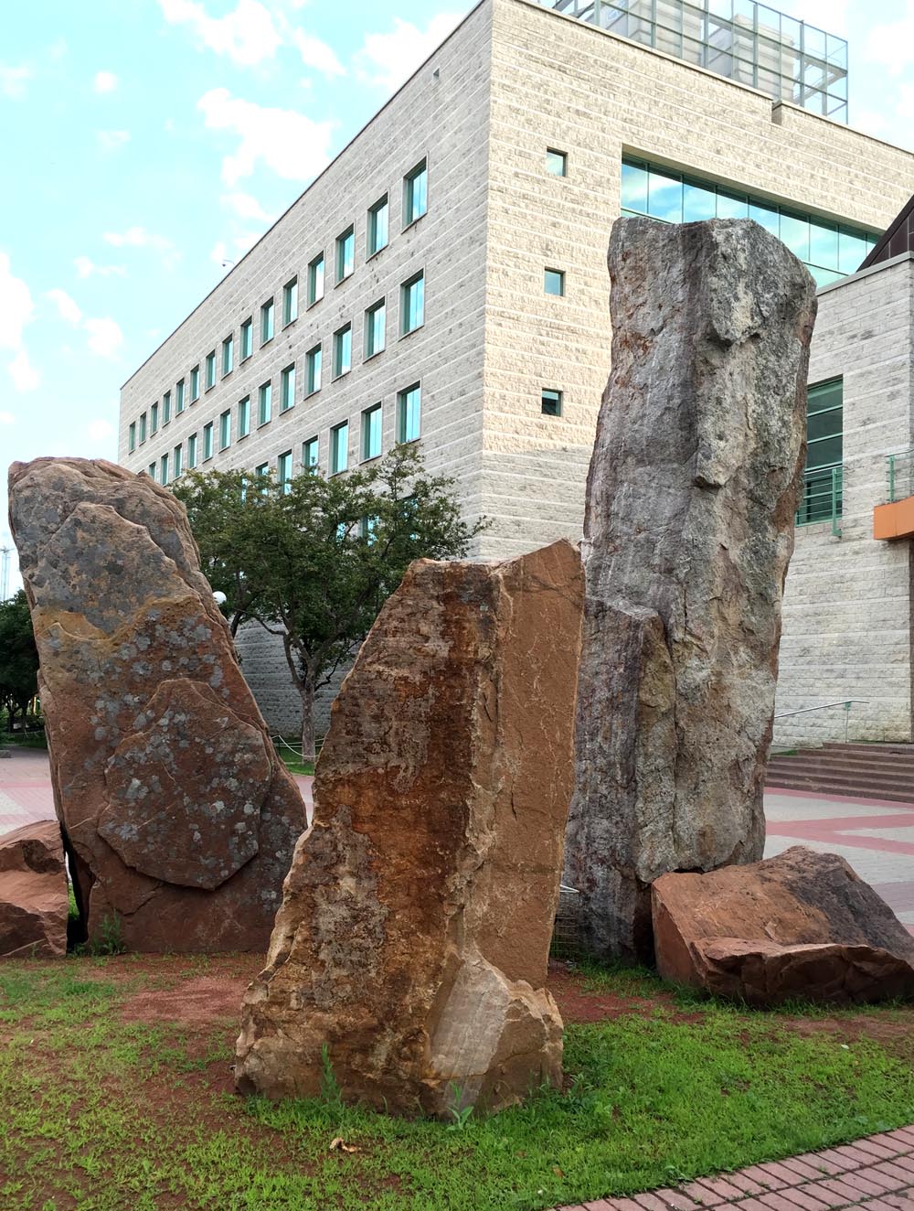
Our last destination is Green Island located in the middle of the Rideau River. To get there I made my way from the Jeanne d’Arc Courtyard over to St Andrew Street which crosses busy King Edward at a signalled crosswalk. I then took Rose Street to the path through Bordeleau Park.
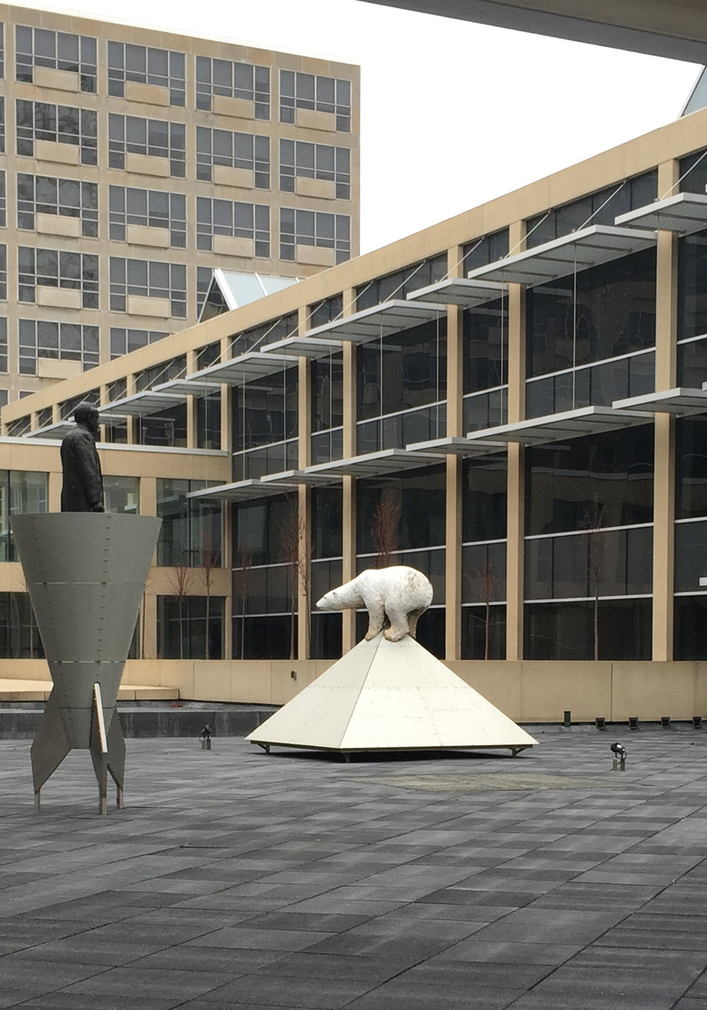
The path through the park pops out onto Union Street and over the white bridge onto Green Island. The Old City Hall covers most of Green Island, and in the central open space sits this sculpture of a polar bear perched on a metal pyramid engraved with star constellations. It is one of a grouping of three sculptures by Catherine Widgery titled Objective Memory. The pieces are surrounded by water in the summer months.
Objective Memory
As I was riding home snowflakes started to fall. Unless we experience another freak thaw such as the one we just had between Christmas and New Year’s, this tour may have to wait until Spring. No worries, lots of great winter riding to come. All very bear-able.
UPDATE 2017 – This extension is now out of commission as it was only temporary until the Booth Street Bridge was completed. Unfortunately the Booth Strret Bridge has awful bike infrastructure. Promises have been made to improve them.
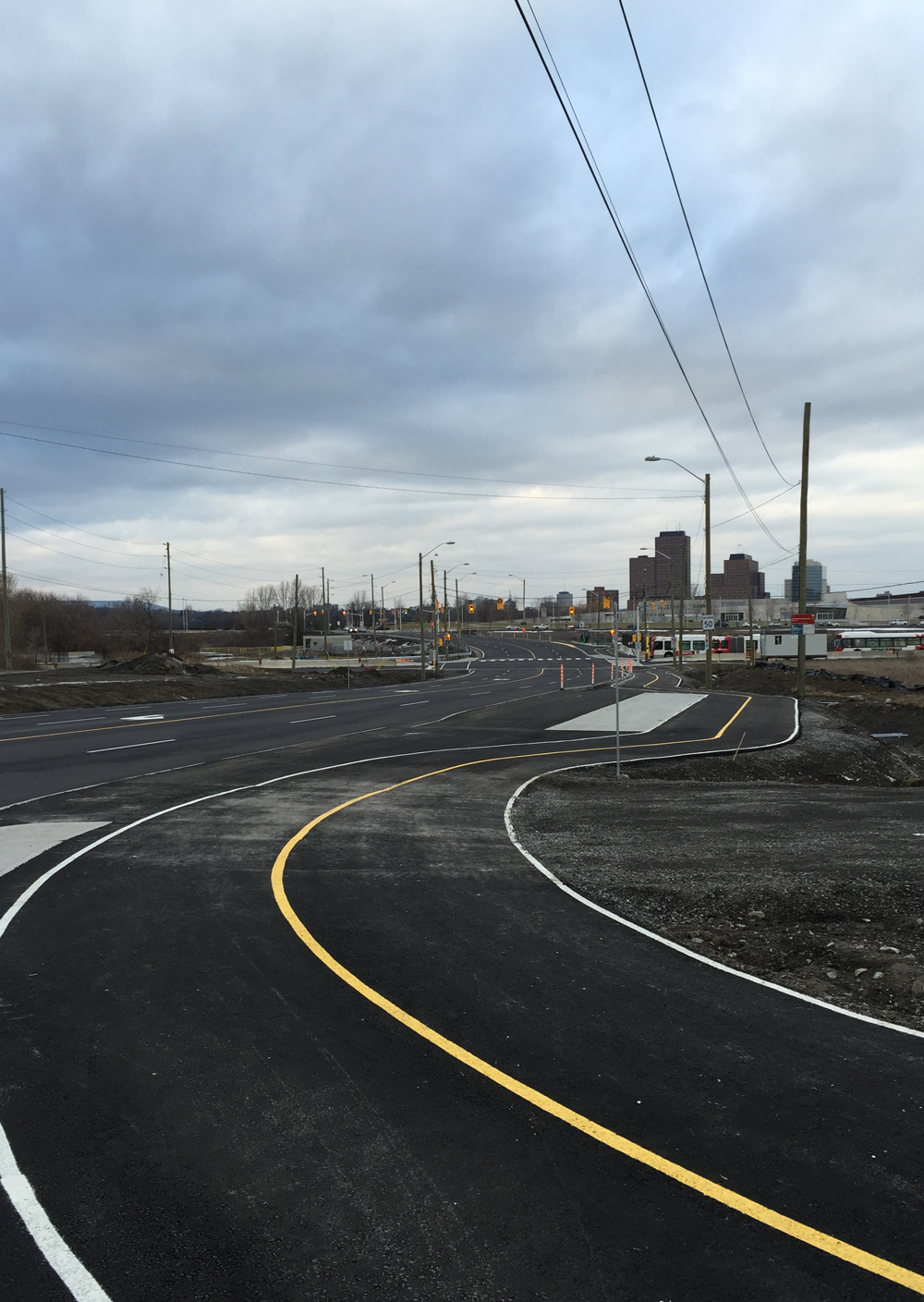
Preston Street has been extended between Albert Street and the Sir John A Macdonald (SJAM) Parkway. That’s because Booth Street north of Albert will be closed for two years while they build the Light Rail Transit. The new extension of Preston includes a multi-use path which will provide winter bike access to the Canadian War Museum. This is an improvement as the section of Booth it is replacing was treacherous to ride along even in the best of snowless conditions. Because this shared pathway also provides pedestrian access to bus stops along it’s length, I am confident it will be cleared all winter (to be confirmed after the next big snowfall). Today I went and tried it out. Blue line is my ride there, orange line is the way I should have gone to get to the start of the extension, and purple line is the way I rode back to access the Laurier Bike Lane.
I approached from the south along Preston starting at Primrose Avenue. I chose Preston because Albert is very dangerous to cross or ride along and there are traffic lights where Preston and Albert intersect. Preston has always been a busy street and promises to become more so now that it is a main north/south artery towards the Chaudière Bridge over to Gatineau. Apart from the new extension, there are no bike lanes along the length of Preston, which in the winter becomes even narrower with the snow, so I took to the sidewalk for the block between Primrose and Albert. In retrospect I should have taken the cleared O-train path under Albert and accessed the sidewalk on the north side of Albert, as suggested by the orange line on the above map. There’s a short section of sidewalk to follow heading east before it joins the path that runs along the north side of Albert.
Preston between Primrose and Albert
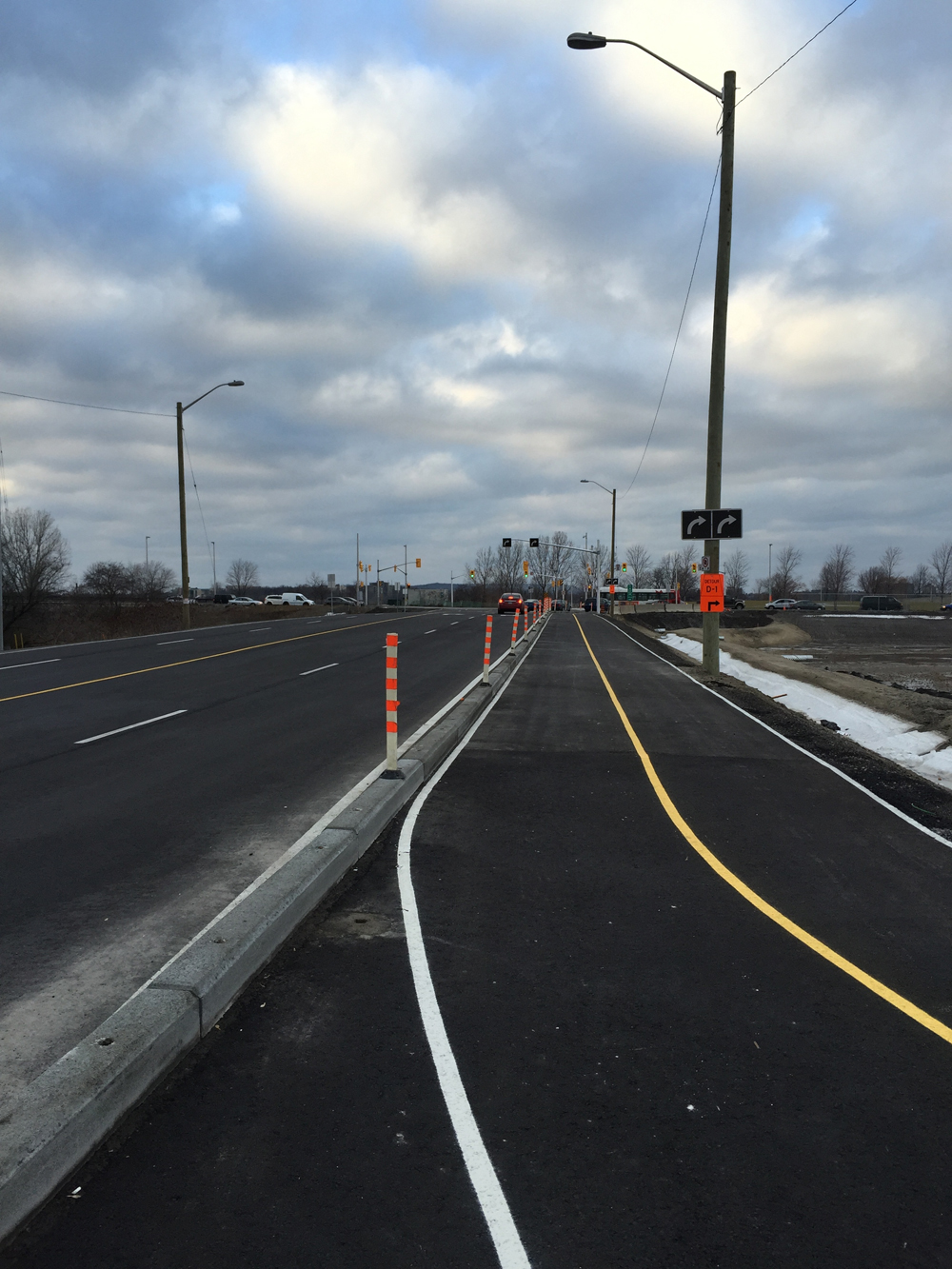
The new extension and multi-use path begins on the north side of Albert.
The paths weave behind bus shelters located along the path.
Where it runs adjacent to the road, the path is separated from the traffic with low concrete curbing and attached fiberglass tabs
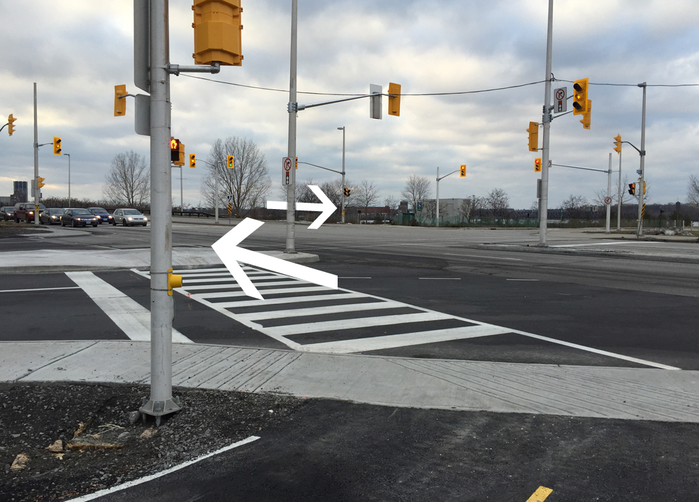
Getting across the SJAM Parkway intersection to the museum first requires crossing to the west side of Preston. The SJAM consists of multiple lanes of speeding traffic, and Preston has a large merging turn on to SJAM. This creates the type of intersection where drivers anxiously rush the light as they transition from one busy street to the other. I had to make eye contact with a driver before he halted suddenly and let me cross, even though there are multiple no-right-on-red signs.
Crossing the intersection at Preston and SJAM Parkway
Once arrived safely on the other side of SJAM I rode along the quiet service road to the entrance to the museum.
Entrance to the Canadian War Museum
On my return trip, after taking the new path back to Preston and Albert, I continued east along the path on the north side of Albert. It ends at the corner of Commissioners St and Albert. Plans are afoot to introduce multi-use path links between Albert and the Laurier Bike Lane, as described here. Until such time the best way to get to the Laurier Bike Lane is to push your bike up the side walk on the west side of Bronson. Unless traffic is very light, I suggest taking to the sidewalk not only because it’s a steep little hill up to Laurier, but cars really roar around the corner and up the hill, often clipping the edge of the sidewalk at the corner of Slater and Bronson.