Queensway Mid-Town Bridges

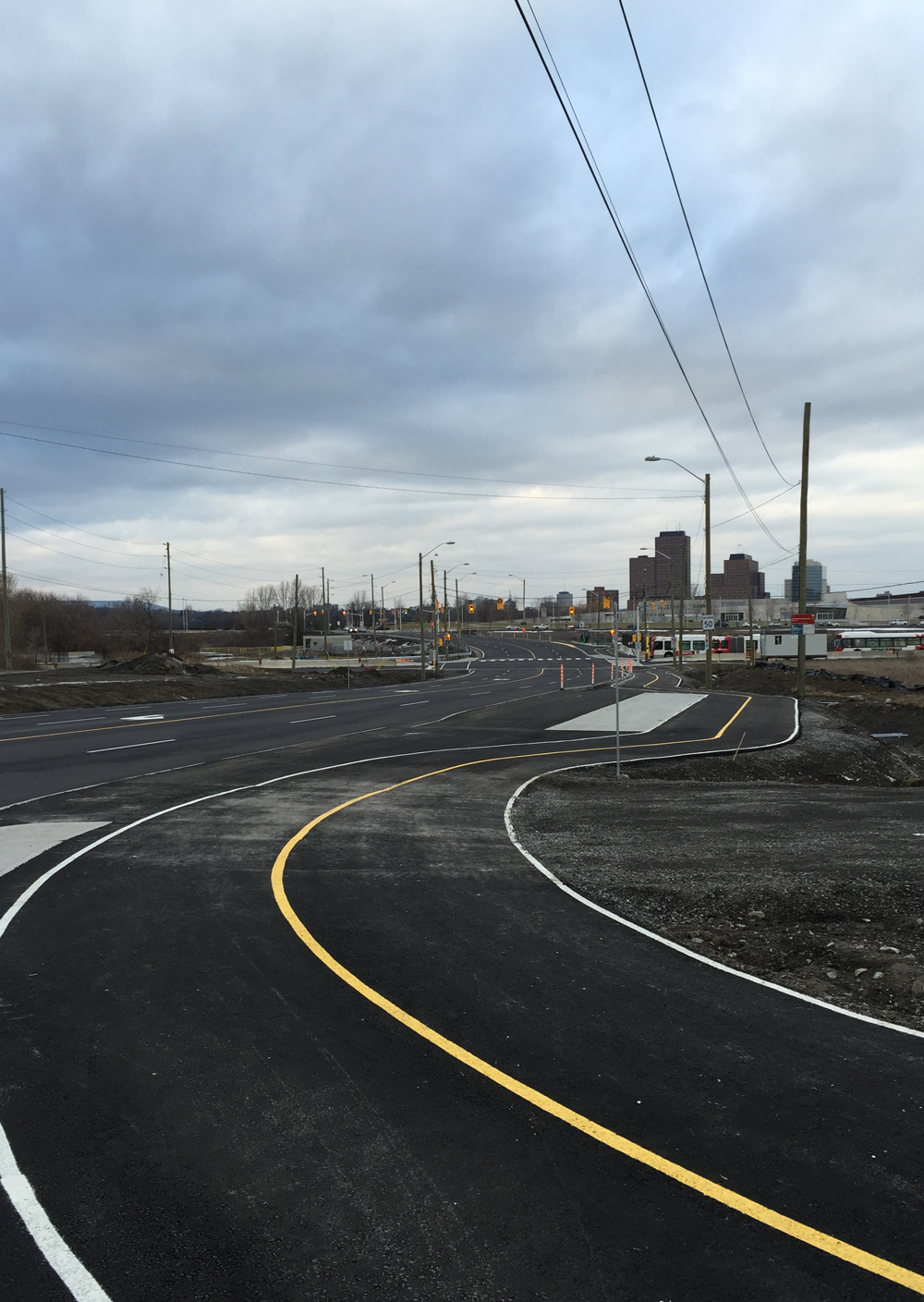
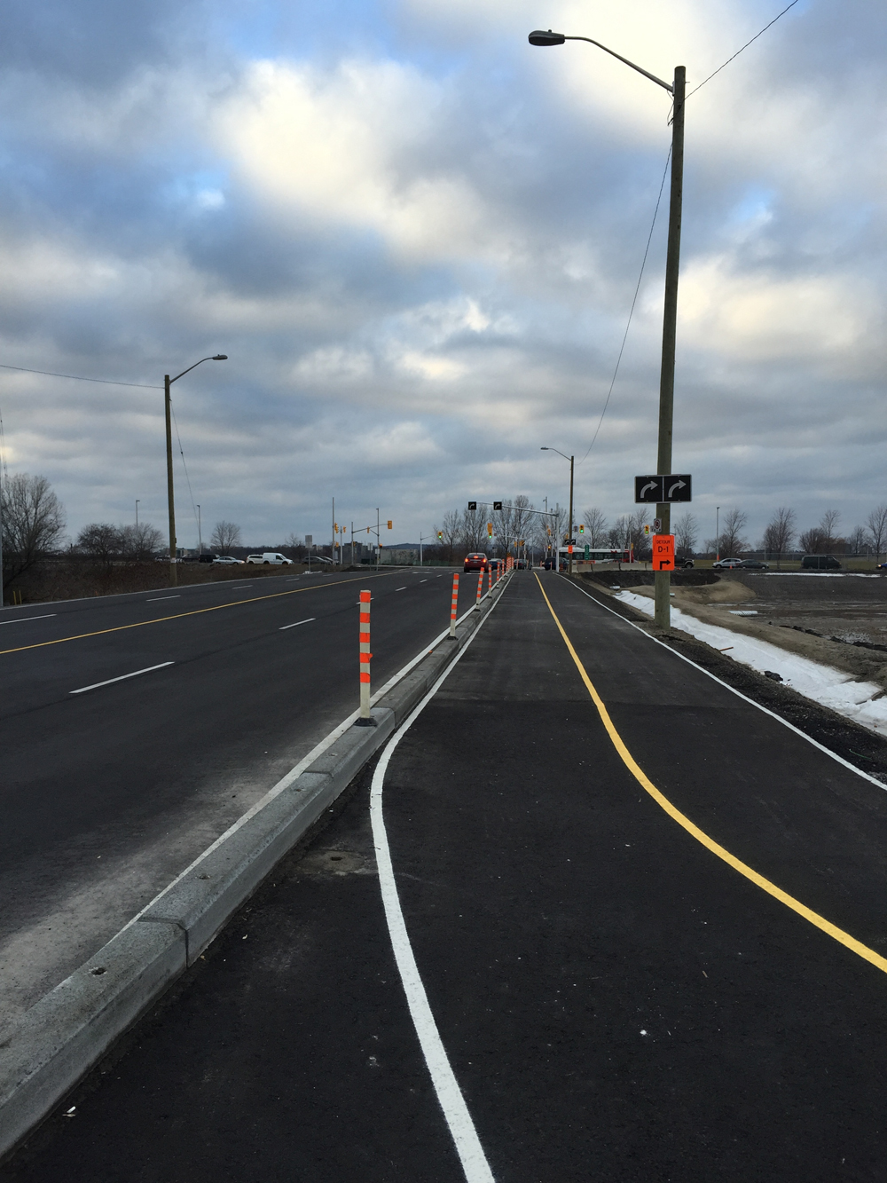
The provincial Ministry of Transportation is planning on replacing a number of bridges that go under the Queensway. The overall recommendations prepared by the consultants studying the design requirements of the bridges is to maintain the status quo. This would be a lost opportunity to re-visit the design of these underpasses to meet modern transportation needs and accommodate infrastructure requirements for all users including pedestrians, cyclists and motorized vehicles. For more insight on this potential opportunity, click here.

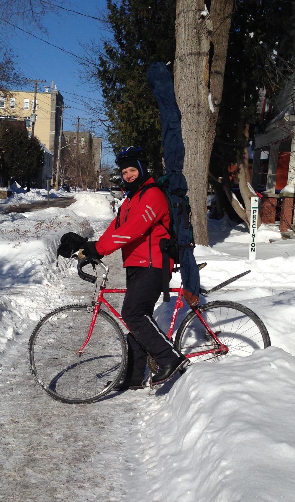
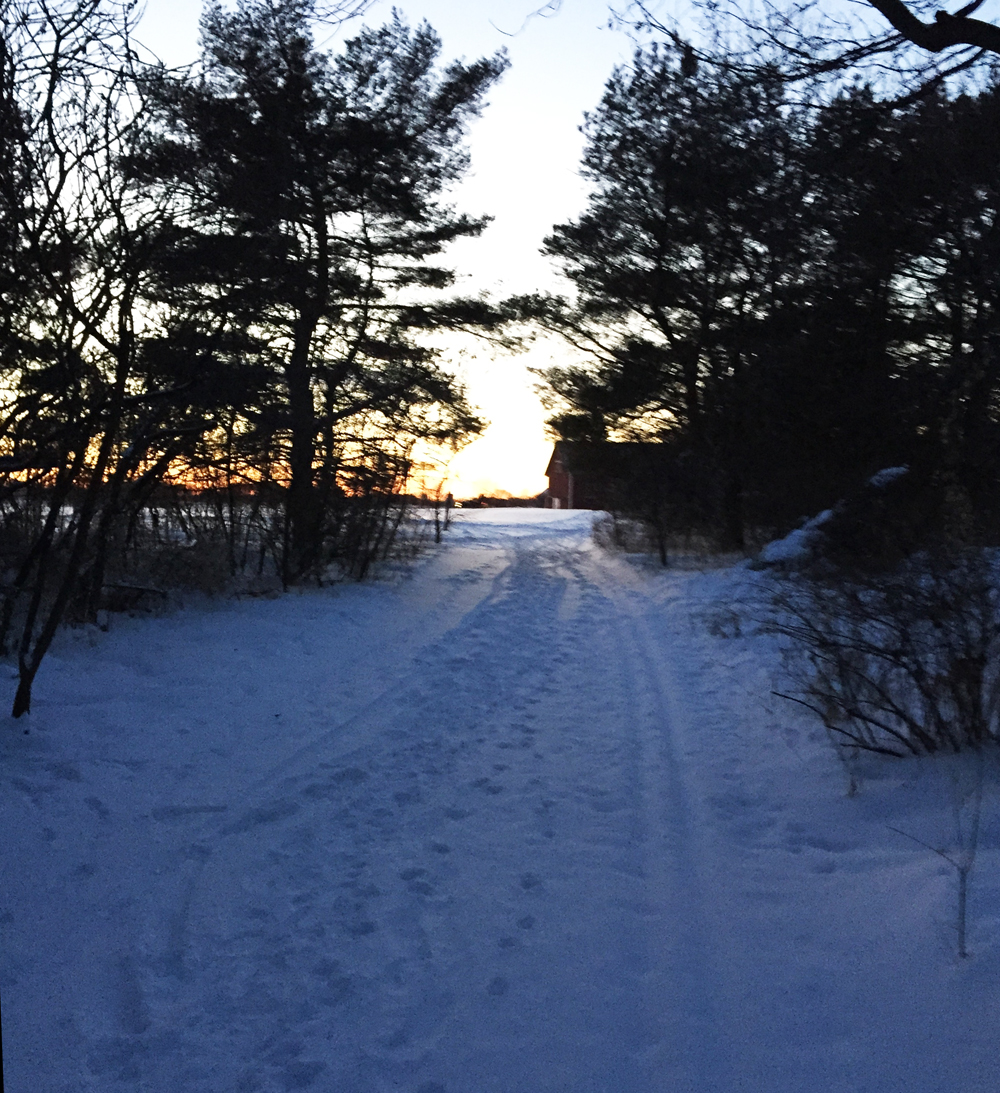
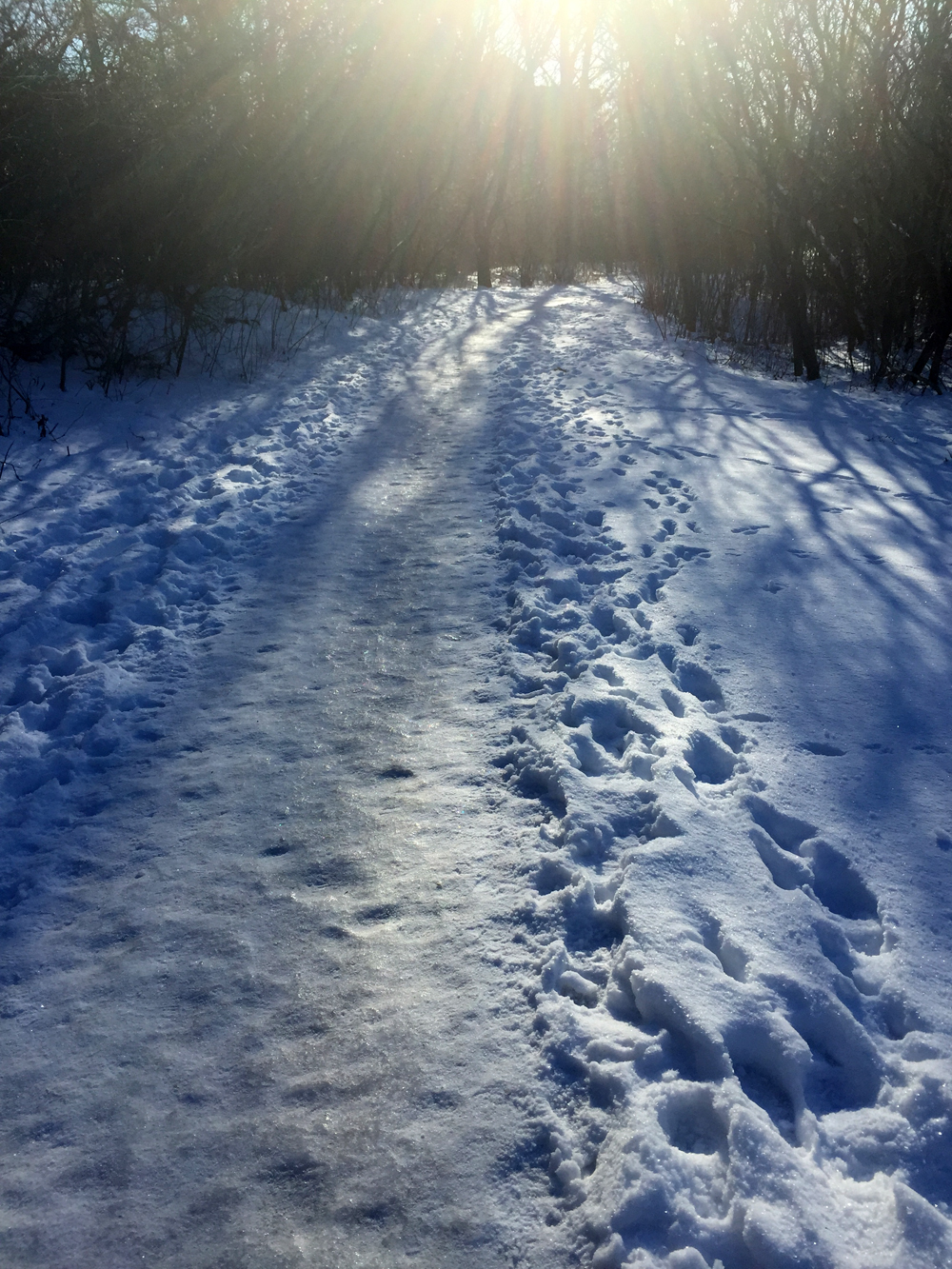
This weekend I travelled under the bridges in sequence as shown on the map below, beginning with the westernmost span along Holland Avenue. I’ve given them a grade on safety, from 0 (super dangerous, stay away) up to 5 (one that I would feel confident recommending to all riders within the 8-80 age range).

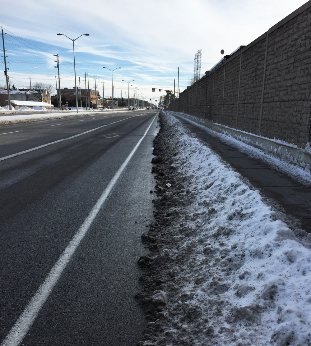
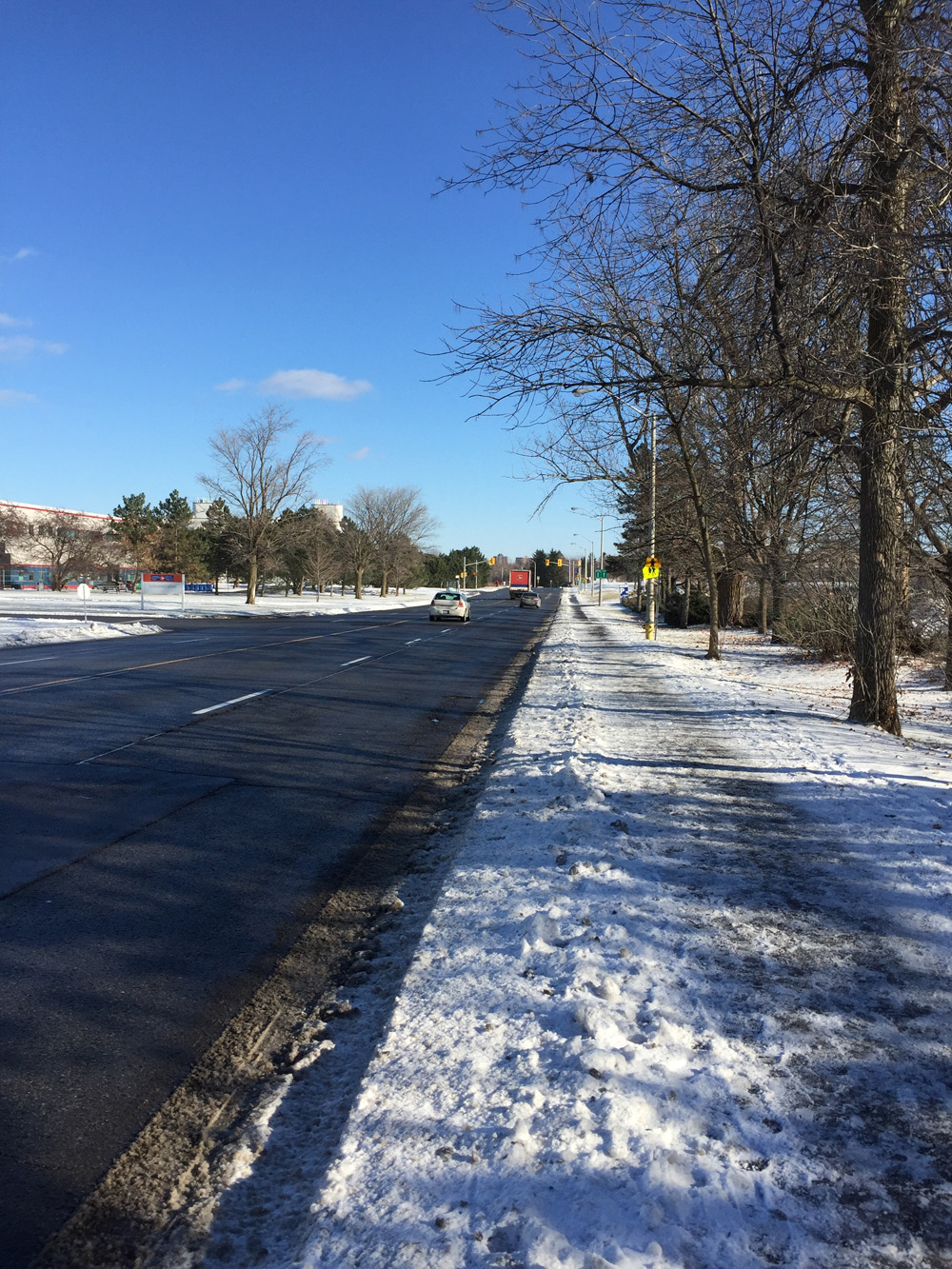
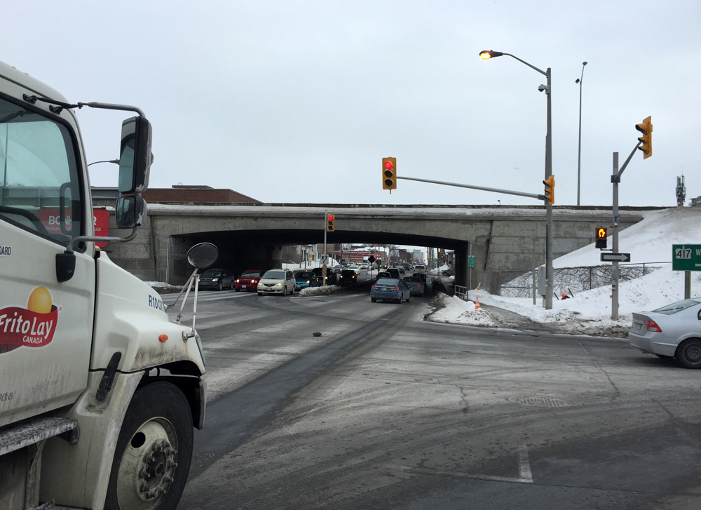
Holland Avenue is 4 lanes of speeding traffic heading under the bridge, or it’s crammed with commuter traffic during the week. Bike infrastructure would be a great asset along this strip, particularly for the kids attending Fisher Park School, located just on the north side of the bridge.
OVO-Safety-Scale : 1/5.

Holland Ave, from the north side of the Queensway
Holland Ave, from the south side of the Queensway

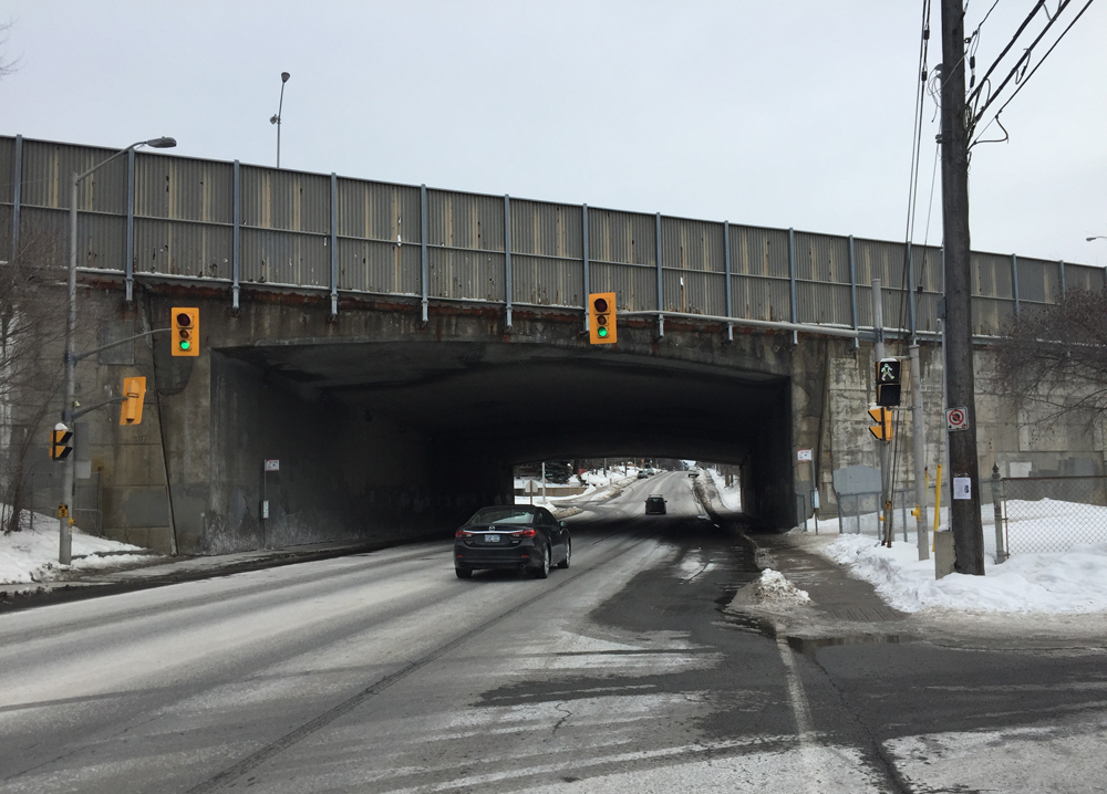
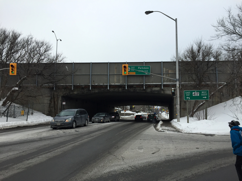
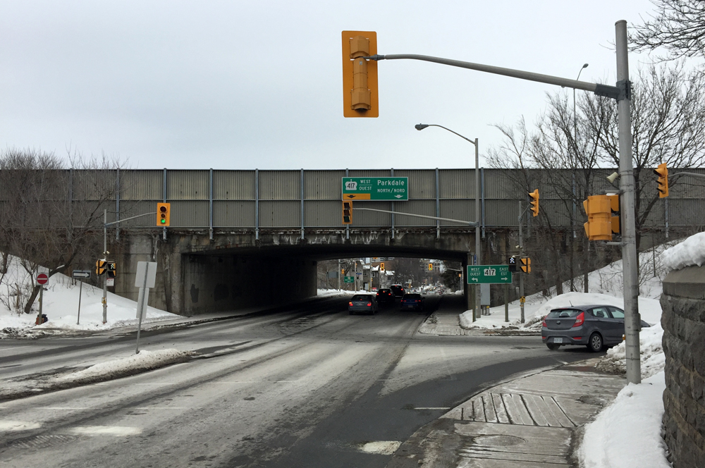
Parkdale Avenue is much like Holland Avenue in terms of traffic, but with more frantic distracted drivers jostling to get on and off Queensway ramps.
OVO-Safety-Scale : 1/5.

Parkdale Ave, from the north side of the Queensway
Parkdale Ave, from the south side of the Queensway

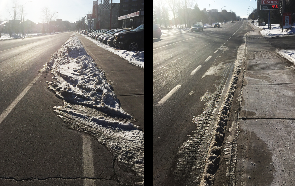
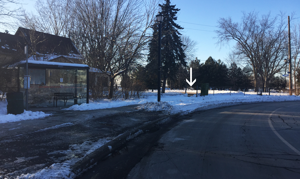
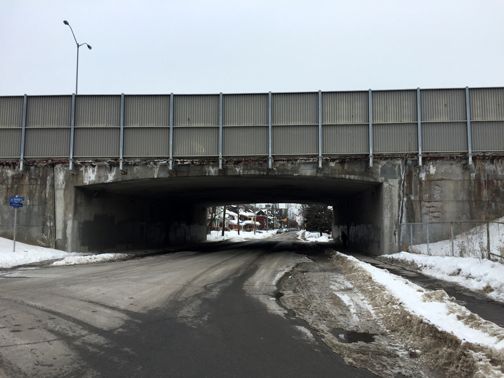
Fairmont Avenue is one of the safest roads under the Queensway. It connects residential areas on either side and has minimal traffic. There is usually ample space on the shoulders, as evidenced by the snow piled in the outside lanes. I imagine there is room to introduce bike lanes without having to increase the width of this bridge.
OVO-Safety-Scale : 3/5. Cleared bike lanes on either side would get it to 5/5.

Fairmont Ave, from the north side of the Queensway
Fairmont Ave, from the south side of the Queensway

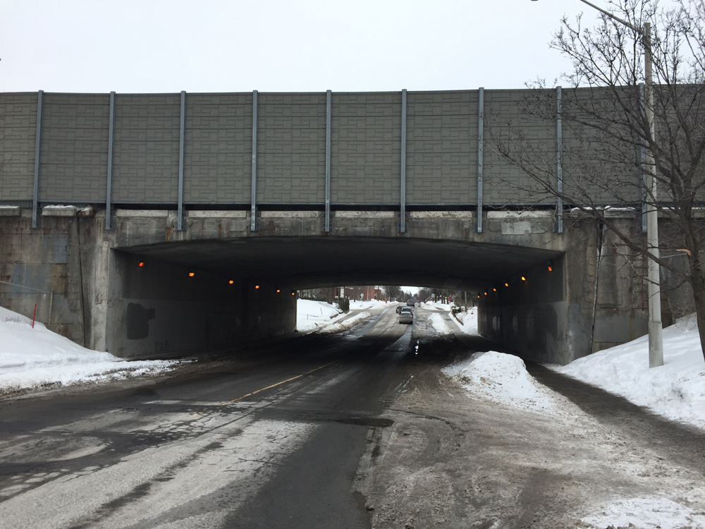
Bayswater Avenue is also a pretty good street to ride along and under the Queensway. Similar to Fairmont it could use cleared bike lanes. It was the only one with lights on under the bridge.
OVO-Safety-Scale : 3/5.

Bayswater Ave, from the north side of the Queensway
Bayswater Ave, from the south side of the Queensway

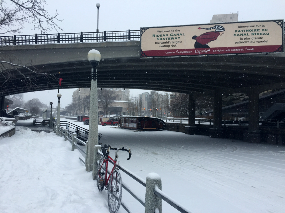
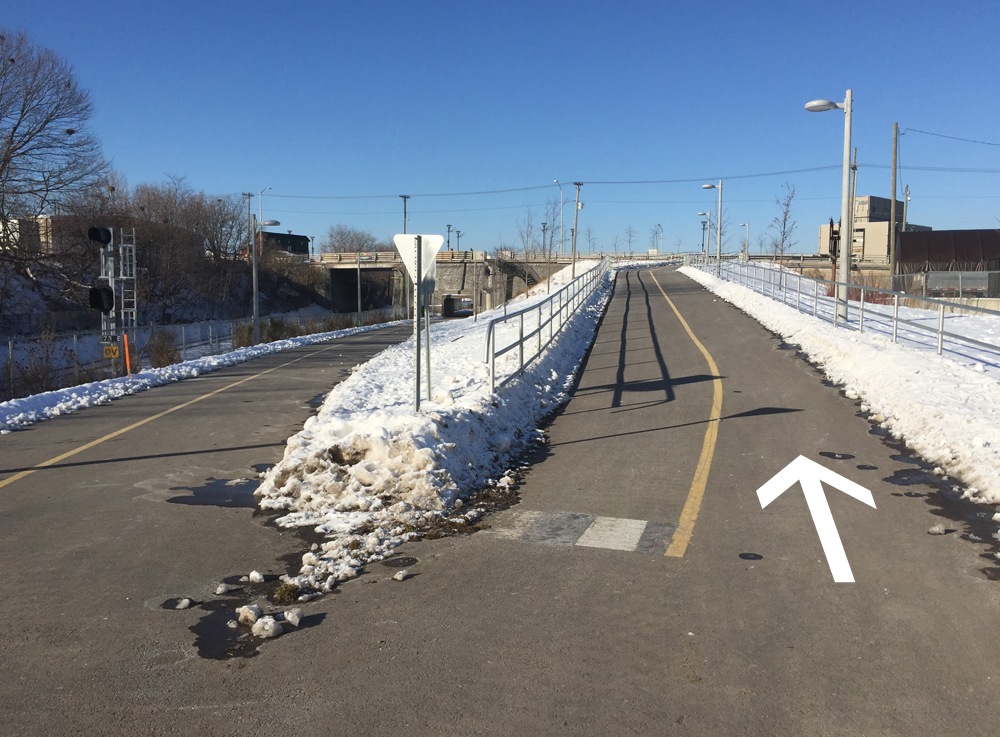
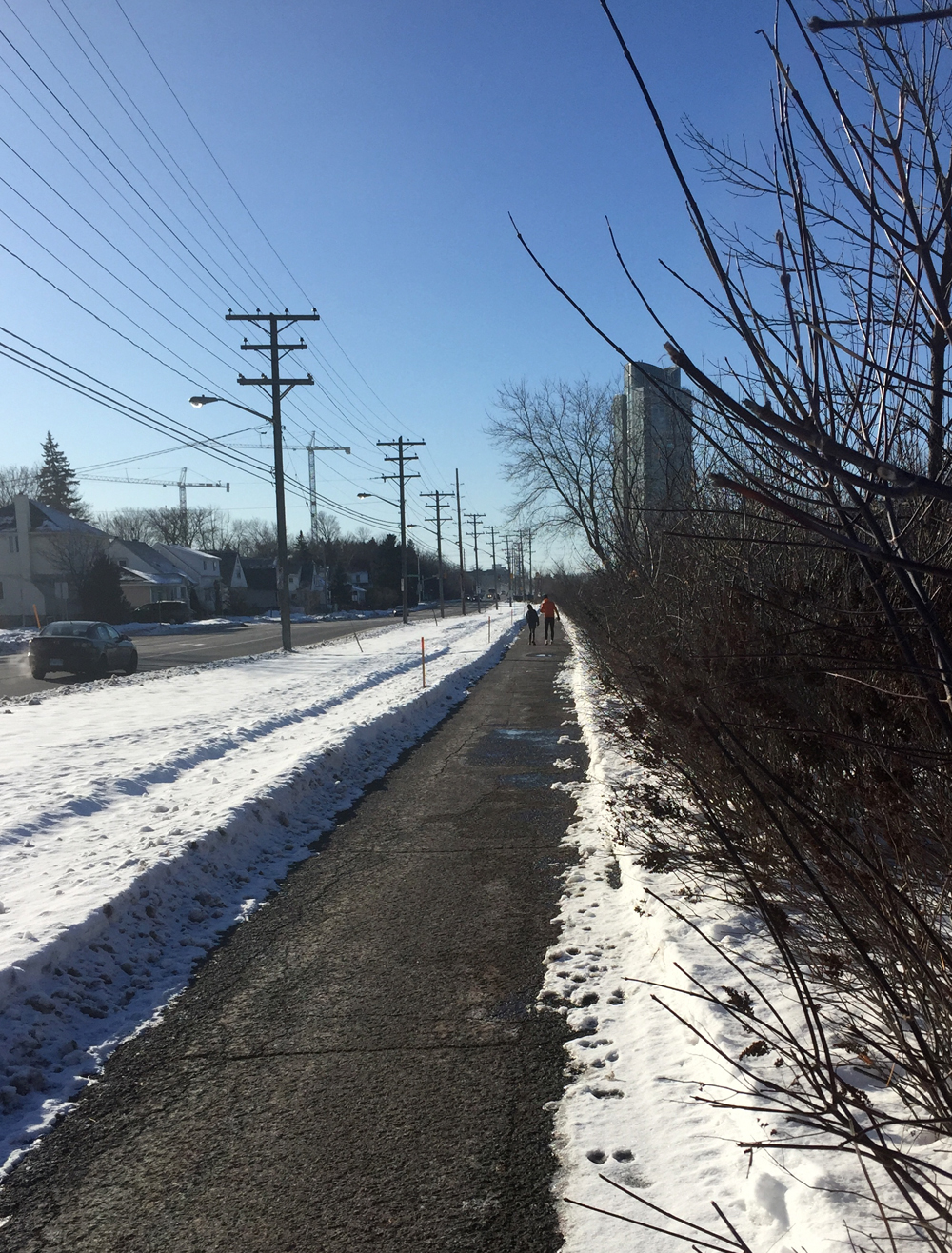
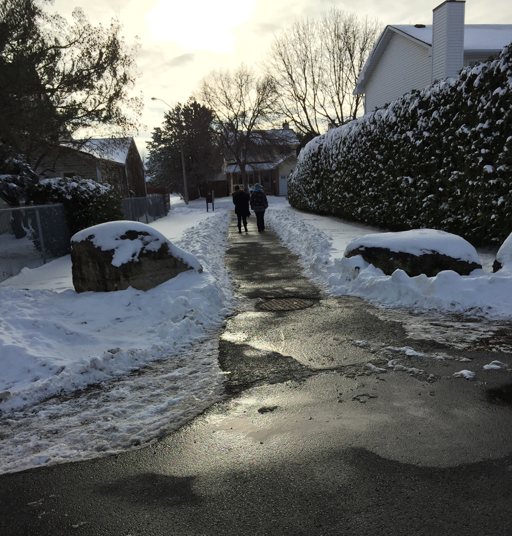
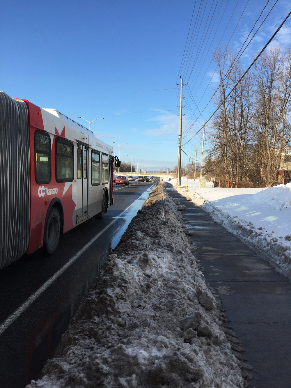
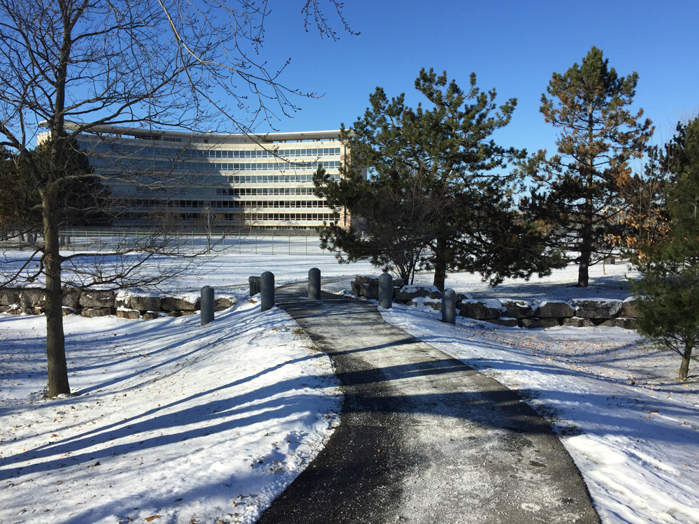
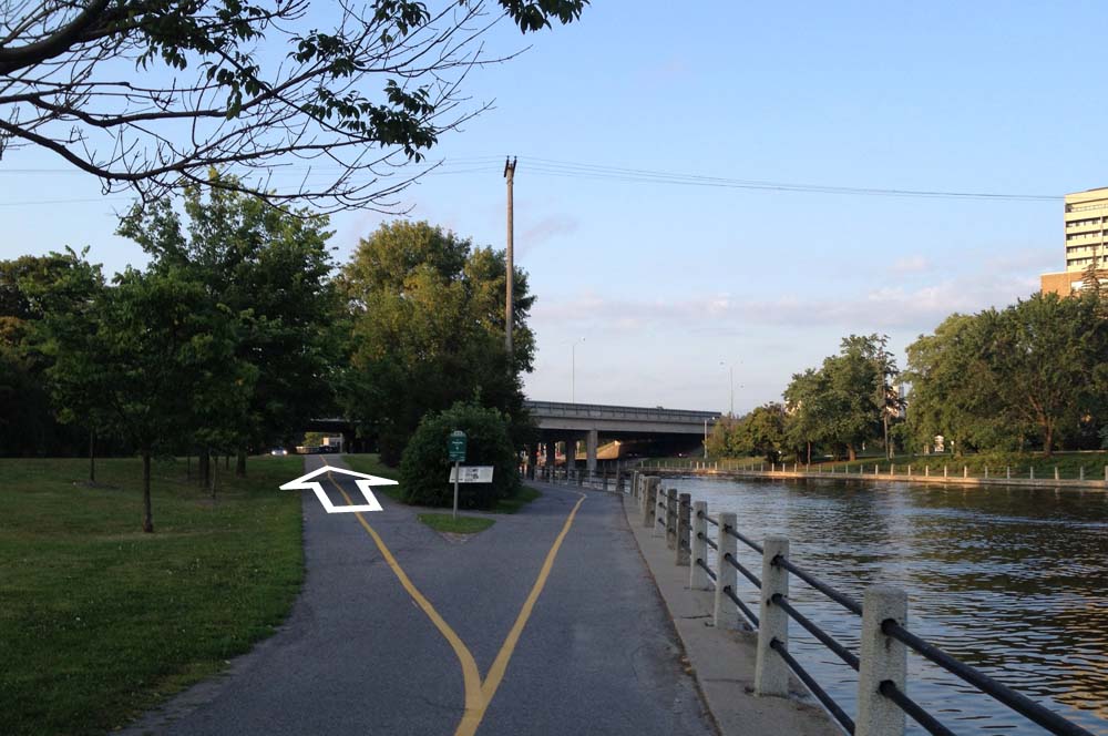
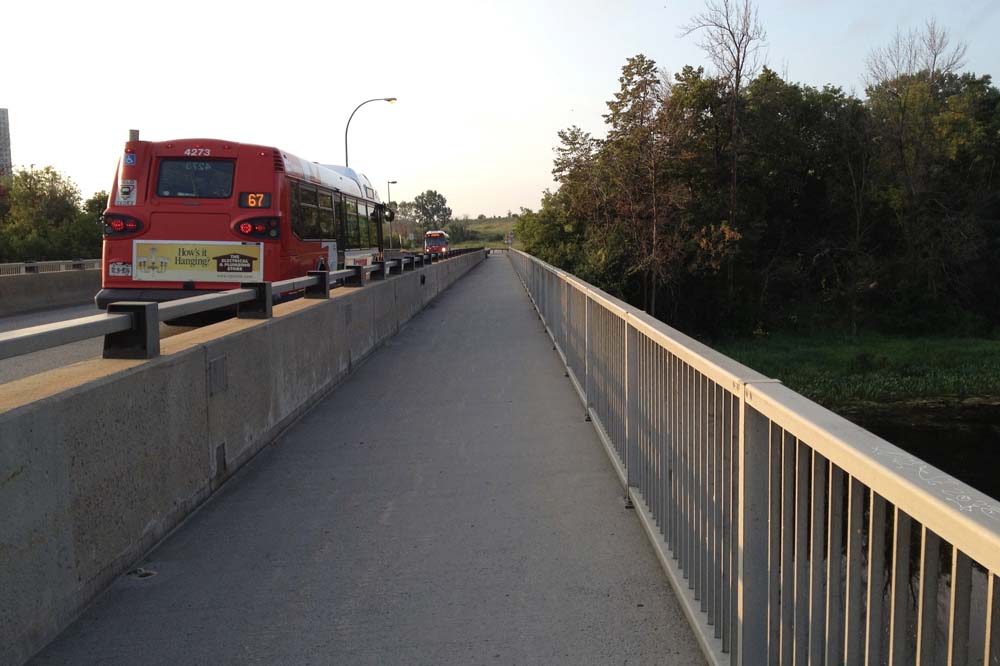
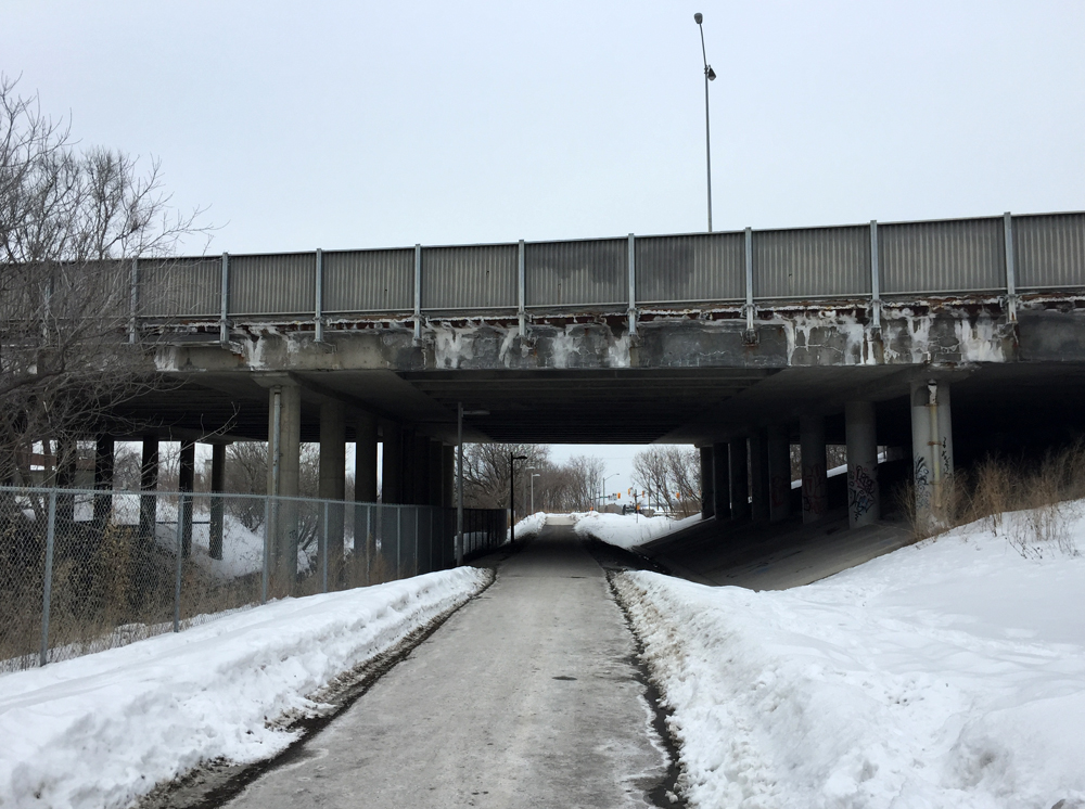
The O-Train Bikepath is fantastic. Whoever has been clearing and salting the path in a very timely manner all winter deserves the OVO-Safety-Scale Gold Medal!
OVO-Safety-Scale : 5/5

O-Train Path, from the north side of the Queensway
O-Train Path, from the south side of the Queensway

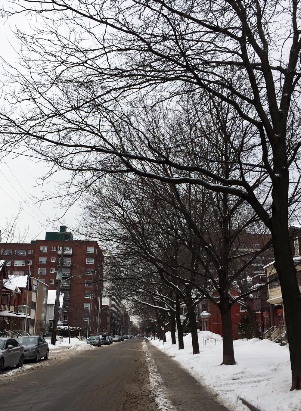
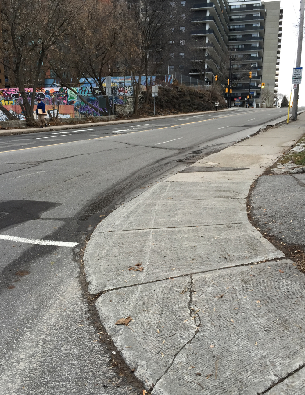
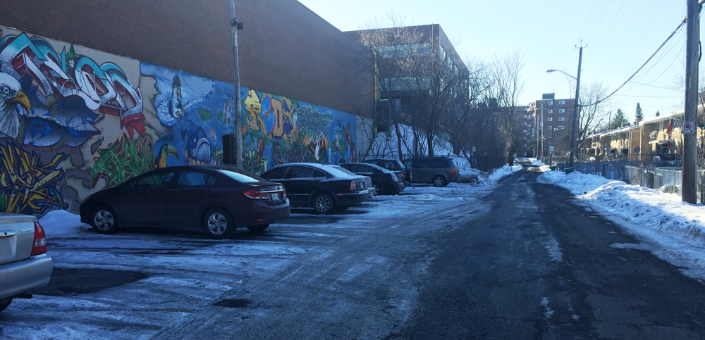
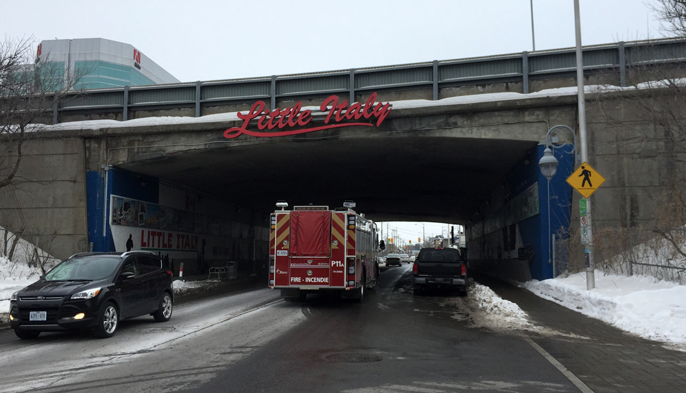
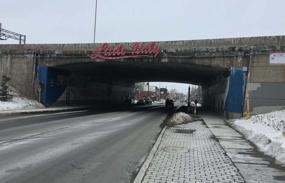
Preston Street is the only road bridge that embraces the notion humans pass under it. There are the Little Italy signs at the entrances to the tunnel, painted murals, some streetscaping, and park benches. There are ample sidewalks, but no bike infrastructure, and the only potential remaining bit of shoulder that might possibly be used for bike lanes is taken up by street parking. So it’s nice on a quiet Sunday morning, but not so safe during the rest of the week when it becomes a busy roadway with no infrastructure for cyclists.
OVO-Safety-Scale : 2/5

Preston St, from the north side of the Queensway
Preston St, from the south side of the Queensway

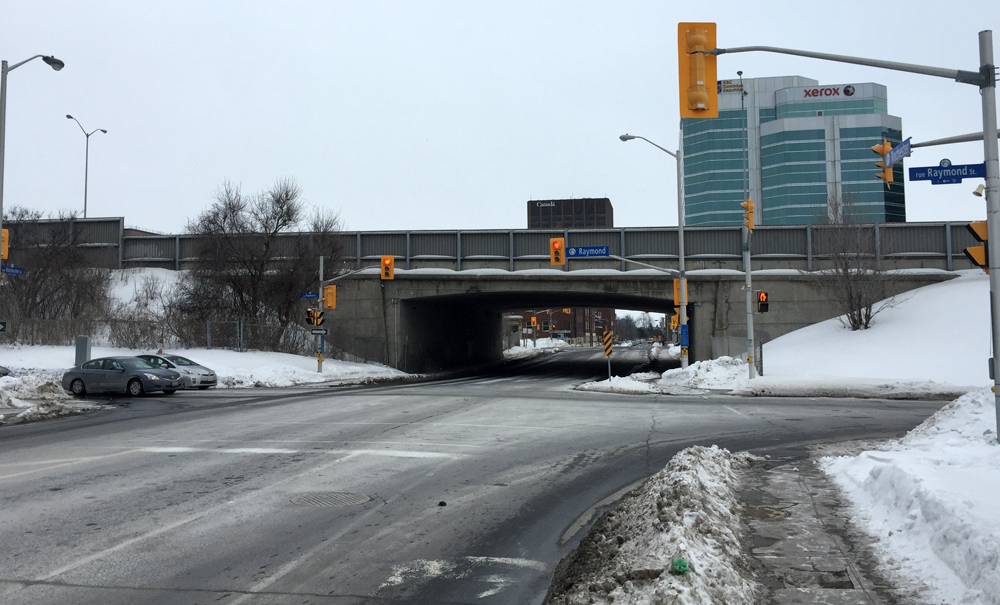
Rochester Street has some shoulder space, and there are lights at both ends for the Queensway on & off ramps, but speedy traffic makes it unsafe.
OVO-Safety-Scale : 2/5

Rochester St, from the north side of the Queensway
Rochester St, from the south side of the Queensway

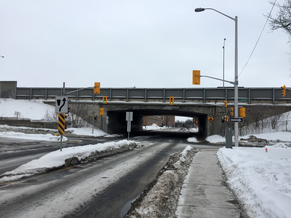
Booth Street is similar to Rochester but because it is a block away from the on and off ramps it seems less frantic. There is also some shoulder room heading under the bridge. On the north side a meridian has recently been added, which must help with traffic calming, but it takes away any room for cyclists. Heading south, one is nudged on to the sidewalk.
OVO-Safety-Scale : 3/5

Booth St, from the north side of the Queensway
Booth St, from the south side of the Queensway

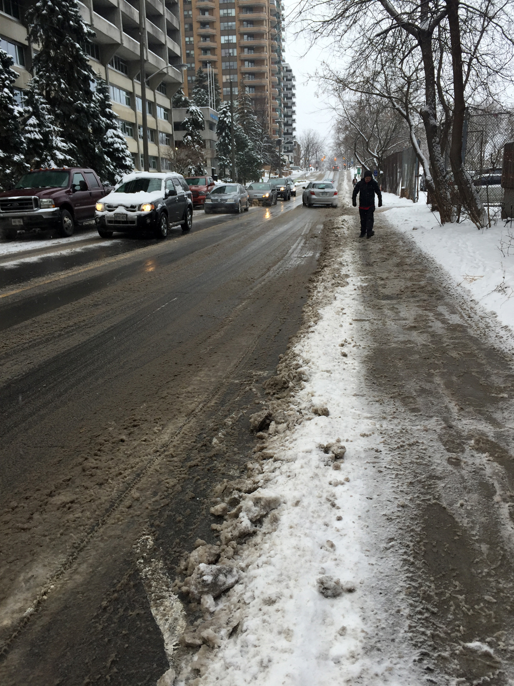
Bronson Street heading under the Queensway is one of the most dangerous stretches to ride along in the city. It’s always filled with busy traffic, even on Sunday afternoons. It’s also dangerous for the many pedestrians with traffic rushing the lights to get across lanes heading on and off Queensway ramps.
OVO-Safety-Scale : 0/5

Bronson Ave, from the north side of the Queensway
Bronson Ave, from the south side of the Queensway

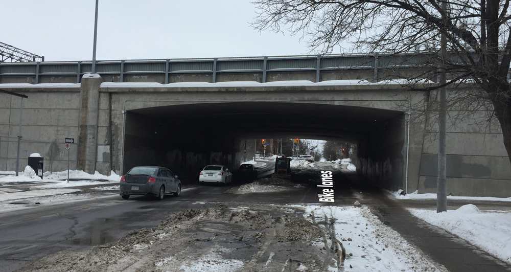
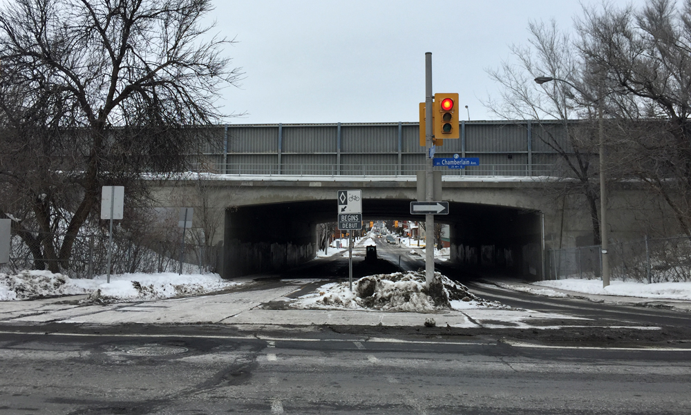
Percy Street has a nice wide two way bike lane and traffic lights at either end to get across Chamberlain St on the south side and Catherine on the north. I also believe it is destined to be cleared next winter, so in anticipation of that, it gets:
OVO-Safety-Scale : 5/5

Percy St, from the north side of the Queensway
Percy St, from the south side of the Queensway.jpg

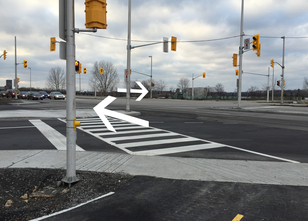
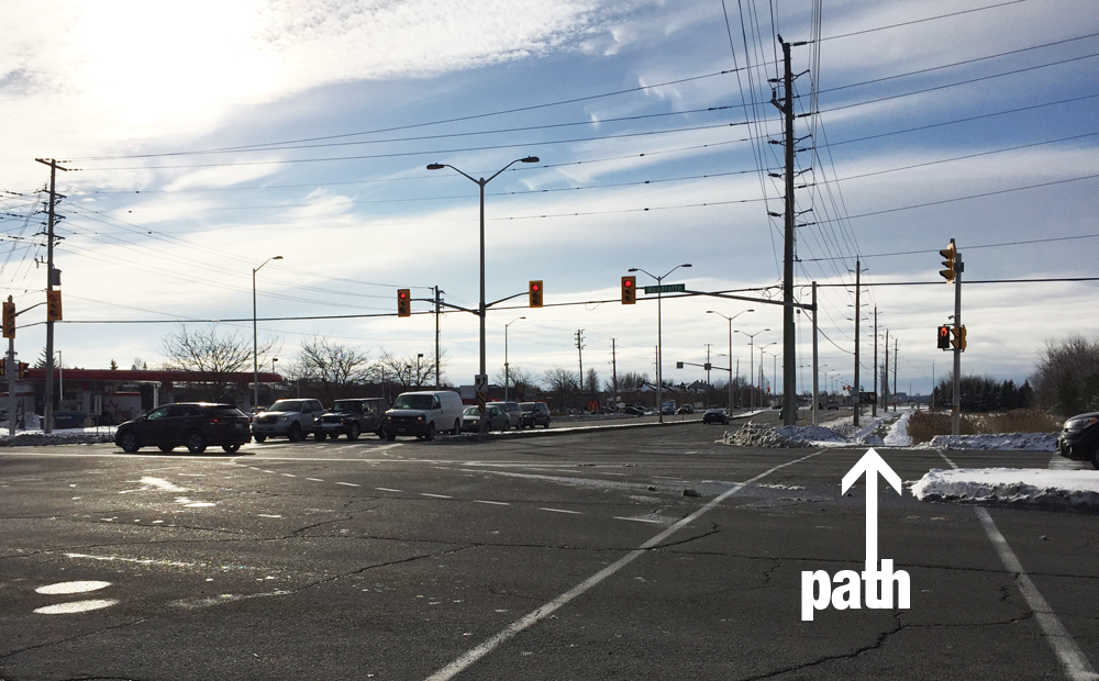
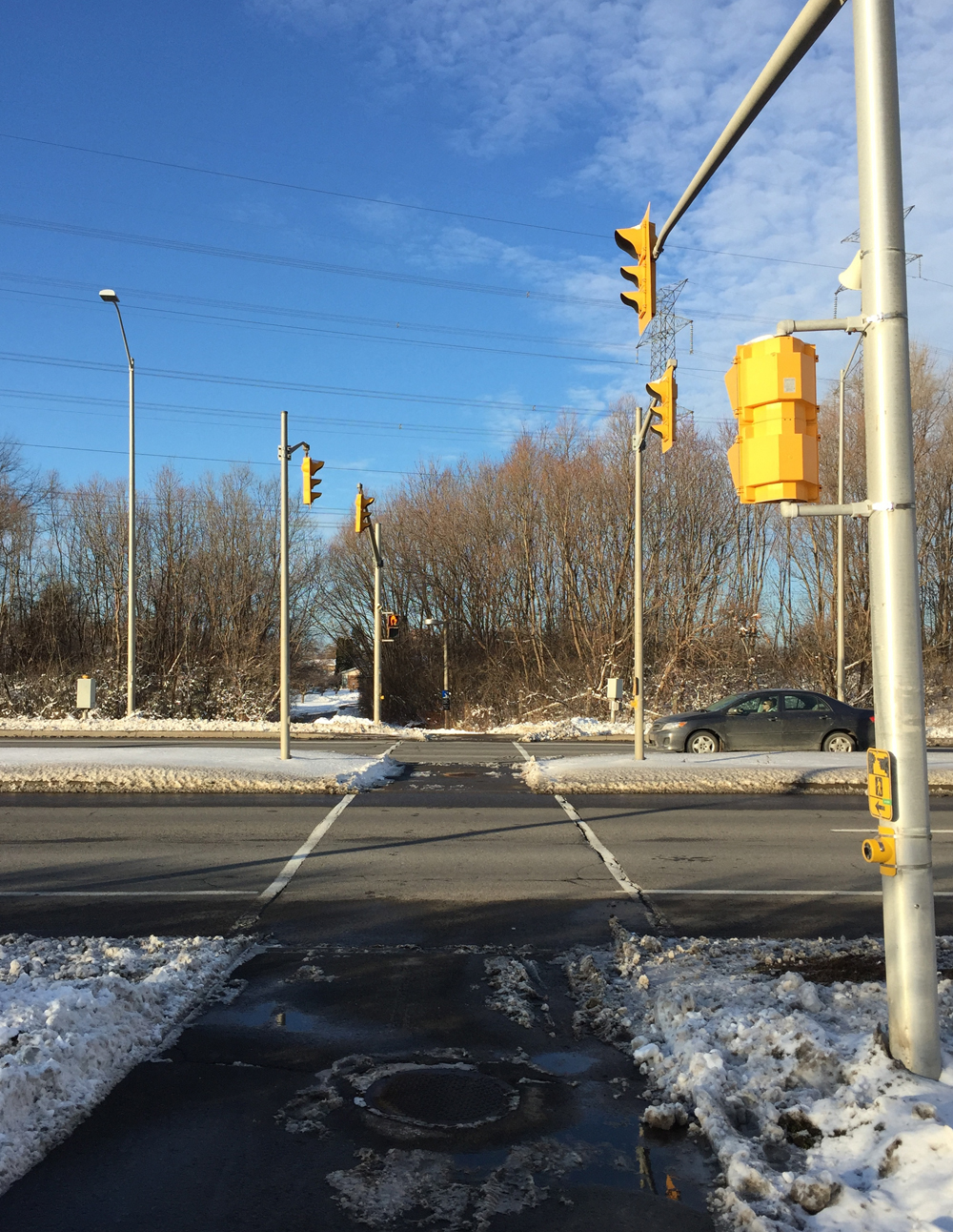
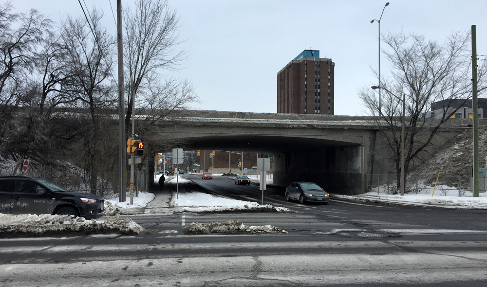
Bank Street is always busy. It really needs bike infrastructure as it’s an important link between residential communities and businesses on either side of the Queensway. The intersection at Catherine Street is particularly dangerous.
OVO-Safety-Scale : 1/5

Bank St, from the north side of the Queensway
Bank St, from the south side of the Queensway

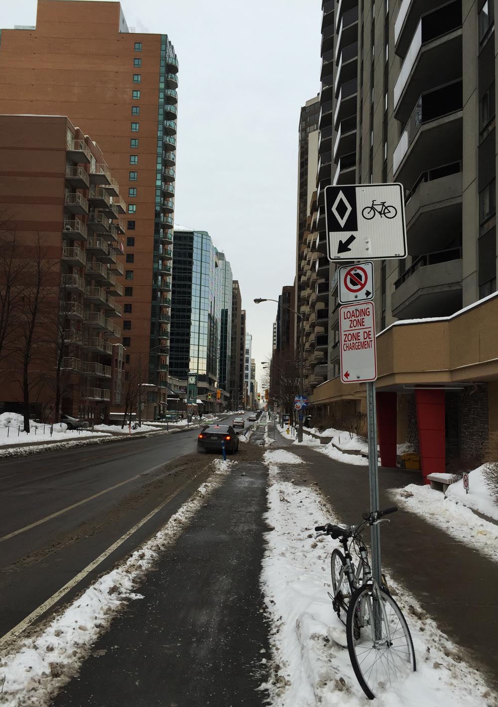
O’Connor St is a one way heading south. It has a summer bike lane heading in that direction under the bridge, but getting there from downtown is dangerous. O’Connor is a speed strip for drivers rushing out of downtown towards the Queensway. Without a protected segregated bike lane I could not recommend biking along O’Connor, or across Catherine and the Queensway on ramp. Under the bridge, in the summer, gets a 4/5 but getting there merits a 0/5. There’s no bike lane for those heading north.

O'Connor, from north side of Queensway
O’Connor, from north side of Queensway
O'Connor, from the south side of the Queensway
O’Connor, from the south side of the Queensway

Et voila. Lot’s of room for improvement. The consultants are welcoming comments until March 13th.
comments sheet

Biking Over the New Coventry Pedestrian and Cycling Bridge

The Coventry Pedestrian and Cycling Bridge over the Queensway links the Ottawa train station to a semi-professional baseball stadium, but more importantly facilitates a traverse across the Queensway highway, the most predominant north/south barrier that stretches the width of the city. The following video captures the hasty termination of the oficial launch as it quickly wound down due to cold weather (-14ºC not including wind chill) I filmed the following traverse heading north over the bridge, and down the ramp on the other side to the edge of the stadium.

The following map describes my ride to the event from Centretown (blue line) and back (purple line). The blue cyclist emoji is where the momentous occasion unfolded.

Et voila!

DCIM100GOPRO

Biking to and Skiing Through the Arboretum : Version 2

Ottawa is very fortunate to have a wonderful arboretum quite close to Centretown, located between the Rideau Canal to the east and Prince of Wales Drive to the west. A four kilometre machine groomed cross-country ski trail that runs through it has recently been prepared for the annual Winterlude Triathlon. Normally the breaking in of ski trails is left to intrepid skiers, as described in my first post on Biking to and Skiing Through the Arboretum. This modus operandi will most likely return once the next significant snow fall occurs, however until then it is definitely worth taking advantage of the groomed trail, identified by the purple line on the map below. Accessing the arboretum from the edge of Dows Lake is a fine way to get to the trail. The blue line on the map is a suggested bike route to get there from Centretown. Here’s how it goes.

Our adventure begins near the corner of Somerset and Cambridge. I bundled my skis and poles into a ski bag, strapped them to the side of my hiking backpack, and headed out.

Heading out!
And we’re off!

I rode along quiet streets towards Dow’s Lake, crossing busy Gladstone at the traffic lights at Arthur Street. On the opposite side of Gladstone I continued down Arthur Lane.

View across Gladstone to Arthur Lane

To get beyond the Queensway I turned on to Booth Street from Arlington. As Booth is one of the few roads that goes under the Queensway it can get busy, particularly during the week. A meridian has recently been added to the middle of the road along Booth just north of the Queensway underpass, narrowing the lane at this pinch point. If traffic is heavy I may choose to take to the sidewalk along Booth between Arlington to Raymond Street. This Sunday it wasn’t so bad. Booth Street widens once again beyond the intersection at Raymond as it heads under the Queensway.

SQUEEZE! - Pinch point, intersection at Booth & Raymond
SQUEEZE! – Pinch point, intersection at Booth & Raymond

At the north end of Booth there are traffic lights to help get across busy Carling Avenue. On the other side of Carling there is a plowed path that cuts through Commissioner’s Park to the Queen Elizabeth Driveway.

Access to path through Commissioner's Park on the other side of Carling
Access to path through Commissioner’s Park on the other side of Carling

There aren’t any traffic signals to help get across the Driveway to the Rideau Canal Western Pathway so watch out as drivers tend to speed along this stretch. It’s a much calmer crossing on Winterlude weekends when they close the Driveway for all vehicles except OC Transpo shuttle buses.
I then rode along the Rideau Canal Western Pathway, which is cleared throughout the winter, to the Dow’s Lake Pavilion.

Rideau Canal Western Pathway towards the Dows Lake Pavilion

To get to the groomed ski trail I took the well travelled path just to the right of the Dow’s Lake service ramp. If this path proves to be inaccessible by bike, I would lock my bike to a post or canal railing near the pavilion and ski in from this location, however on this occaision I had no difficulty getting through.

Trail to the right of Dow's Lake access ramp......that continues past the canons
Trail to the right of Dow’s Lake access ramp……that continues past the canons

I then locked my bike to this sign post a short distance further along the path, right where the groomed trail passes by. I’ve found this to be a fine spot to access the Arboretum to go skiing, even without a machine groomed trail as most often another skier has already arrived ahead of me, although early one morning after a big snowfall my daughter and I took the lead and broke trail, which can be exciting too.

Trailhead
Trailhead

The trail winds through the arboretum like so.

Trail through Arboretum
Trail

One of the joys of the arboretum in the winter is seeing the varied mix of users, making it a veritable winter playground. On a typical outing one may expect to come across snow shoers, skiers, tobogganers, skaters along the canal, fellow cyclists and dog walkers.

Happy trails!
Happy trails!

UPDATE– February 2nd: It snowed a few centimetres last night, making the trail less groomed but discernible. Someone had ridden a Fat Bike along the packed skate ski portion of the trail which must have been fun. Portions of the trail run along paths popular with dog walkers, but the classic ski tracks are off to the side. I hope to revisit the route throughout the winter. Definitely worth it.

Arboretum trail

Citizens for Safe Cycling 4th Annual Family Winter Cycling Parade : The Route

The Fourth Annual Citizens for Safe Cycling Family Winter Parade takes place on Sunday, January 25th starting at 11am. This year’s route follows a 4km elongated east-west loop through Centretown, beginning and ending at the south entrance to City Hall. Here’s how it goes.

Ottawa City Hall south entrance

Riders will head south on Cartier Street for a short block before turning left onto Cooper Street. Cooper is a one way that curves south just before it reaches Queen Elizabeth Drive and becomes The Driveway. There’s a stop sign where The Driveway meets Somerset Street. Traffic on Somerset doesn’t have a stop, so crossing Somerset requires a gap in traffic. I’ve hi-lited on the map where this occurs at other intersections along the route. Gaps in traffic were frequent and generous at all intersections on the two wintry Sunday mornings I tested out the route at 11am.

Just beyond Somerset the route veers right on to MacLaren Street. MacLaren is a calm one way heading west through Centretown.

MacLaren Street
MacLaren Street

There is a potpourri of interesting architectural styles to be seen along MacLaren, like this well preserved home built for lumber baron JR Booth in 1909 at the corner of Metcalfe & MacLaren.

Booth residence
Booth residence

Or this assortment of styles from various decades throughout the history of Centretown.

Architecture along MacLaren St

The parade will then turn north onto Bay Street beside Dundonald Park. There is a bike lane along Bay Street that unfortunately isn’t cleared in the winter, but it is a quiet street on Sunday mornings in January.

Bay Street
Bay Street

The tour will then turn right onto the Laurier Street Bike Lane which IS cleared and salted throughout the winter.

Laurier Bike Lane
Laurier Bike Lane

After crossing Elgin Street the parade will turn onto the plaza on the north side of City Hall.

North side of City Hall

Riders will then follow the short path on the west side of City Hall to complete the loop.

Path beside City Hall
FINISH/ARRIVÉE
FINISH/ARRIVÉE

POST EVENT UPDATE: It was a big success! Around 50 riders showed up. A thorough description of the event can be found on the Citizens For Safe Cycling website by clicking here.

The 4th Annual Winter Bike Parade! - Photo : Hans Moor
The 4th Annual Winter Bike Parade! (Photo : Hans Moor)

Biking to the Rideau Canal Skateway from Centretown

One of Ottawa’s finest winter assets is the the Rideau Canal Skateway. Walking there from most parts of Centretown is pretty good, but if you live on the western edge of the ward it may be more convenient to go by bike. Here’s how.

If your starting point is west of Bronson, find your way to Arthur street and head north (see blue line on the following map). There’s a traffic light to help get across busy Somerset. Turn right on Primrose, then left on Cambridge, which veers right and becomes Laurier. On the other side of the lights at the intersection of Laurier and Bronson is the start of the Laurier Bike Lane heading east, which is cleared and salted throughout the winter.

Laurier Bike Lane
Laurier Bike Lane

If you are starting on the east side of Bronson, the safest road to follow to the Laurier Bike Lane is Bay Street, a one way heading north. It has a bike lane that is not cleared in the winter, but sections of it are often partially visible, depending on the amount of snow.

I follow the Laurier Bike Lane all the way to the plaza at City Hall, just east of Elgin Street. I then cross Laurier at the crosswalk in front of the plaza and cut through Confederation Park where there are stairs down to the canal skateway. You can lock your bike to the steel tube railing that runs pretty much the length of the canal.

Rideau Canal Access point at Confederation Park

The canal is void of skaters in the above photo because this section hadn’t opened yet, however when it is good-to-go it tends to be very busy, especially on weekends or during Winterlude, so I often prefer accessing the canal at the end of Somerset street. To do so, I cut through the plaza and around City Hall (purple line on above map). I then follow quiet side streets and cross Queen Elizabeth Drive at Somerset where there is a crosswalk to the canal pathway. There are some cleared stairs that bring you down to the ice, just to the right of the pedestrian bridge over the canal, like so.

Access to skate way at the end of Somerset St

The paths along either side of the canal are cleared, so you can bike to to most of the many access stairs.

On the way back I followed the canal path to and through Confederation Park (green line on map).

Path through Confederation park

This brought me to the corner of Elgin and Laurier, and back on the Laurier Bike lane heading west. The segregated & cleared portion unfortunately ends at Bay Street. There is a narrow non-segregated bike lane but it isn’t cleared. Laurier is a busy street. If the lane is full of snow I take to the sidewalk.

Laurier west of Lyon

If you are staying on the east side of Bronson, the best street to take south is Percy. It too has a bike lane, but similar to the one on Bay, it isn’t cleared in the winter. I live west of Bronson, so I continue straight along Laurier and cross at the traffic lights at Bronson.

Et voila – happy skating!

Carla on opening day, 2015

Multi-use path along the new extension of Preston Street : A winter bike access to the Canadian War Museum

UPDATE 2017 – This extension is now out of commission as it was only temporary until the Booth Street Bridge was completed. Unfortunately the Booth Strret Bridge has awful bike infrastructure. Promises have been made to improve them.

Preston Street has been extended between Albert Street and the Sir John A Macdonald (SJAM) Parkway. That’s because Booth Street north of Albert will be closed for two years while they build the Light Rail Transit. The new extension of Preston includes a multi-use path which will provide winter bike access to the Canadian War Museum. This is an improvement as the section of Booth it is replacing was treacherous to ride along even in the best of snowless conditions. Because this shared pathway also provides pedestrian access to bus stops along it’s length, I am confident it will be cleared all winter (to be confirmed after the next big snowfall). Today I went and tried it out. Blue line is my ride there, orange line is the way I should have gone to get to the start of the extension, and purple line is the way I rode back to access the Laurier Bike Lane.

I approached from the south along Preston starting at Primrose Avenue. I chose Preston because Albert is very dangerous to cross or ride along and there are traffic lights where Preston and Albert intersect. Preston has always been a busy street and promises to become more so now that it is a main north/south artery towards the Chaudière Bridge over to Gatineau. Apart from the new extension, there are no bike lanes along the length of Preston, which in the winter becomes even narrower with the snow, so I took to the sidewalk for the block between Primrose and Albert. In retrospect I should have taken the cleared O-train path under Albert and accessed the sidewalk on the north side of Albert, as suggested by the orange line on the above map. There’s a short section of sidewalk to follow heading east before it joins the path that runs along the north side of Albert.

Preston between Primrose and Albert
Preston at the start of the new extension
The new extension and multi-use path begins on the north side of Albert.
Weaving behind the bus stops
The paths weave behind bus shelters located along the path.
Section of path parallel to the road
Where it runs adjacent to the road, the path is separated from the traffic with low concrete curbing and attached fiberglass tabs

Getting across the SJAM Parkway intersection to the museum first requires crossing to the west side of Preston. The SJAM consists of multiple lanes of speeding traffic, and Preston has a large merging turn on to SJAM. This creates the type of intersection where drivers anxiously rush the light as they transition from one busy street to the other. I had to make eye contact with a driver before he halted suddenly and let me cross, even though there are multiple no-right-on-red signs.

Crossing the intersection at Preston and SJAM Parkway

Once arrived safely on the other side of SJAM I rode along the quiet service road to the entrance to the museum.

Entrance to the Canadian War Museum

On my return trip, after taking the new path back to Preston and Albert, I continued east along the path on the north side of Albert. It ends at the corner of Commissioners St and Albert. Plans are afoot to introduce multi-use path links between Albert and the Laurier Bike Lane, as described here. Until such time the best way to get to the Laurier Bike Lane is to push your bike up the side walk on the west side of Bronson. Unless traffic is very light, I suggest taking to the sidewalk not only because it’s a steep little hill up to Laurier, but cars really roar around the corner and up the hill, often clipping the edge of the sidewalk at the corner of Slater and Bronson.

Well worn corner of Bronson & Slater

Et voila!

Winter bike ride to the Bayshore Park Community Oven

Members of the community surrounding Bayshore Park came up with a great idea – to build a brick oven for people to come together and cook.  On Saturday I packed up some prepared bun dough and biked over to the park to attend one of their scheduled oven lightings, and it was fantastic.

The blue line on the map below describes the route I followed to get there. Purple lines are deviations I took on the way back.

Our adventure begins at the base of the hill leading up from the O-Train path to Somerset St, both of which are cleared of snow! If anyone needs a bike route to get to this starting point, send me your cross street and I would be pleased to figure it out.

Hill heading up from OTrain path to Somerset

I crossed Somerset and followed the cleared bike lane to the west side of the bridge. UPDATE: On January 5th this bike lane and the one on the opposite side of street were not cleared of snow, and it is uncertain when or if they will be plowed. When they aren’t cleared I take to the sidewalk, as cars tend to speed when heading up and over this bridge.

Over Somerset Bridge

The bike lane ends suddenly on the other side so I took the short set of stairs to the right, down to Breezehill Avenue.

Steps  down to Breezehill  from Somerset
Steps down to Breezehill from Somerset

I then wove my way along quiet streets through the Hintonburg and Wellington Village neighbourhoods, all the way to the intersection of Scott Street and Carleton Avenue where there are lights to safely cross speedy Scott Street. I then followed the cleared multi-use path that runs along the north side of Scott.

Multi-use path along Scott Street

The path continues to be cleared beyond Churchill where Scott ends, as far the parkway along the river. The path that runs along the south side of the parkway isn’t cleared, however there is a very well trampled desire-line path to Fraser Avenue that was easy to follow, especially with my studded front tire.

Trampled desire-line path over to Fraser Avenue

I biked up quiet Fraser and across Richmond road at the lights to access the multi-use path that runs between Richmond and Byron all the way to New Orchard Avenue.

Multi-use path between Byron and Richmond Road

I crossed back over to the north side of Richmond at New Orchard Avenue where there are traffic lights. The bike lane heading west along Richmond starts at New Orchard, however the level of snow clearing varied. Between New Orchard and the bridge it wasn’t great, however the lane heading over the bridge was cleared.

Bike lane before the bridge heading west along Richmond ..... and over the bridge
Bike lane before the bridge heading west along Richmond ….. and over the bridge

Once over the bridge I turned onto Regina Lane that runs parallel to Richmond for a short spell. There’s a great mural part way down the lane. More detailed photos of the work can be found here.

Regina Lane mural
Regina Lane mural

I continued along residential streets through the Lincoln Heights neighbourhood, and took advantage of a small opening in the fence along Greenview Avenue to access Farrow Street.

Opening in the fence along Greenview Avenue

UPDATE: March 2020 – they have paved this little link and it gets cleared.

Paved link from Greenview to Fallow

The final challenge was to get to Bayshore Drive without having to ride along busy Carling Avenue. This required following a couple of short, well traversed but not cleared, pedestrian paths between Kempster to Wylie avenue and Oakley to Birchdale avenue.

Path between Kempster and Wylie avenues

Then it was across Carling to Bayshore Drive, along Woodridge Crescent, and into Bayshore Park where sits the communal oven. When I arrived there were a whole bunch of wonderful people cooking and sharing an assortment of dishes. Tom, the head baker of the day cooked up the little buns I had prepared and they turned out perfect! Everyone was very pleased.

To know more about how the oven came to be check out this CBC interview with John McDougall the oven builder and Mete Pamir, one of the community organizers. They also have a Facebook page with more history.

Bayshore Park Community Oven
Success! Tom the baker, et  les petits pains maison!
Success! Tom the baker, et les petits pains maison!

Time to head home. On the return trip I couldn’t ride back along Regina Lane because it’s a one way heading west. Closer to Centretown, I avoided Breezehill because it’s hard to see cars coming when crossing Bayswater heading east, as the two streets meet on the inside of a curve. Crossing Somerset at the top of the Breezehill stairs to get to the bike lane heading east is a bit tricky as well, as it’s hard to see cars coming over the crest of the bridge.

Et voila!

Winter ride from Baseline&Clyde to Barrhaven

A fellow cyclist is in need of a winter bike commute route from Barrhaven to the corner of Merivale and Baseline. That’s because the bike path along Greenbank which he follows on his summer commute is full of snow. The green line on the map is his regular summer route. Here’s a description of a winter route I plotted and tested a couple of days after this season’s first big snow fall, identified by the blue line on the map. I started from Merivale & Baseline. The purple line is a slight variation I took on the return trip.

Our journey begins in the parking lot at the end of Granton Avenue that fronts onto Clyde. Granton is accessible via a short, well trodden path to the left of this photo.

looking west down Granton Ave

I wove my way along quiet residential streets to always-busy Meadowlands Drive. There isn’t a traffic light where Meadowlands intersects Sullivan Avenue, however there is a cross signal half a block east in front of the school which I took advantage of on my return trip as there was no let up in traffic. I also had to use the sidewalks along Meadowlands to get to and from the crosswalk.

View of Meadowlands signalled crosswalk in front of St Gregory School seen from Sullivan Ave.

I continued down Sullivan and turned west on Novice towards Woodroffe Avenue.

The biggest obstacle to commuters heading south of Ottawa are the two sets of east/west railway tracks. It’s a challenge to choose which of the minimal number of places to get across are the safest. On this route the crossing of the first set of tracks happens along the busy six lane Woodroffe underpass. There are bike lanes along Woodroffe, which were mostly cleared, except for one spot heading south where it suddenly was filled with snow for a short stretch. Up until that spot the sidewalk wasn’t cleared, but now it was, thus the snow in the bike lane. There are bus lanes beside the bike lanes and there weren’t any buses coming up behind me so I managed to bike around the short section of snow filled bike lane. If there were buses roaring up behind me I probably would have chosen the sidewalk.

Bike lane along Woodroffe. Cleared most of the way.... then filled for a short stretch.
Bike lane along Woodroffe. Cleared most of the way…. then filled for a short stretch.

I continued along the Woodroffe bike lane which was mostly cleared, however the crossing at Hunt Club Road was pretty treacherous with six lanes of impatient traffic meeting six other lanes of impatient traffic. I chose to avoid this intersection on the way back (see purple line on map) which I’ll describe in more detail further down the post. I’ve also been told by a local cyclist that the Woodroffe bike lane between Knoxdale and Hunt Club is often filled with snow due to the limited space between the road and the concrete sound barrier. The purple line detour avoids this as well.

Woodroffe bike lane heading south between Knoxdale and Huntclub
Woodroffe bike lane heading south between Knoxdale and Hunt Club

I was pleased to get off of Woodroffe at the entrance to the Nepean Sportsplex, and onto the CLEARED multi-use path that runs along the east side of Woodroffe all the way to Fallowfield Road. And it’s a pretty spectacular ride too. There’s a section that floats through a tall pine wooded area, while the rest is mostly farmland.

Path along Woodroffe through the woods

There’s a bit of an obstacle course where the path crosses the second set of tracks, but it’s very manageable and safe if navigated slowly.

Crossing train tracks along Woodroffe

I crossed at the intersection of Woodroffe and Fallowfield over to the cleared bike path that runs along the north side of Fallowfield to Via Park Place.

Towards path across  Woodroffe along Fallowfield.
Towards path across Woodroffe along Fallowfield.

At Via Park Place I crossed at the lights over to the very well cleared path that continues along Fallowfield before veering south alongside the Transitway and train tracks.

Path between new Barrhaven housing and the Transitway

I got off the path at Berrigan Drive and followed it across Greenbank Road. Greenbank is a busy street, and when there are signs warning drivers about a red light camera as you approach, one can imagine what a frantic intersection it promises to be. I didn’t find it too crazy or dangerous, but I did consider the sidewalk.

Crossing Greenbank Road
Approach to Greenbank Road

I then rode along Wessex and Exeter Road to the round-about at Jockvale Road. I was very pleased to notice a cleared path running along the south side of Jockvale Road, which I followed over the train tracks.

Cleared path along Jockvale Road

I was impressed to see Barrhaven United Church thriving on another form of heavenly energy – large sections of their roof are covered with solar panels.

Barrhaven United Church

Not far beyond the train tracks I turned off the path along this short cleared link that brought me to Pickwick Drive.

Path link to Pickwick Drive

I then wove my way along quiet residential streets to my final destination – the corner of Flanders St and Peacock Crescent, deep in the heart of Barrhaven.

Flanders St & Peacock Crescent, deep in the heart of Barrhaven
Flanders & Peacock

Now I had to get back before it got dark! Here’s a view of the farm along the Woodroffe path.

Farm along Woodroffe path

Here’s a description of the detour I took to avoid the crazy Woodroffe/Hunt Club intersection (purple line on the above map): I turned onto the path that runs parallel to the entrance to the Nepean Sportsplex.

On the left: view towards the north down Woodroffe Ave. ............On the right: the bike path heading in to the Nepean Sportsplex. I chose right.
On the left: Looking north along Woodroffe Ave. ………. On the right: The bike path heading in to the Nepean Sportsplex. I chose right.

The bike path ends at the edge of the parking lot. I biked through the expansive lot to the north/east corner where the path continues for a short distance to a signalized crosswalk that is MUCH more civilized than attempting to cross Hunt Club along Woodroffe.

Safe way to get across Hunt Club

I then rode along residential streets, popping out onto Woodroffe at Medhurst Drive. Once again the bike lanes were partially cleared. The sidewalk was completely cleared.

Woodroffe bike lane under the train tracks heading north

Once beyond the train tracks I turned off Woodroffe onto Norice, and retraced my route all the way back to the little path at the end of Granton Avenue that leads to the building at the corner of Baseline and Clyde. Ta-dah!

Path at the end of Granton Ave.

Winter bike route from The Glebe to the RA Centre

A friend was wondering whether there was a safe winter bike route from The Glebe to the RA Centre. There is, as per the map below, but it’s quite circuitous – sadly so, when you consider how physically close the two destinations are from each other. At the time of the RA’s conception, driving was the de facto mode of transpo and, by default, still is. As we wait for the powers-that-be to bring our city’s cycling infrastructure up to par, I suggest the following as the safest winter bike route to get there. I also recommend a studded front tire for winter riding.

Winter cycling along Bronson is to be avoided. I crossed Bronson at Fifth Ave where there are traffic lights.

Crossing Bronson at Fifth Ave

The other side of Bronson becomes a pleasant meander along Madawaska Drive to Commissioner’s Park which explodes with tulips come springtime. A minimal number of city paths are cleared throughout the winter which often forces one to rely on shared Desire Lines, i.e. trampled down paths popular with pedestrians regardless of whether plowers were instructed to clear them or not. I followed this one that cuts across the park to the edge of the Queen Elizabeth Driveway. This path is proportionally more trampled relative to the skate-ability of the canal.

Path through Commissioner's Park at the end of Madawaska to Queen Elizabeth Drive
Path through Commissioner’s Park at the end of Madawaska to Queen Elizabeth Drive

On the other side of the driveway I rode a short distance along the plowed-and-salted Rideau Canal Western Pathway to Preston Street. I crossed at the lights to the usually cleared bike lane along Prince of Wales and followed it for a short distance to the lights at the entrance to the Arboretum, just over the O-Train tracks.. If biking along Prince of Wales seems (understandably) spooky, the sidewalk between Preston and the entrance to the Arboretum is clear, and usually empty. UPDATE – 2019: There is now a bi-directional bike lane from Preston Street almost all the way to the Arboretum. It ends just before going over the O-Train tracks.

Biking along Prince of Wales Drive between Preston St and the entrance to the Arboretum just over the train tracks

Once safely in the Arboretum I rode along the cleared/not salted path that ends at the bottom of the hill that officially isn’t to be used for toboganning.

Path from the north edge of the Arboretum

I then relied on some of winter cyclists best friends – dog walkers! The Arboretum is extremely popular with dog walkers who, within hours of a snow fall, recreate a network of well trampled paths. My destination was the canal locks across from Carleton University which can be traversed 12 months of the year. The paved path along the canal proper isn’t always trampled flat, however there is one that goes up through the Fletcher Wildlife Garden which hi-lites the beauty of Desire Lines. They exist where people want to go. In the winter, dog walkers park in the Fletcher Wildlife Garden parking lot. From there they work their way down through the arboretum, not along the official paved path that hugs the canal, but along the old service road that leads down from the parking lot.

Another reason I like to follow this route is the passion the Fletcher Wildlife Garden maintenance crew has for this microcosm of varied natural environments. Around every corner along the myriad of intimate paths they have created initiatives that engage visitors to the subtleties of the surrounding natural environment, like this insect hotel.

Insect Hotel
Insect Hotel

I crossed at the locks and followed the Rideau Canal Eastern Pathway, which is cleared-&-sanded, all the way to Hogs Back.

Path to Hogs Back
Path to Hogs Back

The path up and over the falls is salted as well, as is the path along Hog’s Back Road to Riverside Drive.
UPDATE – 2019: A new bi-directional bike lane has been added to the south side of Brookfield Road from Riverside Drive to the round-about making it much safer.

Brook filed Road looking east with the new bi-directional bike path introduced in 2019

I then crossed at the roundabout over to the cleared & salted path that winds down beside the transit station and up to Heron Road. I then crossed at the lights at Heron, and continued along the equally cleared and salted path behind the Sir Leanord Tilley building.

Path beside the Tilley building

While driving to the airport I’ve often noticed two small pillbox shaped pavilions on either side of Bronson which I assumed to be some sort of utility stations, but are actually access points to an all-season pedestrian tunnel under Bronson. The wide circular stairwell has very shallow steps and ample room to either push or carry ones bike.

Pillbox shaped building - access to passageway under Bronson
Pillbox shaped building – access to passageway under Bronson
Bronson pedestrian underpass

Once on the east side of Bronson, I cut along the salted path towards the tall government buildings. UPDATE 2019 : Previously this route followed Data Centre Road down the hill towards Riverside Drive. This updated route now follows a cleared and salted path on the north side of the Canadian Revenue Agency building down to the parking lot of the RA Centre, as indicated on the above map. It’s safer (no cars) and more direct.

Concrete path along the north side of the Canadian Revenue Agency building that becomes an asphalt path that leads down to the RA Centre parking lot.
RA Centre
RA Centre

Et voila!

Biking to Hockey One, or Figure 8, From Centretown for Skate Sharpening

One of the finest places in the city to get your skates sharpened is at Figure 8, or Hockey One, on Industrial Avenue. They do a great job and keep track of how you like them done. Hockey season has started up for hundreds of kids around town and my sons skates needed sharpening. Blue line on the map is the bike route I took to get there from Centretown. Purple lines an alterations I took on my way back.

.
I rode along the Laurier Bike Lane which extends east of Elgin in front of the Provincial court house and City Hall.

Laurier Bike Lane extension
Laurier Bike Lane extension from Elgin St

There’s a short bike lane just beyond City Hall to the right along the exit from Laurier to the Queen Elizabeth Driveway, as shown in the photo below, however there’s a sign at the opposite end suggesting the lane is for cyclists riding towards oncoming traffic. All a bit confusing, so if you do take this bike lane watch out for cyclists heading your way along with cars exiting off Laurier. A safer bet would be to cut through the plaza in front of City Hall (See green line on above map that I followed on my winter ride, crossing the Driveway at Somerset). UPDATE – Summer 2018: There is presently a bi-directional multi-use path on the right side of this exit (not shown on the photo) making this exit much safer. 

Exit to the right off Laurier towards the canal

I rode along the canal, crossed over the pedestrian/bike bridge at the end of Somerset, and continued along the canal until I turned off at the exit up to Pretoria Bridge.

Turn off towards Pretoria Bridge

That took me to the intersection of Hawthorne Avenue and Colonel By, on the east side of the bridge. Things get a little tricky at this spot. If traffic is bad I recommend crossing to the opposite corner and walking your bike for a short distance along the sidewalk to where it veers left along Echo Drive, like so.

Making your way over to Echo Drive

I then turned down the first street on the left which is Graham Avenue. It has a bike lane.

Graham Ave
Graham Ave

Graham ends at Main Street, and continues as Lees Avenue across the intersection. There is a bike lane along Lees heading east, but it doesn’t start for a hundred yards or so east of Main. Depending on the amount of traffic, it may be safest to walk your bike along the sidewalk to where the bike lane starts. UPDATE – Summer 2018: The east bound bike lane now starts at Main St.

Lees Avenue bike lane

The Lees bike lane abruptly ends at Chestnut Street. Drivers always speed along Lees Avenue. Without a bike lane it’s extremely dangerous. The ‘Share the Road’ sign partially obstructed by trees does nothing to alleviate this danger. I turned right onto Chestnut. UPDATE – Summer 2018: The east bound bike lane now extends to the bridge over the Queensway.

UPDATE January 8: Bike lane wasn’t cleared so I took the first opportunity to get off Lees and turned on to Rosemere Avenue.

Corner of Lees & Chestnut where the Lees bike path ends

This took me to Springhurst Ave where I turned left and followed it to the path that brought me to the Rideau River Nature Trail.

Path at the end of Springhurst

UPDATE – January 8: The Rideau River Nature Trail is not cleared in the winter, but it is packed down by pedestrians. I managed to ride along the path for half the distance and pushed my bike the rest of the way. A day or more without a snowfall and it most likely would be entirely bikeable.

Rideau River Nature Trail in the winter

I took the path along the transitway bridge over the river, like so.

Bridge over the Rideau River

I continued past the OC Transpo hub to the intersection at Riverside Drive. I won’t deny this is a spooky major intersection, however don’t let it intimidate you. There are usually many other pedestrians and cyclists crossing at this spot and the path does continue on the other side of Riverside Drive along Industrial Avenue.

Path continues in the distance on the other side of Riverside Drive

Hockey One / Figure 8 is a bit further down Industrial Avenue, however the bike path veers away diagonally at Alta Vista Drive. True to it’s name, Industrial avenue has industrial quantities of cars and trucks desperately jockeying amongst themselves for lane position, so I followed the path off to the righ at the south east corner of Alta Vista and Industrial, and circled back behind Hockey one via neighbourhood Way. This adds just a few seconds to the ride and is definitely worth the safety factor.

Bike path turn off at Industrial and Alta Vista

Et voila!

UPDATE: Fall 2015 – They have installed a bike rack just to the right of the front door under the overhang and told me they would leave it there throughout the year. A fine and encouraging initiative.

Hockey One

On the way back, rather than get back on to Lees, which hasn’t any bike lane heading west, I rode up Evelyn Avenue where I crossed Main. I then cut through the school parking lot to Graham Avenue.