Many Canadians are drawn to the November 11th Remembrance Day Ceremonies held at the National War Memorial to pay tribute to those who have fought and given their lives in the service of our great country. The following is a commemorative bike tour starting from the National War Memorial, with visits to a number of lesser known Canadian War Memorials throughout the capital, and ending at the National Military Cemetery.
.
The National War Memorial was unveiled in 1939 to commemorate those who served in the armed forces during World War !. It has since come to symbolize the sacrifice of all Canadian Armed Forces in times of war.
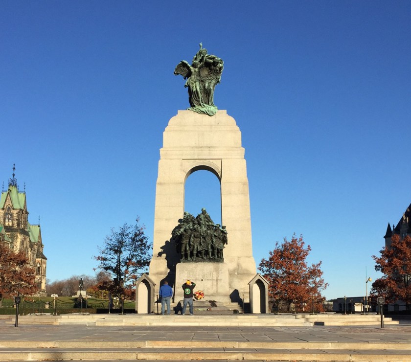
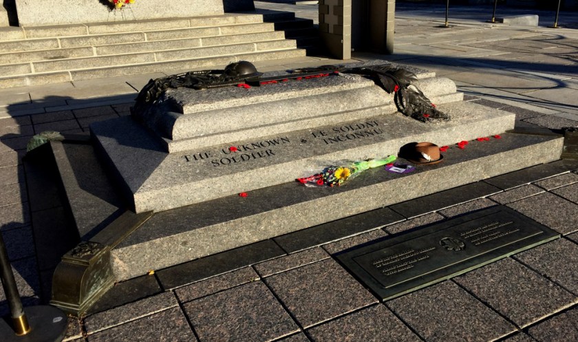
Immediately in front of the Memorial is the Tomb of the Unknown Soldier. It contains the remains of an unidentified Canadian soldier who died near Vimy Ridge during the First World War. This tomb represents the many Canadian soldiers who have no known grave.
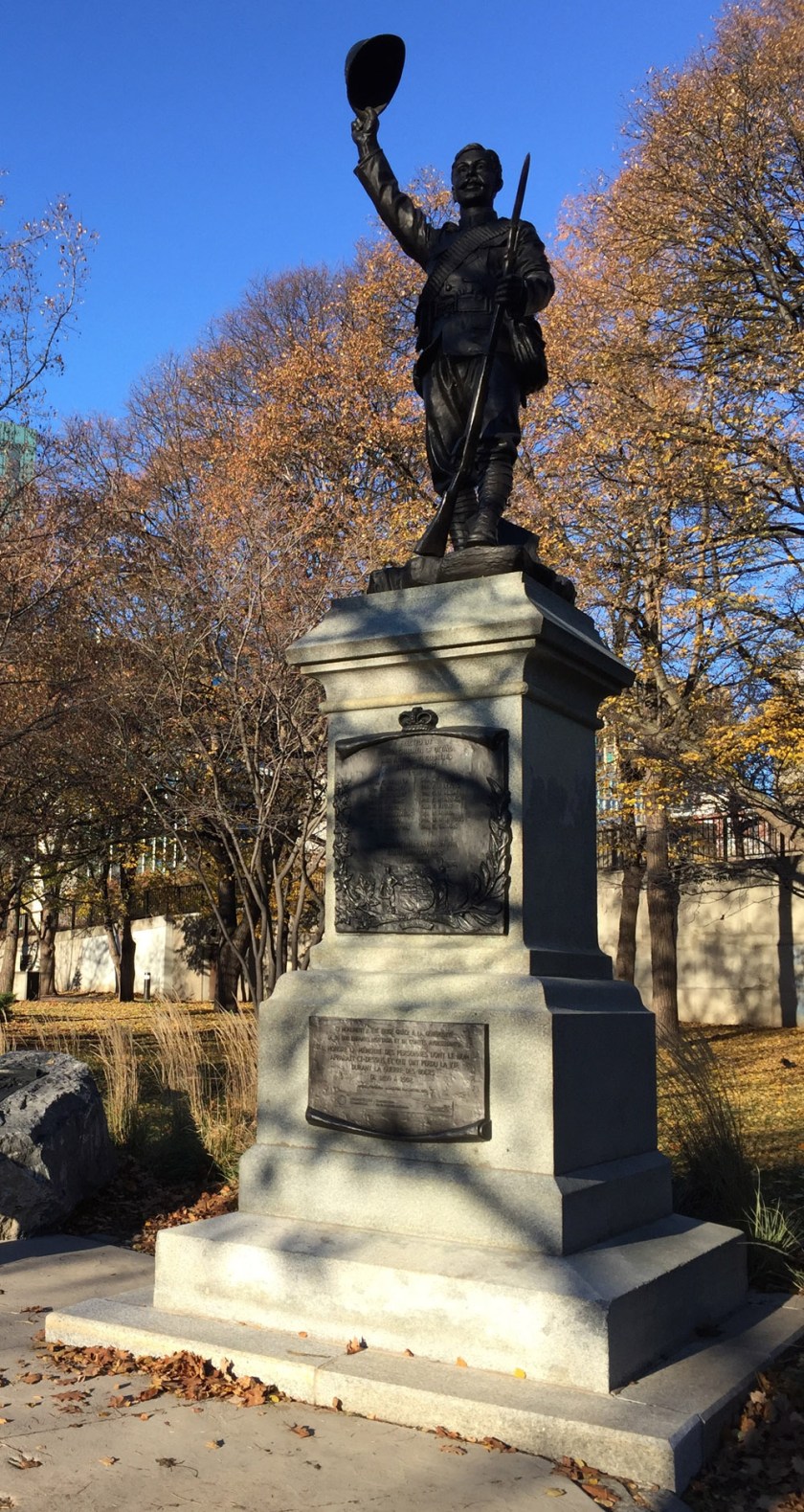
Leaving the War Memorial, Head down along the edge of the Rideau Canal beside the National Arts Centre to Confederation Park where the South African War Memorial is located.
Continue through the park to Elgin Street where one can see the National Aboriginal Veterans Monument.

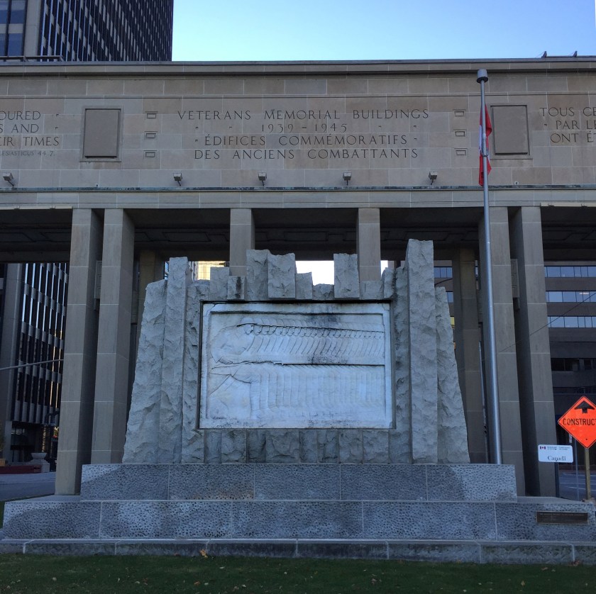
The tour crosses Elgin street and follows the Laurier Bike Lane heading west before turning north along the Bay St bike lane. After crossing Wellington at the northern end of Bay, head east for one block to Lyon St. There is a gravel path through the park just to the east of the National Archives building that leads to Lyon. Looking across Wellington up Lyon Street, one sees the Veteran Memorial Buildings . Beneath the arch connection the two buildings across Lyon St there is a stone relief carving by Ivan Mestvovic in honour of those who fought in the First World War.
The tour continues west along Wellington which has a bike lane beginning at Lyon St. This bike lane continues across the Portage Bridge. Just before heading over the Ottawa River there is a path off to the right that leads down to the waters edge and the Royal Canadian Navy Monument.
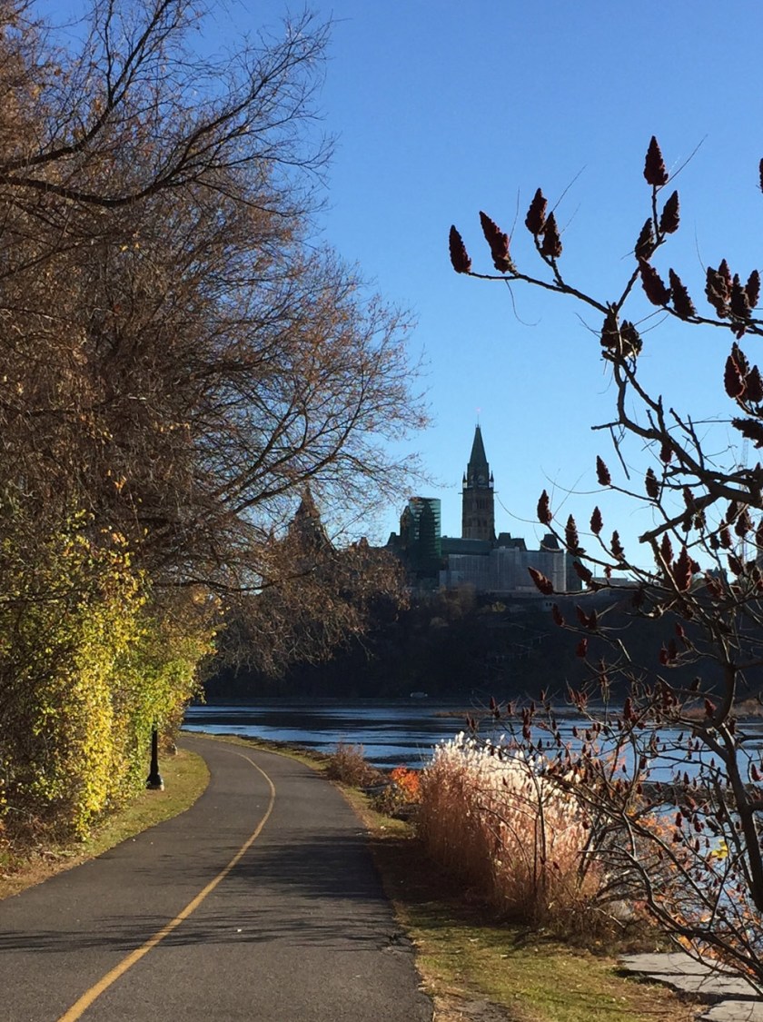
Head back up and over the Portage Bridge, then east along the Voyageurs Pathway that hugs the shore of the Ottawa River. One of the finest views of Parliament Hill can be seen from this section of path. The Memorial Chamber is located inside the Peace Tower. it contains the Books of Remembrance, recording every Canadian killed in service from Canada’s first overseas campaign, the Nile Expedition, to the present.
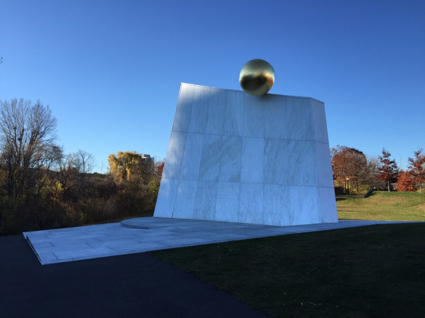
The tour heads back over the Ottawa River over the Alexandra Bridge. The Peacekeeping Monument, dedicated to Canadians who have served as peacekeepers around the world, is located on a traffic island along Sussex Drive between the national Gallery and the American Embassy.

The next section of the tour continues north along Sussex Drive which has a bike lane. The Defence of Hong Kong Memorial is located at the corner of Sussex and King Edward Avenue. This Memorial is dedicated to those Canadian Soldiers who served in the defence of Hong Kong during the Second World War.

Cross Sussex and follow the path overlooking the Rideau Falls. There are two memorials on Green Island located between the two sets of falls: The Commonwealth Air Forces Ottawa Memorial, and the Mackenzie-Papineau Battalion Memorial dedicated to Canadian volunteers of the Mackenzie–Papineau Battalion during the Spanish Civil War.


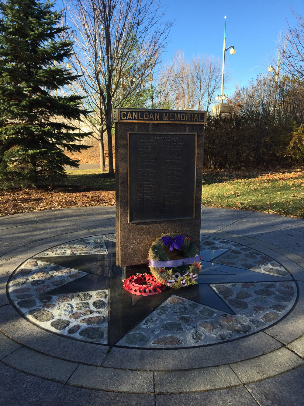
The tour continues along the path overlooking the second set of falls, then back across Sussex. On the opposite side of Sussex is the CANLOAN Monument, dedicated to Canadian soldiers who died while volunteering with the British army during the Second World War.
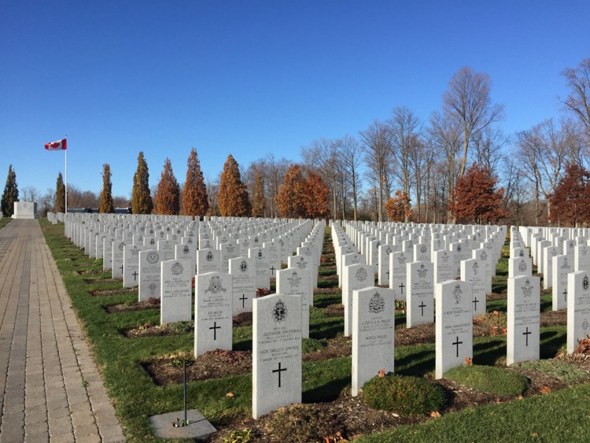
Head east along Stanley Avenue and the Rideau River Eastern Pathway. Then weave your way north along Barrette St to avoid the busy section of Beechwood, then get back on to Beechwood where the bike lane starts at Marier avenue. A bit further along one arrives at the entrance to Beechwood Cemetery. The National Military Cemetery is located within the grounds, as indicated on the above map.
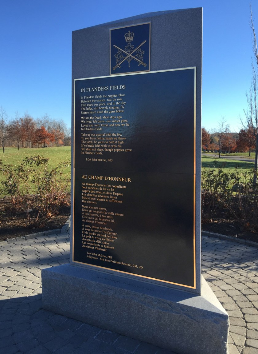
the poem In Flanders Fields is cast onto a bronze plaque and mounted on a simple elegant plinth.
It is from this poem that the red poppy was drawn to become the symbol of Remembrance Day.
In Flanders fields the poppies blow
Between the crosses, row on row,
That mark our place; and in the sky
The larks, still bravely singing, fly
Scarce heard amid the guns below.
We are the Dead. Short days ago
We lived, felt dawn, saw sunset glow,
Loved and were loved, and now we lie
In Flanders fields.
Take up our quarrel with the foe:
To you from failing hands we throw
The torch; be yours to hold it high.
If ye break faith with us who die
We shall not sleep, though poppies grow
In Flanders fields.
John McRae, 1915