Gatineau housing developments are rapidly pushing westward. Todays ride brought me to the frontier of one such development along Boulevard du Plateau. Here one can, or will be able to explore streets named after famous galleries such as Rue du Louvre, Rue du Prado, Rue Glenbow, etc, or roads named after European centres such as Rue de Munich, Rue de Naples, or Rue de Londres, etc. What they have to do with these famous places I do not know as of yet.
Construction is moving so rapidly that houses are popping up on streets that had yet to appear on a MapArt I bought a year ago. So rapid that they haven’t had time to install posts to hold up the new street signs.
Street Signs
On the Gatineau Park Pathway heading back from Frontierland, I noticed someone has painted the symbolic carré rouge along with the plea REVEILLEZ VOUS!
This morning I pedalled through the grounds of the original Ottawa Hunt Club.
With names like Paul Anka Drive and Rich Little Street I’m guessing the area was developed in the 60’s and 70’s. This interesting roof detail was quite prevalent along Plante Drive. They remind me of pill box fur hats also popular in the 60’s. UPDATE – March 2020 : It’s a house design called the Bonnechere introduced by the developer Robert Campeau who was very active in Ottawa in the 70’s. Here’s a link that includes a drawing and description of the design, mid-way down the post.
Interesting Lids
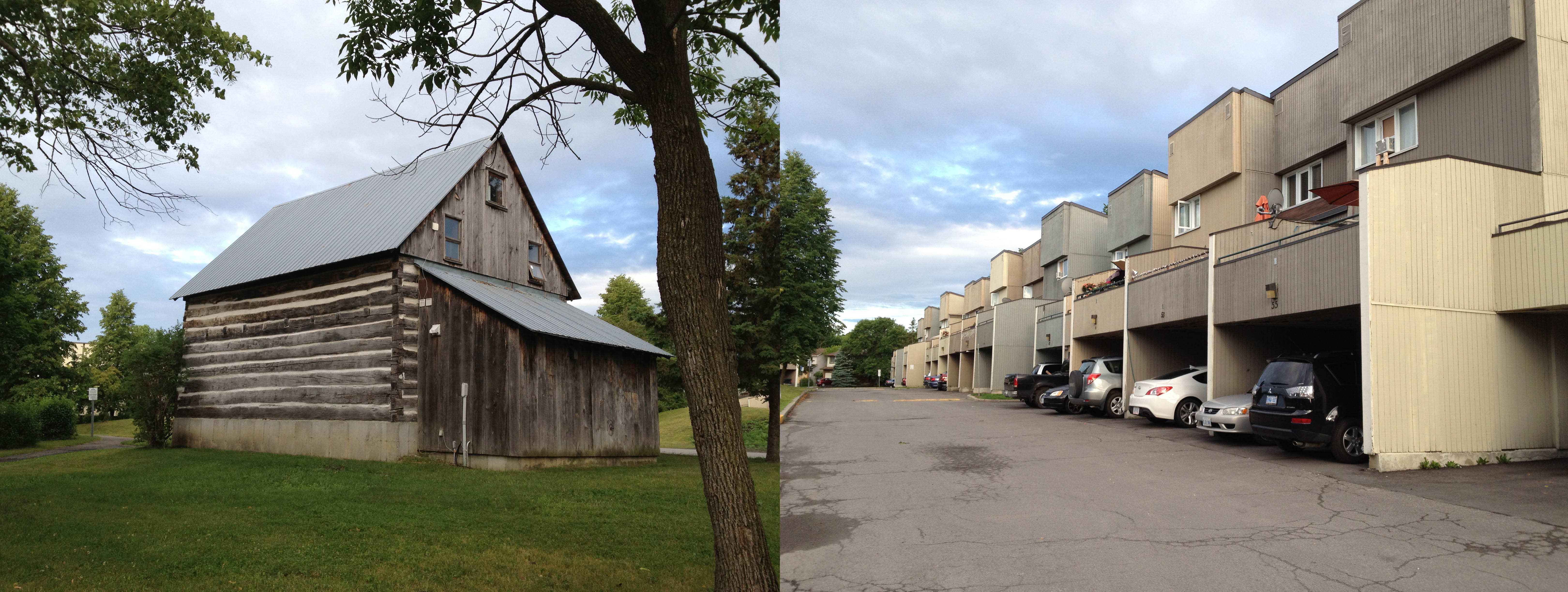
turning down Finch street I came upon this old log building, surrounded by these row houses.
Old & New
Here is it’s story.
In other news, a blue heron scared the bejeezles out of me when it took off as I passed right beside him along the bike path in the arboretum on my way to Hunt Club Woods, Estate & Chase. Glorious elegant birds they are.
I headed off to Gatineau to check out Rue Deveault, which leads you up to the station where the Wakefield train used to depart. As this article explains, it hasn’t left the station for awhile and seemingly won’t be anytime soon, due to problems with washed out tracks. What I saw was a sad abandoned modern train station.
Quiet train station
Across the street, however, was this bright po-mo fire station. I was fortunate enough to be there when various firetrucks were out front testing their emergency lights.
Bling fire station
My way back to Ottawa was almost entirely along bike paths, even though Rue Deveault finds itself in the middle of a large industrial area.
Ride back
Part of the ride takes you along the shores of Lac Leamy. It was disheartening to read about this recent creepy incident, as I have travelled numerous times along the paths that circle the lake and have felt perfectly safe. I would, however, recommend bringing a GPS, as there are a number of twists and unmarked turns along the way.
There are a few streets in the Alta Vista neighbourhood I still haven’t travelled down, so this morning I set off in that direction, destination Tweed Avenue.
.
This is Tweed Avenue……………………………………………………… and this is tweed.
Tweed
Tweed is a rough unfinished woven wool – solid, hardy, not too risky. As a result of it’s rough weave, small variances occur, contributing in part to it’s endearing character. Same thing with Tweed Avenue, or rather this part of Alta Vista in general. Take, for example, the front yard on Colson Avenue shown below, completely covered in potted plants.
Colson Ave
Or this skate/bike sculpture on the roof of a mini mall.
Bike Sculpture
All of the streets I biked along in this area are shaded by hearty trees, which stand proudly in front of detached single family homes.
Tree canopy
Pleasant Park Road is different. For whatever reasons, perhaps because it is more of an arterial road, or maybe because the yards extend further back, it appears to be a more coveted street adress, as indicated by newer monster homes like this.
The initial section of the NCC Voyageur Pathway is reflective of the Chaudière rapids it follows – twisty with lots of ups and downs. The path smoothens out a bit before reaching the Deschênes Rapids, where you can pause and take in ruins of an old dam while looking out across the rapids.
Deschènnes Rapids
A bit further on just above the rapids, one can admire the vastness the Ottawa River.
Ottawa River
At this point the path veers inland, where you come upon a whole new development built over the last few years in the section of town called Wychwood. A friend told me that it had never previously been developed because it was on a flood plane. A bit further on I biked through the original housing area of Wychwood – a diverse mix of houses built over many years. Very intimate and human scale. Weaving my way along various streets, I arrived at the Symmes Inn Museum. Something to go back and visit some day. Right across the street was this interesting derelict building.
Symmes Museum & Derelict Building
Heading back on Rue Principale I was reminded that la Fête nationale would soon be upon us.
I first biked along the NCC Experimental Farm Pathway when I arrived in Ottawa a few decades ago, as my older sister lived on Fisher Avenue across the farm from the Carleton University residence where I was staying. I’ve since travelled its entire length, which terminates much further west, beyond Woodroffe Avenue.
The fact there is a huge farm plopped in the middle of a city is wonderful, but the portion of the path that passes through the centre of the farm that gives it it’s name is just one hi-lite to this route, as it travels through at least three distinct natural environments over it’s entire length. Here it is:
First the farm.
Near Fisher Avenue looking east.
Now why, you might ask, does the path jog to one side at this location? Well in that spot there used to be a concrete pad filled with a huge pile of dung. This, after all, is a farm. It made for some interesting olfactory experiences as you biked by. The pile is gone, but the route the path took around it still remains.
After crossing Merivale Road the path then climbs up and down through a wooded section, until it reaches Maitland Avenue.
Woods
If farmland and woods aren’t enough for ya, the final stretch to Woodroffe winds through fields of tall grass and wild flowers. What I find most amazing is not just the rich diversity of environments experienced along the route, but also how the path snakes it’s way towards the outskirts of the city without ever feeling encumbered by development. Quite the accomplishment.
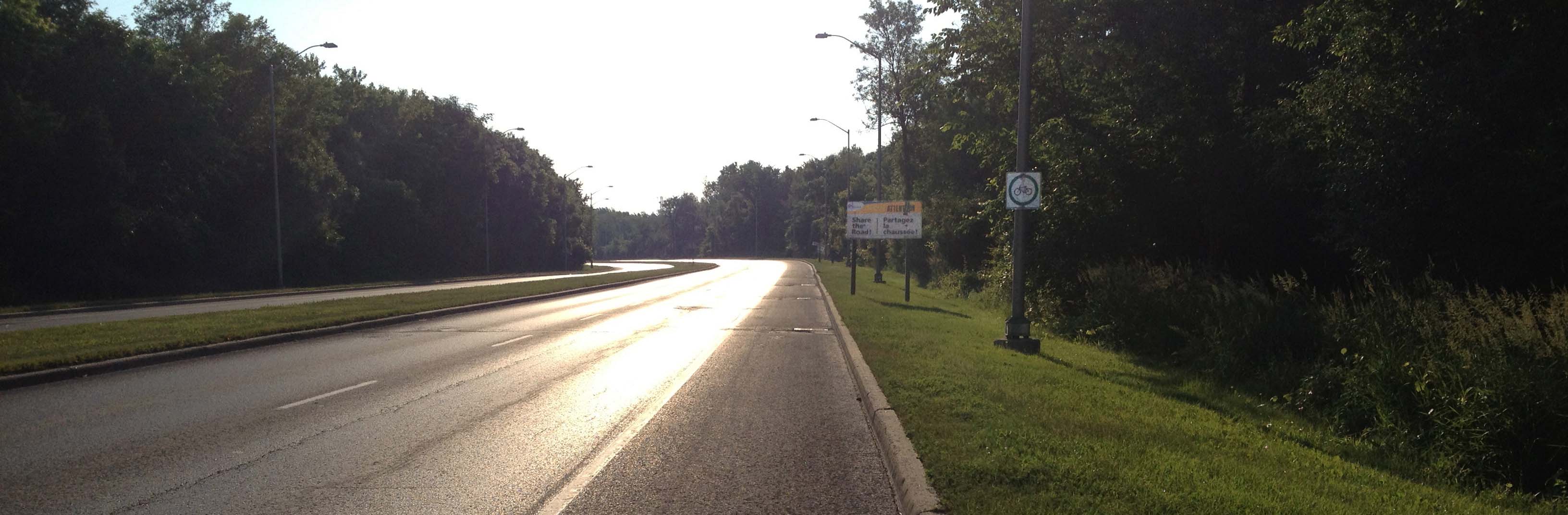
Decided to check out Cleopatra Drive within the Merivale Industrial Area. Unfortunately it did not live up to it’s glorious namesake in any way, so I chose to leave the adjoining Caesar Avenue for another day. There wasn’t a way into the network of trails within Pinhey Forest from Cleopatra Drive so I took West Hunt Club Road to where it crosses a bike path that leads to the entrance to Piney Forest. West Hunt Club has wonderful large shoulders for bicyclists to ride on, as does Prince of Wales Drive. Too many drivers speed recklessly along both streets.
Pinhey forest: What a wonderful discovery! The lacework of trails are easily navigable due to this system of way finding with signs at each intersection.
Pinhey Forest
The MET. No it’s not a new Cineplex or library. It’s a honking big church! Corner Prince of Wales and West Hunt Club.
Church!
This has nothing to do with today’s ride. It’s the final race of the day heading down Rochester Street near Dow’s Lake as part of this year’s Italian Week celebrations. Those guys were zippin’!
UPDATE 2017:I recently re-visited the path along Boulevard de la Vérendrye, indicated on the map below, and was very pleased to see that the majority of it has been repaved and drastically improved over the last couple of years, particularly east of highway 50.
I biked a section of the path along Boulevard La Vérendrye, heading east from where it crosses Boulevard Gréber. It was a gradual climb, past housing and businesses on either side.
Boulevard La Verendrye bike path
I continued along La Vérendrye after the path ended at Rue Main, then scooted down Boulevard Labrosse down to the edge of the Ottawa river. As I headed along a bike path beside the shore, I discovered a little foot path to a beach of small boulders and the remains of a well used fire pit. Crossing the path is a concrete sidewalk, a ghostly remain of some settlement in this area, now overgrown.
boulder beach & old sidewalk
I then wove my way back west along Gatineau streets I had yet to travel, and happened upon the enormous national Library and Archives Canada Preservation Centre. Such an impressive building cannot be fully appreciated from one angle so I took the bike path circling the edifice.
Library and Archives Canada Preservation Centre
A bit further along Boulevard de la Gappe I happened upon La maison de la Culture. Across the street is the Cégep de l’Outaouais Félix-Leclerc campus, on one wall of which is painted this clever graffiti trompe l’oeil.
trompe l’oeil
Most of the small Gatineau residential streets looked like this. Many garage sales.
To get to and from the eastern side of Gatineau I take the NCC bike path along the river shore on the Outaouais side. One section in Jacques Cartier Park is a raised board walk. I love this portion of the path, as it hovers above the waters edge, and allows for wonderful views such as this.
Headed south-east to cover a few yet-to-be-traveled streets within the triangular area bordered by Bank, Heron and Walkley. Getting there by bike, especially from downtown, can be pretty tricky. This is my preferred circuit. Apart from the narrow section of road between Hogs Back and Riverside Drive,the route is mostly bike path or quiet road.
The Arboretum
If you are early enough you can catch soldiers from HMCS Carleton, a unit of the Canadian Forces Naval Reserve on a morning run in full fatigues. That’s them barely visible between the trees. Soldiers trainingCrossing the canal at the locks at Carleton University, and following the bike path on the opposite side up to Hogs Back, you might happen upon a duck family like this one. Ducks!
There are many wonderful views of Hogs Back Falls to be had from pathways on either side and above.Hogs Back Falls
Along Brookfield Road, just before reaching the Airport Parkway there is a fun section of bike path that dipsy-do’s under the parkway, over a stream and across two train tracks before continuing on as Brookfield Road on the other side. Dipsy-do path
There is then another short path at the end of this section of Brookfield that cuts through to Bank Street.
From there you’re on your own.
A section of today’s ride took me down a path that runs alongside Nepean Creek between Merivale Road and Prince of Wales Drive. It’s a little nature sanctuary, with vigorous building construction and development on the south side.
Along the path I came upon two poems cast into bronze plaques. Down the Merivale Road by William Wilfred Campbell and Le cronyism by Alfred Garneau. Turns out this trail is part of the Poets’ Pathway which, until today, I knew nothing about. I look forward to exploring more of it on my biking adventures.