With recent threats from our southerly neighbour to absorb us, I thought it timely to re-visit a route that checks out examples of long barrelled artillery on display throughout our National Capital Region.
if you are interested in how we’ve evolved from the original Cannons in the Capital tour check it out here .
Our ride begins at the Canadian War Museum. Head over to the immense glass wall along Booth Street and peer in.
This’ll give you a great view of an assortment of big artillery and then some.
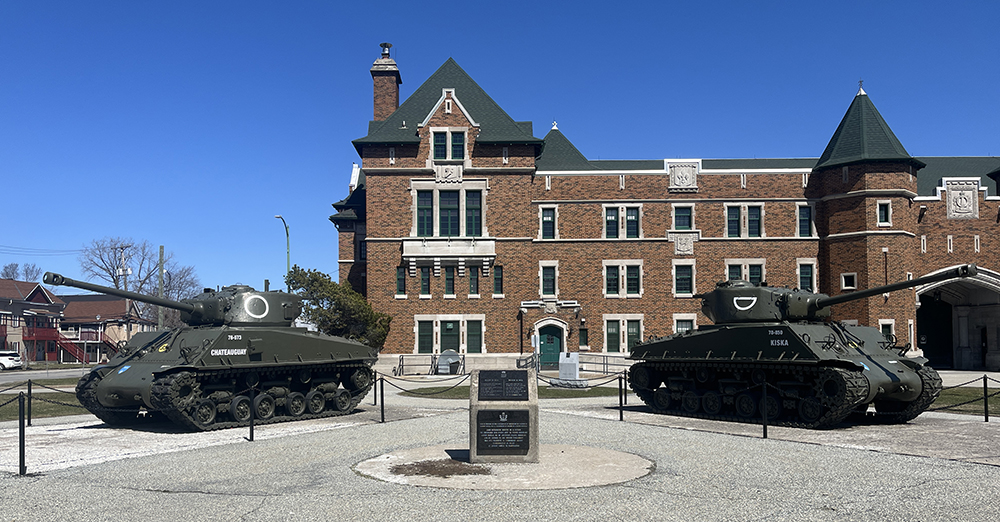
Follow the bike lane north over the Chaudiere Bridge to Gatineau, then turn left along Alexandre-Taché Boulevard. At the corner of Boulevard Alexandre-Taché and Boulevard St Joseph you will find these two tanks on display outside the Salaberry Armoury.
This armoury was named in memory of Lieutenant-Colonel Charles-Michel d’Irumberry de Salaberry. In 1812 Salaberry was put in command of a new corps of volunteers, the Canadian Voltigeurs (light infantry) and in November 1812 they turned away an American attack at La Colle Mill. In October 1813 he and 300 of his troops repulsed several thousand American troops threatening Montreal.
The armoury presently houses the Régiment de Hull.
Salaberry Armoury
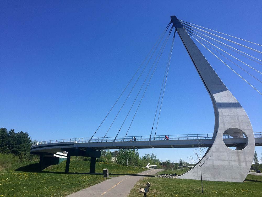
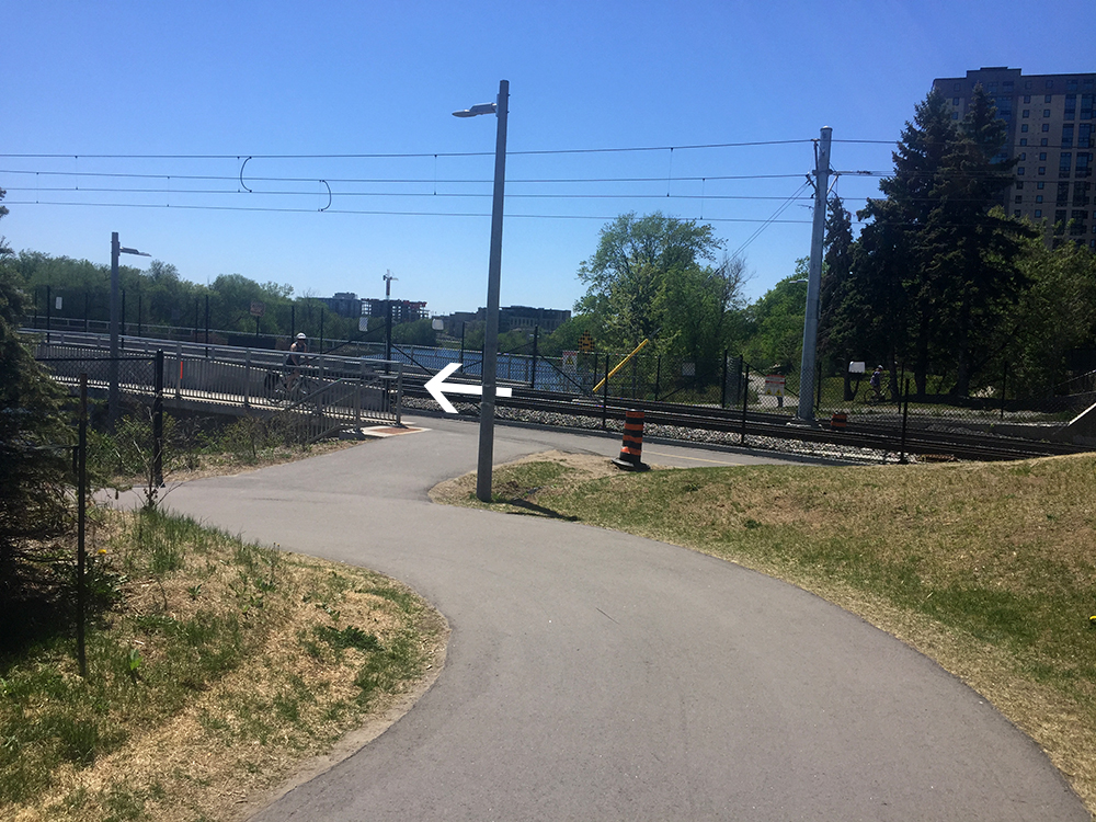
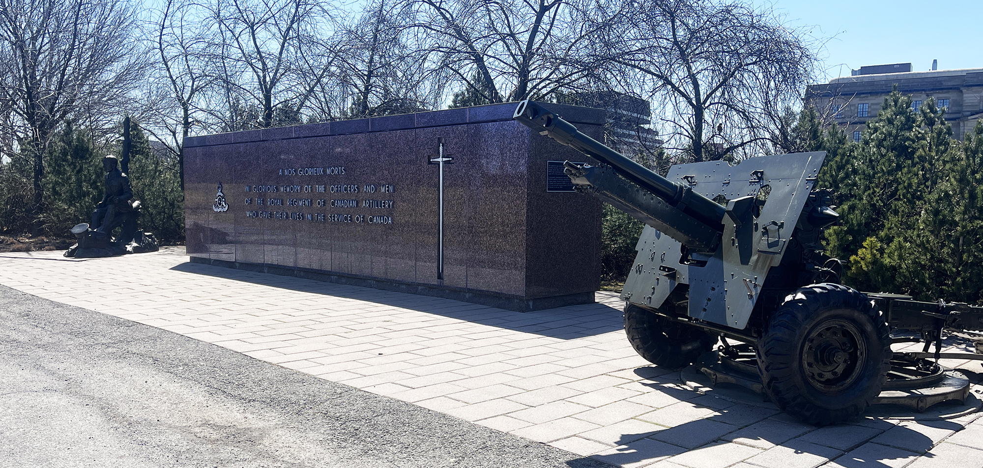
Continue along the route indicated on the map which crosses back over to Ottawa via the Macdonald-Cartier Bridge bike lane. Weave your way behind the National Research Council building and over the pedestrian bridge just above the Rideau Falls. To the right you will see the National Artillery Monument comprised of a memorial wall and 25-pounder artillery field gun, commemorating the Royal Regiment of Canadian Artillery and their members who gave their lives in the service of Canada.
National Artillery Monument
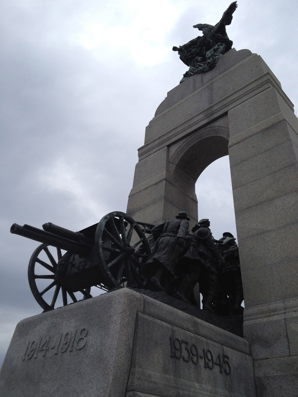
Our ride now heads downtown to the National War Memorial. The sculpture depicted in the memorial is titled The Response. It includes a field gun used in World War I, being pulled through a stone arch by Canadian combatants.
The Response
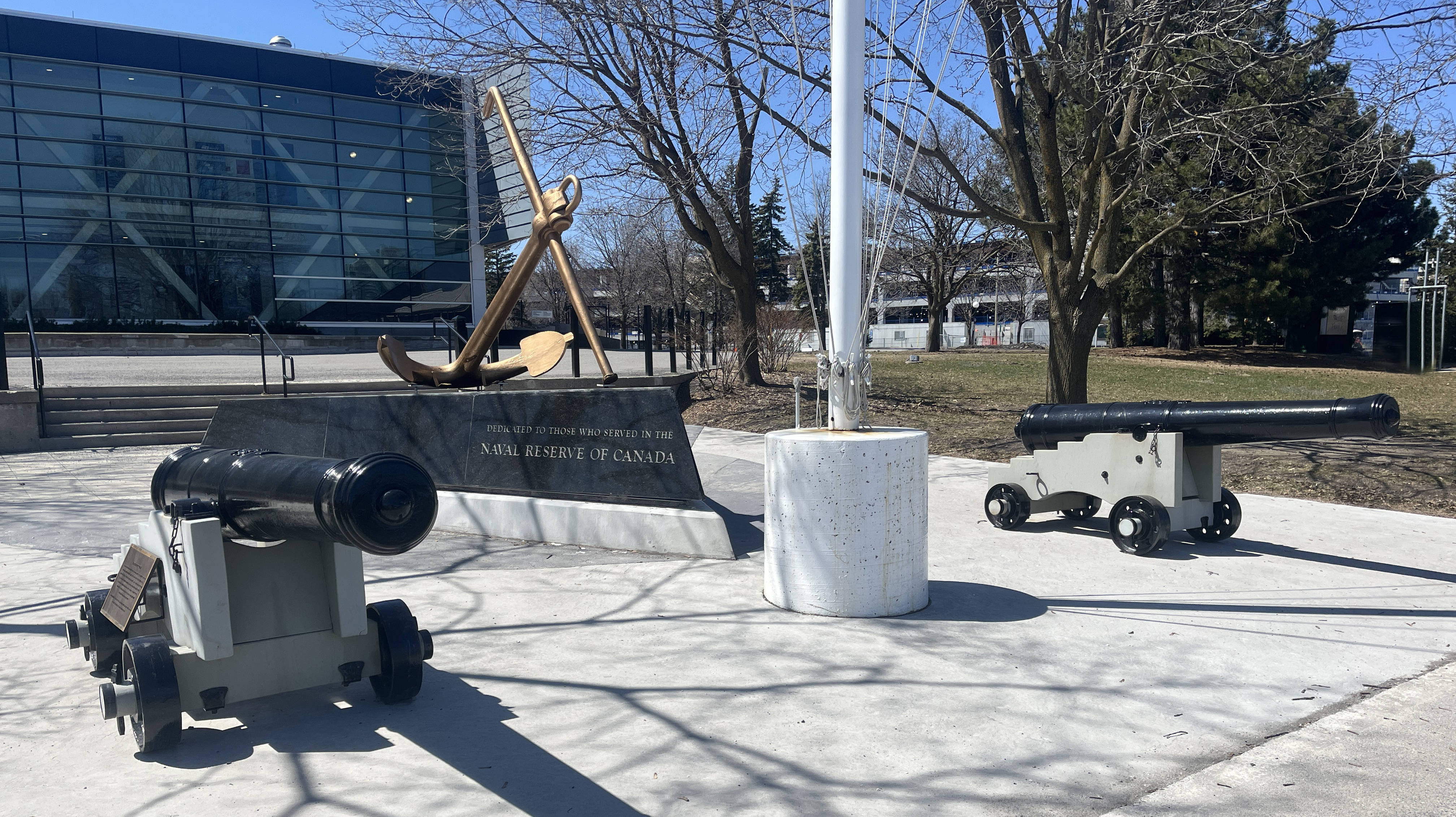
The final stretch of our ride goes along the Rideau Canal via the wonderful Rideau Canal Western Pathway, which takes us to these two replica 9-pounder cannons stationed on the edge of Dow’s Lake, right in front of HMCS Carleton naval reserves. They are part of the National Naval Reserve Monument.
9 Pounders
Just around the corner on Prince of Wales Drive, plopped on the lawn of the naval reserves sits a few more contemporary sorts of cannons, visible through some barricade fencing.
Outside CFRB Dow’s Lake
So there you have it – many depictions of local cannons to discover! Just wish we didn’t ever need them, but here we are.
The Ottawa International Airport is a comfortable 13-15 km ride from downtown. The following route is my favourite. The EY Centre is a huge convention space used for various events and is very close to the airport, so I’ve included a slight detour that’ll get you there as well (orange line on the map).
. Starting off from the corner of Laurier Avenue and Percy St, head south along the Percy bike lane. (Percy and Laurier is an intersection easily accessible from many points within the downtown core via the Laurier Bike Lane).
Bike lane along Percy
Percy continues on the opposite side of the Queensway sans bike lane.
Percy south of the Queensway
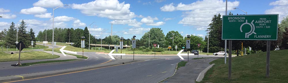
Turn right on Fifth Avenue and cross Bronson Avenue at the intersection.
Traffic lights at Fifth & Bronson
Once across Bronson continue down Madawask Drive, then onto the pathway that cuts through Commissioners Park.
Lovely path through Commissioners Park. Always lots of flowers.
Follw this path to the intersection of Preston Street and Prince of Wales Drive.
Approaching Prince of Wales and Preston
Cross the lights to get to the bike path that runs through the Arboretum along the edge of Dow’s Lake and the Rideau Canal.
Path through the Arboretum
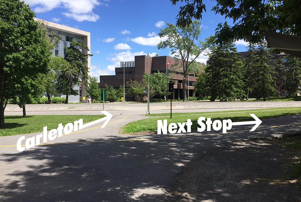
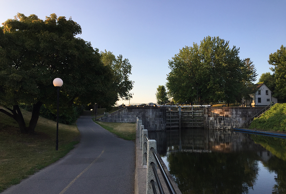
Pushed you bike over the canal locks opposite Carleton University and turn right along the Rideau Canal Pathway as far as Mooney’s Bay.
Up & over the locks
The path continues over the Rideau River along Hogs Back Road. Once over the Hogs Back Falls bridge take the path to the right that goes through Mooney’s Bay park
Path to the right that goes through Mooney’s Bay park
On the other side of Mooney’s Bay Park the path continues along Riverside Drive for a short distance until it ends at Walkley Road. Riverside Drive is a very busy street with lots of speeding traffic. There are raised paved shoulders along Riverside beyond Quesnel Drive, but not between Walkley Road and Quesnel Drive. To avoid this section, ride on the packed grass beside the sidewalk along Riverside for a short distance and cross Riverside to the parking lot of the Anglican Church.
Intersection of Walkley and Riverside Drive
Entrance to church parking lot off Riverside
Ride through to the opposite side of the church parking lot to the short path that cuts through to Otterson Drive.
Path from church parking lot to Otterson Drive
Turn right onto Otterson, and take the short path that links to Quesnel Drive. Follow Quesnel Dr that ends at Riverside Drive. Get back on Riverside Drive and continue south along the previously mentioned raised paved shoulders. They extend from Quesnel to Uplands Drive.
Paved shoulder along Riverside Drive
Turn left onto Uplands Drive and follow it for a short distance before turning right along Bowesville Road.
Mid way down Bowesville there’s a NO THROUGH TRAFFIC sign, and a smaller green one below it that asks pedestrians and cyclists passing through to remain on the road. That’s because it cuts through the Ottawa Hunt & Golf Club. There’s a steel gate a bit beyond the signs, however there’s space to ride by just to the right.
Signs midway down Bowesville, and gate a bit further on.
Once beyond the golf club property cross Hunt Club Road at the lights and continue south along Paul Benoit Driveway. This is a very pleasant road to ride along. Traffic isn’t too speedy, the posted limit being 50km/h. There is also a paved path that runs along the west side of the road.
Path along Paul Benoit Driveway
Normally, to get to the terminal turn right off of Paul Benoit Driveway onto Kiowa Pr, cut through the employee parking, then left at the end of the parking lot, which becomes a lane airport employees use to walk back and forth to their cars. This lane leads right to the arrivals doors in front of the terminal. At the time of writing they were constructing the O-Train connection to the airport, which required a slight deviation to the normal route, as per the green line indicated on the above map. i.e., rather than cut through the employees parking, ride to the end of Kiowa Pr to Clear Skies Pr, then turn left onto Clear Skies Pr, which leads to the aforementioned lane that brings you to the entrance to the terminal.
Turn right onto Kiowa Pr
Connection from Clear Skies Pr to path leading to front of airport terminal
There are bike racks infront of the concrete pillars located just outside the entrance to the airport.
Bike racks
Accessing the EY Centre
If you are heading to the EY Centre (orange line on the above map) turn left off of Paul Benoit Driveway onto Breadner Blvd, which has ample room for cars and bikes.
Breadner Blvd
Turn right onto Uplands Drive, which is a busy street, but also has wide paved shoulders. The entrance to the EY Centre is a short distance further along Uplands.
Uplands Dr
Follow the same route heading back to Ottawa, except for the last stretch north of the Queensway where the bike lane follows Bayswater versus Percy, as indicated by the purple line on the above map.
I rode out to Ikea and Lee Valley to pick up some items for this summer’s production of Shakespeare’s The Tempest, being performed by A Company of Fools. I designed the set. It opens next week and will be performed in parks around the city throughout the summer. Check out their show calendar to see when there is a performance in a park near you!
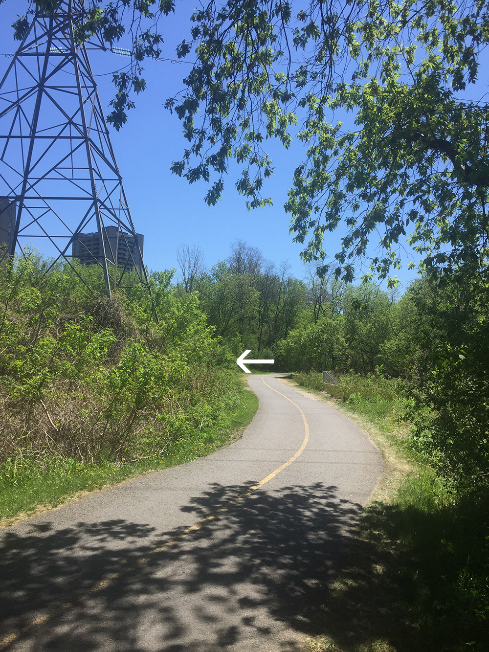
This bike route is an update to one originally posted in the summer of 2012. I followed the Ottawa River Pathway and the Pinecrest Creek Pathway as far as Iris Street on the way there, and then the Experimental Farm Pathway back. A lovely loop.
The overall route hasn’t changed much over the last ten years, however the ongoing construction of the LRT extension heading west along the SJAM Parkway, and then south along the transit way, has resulted in a dog’s breakfast of mini-detours along the Pinecrest Creek Pathway. The detours aren’t too drastic, just very zig-zaggy and choppy. I hope the bike infrastructure will be the same as before, or better, once all construction is completed. Until then, I anticipate this messy bit will remain for a couple of years to come.
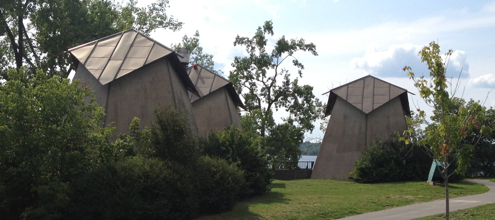
Love these service pavilions at Westboro Beach, designed by architect James Strutt. They remind me of Don Quixote’s windmills. Check out other bike tours that visit buildings Strutt designed around the region by clicking here.
Westboro Beach pavillions
The Ottawa River Pathway isn’t being drastically affected by the construction. If you like construction sites, look left. If you like majestic rivers, look right.
Ottawa River Pathway heading west
This is the type of choppy detour you may expect to find along the Pinecrest Creek Pathway.
Pinecrest Creek Pathway heading south
Heading back along the Experimental Farm Pathway, just east of Woodroffe Avenue, they are installing what seems to be a huge reservoir. Looking forward to see what becomes of that.
The original version of this route was posted in 2014. In the wake of the present invasion of Ukraine I have revisited and updated the route in the hopes that it may be used by those who wish to to pay tribute to the incredible resilience of the Ukranian people, and to help better understand the Ukranian community amongst us.
Canada is home to one of the largest number of persons of Ukrainian descent outside of Ukraine. Most reside in the western provinces, however many have chosen Ottawa as their home. This bike tour visits edifices around town representing the Ukrainian diaspora within Canada’s capital.
We begin our ride at the Ukrainian Embassy located at the corner of Somerset and O’Connor. Ukraine purchased this building at 310 Somerset St from the federal NDP party in 1994. It’s been their embassy ever since.
Ukrainian Embassy
Our next stop is just a few blocks south east. On December 2nd, 1991 Canada recognized Ukraine’s independence. Suddenly in need of an embassy, this building on Metcalfe St was purchased with the help of funds gathered by Ukrainian-Canadians. This location has served as a consular building ever since the embassy moved to its present location.
Ukrainian Consular Building
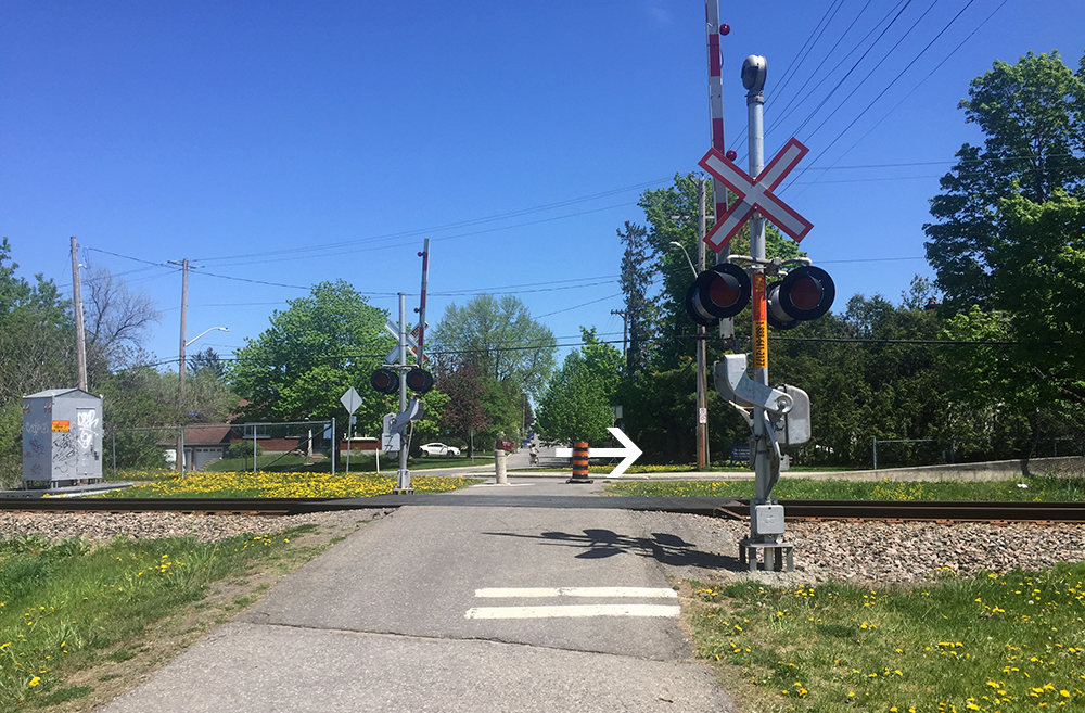
Next stop – the Saint John the Baptist Ukrainian Catholic Shrine near the corner of Heron Road and Prince of Wales Drive. To get there I rode south along the O’Connor bike lane before turning left on Fifth Ave and crossing the canal over the Flora Foot Bridge. I then rode along the Rideau Canal Eastern Pathway all the way up to where Heron Road crosses overhead. I accessed Heron by pushing my bike up the mini bike ramp along the edge of the stairs.
There is a bike lane along Heron Road. Just over the bridge I took this well trodden path righ that leads to the back of the church.
The statue on the edge of the parking lot is a monument to Taras Shevchenko (1841-1861), artist and national hero for his promotion of Ukrainian independence.
Taras Shevchenko
The church (or Sobor, or Shrine) was completed in 1987. An annual Capital Ukraininan Festival is held at this site.
Saint John the Baptist Ukrainian Catholic Shrine
Next destination is the Ukrainian Orthodox Cathedral at 1000 Byron Avenue. To get there I cut through the Experimental Farm, along Island Park Drive, then west along Byron. There is serious disruptive construction for the new LRT extension along Byron, thus the slight detour as one approaches our final stop. The Cathedral opened in 1978. More on it’s history can be found here.
The O-Train Trillium Line is closed until some time in 2022 as they lengthen the tracks. Here is a bike route that visits each of the original stops, starting from Bayview Station at the northern end of the line. The route is indicated by the blue line on the following map.
Follow the Trillium Pathway heading south under the Bayview Station.
Trillium Path heading south under the Bayview Station
This path continues beside the O-Train tracks.
Trillium Pathway running alongside O-Train tracks
There is a slight detour one block over along Preston heading under the Queensway.
Short detour along Preston St
Beyond the Queensway the path continues beside the tracks. A bit further along is the second O-Train stop, Carling Station.
Carling Station
Next stop – Carleton University.
Cross Carling Avenue at the lights and continue straight along the Trillium Pathway to where it ends at Prince of Wales Drive. Turn left along the path that runs parallel to Prince of Wales Drive, then cross at the lights at Dows Lake.
Follow the bike path that runs through the Arboretum. This path eventually runs parallel to the Rideau Canal and up to the Hartwell Locks across from Carleton University. Cross the canal at the locks.
Bike path through the Arboretum
Crossing the Hartwell Locks
If Carleton University is your destination then cross Colonel By Drive and you’re on campus. Left on Library Road brings you down to the Carleton Station.
Carleton Station
If your destination is a stop further down the line don’t cross Colonel By Drive. Instead turn right and ride along the Rideau Canal Eastern Pathway.
Rideau Canal Eastern Pathway
The path goes under Hogs Back Road, then curls up to Mooney’s Bay.
Heading up past the locks and under Hog’s Back Road
First sight of Mooney’s Bay
Turn right onto Hog’s Back Road. The Hog’s Back Road bridge over the Rideau River is presently being rebuilt however there is a detour that runs along the side of this short bridge. Bonus – this affords a spectacular view down onto the falls.
Hogs Back Falls
Once over the bridge and back onto Hogs Back Road you can ride along either path on both sides of the street although I would suggest crossing onto the south side so it’s easier to cross busy Riverside Drive at the next lights.
View down Hogs Back Road
Crossing Riverside Drive brings you to Brookfield Road which has a bi-directional bike path on the south side of the road. Follow this path all the way to the round-about. Once arrived at the round-about take the first crosswalk to the other side of Brookfield Road.
Crossing Brookfield Road at the round-about
If your destination is the Mooney’s Bay Station turn left onto the path that meanders for a short distance down to the station.
Left to Mooney’s Bay Station or right to next station
Mooney’s Bay Station
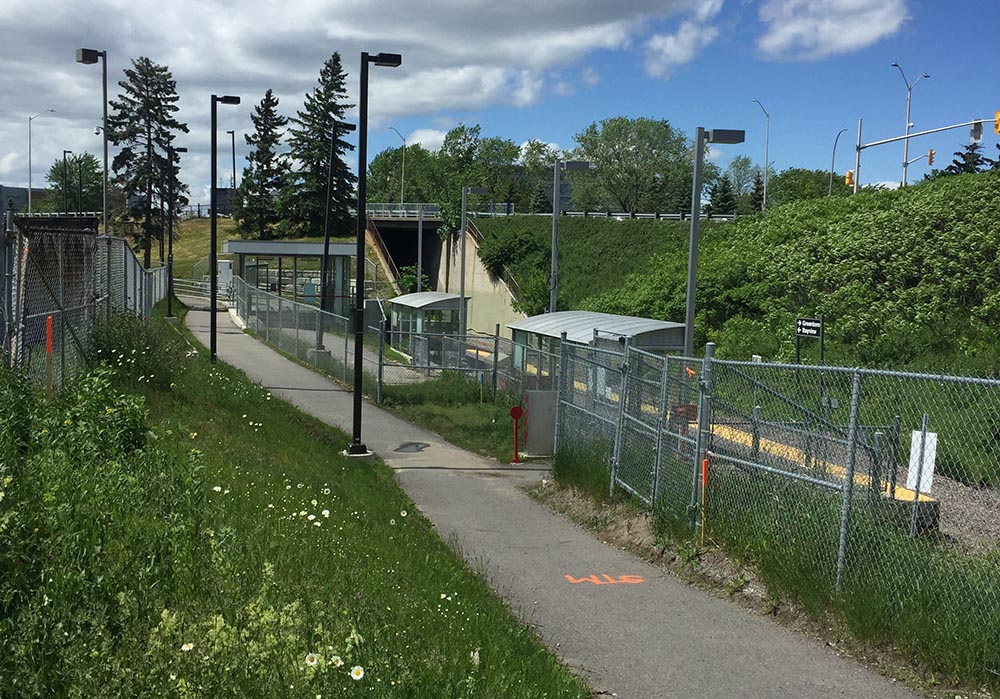
If your destination is the next stop, Greenboro Station, then turn right onto the Brookfield Pathway that skirts the edge of the round-about before curving under the Airport Parkway and up over a set of train tracks.
Brookfield Pathway heading over the train tracks
Just beyond the train tracks turn right onto the Sawmill Creek Pathway. This path runs mostly alongside the Airport Parkway. It veers off a bit and follows the transitway for a short spell before continuing along the Parkway. You will ride past the Sawmill Creek Wetland, a fantastic series of ponds and a natural habitat for all sorts of birds.
Exit off the Brookfield Pathway onto the Sawmill Creek PathwaySawmill Creek Pathway running alongside the Airport Parkway
Continue under the distinct pedestrian/bike bridge, then take the second exit left off the pathway (the first exit is the ramp up over the bridge. Don’t take that) .
Heading under the bridge towards the second exit off the Sawmill Creek Pathway
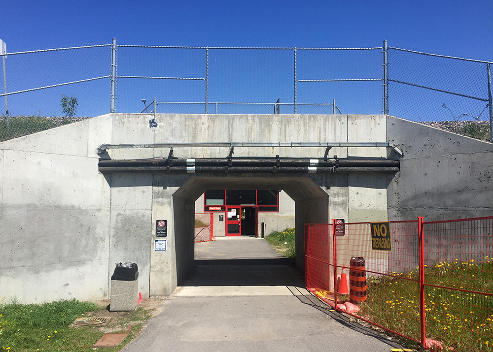
This short section of path will take you to a tunnel that leads under the O-Train tracks, then through an enclosed passageway that goes under the transitway. The confusing sign at the entrance of the enclosed section says no bikes allowed, but OC Transpo confirmed you can walk your bike through.
Tunnel & passageway
On the other side you will find yourself at the southern back corner of South Keys Shopping Centre. Turning left onto the service road that runs behind the shopping centre will bring you to our final stop, Greenboro station.
Greenboro Station
Et voila!
Biking is a great alternative to taking the train.
This is an update of a tour posted a few years ago as there have been a number of improvements to the route and the status of some of the walls has changed. The purple markers on the map identify legal walls, or those onto which artists can paint without the risk of being chased away or arrested. The red markers are a couple of non-legal graffiti walls along the route.
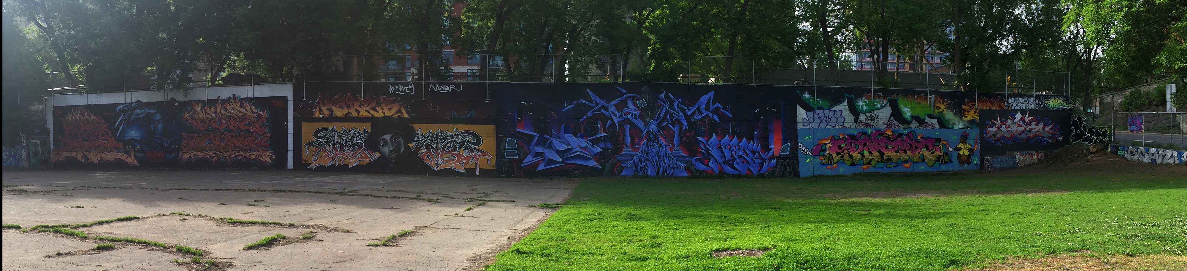
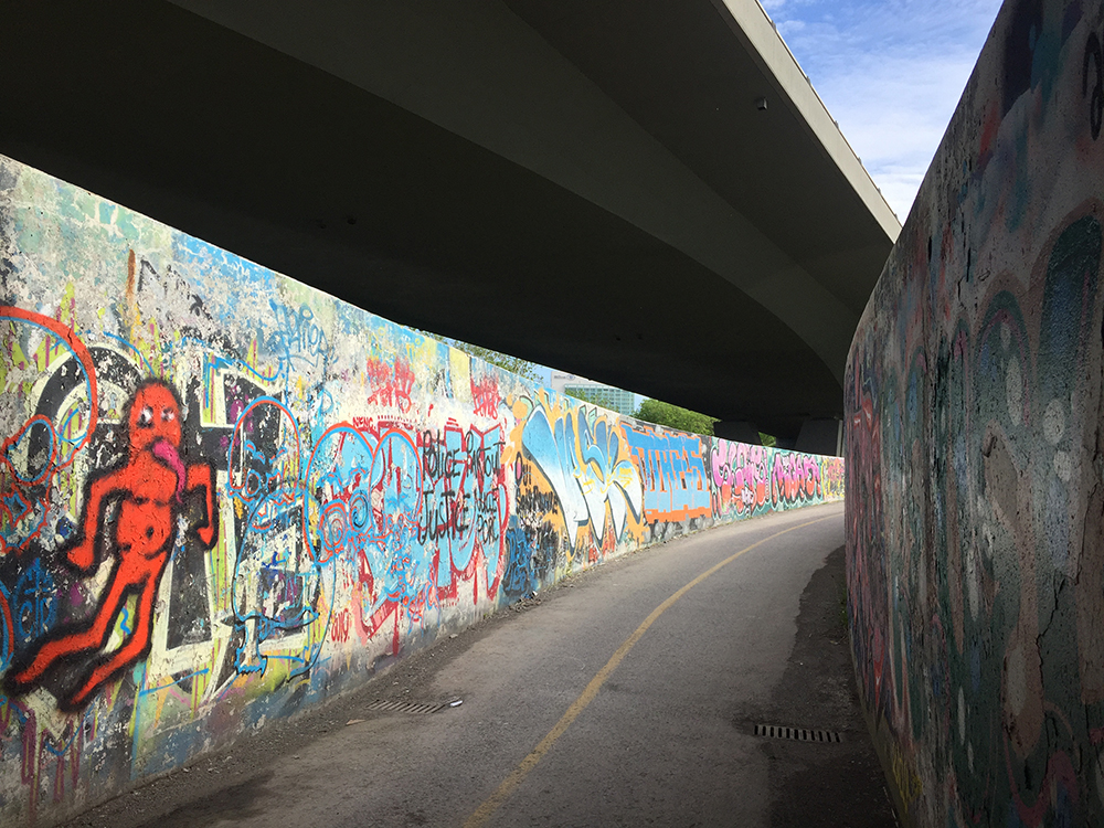
Our tour begins at the edge of the Rideau River underneath the Bronson Avenue bridge. You can access the site from Brewer park on the east side or along a dirt path from Carleton University campus. In this breathtaking setting you will discover two huge sets of walls facing each other across an expanse of packed earth. It’s also the site of the annual House of Paint Festival of Urban Arts and Culture .
Graffiti under the Bronson bridge
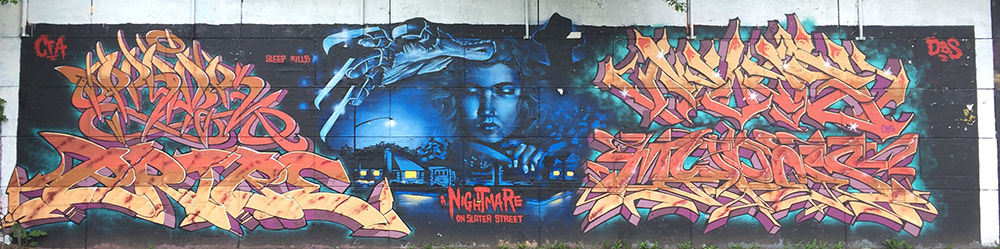
Our next stop is popularly known as the Tech Wall, located at the corner of Bronson and Slater. To get there cut through the Carleton campus, push your bike over the Rideau Canal locks, follow the bike path along the canal through the beautiful Arboretum, then follow the bike path along the O-Train tracks. After passing under Albert Street at the Bayview Station, turn right along the path that heads east along Albert. Cross Albert at the bike/pedestrian crossing and follow the path up to the intersection of Bronson and Slater. The path takes you across that intersection to where you will be facing the Tech Wall across a fenced in dog park. You can enter the dog park to get a closer look at the works of the various artists.
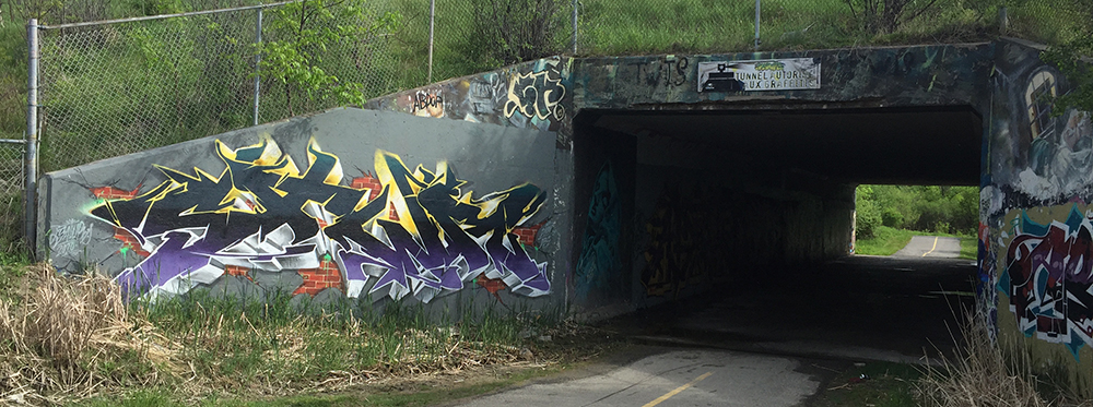
The next bunch of walls are in Gatineau. Continue along the Laurier bike lane to Bay St, follow Bay to Wellington, turn left onto the bike path that runs beside Wellinton and follow it over the Ottawa River along the Portage Bridge, then turn right onto the Voyageurs pathway. There’s usually some interesting graffiti on the Voyageurs pathway tunnel walls passing under the Portage Bridge.
Voyageurs Pathway tunnel under Potage Bridge
Continue along the Voyageurs Pathway and cross Alexandre-Taché Blvd at the lights. There’s a path that cuts through the small park, then over a small bridge. Turn right onto the road that eventually becomes the Ruisseau de la Brasserie Pathway. This pathway dips along and over the stream before heading under the Autoroute de la Gatineau. This fantastic immersive stretch pops up beneath a web of overpasses, made all the more sensational with graffiti filled walls. Occasionally the walls get re-painted a neutral grey in preparation for the next round of artists.
Ruisseau de la brasserie pathway
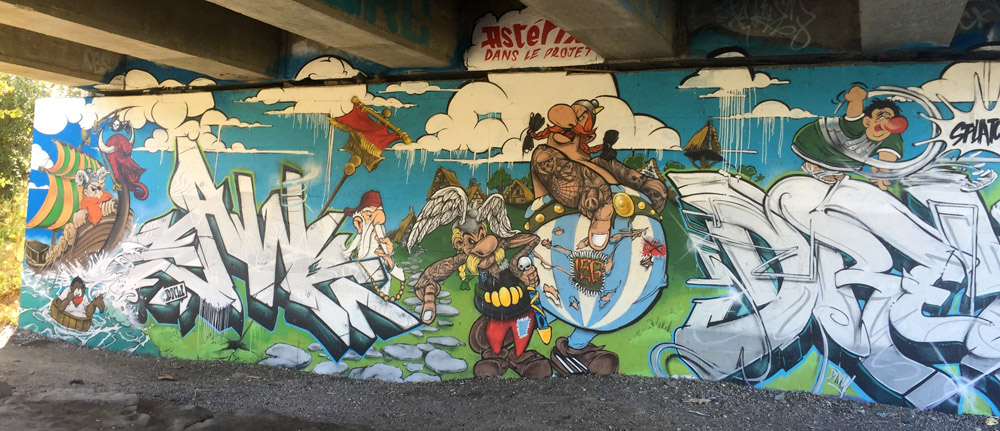
The path splits just beyond the underpass. Stay right (versus taking the small bridge over the stream) and continue a short distance along the path to check out the next series of walls. This spectacular spot is located beneath the interchange ramps of the two major highways that cut through Gatineau, the 5 and the 50. The legal walls are on both sides of the stream, accessible by a small wooden bridge. On my most recent visit they had recently been given the grey overcoat. Artists had started to paint but there wasn’t too much to photo so the following examples are from a previous visit.
Graffiti under highway 5 to 50 interchanges along Ruisseau de la brasserie
Retrace your route a short distance to the earlier exit that takes you across the samll bridge. This bike path continues around Leamy Lake then along the Gatineau River. Turn right off the path towards Gatineau Park where it goes under the transitway. At both entrances of this tunnel there is graffiti.
The path weaves its way up and under Highway 5 for a second time. This is where our final set of walls are located.
It was great having my nephew from Montreal along for the first version of this tour. He is well versed in the subtleties of graffiti art and he taught me lots!
James Strutt (1924 – 2008) was one of Ottawa’s most successful Modernist architects. He was called upon to design many innovative buildings for clients throughout the National Capital Region. Along with office towers, private residences and public facilities he also designed a number of churches throughout the 1950’s and 60’s for Ottawa’s expanding mid-century suburbs . This bike tour visits these churches, identified by the red markers on the attached map. The blue markers show the location of other buildings he designed including The Strutt House his family home he built on the edge of Gatineau Park. It has recently been restored to it’s original design and has been preserved as an interpretive centre dedicated to the study of his works. A bike route to the Strutt House from Ottawa can found here. Clicking on a blue marker will bring up an image of each building.
The orange markers are buildings that unfortunately are not visible from points accessible by bike. The grey markers are those I have yet to visit but I will update the map with photos once I do.
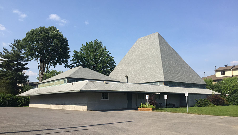
We begin at the Bells Corners United Church. In 1960 the decision was made to build a new church to replace its predecessor on Robertson Road (now a spa) as it could no longer accomodate the growing number of parishioners. It was completed in 1965.
Bells Corners United Church
Our second stop is St Paul’s Presbyterian Church on Woodroffe Avenue. This smaller, more intimate house of worship, was an earlier design, completed in 1958. The wooden boxes on the roofs were not part of the original design nor obviously were the solar panels.
St. Paul’s Presbyterian church
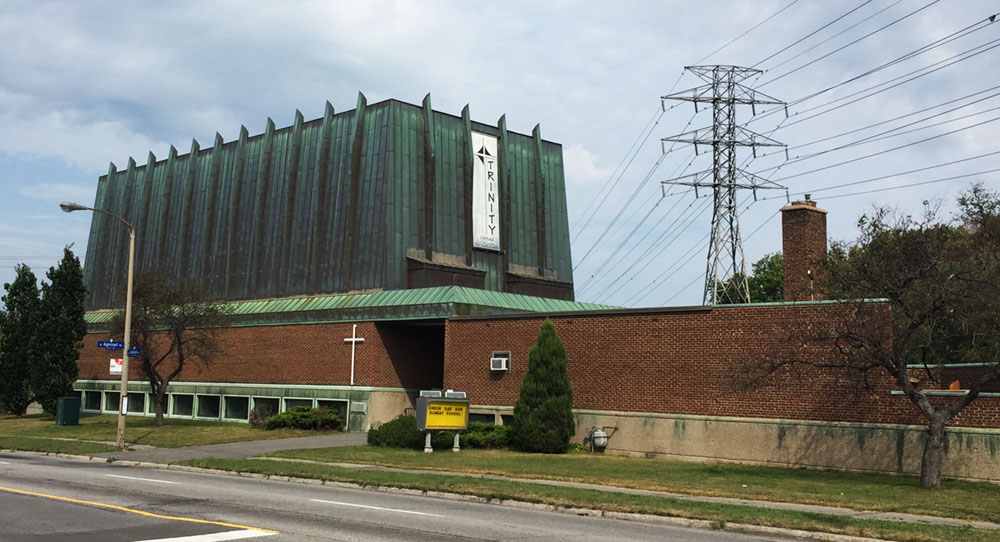
Cyclists riding along the Experimental Farm Pathway will have noticed the distinct copper clad building just off the path at Mailand Avenue. This is the Trinity United Church designed by Strutt in 1963. The form was supposedly inspired by Noah’s ark.
Trinity United Church
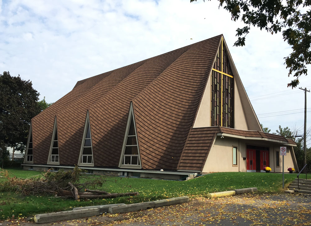
The dominating wavy form Strutt designed for St Peters Anglican Church on Merivale Road (now the St. Teklehaimanot Ethiopian Orthodox Church) was achieved by using a modern concrete spray. It was then clad in cedar shingles, similar to the one in Bells Corners, but since replaced with metal cladding.
St. Peter’s Anglican Church
St Marks Anglican Church on Fisher Avenue is from 1954. A number of modifications have been made to the original building but there is a great slide show with sketches and descriptions of the original design along with pictures of the church in construction that you can view by clicking here.
St Marks Anglican Church
St Paul’s Anglican Church (now the Ottawa East Seventh-Day Adventist Church) in Overbrook is tucked in between Presland and Prince Albert Street. Strutt designed this one in 1963. Originally there was a small cross at the peak of the taller roof.
St. Paul’s Anglican Church
Our final stop is the Rothwell United Church in Cardinal Heights. Completed in 1961, it has changed little from Strutt’s original design.
Rothwell United Church
A few more details on the design of these churches can be found here.
David Ewart was Canada’s Chief Dominion Architect from 1896 to 1914. During his prolific career he designed numerous buildings across the country, four of which are still standing here in Ottawa – the Royal Canadian Mint on Sussex Drive, the Connaught Building on Mackenzie Street, the Victoria Memorial Museum (now the Museum of Nature), and the Dominion Observatory on the grounds on the Central Experimental Farm. This bike tour visits all four.
We begin at the Royal Canadian Mint located just beside the National Gallery of Canada. The Mint was built to function as a centre of the country’s wealth at a time when Canada was flexing its growing monetary independance. Ewart applied details reminscent of medieval castles and late gothic styling over a Beaux-Arts-inspired design.
Royal Canadian Mint
To get to our next stop, follow the bike lane along Sussex Drive past the National Gallery. The bike lane gets pretty tight at the corner of St Patrick and Sussex so I cut across the broad plaza infront of the giant spider to get to the bike crossing .
Cutting across the plaza in front of Maman
Double cross the intersection to eventually get over to the bi-directional bike path that runs along Mackenzie Avenue infront of the American embassy.
Double cross over to path infront of U.S. embassy
You will need to weave between two sets of huge bollards set in the middle of the path that are meant to protect the embassy. They are a bit tricky to negotiate. Just beyond the second set of bollards is our next stop – The Connaught Building.
The Connaught Building was designed to house the first Canadian archives, reflecting the nation’s growing sense of Canadian identity. It was designed in part to meet Prime Minister Laurier’s vision for an architecturally coherent image for the capital. Ewart again used Beaux-Arts inspired principles as seen in its symmetrically organized facade and central main entry. To this he applied a combination of detailing from the Victorian Gothic style, as seen in the Parliament buildings, and large manors built during the Tudor period.
Connaught Building
The interpretive panel visible in the bottom right of the above photo describes David Ewart and his work within the context of this incredibly productive period of building design in the capital. Definitely worth a quick read.
Continue along the bike lane to where it ends at Wellington Street. There is an advance bike signal at this intersection that allows cyclists to cut diagonally across Wellington to the ramp that leads down to Colonel By Drive. At the next set of lights hop onto the Rideau Canal Eastern Pathway.
Diagonal crossing with signal across Wellington
Transition from the bike lane where it ends at Colonel By Drive to the Rideau Canal Pathway
Ride under the Corkstown pedestrian/bike bridge, then circle up and over the bridge to get to the other side of the canal.
Corkstown Bridge.
Once across Queen Elizabeth Drive access MacLaren Street via a short jog along Somerset and The Driveway. MacLaren is a quiet street that you can follow west as far as O’Connor Street. Turn left onto the bi-directional segregated bike path along O’Connor and follow it to McLeod Street where on the left you will see our next stop – the Museum of Nature. McLeod Street is a one way heading west so to get to the front of the museum get on the path at the corner of O’Connor and McLeod that goes through the park past the wooly mammoth.
The Museum of Nature was originally called the Victoria Memorial Museum in honour of Queen Victoria who’s reign ended in 1901. This was Ewart’s most ambitious building for the capital, once again using the Tudor Gothic style. Unfortunately the instability of the soil on which it was built required that the original central tower be reduced by one level to keep it from sinking in to the ground. The glass tower now occupying the space was added in a more recent major renovation to the building. The fascinating history of the museum is explained in extensive detail here and here.
Museum of Nature view of the west face
Next get back on the O’Connor bike lane and follow it under the Queensway and on through the Glebe where it switches sides of the street and disappears/reappears in a few spots.
O’Connor bike path north of Queensway
O’Connor bike lane south of Queensway
O’Connor ends at Fifth Avenue so turn left onto the bike lane that brings you the signalised intersection across Queen Elizabeth Driveway. Once across, turn right onto the Rideau Canal Western Pathway and follow it all the way to Dow’s Lake where it ends at Preston Street.
Rideau Canal Western Pathway
At Preston cross over to the opposite corner of the intersection to the path that continues up along Prince of Wales Drive.
At the next set of lights, which is a pedestrian crosswalk towards the arboretum, turn right along a short paved driveway that becomes a worn path leading up a hill towards Birch Drive.
Path up to Birch Drive
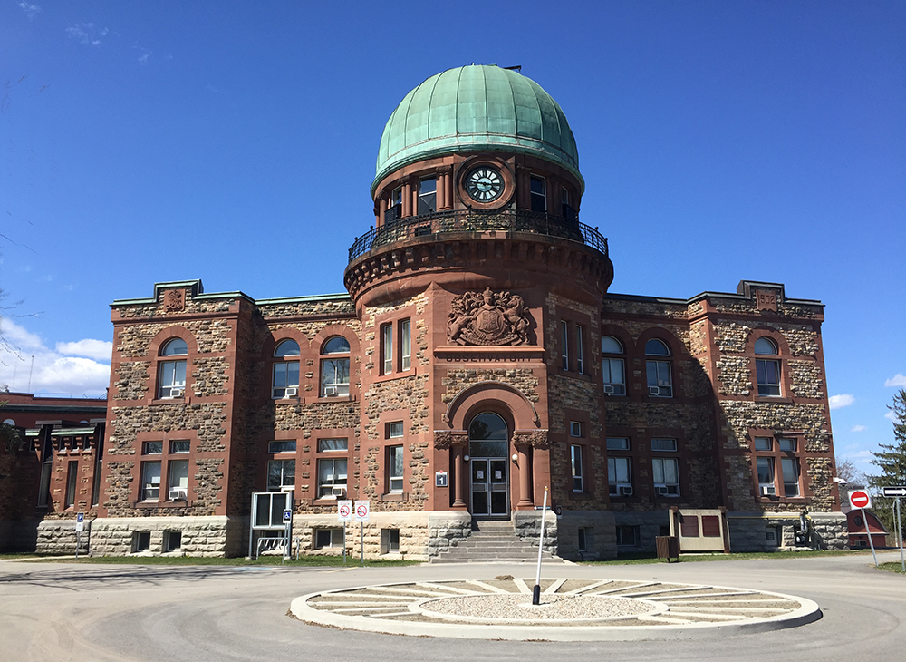
Continue straight along Birch Drive, then right on Maple Drive to our final destination the Dominion Observatory.
Designed in a Romanesque Revival style, the Observatory was used to establish coordinates for timekeeping that at the time could only come from an observatory. Fortunately this beautiful heritage building has survived any threats of demolition even though it ceased serving as an observatory in 1970.
More about the history of the Observatory including pictures of it during construction can be found here and here.
Jeanne was asking about a bike route from Strathcona Park to the South Keys Shopping Centre. Here’s a map. Description and photo’s below.
Starting from the Strathcona Park side of the Adawe bridge River follow the path that runs along the Rideau River heading upstream.
START : Path through Strathcona Park heading upstream from the Adawe bridge
The path continues along the river, going under the Queensway and up behind the University of Ottawa football field, before reaching the Hurdman Bridge. Cross over the Hurdman Bridge bike path beside the O-Train tracks.
Approaching the Hurdman Bridge
Once over the bridge circle down to your left and continue heading upstream along the Rideau River Pathway.
Just after some big power line towers turn left onto a path which will bring you to a signalised crossing at Riverside Drive over to Frobisher Lane.
Rideau River Pathway. Arrow indicates exit path beyond the power line tower.
Crossing at Riverside to Frobisher Lane
Frobisher Lane gets you over the transitway. Once over the transitway turn right at the ‘T’ which continues as Frobisher Lane. Travel along to the end of the road where it transitions into a wide concrete walkway. Keep riding along this walkway to the lights across Smyth Road.
Cross Smyth Road and continue through the Riverside Hospital campus. At the south-west corner of the campus there is a path that allows you to continue straight.
Path at south corner of Riverside Hospital
This path then curls to the left over the train tracks. Once over the tracks turn right onto Rodney Crescent.
Sharp right onto Rodney Crescent after riding over the tracks
This brings you to Pleasant Park Drive. Cross Pleasant Park to the path starting slightly to the right on the opposite side. This path merges into Lamira Street.
Continue straight through the round-about along Lamira. The section of this route with the most traffic is the short section along Lamira between the round-about and Bank Street but it usually isn’t too bad.
Lamira St between the round-about and Bank St
Head straight through the intersection at Bank onto Belanger Ave which is a quiet residential street. So is Clementine Blvd onto which you will turn left where Belanger ends.
Biking along Clementine Blvd
Follow Clementine all the way to Brookfield Road. Turn right onto Brookfield. At the corner of Brookfield and Junction Ave head straight onto the Brookfield Path.
Accessing Brookfield Path from the corner of Brookfield Road and Junction Ave
Brookfield Path winds its way down a curving wooden boardwalk under the train tracks, then up the other side. It’s quite a lovely little section.
Start of Brookfield Path boardwalk
At the top of the hill turn left onto the Sawmill Creek Pathway.
Exit off Brookfield Path to Sawmill Creek Path
Sawmill Creek Pathway mostly runs alongside the Airport Parkway, occasionally veering further away, at one time following the transit way for a short spell.
Sawmill Creek Pathway running alongside the Airport Parkway
Continue under the distinct pedestrian/bike bridge that goes over the Airport Parkway. Once on the other side take the second exit left off the pathway (the first exit is the ramp up over the bridge. Don’t take that) .
Heading under the bridge towards the second exit off the Sawmill Creek Pathway
This short section of path will take you to a tunnel that goes under the O-Train tracks and an enclosed passageway that goes under the transitway. The confusing sign at the entrance of the enclosed section says no bikes allowed, but OC Transpo confirmed you can walk your bike through.
Tunnel & passageway
On the other side you will find yourself at the southern back corner of South Keys shopping centre. Follow the road around to the front.
As the new school year begins many students are looking for a bike route to their campus. Susan requested one to Algonquin College from her home in the Alta Vista ward. Here’s what I came up with.
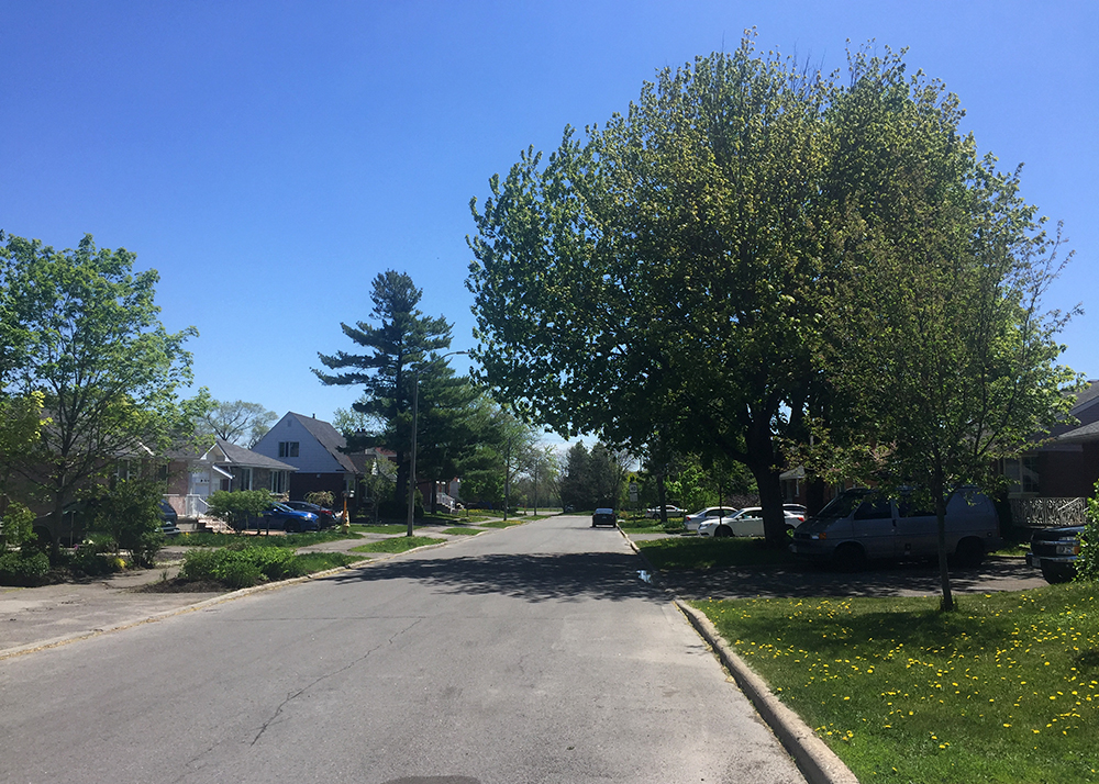
Our ride begins at the corner of Colson Avenue and Saunderson Road. Head west along Colson, a quiet residential street lined with big trees and a beautiful leafy canopy.
Riding along Colson Avenue
Turn left onto Haig Drive then cross Dauphin Road to get to Portage Ave. Portage becomes a dead-end for cars but merges into a bike path that runs along the edge of Lynda Lane Park.
Bike path along the edge of Lynda Lane Park
This leads you to Lynda Lane which is a slightly busier street but there is a bi-directional bike lane on the western side of the road that brings you a block over to Pleasant Park Road.
Bike path along Lynda lane to Pleasant Park Road
Pleasant Park Road is a busy street that cuts east-west through Alta Vista. Many cyclists tend to use it because it is direct and the lanes are wide enough to accomodate a car and bike. There are also a couple of stop signs that help calm down speedy drivers. Unfortunately it doesn’t have bike lanes.
Biking along Pleasant Park Road
An alternative to riding along Pleasant Park Road would be to cycle down Billings Avenue, which is a calmer street that runs parallel to Pleasant Park as far as Rodney Crescent (see orange line on the above map), however it doesn’t have traffic lights to get across busy Alta Vista Drive.
Pleasant Park dips down to where it meets Riverside Drive. There are lights to get you across Riverside to a bike path that links to the Rideau River East Pathway.
Path across from Riverside leading to Rideau River Eastern Pathway
Ride along the very picturesque Rideau River Eastern Pathway to Bank Street for a few hundred yards. This brings us to the the worst section of our route – crossing the Bank Street bridge over the Rideau River. One may chose to ride in the roadway but that would force you into in a narrow car commuter artery that barely has enough room for the existing four lanes of impatient drivers. There are sharrows (a bike logo with a couple of pointy lines) painted on the surface of the outside lanes that are barely visible. Research has shown sharrows to be worse than useless, they are dangerous as they instil a false sense of confidence in cyclists by suggesting they are safe bike infrastructure when they aren’t. A safer alternative to riding in the roadway over the Bank Street bridge is to walk your bike along the protected sidewalk. One small consolation is this bridge isn’t very long.
View heading north over Bank St Bridge shows two options – riding on the Road ….. or walking your bike along the protected sidewalk. I recommend the sidewalk.Narrowness of Bank St Bridge over Rideau River, view heading south
Sadly, safe options for biking across the Rideau River in this part of town do not exist. I’ve shown an alternative route on the map at the bottom of this post that continues along the Rideau River eastern Pathway up to Hogs Back Drive, but Hogs Back Bridge is closed for repairs requiring you to walk your bike across the boardwalk detour over the canal. While this detour is nice and accomodating, the time required to access and negotiate it is most likely the same as walking your bike across the Bank Street Bridge. Also, working your way to and through the intersection of Prince of Wales Drive and Hogs Back Drive is a dangerous mess.
So, back to the suggested route. Once across the bridge take the path that circles under the bridge and up past the Olympic medal display to Warrington Drive.
Path continues past the Olympic medal interpretive display
Continue along Warrington Drive, a nice quiet street that runs along the river, then turn right onto Wendover Street which brings you to Cameron Avenue. Cameron is a one way heading east, however there is a bike lane heading west. Very convenient. Follow this path all the way to Brewer Park.
Bike lane heading west along Cameron Ave
Ride along the path that cuts through Brewer Park to the lights that take you across Bronson Avenue.
Lights across Bronson Avenue to the Carleton University campus. Whoever’s at the wheel in the red car is a lousy driver.
Once across Bronson cut through the Carleton University campus over to Library Road as per the above map. The only tricky spot heading across campus is the tunnel under the O-Train tracks. It’s a little narrow and has a sharp turn to the right at the western end.
Tunnel under the train tracks
Take the paved link from Library Road to the crossing at Colonel By Drive.
Paved path off Library Road to the crossing of Colonel By Drive
Once across Colonel By push your bike up the ramp to the canal.
Stairs with ramp to push bike up to the canal locks
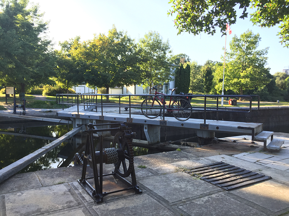
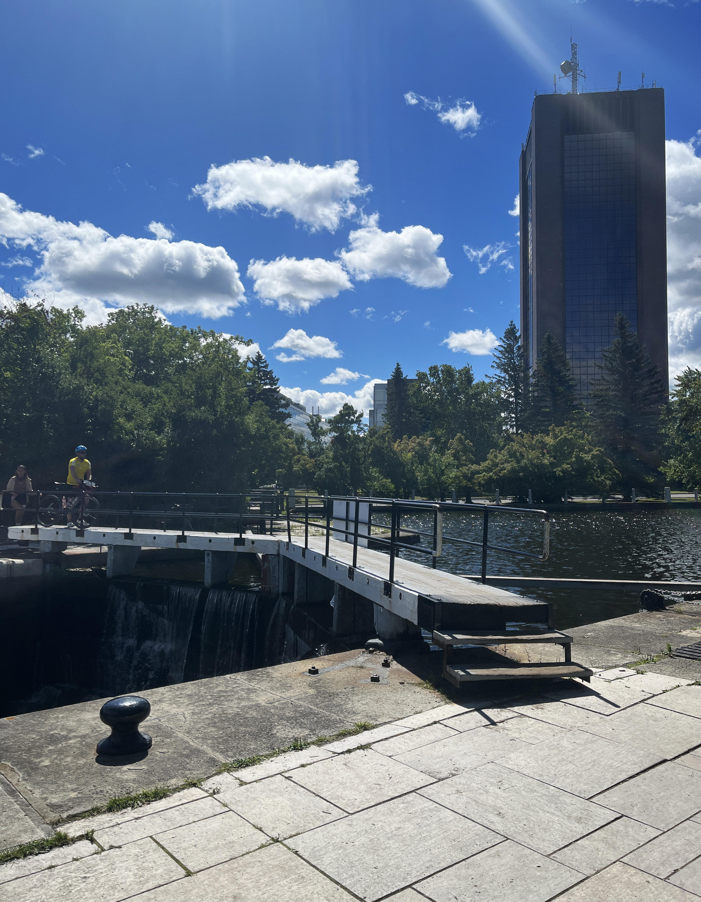
Getting across the canal requires carrying your bike up and down a couple of steps and pushing your bike over the locks.
Crossing the Hartwell Locks
Take the path perpendicular to the canal that leads to a service road which doubles as the start of the Experimental Farm Pathway.
Path perpendicular to the locks that takes you to the service road (take either the dirt path or the paved one these cyclists are using)Start of the Experimental Farm Pathway along the service road
Now you will be following the Experimental Farm Pathway for quite a distance all the way to Woodroffe Avenue. It is mostly paths with some stretches along quiet roads with a wonderful mix of scenery. Fortunately the pathway is quite well signed.
Sections of the Experimental Farm Pathway between Prince of Wales Drive and Fisher Avenue
The only messy spot is the crossing at Fisher Avenue. Fisher is a busy street that requires lights to get across, but the crossing doesn’t allign with the path on the west side of the Fisher and the trail sign isn’t visible from the lights.
Experimental Farm Pathway continues a short distance north of the crossing at Fisher
There also isn’t a bike lane heading north to get you from the crossing to where the path continues. This forces one to take to the sidewalk or ride along the space between the sidewalk and oncoming bike lane.
View north along Fisher to where the Experimental Farm Pathway continues west
So, the Experimental Farm Pathway at Fisher is a bit of a mess, but once back on the path on the other side of Fisher things continue smoothly westwardly.
Experimental Farm Pathway between Fisher and Woodroffe Ave
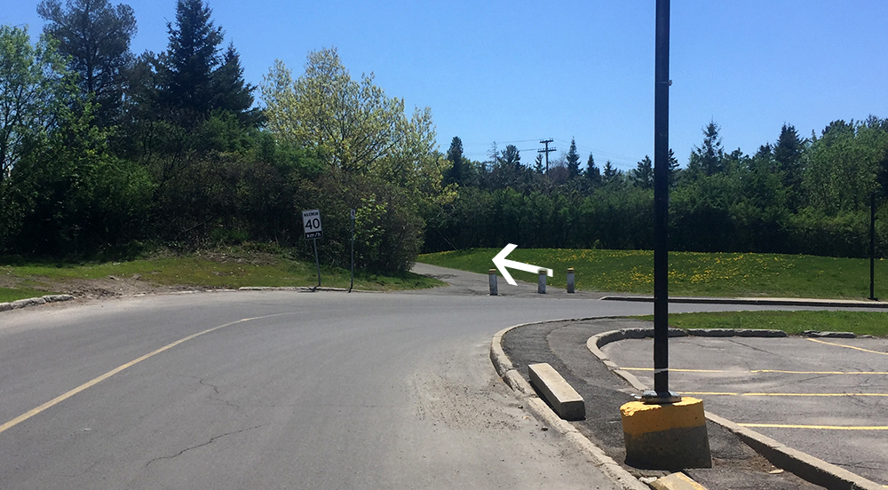
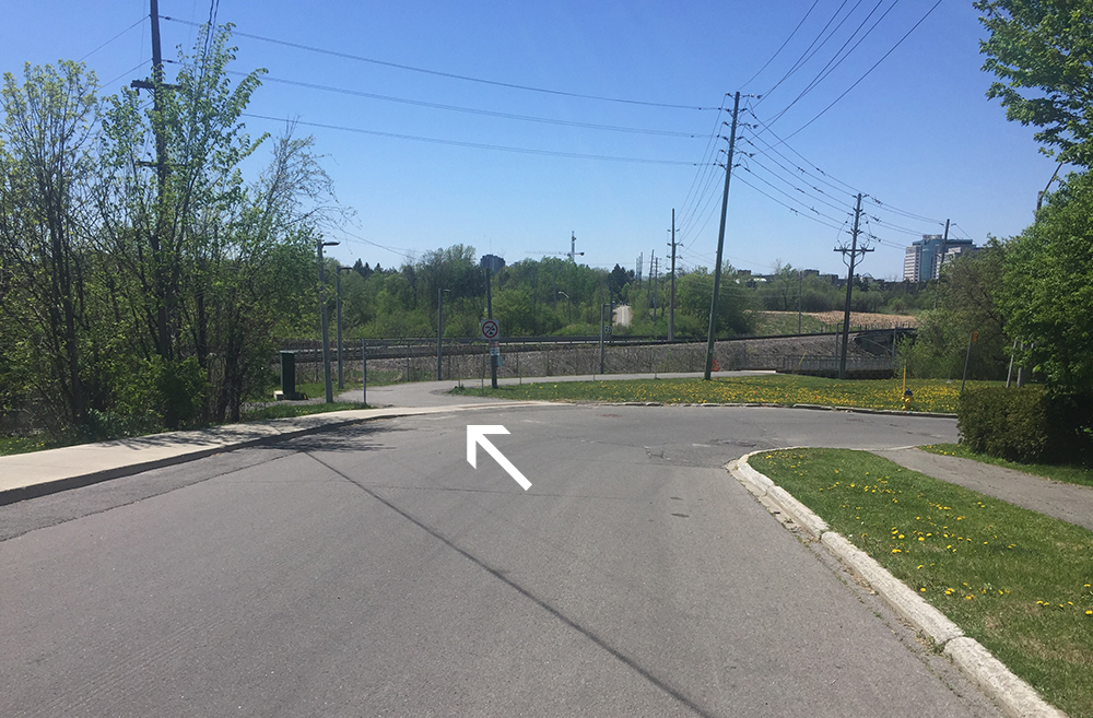
The Experimental Farm Pathway ends at Woodroffe Avenue. There are lights to get you across this very busy street. On the other side of Woodroffe the Watts Creek Pathway continues just to the left of the fire station.
Arrow showing where Watts Creek Pathway begins across Woodroffe Ave beside the fire station. My panorama camera setting created those teeny-tiny cars.
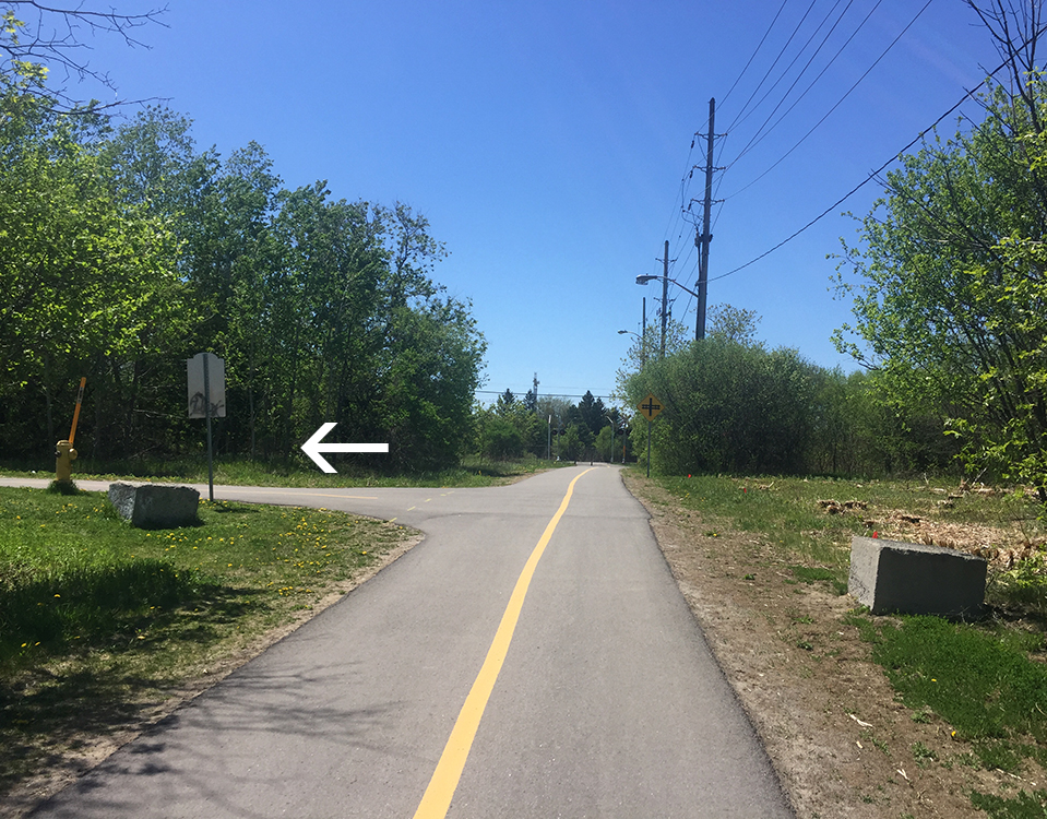
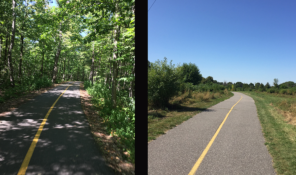
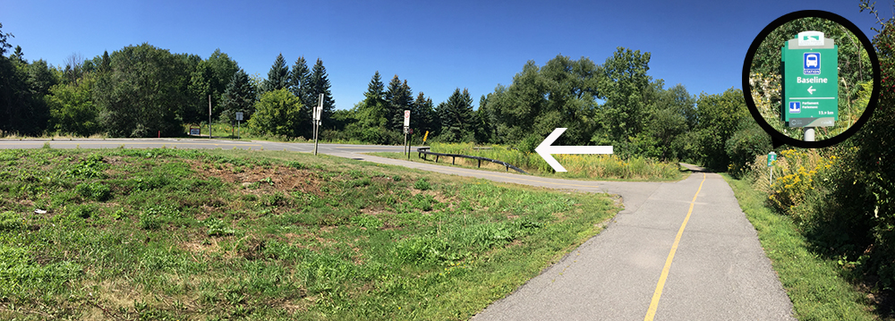
The path dips down along the transit way. Take the exit off the pathway where the sign points to Baseline.
Exit off Watts Creek Pathway towards Baseline
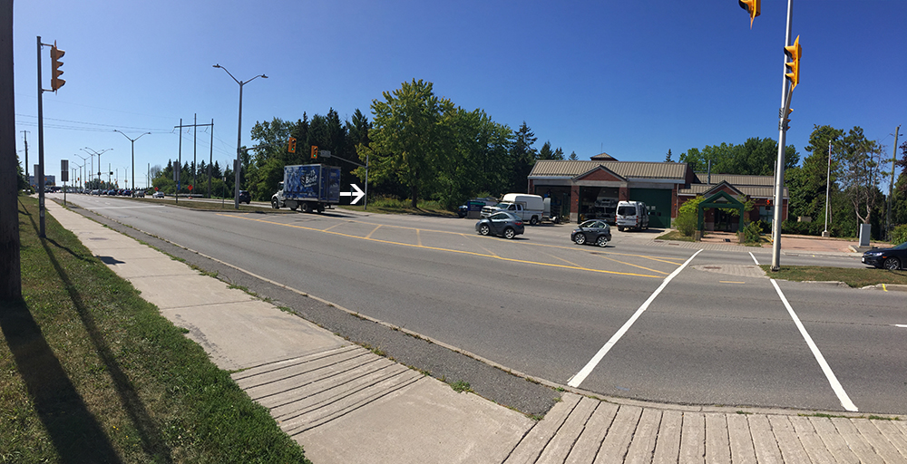
This path then crosses the transitway then goes under Baseline Road. Things get a little tricky just south of Baseline where the path circles around an OC Transpo parking lot. Most cyclists don’t bother with this mini detour and just ride infront of the bus parking .
You will see the Algonquin Campus on the other side of Woodroffe. I continued along the path beside the transitway and crossed over to the campus at College Avenue.
Et voila!
Here is the alternative route that continues along the Rideau River Eastern Pathway at and crosses the river at Hogs Back versus at Bank Street.


 Crossing the Hartwell Locks