
The O-Train Trillium Line is closed until some time in 2022 as they lengthen the tracks. Here is a bike route that visits each of the original stops, starting from Bayview Station at the northern end of the line. The route is indicated by the blue line on the following map.
Follow the Trillium Pathway heading south under the Bayview Station.

This path continues beside the O-Train tracks.
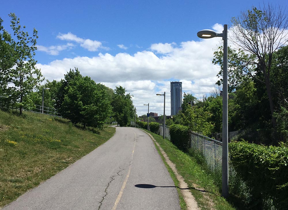
Trillium Pathway running alongside O-Train tracks
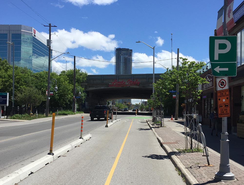
There is a slight detour one block over along Preston heading under the Queensway.
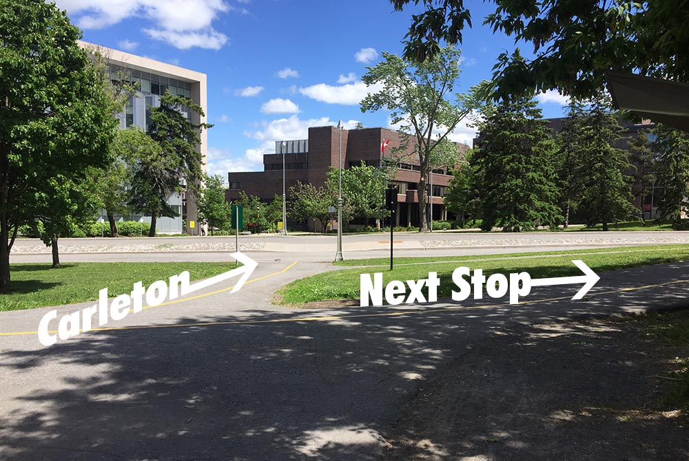
Beyond the Queensway the path continues beside the tracks. A bit further along is the second O-Train stop, Carling Station.

Next stop – Carleton University.
Cross Carling Avenue at the lights and continue straight along the Trillium Pathway to where it ends at Prince of Wales Drive. Turn left along the path that runs parallel to Prince of Wales Drive, then cross at the lights at Dows Lake.
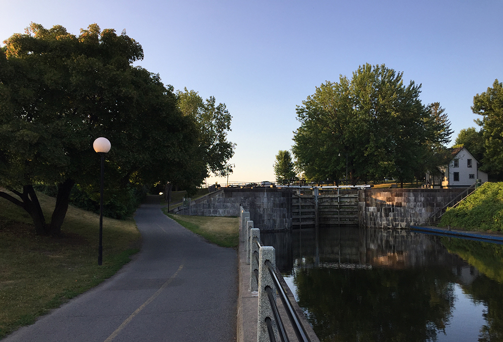
Follow the bike path that runs through the Arboretum. This path eventually runs parallel to the Rideau Canal and up to the Hartwell Locks across from Carleton University. Cross the canal at the locks.

 Crossing the Hartwell Locks
If Carleton University is your destination then cross Colonel By Drive and you’re on campus. Left on Library Road brings you down to the Carleton Station.

If your destination is a stop further down the line don’t cross Colonel By Drive. Instead turn right and ride along the Rideau Canal Eastern Pathway.

Rideau Canal Eastern Pathway
The path goes under Hogs Back Road, then curls up to Mooney’s Bay.

Turn right onto Hog’s Back Road. The Hog’s Back Road bridge over the Rideau River is presently being rebuilt however there is a detour that runs along the side of this short bridge. Bonus – this affords a spectacular view down onto the falls.

Once over the bridge and back onto Hogs Back Road you can ride along either path on both sides of the street although I would suggest crossing onto the south side so it’s easier to cross busy Riverside Drive at the next lights.

Crossing Riverside Drive brings you to Brookfield Road which has a bi-directional bike path on the south side of the road. Follow this path all the way to the round-about. Once arrived at the round-about take the first crosswalk to the other side of Brookfield Road.
If your destination is the Mooney’s Bay Station turn left onto the path that meanders for a short distance down to the station.

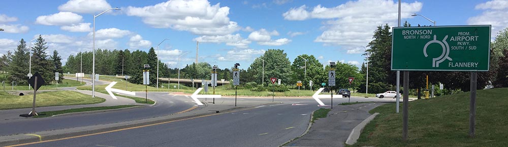
If your destination is the next stop, Greenboro Station, then turn right onto the Brookfield Pathway that skirts the edge of the round-about before curving under the Airport Parkway and up over a set of train tracks.

Just beyond the train tracks turn right onto the Sawmill Creek Pathway. This path runs mostly alongside the Airport Parkway. It veers off a bit and follows the transitway for a short spell before continuing along the Parkway. You will ride past the Sawmill Creek Wetland, a fantastic series of ponds and a natural habitat for all sorts of birds.


Continue under the distinct pedestrian/bike bridge, then take the second exit left off the pathway (the first exit is the ramp up over the bridge. Don’t take that) .
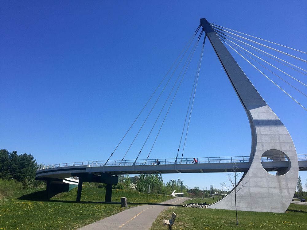
Heading under the bridge towards the second exit off the Sawmill Creek Pathway
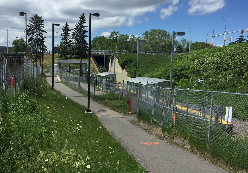
This short section of path will take you to a tunnel that leads under the O-Train tracks, then through an enclosed passageway that goes under the transitway. The confusing sign at the entrance of the enclosed section says no bikes allowed, but OC Transpo confirmed you can walk your bike through.
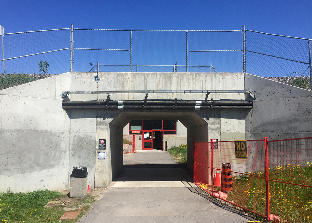
Tunnel & passageway
On the other side you will find yourself at the southern back corner of South Keys Shopping Centre. Turning left onto the service road that runs behind the shopping centre will bring you to our final stop, Greenboro station.

Et voila!
Biking is a great alternative to taking the train.

This is great! Thanks. It’s so helpful for folks unfamiliar with the terrain to have photos so they can see what they’re getting in to.
Great post! I got to it through Bike to Work Ottawa’s Facebook link. Loved the brake lights on the cars, as they noticed you taking a photo of them. I’ll have to dress that way more often, and get more respect on the roads!
Thanks for liking the post! There’s a company in England that has taken bike officer fashion to a whole other level, as described in this bike-blog post from across the pond.
http://www.wheelsuckers.co.uk/profiles/blogs/review-polite-notice-hi-visibility-vest