GCTC Bike-a-Thon

Founded in 1975, the Great Canadian Theatre Company is Ottawa’s longest established independent English professional theatre company. I and a group of fellow GCTC board members with the help of theatre staff, are organising the first annual GCTC Bike-a-Thon to raise funds to go towards mounting upcoming productions. It all takes place early in the morning on Sunday, September 15th.

This Spring I test rode the following route with Eric Coates, GCTC’s new Artistic Director AND avid cyclist. I recently re-visited the route to celebrate the recent launch of our fundraising website and to blab about it in this blog!

It’s a participaction / distance achievement type of bike-a-thon i.e. not a race. Very laid back. In keeping with the bee icon on the cover of next season’s program and posters, all the riders are encouraged to wear whatever yellow and black combo’s they can pull from their wardrobe. Rumour has it some may even sport wings and antenna. The Bike-a-Thon will start from the Irving Greenberg Theatre located at the corner of Holland and Wellington St W, home of the GCTC.

GCTC
GCTC

We will ride east on Wellington and head north on Parkdale to where it joins the Ottawa River Pathway.

Where Parkdale meets the Ottawa River Pathway

Continuing east along the pathway we will be treated to such wonderful sights as this…

Ottawa River
Ottawa River

… and this, where the path follows the edge of the river and continues behind Parliament Hill.

Ottawa River behind Parliament Hill

We will leave the Ottawa River and climb up beside the Rideau Canal locks between Parliament Hill and the Chateau Laurier.

Ottawa Locks
Ottawa Locks

After passing under Sapper’s Bridge…

Sappers Bridge
Sappers Bridge

… we will pull up to our good friends at the National Arts Centre.

National Arts Centre

Once we’ve paused long enough for everyone to catch their breath after the climb up from the river, we will continue along the Rideau Canal where one is treated to glorious views such as this.

Rideau Canal
Rideau Canal

The path circles around Dows Lake and weaves its way through the Arboretum.

Path on the other side of Dows Lake
Around Dows Lake
Through the Arboretum

One more short climb up beside the locks across from Carleton University before our route takes us through the Experimental Farm.

Experimental Farm
Experimental Farm

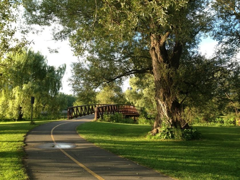
A section of the route that runs parallel to Fisher wanders through a stand of tall majestic trees like so.

A little bit of forest for good measure

The route then crosses Carling and follows the bike lanes along Island Park Drive, like so.

Bike lanes along Island Park Drive

A few blocks east along Byron Avenue.

Path along Byron
Path along Byron

Then one block north along Holland, and voila! – We arrive at the finish line back at the GCTC.

FINISH / ARRIVÉE
FINISH / ARRIVÉE

So dear friends, bikers, and readers, if any of you may be interested in helping fund the great art created at the GCTC, as well as indirectly promote biking as a wonderful activity within our area, please visit the Bike-a-Thon site and follow the instructions.

Happy trails!

Chunks of Old Buildings – round 2

Last November I posted a tour of various architectural ruins that have been selectively placed throughout the city. Since then I’ve discovered a few others so I came up with this second route which I tested out this morning.

First stop on the tour is this sculpture titled Enfin le soleil, located in the Gatineau community of Jardins Taché. It is a piece commemorating a legal struggle in the 1970’s pitting the Association des propriétaires des Jardins Taché against the development of a high-rise that was constructed despite not meeting zoning requirements. The Association des propriétaires persevered and the building was demolished. Two sections of reinforced concrete were recuperated from the demolition and incorporated into this piece.

Enfin le soleil
Enfin le soleil

Second stop is a short distance down river just off the Sentier des Voyageurs. They are steel pipes from an EB Eddy facility, recovered in 1977 during construction of a nearby park and arranged within the landscape as reminders of the area’s industrial past.

EB Eddy Pipes
EB Eddy Pipes

Third stop is Strathcona’s Folly, a play structure created in 1992 by artist Stephen Brathwaite, located in Strathcona Park along the Rideau River. It incorporates architectural details from a number of heritage buildings throughout Ottawa, as described on a bronze plaque mounted within the piece.

Strathcona's Folly
Strathcona’s Folly

And finally, this Gothic Revivalist detail sits on the grass behind the Confederation Building, just to the west of Parliament Hill. There used to be a few others lying about with gargoyle motifs but I didn’t notice them on this occasion.

Gothic Revivalist detail

So there you have it – a few more strategically placed architectural remains commemorating the past within our ever changing built environments.

Biking to Barrhaven

Back in 1959 a Kingstonian by the name of Mel Barr bought a bunch of land Southwest of Ottawa with the intention of building a racecourse. Those plans got messed up when the Rideau Carleton Raceway beat him to it, so he sub-divided the land and sold it to various developers. This started a flourish of housing developments in what was previously an expanse of rural homesteads. And so it was…and so it continues to be, as the majority of the remaining landholdings in the area are owned by developers who continue the suburban trend started by good old Mel. Early Saturday morning I plotted two bike routes to Barrhaven and headed off to test them out. The blue line shows the route I took to get there, purple line is how I got back.

UPDATE 2018 : Modifications to Prince of Wales between Hunt Club and Standherd, including the addition of bike lanes, are happening!

There is a paved shoulder along Prince of Wales Drive from Dows Lake to Hunt Club Road that looks mostly like this ….

POW !
POW – Dow’s Lake to Hunt Club

…except where the shoulder dangerously disappears just before and up to Rideau Heights Lane like so. I rode along the strip of gravel off to the side.

POW just East of Lane

Beyond Hunt Club Road there is a paved shoulder to bike along, albeit narrower and in rough shape, like so.

POW South of Hunt Club

Design plans do exist to widen Prince of Wales between Hunt Club and Woodroffe Avenue to include bike lanes but the project’s implementation phase is scheduled anywhere between 2016-2022.

Riding conditions improve dramatically along the sections of Fallowfield Road, Merivale Road and Leikin Drive that I followed. The shoulders are in much better shape and identified as bike lanes, like so.

Bike lane along Fallowfield Road

The residential area I biked through seems to have been developed in the 70’s and 80’s, based on the size of the trees and style of architecture. A good thing about having various species of big trees on front yards in many suburban developments is how they lend some distinction to properties whose houses are very similar in design.

Trees of Barrhaven
Trees of Barrhaven

The area was also developed before the regional amalgamation when it was still part of the city of Nepean, as suggested by the design of these park signs. They have been around long enough now to have acquired a 70’s retro feel – poured concrete structures, big comfy corner radii and Helvetica typeface in all caps.

Barrhaven park signs

Time to head home. I followed Fallowfield to this very nice recreational pathway that runs along Woodroffe through the Greenbelt.

Pathway along Woodroffe

The path circles behind the Nepean Sportsplex and crosses West Hunt Club Road at this dedicated cross walk.

Crosswalk
Crosswalk

Eventually the path meets Woodfield Drive which I followed to Merivale Road. This section of Merivale doesn’t have the generous bike lane experienced further south. But it does have a paved strip one sometimes finds between busy roads and sidewalks, like so.

Bike lane wannabe along Merivale

I followed it as far as Colonnade Road. Colonnade has no shoulder. Fortunately a bike path turn off is just a short ways along, like so.

No shoulder along Collonade.......but bike path not too far.
No shoulder along Collonade…….but bike path not too far.

UPDATE – August 2015: A new bike path along Colonnade, linking Merivale Road to the bike path described above has been installed!

I continued along the path until I reached the option to turn along a path that follows Nepean Creek, which I did.

I then followed it up to Viewmount Drive, which has this great big allotment garden running alongside it.

Nepean allotment garden
Nepean allotment garden along Viewmount Drive

I followed Viewmount until it reached Fisher Avenue. Ah, Fisher, if only it had bike lanes. It would accomplish wonders in advancing the popularity of bike commuting for so many Ottawans living south-west of downtown. The room is there. At present however, there are none and it’s a dangerous stretch as a result. It wasn’t too bad at 7 am Saturday morning, but I’ve riden down it during regular weekly working hours and it’s pretty scary. If I was following this route as my bike commute from Barrhaven I might consider heading south on Fisher and riding along Prince of Wales into town. But for this route I headed north along Fisher until it met up with the Experimental Farm Pathway.

Fisher Avenue, early Saturday morning

So there you go – two ways to bike to Barrhaven. Neither perfect, but still very do-able and, for the most part, very pleasant. I look forward to re-visiting Mel Barr’s old stomping grounds, to further explore the subtle layers of character introduced over its relatively short history of modern development.

p.s. Here’s another route I followed to get to Barrhaven last summer – (click on this red text).

First Nations – Part II

On January 2nd I described a tour of various locations and monuments within the National Capital Region that are of particular significance or reference to the First Nations. Since then I have learnt of a few others, including one that eluded me on the first tour – the bronze sculpture of an Anishinabe Scout. Here is the route I followed to visit these additional locations.

First stop, 299 Montreal Road where stands the recently completed Wabano Centre for Aboriginal Health, designed by architect Douglas Cardinal who also designed the Canadian Museum of History in Gatineau.

Wabano Centre
Wabano Centre

Second stop is the sculpture of the Anishinabe Scout at the northern tip of Majors Hill Park, tucked behind the small heritage stone building. The first image also shows the statue of Champlain in the distance up on Nepean Point. The sculpture was originally installed at the base of the plinth upon which Champlain stands but was relocated to its present site in 1996 at the request of Ovide Mercredi, former National Chief of the Assembly of First Nations. UPDATE: December 2018 – Just discovered a very good mini-doc on the history of this sculpture.

Anishinabe Scout & Champlain
Anishinabe Scout
Anishinabe Scout

My final stop was along the Ottawa River Pathway, just east of Island Park Drive where this recently installed circular arrangement of stones is located. It is titled the Kitchissippi Medecine Wheel and is the work a fellow named Tim. UPDATE – Summer 2015: The installation is no longer there, but it’s still a great spot to visit, overlooking the Ottawa River.

Kitchissippi Medecine Wheel

This description of the piece is mounted to a wooden post just to the right of the wheel.

Kitchissippi Medecine Wheel interp

Bike commute to Briargreen

Briargreen is a small community within Nepean built in the 1960’s which has been described as a ‘snapshot’ of mid-century architecture in Ottawa. Those who live there are fortunate to have two fabulous bike commute routes into town that are almost entirely along bike paths. Here they are. The blue line is the route I followed from Centretown to get there. Purple line is the alternate route.

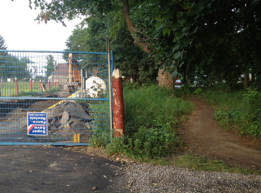
Blue route first – Centretown to Briargreen. Cutting through the Experimental Farm is a bit tricky these days while they are doing construction work along Cow Lane, so I followed the pathway along the NCC Scenic Driveway, then turned onto the gravel path through the small section of woods that runs parallel to Fisher. UPDATE Summer 2014: The path along Cow Lane is all fixed up (see red line on map) which permits avoiding riding along the speediest section of the NCC Scenic Drive.

Wooded path parallel to Fisher

This brings you to the Experimental Farm Pathway which is presently being dug up as well just east of Fisher Avenue, but fear not. You can follow this very well trodden path on the right to Fisher.

Link from wooded path to Fisher Ave

Cross Fisher to Kent Street and weave your way to Kingston St. There is a path where Kingston crosses Hollington Ave that gets you back on to the Experimental Farm Pathway. One thing I love about this and many other sections of the recreational paths is how they look onto people’s backyards where the landscaping tends to be more relaxed and personal, like this garden being guarded by an interesting scarecrow.

Scare-everything!
Scare-everything!

Follow the Experimental Farm Pathway until Woodroffe Avenue, and cross to where it becomes the Pinecrest Creek Pathway. Follow along until you come to a turn off that takes you across the bus transitway. Take this turnoff.

Now things get a little tricky just south of Baseline Road where the path jogs around an OC Transpo parking lot. This jog in the path is confusing because it opens up to a huge parking lot with no directional signs to help you distinguish what is parking vs road vs sidewalk vs pathway. While trying to figure this out I noticed most folks don’t bother with this mini detour and just ride infront of the bus parking rather than go around, as shown here and indicated by the short pink line on the above map (zoom in).

You can go that-away.... or that-away!
You can go that-away…. or that-away!

If you do take the path, versus cutting in front of the OC Transpo parking, the photo below shows where it turns once beyond the bus parking.

Direction of path around Baseline bus stop
Direction of path south of the Baseline bus stop

Continue along the path until you come to this turn off which will bring you to Summerwalk Place Lane.

Path link towards Summerwalk Place Lane

Weave your way to Centrepoint Drive, and cross over to Marble Arch Crescent. Follow Marble Arch Crescent until it elbows south. There on the right you will notice this short path link which will takes you right through to Briargreen!

Path link from Marble Arch Crescent into Briarcliffe

Here’s a well preserved mid-century modern dwelling that caught my eye.

Mid century modern in Briarcliffe
Mid century modern in Briargreen

The alternative bike commute (purple line) turns north along Watsons Creek Pathway where it joins the Ottawa River Pathway. It’s slightly longer but very scenic with fewer roads to cross. If you are gonig downtown continue along the Ottawa River Pathway. If you are coming into town via the blue line route continue along the pathway that runs along the canal from Dow’s Lake.

On that note, if anyone requires info on a safe bike commute from, or to any specific location within Ottawa or Gatineau please text me below and I would be pleased to try and help out.

Happy commuting!