Biking to Acorn Creek Garden Farm to Pick Strawberries

Every year we head over to Acorn Creek Garden Farm for some strawberry picking. This year I biked there and met up with Carla and the kids who drove. Here is the route I followed.

.

It’s a relatively flat 30 km ride almost entirely along recreational pathways BUT I recommend doing so early on a Saturday or Sunday morning, as things get a little tricky riding through parts of Kanata and along Richardson Side Road.

I headed out along the Ottawa River Pathway and followed it all the way to Carling Avenue at the beginning of Andrew Haydon Park.

Where to turn off the Ottawa River Pathway

I got off the Ottawa River Pathway at this spot by turning left across Carling and onto Watts Creek Pathway. The path gets a little convoluted where it reaches Holly Acres Road. I crossed Holly Acres Road and rode down Aero Drive for a short distance to where Watts Creek Pathway continues to the left, like so.

Path ends at Holly Acres......... and continues down Aero Drive
Path ends at Holly Acres……… and continues down Aero Drive

I continued along Watts Creek Pathway to where it crosses Corkstown Road. On the other side of Corkstown Road the path becomes gravel. There is also a directional sign suggesting you bike along Corkstown Road. I prefer the gravel path, however it can get a bit mucky during rainy weather especially where the path reaches Moodie Drive. On this occasion I should have followed the road.

Path meets Corkstown Road....... and puddle along gravel path where I got my soaker
Path meets Corkstown Road……. and puddle along gravel path where I got my soaker

I crossed Moodie, and got back on Watts Creek Pathway.

Where the apth continues on the other side of Moodie
Where the path continues on the other side of Moodie

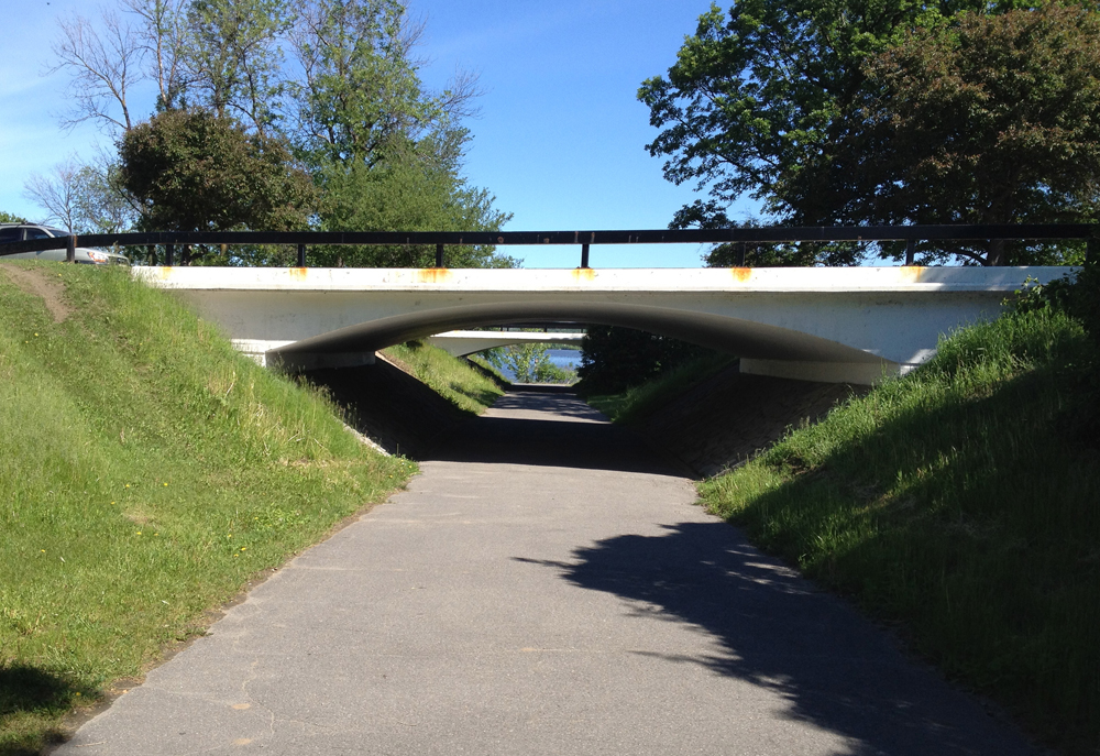
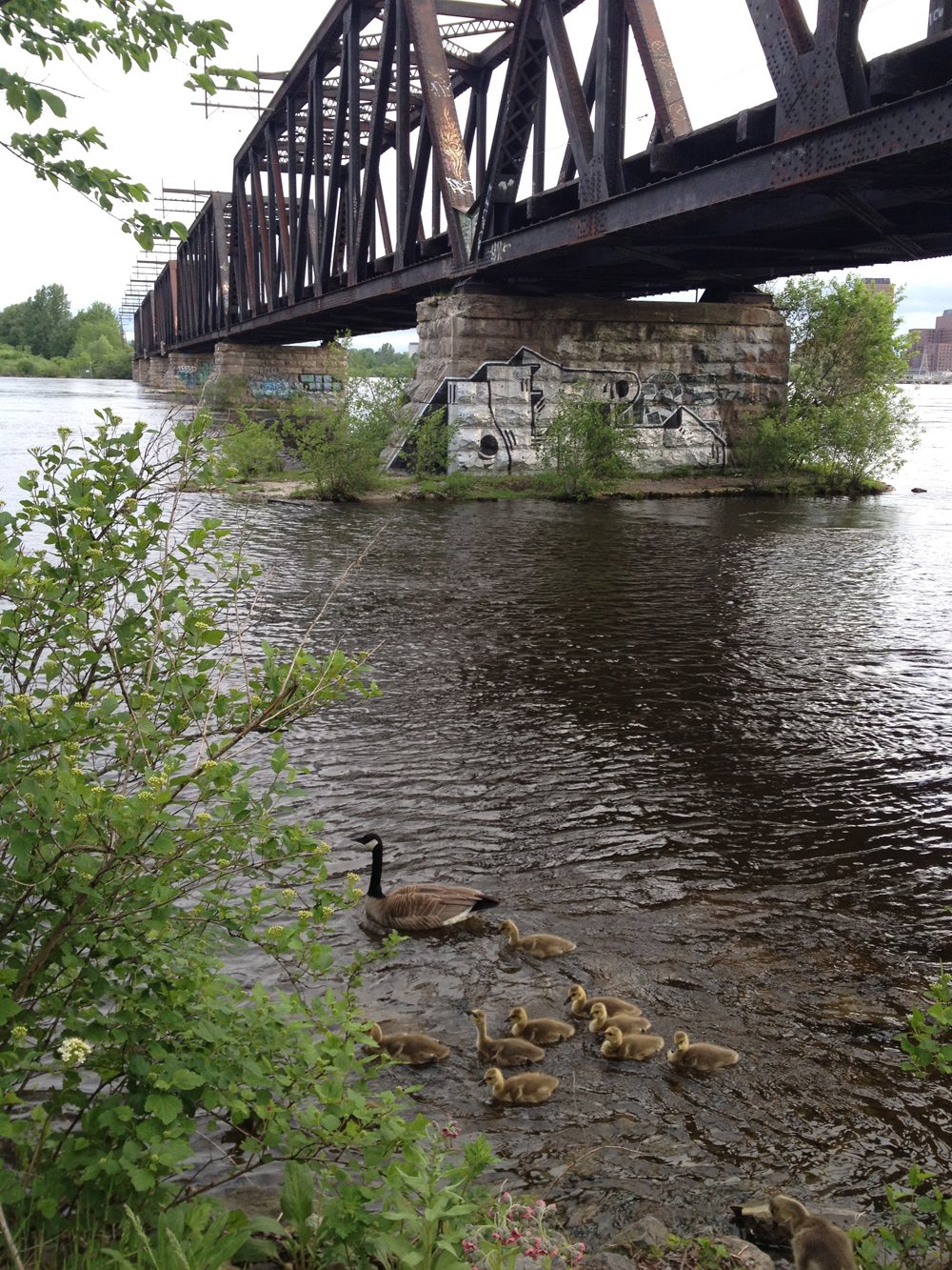
Further along there is a turn off with a sign pointing to Carling Avenue. I ignored it and continued under this train bridge.

Train Bridge
Train Bridge

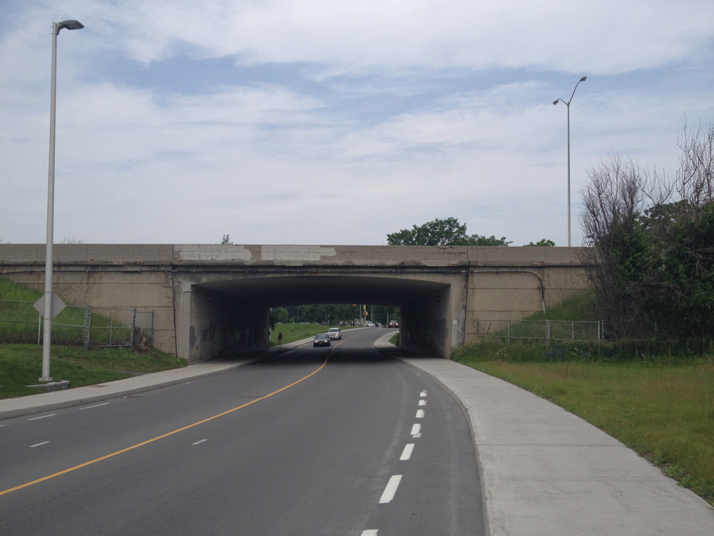
There is another fork in the road further along with a sign pointing towards March Road. I ignored it as well and stayed right to continue through this tunnel under March Road.

Tunnel under March Road

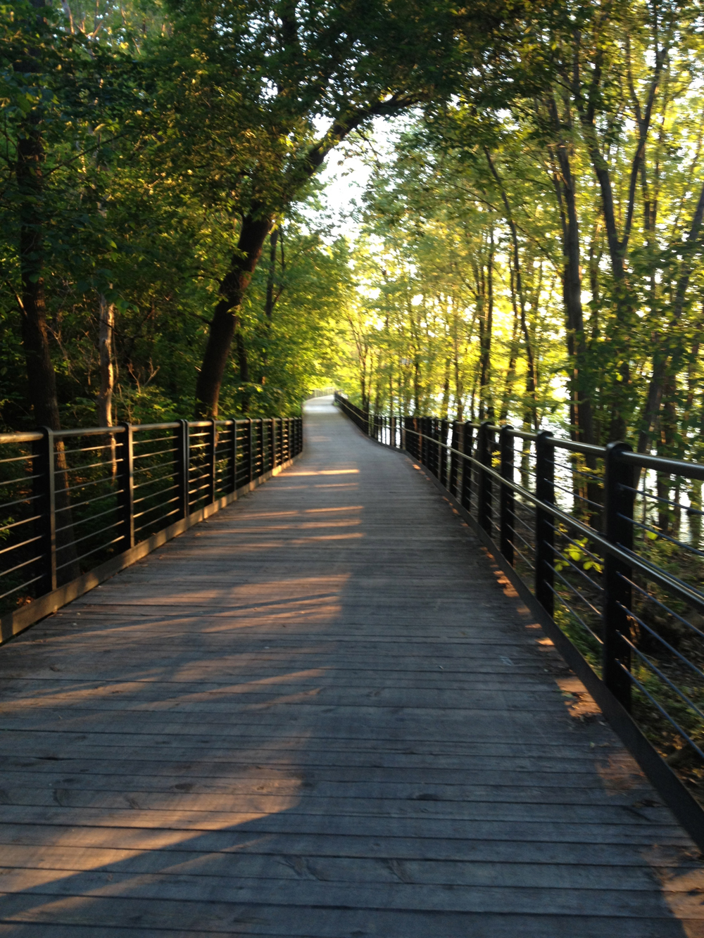
Watts Creek Pathway, which is maintained by the NCC, ends on the other side of this tunnel at Petrie Lane. I crossed Petrie Lane and followed this path for a bit.

Path beyond Petrie Lane

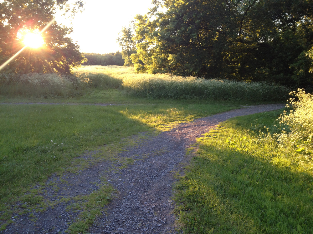
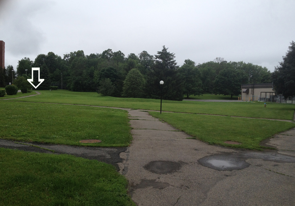
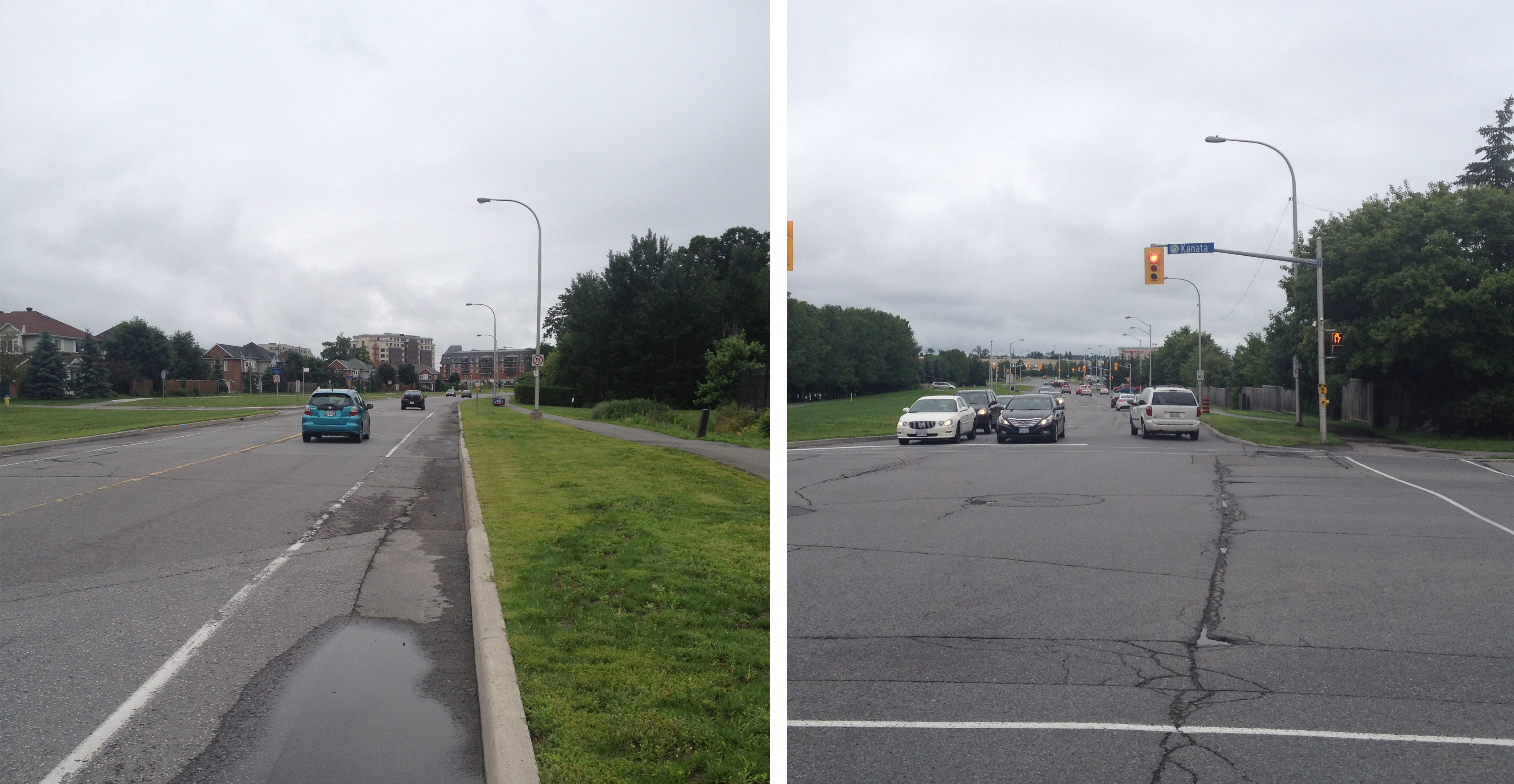
There are very few directional signs throughout this part of Kanata. I assume they were originally developed by the local community whose residents were in little need of directional signs. As such you pretty much have to go on instinct to find your way around the area. For example the path I found myself on splits off in many directions. I took the middle path indicated by the big white arrow on the photo below.

Path through Kanata
Path through Kanata

This brought me to Teron Road which has a bike lane.

Path along Teron Road

I followed Teron Road south to Campeau Drive. It too has bike lanes, but they disappear a hundred yards before and after each intersection. There is a paved path running along Campeau Drive as well. I’ve heard say that paved paths can be interpreted as multi-use paths, so take your pick.

Bike lane along Campeau Drive........... intersections not included.
Bike lane along Campeau Drive……….. intersections not included.

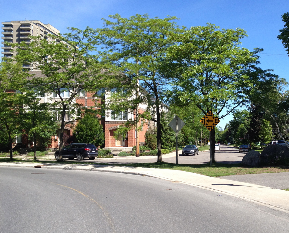
I found myself deep in Car Land – those buffer zones surrounding most North American cities where one rarely sees a human outside a vehicule, other than transferring from their parked car to whatever building they drove to, however bike lanes such as these encourage a more diverse mix of users that are good for local business.

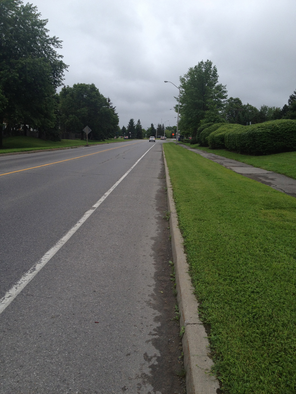
I followed Campeau Drive to Terry Fox Drive. I turned right onto Terry Fox Drive, which has nice generous bike lanes like so.

Terry Fox Drive Bike Lane, intersections included!

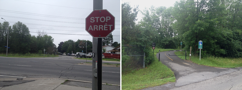
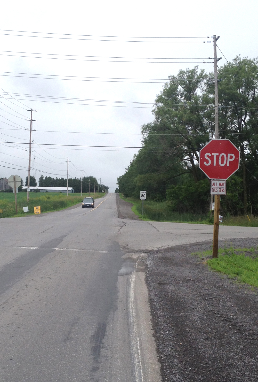
I turned left onto Richardson Side Road and followed it for around 2 km’s to Old Creek Road. Richardson Side Road is a straight two laner with packed gravel shoulders. I felt safe riding on the road at 10 am Saturday morning. Cars slowed down and gave me lots of room as they passed. I suppose those in a hurry take the Queensway that runs parallel to Richardson Road just half a kilometre south. However there must be some speeders to warrant a stop sign this big.

Richardson Side Road

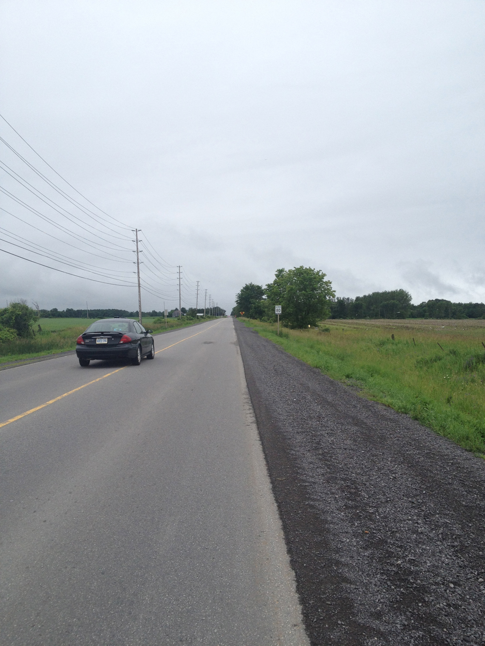
I tested out the gravel shoulder which wasn’t too bad if you don’t feel comfortable biking on the road. I would have felt comfortable doing so as the distance along Richardson Road is only for 2 kilometres. I do suggest biking out early on a weekend morning. That way you are sure to avoid most, if not all traffic along this narrow side road. Acorn Creek Farm opens little after 8am.

Road vs gravel shoulder (Bravo generous driver!)

I turned onto Oak Creek Road which was fine – hardly any traffic at all.

A welcome sign
A welcome sign

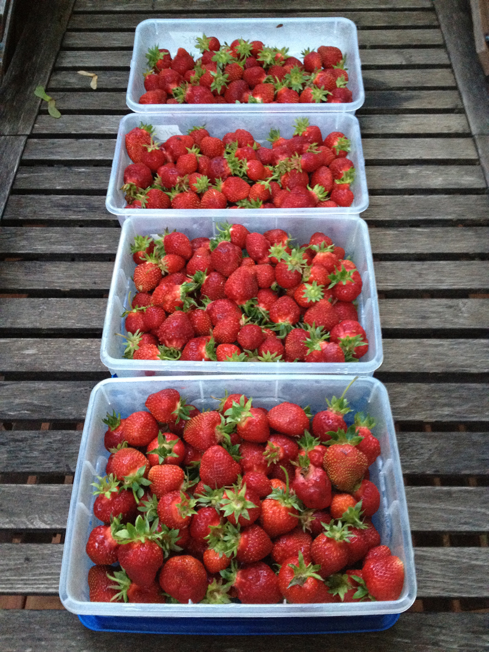
Truth be told, by the time I pulled into the farm parking lot Carla and the kids had finished picking and purchasing all the strawberries we needed. The kids thought that was very funny. If you are planning on heading out to pick strawberries bring good bug spray, and wear long sleeves and pants. There were swarms of mosquitoes this year because of all the rain. Wear rubber boots too. This year the pick-your-own patch is about a kilometer walk into the field. But it’s worth it – the strawberries are very yummy.

strawbs2

Biking to Trailer Pork Boys from Centretown

UPDATE 2017: It seems Trailer Pork Boys has been closed since 2014, but I’ll leave this post up for nostalgia, or for anyone needing directions for a destination within the same area.

Now why, you may ask, why would I suggest a bike route to a food truck located in a big parking lot at the very busy traffic corner of Carling and Merivale? Well I probably never would have, until I read on Twittersphere how one of the Trailer Pork Boys caught someone on a stolen bike belonging to one of his buddies at Tall Tree Cycles. I’m fond of Tall Tree after they gave me great advice on a bike for my daughter and my Brooks saddle, but I was most impressed with the bike salvaging heroics displayed by the quick thinking Pork Boy. But the clincher were these great reviews on Foodies. Now I REALLY had a hankerin’ fer a pulled pork sandwich! But how to bike there safely from Centretown? Well, here’s how. Blue line’s how I got there, orange line was my ride back.

The route there is a bit circuitous, but pulled pork sandwich is a meal you have to earn! Follow the O-Train bike path to Prince of Wales Drive, then cut through the parking lot in front of this rapidly disappearing big Sir John Carling Building  They are in the process of tearing it down. UPDATE 2017: They blew up the building and ripped up the parking lot, but there’s a desire line path short cut through the grass you can take in place.

Big building coming down

The short cut avoiding Prince of Wales to the National Capital Commission Scenic Driveway goes past the historic William Saunders building and the Experimental Farm heritage greenhouses.

William Saunders Building and Greenhouses

There is a bike path with lots of shady trees running along the NCC Scenic Driveway, starting just beyond the big red barn.

Big Red Barn............... and Shady Path
Big Red Barn………………………….and Shady Path

Cross Fisher Avenue and weave your way through quiet residential streets as shown on the map, which will bring you to Merivale Road right across the street from our destination, the Trailer Pork Boys!

Trailer Pork Boys
Trailer Pork Boys

I arrived just before they open at 11:30. There were a couple of people ahead of me, so I had time to relax a bit at one of their parasol’d pic-nic tables and take in the scenery, such as this elegant old Ottawa Hydro-Electric Sub Station no. 3 across Carling Avenue, juxtaposed beside the hyper functional electro wire and truss infrastructure.

Ottawa Electric Sub Station No. 3

And this is the pulled pork sandwich I had for lunch. Very yummy indeed. You will need to take advantage of the roll of paper towels provided at the pic nic table. The pulled pork poutine looked very scrumptious too but I’d have to come up with a much longer bike route to earn one of those.

Pulled Pork Sandwich

Another more direct route to the Trailer Pork Boys, as indicated by the orange line on the map, is mostly the way recommended by our pulled-pork-chef-and-swiped-bike-spotter par excellence, which he rides to work from his home in Hintonburg.

There is a bike lane along Merivale north of Carling, but it disappears just before going under the Queensway, so rather than stick to Merivale I cut through the Royal Ottawa Mental Health Hospital parking lot. A few curbs to hop if you do. Tricky call. I would probably continue along Merivale, as our biker-chef most likely does, if the traffic was light. Either way will take you to Island Park Drive.

Merivale bike lane disapearing as it goes under the Queensway

I’ve always felt comfortable riding on the bike lanes along Island Park Drive regardless of the time of day.

Bike lane along Island Park Drive

Island Park eventually crosses the bike path along Byron which I followed home in the manner described in this post.

So, I highly recommend the Trailer Pork Boys for their great food AND their love of bikes!

Revisiting the Gatineau Ship Wreck

This blog recently turned one year old (note the date – 2013)! To celebrate I re-visited the site described in the very first post – the shipwreck near the confluence of the Lac Leamy outlet and the Ottawa River. Blue line is how I got there. Purple line is my return trip. UPDATES: 2018 – Red lines on the map are detours required for 2018, 1) behind the Museum of History because the NCC has yet to fix the section of path flooded out in the Spring of 2017, and 2) the section through Jacques Cartier Park because of the Mosaique flower display occupies the majority of the park, blocking off a section of the regular bike path.  

To get there I followed the Voyageurs Pathway along the Gatineau side of the Ottawa River, a section of which takes you along this wonderful raised boardwalk.

Out on the boardwalk.

To get to the shipwreck, veer off the paved Voyageurs Pathway to the right onto this gravel path, as indicated by the light blue marker on the above map.

Start of the gravel path

Now you may do as i did and accidentally turn off on a path a little before the one that takes you to the shipwreck, as indicated by the orange line on the map. No worries, it serendipitously takes you a short distance to a spot where you can look across the river towards Rideau Falls, like so.

View across the Ottawa River

Retrace your treads and continue along the gravel path until you arrive at the turn off towards the shipwreck. I’ve indicated the ship’s location with the red marker on the above map. I haven’t found any historical documentation describing the wreck, however a well placed source suggested it had been illegally parked and the owner didn’t want to move it, so the powers-that-be, or the owner himself, scuttled the ship and left it there for curious onlookers to ponder on an annual basis.

Shipwreck
Shipwreck

After contemplating the mysterious wreck you can rejoin the Voyageurs Pathway. I came across three deer munching grass between the pathway and Boulevard Fournier, including this fellow! The biker in the reflective vest calmly rode by saying, ‘C’est beau la nature, hein?’.

Deer me!
Deer me!

I also recommend another short path along the Gatineau River to where it joins the Ottawa River, as indicated by the purple line on the above map. More great views to be had, such as this one back up the Gatineau.

Looking up river.
Looking up river.

To get back I followed multi-use paths that go around Lac Leamy and along the Ruisseau De La Brasserie Pathway.

So Happy Birthday OttawaVeloOutaouais! Here’s looking forward to many more biking adventures.

Deer 2

Biking to the Westboro Superstore from Centretown

Centretowners are blessed with a multitude of fine grocery stores where they can purchase all sorts of unique yummy stuff, be it homemade dumplings on Somerset, or stuffed sausages on Preston. But many Centretowners also need to get to a store that sells the staples at reasonable prices. The Real Canadian Superstore in Westboro is the closest, but it can be a nerve wracking bike ride to get there, especially during regular shopping hours. Instinct would suggest riding down Wellington St W, which turns into Richmond Rd. It is the oldest westwardly street in the region, retaining it’s narrow layout, lined with heritage buildings and historical anecdotes. But over time it has morphed from a human scale promenade to a car traffic, not-very-bike-friendly, ‘artery’. Most surrounding streets have much fewer cars and more room to safely bike along. Here are two suggested bike friendly routes that weave their way through such less travelled vehicular veins, one I take to get there (in orange), the other I follow to get back to Centretown (in blue).

Assuming all Centretown biker’s have discovered their favorite way to get to the O-train bike path, this route starts along the path at the base of the long incline on the south side of the Somerset bridge.

Head on up the incline to Somerset, cross the street, ride along the bike lane over the bridge, and take this mini-flight of stairs (bike trough included) down to Breezehill Ave N on the north side of the bridge, right beside Takaki’s.

Mini stairs with ramp at Somerset and Takaki's
Mini stairs with ramp at Somerset and Takaki’s

You can avoid Somerset/Wellington by weaving your way to Armstrong St, as shown on the map. (n.b. If you choose to return along this route there is a bike lane along the short stretch of Garland St which is otherwise a one way heading north). Big bonus to this route is you get to go right past Parkdale Market and pick up any farmer fresh produce that might be on your shopping list.

Parkdale Market
Parkdale Market

You’re going to eventually have to cross Wellington. I suggest you do so at Caroline and Wellington. It isn’t a direct crossing, as per the photo below, so walk your bike all of 10 yards or so to the lights.

Caroline & Wellington

On the other side of Wellington you will find yourself on Harmer Avenue. Continue along Harmer to Byron, then follow the paved path that runs along Byron. This is one of the most civilized paths in Ottawa, accommodating a harmonious mix of bikers, dog walkers, kids walking/biking to school, etc.

Bike path along Byron

From this path you can pop right through to the Superstore parking lot and weave your way to the bike racks at the western corner of the store on Richmond.

Superstore bike rack

Et voila!

Now, how do you get all of THIS back to Centretown?!

Groceries!
Groceries!

Chaque à son gout (big back pack; trailer; cargo bike; etc), but I recommend expandable panniers like these ones. They are also excellent for touring. And buy your milk at the Shoppers Drug Mart at Bank along the Laurier bike lane. Cheaper, and avoids those heavy milk bags taking up valuable pannier real estate.

All loaded up!
All loaded up!

OK, alternative route #2 – heading home.

Cross Richmond Rd (which was Wellington further East) at Kirkwood.

At the end of Kirkwood take this path link to W. Village Private. Assume W. Village is the name of a distinguished Canadian soldier and carry right on through.

Path link from Kirkwood

Cross busy Scott to Lanark Ave.

Lanark eventually veers West, which isn’t where you want to go, so hop the sidewalk over to Latchford Road, like so. Fear not, the sidewalk is ramped on both sides.

Sidewalk hop from Lanark to Latchford

Weave you way easterly along quiet streets shown on the map until you reach Carleton Ave. Head north along the link to the Ottawa River Pathway. Here’s the elegant Parkway underpass that gets you to the river.

Parkway underpass
Parkway underpass

Follow the Ottawa River Pathway all the way to the turn off to the O-Train path, and head on home. Whoda thunk grocery shopping could be so much fun?

Ahhh Spring…. the schmaltzy tour.

Cuteness abounds all over the city at this time of year. Here’s a tour that will take you some seasonal sweet spots.

I caught this little guy feasting on some remaining bulbs in the tulip gardens at Dow’s Lake.

mmm-yum-yum-yum....
mmm-yum-yum-yum….

Along the canal between the Hartwell and Hogs Back Locks there’s a good chance you’ll catch a peek of this ducky family.

Early morning family outing
Family outing

To get to the Experimental Farm I followed this well worn path off Baseline.

Path to Experimental Farm off Baseline.
Path to Experimental Farm.

These feathered fellas were having breakfast in Pinecrest Creek.

Early bird gets the seaweed.

The Deschenes Rapids Lookout is an important migratory bird hangout, with interpretive panels telling you all about it. These Canada Geese were settling down for a nap.

Geese
Resting Geese

I’ve come across a number of folks in Ottawa who aren’t terribly fond of these guys, due to their appetite for expensive seeds, or their propensity to ‘fowl’ up the pathways along the river, but c’mon, you gotta admit, these goslings are CUTE!

Goslings2

Awwww.....
Awwww…..

I leave you with this wee little Inukshuk spotted along the pathway at the entrance to Nepean Bay.

Inukshuk