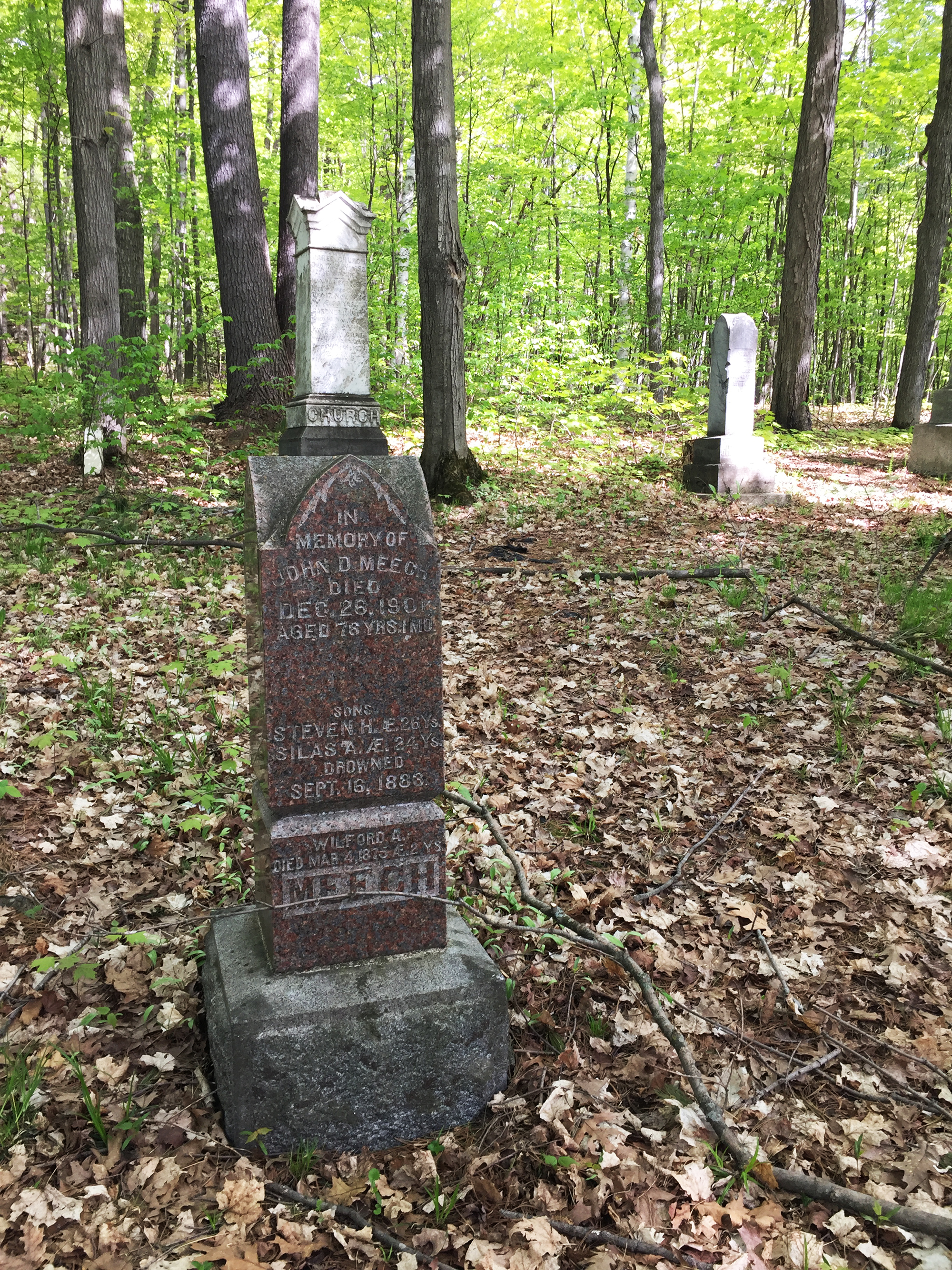
Victoria Day Bike Ride

This 44km ride starts at the statue of Queen Victoria on Parliament Hill and heads up along the Ottawa River before weaving it’s way north through Gatineau Park to the small Chelsea Pioneers Cemetery where lies Private Richard Rowland Thompson, the sole Canadian recipient of a Queen’s Scarf of Honour, one of eight scarves crocheted by Queen Victoria in her final year of life.  

Victoria Day is a distinctly Canadian holiday, celebrated on the Monday that lands between the 18th and 24th of May, in honour of Queen Victoria  born on May 24, 1819. One legend says she chose Ottawa as the nation’s capital by jabbing a hat pin into a spot on a map between Toronto and Montreal to stop the two cities from squabbling over which one deserved to be the capital. Another suggests her appreciation of landscape paintings of the region inspired her to choose this location. There may be an element of truth to both when she ultimately acted on the reccomendations of John A MacDonald, prime minister at the time, and made the final decision.

The statue of Queen Victoria is located just to the west of the Centre Block on Parliament Hill.

Statue of old Queen Vic

Exit Parliament Hill heading west and turn right after passing through the RCMP bollards. Then take Vittoria Street that passes behind the Confederation building and infront of the Supreme Court, before turning left to get to Wellington St .

Leaving the Hill, turn right just beyond the RCMP bollards

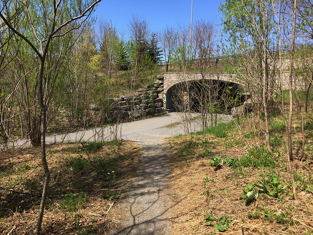
There’s a bike lane along Wellington that starts infront of the National Archives. Follow this lane across Portage Bridge to the Quebec side of the Ottawa River. Once across the bridge follow the Voyageurs Pathway by circling under the Portage Bridge. Follow the path all the way to a fork  just in front of a hydro site. Head right at the fork.

Exit off Voyageurs Pathway towards Gatineau Park

This leads to Rue Belleau, a quiet street with bike lanes leading to the intersection at Boulevard Alexander-Taché. The start of the Gatineau Park Pathway is immediately across this intersection.

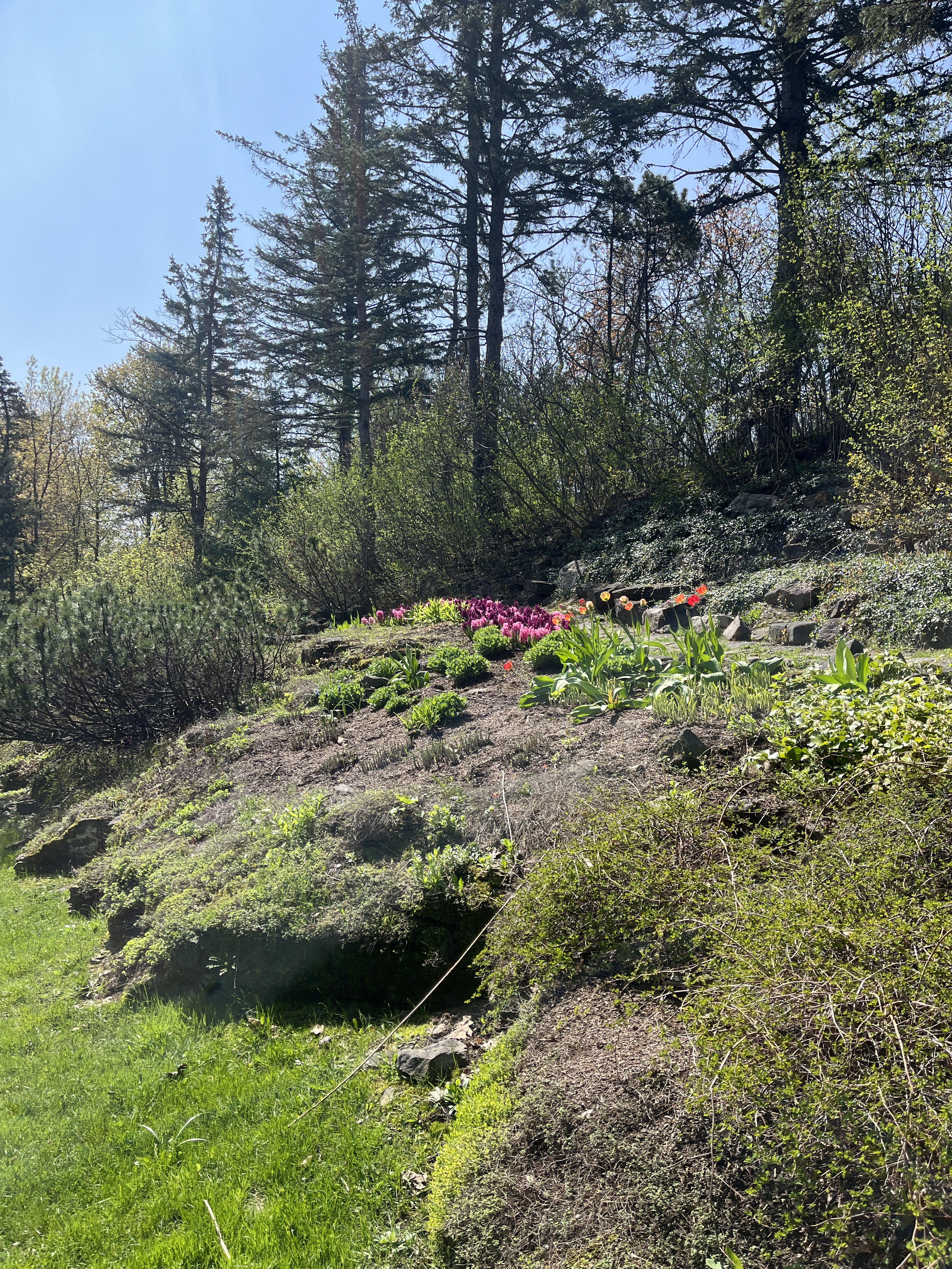
Follow the beautiful Gatineau Park Pathway up through the park all the way to Chemin de la Mine.

Heading up the Gatineau Park Pathway

Access Chemin de la Mine from the pathway and head north along the bike lane on the shoulder of the road. 

Chemin de la mine bike lane

Turn right onto Notch Road which also has bike lanes.

Turn right onto Chemin de Kingsmere then right onto the bike lane along Chemin Old Chelsea east heading over the Gatineau Autoroute, all the way to Route 105.

Turn left up the 105 and ride along the abutting bike lane all the way to the small sign indicating the entrance to the Chelsea Pioneer Cemetery .

Down this short dirt road you will arrive at the small cemetery where lay the remains of Private Richard Rowland Thompson who was awarded the Queen’s Scarf of Honour for saving the life of a wounded colleague and staying with him throughout the Boer War Battle of Paardeberg. He also attempted to save another as the fighting raged about him.  

Grave of Richard R. Thompson

The graveyard itself is very simple and serene, a quiet place to rest before getting back in the saddle.

Chelsea Pioneer Cemetery

Exiting the cemetery continue north along the 105 before turning onto Chemin Scott which also has bike lanes heading into Old Chelsea.

Chemin Scott intersects Chemin Old Chelsea which you can hop back onto and retrace your route back to Ottawa.

Et voila!

Biking To See Some Beautiful Trilliums!

The most amazing display of trilliums I’ve happened upon in our region can be found in a section of forest near the southern edge of Gatineau Park, and they are in full bloom right now! Here’s a bike route to get there.

This ride begins on the Portage Bridge over the Ottawa River. The route travels along a combination of surfaces including paved pathways, roads, stone dust paths, and packed dirt trails through the forest.

If anyone needs a route to get to the starting point please let me know.

View down river from Portage Bridge

On the Gatineau side of the bridge follow Voyageurs Pathway by turning left under the bridge.

Voyageurs Pathway curling under the Portage Bridge on the Quebec side

The path continues alongside Rue Laurier before veering closer to the river’s edge through Parc des Portageurs.

Where the path heads away from the road towards the river’s edge

Continue along the Voyageurs Pathway which weaves up and down  through trees with great views towards the Ottawa River. The path is named after the Voyageurs who portaged their canoes past this section of rapids.

Voyageurs Pathway weaving through the tress

Just beyond the small beach in Parc Moussette take the exit off the path to  Boulevard de Lucerne, then to Rue St-Dominique, then ride across the intersection of Boulevard Alexandre-Taché. Follow the bike path along Boulevard Alexandre-Taché linking Rue St-Dominique to the Moore Farm Pathway.

Bike path along Boulevard Alexandre-Taché

Ride up along the stone dust path through the heritage farm. The stone dust is pretty loose in some stretches, so if you have skinny tires you may have to push your bike along those short sections, or ride on the grassy edge of the path.

Stone dust path through Moore Farm

A bit further along the path just beyond the barn, turn right onto a smaller dirt path.

Exit onto dirt path

A short distance further along it becomes a packed gravel path. My guess is that it once was an railway bed.

Old railway path

The gravel path enventuaqlly veers left and becomes a a dirt trail through the woods. There are a few roots and rocks to negotiate along this path, but for the most part I found it to be well worn and easily negotiable on my hybrid bike.

End of gravel path….to dirt path

I started to notice a few trilliums immediately upon turning onto this dirt path. Gradually more and more appeared as I rode along, as they began to spread out on either side of the path. Absolutely magical.

Trilliums

Eventually the path arrives at an intersection.  Unfortunately these paths aren’t marked. By heading straight ahead the path becomes more rugged and there’s a fenced off compound on the right. That’s a prison. Don’t want to go that way. Instead I turned left at the intersection.

Left at the intersection

The trail continues under some power lines. This monstrous hydro pole confirmed I was heading in the right direction.

Under the power lines

Not too far along from the hydro lines the path gets a little rocky. I suggest walking your bike through this short section leading down to the paved Pioneers Pathway.

Rocky section at the end of the trail

Trail joins up with the paved Pioneers Pathway

Continue along the Pioneers Pathway under the bridge and up to where it intersects the Gatineau Park Pathway. Turn left onto the Gatineau Park Pathway and followed it all the way back down to Boulevard Alexandre-Taché.

Riding down the Gatineau Park Pathway

There are lights to get across Boulevard Alexandre-Taché to Rue Belleau, which has bike lanes.

View down Rue Belleau

At the end of Rue Belleau there is a link to the Voyageurs Pathway . Followed Voyageurs Pathway back to our starting point atthe Portage Bridge and across the river.

Et voila!

Biking to see Daffodils in the Rockcliffe Park Rockeries

It’s not too late to take in the wonderful display of blooming daffodils strewn throughout the Rockcliffe Rockeries. The Rockeries is a lovely public park tucked in the eastern edge of the Rockcliffe neighbourhood overlooking the Ottawa River. Once arrived there’s a path you can follow that cuts through the park. Here’s a 9km bike route to get there from Centretown.

This route follows bike lanes or paths for most of the way. The only spots missing bike lanes are the short connection along Colonel By Drive between the end of the Rideau Canal Eastern pathway to Sussex, and the section of Princess Avenue between the two round-abouts. N.B. – While riding along the Ottawa River pathway, just before arriving at the Rockeries, do NOT cross the Sir George-Étienne-Cartier Driveway (indicated by the red marker on the map) but continue along the paved path on the right side of the road.

There are other flowers and curiosities to discover there as well.

… including tulips.

Spring Bike Tour to Three Big Waterfalls!

Here is a 14km bike tour to three big waterfalls that are particularly awesome in the spring! The ride starts at Hog’s Back Falls, then visits the Chaudière Falls and ends at the Rideau Falls. The spring runoff is, of course, what makes the falls so powerful at this time of year, but the higher volume of water also causes flooding along parts of the Ottawa River and Rideau river shorelines. This route avoids bike paths that are flooded, and also takes into consideration ongoing construction detours.

Hog’s Back Falls was originally a set of rapids known as the Three Rocks Rapids, but the building of the Rideau Canal created the more spectacular version we have now. More on the transformation from rapids to falls can be found in these two links:

A Rapid Ride: The Billings shoot Hogs Back “Falls”.  

 Washed Away The Story of the Building of the Hogs Back Dam.

Hogs Back Falls

Next stop – the Chaudière Falls on the Ottawa River, just west of Parliament Hill. When french explorer Samuel de Champlain  arrived at the falls he noted how its elongated curved form and volume of water flowing over it ressembled a boiling cauldron, or chaudière. More on the history of the Chaudière Falls can be found here.

The above map shows three great locations from which you can view the falls.

Chaudière Falls

Last stop – the Rideau Falls! The Rideau River ends by spilling down into the Ottawa River in most spectacular form resembling a huge curtain of water, or in French a ‘rideau’ of water.  

Rideau Falls

Et voila!