
Evan enquired about a safe bike route he could take from the corner of Hamilton Ave North & Spencer Street in Hintonburg, to Merivale Road & Capilano Drive. No problemo! Here’s how.
UPDATE – July 2015: Pink line is a more direct shortcut behind the Food Basics to Capilano Drive, as described at the bottom of the post.

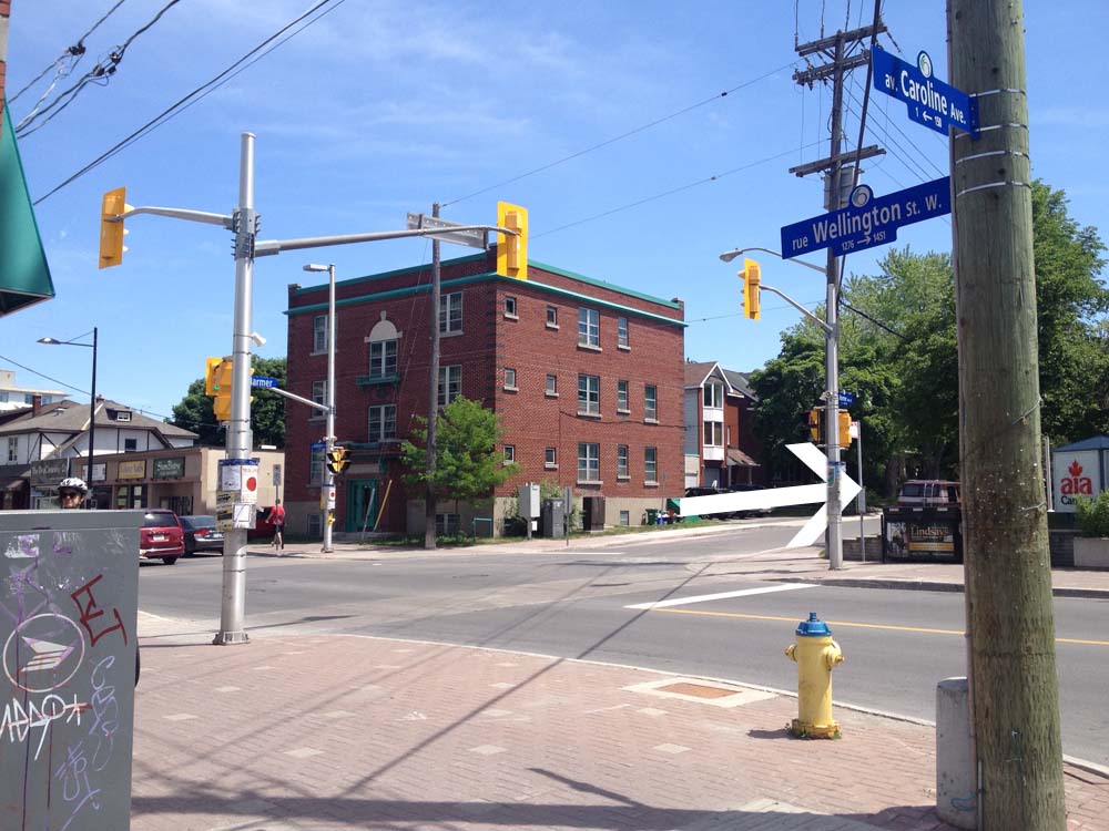
I rode east on Spencer, crossed Holland at the lights, then turned left on Caroline and headed up the hill towards Wellington. There are lights across to Harmer, which doesn’t line up precisely with Caroline, so I walked my bike 10 feet or so along the sidewalk to the lights.
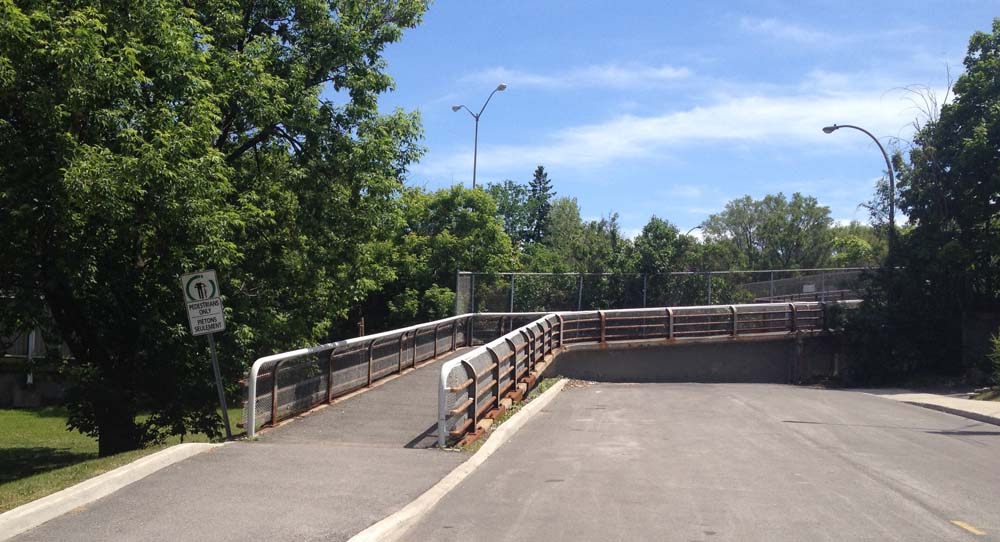
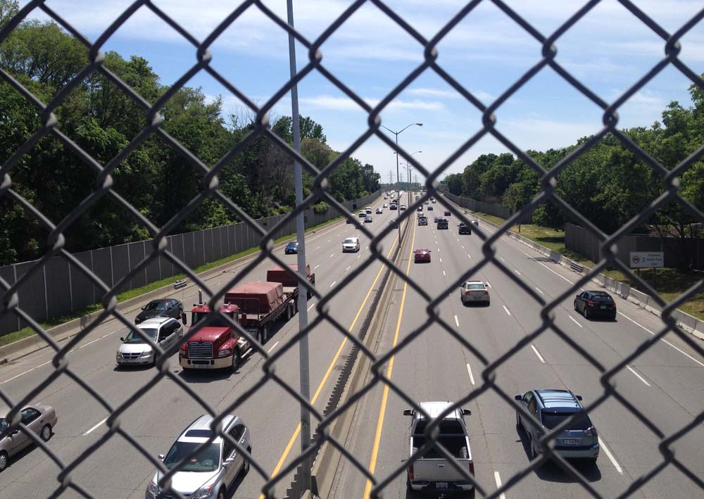
I rode up Harmer to this pedestrian bridge over the Queensway. No stairs.
UPDATE July 29, 2018: The Harmer pedestrian bridge is no more! They ripped it down this weekend and are building a new one that won’t be ready for 2 years. The city has installed a very controversial detour along Holland that will be fixed before the school year starts. I have adjusted the route on the above map accordingly.
Continued along Harmer and turned left onto Island Park Drive, which has bike lanes, and followed it to the lights across Carling.
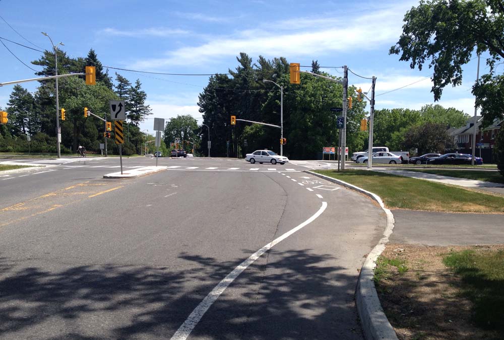
I was pleased as punch to discover the path continue on the other side of Carling. I believe this link between Carling and Holland is recent. Last time I rode across I had to contend with sharing this mini-off-ramp with cars.

The path continues along the National Capital Commission Scenic Driveway on the other side of Holland. There’s a split in the path just as the Scenic Driveway veers east. I turned to the right which took me along a path through the patch of woods beside Fisher Avenue.

The woodsy section of path ends where it intersects the Experimental Farm Pathway. I turned right.
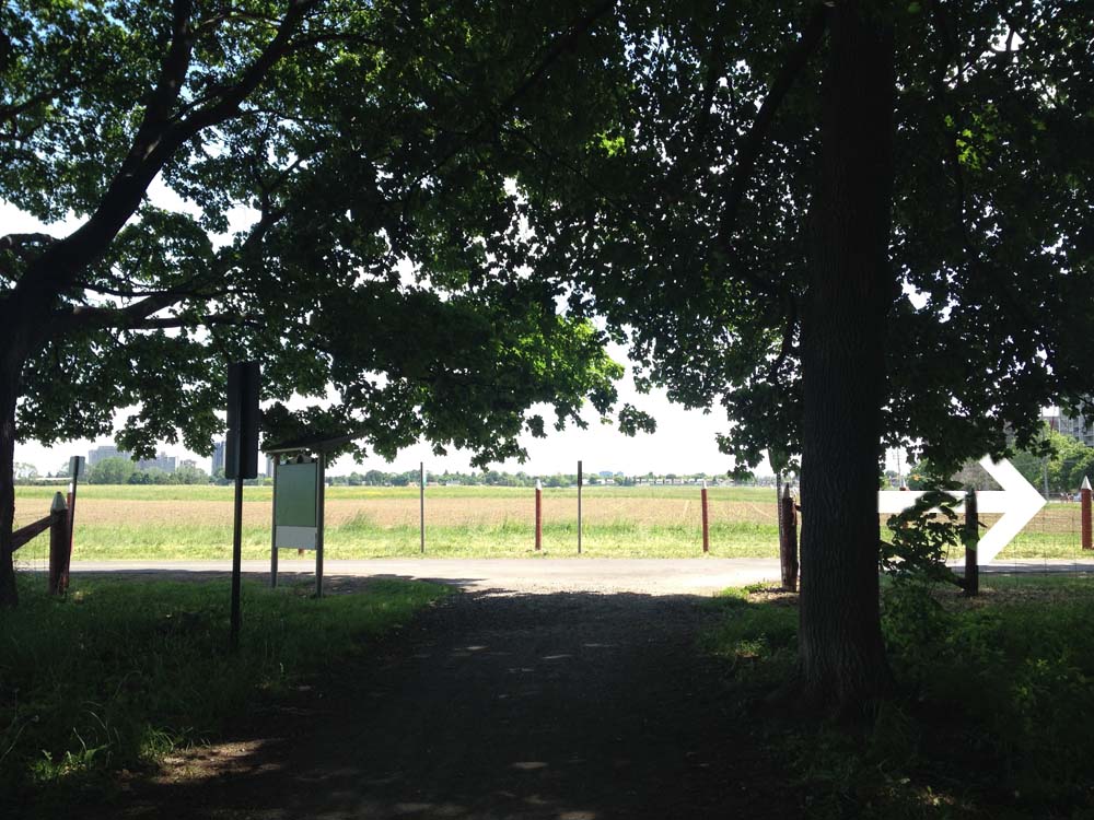
The path follows along Fisher for a bit before coming to lights across Fisher. Things get a little convoluted here. The continuation of the Experimental Pathway on the other side of Fisher is a short distance north along Fisher. It’s barely noticeable from the lights.
I continued along the Experimental Farm Pathway and took the left exit just before the path veers right a short distance beyond Merivale, like so.

The path crosses Whtestone Drive right through to Madison Park.

Once the path reaches Central park Drive it does a dipsy-do over to Celebration Park, like so.

I stayed right on the path through Celebration Park which brought me to the other side of Central Park Drive. I then turned on to Scout Street and followed it to a path that cuts through to the Supercentre mall parking lot.

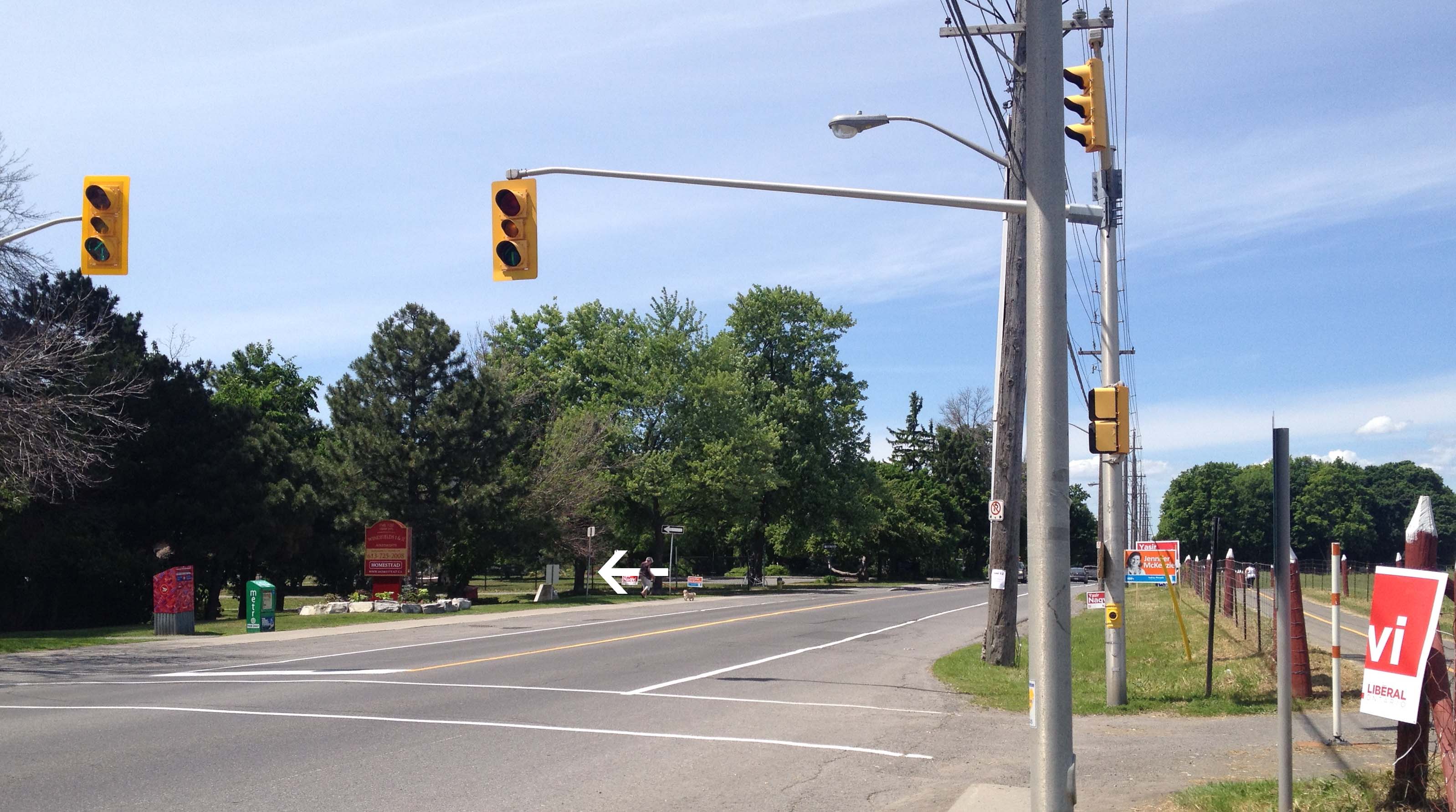
This path eventually merges into the mall entrance street that I followed to the traffic lights across Baseline.

Immediately across the intersection on the north side of Baseline, there’s a short ‘desire line’ path that links to the Loblaws mall parking lot.
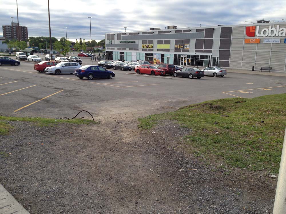
I followed a lane that goes behind the Loblaws to avoid having to ride amongst folks frantically parking their cars. This brought me around to the lights at Merivale. Once through the lights there’s a path just a short distance along that turns off to the left.

This path took me to Eleanor Drive. I then worked my way up Leaver Ave to the turn off through Gilbey Park.

I turned left onto Gilbey Drive on the other side of Gilbey Park which brought me to Capilano Drive. Right on Cailano brought me to Merivale. Don’t know why, but my camera switched to an old-photo filter for this shot of our final destination, the corner of Merivale and Capilano.

UPDATE – July 2015: There’s a more direct shortcut from behind the Food Basics to Capilano Drive, that was recommended by a cyclist who regularly rides through the neighbourhood. I’ve hi-lited it in pink on the above map.

Et voila!

One thought on “Biking from Hintonburg to Merivale Road”