The Côte d’Azure, or French Riviera, is a beautiful hilly region overlooking the Mediterranean sea. There is an area of La Ville de Gatineau with streets named after popular spots along the Côte d’Azure (Rue de Cannes, Rue de Monte Carlo, Rue de Roquebrune, etc). It’s hilly too, and looks out over its own body of water, the Gatineau River. That’s where the similarities end. It’s a fine residential area of Gatineau to bike through. You can do a little bit of switch back climbing while taking in a few interesting house designs.
To get there I biked along Boulevard St Joseph, which isn’t too bad at 6:30 am, but I suggest the much more pleasant route hi-lited in green. Mostly along bike paths, it follows Boulevard de la Carriere for a bit, as a section of the Gatineau River Pathway is closed this summer for rapid transit construction.
Here’s an interesting house I spotted on the Gatineau Riviera.
Try to spot the front door…
I followed this short path at the top of the hill through Parc Saint-Exupéry, named after the author of Le Petit Prince.
Parc Saint-Exupéry
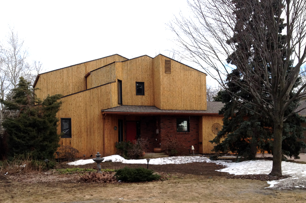
Here’s another interesting house looking out across to the Gatineau hills.
House along the Gatineau Riviera
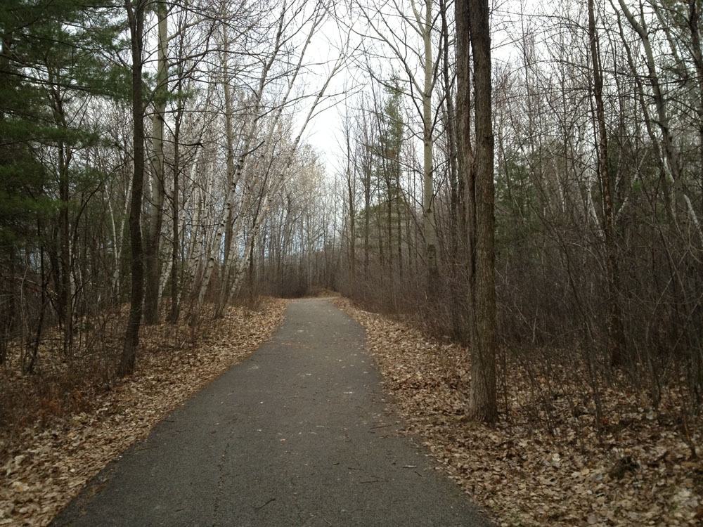
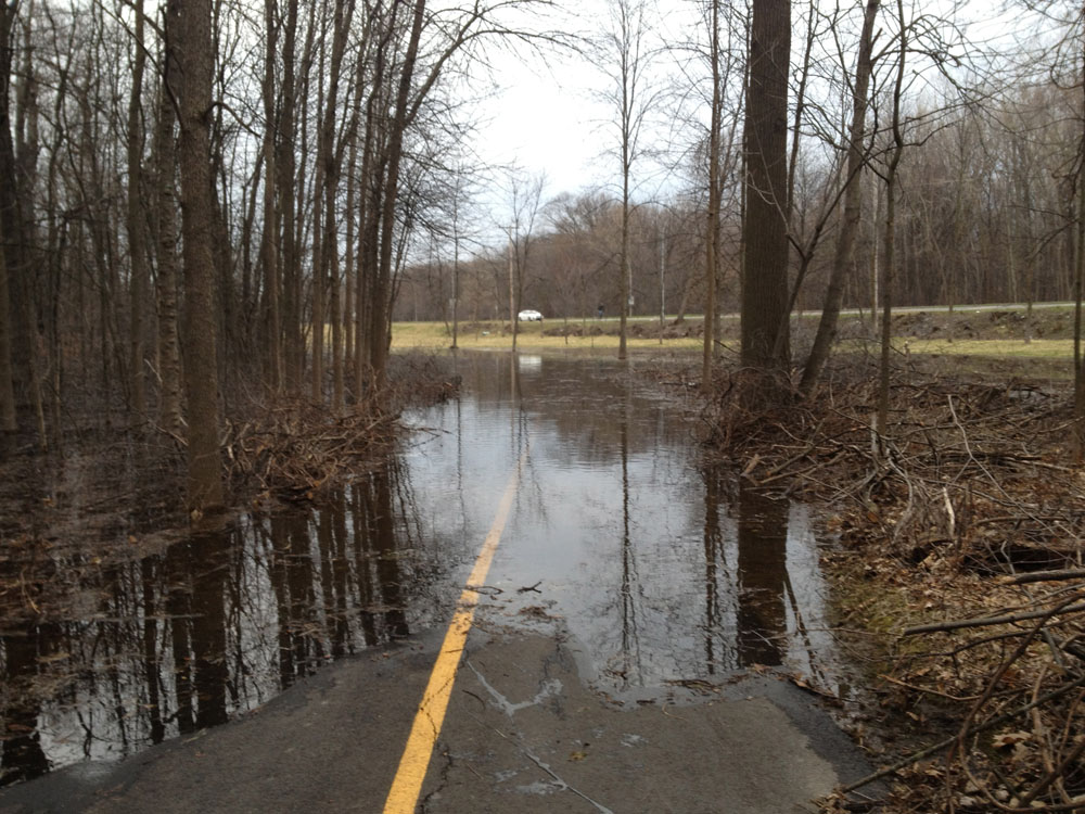
The path along the Ottawa River just west of the Lady Aberdeen Bridge is partially flooded out, but there’s a beaten path you can follow to get around it. The rest is clear sailing.
Carson Grove is a small community defined by a traffic moat – Aviation Parkway to the West, Ogilvie Road to the south, Bathgate Drive to the east and Montreal Road to the north. It’s relatively new, only 7% of the homes having been built before 1960 with a surge of single detached homes built in the 70’s and 90’s. La Cité Collegiale Ottawa campus divides the community in two, north & south. There were a bunch of streets in the southern section I had yet to discover, so early Tuesday morning I went and and checked them out. Blue line’s how I got there, green line’s how I got back, and orange line is a recommended alternate route through Vanier to avoid Montreal Road west of St Laurent (impatient commuter traffic, no shoulders, and very bumpy, particularly around the potholes surrounding drainage covers).
The southern portion I biked through is a residential subdivision mostly built up in the 70’s, one of the many Campeau developments scattered around the city from that period. Campeau offered a bit of variety in plans homeowners could choose from. Along with the slightly varied mix of period house designs, many types of trees were planted on front lawns which have matured over the years. The streets aren’t confined to an overly strict grid, allowing for a pleasant meander.
So, Carson Grove – nice place to visit. Still don’t know out who Carson was or if there ever was a grove. All and any leads are welcome.
David Jackson is an amazing multi-faceted local musician and one of the founding members of the Northern Sound Electrical System, ‘an open member project whose purpose is to explore the fringes of drone, electronics, noise and sound through guitars, software, percussion, field recordings, and whatever else anyone wants to bring to the show.’ David posted a great recording of one of their performances at Le Temporaire in Gatineau earlier this year. I had the urge to explore the pathway along the Ruisseau-de-la-brasserie located close to Le Temporaire, while listening to the recorded session, so as the sun came up I set my iPhone SoundCloud app to David C Jackson, North Sound Electrical System Live at Le Temporaire, and headed off. It was incredible. UPDATE Summer 2018: It is now illegal to wear headphones while biking in Québec.
Here’s the route, and some photos taken along the way.
Rue Montcalm bridge
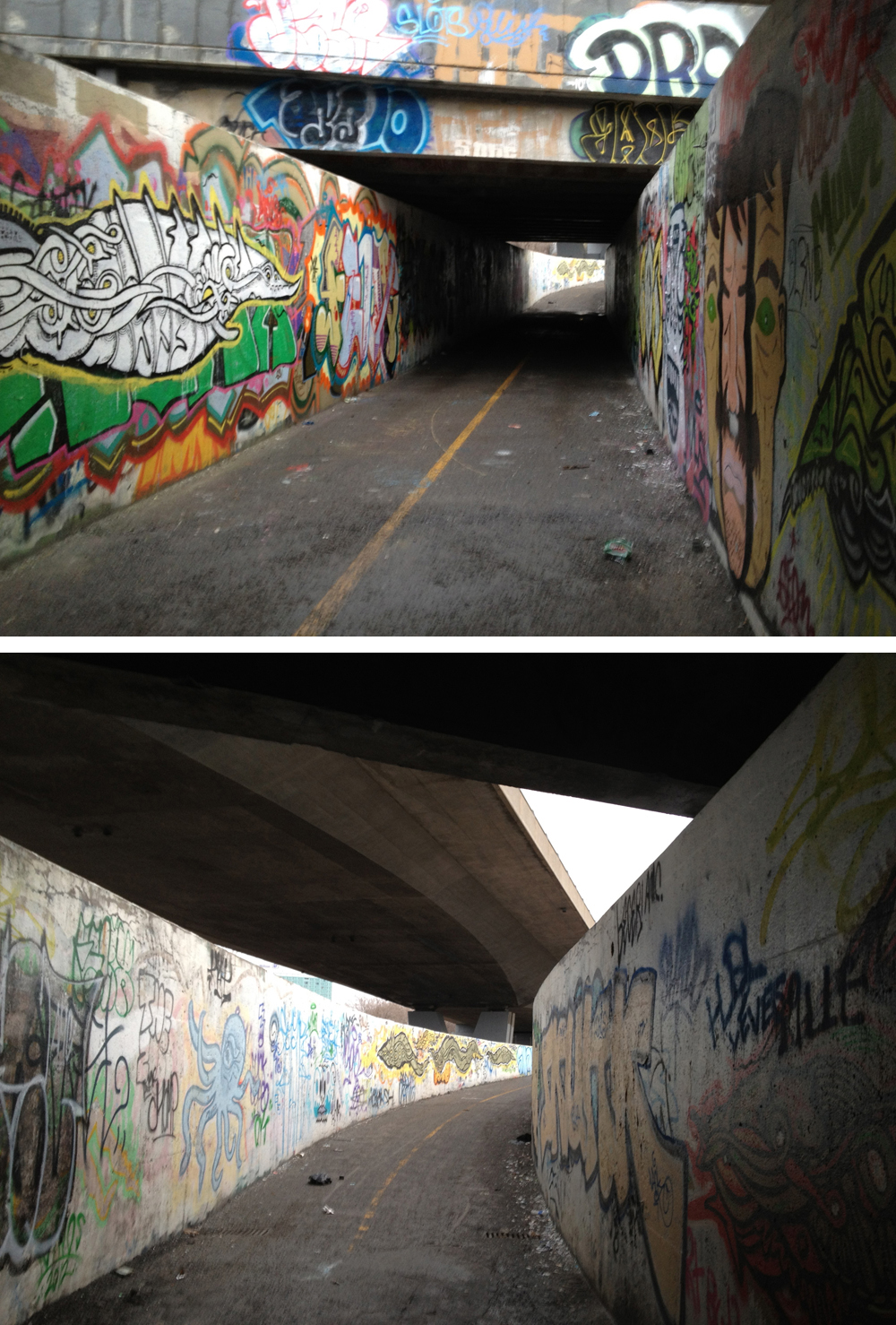
The path dips under a number of major bridges with lots of commuter traffic, the sounds of which lend themselves well to the recording.
Under Autoroute de la Gatineau
The path splits just beyond Autoroute de la Gatineau. Left continues along the Ruisseau de la Brasserie Pathway towards Leamy Lake, but it’s worth continuing along the right hand path for a bit, at least as far as the bridges that connect the two autoroutes. Here’s some of what what you’ll see.
Under the autoroute connectors
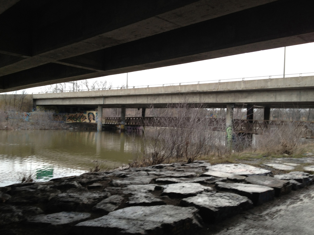
There are two great interpretive exhibits on the shores of Leamy Lake that delve into the history of the area. Conflict of interest warning – Carla designed them.
Leamy Lake interpretive display
If the breeze is up you can feel the coolness of the melting ice off the lake, as was the case at this spot along the shore.
Rich Little is an Ottawa born impersonator who made it big on American TV in the 60’s and 70’s. He now lives in Vegas where he has been performing in his one man play Jimmy Stewart & Friends. There’s a street named in his honour close to the Ottawa Hunt and Golf Club so I went for a ride and checked it out. Blue line is how I got there, green is my route back, orange hi-lites are sections that are a bit treacherous to bike along.
Riverside Drive south of Walkley has raised paved shoulders separate from the sidewalk, like so.
Raised Paved Shoulders, or Bike Path Wannabes
There are sections where these paved shoulders disappear, as I’ve hi-lited in orange on the above map. These are Biker Beware zones, i.e. four lanes, fast cars, and minimal shoulder space.
Rich Little Drive is a pleasant little street, lined with houses all very generous in proportion to their lots. The street must have been developed at a time when multiple garages were a coveted feature, judging by the predominance they occupy in all of the front elevations.
Houses along Rich Little Drive
A bit further east along Fox Hunt Ave this very well preserved Sea Ranch style house stands apart.
Sea Ranch Style
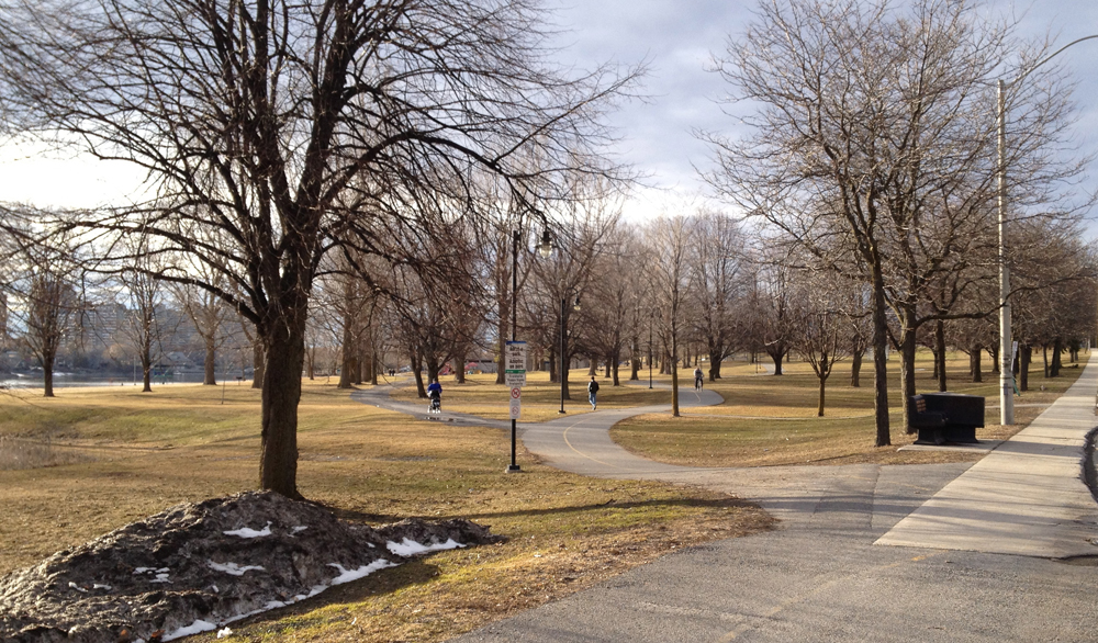
All of the paved paths were clear of snow including these along Mooney’s Bay. Yeah Spring!
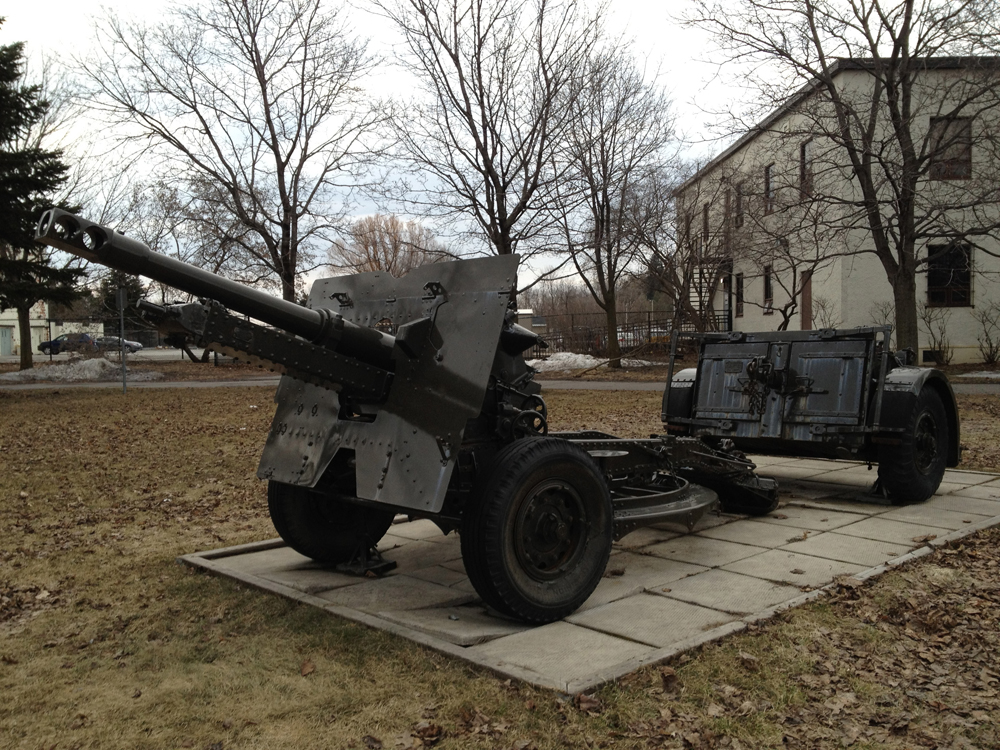
As part of North Korea’s escalating rhetoric and bellicose threats to nuke their southern brethren and the U.S., they have set up missile launchers along their east coast. Most pundits believe they are mostly for show. Whether or not the missiles are capable of lift off, their display has certainly captured the world’s attention. Japan has responded by setting up an anti-missile system of their own. All these shows of force had me pondering the many depictions of long barrelled artillery on display throughout our region, so I came up with the following ‘Cannons in the Capital’ bike tour.
By peering through the angled glass wall just off Booth street into the Canadian War Museum you get a good view of this large collection of tanks and armoury.
Looking in to the War Museum
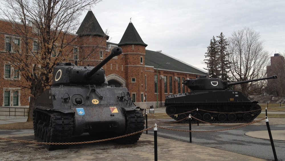
This tank sits just to the north outside the museum, seemingly waiting for an indoor parking spot to open up amongst its peers.
Chaffee Tank
Booth Street Bridge over to Gatineau is under construction, but you can safely make your way across the river by biking down Victoria Island and up over the Portage Bridge.
These two tanks, parked on display outside the Salaberry Armoury at the corner of Boulevard Alexandre-Taché and Boulevard St Joseph, are dedicated to the resident Régiment de Hull.
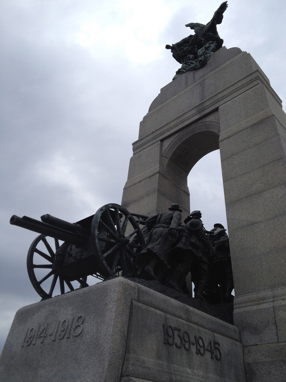
The National War Memorial sculpture titled The Response includes this depiction of a WWI gun being pulled through the stone arch by Canadian combatants.
The Response
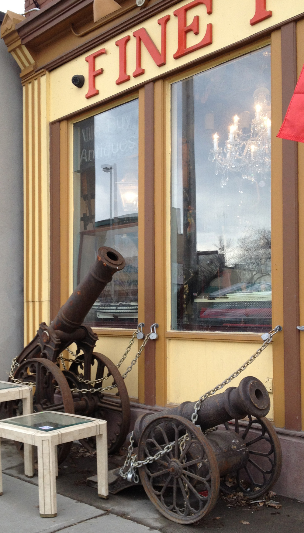
Outside Yardley’s Antiques on Bank street these cannons are available for those who wish to purchase their own pieces of old artillery.
Cannons for sale
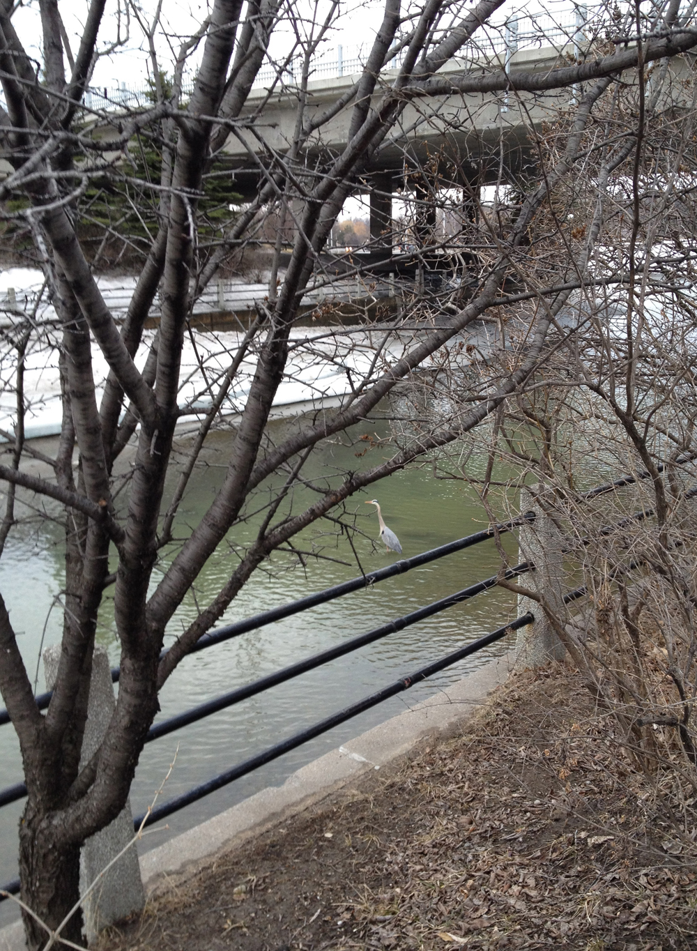
And here’s a blue heron standing in the canal under the Bronson street bridge.
Blue Heron under Bronson
these two replica 9-pounder cannons are stationed on the edge of Dow’s Lake right in front of HMCS Carleton naval reserves.
9 Pounders
Just around the corner on Prince of Wales sits this more contemporary machine of war.
Outside CFRB Dow’s Lake
So there you have it. Many depictions of cannons throughout the region to discover.
Sunday afternoon, while we all paused between Easter egg hunting and holiday feasting, I decided to go for a ride and check out a small isolated residential community up the Rideau River just beyond Hunt Club Road. This community is made up of two smaller sections – Pineglen and Country Place. Based on the style of houses it appears Pineglen was developed in the 50’s and 60’s, and Country Place a bit later. They are surrounded by an industrial area to the north, the river and airport to the east, and farmland to the south and west.
Here’s how I biked there and back.
After stopping off at Herb & Spice on Wellington to pick up some herbs and spices (go figure) I headed south. To get across the Queensway I pushed my bike over this pedestrian bridge that joins the two sections of Harmer Street. Much safer than riding along busy Holland Avenue.
Then I rode all the way down Fisher towards the Rideau River. Fisher is not a great road to bike along. Apart from a short section between Carling and Baseline there is little room and cars go fast along this straightaway. It would be great if they added bike lanes on either side, not only for the likes of me out on a Sunday ride, but to encourage bike commuters though out the year as well.
Biking along Fisher
The first section encountered from Prince of Wales Drive is Pineglen, wherein I discovered a number of mid-century modern homes such as these.
Mid century modern in Pineglen
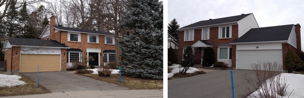
There are also a few recently completed and still-being-constructed big houses such as these, suggesting Pineglen remains a coveted place to live.
Big
At some point heading west Pineglen becomes Country Place. I couldn’t distinguish a specific demarcation, however there is a shift in architectural style from modernist bungalows to two story brick houses with decorative window shutters such as these.
Decorative shutters
I headed home along Prince of Wales Drive. On either side of Prince of Wales north of Fisher there are wide designated bike lanes, but south of Fisher the lanes are narrower or disappear completely. Most cars and trucks drive at Queensway speeds along Prince of Wales south of Fisher as well.
So, Pineglen is an interesting community worth discovering.
Prince of Wales Drive is fine heading out of town as far as Fisher. Beyond Fisher, not so great.
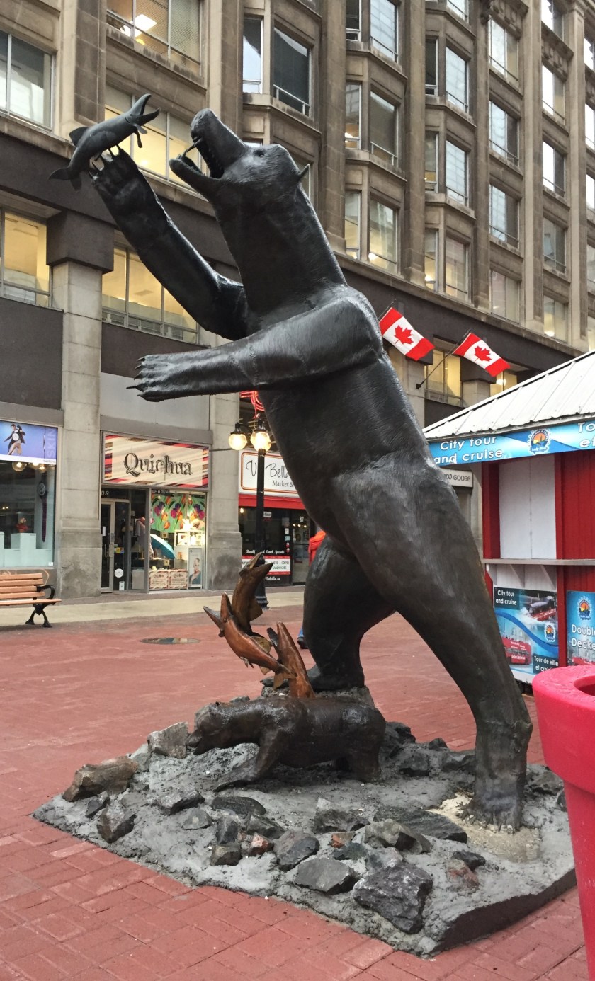
Recent stories in the media surrounding the possible relocation of Bruce Garner’s popular sculpture on Sparks Street of a grizzly bear reminded me of the fine collection of his works installed throughout downtown Ottawa, all within convenient biking distance. So I came up with this tour.
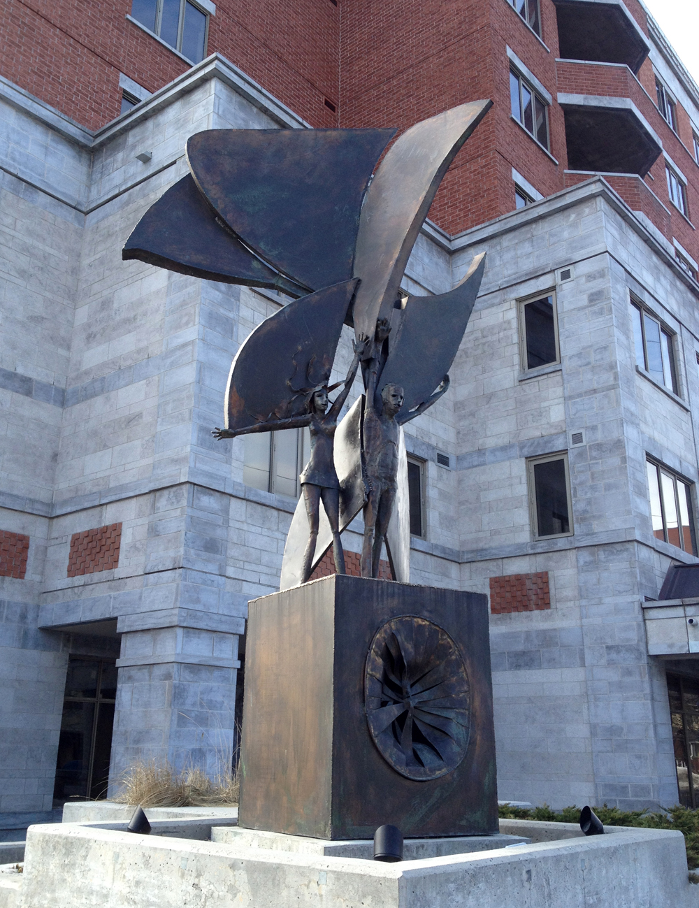
We begin at the corner of O’Connor and McLeod to visit Bruce’s last work, Paso Doble.
Paso Doble
Next stop, Ottawa City Hall, more specifically the southern entrance, where this sculpture titled Outreach sits perched high up on a ledge.
Outreach
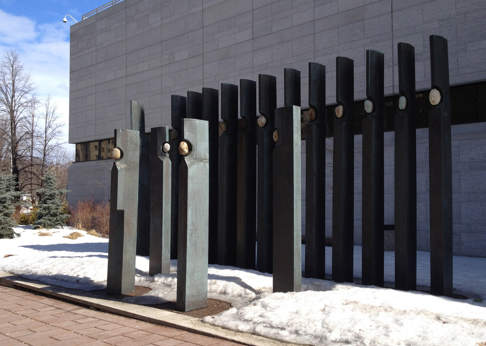
Over on Elgin Street, in front of the Provincial Courthouse, you will discover the sculpture Due Process.
Due Process
The next sculpture at the eastern end of Laurier isn’t one of Bruce’s pieces. It is the Lord Strathcona Fountain sculpted by Marhurin Moreau and donated to the city by Lord Strathcona in 1909, however awhile ago I came across an article that described the time and care Bruce and his wife Tamaya dedicated to the upkeep of this iron sculpture. The article spoke of the passion he had for the piece, so I’ve included it in the tour. Unfortunately the article is no longer online for me to link to.
Lord Strathcona Fountain
Back into town and over to the Byward Market where from atop the Chum FM headquarters fly these two winged wonders, a piece sculpted by Bruce called Dagain.
Dagain
Next, over to Arts Court where sits this sculpture just to the left of the main entrance.
Outside Arts Court
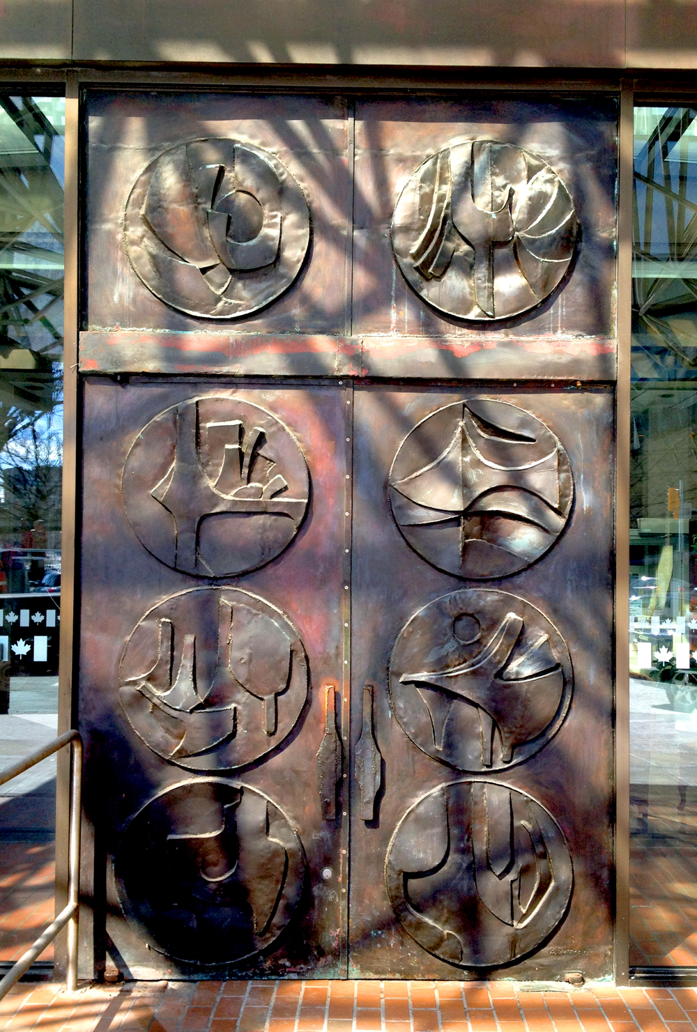
Follow Daly Avenue for a short distance as it dips under the Westin Hotel to the edge of the canal where you will find the Conference Centre. The main doors and transom were sculpted by Bruce out of bronze and copper.
Reflections of Canada
To get to Sparks Street to view the last two works on this tour I suggest walking your bike up along the curved sidewalk, shown in the image below, to Plaza Bridge and continue in front of the Cenotaph over to Sparks Street. I’ve hi-lited this walk in red on the above map. I recommend becoming a pedestrian for this section of the tour because it is far less convoluted and dangerous than trying to weave you way through the usually busy traffic in this area.
Path up to Plaza Bridge
Along Sparks Street, mid block between Elgin and Metcalfe, you will find Joy. As the accompanying plaque describes, it was ‘Donated by E.R. (Bud) Fisher to the Sparks Street Mall Authority and the citizens of Ottawa. Sculptor Bruce Garner.
Joy !
A A bit further west where Sparks meets Metcalfe Street you will encounter the bear. This sculpture was recently relocated to this location from the opposite end of the block near Elgin.
Territorial Prerogative
Thus ends the first tour of sculptures by Bruce. A second tour of other works can be found by clicking here.
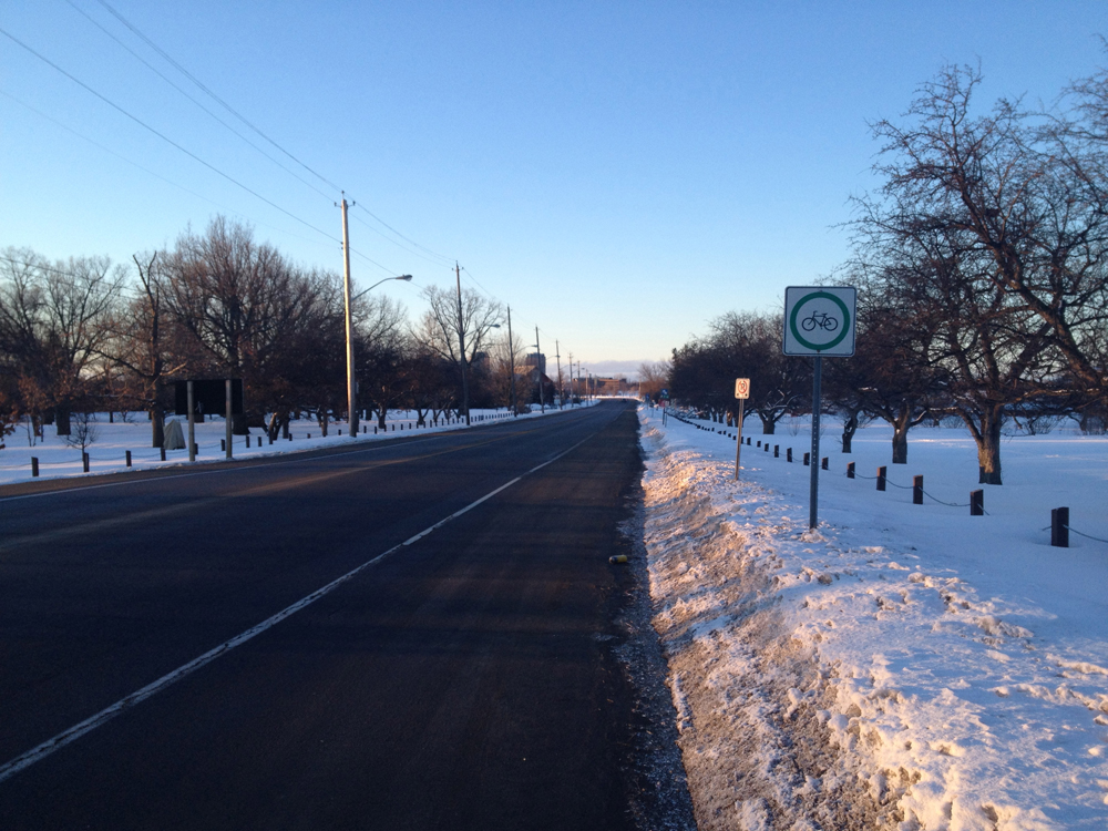
Bank Street, south of the Rideau River bridge, is a treacherous stretch all the way to South Keys Mall – no shoulder to ride on, speeding cars jostling around each other in and out of parking lots, four lane intersections, etc. I avoid it completely by riding through the Arboretum, crossing over the canal locks at Carleton University, and following the path up to Hogs Back, as per the red line shown below. But for many, crossing the locks or riding along packed snow pedestrian paths through the Arboretum in the winter is not an option – cargo bikes, skinny tires, kids trailers, etc., so I set out to find an alternative. Blue line is my ride to Bank St South.
Prince of Wales Drive from Dow’s Lake heading east has a very generous shoulder which has been cleared all winter. Some cars do drive very fast along this stretch and there are trucks, but it still felt safe.
Prince of Wales Shoulders
The Experimental Farm round-about is a bit tricky. The shoulder disappears as you approach, and it isn’t absolutely clear whether we are expected to ride on the paved paths along the periphery, but I think that’s the intention.
Riding along Hog’s Back Road over the canal and the Rideau River is a bit of a challenge as well. No shoulders. Here the sidewalks become a shared path further on, so it’s fair to interpret the whole sidewalk as a shared path, as long as you are willing to walk your bike if you encounter a pedestrian.
Over Hogs Back
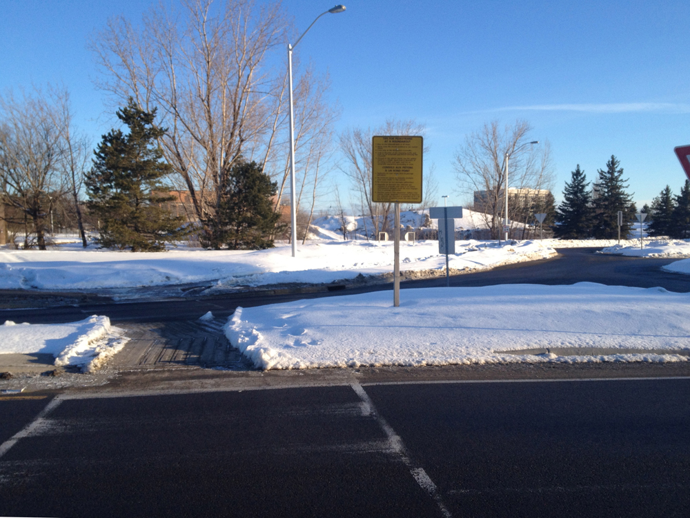
Once beyond the falls the road widens again, although you can remain on the asphalt path as far as Riverside Drive. Brookfield Road is very wide with minimal traffic, no worries there, just be prepared to cross over at the round-about to the path on the opposite side. Can’t miss it, you’ll see the illegible yellow sign that explains how to behave as a pedestrian at a round-about.
Cross round-about here
Stay on this path on the outside of the round-about, which becomes a shared path that dips under Bronson and over the O-train tracks. This path has been cleared all winter.
View from the path under Bronson towards the O-Train tracks
Then it’s straight up to Bank St. Et voila!
N.B. This is a fine route to Bank Street, albeit a bit circuitous. All effort should be made to make Bank Street safe for biking.
‘The Journey of the Nishiyuu‘, meaning ‘The Journey of the People’ in Cree, inspired me to head up the 105 alongside the Gatineau River to meet them on their way to Chelsea from Wakefield on the second to last day of their incredible trek to Parliament Hill. Here are the first members of the group I met who had walked all the way from Whapmagoostui on James Bay.
Lead group of Nishiyuu Walkers
This bike ride is one I would normally not have attempted until the snow had melted but, inspired by the effort and dedication of these youth, I made it on my hefty winter bike, no problem. Here’s how.
I encountered the walkers along Chemin de la Rivière as they completed a very long climb up from the rivers edge. The confidence in their stride was amazing. Here are a few more shots.
Amazing
By the time our paths met their pacing had been stretched out as they were well into their day’s journey, so the above images don’t do justice to the number of youth participating in the trek.
They stopped for a well deserved lunch break where the 105 and Chemin de la Rivière meet.
break
The biking conditions up the 105 are mixed. There are generous shoulders to ride along as far as the Larimac golf course, just watch out for sand left over from the winter.
Sandy Shoulders
North beyond the Larimac golf course conditions remain the same as described in this post.
The Nishiyuu will be treated to some great views such as this over the Gatineau River on their way to Ottawa. Gatineau River from the 105
But unless they deviat from the 105 they will also encounter views like this coming into Gatineau. Carla calls this scenario The Battle of the Pylons, pylons being the type of tall stand-alone signs popular with car dealerships and gas stations.
Battle of the Pylons
Safe journey Nishiyuu walkers, and see you in Ottawa.
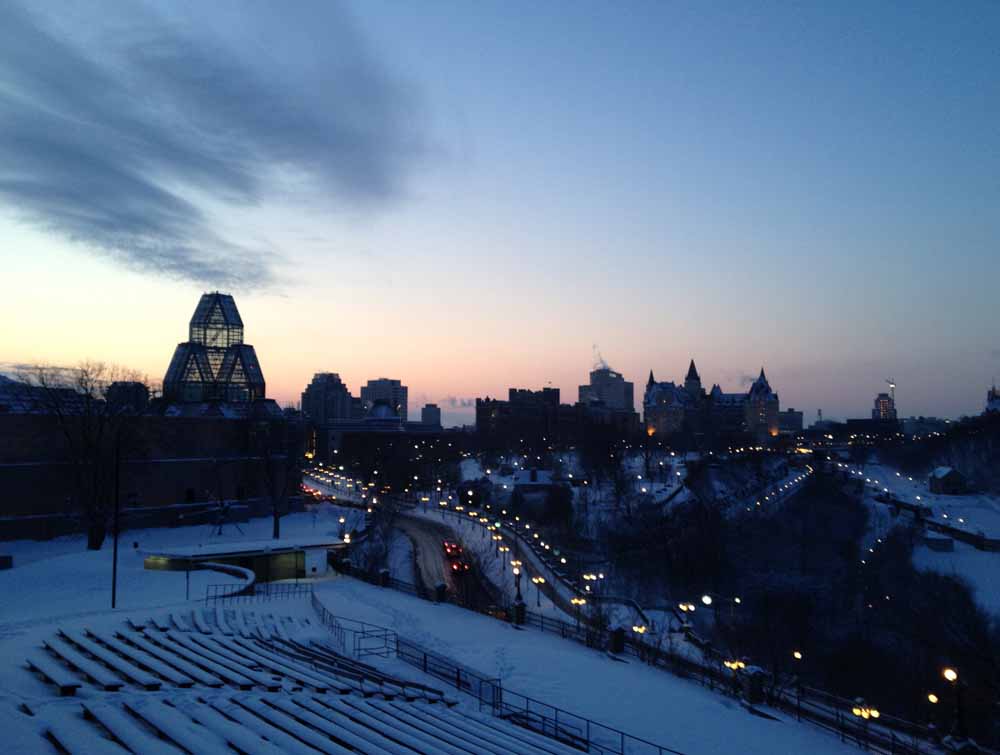
Yeah Spring! I decided to greet its arrival by catching yesterday’s equinox sunrise from Nepean Point. It’s also a great place to watch sunsets and storms approaching along the river valley. The big dump of snow we received the day before made me decide to bike down behind Parliament Hill, and then ski the rest of the way. The pathway isn’t cleared in the winter.
The blue is biking, red line is skiing, purple line is walking/skiing.
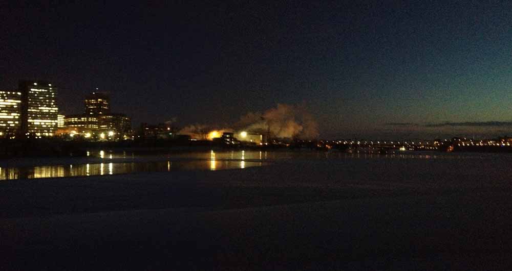
There is a parking lot on the edge of the river just below the National Archives you can access by a road that goes under Wellington. That’s where I locked up my bike, and took this picture looking out across to Gatineau.
Looking out across the Ottawa River
Made it to the Point (phew!) in time to welcome Helios riding his chariot up over the horizon.
Here comes the sun, do-do-do-do…
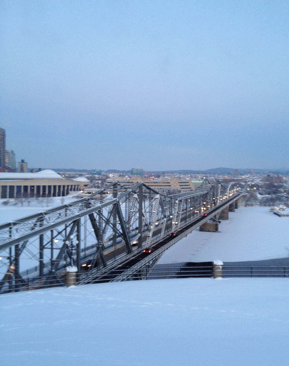
This is an exhilarating view at any time of day, looking north out over the Alexandra Bridge.
Alexandra Bridge
Time to head back. here’s how it looked along the path down towards the river behind Majors Hill Park.
Oh! que bella…
In the winter Parks Canada leaves all the locks open except the very top most one. You can only cross the canal on a closed lock. I decided to ski across the river instead, just in front of where the canal meets the river. It was great. But don’t do that.
Ski tracks on the river
It really is a wonderful ski along the path below Parliament Hill. This is the view towards Asinabka, or Victoria Island, taken from where I parked my bike.
Asinabka
Biking up the Nanny Goat Hill I passed Megan Butcher at the corner of of Bronson and Slater. Megan has been taking great photos throughout the city which you can check out at http://www.flickr.com/photos/meganbutcher/.