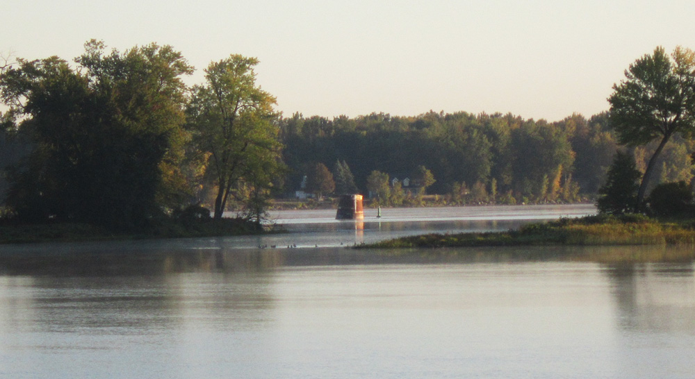
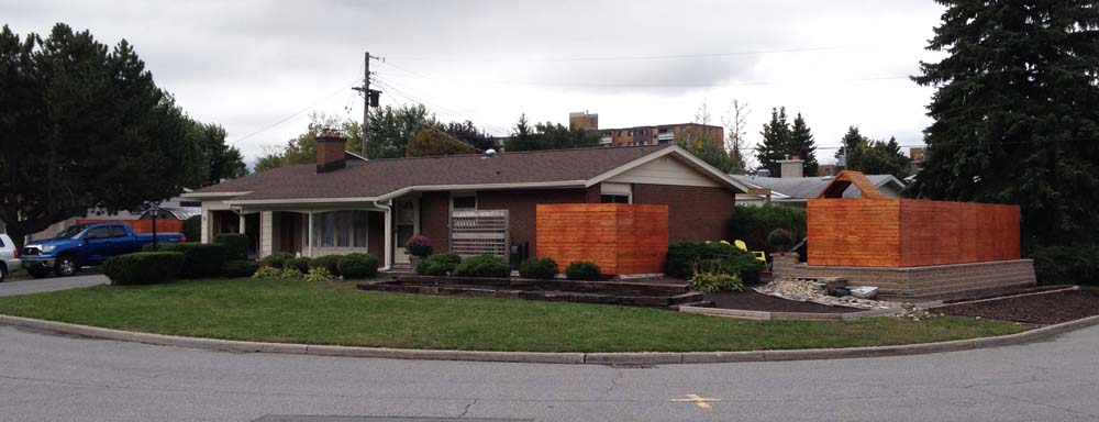
On Saturday I biked over to Sandy Hill to visit the studio of my friends Janet and Mitchell to see their latest paintings and sculptures. Here’s the route I followed across town and back. Blue line is how I got there. Purple line is how I got back.
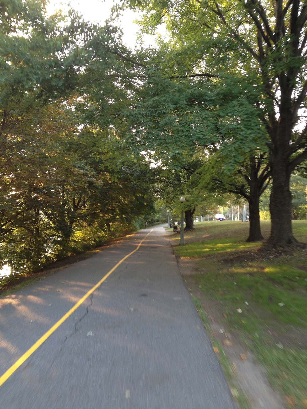
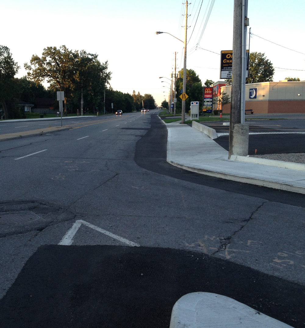
The Laurier bike lane heading east will be kept clear of snow for the winter. Most of the bike lane heading west is to be kept clear as well, however the section heading west between Bays St and Bronson had lots of snow piled in it. I joined the bike lane at Bronson and followed it as far east as it goes to Elgin St.
View down Laurier Bike Lane from Bronson Ave
UPDATE Sept 2014 – the Laurier Bike Lane has been extended east of Elgin in front of the Provincial court house and City Hall.
Laurier Bike Lane extension
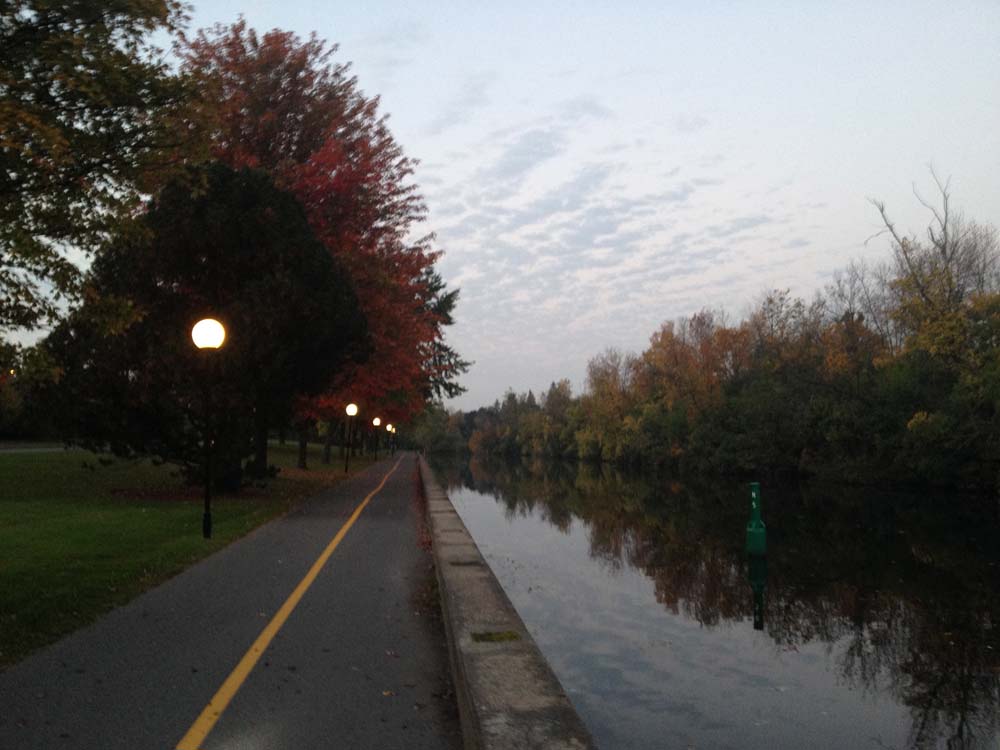
The Rideau Canal pathway is also cleared in the winter.
Canal Pathway
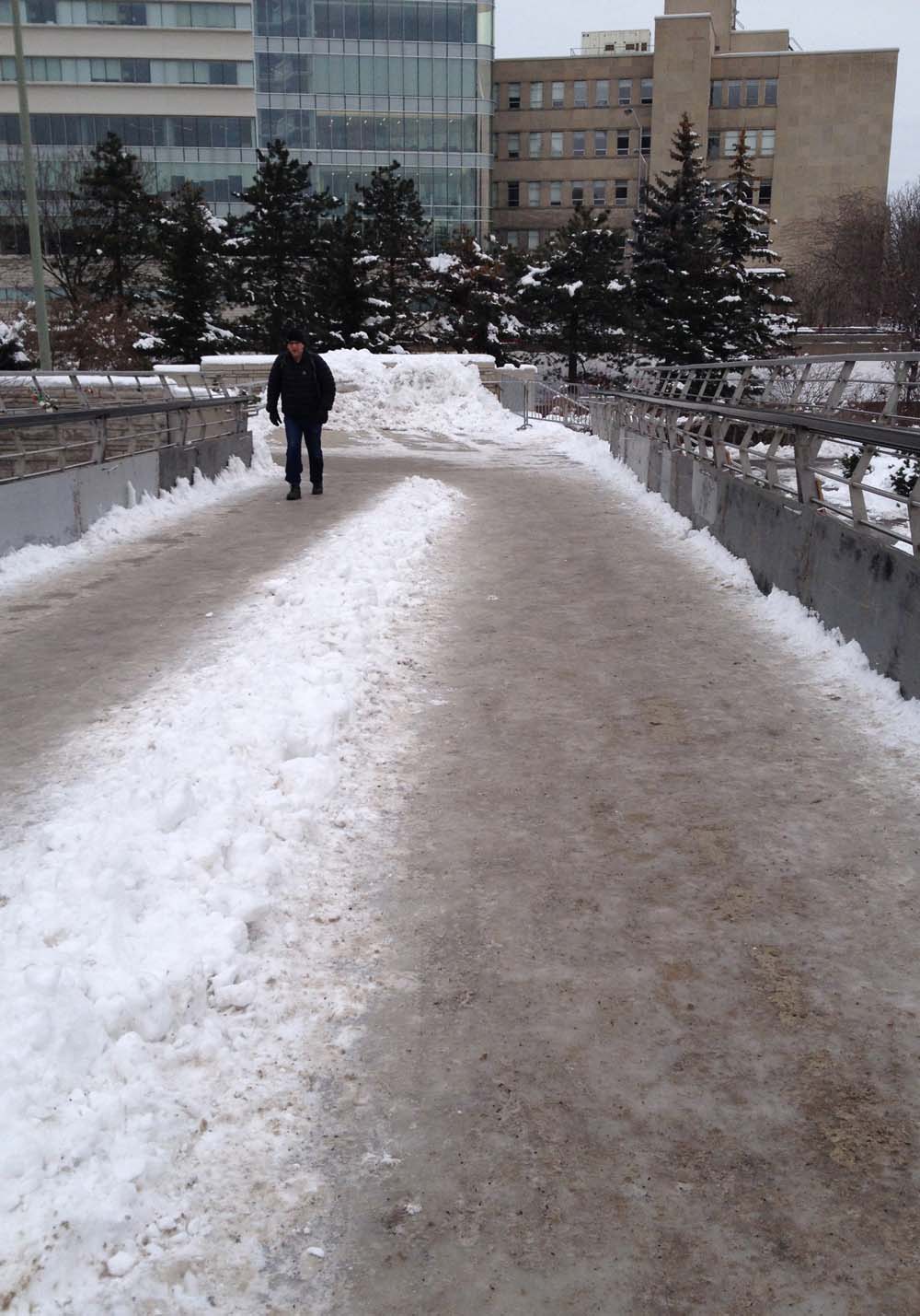
I turned off the pathway at the car-less bridge over the canal at the end of Somerset St W. Be careful crossing this bridge as it can be icy even with the spattering of sand strewn across its path.
Bridge over the canal at the end of Somerset
Here is a view from the top of the bridge, including just a few of the many love locks hanging from the railing.
Love Locks
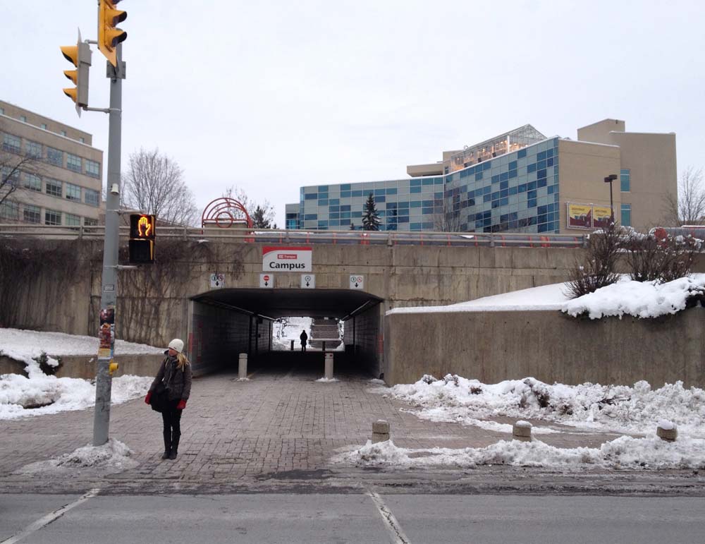
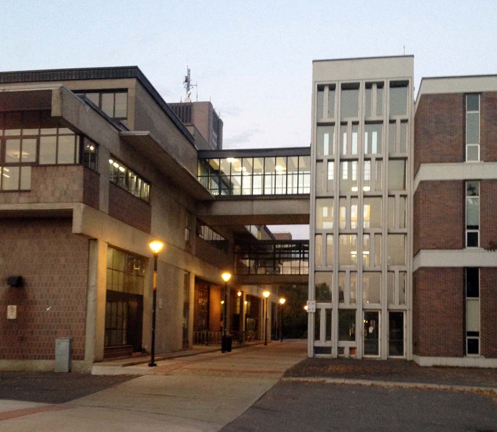
I crossed the driveway at the crosswalk and follow the path under the transitway bridge right up through campus.
Up to and through Ottawa U
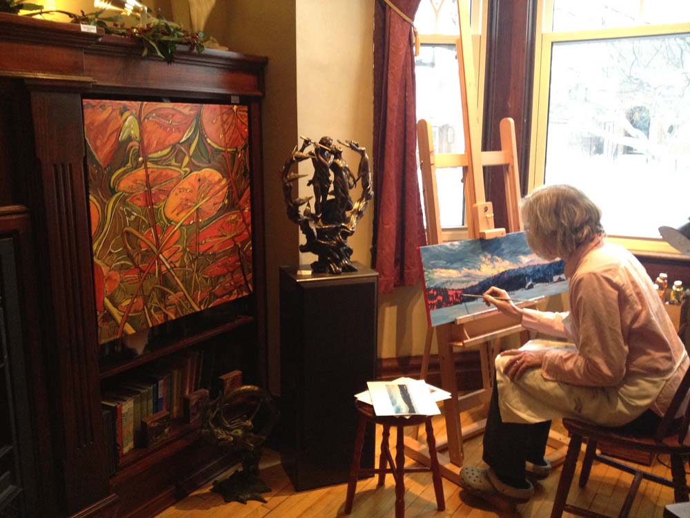
There is a bike lane to follow as far as King Edward Ave. The street opposite is Somerset St E, which isn’t too busy, and cuts right across Sandy Hill. I followed it as far as Blackburn Ave, and turned right up Blackburn to get to the studio.
Worldview Art StudioJanet painting at her easel.
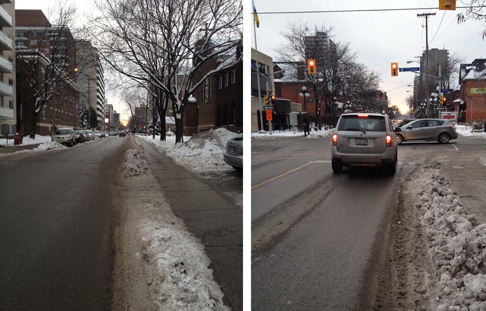
On the way back, after crossing the bridge over the canal, I decided to continue straight along Somerset W. It can be a busy street, particularly in the winter when the snowbanks leave you with little option but to take the traffic lane. The traffic tends to be a little calmer between the canal and Bank Street than between Bank and Bronson.
Somerset St W in the winter
Et voila – two ways to bike across town in the wintertime.
Here’s a healthy 24 km route almost entirely along bike paths. It begins at Carleton University and loops all the way back to the campus. It’s also a ride down memory lane, as it travels past a number of locations my older sister Cathy still recalls from the time she went to Carleton. Here goes.
Cathy graduated from the carleton University School of Industrial Design, as did I a number of years later. The Industrial Design studios were shared between the Architecture building shown on the left in the photo below, and the Engineering building on the right. This bike ride starts in the passageway between the two buildings.
Starting out
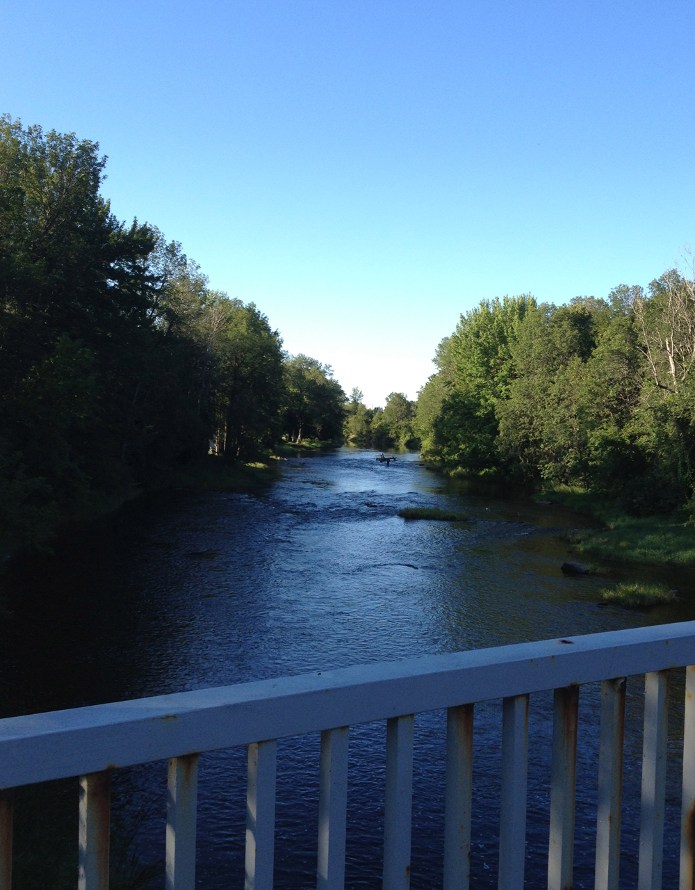
Head right on through the passageway up to and across Colonel By Drive. Hop on the path along the canal and head left towards Mooney’s Bay.
Path up to Mooney’s Bay
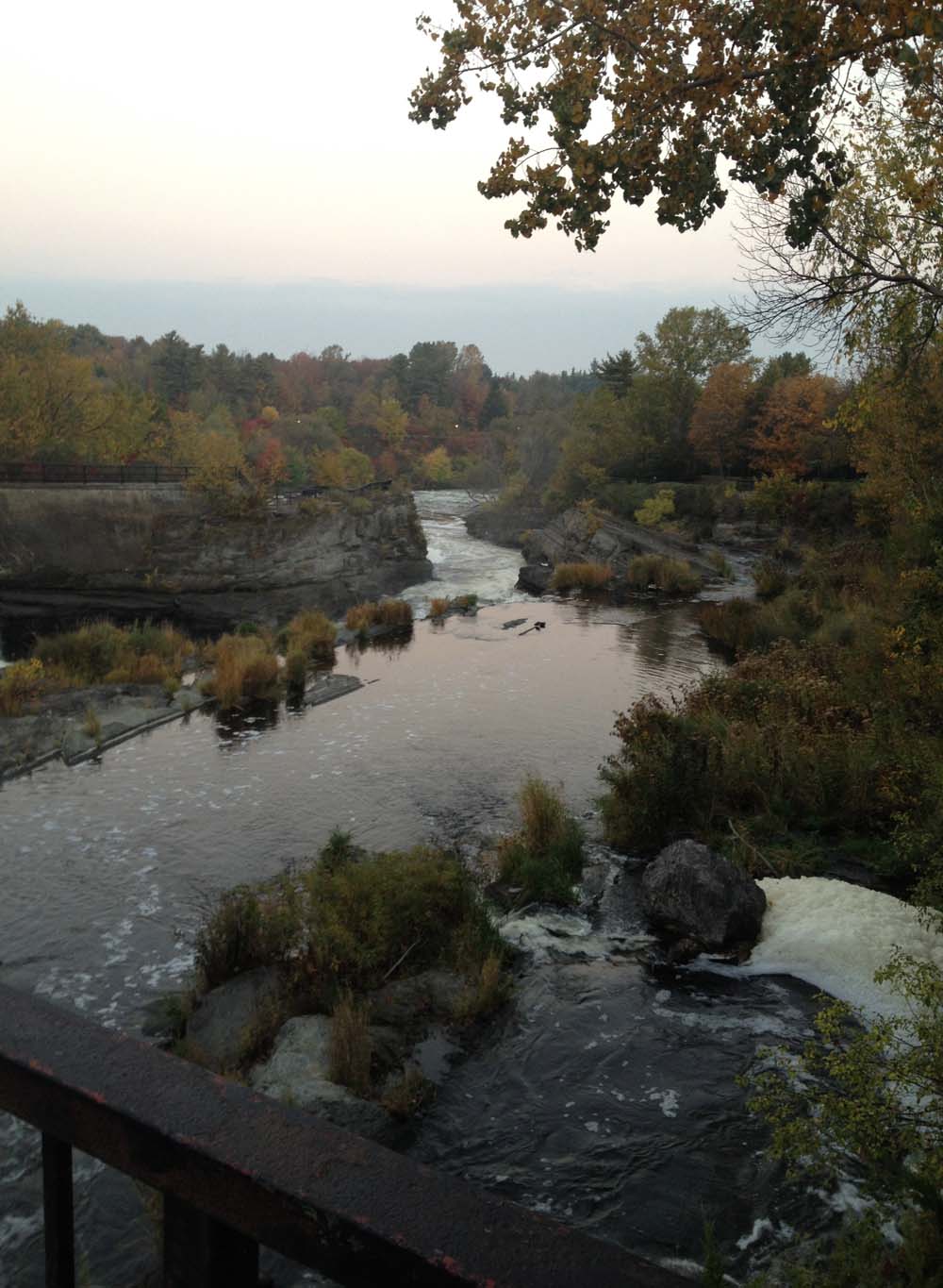
The path eventually goes under and along Hog’s Back Road over the falls. It then curls under the road once again, popping out in Hog’s Back Park, a favourite spot of Cathy’s where she would go to study. Here’s a view from the look-out over the falls just inside the park.
View from Hogs Back Falls
After taking in the Falls, follow the path as it winds through the park and along the river. When the path gets to Bank Street you’ll notice this white bike commemorating the death of a cyclist who was run over by a cement truck at this busy intersection. UPDATE: May 2016 – The ghost bike has been removed by the city.
UPDATE: Summer 2019 – The bike lane has been modified so that it now dips down under the bridge to avoid this terrible intersection when riding along the river.
Commemorative bike
The path then continues all the way along the river with great views like this.
Path along the Rideau River
The next favorite spot of Cathy’s was the Towne Cinema located just off our route on Beechwood Avenue. The cinema has closed and relocated to Rideau Street and renamed the ByTowne Cinema, but the original art deco glass tower and marquee remain. On one of my visits to see Cathy when she was going to Carleton, she and her roommates decided to take me to a late showing of the Rocky Horror Picture Show at the Towne. Because it was restricted, and I was only 15 or 16, they dressed me up in drag, smothered my face in make-up, and wrapped me in a great big ratty old Sally-Ann fur coat. I remember shivering in the entrance, not sure if it was my nerves or the snow penetrating through the thin pumps I was wearing. Anyway, I got in, and it was great!
It’s astounding. Time is fleeting!…. Where the Towne Cinema used to be.
Continue along the path all the way to Sussex Drive, past the Minto bridge.
Minto Bridge
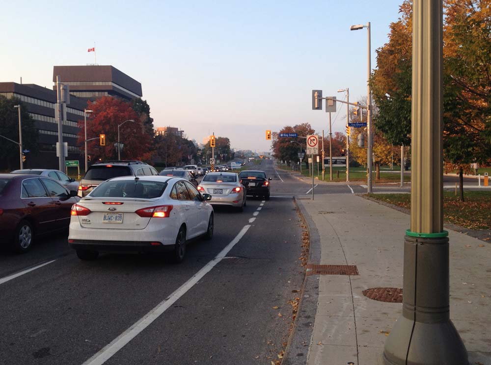
Now Sussex is the only significant stretch on this loop that isn’t along a bike path. There is a bike lane, but it ends a bit further on, like so. UPDATE 2017 : Painted bike lanes have been extended all the way to the National Gallery!
View down Sussex. Update 2017: the bike lane now extends beyond this point all the way to the National Gallery
Once at the National Gallery, go past Maman the giant spider, cross St Patrick, as shown on the above map. Then turn right onto the bike path lane heading towards the Ottawa River.
There’s a lane off to the left at the northern tip of Major’s Hill Park that immediately heads downhill to where the canal meets the river. Take it. If you find yourself on the path heading over the Alexandra Bridge towards Gatineau you missed the turn off. The lane down to the river ends at the last set of Rideau Canal locks. Push your bike over one of the wooden locks.
The locks to cross
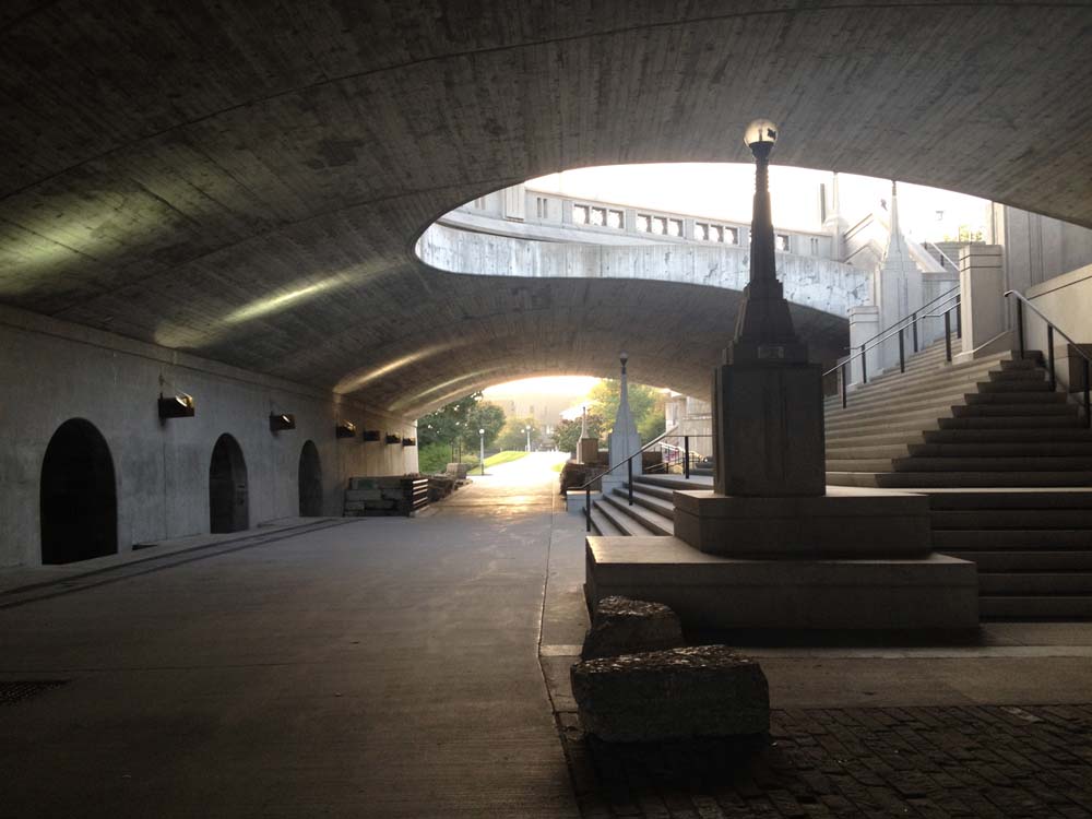
Bike up the hill beside the locks. The path goes under Wellington Street at the top of the hill like so. A very cool space to discover.
Under Sappers Bridge
The path comes out on the NAC drop off lane. Follow it for a short distance where you will notice the bike path re-appear on your left along the edge of the canal.
Another one of sister Cathy’s favorite hang-outs was the Black Cat Café on the east side of the Pretoria Bridge. It has since been replaced by a pub.
Looking across to where Black Cat Cafe used to be
She also loved to walk along the canal on her way to Carleton. Except, of course, for that time a creep flashed her. In later years she also cross country skied along the canal in the Canadian Ski Marathon, which used to end at Landsdowne Park. They’ve long since stopped that, I believe because of the complex logistics involved in laying a snow trail from Hull to the canal. Now it ends in Gatineau. I did participate one year with her. I wasn’t able to complete the 2 day, 100 mile trek (she did and has many times over since), but I did attend the closing dinner, and recall the trail blazing Jackrabbit Johannsen chiding the Courieur de Bois skiers (who not only completed the marathon, but had to carry a full pack and sleep out over night), comparing their sissy adventure to what it was like ‘back in his day!’ By this time he was well in to his late 90’s. It was pretty funny. Cathy has earned the Gold Courieur Des Bois a few times since.
Canal near Landsdowne
Continue on the path along the canal, around Dow’s Lake, and through the arboretum, where you’ll see the Arts Tower (since renamed the Davidson Dunton Tower) looming in the distance. Push your bike over the locks, cross Colonel By one more time and voila – our adventure is complete!
Figuring out how a place got its name can lead to interesting discoveries. Like the neighbourhood of Beacon Hill. There once was a lighthouse in the middle of the Ottawa River, located a few kilometers down river from the Chaudière Falls. The warning beacon it sent to boaters was visible from a hill south of the river, thus the name, Beacon Hill. Here’s a 20 km loop that goes along the river’s edge to where you can see the remaining foundation of the lighthouse, then veers inland and up the hill before heading back into town.
If you go early there’s a good chance you’ll catch some rowers out on the river behind Parliament Hill.
Rowers on the Ottawa
To get across the Rideau Canal, push your bike over one of the two lower locks. I prefer crossing over the second as the wooden walkway is slightly wider than the one closest to the river.
The locks to cross over
Head up the lane on the other side of the canal, then over to Sussex Drive. Follow Sussex all the way to the roundabout just beyond the entrance to the Governor General’s residence. Get on the bike path on the opposite side of the roundabout and follow it all the way up to where it joins the Rockliffe parkway overlooking the river. I was very pleased to discover they have completed the bike path extension down to where it continues along the waters edge.
New section of bike path along Rockcliffe Parkway
There are a few path links down to the crushed gravel bike path along the shore. My favorite is the first link just left of the entrance to the rowing club boathouse because it affords you great views of the old boathouse, like this.
Rowing Club
Follow the packed gravel pathway for a nice long stretch.
Ahhh… Que bella!
To catch a glimpse of what’s left of the lighthouse, continue along the shore for a bit beyond the directional sign that points off to Ogilvie Road, and you’ll see the remaining foundation through the gap between the two islands. You can’t miss it. Near the bottom of this link there’s a photo of what the lighthouse looked like still intact.
Lighthouse foundation
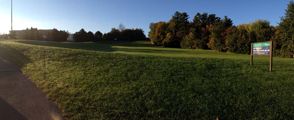
Retrace your route along the gravel path as far as the Ogilvie road turn off. Cross the Rockcliffe Parkway and follow Ogilvie Road as far as Laverendrye Drive. Turn right onto Laverendrye, which will take you to the base of Ski Hill Park. My sister taught skiing there, so the name is true to form. Now it’s a popular toboggan hill. Follow the paved path up the hill to Naskapi Drive, like so.
Path up Ski Hill Park
There’s quite an eclectic mix of architectural styles to take in as you wind your way down the other side down to Montreal Road, like this hacienda at the intersection of Rothwell Drive and Cedar Road.
Hacienda
Continue weaving your way down to Montreal Road, then follow it as far as the Aviation Parkway. There is a bike lane that starts just east of Burma Road. Once arrived at the Aviation Parkway, get on bike path at the north west corner of the intersection. Follow it as far as Hemlock Road. Turn west onto Hemlock Road, which will take you to St Laurent Boulevard. Head south for a bit along St Laurent to the back entrance of Beechwood Cemetery. Don’t bother trying to navigate a direct route from one end of the cemetery to the other, just wind your way westwardly and you’ll eventually make it to the other side.
Beechwood Cemetery
Follow Beechwood to the path that runs along the eastern shore of the Rideau River. The section of Beechwood between MacKay and the river is pretty narrow and can be tight with traffic, so you might want to walk your bike along the sidewalk for this block. Get on the Rideau River Pathway and follow it as far as the Montreal Road bridge which has a bike lane heading west over the bridge. Turn down Charlotte, which curves west and becomes Laurier, which you can follow all the way back downtown.
Next Saturday, September 28th, a number of homes throughout the city that employ green technologies will be welcoming visitors who want to discover how it’s done. It’s all part of the Envirocentre Green Homes Showcase. What a great idea. Here is a recommended bike route along roads, bike paths and alleyways to a few of those houses located west of Centretown.
This tour starts at the top of the Somerset St bridge above the O-Train tracks, easily accessible from the O-Train bike path.
First stop – 69 Fairmont Avenue.
69 Fairmont Ave
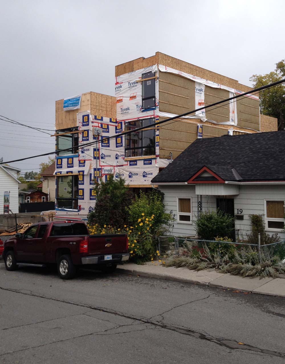
Second stop – 15 Garland St, an infill house that you can tour mid-way through construction.
15 Garland St
Third stop – 296 Royal Avenue. Lots on passive solar design going on here.
296 Royal Avenue
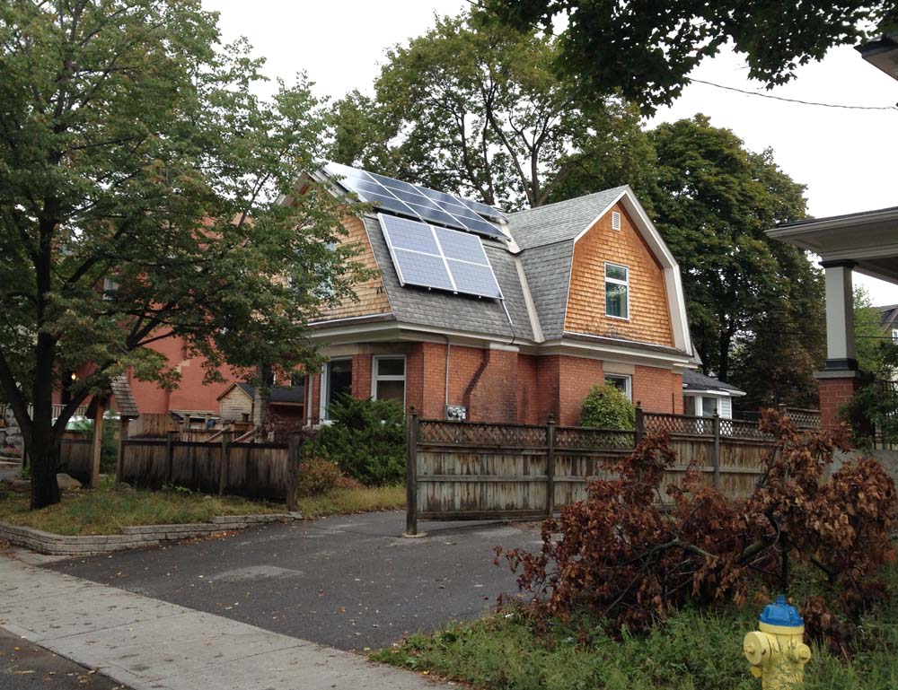
Fourth stop – 10 Firwood Crescent. Geothermal heating and more!
10 Firwood Crescent
Fifth stop – 1288 Kingston Ave – isn’t included on the Envirocentre’s map or Showcase, so it won’t be open for tours, but it is a pretty amazing house that’s been turning greener and greener over the last 30 years. Here it is as seen from the bike path that runs between Kingston Avenue and the Experimental Farm. It’s my sister and brother-in-law’s place. The two big solar panels on the left corner are for water heating. The two smaller ones flanking them are for electricity. All the others covering the roof are for electricity too, that feed back into Ottawa Hydro’s grid. The window’s are triple paned fiberglass. Many, many years ago the weeping tiles around the bottom of the foundation were dug up, cleaned and reset. Before re-filling the foundation we added 3 inches of blue foam insulation to about 2-1/2 feet above grade, then parged before re-filling. That was a big job. It helped pay for my big bike tour around Europe.
‘Hey Glenn. want to go for a bike ride?’
‘Sure, let me get the canoe ready.’
‘Oh-kay.’
That’s sort of how the conversation went which led to today’s Ottawa Velo Outaouais adventure! You see my old friend Glenn Gobuyan is even more crazy passionate about biking than I am. He rides everywhere and has bike toured all over Canada and the planet. On one particular exploit he strapped a kayak to a bike trailer designed and built in Guelph, as described in this blog he kept during the trip. The trailer also pulls a canoe, which he did this afternoon, all the way to Mooney’s Bay. Here’s how the journey went. Blue line’s how we biked there, red line’s our canoe route, and green line’s how he biked home.
Our adventure started in Westboro, just behind MEC.
And they’re off!
We biked over to Dow’s lake, along the canal, and up to Prince of Wales Drive which we followed to Hog’s Back and Mooney’s Bay, eliciting lots of double-takes and smiles along the way.
Pulling the canoe along Prince of Wales Drive
We put the canoe in at the Rideau Canoe Club (thank you very much RCC) and paddled up stream along the Rideau to the train bridge and back.
On the Rideau
Biking back along Prince of Wales Drive we parted ways at the edge of the Experimental Farm where Glenn continued on home with his canoe in tow. SO, a fine adventure. Glenn has previously managed to carry two bikes and passengers in the canoe, which takes a special attachment to keep the bikes stable. We decided to leave that to a future adventure, so stay tuned!
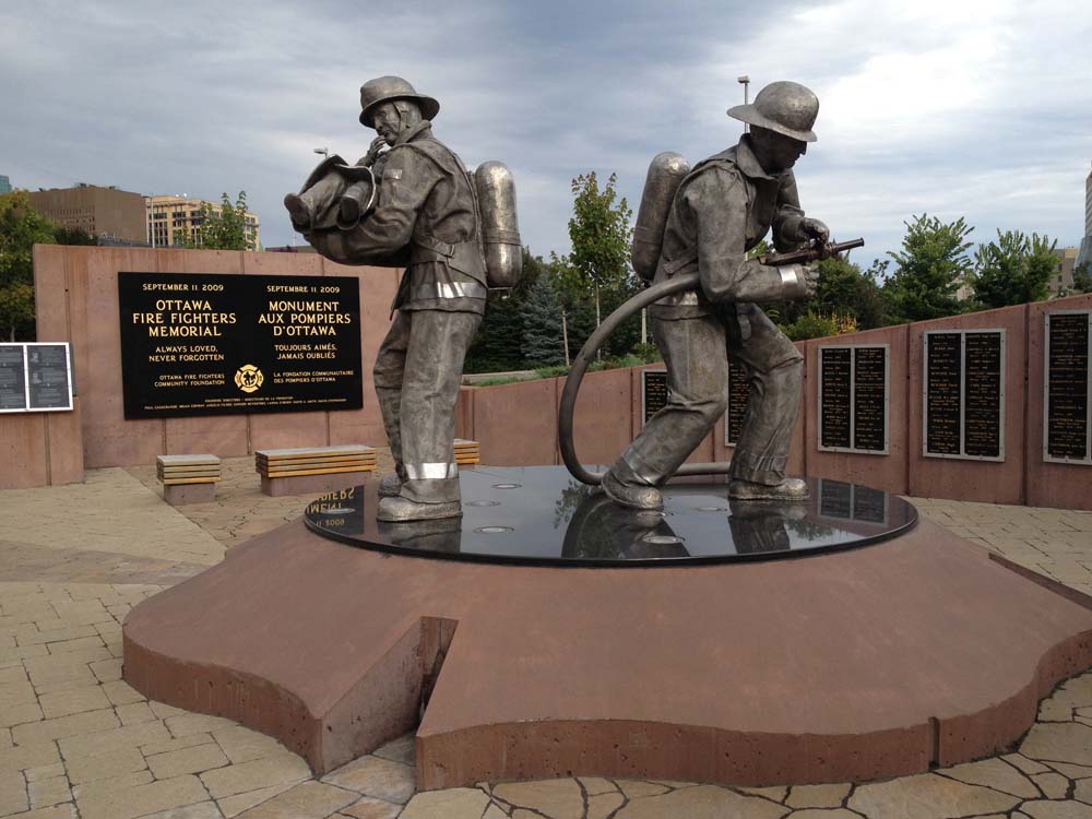
On Friday I happened upon a ceremony at the Ottawa Firefighter Memorial Monument outside city hall, commemorating Ottawa firefighters who have perished in the line of duty. On Sunday another ceremony will take place at the Canadian Firefighter Memorial on the edge of Lebreton Flats in remembrance of fallen firefighters from across the country. I remembered a couple of other installations within the city that commemorate our fire brigades, so this morning I hopped on my bike and toured them all. You can too. Here’s how.
.
This route starts at the Ottawa Firefighters Memorial just off Laurier in front of city hall. Along with engraved walls and sculpted figures, there are a number of black marble plaques depicting images of firefighters who have perished in the line of duty with accompanying interpretive texts describing their service and how they died, some dating back to the mid 1800’s. They are a touching exposé of the fatal dangers Ottawa firefighters have faced over time.
Ottawa Firefighter Memorial (a couple of the black plaques visible at the back on the left)
Follow the path along the canal down to the Ottawa River Pathway behind Parliament Hill. Things get a bit convoluted with the myriad of intersecting paths on the other side of the Wellington Street underpass. Go left at the first fork in the path like so.
Fork in the path
Stay left all the way until you see one of Ottawa’s oldest bridges on your right, Pooley’s Bridge beside the Fleet Street Pump Station.
Fleet St Pumping Station and Pooley’s Bridge
Cross over the bridge, from which you’ll be treated to this view looking north. There’s a kayakers course down there amongst the rapids.
View from Pooley’s Bridge
Once on the other side, turn right along the path that takes you between the kayak course on your right and the condo’s on the left. This will take you right up to the Canadian Firefighters Memorial.
National Firefighters Monument
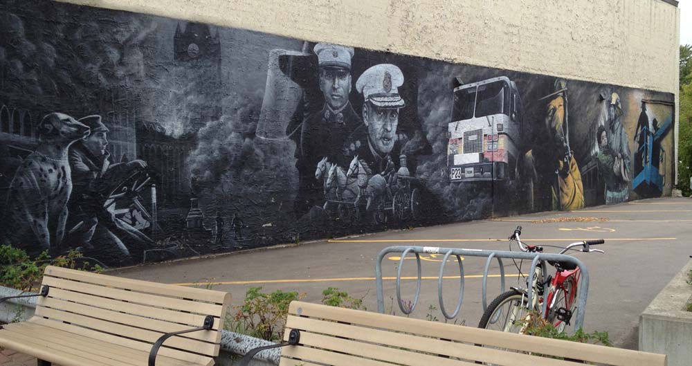
Next, follow the Ottawa River Pathway all the way to Westboro, where you’ll discover this mural across the street from Mountain Equipment Co-op.
Westboro mural
Next, bike over to Scott Street and follow the bike lane all the way to Holland. At Holland the lane disappears and is replaced with sharrows, which also vanish further on – super dangerous along this busy road. So cross Holland and get on the path that runs along the north side of Scott St, like so.
Location of path on north side of Scott St
Turn south on Bayview and weave your way over to the corner of Garland and Wellington St W, as shown on the above map, where you will happen upon this sculpture of a hydrant with firefighter boots and a hose on top. It’s part of a series of fire hydrant sculptures that line Wellington West.
Hydrant sculpture
To complete the loop, head east on Somerset St W all the way to Cambridge St, then north to Laurier and the top of Nanny Goat Hill, then straight down the Laurier bike lane to the Ottawa Firefighter Memorial Monument where the tour began.
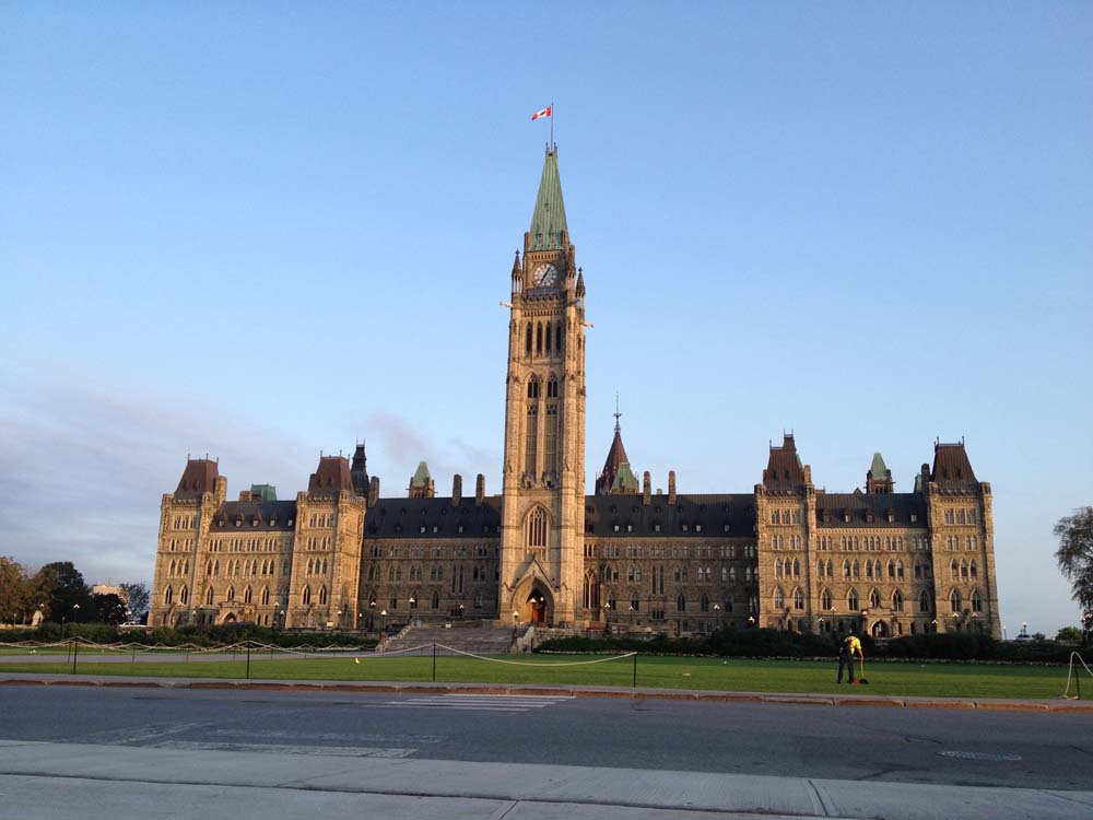
Someone was wondering via Twitter if there is a safe way to bike from Parliament Hill to the Ottawa Hospital General Campus that avoids the ‘horrible Smyth Road bridge’. Here is a route indicated by the blue line on the map below, starting at Parliament Hill to the Ottawa Hospital General Campus and beyond through the rest of Ottawa South.
UPDATE– Spring 2020: The new path along the O-Train from Ottawa University was a big ground breaking change for this route so I’ve updated it accordingly.
Start
Leave Parliament Hill, cross Wellington and head a short distance down Elgin Street.
Elgin St
Turn down the ramp beside the NAC across for the War Memorial, like so.
Ramp heading down beside the NAC to the canal
Ride all the way down the ramp past the NAC stage door, and get on the bike path that runs along the canal.
Path along the Rideau Canal
Take the pedestrian/bike bridge over the canal across from Ottawa of University, like so.
Bike and pedestrian bridge over the canal
Cross Colonel By Drive and go straight under the O-Train tracks. There is a winding path that gets you up to train level. Follow that path heading south parallel to the tracks. Follow it all the way to Hurdman Station.
Cross under Hurdman Station and Continue straight on towards the Riverside Drive/ Industrial Avenue intersection. Now I won’t deny this is a spooky major vehicule intersection, however don’t let it intimidate you. There are usually many other pedestrians and cyclists crossing at this spot and the path does continue on the other side of Riverside Drive along Industrial Avenue.
Riverside Drive and Industrial Avenue
Continue along Industrial Avenue, past the giant metal flowers installed in Cancer Survivors Park.
Big flowers
The first street you will come to is Alta Vista Drive. There is a bike path that starts at the south east corner of Alta Vista and Industrial. Follow it.
Path off the corner of AltaVista and Industrial
It ends a short distance on at Blair Street. Turn right on Blair, then take an immediate left on Station Boulevard. Follow Station Boulevard right to the end where there’s a bike path that takes you through to Ring Road.
Bike path at the end of Station Boulevard
Turn left on Ring Road that rings around our first destination – the Ottawa Hospital General Campus!
Ottawa Hospital General Campus
For those interested in continuing on further into Ottawa South, exit the Ring Road at the first left which is a car entrance to the grounds of the hospital. Turn right on Roger Guindon Avenue, and follow it all the way to Smyth Road. Across Smyth you will see the start of another bike path. This one is really great, because it travels right across Ottawa South through mostly green space all the way to Walkley Road, and goes past the very impressive Kilborn allotment gardens. Our journey ends here, however for those that wish to travel even further south there are bike lanes along Conroy Road as far as Hunt Club Road. Have a great commute!
Conroy Pit is a very popular off leash dog park within the south-east part of the Greenbelt, but it is also a great place to explore by bike. Here are a couple of routes to get there and back from Centretown.
Getting to the corner of Hunt Club Road and the Airport Parkway off ramp alon gthe blue route is pretty safe, however the next section along Hunt Club and Bank Street was hell. Speeding traffic weaving in and out of four and six lane traffic with no shoulders at all, that kind of hell. So I recommend following the much safer red route I took to get home. More on that later.
I accessed the park at the north west entrance where Quail Run Road ends, like so.
Access to Conroy Pit from the end of Quail Run Road
Once in the park the ground is pretty much packed sand everywhere, with a few loose spots, but nothing too difficult to negotiate on a hybrid bike. It would be a sinch on a mountain bike.
Path through Conroy Pit
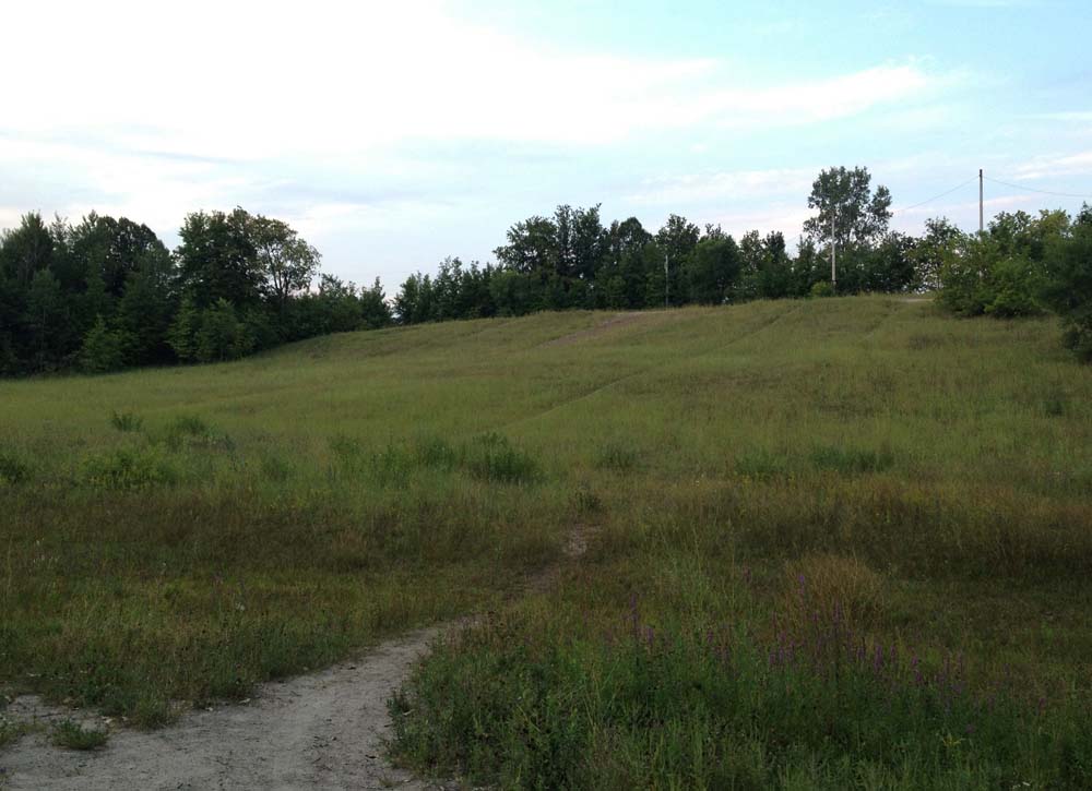
There is indeed a pit, on one side of which is a hill used for tobogganing in the winter.
Toboggan Hill
There were a number of dogs running free along the path so I proceeded at a very comfy careful pace lest they decide to charge on over to say hi, or dart across the path after each other. I think there is an unwritten rule you don’t take aggressive dogs to an off leash park. All the dog walkers were very friendly as well, and, by all indications, very good at picking up after their pets so don’t worry about that.
Dog
There are also lots of small paths not plotted on a map that you could spend time discovering without worrying about getting too lost, as the park is pretty contained.
Small side path
The south eastern part is more wooded.
Woods
Heading back to town I followed the bike lane along Conroy Road. It’s a busy commuter artery, but the bike lane was great for getting me safely all the way to Walkley Road.
Bike lane along Conroy Road
At Walkley I hopped onto the bike path that runs along the Killborn Allotment Gardens, and then wove my way home along the route hi-lited in red. Et voila. Being in the pits can be fun!
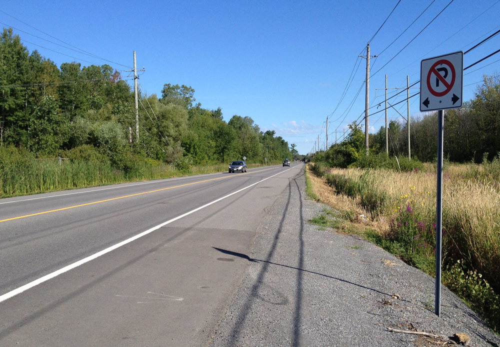
The community of Manotick is a great destination for bikers. It is located a comfortable 30 km or so up the Rideau River from downtown Ottawa. The Village of Manotick was founded in 1859 by entrepreneurs Moss Dickinson and his partner Joseph Currier when they constructed a gristmill on the shores of the Rideau. Their well preserved and still functioning mill remains a symbolic focal point for the community in their attempts to preserve its small town character. Choosing a safe bike route to Manotick and back can be a challenge, so early last Sunday morning I set out to do so. Here’s what I came up with – blue line on the map below is how I got there, red line’s how I made it back. While plotting my route I leaned heavily on two other intrepid bikers who scouted out the journey to Manotick before me, and wrote about it here and here.
Early Sunday morning is a good time to ride along Prince of Wales Drive heading south. There is a generous shoulder to ride along for most of the way and few vehicules. During the week the ride is much less pleasant with a lot more traffic using it as as a major commuter artery into town, big trucks included.
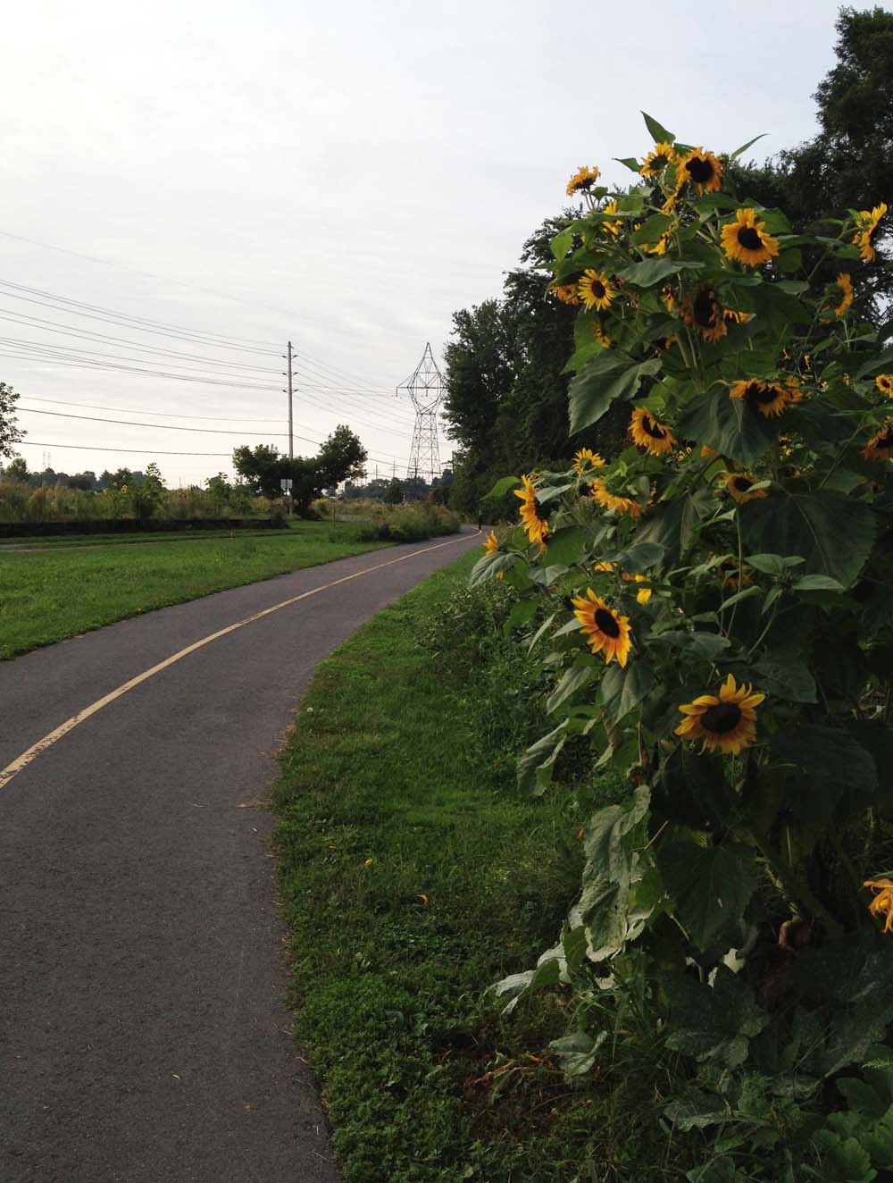
Experimental Farm Ornamental Gardens looking good
The city has done a fine thing by removing the concrete protrusion that used to stick out from the edge of the road at the Hog’s Back intersection. Before bikers travelling along the shoulder of the road were suddenly obliged to merge into traffic. This fixes that.
Fixed sidewalk at Hog’s Back intersection
Unfortunately the problem persists at all other intersections between Hogs Back and Fallowfield Road, the worst instance being the approach to Rideau Heights Lane where Prince of Wales takes an uphill turn, providing little chance for overtaking traffic to notice riders. I rode off the road onto the well worn gravel path shown below. This worn path’s existence is indicative of how much this corner is a safety problem for bikers and pedestrians.
Crazy POW corner just before Rideau Heights Lane
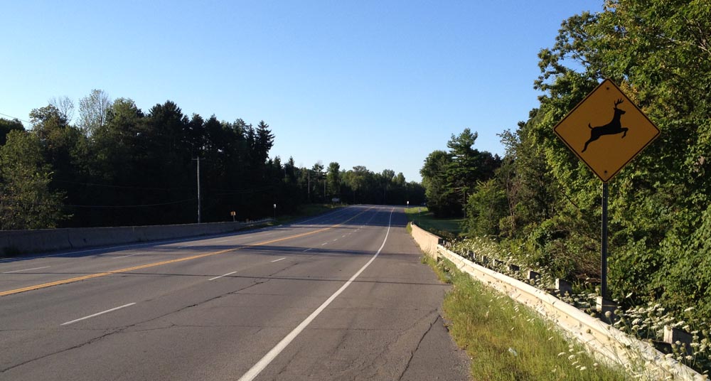
So, be extra careful wherever Prince of Wales meets another street. Otherwise, enjoy the scenery, like this interesting old dead tree.
Dead tree in a field
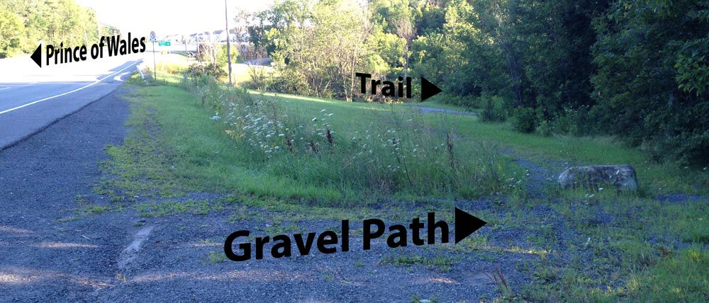
I’ve heard that Prince of Wales from Fallowfield Road to Manotick is pretty treacherous so I avoided it by riding along residential streets and a wonderful stone dust path through the woods. Here’s how. First, turn off Prince of Wales onto Fallowfield. It has a generous bike lane, as does Merivale Road, onto which I turned and headed south.
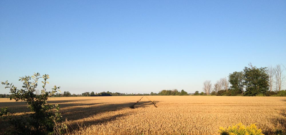
Golden Fields along Merivale Road
Leave Merivale and turn onto Leikin Drive, along which there’s a generous shoulder AND a recreational pathway to choose from, like so.
Gotta be Leikin this!
Leikin turns into Cresthaven Drive and the bike lane disapears, but the ride is through residential areas which have very little traffic on Sunday mornings. Cross Strandherd, and turn onto a path that runs alongside heading east like so.
Path parallel to Strandherd Drive
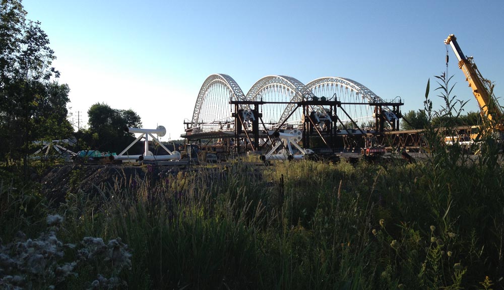
This will alternate between short stretches of paths and streets until you get to Bakewell Crescent. The Strandherd Bridge across Prince of Wales is still being constructed, so I went and took a closer look. Pretty amazing structure. UPDATE– July 2014: The bridge is completed, and it’s pretty impressive! I test rode it shortly after it opened and described it in this post.
Strandherd Bridge under construction
Follow Bakewell Crescent to Rocky Hill Drive, which crosses Prince of Wales to Lodge Road. Very pleasant little street, with the Rideau River on one side, and the Carleton Lodge Long Term Care Home on the other, which must hold the title for the most eclectic collection of birdhouse architecture in the region.
Birdhouses!
To get over the Jock River one has no other choice but to get back on Prince of Wales Drive. Fortunately there is a shoulder along this stretch, like so.
POW over Jock River
Once over the bridge there is a gravel path on the Rideau River side that takes you down to a trail which you will need to cross over Prince of Wales to get to, like so.
How to get to the trail on the other side of Jock River
The trail weaves its way through woods and over little streams flowing to the Rideau River.
Path through the woods
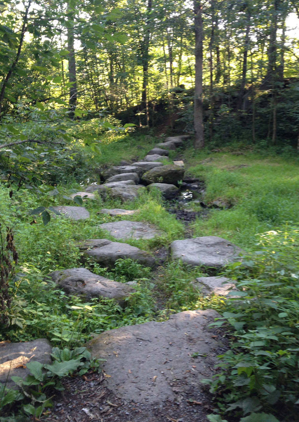
At one point the path splits. There aren’t any directional signs so I chose to veer left along the river, which led to this series of flat faced boulders strategically placed to help get across a brook. It was very easy to negotiate carrying my bike, however if this seems inconvenient (trailer pulling, loaded panneirs, etc), the map suggests that, by following a path to the right towards the Rideau Valley Conservation Authority building, you can avoid this zen garden-ish method of river crossing. But I’m not sure, didn’t check. My apologies.
Zen Crossing
Eventually the trail comes out at Lockview Road. For a more detailed description of the trail just travelled, albeit heading in the opposite direction, click here.
I then rode along Barnsdale Road to get onto Long Island, which sits in the middle of the Rideau River.
Rideau River from Barnsdale Road bridge
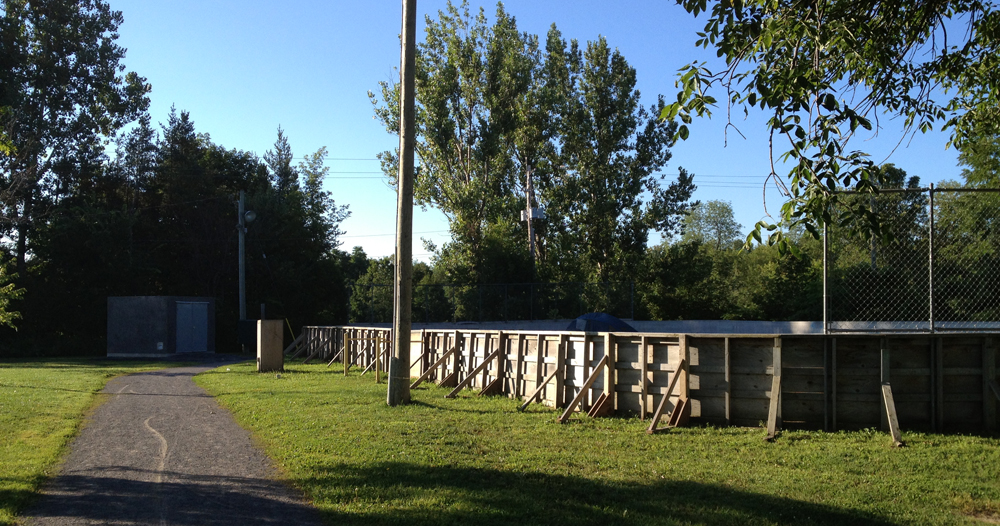
Turn onto McLean Crescent, until you reach a path that takes you through George McLean Park. You’ll recognize it by the hockey boards all up and ready for next season.
Path through McLean Park
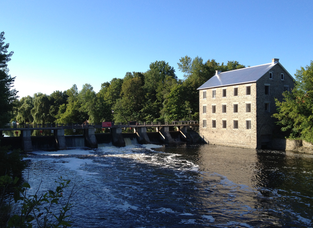
Once through the park carry on along West River Drive and cross Bridge Street on into AY Jackson Park, named after one of the Group of Seven painters who lived in Manotick for a spell. Ride on down the path to the great lookout over the river towards Watson’s Mill. Et voila – made it to Manotick!
Watson’s Mill
Time to head back to Ottawa on the east side of the river, but before doing so I explored the southern tip of Long Island, which is mostly residential with a mix of big bushy trees, like so.
Various big bushy trees on Long Island
Then over to the north-east shore via Bridge St. As you can see it was pretty busy even on a Sunday morning. Cars also tend to speed over this bridge, so, depending on the amount of traffic, you might consider walking your bike along the sidewalk.
Bridge Street
Bridge Street becomes Mitch Owen Drive. It’s got a shoulder, but it’s got lots of fast traffic too.
Mitch Owens Drive
I prefer roads with less traffic even if they are shoulder less, so I turned up Spratt Road.
Spratt Road
The above photo is also the intersection where I turned east onto Rideau Road, which is similar to Spratt Road in terms of surface quality, amount of traffic and farmland scenery. I Continued along Rideau Road until Bowesville Road where I turned north. Very nice road – not much traffic and excellent shoulders. AND, if your timing is right, you might spot a big metal low flying bird.
It’s a bird! It’s a plane!! It’s Supe…., it’s a plane.
When you get to the end of Bowesville Road Where it crosses Leitrim Road you will be greeted by a chain link fence topped with barbed wire and no access signs. Fear not! There’s an inconspicuous access point right where the arrow is pointing for cyclists and pedestrians to get through.
Access to High Road
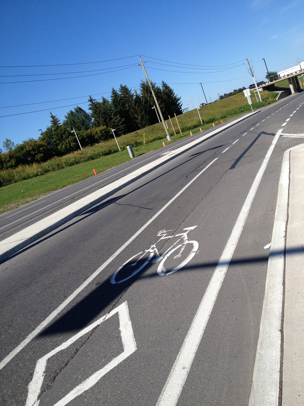
Once you’re through, follow the road around the airport. The Uplands Drive intersection and stretch to the Airport Parkway was a bit confusing and felt like a freeway off ramp. There is a generous bike lane along Uplands that takes you under the Airport Parkway, like so, but be extra careful as it crosses merging traffic lanes, and cars always seem to be rushing to and from the airport.
Uplands bike lane
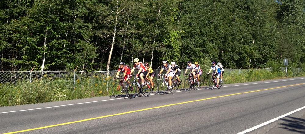
Once clear of the Airport Parkway, Uplands is endowed with great big shoulders like so, making it a pleasure to ride along.
Uplands shoulders
It’s also very popular with the zip-zip set. This was the third pack that passed me heading in the opposite direction.
Hi! Hi! Hi! Hi! Hi! Hi! Hi! Hi!
Now the next trick is finding a safe way to the recreational path along Mooneys Bay, which primarily means avoiding riding along Hunt Club Road, Riverside Drive and Walkley Road, all very busy, not very bike friendly roads. Here’s how: Continue along Uplands across Hunt Club. Turn right on Cahill Drive West and then left on Twyford Steet. Than cut through to Annapolis along this short path.
Path to Annapolis
Turn left on Annapolis, left on McCarthy, left onto Southmore Drive West and finally left on Fielding Drive for just a short distance until you reach a short path on the right like so.
Fielding path
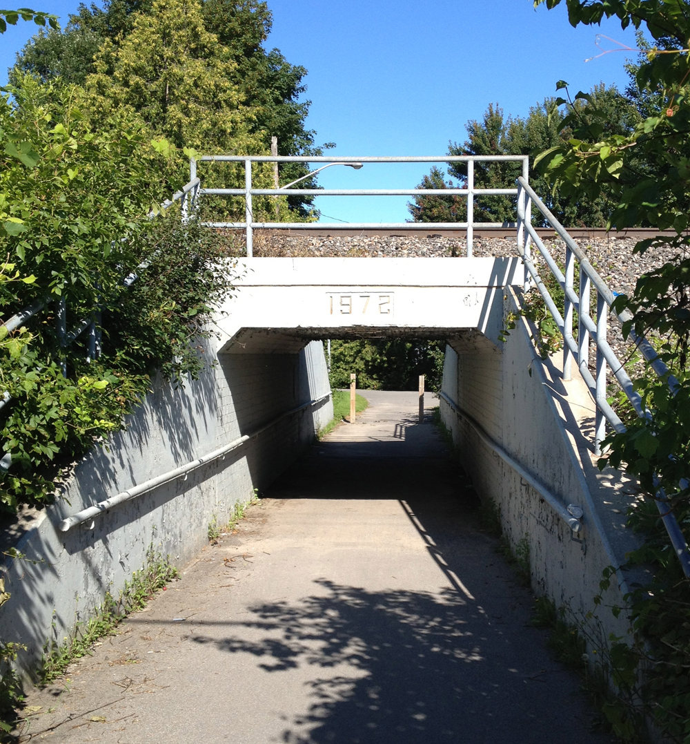
It takes you under the train tracks through to Otterson Drive.
Nineteen-seventy-tchoo-choo!!!
Shortly after Otterson Drive curves left there is another short path like so….
Path through Otterson park
Which takes you through to the Riverside United Church Parking lot.
Riverside United Church
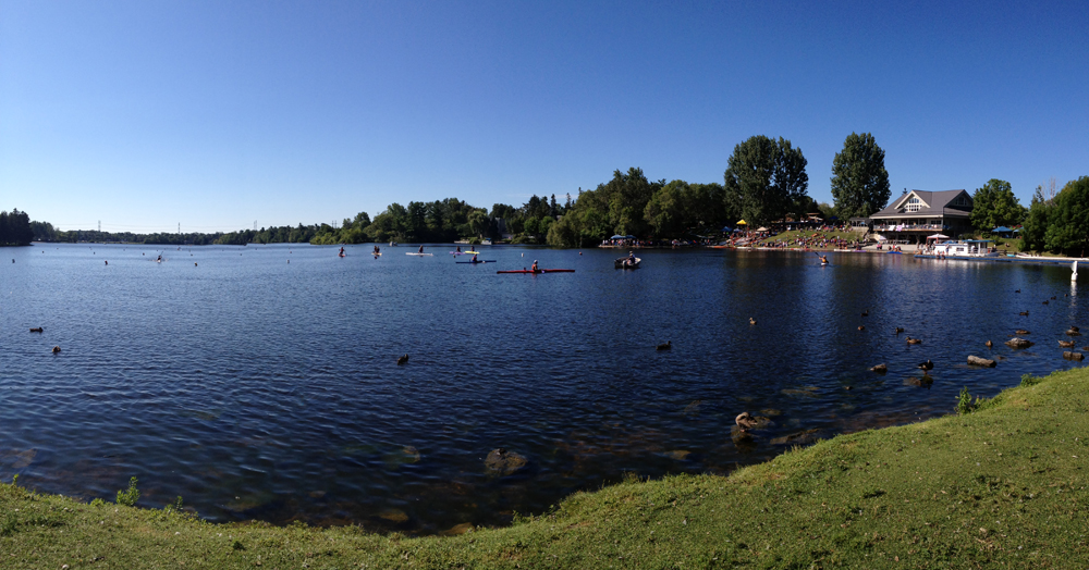
Cross Riverside to the path that takes you through Mooneys Bay. Continue along the path, cross the bridge over Hogs Back Falls, and, if you wish, check out a regatta.
Regatta be kidding!
It being Sunday, there’s a good chance you’ll be able to bike right down Colonel By Drive which is closed for Sunday Bike Days. So there you go. A fine early Sunday morning ride to Manotick. Happy Trails!
Last Thursday I biked to a friend’s cottage on Sharbot Lake just south of the Blue Skies music festival, and then rode up to the festival site the following morning to set up our tent. Here’s how it went.
To get out of Ottawa I followed the Ottawa River Pathway and Watts Creek Pathway as far as Moodie Drive. A description of those paths can be found on this post. Rather than follow Watts Creek Pathway which continues on the other side of Moodie, I rode along Corkstown Road to where it meets the Greenbelt Pathway before it goes under the Queensway.
Corkstown Road, and the turn off to the Greenbelt Pathway under the Queensway
This section of the Greenbelt Pathway is a very pleasant meander through fields and woods.
Greenbelt Pathway
I followed this path as far as Robertson Road to where it joins the rail-to-trail path that takes you all the way to Carleton Place, as described in this post. This time I rode through the rain, which made the crushed gravel a little slower going.
Carleton Place has a number of fine heritage buildings to ponder on your way through, such as the Town Hall on the edge of the Mississippi River.
Carleton Place Town Hall
I crossed the Mississippi at Bridge Street, and then headed South West on High Street – a safe road to bike down, with big old houses on either side as you head out of town.
House on High Street
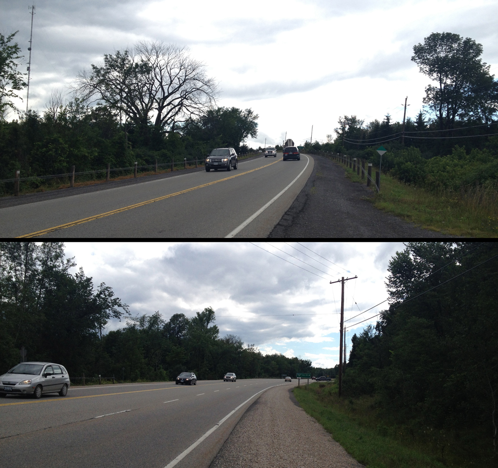
I then followed the Trans-Canada Highway for a 4km stretch. The Trans-Canada is a terrible two lane road to ride on. Folks drive along it as fast as they can to get from point a to b. That includes big transport trucks. Fortunately the section heading out of Carleton Place has a small paved shoulder and packed gravel that’s ride-able. I regret not having a small mirror attached to my helmet or handle bars to anticipate trucks roaring up behind me. It would have helped brace myself for the backdraft that shakes you on your bike as they pass.
4km stretch along the Trans-Canada Highway between Carleton Place and Tatlock Road
I turned onto Tatlock Road, a two laner that wasn’t too busy.
Tatlock Road, heading towards Blue Skies
Before this trip I hadn’t realised how generous Google Maps is in their interpretation of what constitutes a road, that is until I reached the turn off to Forest Road.
Forest Road
That’s OK, says I. Carla had a copy of my route and my phone still had batteries, so off I went down Forest Road. It was a little bumpy, but quite bikeable.
After crossing Old Perth Road, Forest Road became much more navigable, like so.
Forest Road beyond Old Perth Road
Concession Road 1 Ramsay and Boyds Road which became Ferguson Falls Road were very similar – packed gravel through farmland. Very nice to bike along.
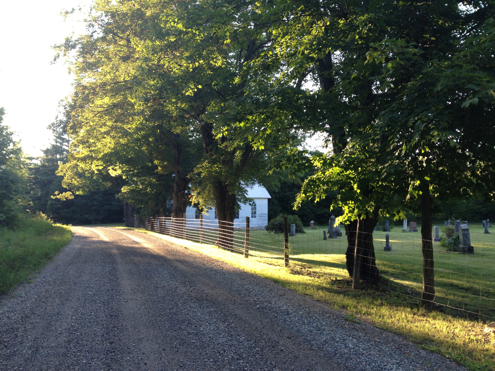
This Methodist graveyard along Ferguson Falls Road is located just before Pine Grove Road, or Route 12. I was struck by the landscape’s layers of rich contrasting colours.
Methodist Cemetery
I quickly discovered cars like to travel fast along route 12. Not as fast as on the Trans Canada, but still pretty fast.
Heading down Route 12
There were also a number of dump trucks travelling in the opposite direction, that I soon discovered were heading away from a huge quarry just off Route 12.
Dump Truck Alley
I rode into Lanark Village and paused long enough to buy liquids at their general store. I sensed this was a very special place, full of resilience and rich heritage. This building for example, that someone is conserving and re-pointing. I’ve since found this walking tour of Lanark Village that describes some of the towns origins. Can’t wait to re-visit.
Back to life in Lanark
Route 12 heading South of Lanark felt a lot safer with fewer cars and a nice wide shoulder in places.
Route 12 South of Lanark
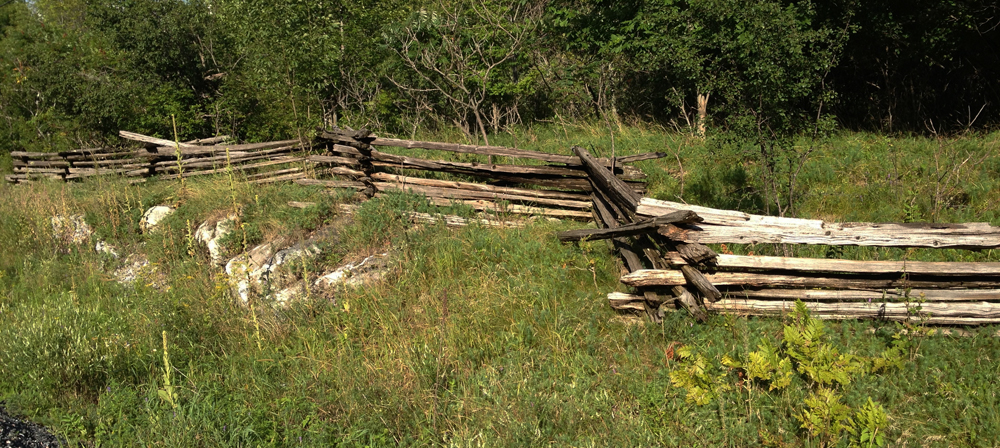
Lot’s of cedar post fences like these.
Cedar post fence
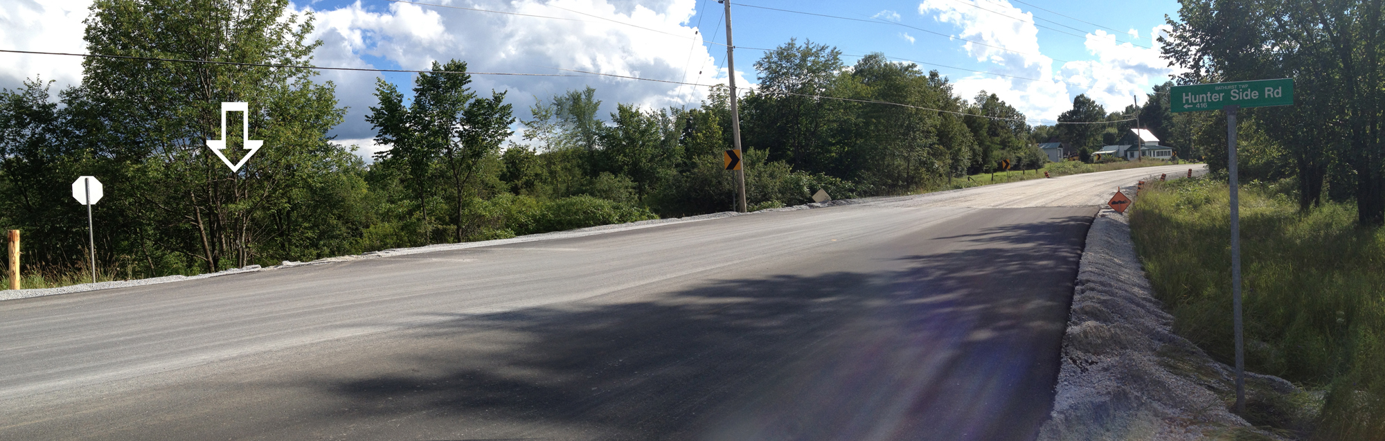
They are also right in the middle of paving the road further south in a way that suggests a wider shoulder will be in the offing. While I was humming along on this fresh asphalt I almost missed a little sign indicating Hunter Side Road, which was supposed to be my next turn. Where was the road? Just there, over the edge where the white arrow is pointing.
?
And voila – Hunter Side Road!
Hunter Side Road
I turned onto Bennett Lake Road, which is the perfect country road to bike along – very little traffic, and the few vehicules that did overtake me slowed right down and gave me lots of room.
Bennett Lake Road
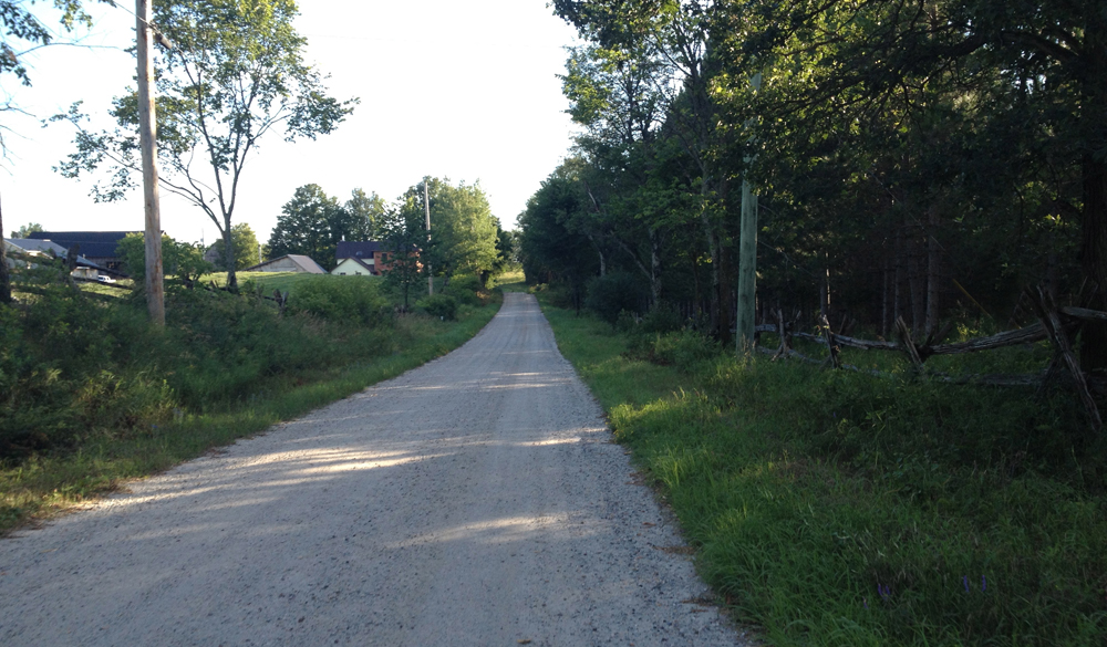
After crossing Elphin-Maberley Road, Bennett Lake Road became 11th Line Road, surfaced in a light coloured packed gravel excellent for biking.
11th Line Road
11th Line joins Zealand Road which is paved and just as great as Bennett Lake Road.
Old house along Zealand Road
Turned onto Bell Line Road, which is a brown gravel surface, that alternates between packed and loose, still very good for biking.
Bell Line Road
Next turn will be onto the K&P Trail which crosses Bell Line Road. There isn’t a sign indicating where the trail crosses Bell Line Road. Here’s what the intersection looks like.
K&P Trail crossing
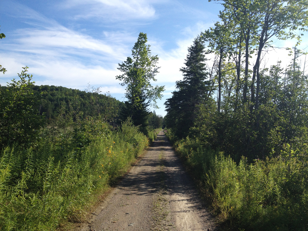
The trail is mostly packed dirt and gravel, like so.
K&P Trail
However there are a couple of short stretches where they’ve put down some stones for draining which may require dismounting and walking your bike.
Stones along short section of K&P Trail
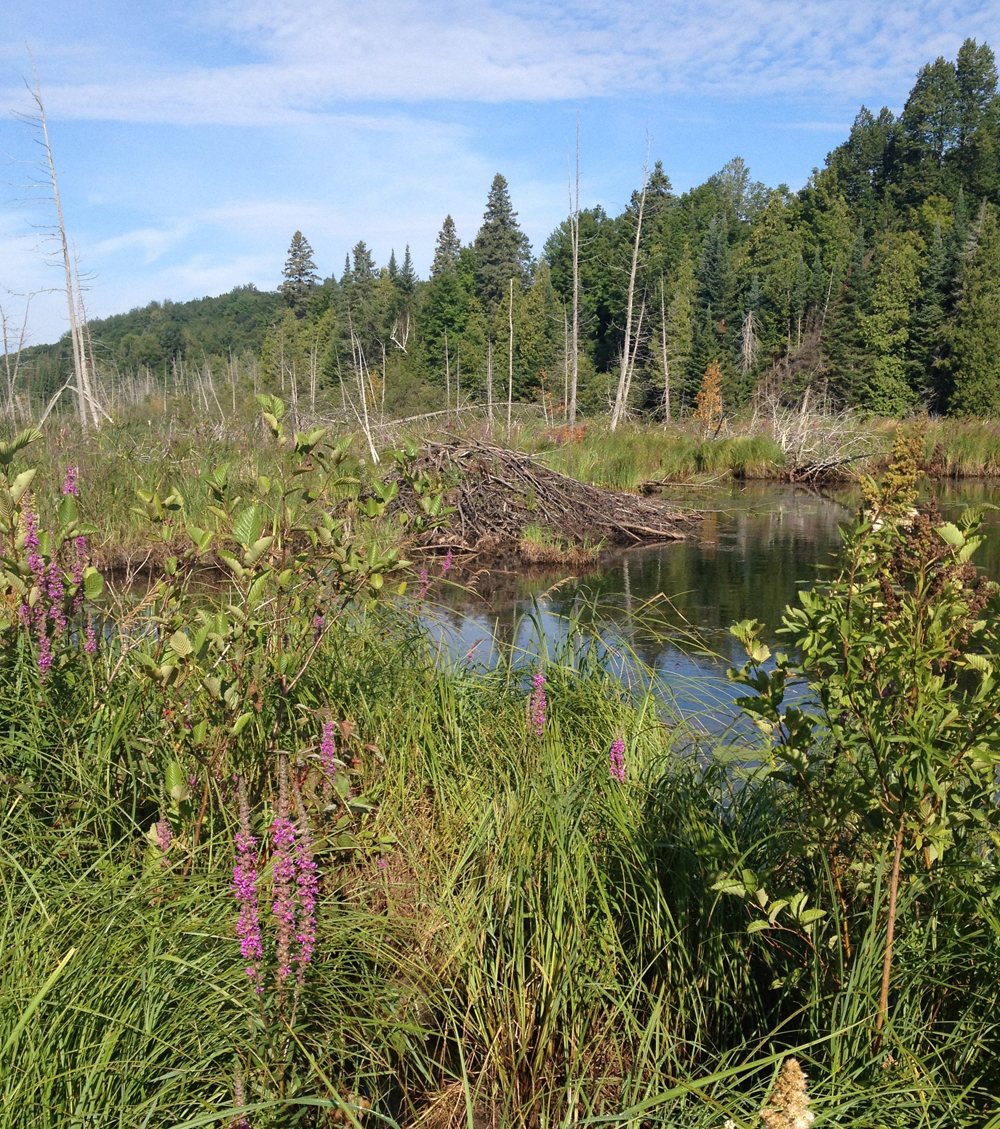
There’s a beaver house just off the trail along one of these stretches.
Beaver hut
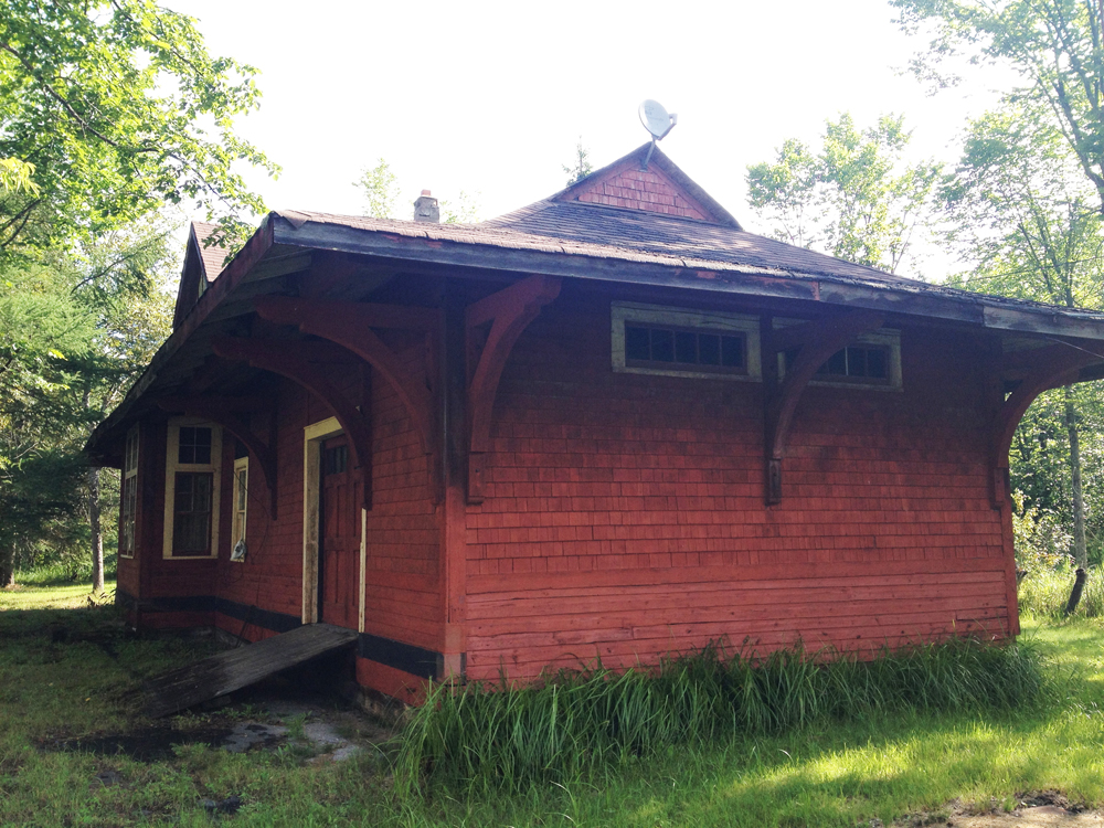
The trail crosses Clarendon Road, which you will know you’ve reached by the abandoned station house on the opposite side of the road.
Clarendon Train Station
Follow Clarendon Road for a short bit to get to the entrance of the festival site. It’s hilly and narrow so watch out for cars heading to the festival.