Clemow Avenue is a unique street within the Glebe. It was supposed to become a grand avenue linking the Queen Elizabeth Driveway along the canal to the Experimental Farm but never quite got that far. More about it’s interesting history in this post. Yesterday I had a meeting on Clemow Avenue so I biked there. Here’s how.
These two houses, most likely identical at birth, have really taken on their own personality over the years.
Twins!
This house at 170 Clemow was built in 1926 and is now the High Commission for Cameroon.
High Commission of Cameroon
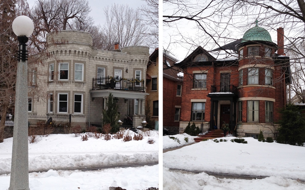
Here are a couple of other interesting houses along Clemow.
The Castle & The Cupola
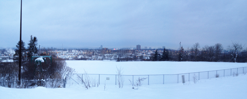
The eastern end of the street runs along Patterson Creek for a bit like so. When the canal is skate able the NCC usually clears the creek and installs a change shack a bit further east along Linden Terrace which would make for a fine bike & skate outing.
Patterson Creek
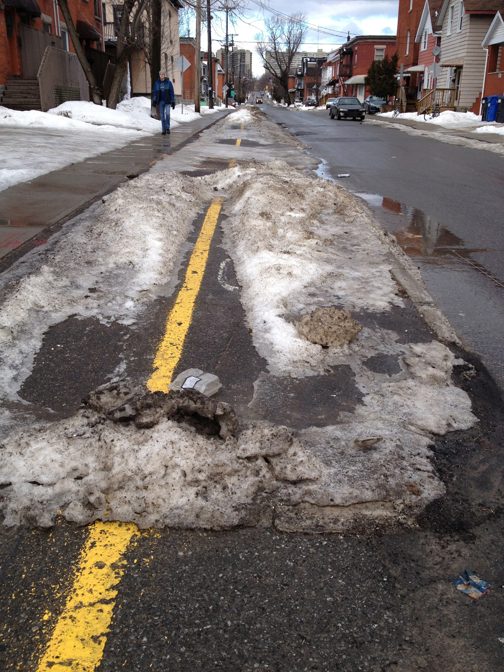
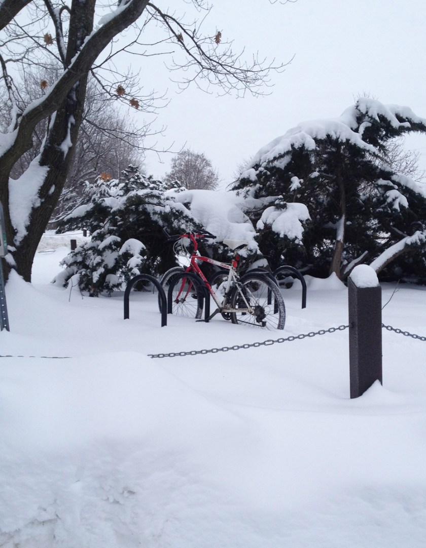
Clemow is a great street to bike down. It is nice and wide, there are traffic stopping planter boxes near Patterson Creek and no car access from Bronson. Unfortunately the bike lanes along Percy Street north of the Queensway aren’t cleared, requiring law abiding cyclists heading north to walk their bikes east to Bay Street.
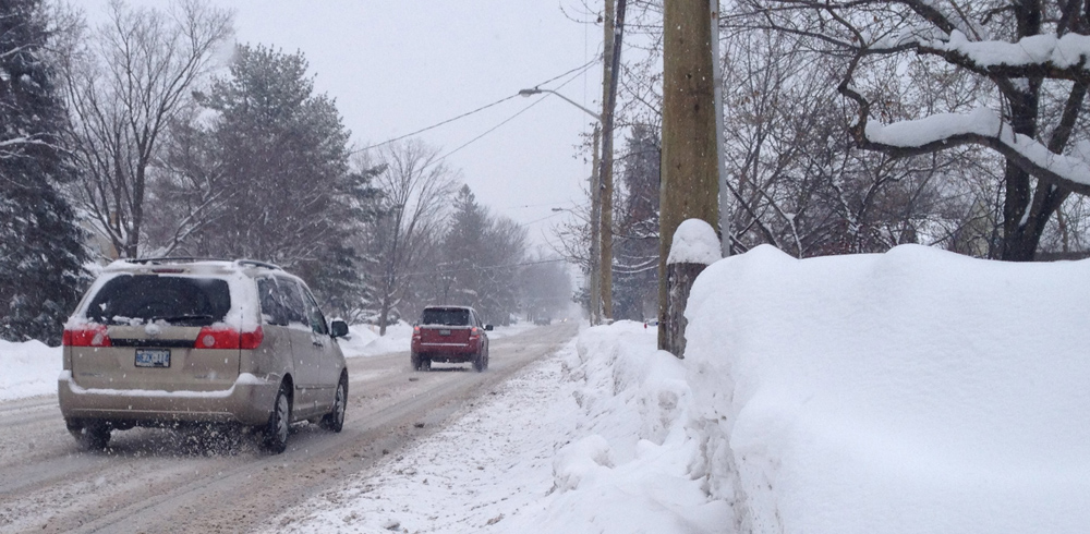
Most days I would say winter biking is a safe venture, however yesterday was brutal. Along with having to negotiate snow piled up from previous storms yet to be cleared I rode through flurries to get to the Brian Kilrea Arena. I learned lots.
Pausing along Kilborn Avenue
Here are a few things I discovered:
• Should have packed goggles.
• If it’s snowing, flashing lights front and back are a VERY good idea even in the middle of the day.
• Clothing with retro reflective bling is a good idea too.
• Most people these days think you are nuts to cycle in such conditions.
• I was forced to go down roads I would avoid in the summer, like the length of Bank Street between the canal and the Billings Bridge.
• I had to take the lane on many occasions – no choice. Fortunately every driver I encountered was good about it.
• Sometimes along extended stretches of road when I am taking the lane I’m OK with pulling over to let a line of cars pass, as I did somewhere of Kilborn. Within reason. Analogous to a tractor hauling huge bales of hay along a country road who sometimes pulls over for the same reason.
• It helps to be a bit familiar with which streets are slightly more travelled than others and, subsequently, are more likely to be cleared. Like Holmwood in the Glebe (cleared) vs 5th Avenue (not cleared, and impossible to ride down).
Now, why even try to bike in such conditions? Apart from actually wanting to for various reasons (health, environment, etc), folks who don’t have a choice, like those who forego owning a car and still have to commute, need to be able to ride through anything a car can. Here’s hoping these observations help. We have a ways to go.
Back in October I blogged a bit about the abandoned ski hill up at the Carlington Heights Reservoir. A friend mentioned he toboganned there with his kids so I decided to go check it out early this morning. Blue line is how I got there, orange is how I got back. Red is where I had to get off my bike and push.
It’s been awhile since I’ve gone for a ride at 6:30 am as I do in the summer. That’s because the combination of cold and darkness make my pillow simply irresistible. But this morning I gave it a shot. The thing that struck me the most as I saddled up was the dense hum of the morning city traffic, like that of a huge waterfall just a short ways off. Maybe it’s amplified by the wet roads, and perhaps in the summer it’s all muffled by the leaves on the trees.
I biked through the farm along the NCC Scenic Driveway like so.
NCC Scenic Driveway
On my way to the reservoir ski hill I happened upon another really steep toboggan hill at the top of Edgecliff Avenue.
Rated black diamond
To get to the very top of the reservoir I carried my bike up a steep incline and across a snowy plateau to be able to look out over the old ski hill like so. The toboggan run starts on the other side of the chain link fence.
Atop Carlinghton Heights Ski Hill
Here is the top of the toboggan run. It’s pretty awesome, with built up snow jumps thrown in for good measure. It was so well used and packed that I managed to bike down the hill without sinking in.
Looking down the toboggan run
Now THESE are one of the winter cyclists worst enemies – icy ruts on icy roads. They seem to thrive in the conditions we are experiencing, whereby accumulated packed snow turns to ice, and slightly warmer conditions allow the ruts to form. Even studded tires are defenceless against these suckers. Fortunately they are primarily found on side roads where there isn’t a lot of traffic. Best way to deal with these is to go nice and slow.
The O-Train path isn’t bikeable in the winter, but is it skiable? The other day I went to find out. Blue line shows where I biked to, orange is where I skied. UPDATE – Nov 2014: The path is now being cleared and salted from Young St to the train stop at Albert. Should still be able to ski along the side of the path for most of the distance described below, or just ride to the Albert station and start skiing from there.
I am really liking the bike&ski concept. Many cross country ski trails, inconvenient to get to by foot or car, are but a quick bike ride away! The new trail along the O-Train is accessible between Somerset and City Centre. I locked my bike to one of the recently installed lamp posts like so.
Parked between Somerset & City Centre
I headed south along pre-set tracks. It is possible to access Gladstone, as shown in the image below, however I decided to turn around and head north towards the river after realizing I wasn’t too keen on having to take off my skis to cross a few streets if I was to continue south.
To continue along the path beyond the O-Train station at Scott Street requires climbing over two of these short 3-rung fences.
O-Train Station
The path from the station to the river is plowed, but not sanded or salted, so pleasantly skiable.
Plowed part of trail
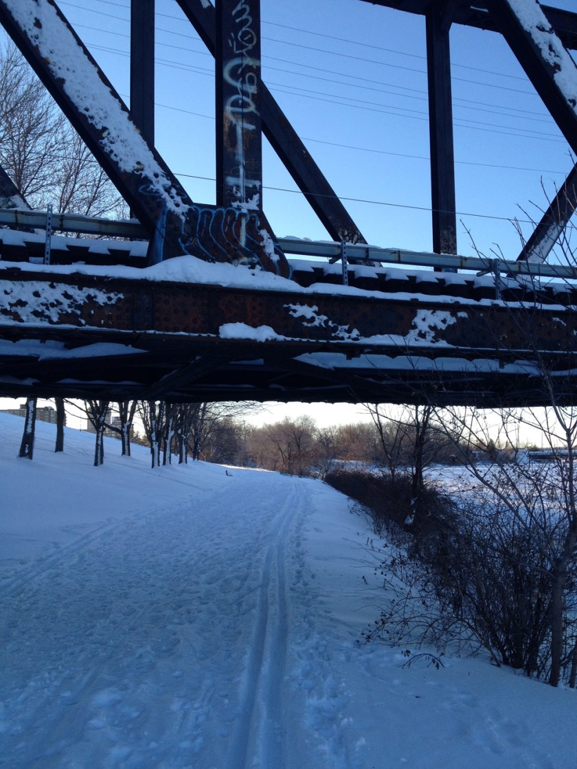
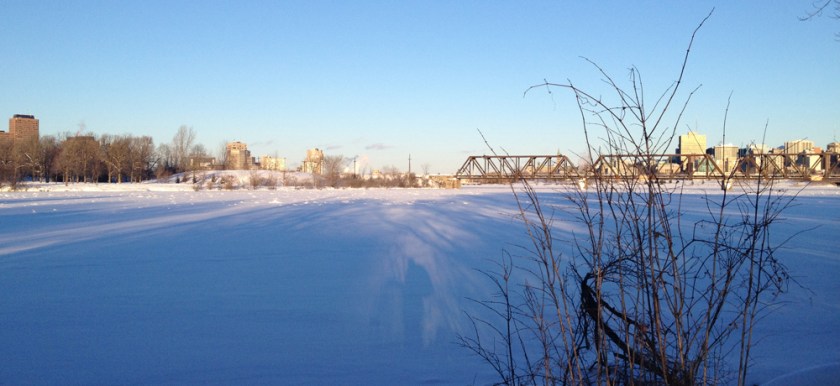
The stamped letters atop the railway bridge across the river reads INCE OF WALES. Strange name, but it could work with a little P.R.
Ince of Wales Bridge
The Ottawa River Pathway had evidence of all sorts of winter loving traffic – snow shoes, ski tracks and a well worn pedestrian path. I followed it west.
Ottawa River Pathway in the winter
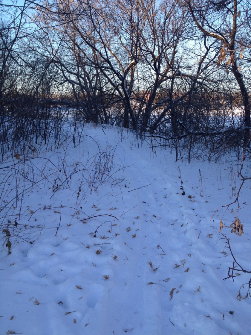
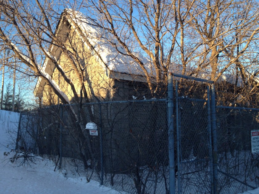
At the entrance to Lemieux Island someone had broken trail along the jut of land beside the river, an area I had never explored before.
Someone has cut a huge opening in the chain link fencing surrounding the ruins, however I would heed the DANGER – UNSTABLE STRUCTURE signs and stay out, for the building is obviously unsafe as you can see.
Hintonburg Pumphouse ruins
I then retraced my strides back to my faithful steed, packed up my skis, and headed home. A wonderful winters outing indeed.
As I write, Chief Theresa Spence of Attiwapiskat is in her 23rd day of her hunger strike on Victoria Island halfway across the Ottawa River. The following press release re-iterating her cause was sent out on New Years Eve.
The entire National Capital Region is of significance to the First Nations as they were its occupants and guardians for thousands of years before Champlain visited in 1615. On Monday I toured a few sites and locations with specific reference to the First Nations. Here’s how.
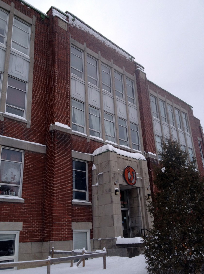
First stop was the Odawa Friendship Centreon Stirling AvenueUPDATE – The Odawa Friendship Centre has moved to 250 City Centre Ave, The Centre’s mission is ‘To enhance the quality of life for Aboriginal people in the Capital region. To maintain a tradition of community, an ethic of self-help and development as well as to provide traditional teachings from our elders.’.
Odawa Friendship Centre
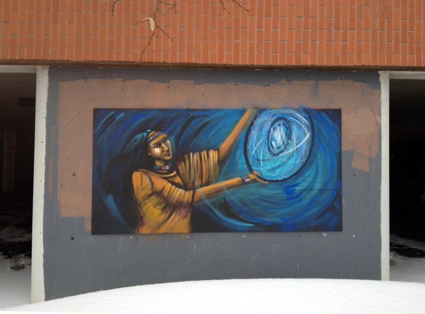
Around the side and back of the centre are the following murals.
Murals outside the Odawa Friendship Centre
Next stop, Victoria Island, or Asinabka. In the Algonquin language the word “Asinabka” means “place of glare rock”. It is considered a sacred site, where for thousands of years ceremonies and offerings have been made. Lots more on Asinabka here.
The cedar fence was constructed to house a summer interpretive program called Aboriginal Experiences. The tee-pee is where Chief Theresa Spence is holding her fast.
A bit further down river sits The Canadian Museum of Civilization, designed by architect Douglas Cardinal who is of Metis and Blackfoot heritage. His First Nations background is said to have greatly influenced his indigenous style of architecture, as described in this CBC radio interview.
Entrance to the Canadian Museum of Civilization
Back over on the Ottawa side, behind the National Gallery, atop Nepean Point stands this statue of Champlain looking out over the Ottawa River. There used to be a bronze sculpture of a kneeling Anishinabe scout at the base of the plinth on which Champlain stands, but it was removed in 1996 at the request of Ovide Mercredi, former National Chief of the Assembly of First Nations. I did not know that the sculpture of the scout had been relocated to Majors Hill Park a short distance away.
Champlain
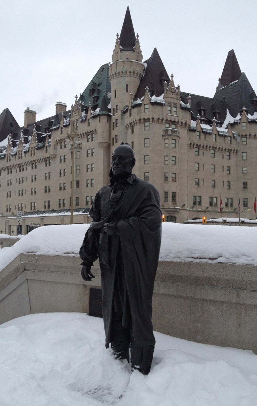
Near the National Cenotaph is the Valiants Memorial made up of a number of sculptures of key figures from the military history of the country, including that of Thayendanegea or Joseph Brant, a Mohawk who supported the British during the American Revolution. He relocated to the area near the present day City of Brantford in southern Ontario after the revolution.
Thayendanegea
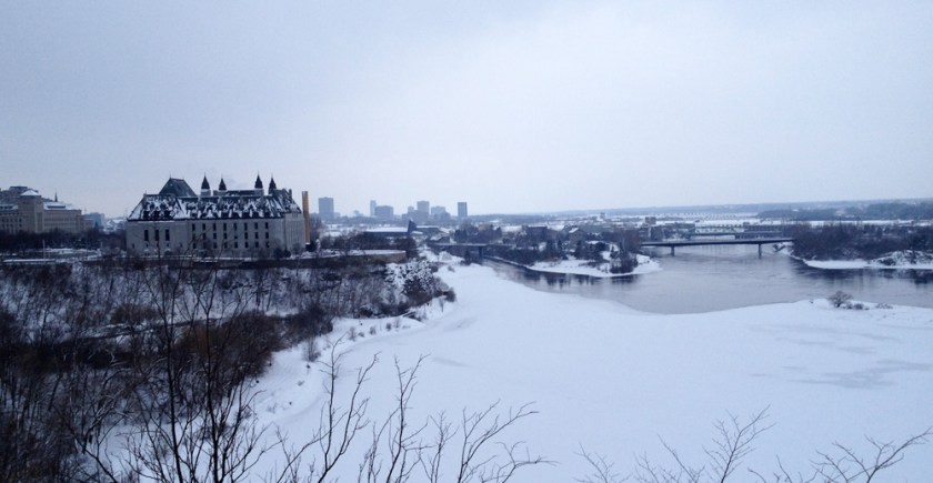
I then rode up behind Parliament Hill to photo the Ottawa River, the highway used by First Nations for millennia before more modern forms of transport took over, first by rail, and now by road and air. There is Victoria Island in the middle, with the Supreme Court on the cliff to the left.
Ottawa River
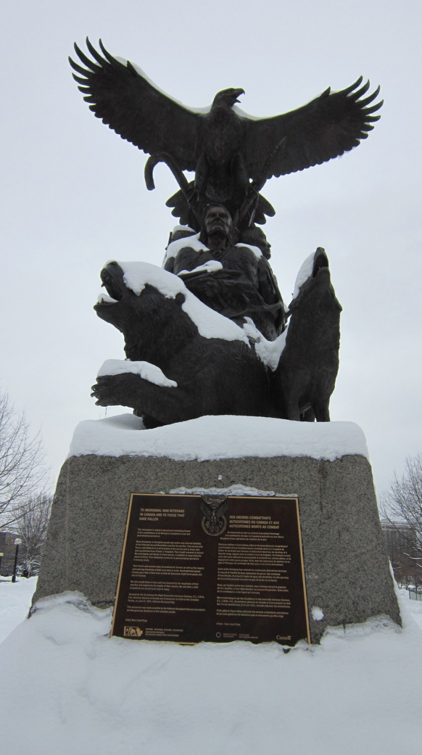
My final stop was in Confederation Park where stands this monument ‘To Aboriginal War Veterans in Canada and to Those That Have Fallen’.
Yesterday was a wonderful day for a trip to the Museum of Nature.
After dropping off some books at the downtown library I biked along O’Connor to meet Carla and the kids at the museum. Now O’Connor is a street I would normally avoid as many drivers tend to zip down this one way street or impatiently jostle each other in their rush to get to the Queensway, but there isn’t much Ottawa traffic on Sunday mornings so I wasn’t too worried.
This view down O’Connor makes it appear as if bland mid-rise buildings dominate the street. This Urbsite post describes the boom in Centretown apartment building in the sixties that contributed to this image.
O’Connor Street
But tucked in in amongst these mid-risers are a number of jewels, such the City of Ottawa Public School Board’s old administrative building at the corner of Gilmour Street. Urbsite once again comes through with this post which not only describes the building, but the two big blue spruce flanking the entrance as well, and how this same entrance was incorporated into a logo used on Ottawa elementary school report cards in the’50’s.
Ottawa School Board building
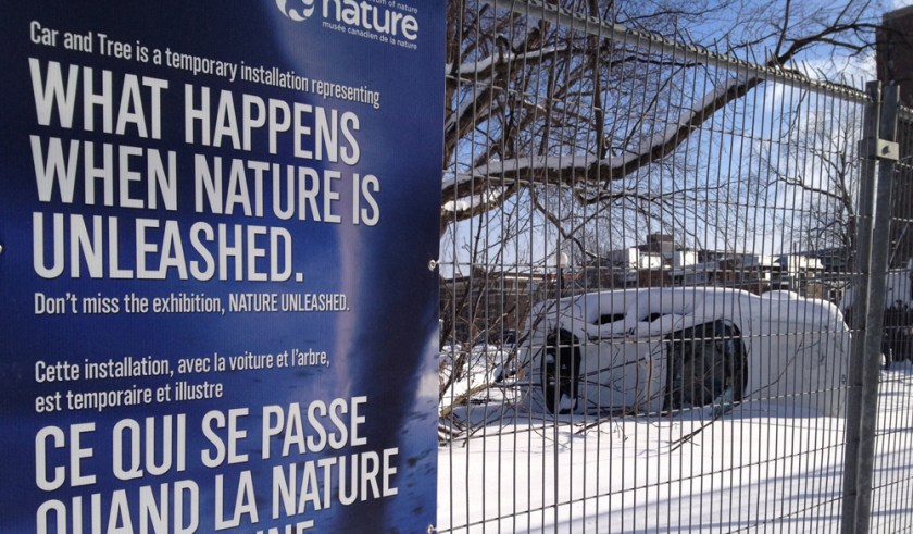
As I closed in on my destination, Pleased with my safe journey along O’Connor, I was shocked to see this smashed up car at the corner of McLeod and O’Connor!
Fooled me. Very clever.
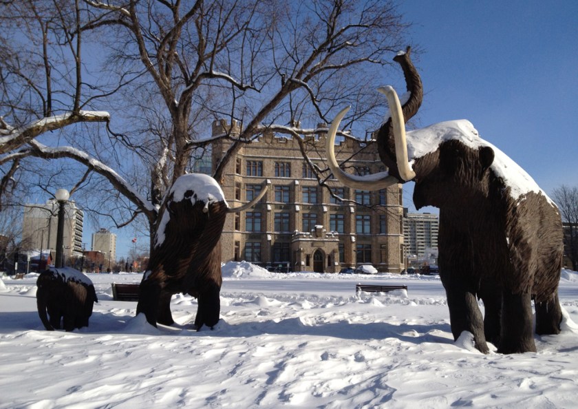
Right beside the faux crash site stand our faithful family of wooly mammoths that have been foraging on the grounds of the museum for as long as I can remember.
Wooly mammoths
On the opposite side of the street sits this great sculpture called Paso Doble by Bruce Garner.
Paso Doble
On the east side of the museum there are BIKE RACKS!
Yeah bike racks!
They’ve done a great job with the renovations to the museum. Here’s a view looking up from the old space into the new, of the gang looking down from the new into the old.
Old & New
Rode home safely along Metcalfe and Somerset. A fine outing.
OK, I’m going to go a little off script on this post. With all the great snow we’ve been having I decided to go cross country skiing in the Arboretum yesterday, and what better way to get there than by bike? Here’s how.
The biggest challenge of course is how to transport skis and poles while riding. I stuffed mine into a ski bag and strapped them to the side of my big backpack like so. It worked well, but I’m going to try to attach them a little lower next time.
All bundled up, and away we go!
I biked down Booth Street which is normally quite busy especially during the week as it proceeds north to Gatineau over the Chaudière Bridge, but it isn’t so bad early Saturday morning. There are a great mix of buildings along Booth. This facade just south of Somerset, with all of it’s various doors and openings, some bricked up, others introduced as required over time, suggests many narratives that must have played out within it’s walls.
Facade along Booth near Somerset
This small brick house a bit further south has survived the test of time nicely.
I’ll be your brick …. house!
This interesting building is a recent addition to the street.
New kid on the block
St Anthony’s maintains a commanding presence at the corner of Gladstone because of its size and orientation to Gladstone facing down the hill towards Little Italy on Preston Street.
This one on the opposite side of Booth was built in the mid ’50’s and also has FHBRO heritage designation.
Chemical Radioactive Ores Building
I biked to the parking at the top of Prince of Wales Drive, as the bike lane on the shoulder was partially cleared and the traffic was light. You can also bike up the path hi-lited in purple beside Prince of Wales which is plowed, as I discovered on the way home. I found the snow covered bike rack and locked up my trusty steed. Time to ski!
Bike rack
The Arboretum is a very popular spot for dog walking, resulting in many well worn paths such as these that can accommodate any width of skis and bindings.
Winter path through the Arboretum
I also skid through Fletcher Wildlife Garden which I first discovered back in October and wrote about in this post. I even took this photo from the same spot – sheer coincidence, believe it or not.
Fletcher Wildlife GardenSame spot in October
Along with the network of dog walker paths throughout the Arboretum, there are usually a number of trails broken by other skiers or snowshoers, pretty much guaranteeing a fine ski outing.
The true heroes on birth days are mothers, a status all the more enhanced when the magical moment occurs in less than ideal conditions, like in a manger surrounded by livestock. So in recognition of this I toured a few depictions of Mother Mary throughout the city. Here’s the route I followed, purple line going one way, blue line coming back.
First stop was just inside the gates of St Vincent Hospital overlooking Lebretton Flats towards the Gatineau Hills. That’s where this statue of Mary stands in a small grotto.
Mary at St Vincent Hospital
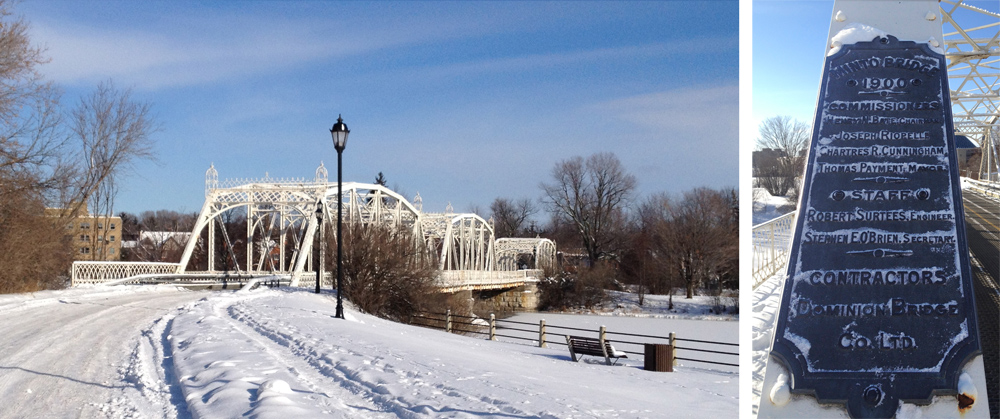
in my last post I lamented not being able to cross over the pretty white bridge leading to New Edinburgh. I took a closer look at the map and discovered there was another way to gain access by following a path off Sussex Drive as shown on the above map. The plaque mounted on one of the steel supports tells us it’s the Minto Bridge, installed in 1900.
White Minto Bridge
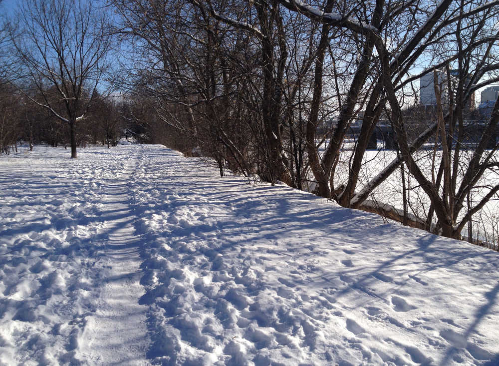
I was also able to ride along the well travelled and packed down Rideau River Trail as far as Beechwood Avenue. A little bumpy but well worth it.
Rideau River Trail in winter
The second depiction of Mary on our tour is this statue at the end of Avenue des Pères Blancs. The Pères Blancs is a Catholic Society of Missionairies of Africa whose scholasticate occupied the site of Parc Richelieu. They were expropriated by the city of Vanier when the province ordered the city to acquire more park land. This statue of the Virgin Mary left by the missionaries greets visitors as they enter the park.
Mary sporting a crown
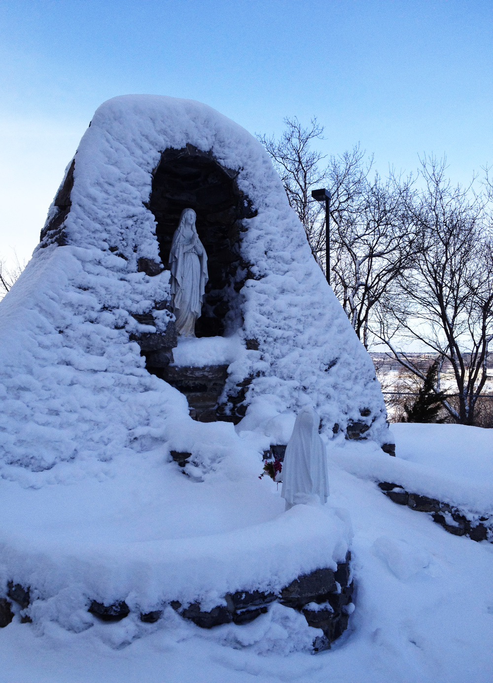
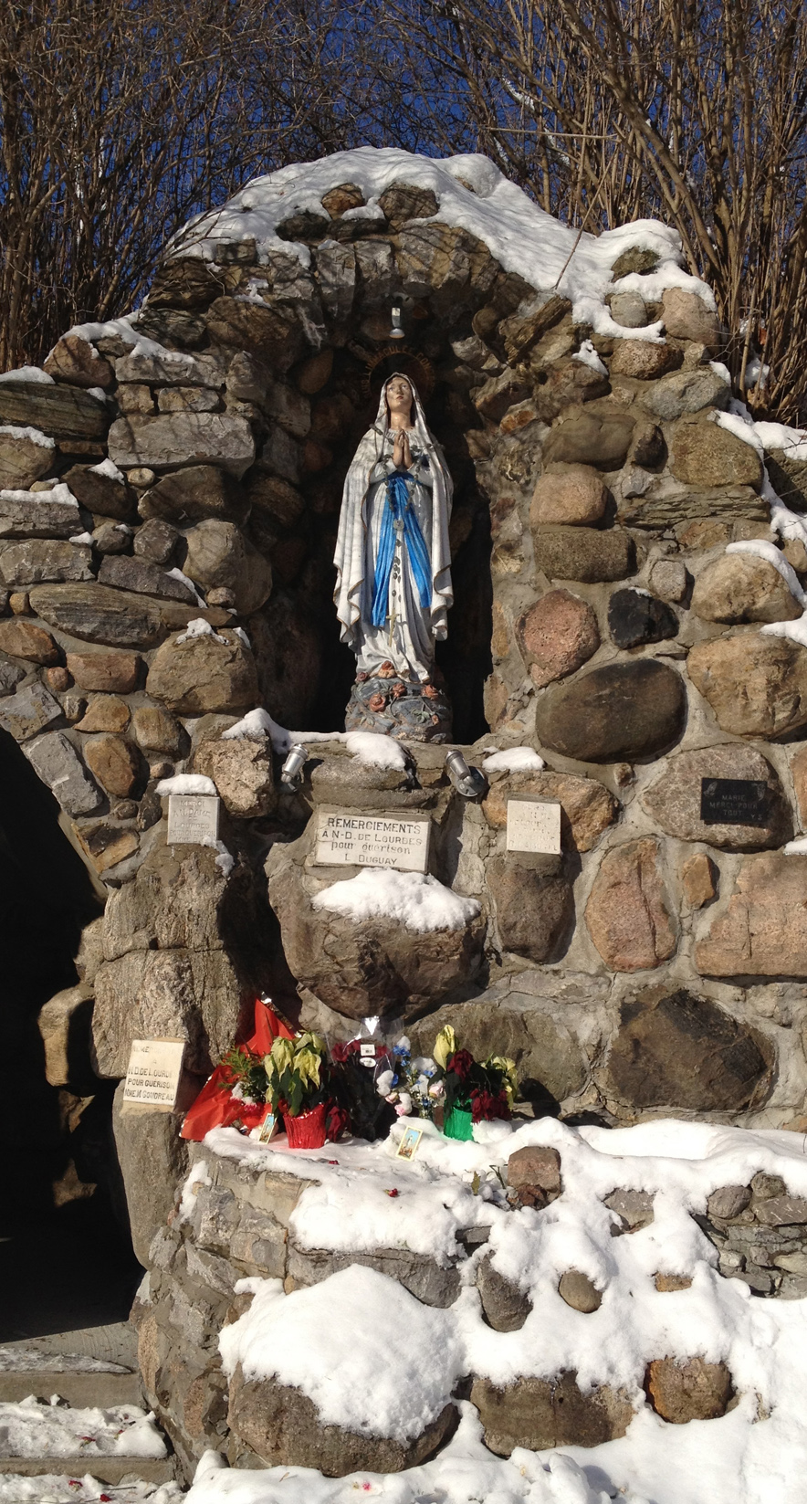
Next stop – Notre Dame de Lourdes Grotto.
Statue of Mary at the Notre Dame de Lourdes grotto
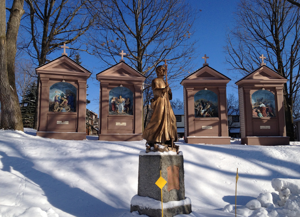
The surrounding context is quite a sight to behold. All around there are miniature shrines depicting the stations of the cross such as these.
A few stations of the cross
Near the entrance to the site is this assemblage of miniature plaques giving thanks for various divine interventions. It is interesting to note the evolution of mini-plaque designs over the years.
Plaques
UPDATE – Christmas 2019 – The original tour included a final stop back in Chinatown, where this painted icon of Mary and child was mounted outside the Annunciation Orthodox Cathedral. Hélas, it is no longer there.
Icon of Mother Mary and Child originally outside the Annunciation Orthodox Cathedral at the time of the original post (December 2012), since removed.
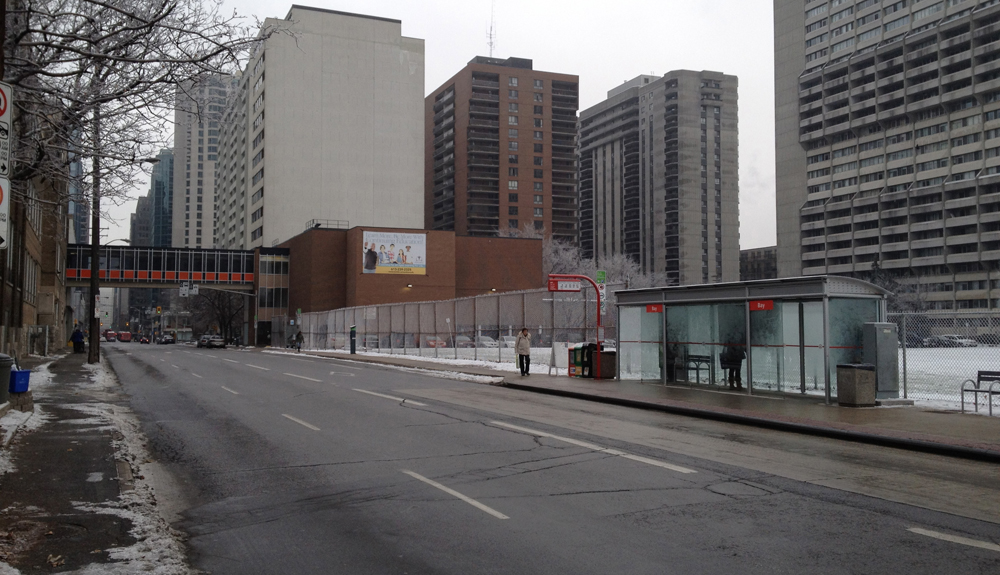
My goal is to pedal down every Ottawa/Outaouais street at least once. For some streets, once is enough. Like Slater Street and Queen Street, which I rode along yesterday morning. They are not very bike friendly, regardless of the green bike ROUTE signs fastened to the occasional telephone pole. But they ought to be safe to bike down for folks who work there, live there or need to ride down them for whatever reason.
My destination was the old post office at Sparks and Elgin to mail off Christmas gifts. Blue line’s how I got there. Red line’s how I got back.
At the corner of Bronson and Slater there is a very wide graffiti wall. Here’s how it appeared through the frost covered chain link fence.
Graffiti wall along Slater
Slater is three lanes heading east one way. The south side is pretty much a transit way, forcing bicyclists to hug the shoulder-less curb on the opposite side. Drivers instinctively consider this outside lane to be the passing/speeding lane. Pretty nasty.
Slater St
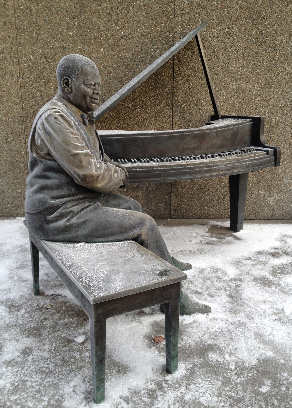
I was pleased to turn up Elgin Street and see Oscar sitting outside the NAC covered in a frosty layer. This wonderful commemorative statue by Ruth Abernethy is extremely welcoming. I often see folks sitting on the piano bench beside Oscar, listening to his music coming from speakers placed up above.
Oscar Peterson
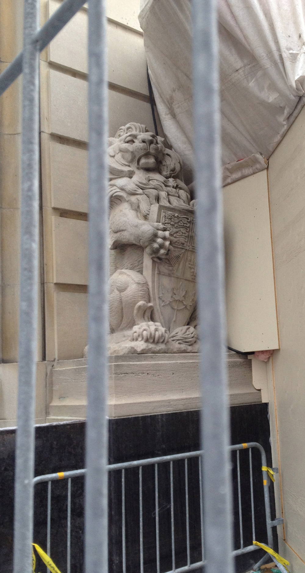
Construction scaffolding and plywood presently surrounds the main entrance of the post office at Sparks and Elgin, caging in this noble sentry.
Caged Lion
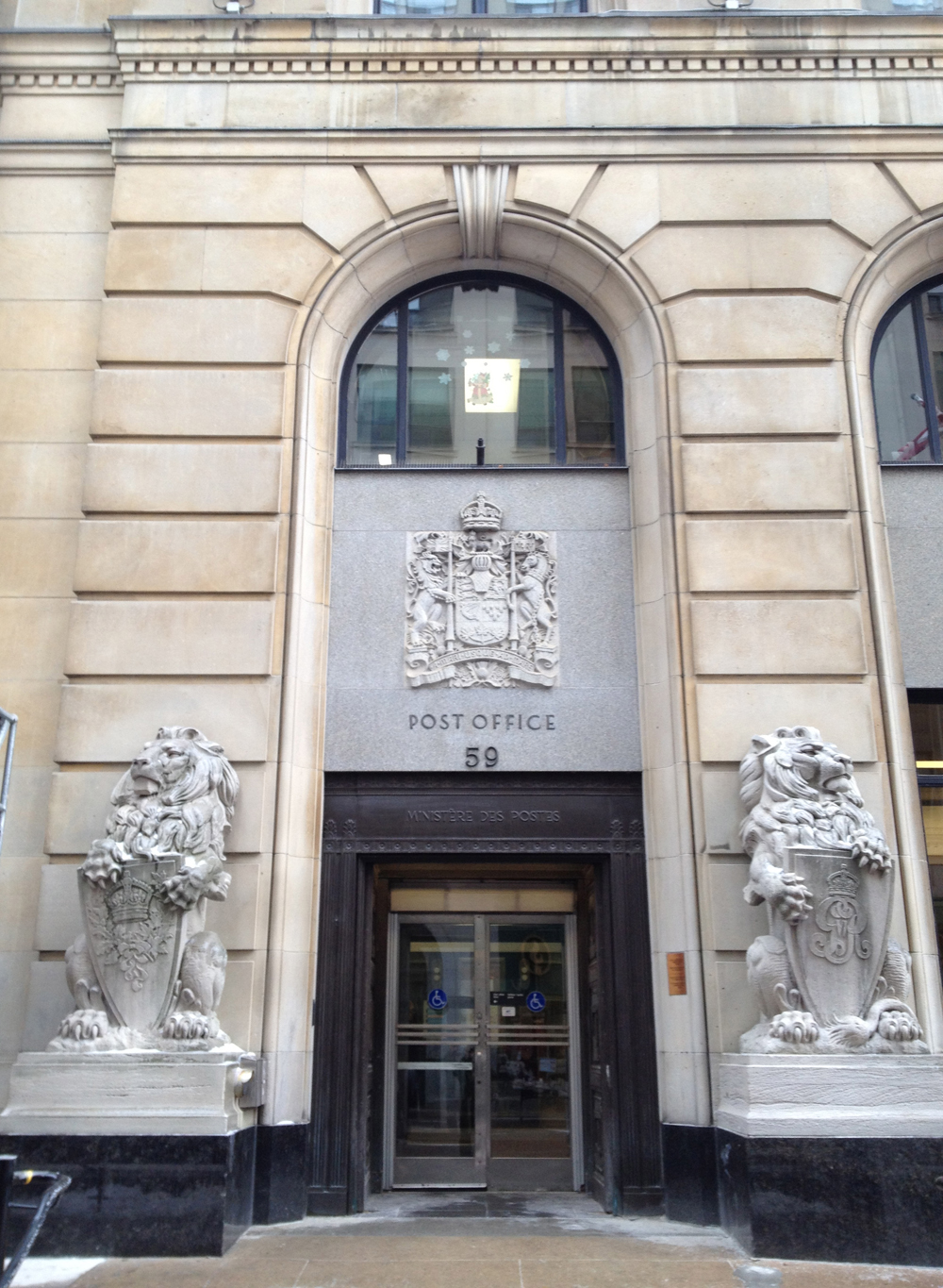
Fortunately these two proud beasts remain on duty at the side door on Sparks St.
Lions on duty
I travelled down Queen Street on the way home. It felt safer than Slater, perhaps because there was only one lane keeping the traffic calm.
Queen St
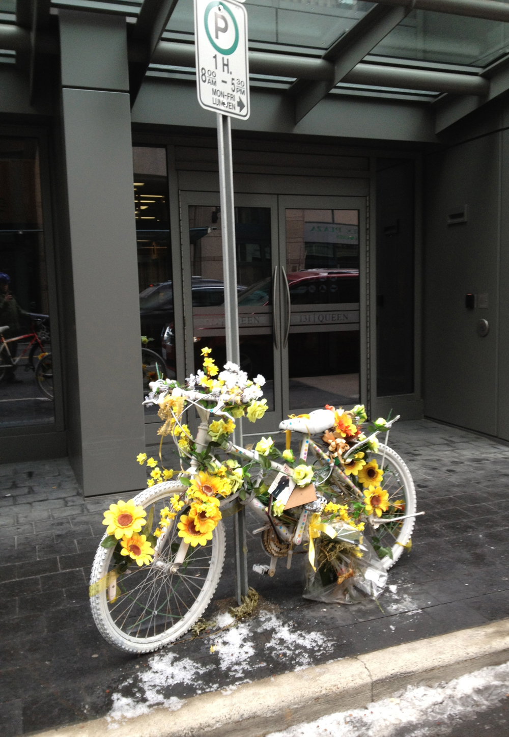
The narrow space between the parked cars and the traffic presents another very real danger of being doored, i.e. when a passenger of a parked car opens their door without checking to see if any bicyclists are coming, forcing a collision. This is what lead to the senseless death of Danielle Naçu in October 2011. Here is the ghost bike along Queen Street commemorating this tragic event.
Commemorative ghost bike
They knocked down part of Christ Church Cathedral awhile ago along with a few other old dwellings to build condo’s, but retained these facades to be incorporated into the new building. I am often fascinated by the juxtaposition of temporary structures used to retain or protect old structures as shown in this image.
Bracing
And finally, a shot of Jack Frost’s handiwork, looking out towards the park at the western end of Queen St.
I biked to Yarn Forward in the Glebe late in the afternoon to buy some sewing supplies. Here’s how I managed to get there and back, avoiding traffic as much as possible along the way.
I set out following the north-south bike path along Percy Street. Once on the other side of the Queensway I turned east on Glendale Avenue. This led me to the edge of Ottawa’s very own Central Park. The path through the park isn’t cleared, as you can see in the image below, but it’s extremely well travelled, so I’m guessing it will be navigate-able throughout the winter. Yes, that’s ice all over the path. My studded front tire was an absolute necessity through this section.
Path through Central Park
Most of the houses in the Glebe were constructed in the early part of the 1900’s. It was one of Ottawa’s first suburbs. The sturdy dwellings which have survived the test of time have adapted over many generations of residents and taken on their own personal character, like this house along Roseberry Avenue with its interesting porch detailing.
Glebe porch detail
Yarn Forward on Bank Street is a great mid-sized store for all kinds of sewing and knitting supplies.
Yarn Forward
I decided to take a more circuitous route home that took me along the Rideau Canal and the Laurier Avenue bike lane.
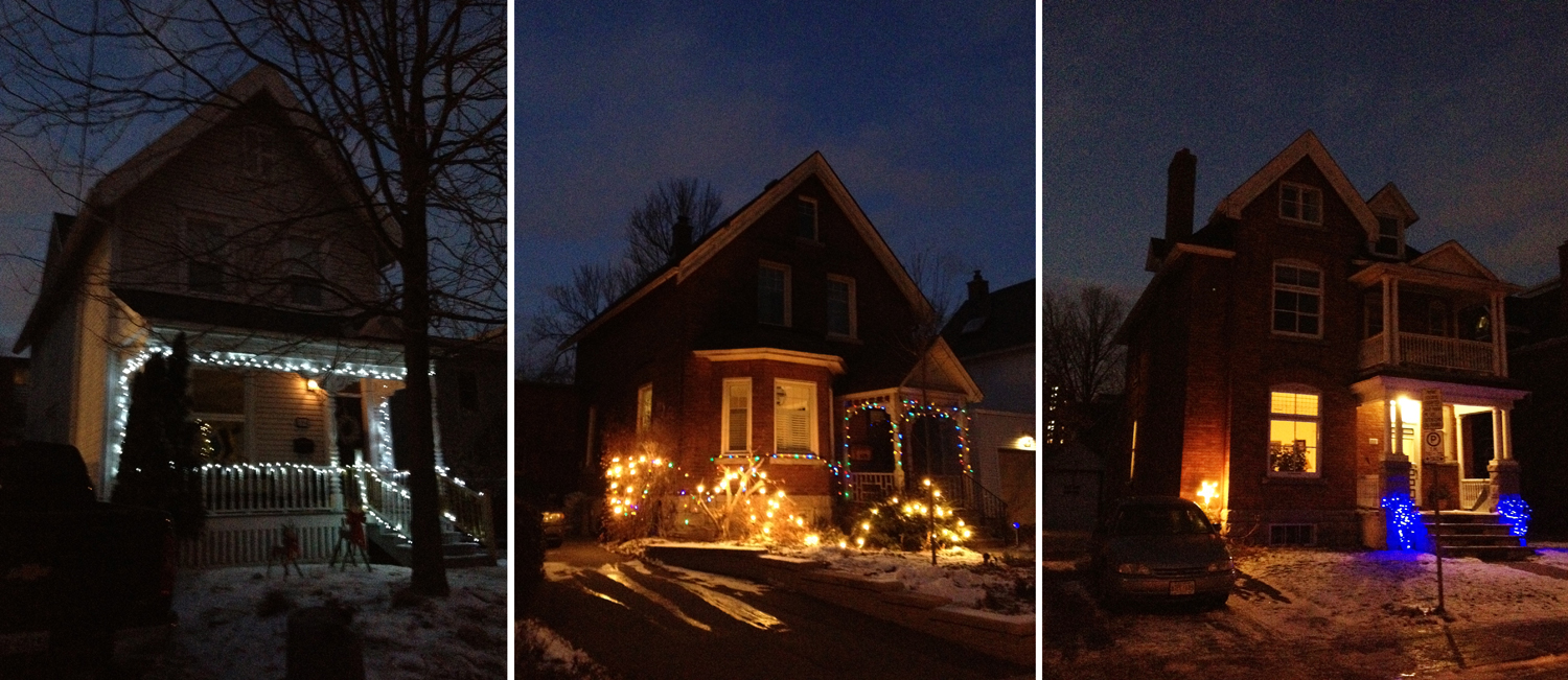
Here are a few other examples of early Glebe dwellings along Strathcona Avenue decked out in Christmas lights, all set for the festive season.
Some lit up houses in the Glebe
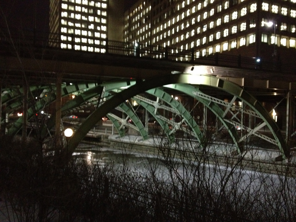
The path along the west side of the canal is cleared making it a great ride all year round, with the Pretoria Bridge and Laurier Bridge to be admired along the way.