30 Days of Biking – Day 26 : Riding to the Canadian Museum of Science and Technology

I needed to pick something up at the Museum of Science and Technology so I rode there, on Day 26 of 30 Days of Biking. Blue line on the map shows route I followed there. Red line is the one I took to get home.

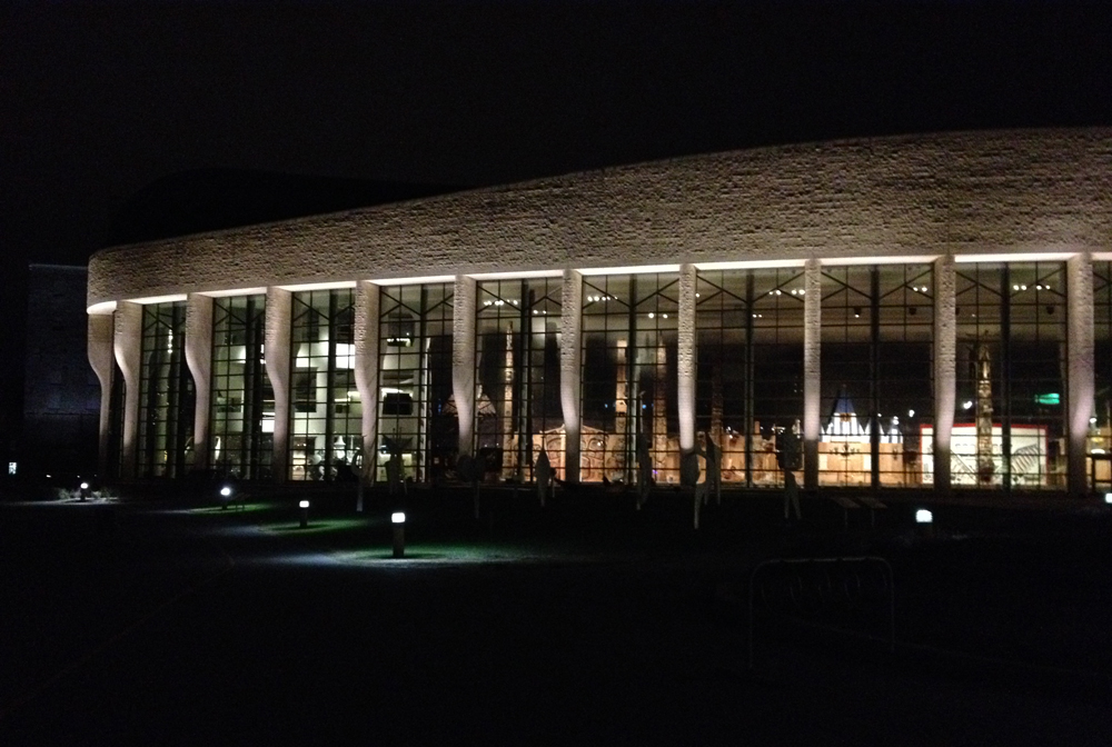
One thing I like about riding at this time of year is the opportunity to notice details within the landscape less visible once the trees have sprouted leaves. Such as this pavilion, attached to the back of the slowly disappearing Sir John Carling Building presently being torn down. I hope it avoids the wrecking ball. You can take this narrow path up to take a closer look.

Up the path........ to see the pavilion
Up the path…….. to see the pavilion

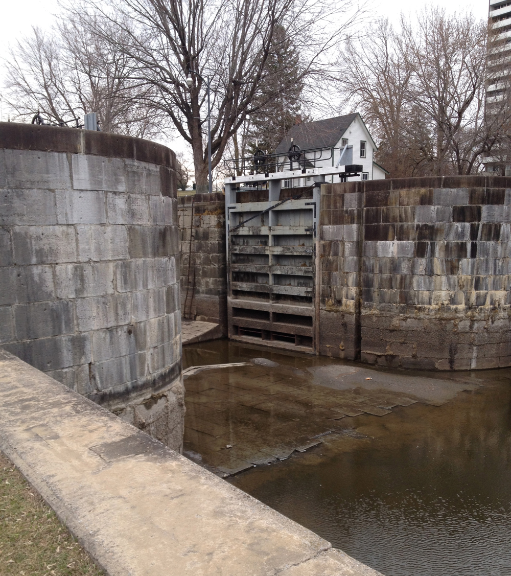
I then biked through the Arboretum, crossed the locks across from Carleton U, and rode up the bike path towards Mooneys Bay.

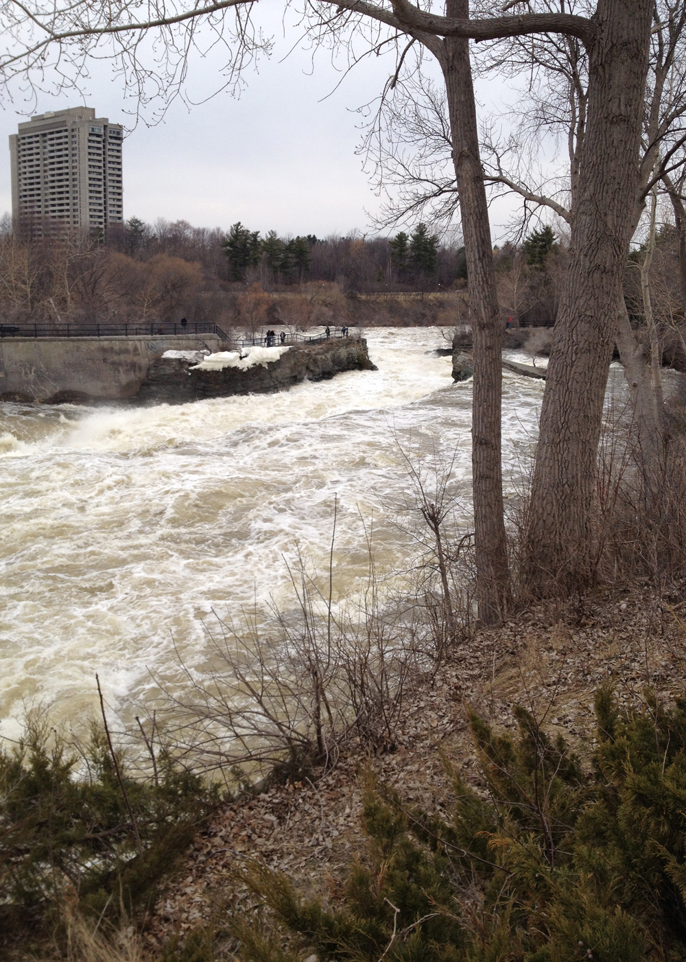
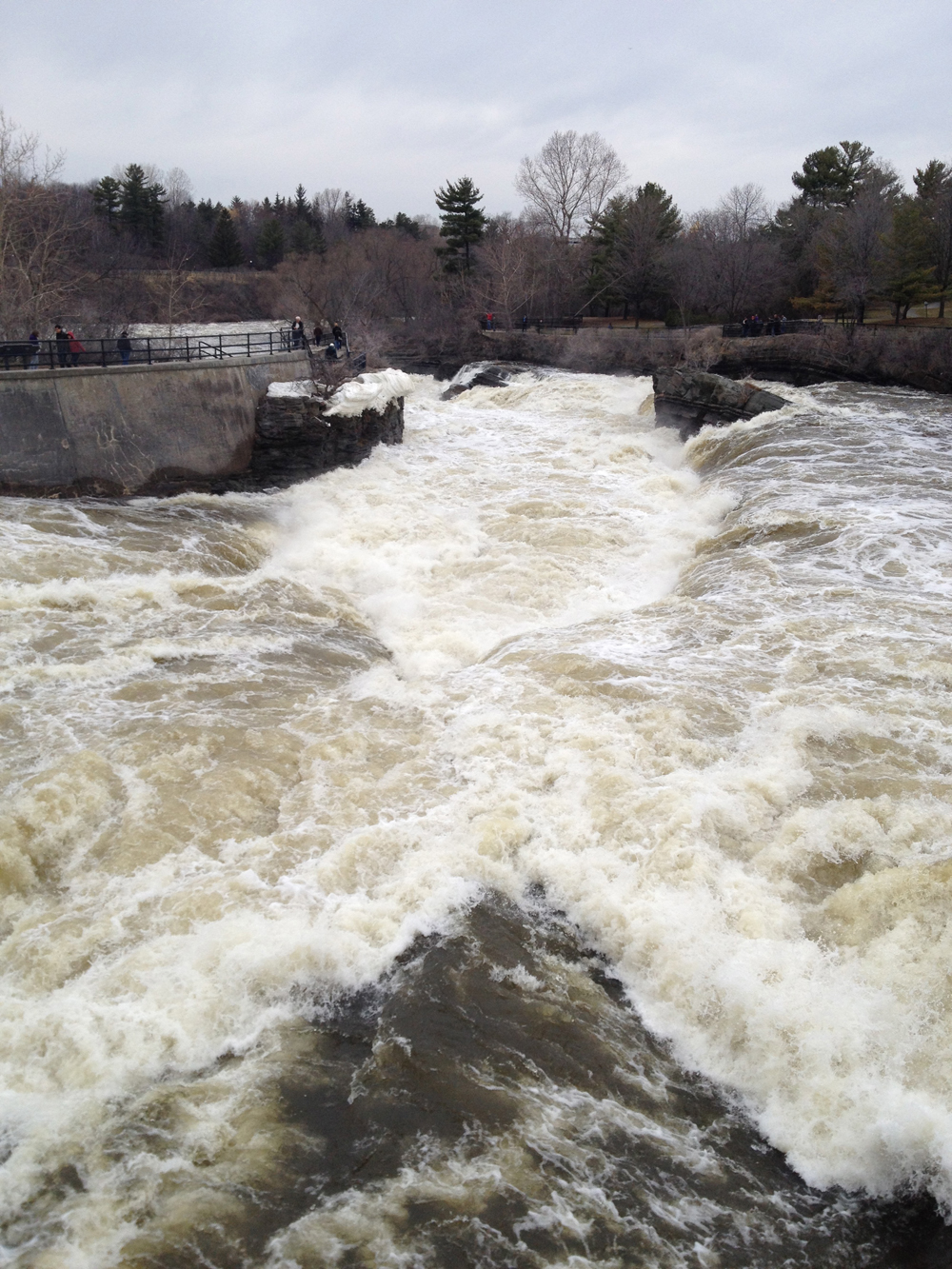
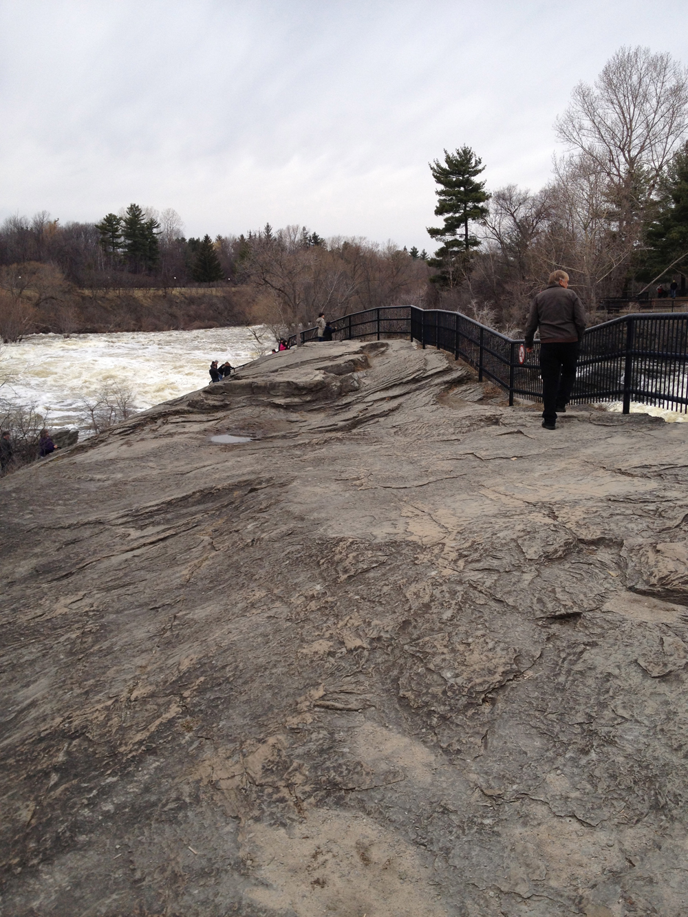
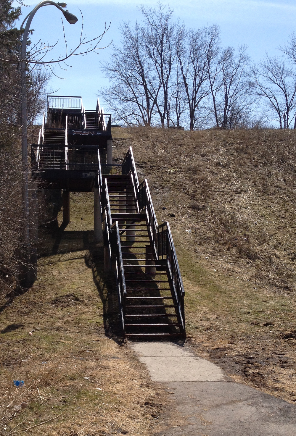
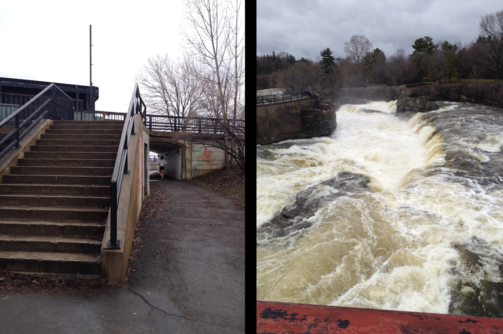
The path gets a little convoluted at Mooneys Bay. You can ride over the falls along the path on the west side of the street, but you won’t see the falls, which are pretty spectacular at this time of year. or you can cross back under the road and ride over the falls the east side, as I did and indicated on the above map, where you will catch great views of the falls. It means carrying your bike up a few steps.

Stairs to climb..... to view the falls
Stairs to climb….. to view the falls

I rode down along the Rideau River Eastern Pathway (no more flooding) then turned up Pleasant Park Road, which around Pleasant Park Woods, isn’t so pleasant. This huge swath of trees has been cut down because of the Emerald Ash borer bug.

Sad Pleasant Park Woods

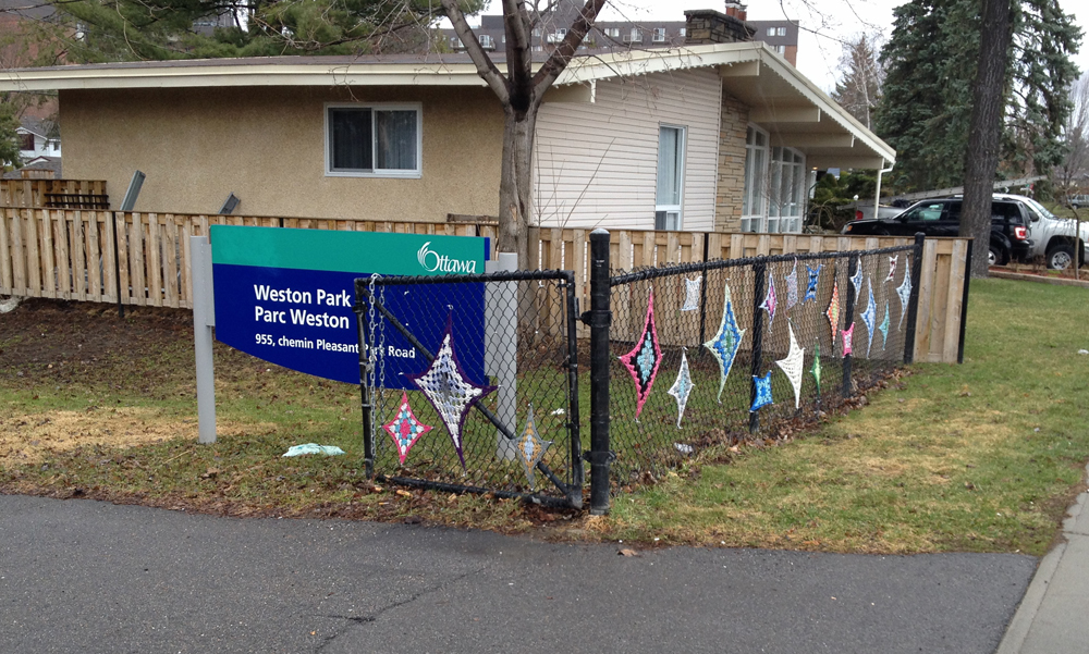
I took a short cut through Weston Park to Weston Drive. It’s the one with the colourful works of crochet stretched on the chain link fence.

South entrance to Weston Park

Weston Street is on the other side of Weston Park, which I followed to Othello St. I rode north along Othello then cut through the Elmvale Acres Shopping mall parking lot to the intersect at Smyth Road and St Laurent Boulevard.

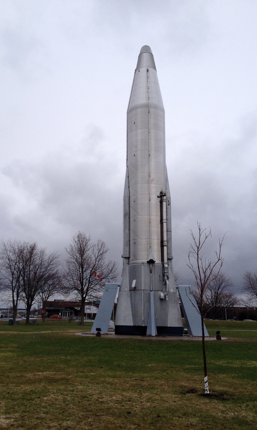
I then rode through the huge park in front of the museum, which brought me up close to a giant old locomotive and the big silver rocket.

Hello rocket!
Hello rocket!

Bike parking is located just to the north of the main entrance.

Museum is behind you.
Bike rack near museum entrance. Not that white dome

On my way home I turned off Pleasant Park road onto the bike path that goes past the allotment gardens and followed the same route described in this post.

Et voila – only 4 more days to go!

30 Days of Biking – Day 25 : Late night ride to Nepean Point and back

Day 25 was so crazy busy that I didn’t have a chance to hop on my bike, so to meet my 30 Days of Biking pledge I decided to go for a late night ride down to Nepean Point behind the National Gallery. It was great. I rode along the Ontario side of the river and back along the Quebec side. Here’s how.

To get down to the Ottawa River Pathway from Chinatown I took the stairs at the end of Empress Avenue. Good lighting and bike ramp.

Empress Ave stairs down Nanny Goat Hill

On a late night ride through La Capitale Nationale one is reminded of how well we light our national edifices. Take, for example, the always impressive Library and Archives Canada, as seen from the Ottawa River Pathway.

National Archives at night

And of course there’s always fabulously lit Chateau Laurier, as seen from the Rideau Canal locks.

Chateau at night
Chateau at night

Maman, the spider sculpture by Louise Bourgeous, sits infront of The National Gallery, across the street from the elegantly lit Notre Dame Cathedral.

Maman et Notre Dame
Maman et Notre Dame

Off the path up to Nepean Point sits this Majestic sculpture, composed of lamp posts blown over by Hurricane Catrina in New Orleans.

Majestic at night
Majestic at night

Looking across the river from Nepean point you can see and hear the sound of the car wheels humming over the Alexandra Bridge’s metal surface.

Aleaxandra Bridge from Nepean Point

It’s a fantastic place to watch summer storms roll in along the Ottawa River, or to watch the Equinox sunrise.

I crossed the river along the bike path and zig zagged down to the Voyageurs Pathway behind the Canadian Museum of History. It’s a great time of day to view the large impressive sculptures within the Grand Hall. Many of these works were meant to be viewed from a distance which is possible when looking through the windows from outside into the space at night.

CMH

View into the Grand Hall

I rode along the Voyageurs pathway, which was very serene, to the Portage Bridge where I crossed back into Ottawa as rider number 1044 for the day.

NCC counter

Et voila!

30 Days of Biking – Day 24 : Chinatown to Vanier to pick up Indian take-out.

Golden India Restaurant in Vanier was highly recommended to us by a friend from India, so this evening I rode over and picked us up a yummy feast!

We placed our order on line, which was very convenient. The restaurant called back to confirm the timing just as I headed out the door. I gave myself 30 minutes to get there, which turned out to be accurate as I’m not a particularly fast cyclist. I mapped out a route that mostly took me along cycle lanes or quiet residential streets. There were, however, a few short linking sections where the roads are not very safe for cycling. I have hi-lited those in red on the attached map.

Laurier is fantastic along the Laurier Bike Lane and over the canal bridge which has bike lanes, but dangerous between Elgin and the bridge, and east of the bridge, particularly right around Ottawa U. That’s why I got off Laurier as soon as I could by cutting across campus to access quieter streets through sandy Hill.

Cutting through campus

Here are some nice row houses I passed along Daly Ave.

Old row houses in Sandy Hill

The next danger zone along this route was over the Cummings Bridge into Vanier. There is a bike lane heading west, but none heading east. They have painted sharrows in green boxes along the east lanes but no matter how you dress them up, sharrows are the most useless form of bike accommodation imaginable. Worse than useless, they are dangerous because they falsely suggest to riders that they are designated safe routes when drivers ignore them because they can.

Splat
Splat

Montreal Road is pretty nasty too – no shoulders, lots of potholes, and a main artery for cars commuting east – so I rode along it as far as the Vanier Parkway and cut through to Kendall Avenue. I then rode safely along quiet streets through Vanier until I was close enough to Golden India restaurant. McArthur is a busy street and dangerous to ride down so I avoid it.

Apartment buildings along Jeanne Mance

The food was all packed up waiting for me and the service was fantastic. They even included some complimentary rice pudding. I filled my panniers and headed home. Made it safe and sound. It was still warm and very yummy.

Bon appetit!

Yum

30 Days of Biking – Day 23 : Riding to Théâtre de l’Île and the Royal Oak on Slater

Rode to a couple of locations on day 23 of 30 Days of Biking. First foray had me pedalling to Le Théâtre de l’Île (blue line on the map below). Second one was to the Royal Oak in the Minto building for the annual Spring meeting of the Centretown Garden gardeners (red line).

Théatre de l’Ile is a wonderful performance space in Gatineau. More about the theatre in this post.

Théâtre de l'Île (prettier pics in the above link)
Théâtre de l’Île (better pics in the above link)

The Centretown Community Garden is located at the corner of Lisgar and Lyon. This year’s annual Spring meeting for gardeners was held just a few blocks away at the Royal Oak on Kent St. I never knew this pub existed, most likely because I never bike down Kent. It’s a three lane one way street with no bike infrastructure and very speedy traffic heading north.

Kent St
Kent St

The entrance to the pub is half a block north of Laurier so I walked my bike back to the Laurier Bike Lane to get home.

30 Days of Biking – Day 22 : Rainy Day Ride to Les Ateliers du Théâtre de l’Ile

Today I had to bring a bunch of big painting drop cloths to Les Ateliers du Théâtre de l’Ile in Gatineau, so I stuffed them in my panniers and biked there. Now I may have driven there on this rainy day if I hadn’t taken the 30 Days of Biking pledge – a personal promise to pedal every day throughout April.

.
Good thing I did, because I would have missed an opportunity to pause and contemplate the brooding Edgar-Allen-Poe-ish beauty that hung over the region on this rainy spring day. Take, for example, the mist rising over the majestic Ottawa River, as seen from the Portage Bridge.

Mist rising over the mighty Ottawa River

Or the big old abandoned carbide mill on Victoria Island.

Carbide mill on Victoria Island

Vieux Hull has some fine examples of heritage architecture to admire while passing through.

Gatineau1

Old buildings in Vieux-Hull

Don’t know too much about these buildings, but on May 2nd I hope to learn more on a free tour À la découverte du patrimoine du Vieux-Hull, one of this years Jane’s Walks.

Et voila!

30Days of Biking – Day 21 : From Chinatown to Fairmont Park

Fairmont Park is a great place for kids to play and run around, as did my son this afternoon with a group of friends from his days at Devonshire School. Here’s a safe route we followed to get there and back on day 21 of 30 Days of Biking.

We carried our bikes down the stairs that join upper and lower Primrose Avenue and wove our way along residential streets to City Centre where you can access the O-Train Pathway. We zipped up the path that brings you to Somerset, and turned onto Breezehill Avenue which took us past old Devonshire School. The Tudor entranceway was of the Collegiate Gothic style typical of ottawa schools in the early 1900’s, as mentioned on the bronze plaque to the right of the entranceway.

Devonshire Public School
Devonshire School

We then turned right on Laurel St, then left on Irving. A short distance south on Irving there’s a short alley that allows you to cut across to Fairmont Avenue.

Alleyway from Irving to Fairmount Ave
Alleyway from Irving to Fairmont Ave

Then it’s left on Fairmont which goes under the Queensway, one of the few Queensway underpasses that feels safe for biking.

Queensway underpass along Fairmount Ave
Queensway underpass along Fairmont Ave

A couple of blocks beyond the Queensway is Fairmont Park.

Fairmont Park
Fairmont Park

Et voila!

30 Days of Biking – Day 20 : Visiting an Industrial Park on Easter Sunday

Ever since I set out on my goal to ride down every street in Ottawa/Gatineau four years ago I’ve shied away from big industrial parks as they aren’t usually the safest places for cyclists. Or pedestrians. Or anyone else not encased in moving metal. This shouldn’t be the case as everyone needs to feel safe getting to work, but reality and desirability often don’t match up when it comes to bike infrastructure. Yet. That’s why, when I do venture in to these pedal badlands I often choose a quiet Sunday, and what quieter Sunday could there be than Easter? So on the 2/3 mark of 30 Days of Biking, between egg hunting and feast hosting, I rode over to an industrial park in the east end behind the Museum of Science and Technology. Blue line is how I got there. Red line shows how I got back to Chinatown.

To get to the east end of town I often pass under the Queensway along the path on the western shore of the Rideau River, and cross the river on the old train bridge, however having been warned via Twittersphere that it was closed for construction, and encouraged by a myriad of detour signs, I took the the Lees Ave bridge sidewalk over the Queensway. Another sign said to walk your bike because the sidewalk is pretty narrow. I recommend avoiding this route until the construction is completed.

Construction of Rideau River path under Queensway

I rode past the train station, then followed the bike path along Tremblay Road and crossed St Laurent Boulevard. That’s where the Industrial Park begins. While there is very little truck traffic in these areas on Sunday mornings, there are things to watch out for, like loose sand and debris along the edges of the roads, and GIANT POTHOLES! These are particularly treacherous on rainy days when they are filled with muddy water and less noticeable. This one’s about 3 inches deep.

Nid-de-poule
Mega pothole

I crossed Innes at Bantree where a ghost bike rests against a light post on the north west corner in memory of Tyler Brown, killed in an collision with a pickup truck. As I approached there was a woman quietly contemplating the roadside memorial so I rode on without disturbing her.

What I find most interesting within industrial parks are the designs of many of the buildings and surrounding landscapes occupied by various companies. Their need to be noticed often results in some audacious architecture shaped by the amount of visibility they desire, or by the large and unique scale of the service they provide. One particularly interesting building is the headquarters of RJW Stonemasons on Edinburgh Place. Their huge front facade is an exhibit of their fine craftsmanship in stone masonry, made all the more obvious in stark contrast to the blue metal siding of the rest of the building.

RJW

RJW
RJW

Here are a few other buildings and sites that caught my eye.

Speedy
trucks

Interestingly Industrial

On the way back I rode along Old Innes Road, which leads to a desire-line path that takes you down to the bike path that running along Innes Road.

Desire line from Old Innes to new Innes

Industrial Avenue on the other side of St Laurent turned out to be pretty dangerous even on Easter Sunday with 4 lanes of speeding cars and small shoulders, so I turned on to Russel Road, then Coronation street to where it becomes Blair St. From there I wove my way back downtown along the route shown on the above map and described in more detail in this post.

A fine ride indeed.

30 Days of Biking – Day 19 : Riding towards the Byward Market

This afternoon my son and I biked downtown to do some gift shopping. Unfortunately there isn’t a safe route into the heart of the Byward Market so we parked our bikes on the outskirts of the market and walked the rest of the way. Here’s how we did so on day 19 of 30 Days of Biking.

We rode towards downtown along the Ottawa River Pathway and crossed over the locks where the Rideau Canal feeds into the Ottawa River.

Ice gathered in the canal lock.

We then climbed the steep pitch on the east side of the canal. It’s a popular descent with skateboarders and cyclists.

View from the top of the hill behind Majors Hill Park

Usually I lock my bike in front of the National Gallery but today we rode through Major’s Hill Park and locked our bikes to the fence at the entrance to the park near the U.S. embassy, bringing us closer to some of our shopping destinations.

Bikes locked to fence at the entrance to Majors Hill Park

The market is down the steps across the street from the entrance to the park.

Steps down to the Byward Market

Purchases made, we rode home the way we came. Et voila!

30 Days of Biking – Day 18 : Ride to Hog’s Back Falls

Hog’s Back Falls is a pretty spectacular sight at this time of year as a result of the spring melt off. The falls were created at the time of the construction of the Rideau Canal, as explained in this very interesting post. On day 18 of 30 Days of Biking, my son and I biked over to check them out, and discovered some wonderful vantage points.

To get there we followed the O-Train path as far as Young St. That’s where the path surface changes from asphalt to packed dirt. (UPDATE Spring 2019: The path is now paved all the way to Prince of Wales Drive!). We rode through the arboretum and crossed the canal locks at Carleton University. (The purple line is an alternate route should the path through the Arboretum still be snowed in).

That got us on the canal pathway which we followed all the way to Mooneys Bay. The canal is still empty allowing for some great views of the locks, including this one at Mooneys Bay. The patine on the stonework is pretty fantastic. Nic says it looks like the walls of a medieval fortress!

Canal lock at Mooneys Bay

The path circles under and up onto Hogs Back Road over the falls. You can’t really see the falls from this path, but you sure can hear them. Once on the other side of the bridge the path circles under Hogs Back Road once again, which takes you into Hog’s Back Park, from where you can go right up to the edge of the falls.

View of falls from the south shore

There’s a path that goes right over the falls, allowing you to stare straight down into the torrential frothing.

One point perspective of Hog's Back Falls
One point perspective of Hog’s Back Falls

On the north shore you can follow the path down onto the exposed rock.

Exposed rock
Exposed rock

There are a few short sets of stairs so you may wish to lock your bike on the opposite shore. We brought ours, allowing us to follow another path on the north side of the falls under Hogs Back Road. This path joins the one that continues along the canal.

Path under Hogs Back Road on the north side of the river

I know this way-finding description around the falls is confusing, so zoom in on the above map to the area around the falls and it will make more sense.

I highly recommend riding over and checking out the fury of the falls before the snow melt excitement subsides.

30 Days of Biking – Day 17 : Ride to Courtwood Crescent

Courtwood Crescent is short street with small office buildings nestled in a tight triangular industrial zone south of the Queensway, west of Carlington Park, and east of Maitland. At the mention of industrial zone the backs of most cyclists justifiably bristle. That’s where trucks hang out, from pick-ups to transports, and where drivers of such vehicles often don’t expect to see two wheeled self-propelled pedallers. But they should, because everyone needs to feel safe biking to work. So here’s how I accessed and got out of the Zone on a job errand, on day 17 of 30 Days of Biking.

First, I had to get myself a new riding windbreaker. The 18 year old MEC-collectors-item I’ve been sporting was getting very tired, even with the new reflecto sewn on by Carla that helped me survive riding through the winter. So I stopped off at Bushtukah, who didn’t quite have what I was after, and MEC who did. Only realised when I got home that the jacket I LOVED (and bought) was a women’s large. It’s a windbreaker that needs to keep me dry and visible. Whatever works.

MEC Derecho Jacket
MEC Derecho Jacket

Purchase made, I rode south on Roosevelt, then across the lights at Cole and Carling. South of Carling is where things start getting industrial – i.e. lot of trucks, road sand accumulated over the winter street cleaners will probably never see, and supersized potholes. Even so there was enough shoulder space to feel safe with minimal street parking. The traffic felt less erratic and dangerous than the stretch along Richmond between Bushtukah and MEC.

Woodward Ave
Woodward Ave

What I find unique about this area of town, is that right beside the industrial muck and trucks sits a park, with an excellent hockey arena, two baseball diamonds, and a toboggan hill. Rather than re-trace my treads home, I cut along the paths on the edge of the baseball diamonds to the residential area on the other side. These were fine, although a little mushy as stone dust paths tend to be at this time of year.

Path behind baseball diamonds

Once beyond the baseball diamonds, accessing the Experimental Farm pathway required a bit of a stair climb up to Caldwell Ave.

Stairs up to Caldwell

I got on to the Experimental Farm Pathway from Caldwell. Sad to see a bunch of ash trees recently felled along Ash Lane in the middle of the farm, probably more victims of the Emerald Ash Borer beetle. Some creative tree cutter made the best of it by carving this champignon out of the trunk.

Ash trunk toad stool
Ash trunk toadstool

Et voila.