Cuteness abounds all over the city at this time of year. Here’s a tour that will take you some seasonal sweet spots.
I caught this little guy feasting on some remaining bulbs in the tulip gardens at Dow’s Lake.
mmm-yum-yum-yum….
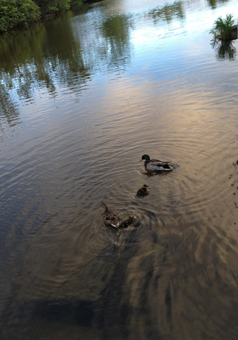
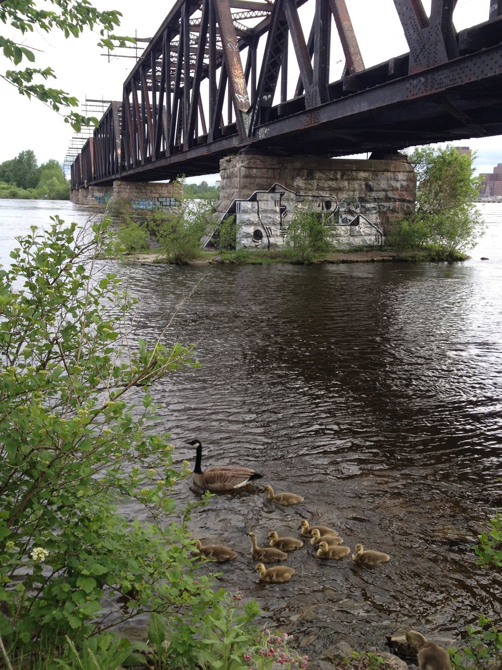
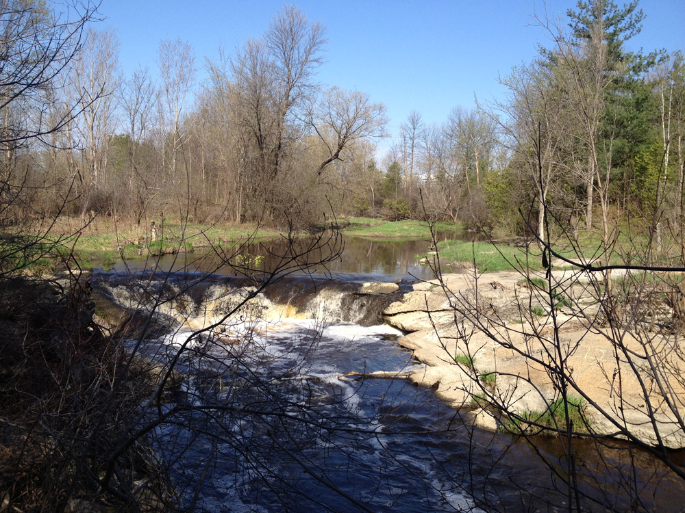
Along the canal between the Hartwell and Hogs Back Locks there’s a good chance you’ll catch a peek of this ducky family.
Family outing
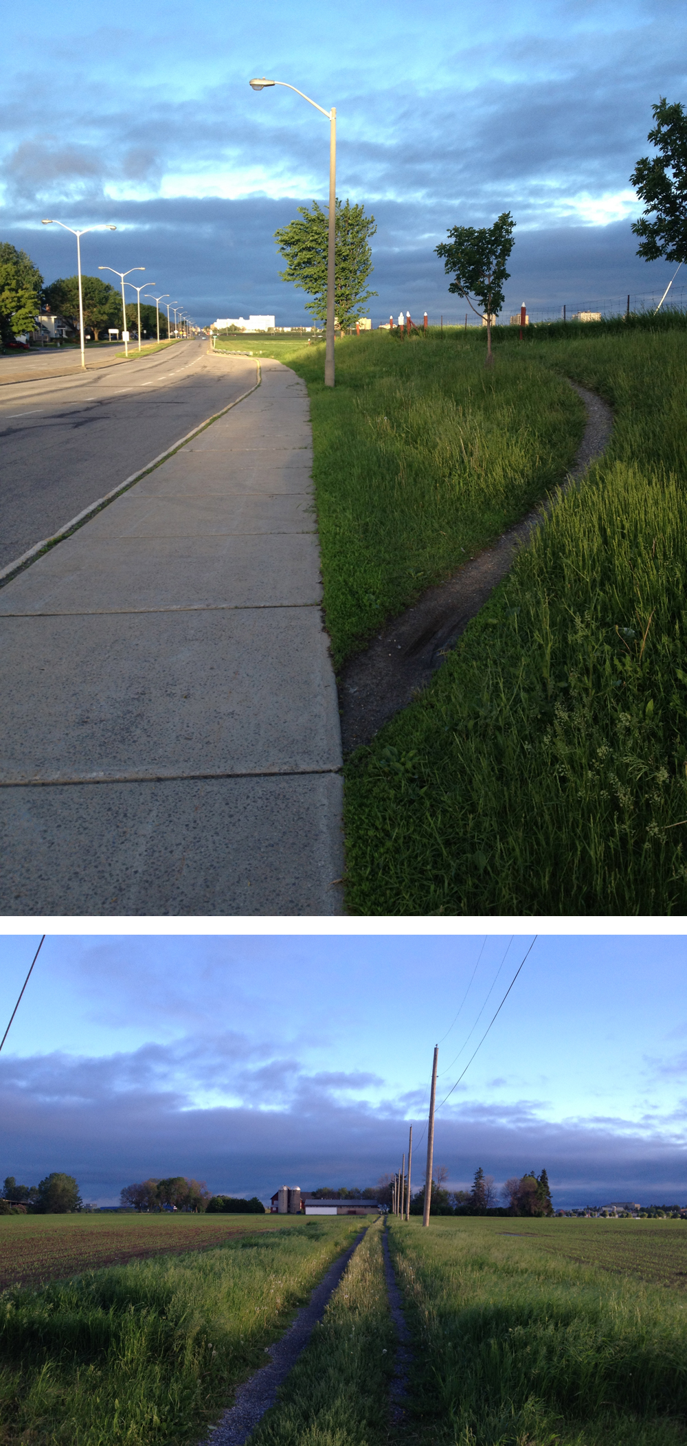
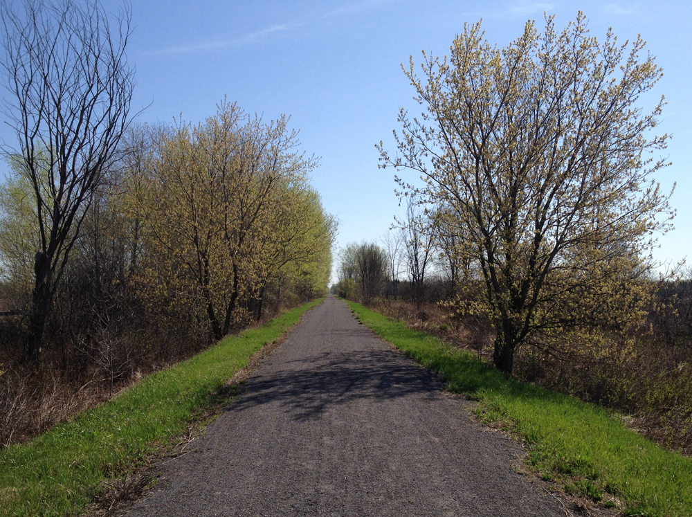
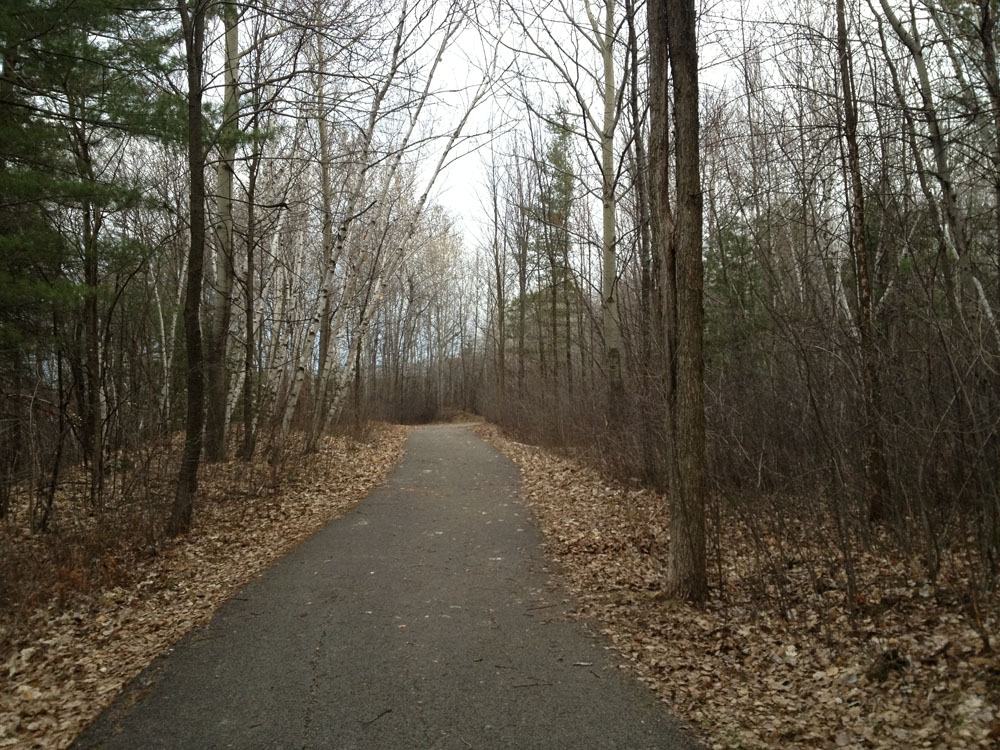
To get to the Experimental Farm I followed this well worn path off Baseline.
Path to Experimental Farm.
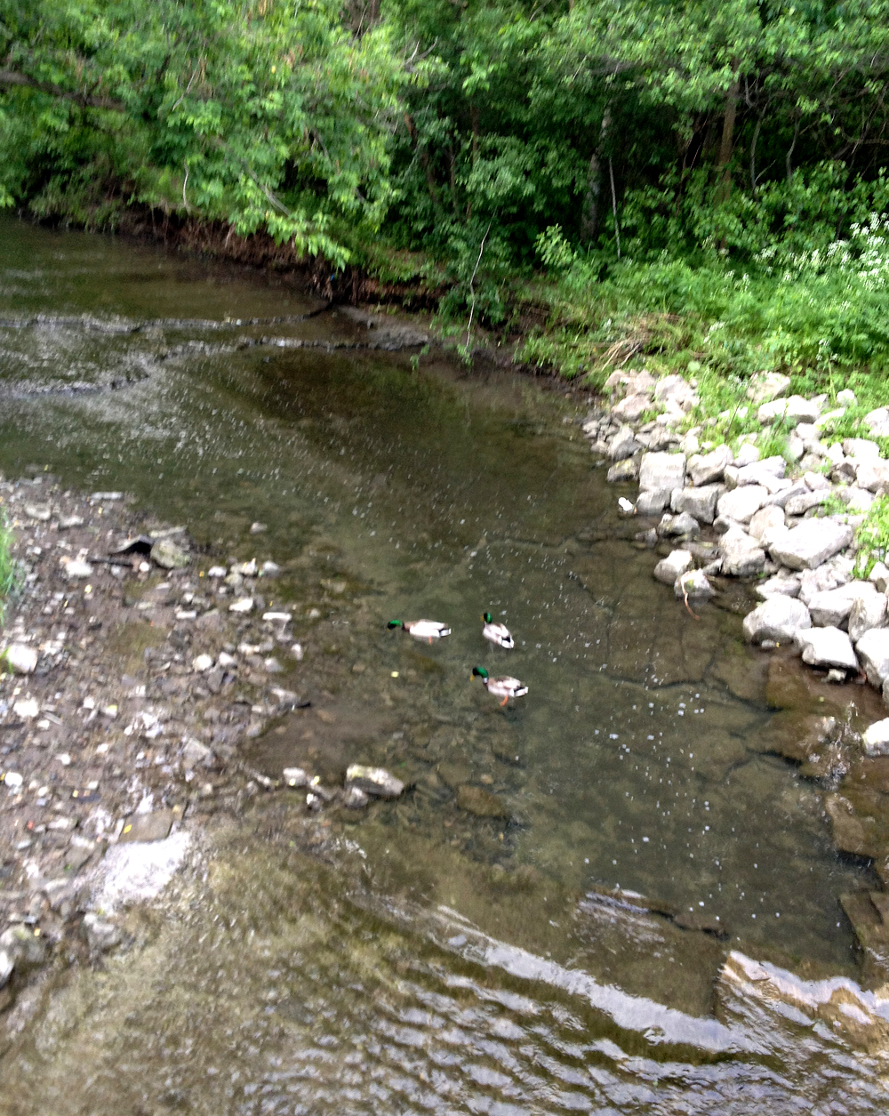
These feathered fellas were having breakfast in Pinecrest Creek.
Early bird gets the seaweed.
The Deschenes Rapids Lookout is an important migratory bird hangout, with interpretive panels telling you all about it. These Canada Geese were settling down for a nap.
Resting Geese
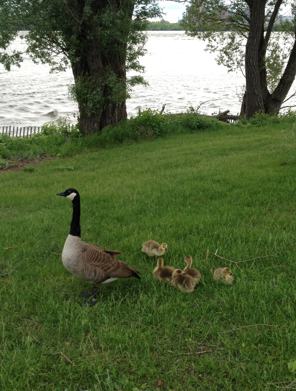
I’ve come across a number of folks in Ottawa who aren’t terribly fond of these guys, due to their appetite for expensive seeds, or their propensity to ‘fowl’ up the pathways along the river, but c’mon, you gotta admit, these goslings are CUTE!
Awwww…..
I leave you with this wee little Inukshuk spotted along the pathway at the entrance to Nepean Bay.
Here’s a good early morning loop to Aylmer and back.
.
Every time I see a biker heading over the Pont de la Chaudière I cringe in fear for their safety due to the speeding traffic and limited space. However at 5:30 am it isn’t so bad. It also affords the only view of the Chaudière Falls, an amazing natural formation hidden from all other vantage points by an assortment of crumbling industries. UPDATE- Summer 2015: The industrial buildings surrounding the falls have been sold to a developer. Plans include providing public access to the site with views onto the Chaudière Falls. See 30 second mark into this promo video.
Chaudière Falls
The Voyageurs Pathway mostly twists and turns along the rivers edge like so, all the way to Aylmer.
Voyageurs Pathway
There are a number of clearings along the way where you can pause and ponder the majestic Ottawa River, such as this spot looking out upon the foundations of long abandoned mills.
View out over the Ottawa River
This pathway bridge floats above a boggy stretch.
Pathway bridge
In the Spring there are a few spots along the path that risk being a bit waterlogged, but they usually can be negotiated along short impromptu desire lines.
The path veers away from the river on the outskirts of Aylmer and continues straight through towards the centre of town.
Heading into Aylmer
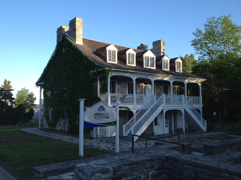
Once in Aylmer I cut north along Front Street to check out these two heritage buildings, the Symmes House and the Parker House, both described on this web site.
Symmes HouseParker House
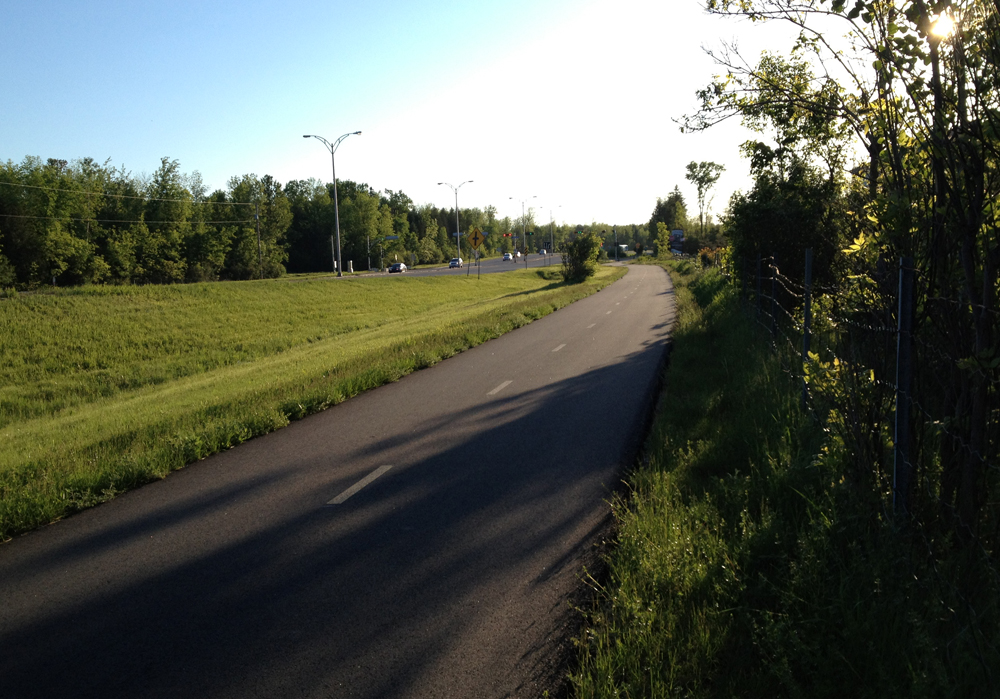
I continued north along Front street to join the Pionneers Pathway. Beyond the two buildings previously mentioned, Front Street is pretty boring, filled with lots of traffic, so after you’ve checked out the two heritage buildings I recommend getting back on the Voyageurs Pathway and continuing around through Parc des Cèdres, as I’ve hi-lited in orange on the above map.
The Pionneer Path follows along the Boulevard des Allumeteries most of the way. It’s more of a commuter route than the Voyageurs Pathway, but still a very pleasant ride.
Pionneers Pathway
Eventually it veers south through a mixed area of woods and houses and gets a bit confusing as it twists and turns southward. Fear not, it eventually intersects Boulevard des Trembles and its bike path that runs directly east across Boulevard St-Raymond.
Once beyond Boulevard Saint Raymond the path becomes the Moore Farm Estate Pathway. It’s a stone dust path that heads south through this heritage farm. There are a few well preserved old farm buildings on the estate including this fabulous barn.
Old barn
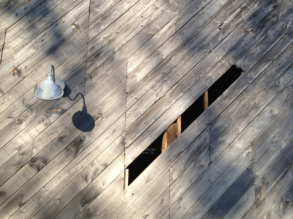
Looks like someone has torn off a small piece of barn board to look in.
Side of barn
And this is what they saw.
Inside barn
The Moore Farm Estate Pathway ends at Boulevard Alexandre-Taché, which I qualify as one of the worst roads to bike along in the region, however one need only follow it for a very short distance before cutting through the STO Park-and-Ride parking lot to Boulevard Lucerne. This is a quiet street which brings you to Moussette Park and then on to the Voyageurs Pathway for the ride back in to Ottawa. Rather than crossing back over the Chaudière Bridge, follow the path to and over the Portage Bridge.
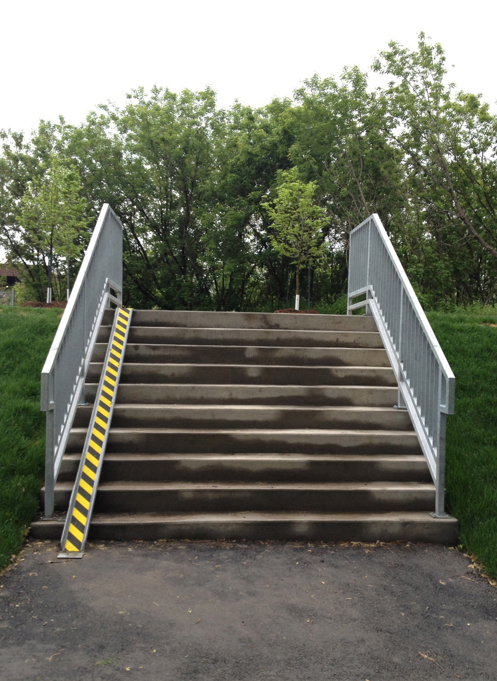
All the excitement surrounding the new bike ramp at Hartwell Locks inspired me to come up with this tour of ramps I know of in the area. Felt like a giant version of Snakes and Ladders!
First, the new ramp itself at Hartwell Locks. Mmmmm, very nice!
Ramp at Hartwell Locks
The curbs have yet to be ground down at the intersection of the O-Train Path and Beech St, so someone poured these mini-concrete ramps to compensate. Much obliged. UPDATE 2017: The city has made this crossing level to the road.
Concrete Ramp at Beech
A bit further along, where Louisa joins the O-Train Path, the city has installed this fabulous ramp.
Ramp at Louisa
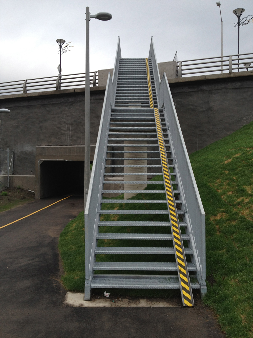
To get up the stairs to Somerset St W from the O-Train Path path this steep ramp is there to help. What’s great about the black and yellow cross-hatched road decal isn’t so much it’s visual punch, but how it has a grit impregnated into it’s surface making for a much more controllable push up this particularly steep incline.
Ramp at Somerset
Should you wish to continue north there’s this mini-set of stairs and ramp to access Breezehill Ave on the north side of Somerset.
Ramp at Breezehill
After circling along the Ottawa River Pathway behind the War Museum you can avoid the steep and nasty climb up Nanny Goat Hill along Bronson by heading a bit West and pushing your bike up this fabulous series of ramp joining the two sections of Empress Ave. You would be amazed the number of bike rides this mother of all Ottawa bike ramps has saved with tired kids in tow.
Ramp at Empress
So, bravo for city of Ottawa for coming through on these ramp initiatives, any others I have yet to discover, and many more to come (fingers crossed).
On two previous occasions I’ve tried to check out the remains of last summer’s Stony Swamp forest fire, as described here and here, but was denied access to the site. So when Pedro suggested we ride out there Sunday morning I thought OK, let’s try again! Well man-oh-man it was definitely worth it. Here’s how it went.
Blue line is how we got there. Orange line is the route home.
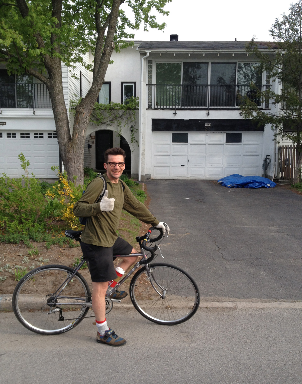
On my previous trips to the swamp I headed out along the Ottawa River Pathway, but this time we scouted out a route through the Experimental Farm, and made it all the way, mostly along paths, without ever having to ride along a busy road. The trickiest part was figuring out how to get from the end of the Experimental Farm Pathway at Woodroffe to Stony Swamp. It helped that Pedro almost grew up in the area during his teen years. Here he is in front of the house he lived in on Hobart Crescent.
Pedro in his old ‘hood
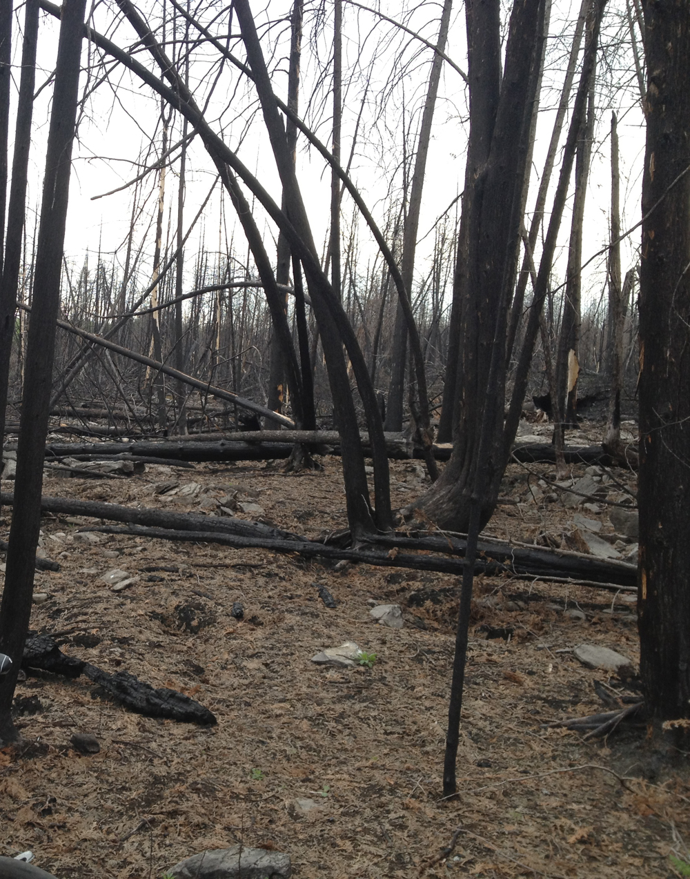
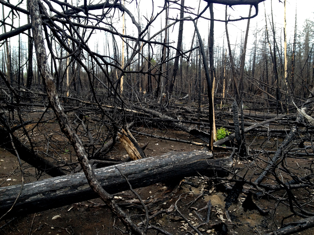
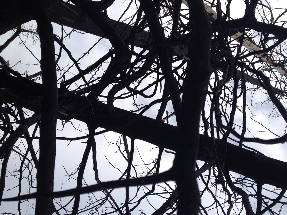
OK, straight to the site of the forest fire. It was mind blowing. Check it out.
Remains of the Forest Fire
The path from the pond through the area affected by the fire is covered in this mulch, which requires extra energy to bike through, although it shouldn’t take too long before it’s all packed down.
Mulch
We chose to head home along the Ottawa River, taking advantage of NCC’s Sunday Bike Days to ride on the parkway devoid of vehicles.
Pedro taught me about drafting. Mostly me behind him. Now he’s a much stronger rider than I, so we kept up a pace that was challenging but didn’t leave me exhausted. Nor did he make me feel like I was holding him back. It was a whole lot of fun. I highly recommend everyone get themselves a bike buddy like Pedro.
Local guy Andrew King has put out two clever series of t-shirts with screen prints borrowing from some Ottawa sign graphics from yesteryear. Here’s a tour with images of the signs that still exist from his first series of tees.
First stop, Jules Patry, as seen from the Somerset Bridge over the O-Train tracks. It’s on the southern facing wall of the City Centre building. On his web page Andrew acknowledges the tongue-in-cheek typo on his shirt, Pastry vs Patry, because most folks do mistakenly think it reads as Pastry, or Party. EDIT 2017 – The Jules Patry sign is long gone.
Jules Patry
Speaking of City Centre, There used to be big distinct channel letters on the hi-rise part of the building, but they’ve been removed! Fortunately they are depicted on another one of Andrew’s t-shirts from the same series.
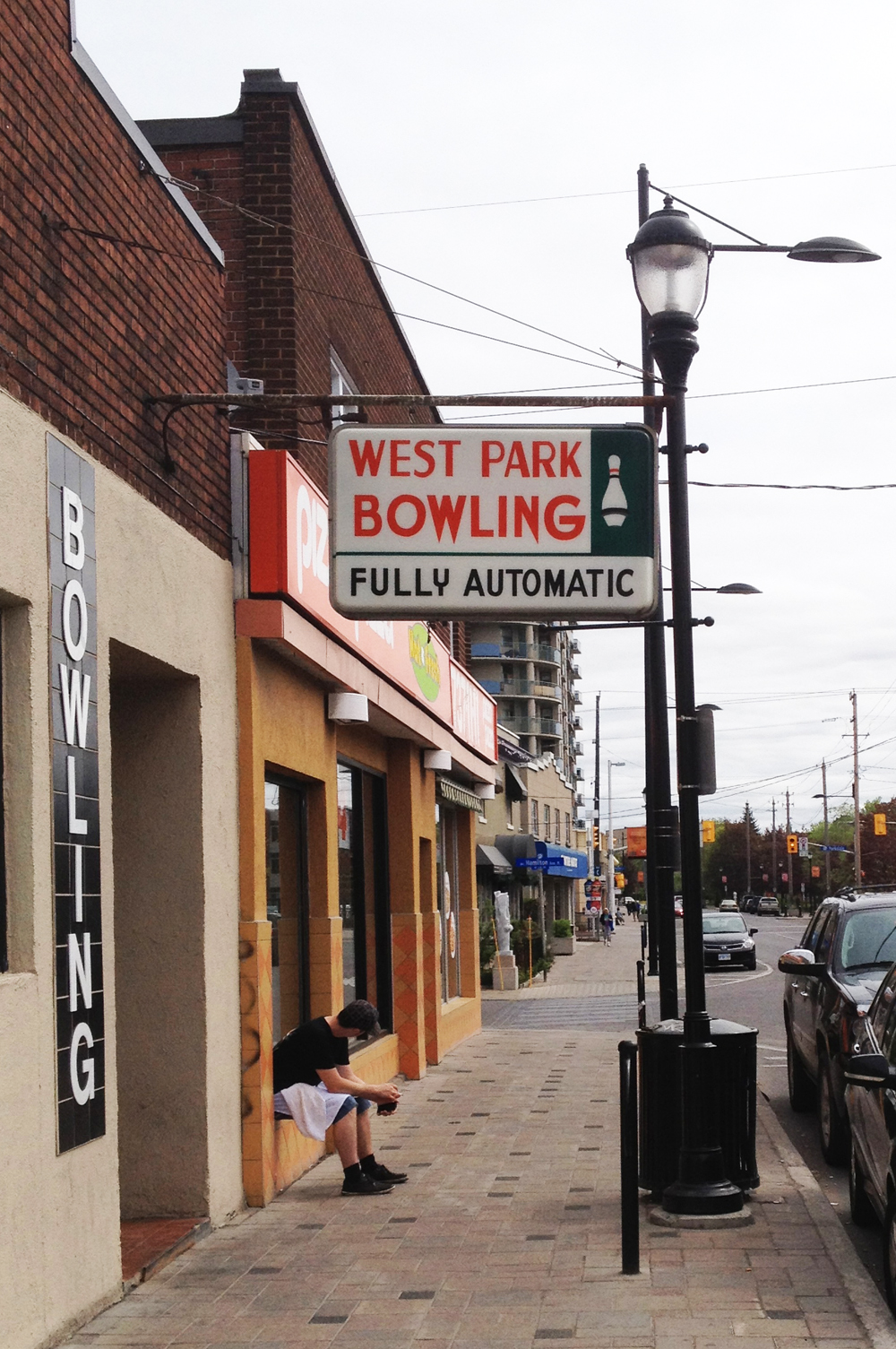
Stop #2 – West Park Bowling on Somerset near Holland Ave. Great sign, great bowling alley.
West Park Bowling
Next stop – Civic Pharmacy on Carling. Love it.
Civic Pharmacy
And finally, the Elphin. Hope they replace his foot.
The Elphin
Andrew’s t-shirt designs help remind us how these and other great heritage signs are to be cherished, and how much they contribute to the city’s character.
After posting my first bike tour of Bruce Garner’s sculptures in and around downtown Ottawa, his wife Tamaya got in touch and generously forwarded me locations of a number of other pieces throughout Ottawa I didn’t know of, or didn’t realise were his creations. Pleased as punch, I subsequently put together this second tour.
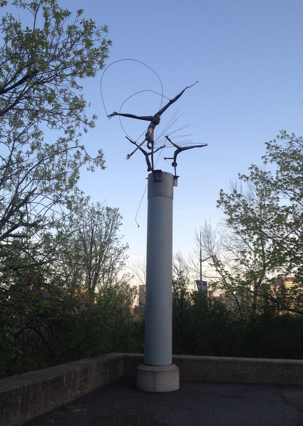
First stop – Children of the Wind, tucked off of Wellington across the street from the Library and Archives Canada building.
Children of the Wind
The next two are in Lowertown. To get there I rode along the Voyageur Pathway on the Quebec side.
Phoenix is located on the lawn of a private home at 152 St Patrick St.
Phoenix
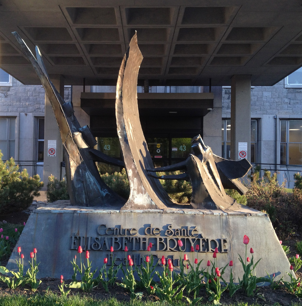
Succor is located a few blocks north at the entrance to the Elizabeth Bruyère Centre.
Succor
Next stop – Ulysses, in the courtyard of the University of Ottawa Arts building. A majestic grouping of figures in a wonderful setting. This has become my favorite of Bruce’s sculptures.
Ulysses
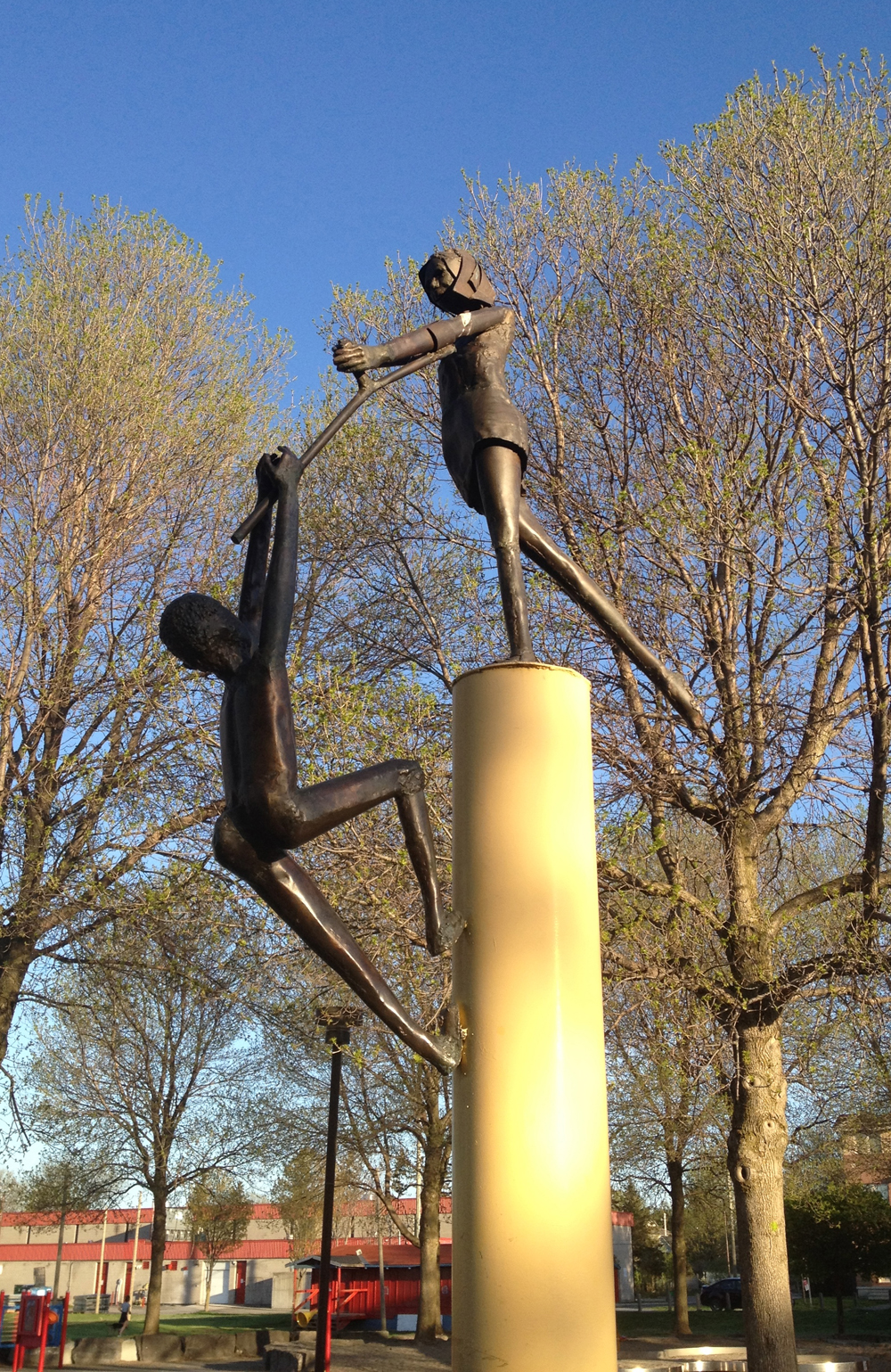
The final sculpture on the tour is Play Pals, located in Brewer Park.
Play Pals
There is also a sculpture Tamaya mentioned located downtown in the World Exchange Plaza, titled Moon Fragments, which I did not include on the tour as it is indoors, however I have marked its location on the map below, along with all of Bruce’s sculptures from tours 1 and 2, for those who may wish to plot a bike or walking tour of their own.{“type”:”block”,”srcClientIds”:[“5373212b-4257-4464-a624-cf1336ce3ca9″],”srcRootClientId”:””}
UPDATE – July 2018: While biking through Barrhaven I discovered this work by Bruce, located on the south-west corner of Malvern Drive and Greenbank Road. I’ve added it to the map below.
UPDATE – March 2021: Here is another wonderful sculpture by Bruce from 1975 located in Ambleside Park, as noted by Tania Garner-Tomas in the comments. Thank you Tania! I’ve added it’s location to the map below.
Our three big rivers – the Ottawa, Rideau, and Gatineau – get all the attention when it comes to local waterways, however there’s a little creek in the east end full of charm and grace that quietly weaves it’s way north. I was very fortunate to happen upon a short section of it by accident during one of my rides. You can too. Here’s how.
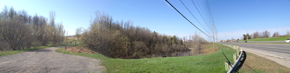
This all happened while on a bike errand to the Home Depot in the east end. I decided to make the most of it and explore a trail noted on Google Maps a bit further east off Innes Road as it heads through the Greenbelt.
Trailhead off Innes Road looking west
While venturing along, I noticed another path turning off to the right. It lead me over this old abandoned train bridge…
Old train bridge over Greens Creek
… winding up at the back of this big box store that fronts onto Innes Road…
Back of the big box store
…so I turned around.
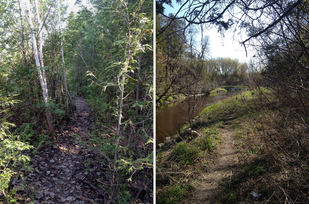
Crossing back over the train bridge I noticed another unmarked path that continued along the bank of Green’s Creek. Couldn’t resist. Now this is pretty much a foot path, so I recommend either walking/carrying you bike most of the way, or locking your bike to a tree and exploring by foot. You will not be disappointed.
Path along Greens CreekLittle falls
Along the shore there are many hints that this was not always a predominantly natural environment, as suggested by these remains.
Twisted metal, concrete and brick
The path eventually veers away from the creek as it comes upon the Trans-Canada Highway, and ends a bit further along at some train tracks.
Where the path ends
I turned around and headed back to the marked trail, which takes you between two farmers fields like so.
Trail between fields
This leads to the wider stone dust Prescott Russell rail-to-trail path that you can follow all the way to Quebec.
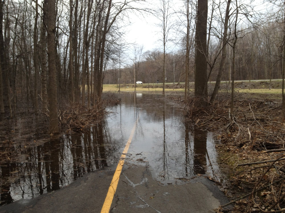
This route is one of my favorites through Gatineau because it is entirely along bike paths… most of the time… but not right now. The swollen Ottawa River has flooded sections of the path near and around Lac Leamy. Another section beyond the lake is closed due to construction of rapid transit facilities, forcing one to detour along a road. This section of path will be reopened in the Fall. HOWEVER, it’s still a fine ride, which will become great once the water recedes, and fantastic when they finish building the rapid transit.
Blue line is where I biked. Red lines are the flooded sections of path. Orange line is the section of path blocked off until the Fall.
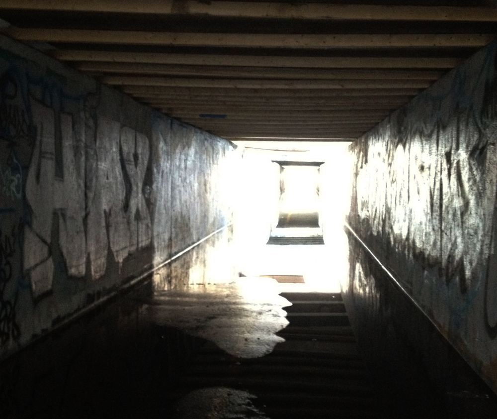
The tunnel where the Ruisseau-de-la-Brasserie Pathway goes under the Autoroute de la Gatineau is flooded. I rode through and got my feet soaked.
Flooded tunnel under the autoroute
The section of path along the eastern shore of Lac Leamy is flooded as well, but avoidable by biking inland to the parking lot.
Flooded shores of Lac Leamy
The Leamy Creek Pathway weaves it’s way through the woods like so.
Sentier du Ruisseau-Leamy Creek Pathway
Along the Gatineau Park Pathway heading south there are a number of huge impressive boulders like this one gathered at the top of a hill. I’m guessing they were dragged there by a glacier.
Sisyphus’ training grounds
I was worried the Voyageur Pathway along the Ottawa River above the Chaudiere dam would be flooded as well, but it wasn’t, so smooth sailing all the way home.
The Côte d’Azure, or French Riviera, is a beautiful hilly region overlooking the Mediterranean sea. There is an area of La Ville de Gatineau with streets named after popular spots along the Côte d’Azure (Rue de Cannes, Rue de Monte Carlo, Rue de Roquebrune, etc). It’s hilly too, and looks out over its own body of water, the Gatineau River. That’s where the similarities end. It’s a fine residential area of Gatineau to bike through. You can do a little bit of switch back climbing while taking in a few interesting house designs.
To get there I biked along Boulevard St Joseph, which isn’t too bad at 6:30 am, but I suggest the much more pleasant route hi-lited in green. Mostly along bike paths, it follows Boulevard de la Carriere for a bit, as a section of the Gatineau River Pathway is closed this summer for rapid transit construction.
Here’s an interesting house I spotted on the Gatineau Riviera.
Try to spot the front door…
I followed this short path at the top of the hill through Parc Saint-Exupéry, named after the author of Le Petit Prince.
Parc Saint-Exupéry
Here’s another interesting house looking out across to the Gatineau hills.
House along the Gatineau Riviera
The path along the Ottawa River just west of the Lady Aberdeen Bridge is partially flooded out, but there’s a beaten path you can follow to get around it. The rest is clear sailing.
Carson Grove is a small community defined by a traffic moat – Aviation Parkway to the West, Ogilvie Road to the south, Bathgate Drive to the east and Montreal Road to the north. It’s relatively new, only 7% of the homes having been built before 1960 with a surge of single detached homes built in the 70’s and 90’s. La Cité Collegiale Ottawa campus divides the community in two, north & south. There were a bunch of streets in the southern section I had yet to discover, so early Tuesday morning I went and and checked them out. Blue line’s how I got there, green line’s how I got back, and orange line is a recommended alternate route through Vanier to avoid Montreal Road west of St Laurent (impatient commuter traffic, no shoulders, and very bumpy, particularly around the potholes surrounding drainage covers).
The southern portion I biked through is a residential subdivision mostly built up in the 70’s, one of the many Campeau developments scattered around the city from that period. Campeau offered a bit of variety in plans homeowners could choose from. Along with the slightly varied mix of period house designs, many types of trees were planted on front lawns which have matured over the years. The streets aren’t confined to an overly strict grid, allowing for a pleasant meander.
So, Carson Grove – nice place to visit. Still don’t know out who Carson was or if there ever was a grove. All and any leads are welcome.