The recently completed section of bike path along the shoreline of the Ottawa River, just east of the confluence of the Gatineau and Ottawa rivers, allow for spectacular views across the water. Previously this stretch of Rue Jacques-Cartier consisted of two narrow lanes with lots of potholes and speeding traffic, making it a challenge for cyclists to concentrate on anything but survival. Now users of all ages visit and cycle along the shoreline, testament to the huge success of this new bike infrastructure.
The blue line on the following map shows how to get there entirely along bike paths starting from Centretown in Ottawa. The purple line is the new stretch of path along Rue Jacques-Cartier, described in more detail below.
.
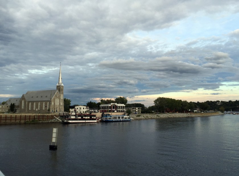
Upon crossing the Gatineau River over the steel truss Lady Aberdeen Bridge, one arrives in the old town of Pointe-Gatineau with the Saint-François-de-Sales church to your right. This is where the new section of path heading east along Rue Jacques-Cartier begins.
View of Pointe-Gatineau from the Lady-Aberdeen BridgeNew path along Rue Jacques-Cartier
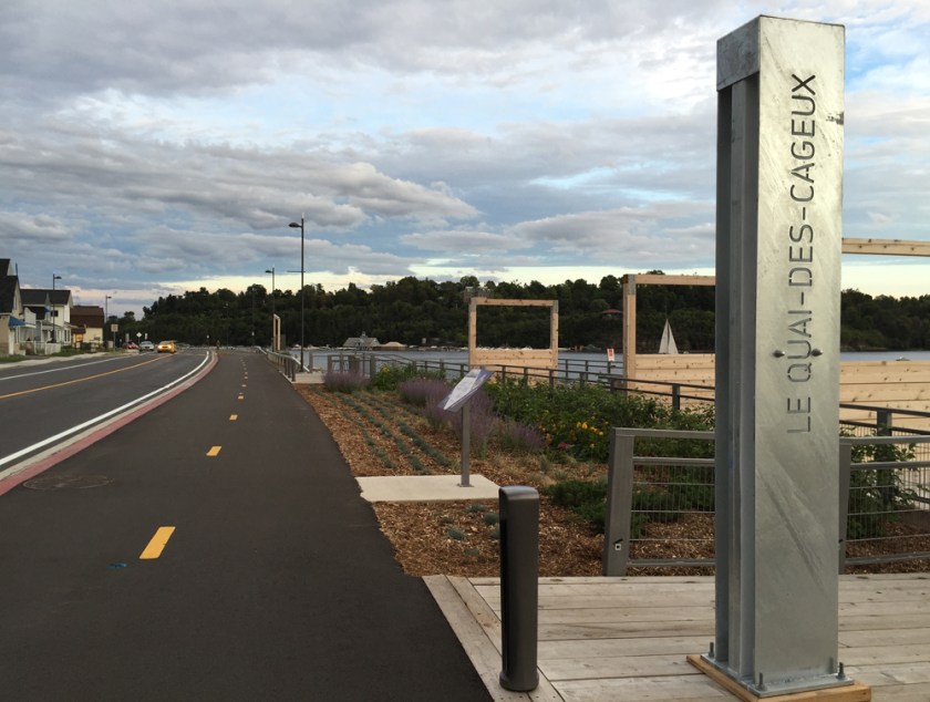
The re-design of the shoreline has included gathering nodes for people to pause and take in the scenery. Many of the stops have interpretive panels that describe the history of the area.
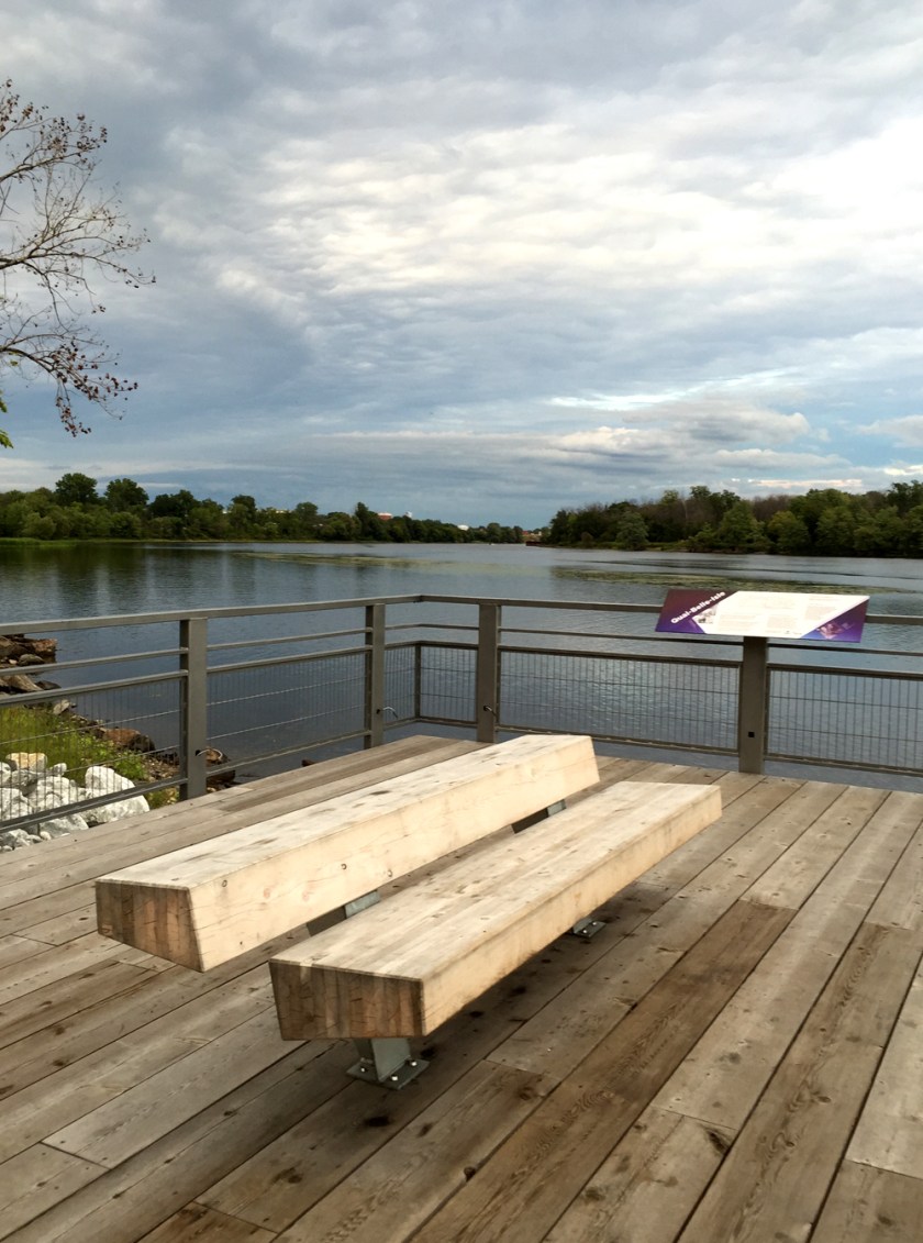
Lookout over the river
The design of the various furnishings appear to have been inspired by the lumber industry so prevalent in Point-Gatineau’s past.
Pathway bench
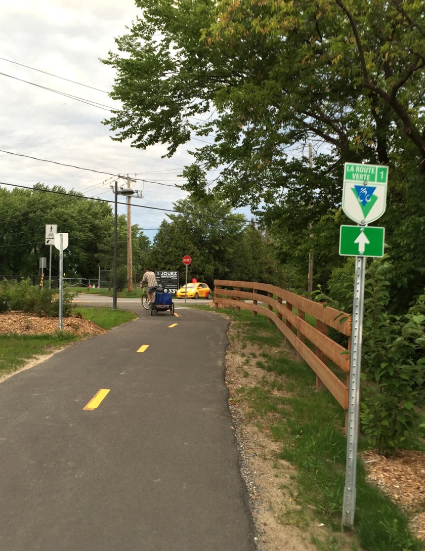
Not only has this new bike infrastructure created a fantastic destination well worth the visit, it also provides an important link to the Route Verte recreational path network that runs across Quebec. It also encourages bike commuting for hundreds of residents living in Pointe-Gatineau and beyond.
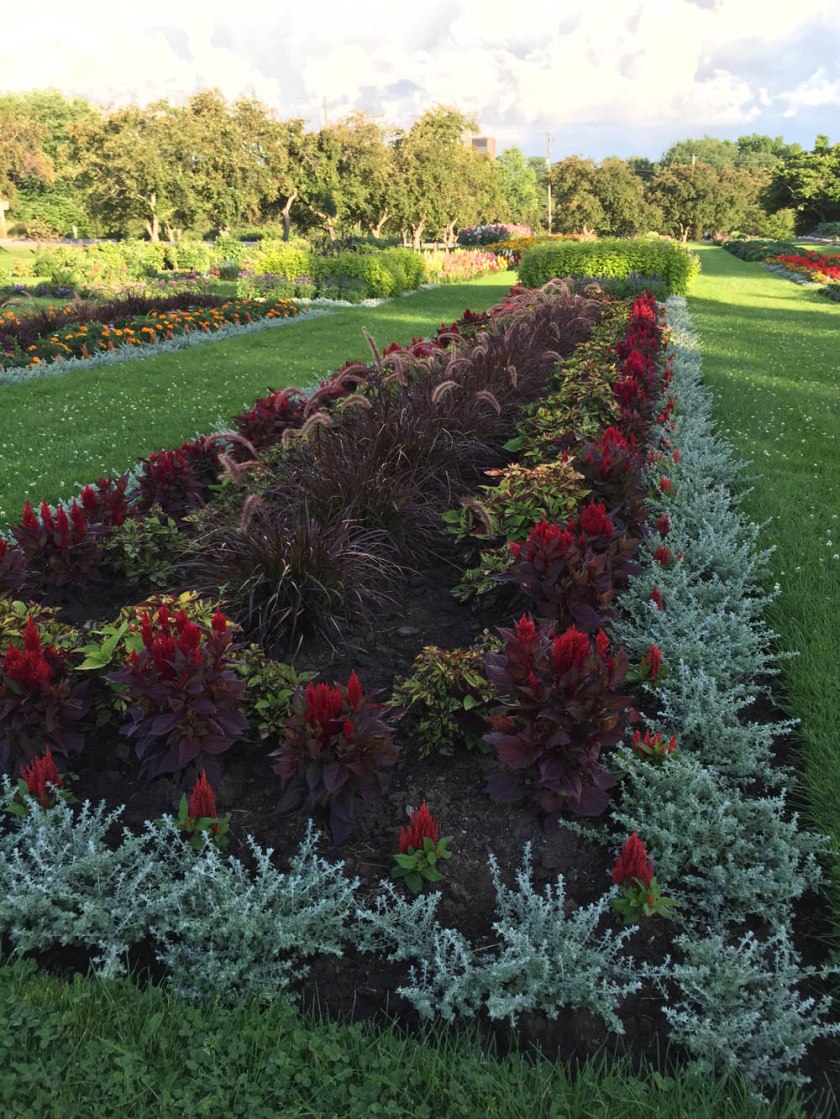
All sorts of midsummer flowers are in bloom! There are a number of wonderful gardens throughout the National Capital Region that are open to the public and maintained with lots of tender loving care. Here’s a ride I took to visit a few of them that , starting along the O-Train path between Carling and Scott.
Second stop – the First Unitarian Meditation Garden, located at 30 Cleary Ave beside the very cool looking modern church. As the name implies, this horticultural gem has a more organic groove to it with lots of wonderful discoveries to be made along its meandering paths. It is also maintained by a volunteer group of garden enthusiasts.
First Unitarian Meditation Garden
Third Stop – The Central Experimental Farm Ornamental Gardens, just off Prince of Wales Drive south of the round-about. Here’s a link to a detailed map that shows it’s location, along with a number of other gardens on the Farm. The layout of this garden is strict but the flora is fantastic! Another volunteer group plays a big role in maintaining the garden.
Central Experimental Farm Ornamental Garden
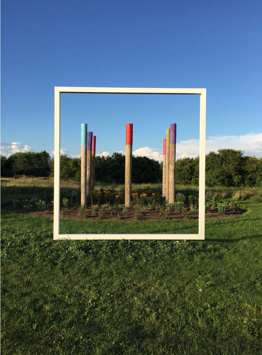
Fourth stop – Beyond the Edge: Artists’ Gardens, located across the street and a short distance further south along Prince of Wales Drive. The three art garden installations are located along a path that circles around a big Agriculture Canada research plot. This annual display is organized by the Candenses Botanical Garden Society.
Engelina Schmitz: Bee Haven
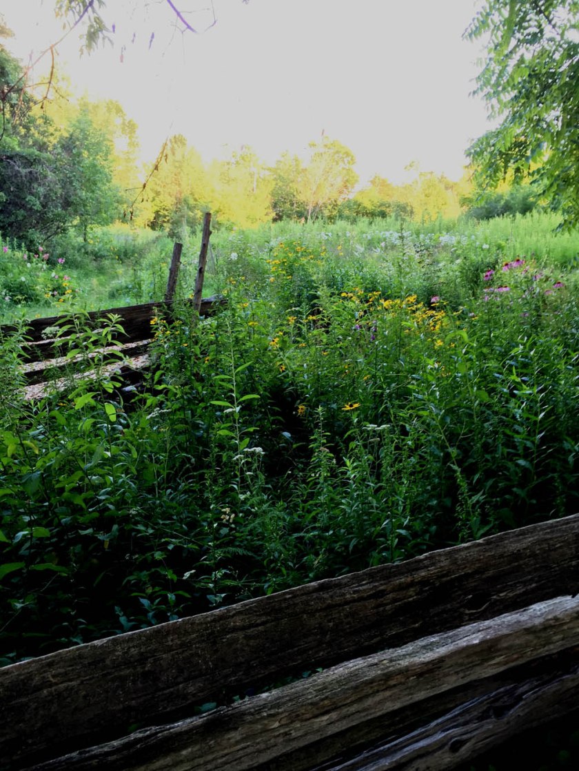
Final stop – Fletcher Wildlife Garden, accessible by path just to the east of our previous stop. Lots of volunteers help maintain this magical network of paths that run through a mixture of natural habitats and gardens. Well worth a visit any time of the year.
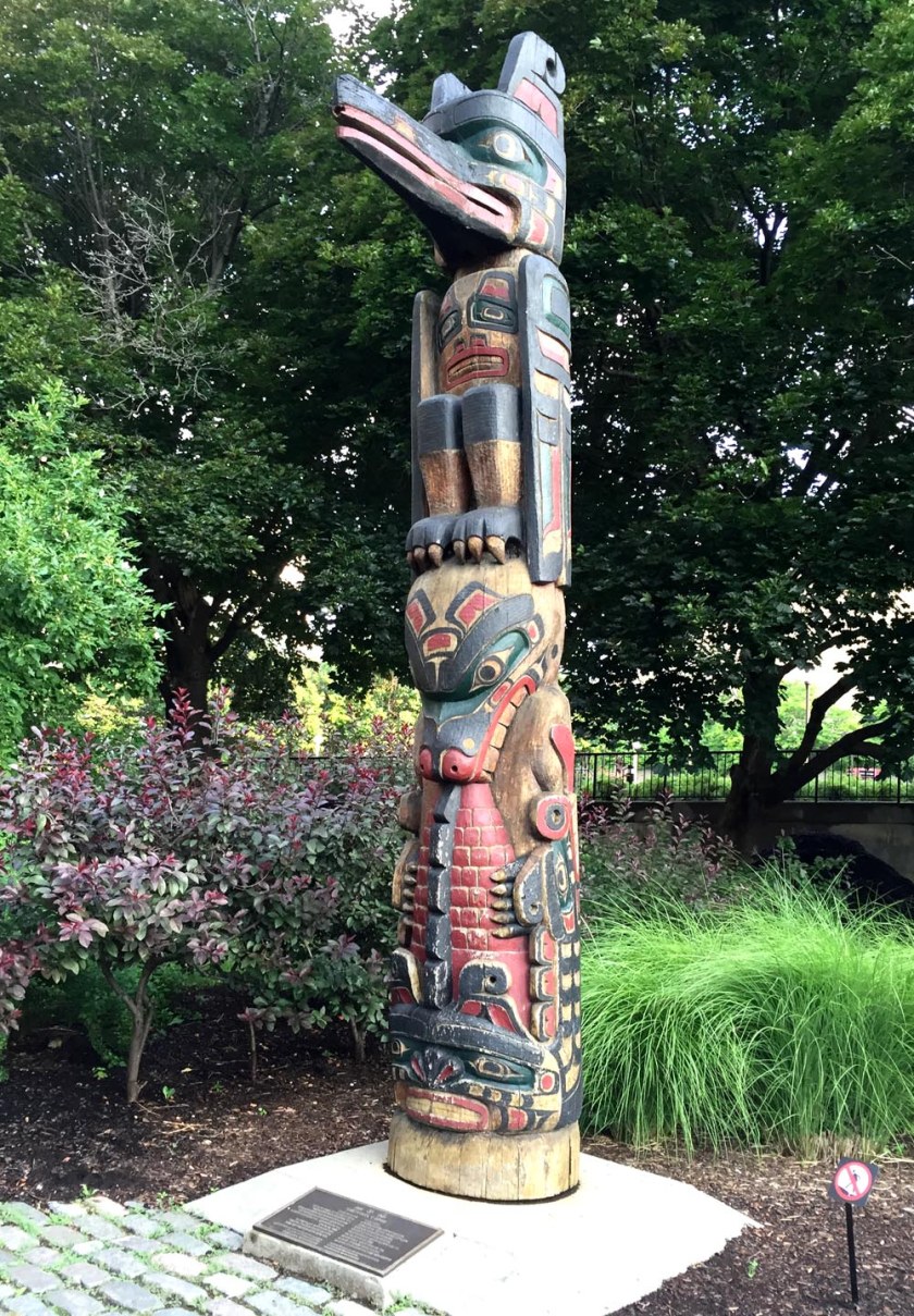
Indigenous Walks is ‘A guided walk & talk through downtown Ottawa that presents participants with social, political, cultural & artistic spaces from an Indigenous perspective‘. I put together the following bike tour for Indigenous Walks with Alanis King. Alanis is a published playwright and theatre director, as well as past Artistic Director of Native Earth Performing Arts and Saskatchewan Native Theatre. If you are interested in taking this tour I suggest calling Indigenous Walks to see if they are planning any future group rides.
Here’s a map of the route, starting in front of the Totem Pole on Victoria Island, and ending in the plaza looking in to The Grand Hall of the Museum of History.
Start – Totem Pole sculpted by Walter Harris on Victoria IslandFirst stop – Totem Pole sculpted by Henry Hunt2nd stop – The Lost Child by David Ruben Piqtoukun3rd stop – Anishinabe Scout4th stop – Lookout over the Ottawa River5th stop – The Three Watchmen by Chief James HartLast Stop – Exterior view of the totems within the Grand HallMuseum of History, Namaxsala (To Travel in a Boat Together) by sculptor Anne Barkhouse
Here’s a bike ride that works it’s way westwardly through the centre of Gatineau, starting from Jacques Cartier Park on the edge of the Ottawa River to just within the southern tip of Gatineau Park. The route follows a series of connecting paths along which there are a number of interesting sculptural installations and interpretive panels that describe the history of the area.
.
Our adventure begins just to the east of Maison Charon facing a trio of bronze and stone interpretive displays. These describe, in turn, the entrepreneur Philemon Wright who settled in the area during the 1800’s and developed the logging industry; the importance of the Ottawa River as a trading route and meeting place throughout time; and the history of Maison Charon.
Maison Charon
Interpretive displays at Maison CharonThe Voyageurs Pathway runs behind Maison Charon. I followed it south a short distance to another grouping of panels that describe the Ottawa as a ‘River of many Stories’, including those of the First Peoples, the coureurs de bois, loggers and log drivers.
River of Many Stories
I followed the path that circles away from the river, up towards a landing overlooking Jacques Cartier Park and a series of panels that describe how the area has transformed from an industrial site in the 1930’s to the public space that it is now.
View overlooking JCP parkJacques Cartier Park interpretive panel with view towards the Alexandra Bridge and the National Gallery
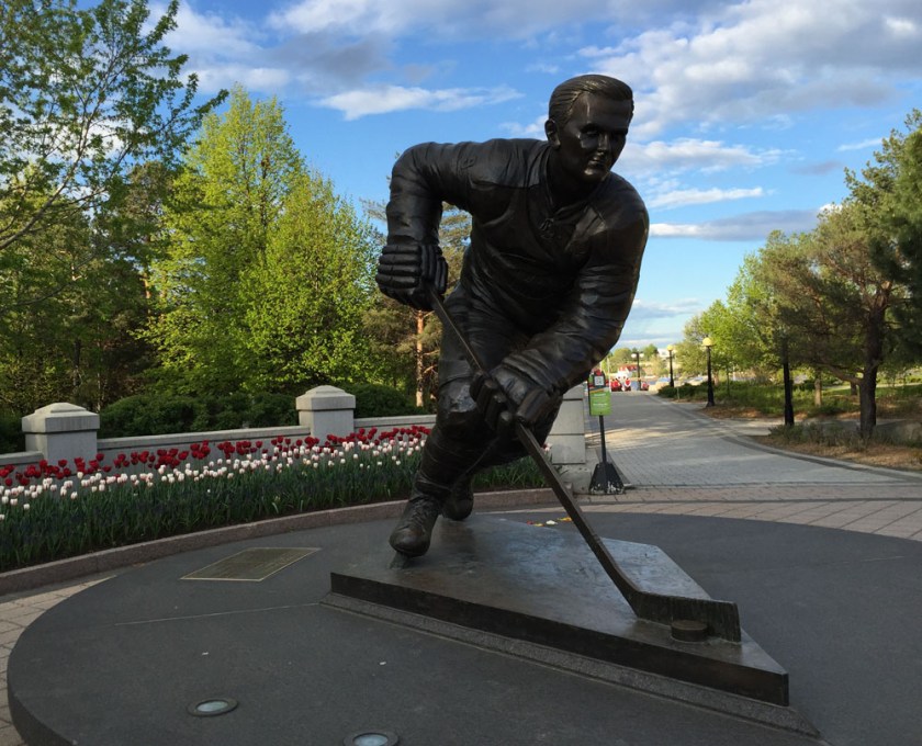
I spun around and headed straight out of the park to the corner of Boulevard des Allumettières and Rue Laurier, where there’s huge bronze sculpture of Montreal Canadiens hockey legend Maurice Richard.
The Rocket
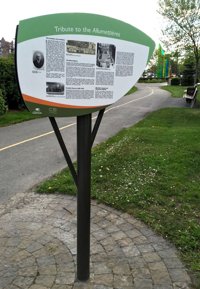
The De l’ile pathway starts on the other side of Rue Laurier and winds it’s way west. Just before reaching the intersection of Boulevard Maissoneuve and Boulevard des Allumettières there is an interpretive panel describing who the Allumettières were: female labourers who worked in the local EB Eddy factories making matches, and their struggles for workers rights.
At the corner of Rue Laval and Boulevard des Allumettières sits a metal sculpture inspired by origami. Created by a group of local artists from the Tripode Group, it was commissioned to celebrate the International Year of the Family in 1994.
Monument to the Family
The next section of the De l’ile pathway is a pleasant meander through the local community as far as Rue Saint Rédempteur.
De’l’ile Pathway
There is a signalized crosswalk to get across Rue St Rédempteur before the path continues between a high school and the Robert Guertin arena where the Gatineau junior hockey team Les Olympiques play.
Robert Guertin Arena
The path eventually meets up with the Ruisseau de la Brasserie Pathway. Turning left where the two paths meet leads to a bridge with some fine views overlooking the stream (or ruisseau).
View from the bridge over the Ruisseau de la Brasserie looking north
The path continues alongside the ruisseau. Part way down the path there is a french interpretive panel describing the biodiversity found in this area.
Interpretive panel along the pathway
I turned off the Ruisseau de la Brasserie Pathway just before it continued under the Boulevard des Allumettières, and followed the path that goes alongside les Allumettières.
Exit up to Boulevard des Allumettières
The path along Boulevard des Allumettières is generous and physically separated from the busy boulevard, however a few intersections along the way can be a bit nerve wracking. These include on & off ramps to highway 50, and a couple of round-abouts.
Path along Allumettières at seen from under highway 50
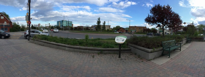
At the first round-about there is a french interpretive panel that describes the struggles and efforts members of the local population undertook to minimize the impact Boulevard des Allumettières would have on their community. The Boulevard was eventually completed in 2007.
Round-about panorama. Left side of image is where I came from. Right side is where I’m heading.
The path continues west with sound dampening walls separating it from Boulevard des Allumettières. This stretch of path is interrupted only by a second round-about intersection before reaching the exit ramp to the Lac-des-Fées Parkway.
Path along Boulevard des Allumetteèrres
The route gets a tad wonky once arrived at the exit ramp. The end goal is to continue west along Boulevard des Allumettières, however to do so one must follow a distorted figure 8 by first riding down alongside the Lac-des-Fées exit ramp, then winding your way back up on the other side of the ramp. Wouldn’t be too confusing it was uninterrupted, but it intersects the Lac-des-Fées pathway heading north-south at two spots. Best rule to maintain is to stay right.
Riding down alongside Lac-des-Fées down ramp, before first of two right turns back up to Promenade des Allumettières
Once back up beside Promenade des Allumettières there’s another french interpretive panel describing the history and surroundings of the viaduct over which the path continues.
Le viaduc Oscar-DuquetteView north from the viaduct
Crossing over the viaduct brings you into Gatineau Park. A short hill once across the viaduct leads to the Gatineau Park Pathway where our discovery ride ends.
Intersection with the Gatineau Park Pathway. Arrivée!
For a fine alternative return route back towards the starting point, I would suggest one described in part on this post, Biking from Gatineau Park to Ottawa.
Greenboro is a residential community located just south of Johnston Road and west of Conroy Road. Here’s a route I tested out that’ll get you from Greenboro to downtown.
.
I started off from the Greenboro Community Centre and headed west towards Bank Street, following a selection of the many multi-use paths that weave their way through the community.
Path through Greenboro
After crossing Albion Road and cutting through Pushman Park, I turned right on Pebble Road then Left on South Keys Place to Clearwater Crescent. Across Clearwater Crescent there are a series of paths that cut through to Southgate Road.
Shortcuts
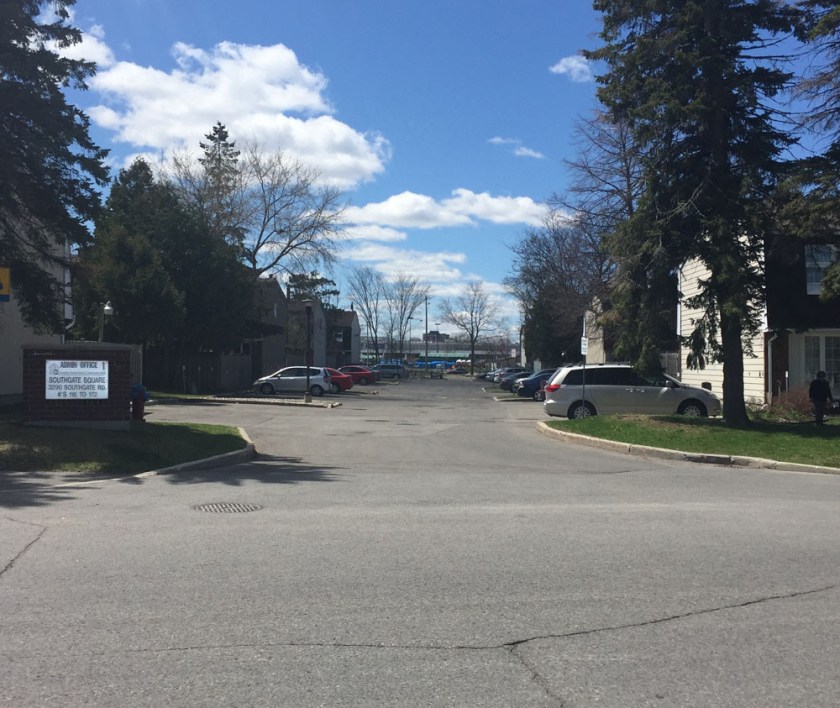
I rode north on Southgate for half a block before turning into the lane heading into a housing complex called Southgate Square. This I followed a short distance to Bank Street.
Laneway into Southgate Square
The next section of the route is less than stellar. That’s because there is no clear safe way to bike across Bank Street to access the Sawmill Creek Pathway on the opposite side of the South Keys Shopping Mall.
Once at the end of the driveway there is a shortcut that I took up and on to the sidewalk along Bank.
Path to Bank St at the end of Southgate Square laneway
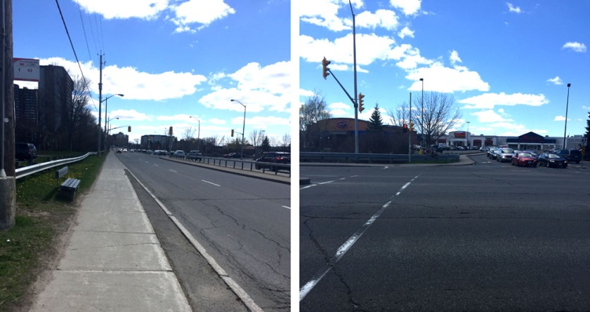
I followed the sidewalk south a short distance to the traffic lights across Bank Street into the South Keys Mall parking lot. The only crossing is on the south side of the intersection. I stayed along the sidewalk on the other side until I was able to access the parking lot.
Sidewalk along Bank to lights….crosswalk at the lights to South Keys Mall
Access to the Sawmill Creek Pathway is though a tunnel under the O-Train tracks at the south end of the mall, so I rode through the mall parking lot to get there. The sign at the entrance to the tunnel is confusing, however I have Tweeted confirmation from OC-Transpo that it is meant to be interpreted as ‘no riding your bike’, versus ‘no bikes allowed at all’.
Tunnel under Otrain to Sawmill Pathway..and it’s confusing sign
Beyond the tunnel is the Sawmill Creek Pathway, which is wonderful to ride along all the way to where it intersects the Brookfield Pathway.
Sawmill Creek Pathway – I stayed right
I turned left at the Brookfield Path intersection which eventually brought me to the Brookfield Road round-about.
Brookfield path towards the round-about
UPDATE – 2020 : A separated bike path has been added to the south side of Brookfield Road which is fantastic! Continue along this path to Riverside Drive.
I then crossed Riverside Drive and Hog’s Back Road, then continued along the path on the north side of Hog’s Back Road, which is identified as a shared pathway. That said, the path on the south side is commonly used by riders heading west as it is also paved and twice as wide.
Path along Hog’s Back Road
Update, 2020 – They are rebuilding the bridge over Hog’ Back Falls which requires walking your bike along a tiny detour, identified by the purple line on the above map. Bonus – it affords a spectacular view over the falls.
Hogs Back Falls
I then followed the path that dips under Hog’s Back Road then down along the Rideau Canal.
Rideau Canal Eastern Pathway
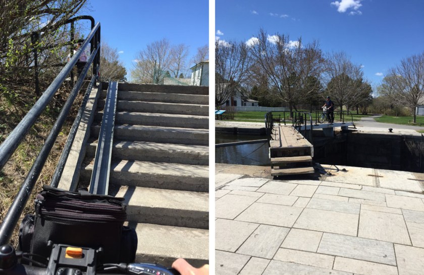
I crossed the canal at the locks near Carleton University. There is a metal u-channel to push your bike up the flight of stairs that gets you to the locks.
Up the stairs…to the locks
I then rode down the hill and along the paved path that runs beside the canal all the way to the Dow’s Lake pavilion. I then crossed Prince of Wales Drive and turned left along the bike path for a short distance and then turned right onto the Trillium bike path that heads north beside the O-Train tracks.
Path along the O-Train just before it heads right up up to Albert St
I followed the path along Albert Street as far as the crosswalk that leads towards the Laurier Bike Lanes.
Crosswalk along Albert St
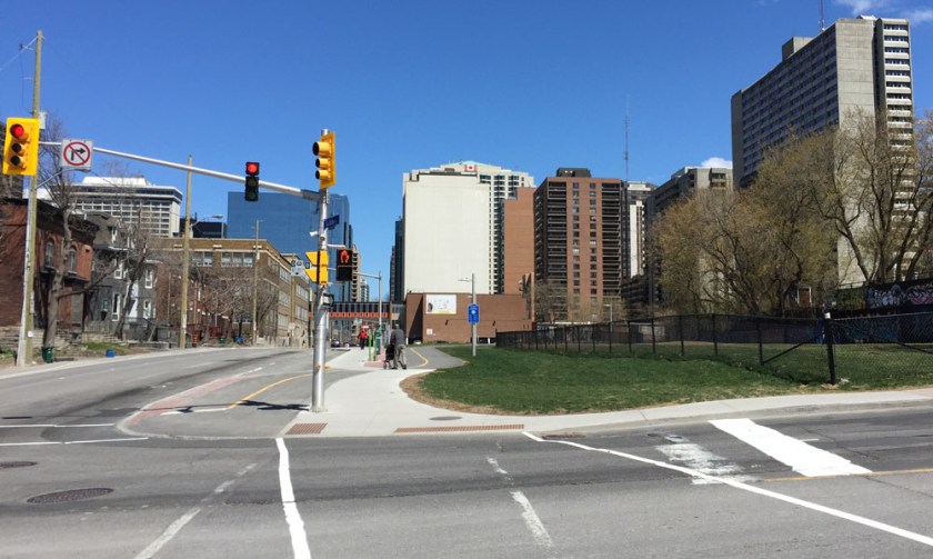
The path continues through the intersection at Bronson & Slater before eventually cutting through to the Laurier Bike Lanes.
Bronson & Slater intersection
The laurier Bike Lanes cut west to east across downtown as far as City Hall.
Laurier Bike Lane heading east
Et voila!
N.B. Here is another route I have ridden. I don’t recommend it as much as the route described above. That’s because while Conroy Road has bike lanes, it is still a major arterial road with lots of speedy traffic.
Here’s a route from the corner of Somerset & Elgin to the Children’s Hospital of Eastern Ontario (CHEO).
The blue line on the map below is the route I followed. A lot of road and path construction is happening between our start and finish points. The green line is the route I would take after all the construction dust settles. UPDATE – summer 2018: The construction along Hurdman Bridge has been completed so the green line option is once again an option.
.
Away we go!
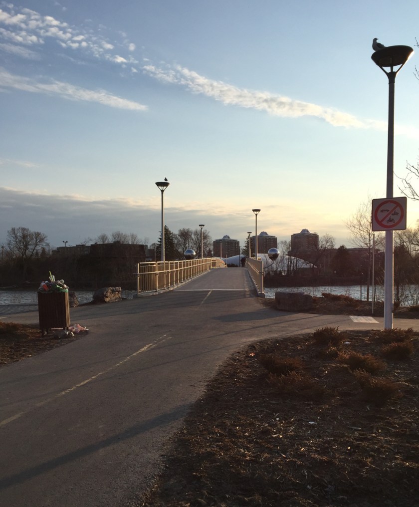
I rode down Somerset to the canal and crossed over the Corktown Footbridge.
View downtime canal through the love locks
UPDATE June 2017 – Previous version of this took a detour to north as the Nicholas St underpass was under construction. It’s still partially under construction, but you can ride under it regardless.
I cross Colonel By Drive then ride under the Nicholas St underpass. I continue straight along Marie Curie, across King Edward at the lights, then down Somerset all the way to the Rideau River and the Adawe pedestrian/cyclist bridge.
Looking down Somerset just east of King EdwardAdawe BridgeView from the bridge
Once arrived on the eastern shore I turned right and followed the Rideau River Eastern Pathway.
Rideau River Eastern Pathway
After passing under the Hurdman Bridge I turned off the path and rode along the detour past the major construction happening in and around the Hurdman transit station. This path is mostly crushed gravel.
Crushed gravel detour around Hurdman Station
The path becomes paved and continues through to the major traffic intersection at Riverside Drive and Industrial Avenue. Once across Riverside Drive I continued along the path that runs along Industrial Avenue beside the memorial to victims of cancer.
Path along Industrial Avenue
After crossing Alta Vista Drive the path then veers off to the right away from busy Industrial Avenue.
Path off Industrial at Alta Vista intersection
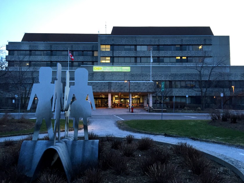
I then followed Coronation Avenue for a very short distance before turning on to Station Boulevard. At the end of Station Boulevard there is a path that cuts through to the ring road that circles the CHEO campus.
Path at the end of Station Boulevard
I then followed the ring road around to the main entrance of the hospital. Because there are no shoulders along the ring road one may feel more comfortable cutting through the parking lots, as suggested by the yellow line on the above map. I noticed a couple of bike racks right near a small playground, indicated by the yellow drop on the map.
Here’s a suggested bike route from the Glebe to Centretown, in response to a request from a cyclist in search of a commute route that avoids having to ride along busy Bronson Avenue or Bank Street. This ride begins at the intersection of Holmwood Avenue and Craig Street and ends at the intersection of Bank Street and Somerset Street West.
View up Craig Street from Holmwood
Head north along Craig St. There’s a short jog left where Craig meets Fifth Ave before the route continues north along Percy Street.
Jog in the road from Craig to Percy
There is often a fair amount of traffic along Percy Street heading through the Glebe, and there are no bike lanes, however stop signs at almost every intersection seem to help keep drivers calm.
View down Percy through the Glebe
A bike lane appears just before Percy continues under the Queensway. It requires easing your way over to the centre of the street. There are traffic lights to help get across the busy three lane speed strip that is Chamberlain Ave.
Percy at Chamberlain
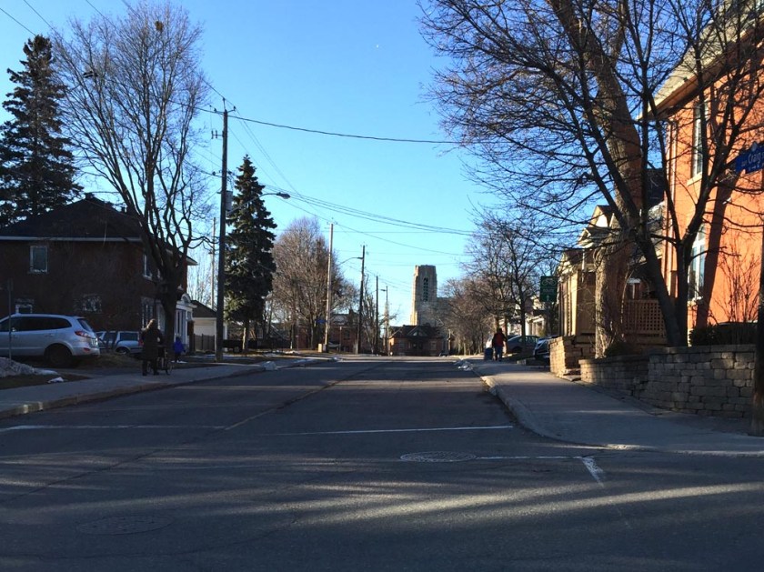
The bike path continues bi-directionally along Percy under the Queensway, however the northbound bike lane disappears a few blocks later at Flora St.
Northbound bike lane along Percy ending at Flora St
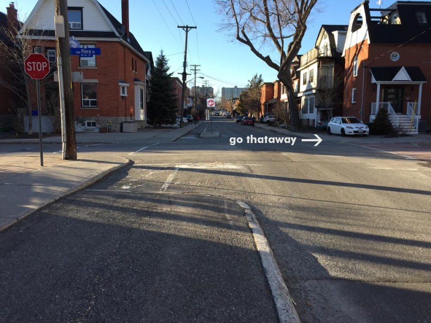
Turn east on Flora, then continue north along Bay St, which has a bike lane.
Bike lane along Percy
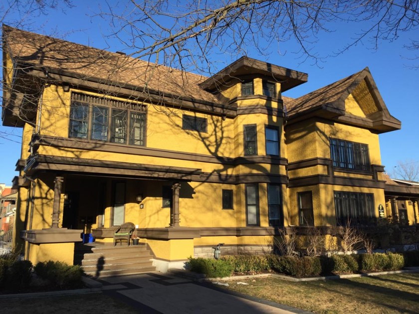
This stretch of Bay goes past the Powers House designed by architect Francis Sullivan. Sullivan worked with Frank Lloyd Wright before settling in Ottawa. If the works of Sullivan strike your fancy there’s a tour with visits to this and other buildings he designed within Ottawa that can be found by clicking here.
The Powers House
The trickiest part of this route is encountered at the intersection of Bay & Gladstone where there aren’t any traffic lights to help get across busy Gladstone. You have to wait for a break in traffic.
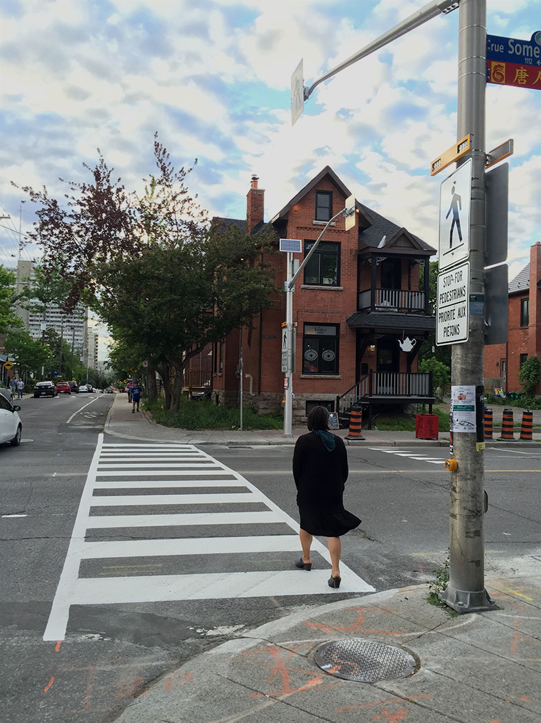
The next busy street to get across is Somerset a few blocks further north along Bay. UPDATE – June 22, 2016: A cross walk with pedestrian activated lights has just been installed at this intersection that greatly facilitate traversing busy Somerset.
Crosswalk at the intersection of Somerset and Bay
Once across Somerset, continue for a block along Percy, then turn right on to Cooper St. Cooper is a quiet one way street. The next two streets that require crossing are Lyon St and Kent St, both of which are one ways that drivers fly along on their way in or out of Centretown. No cross lights at these intersections but the gaps in traffic tend to be quite generous due to lights being one block away. Being one-ways there is also less traffic to contend with.
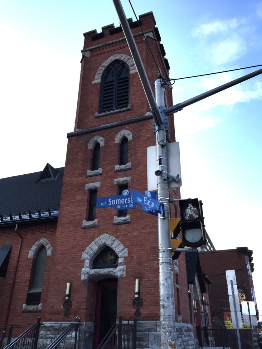
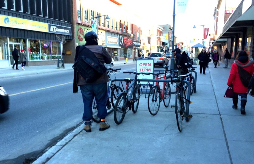
Once arrived at Bank Street I recommend walking your bike the final block to Somerset because Bank & Somerset is a pretty crazy intersection with cars and buses squeezing around each other or jumping the lights. You can also lock up to one of these sidewalk bike racks.
Bank St bike rack
OR you can lock up to this fine bike rack in front of the Independent Grocery, also popularly known as Hartman’s.
Bike rack at Bank & Somerset
Heading home, walk another short block along Bank to MacLaren, another quiet one way heading west, and follow it all the way to Percy. Another fine building encountered on this route along MacLaren is the old St Elijah’s Antiochia Orthodox church that was successfully converted into apartments, while maintaining it’s original outer form and aesthetic. It’s at the corner of Lyon and MacLaren right across from Dundonald Park, a.k.a. The Beer Store Park.
Speed bump hoping in front of the old St Elijah’s Antiochia Orthodox church
Once arrived at Percy St, head southwardly along the bike lane back to the Glebe. Fortunately there are lights at the intersections of Somerset and Gladstone along Percy.
Many Canadians are drawn to the November 11th Remembrance Day Ceremonies held at the National War Memorial to pay tribute to those who have fought and given their lives in the service of our great country. The following is a commemorative bike tour starting from the National War Memorial, with visits to a number of lesser known Canadian War Memorials throughout the capital, and ending at the National Military Cemetery.
.
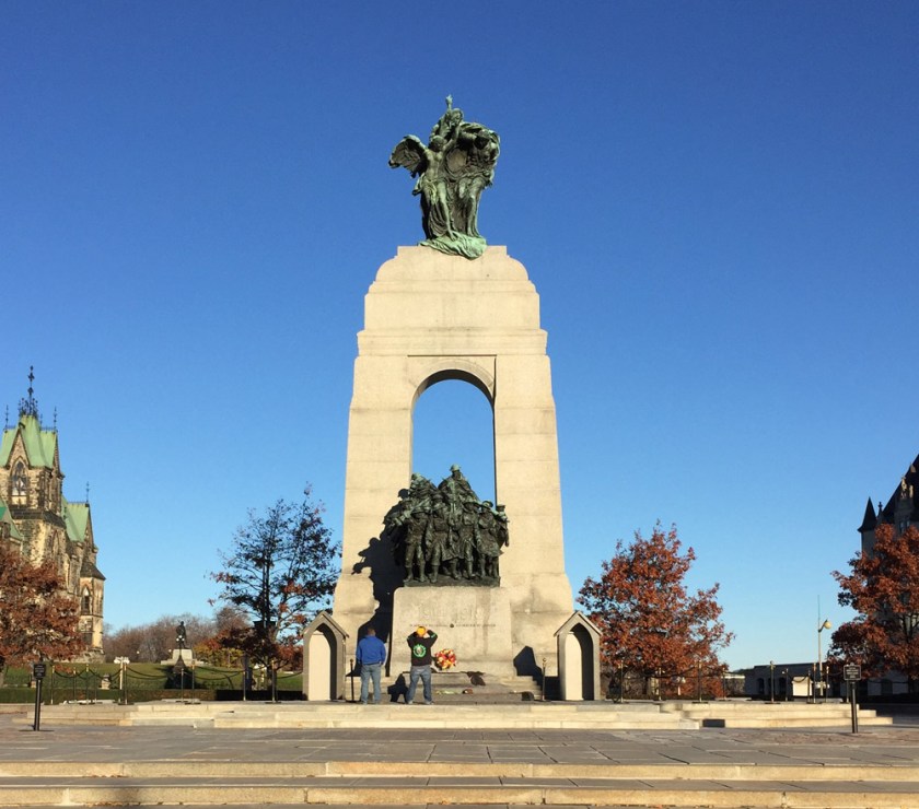
The National War Memorial was unveiled in 1939 to commemorate those who served in the armed forces during World War !. It has since come to symbolize the sacrifice of all Canadian Armed Forces in times of war.
National War Memorial
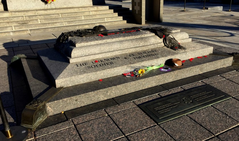
Immediately in front of the Memorial is the Tomb of the Unknown Soldier. It contains the remains of an unidentified Canadian soldier who died near Vimy Ridge during the First World War. This tomb represents the many Canadian soldiers who have no known grave.
Tomb of the Unknown Soldier
Leaving the War Memorial, Head down along the edge of the Rideau Canal beside the National Arts Centre to Confederation Park where the South African War Memorial is located.
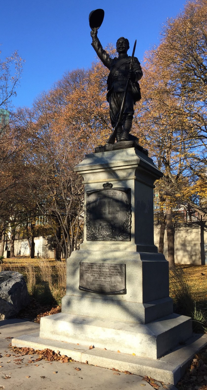
The tour crosses Elgin street and follows the Laurier Bike Lane heading west before turning north along the Bay St bike lane. After crossing Wellington at the northern end of Bay, head east for one block to Lyon St. There is a gravel path through the park just to the east of the National Archives building that leads to Lyon. Looking across Wellington up Lyon Street, one sees the Veteran Memorial Buildings . Beneath the arch connection the two buildings across Lyon St there is a stone relief carving by Ivan Mestvovic in honour of those who fought in the First World War.
Veterans Memorail Buildings
The tour continues west along Wellington which has a bike lane beginning at Lyon St. This bike lane continues across the Portage Bridge. Just before heading over the Ottawa River there is a path off to the right that leads down to the waters edge and the Royal Canadian Navy Monument.
Royal Canadian Navy Monument
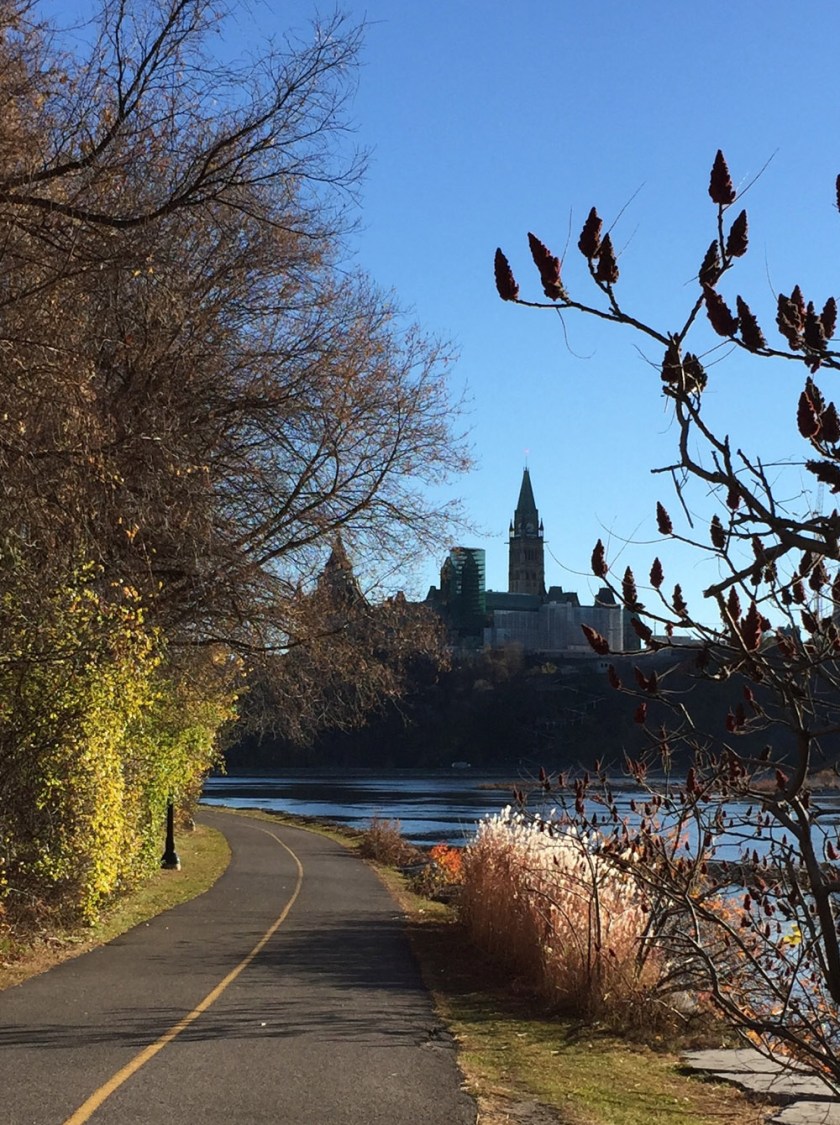
Head back up and over the Portage Bridge, then east along the Voyageurs Pathway that hugs the shore of the Ottawa River. One of the finest views of Parliament Hill can be seen from this section of path. The Memorial Chamber is located inside the Peace Tower. it contains the Books of Remembrance, recording every Canadian killed in service from Canada’s first overseas campaign, the Nile Expedition, to the present.
View of Parliament Hill from the Voyageurs Pathway
The tour heads back over the Ottawa River over the Alexandra Bridge. The Peacekeeping Monument, dedicated to Canadians who have served as peacekeepers around the world, is located on a traffic island along Sussex Drive between the national Gallery and the American Embassy.
Peacekeeping Monument
The next section of the tour continues north along Sussex Drive which has a bike lane. The Defence of Hong Kong Memorial is located at the corner of Sussex and King Edward Avenue. This Memorial is dedicated to those Canadian Soldiers who served in the defence of Hong Kong during the Second World War.
Defence of Hong Kong Memorial
Cross Sussex and follow the path overlooking the Rideau Falls. There are two memorials on Green Island located between the two sets of falls: The Commonwealth Air Forces Ottawa Memorial, and the Mackenzie-Papineau Battalion Memorial dedicated to Canadian volunteers of the Mackenzie–Papineau Battalion during the Spanish Civil War.
The Commonwealth Air Forces Ottawa MemorialMackenzie-Papineau Battalion Memorial
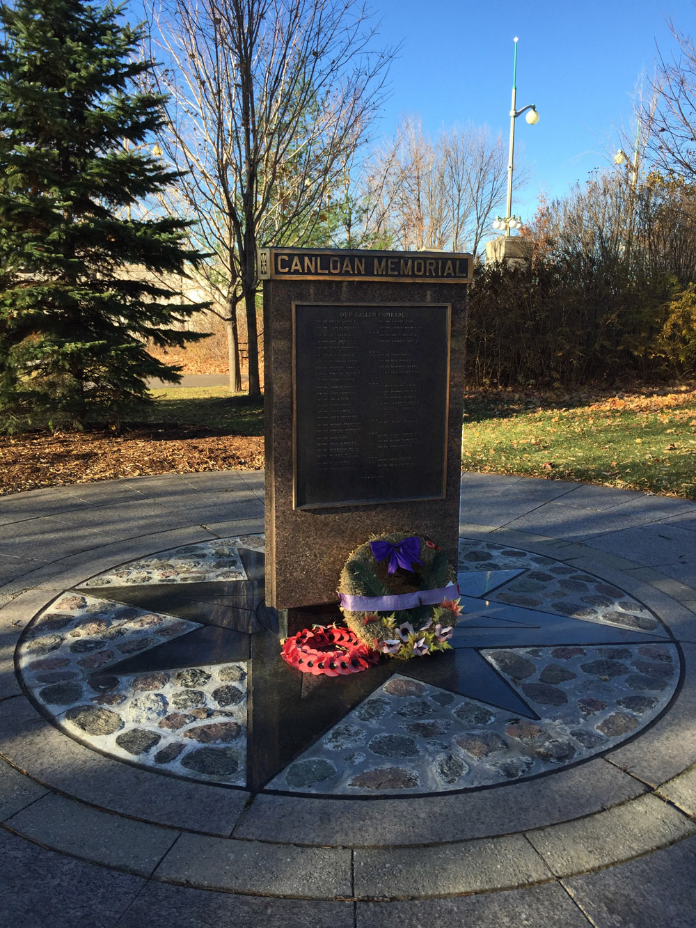
The tour continues along the path overlooking the second set of falls, then back across Sussex. On the opposite side of Sussex is the CANLOAN Monument, dedicated to Canadian soldiers who died while volunteering with the British army during the Second World War.
Canloan Monument
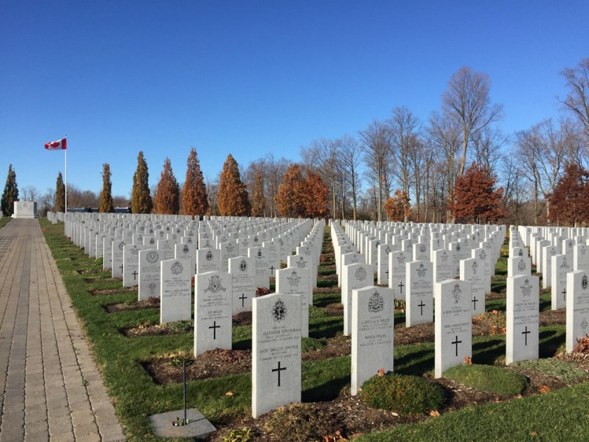
Head east along Stanley Avenue and the Rideau River Eastern Pathway. Then weave your way north along Barrette St to avoid the busy section of Beechwood, then get back on to Beechwood where the bike lane starts at Marier avenue. A bit further along one arrives at the entrance to Beechwood Cemetery. The National Military Cemetery is located within the grounds, as indicated on the above map.
National Military Cemetery
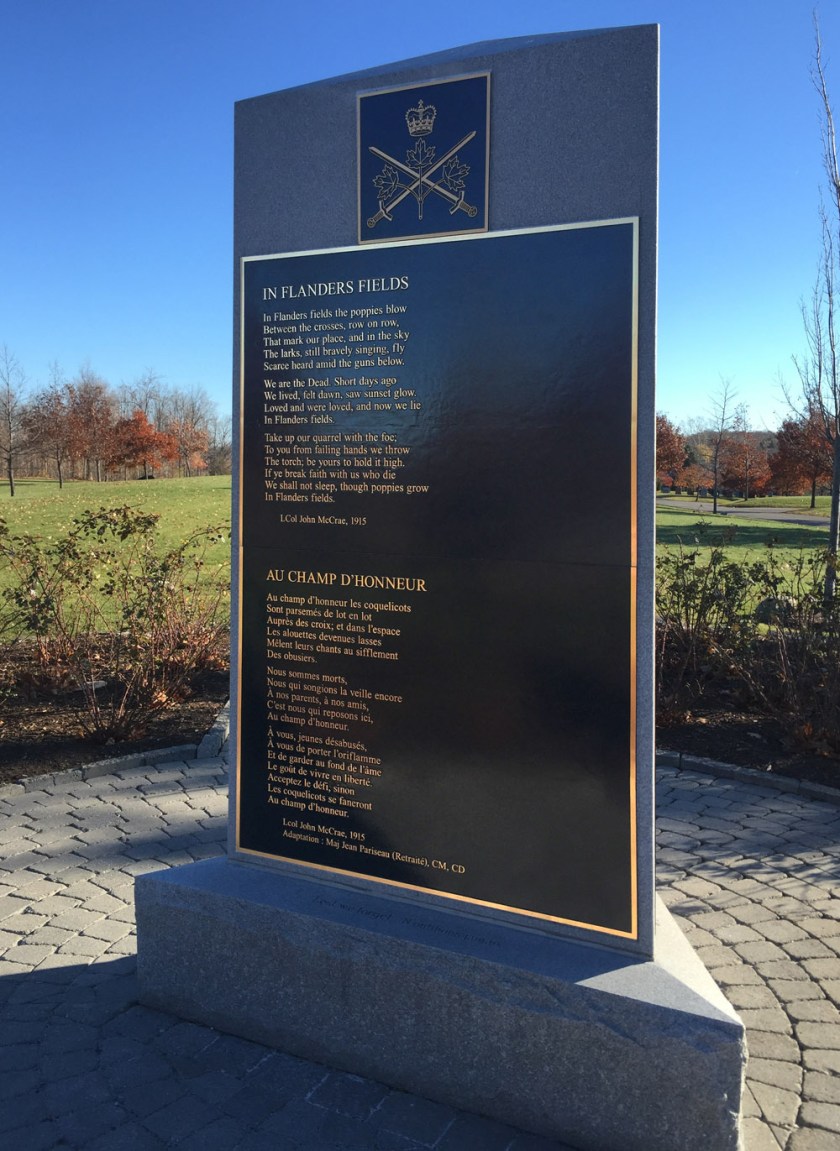
the poem In Flanders Fields is cast onto a bronze plaque and mounted on a simple elegant plinth.
It is from this poem that the red poppy was drawn to become the symbol of Remembrance Day.
In Flanders fields the poppies blow
Between the crosses, row on row,
That mark our place; and in the sky
The larks, still bravely singing, fly
Scarce heard amid the guns below.
We are the Dead. Short days ago
We lived, felt dawn, saw sunset glow,
Loved and were loved, and now we lie
In Flanders fields.
Take up our quarrel with the foe:
To you from failing hands we throw
The torch; be yours to hold it high.
If ye break faith with us who die
We shall not sleep, though poppies grow
In Flanders fields.
Nanny Goat Hill is a rise of rock that cuts through a section of Centretown, separating Chinatown from Lebretton Flats. It is roughly defined by the yellow line on the map below and extends from Bronson Ave to Somerset St. A longstanding challenge for many cyclists heading north or west has been how to negotiate a safe way down this mini-precipice.
.
One of the few options that avoids having to dismount your bike is to take the steep hill down Bronson, identified by the red line on the above map. But Bronson is filled with speeding traffic at all times of the day flying blindly over the crest of the hill, except at rush hour when it tends to look like this:
Traffic jam on Nanny Goat Hill along Bronson
The recently opened path link that cuts below Nanny Goat Hill Community Garden connecting the Laurier Bike Lanes to the Albert Street Bike Lanes, as per the purple line on the map, has done wonders to facilitate avoiding Bronson. It is also the safest option of all for those pulling a trailer. Here is a clip starting from the intersection of Laurier and Bronson down to the Albert Street Bike Lanes.
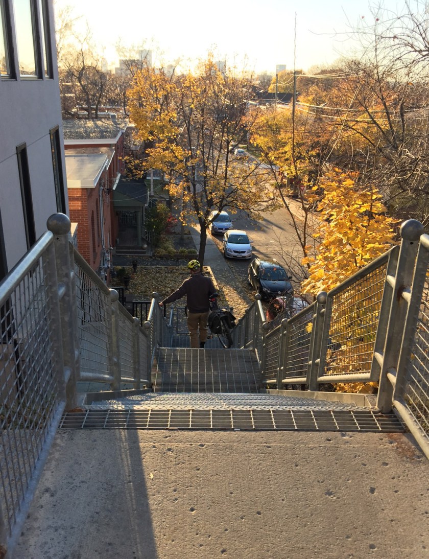
Another north-south option is to take the set of stairs that joins the upper and lower sections of Empress St, as shown in orange on the above map. This set of stairs has a trough along which you can push your bike.
Stairs with bike trough joining upper and lower sections of Empress St
Many cyclists ride east-west down Somerset, as per the light blue line on the map, however I’ve seen a number of cyclists get hit by drivers along this stretch. I’ve also seen a cyclist get doored by a someone getting out of their parked car, as well as many other close calls along Somerset. It’s a popular commute route where aggressive drivers have been known to threaten cyclists who dare to take the lane. Suffice to say it is not one I would recommend. UPDATE Augutst 2018 – For example, this cyclist getting hit by a driver, Somerset & Bronson.
My preferred east-west option is to carry one’s bike down the stairs that join the two sections of Primrose – see dark blue line on the map. While much safer than riding down Somerset, this set of stairs unfortunately doesn’t have a trough which makes it difficult for those with heavier bikes, loaded panniers or little kids in tow.
Stairs joining upper and lower sections of Primrose
Et voila – a few options to get down or around this challenging geographical feature.
Stromatolites are eerily stunning fossils dating back to the emergence of life on earth. The Ottawa-Gatineau Geoheritage Project describes them as ‘biosedimentary structures built up during sedimentation by cyanobacteria and blue-green algae’. The following is a bike tour of a few examples of Stromatolites visible on both sides of the Ottawa River.
.
Choosing the Portage Bridge as our starting point, we crossed over the Ottawa River to Gatineau and rode upstream along the Voyageurs Pathway.
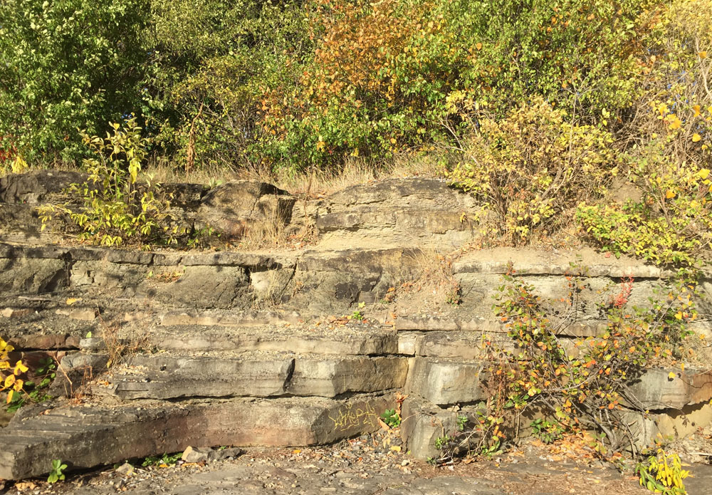
Our first stop is located just off the pathway immediately west of the Champlain Bridge. These stromatolites are visible when water levels are low in the summer and fall. It’s the most impressive display of these fossils in the region.
Stromatolites along the edge of the Ottawa River just west of the Champlain Bridge
Another example of a few local Stromatolites visible in cross section can be found on the Ottawa side of the river at the eastern tip of Westboro Beach. To get there we followed the bike lanes over the Champlain Bridge back to Ottawa, then continued upstream along the Ottawa River Pathway to Westboro Beach. There are bike racks in front of the beach pavilions if one prefers avoiding having to push their bike through the sand.
Section of Stromatolites at Westboro Beach
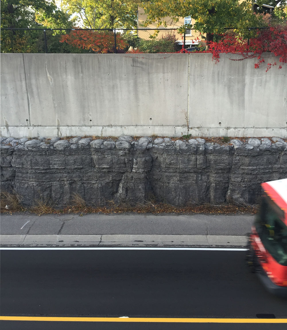
Our final stop is located along the bus transitway near Roosevelt Avenue. To get there we took the tunnel under the SJAM parkway at Westboro Beach, then followed Kirchoffer Avenue to the pedestrian bridge over the OC Transpo transitway. From the opposite side of the pedestrian bridge one can see a layered section of Stromatolites exposed at the top of the stone channel that was cut to create the transitway.
Section of Stromatolites at top of stone channel
To get back to our starting point we retraced our treads along Kirchoffer to Westboro Beach, then rode back along the Ottawa River Pathway to the Portage Bridge – a rock & roll tour almost entirely along pathways!
More on Stromatolites can be found by clicking here or on any of the Geoheritage Project links hi-lited in the above post.
UPDATE – September 2019: Here’s a recent CBC post about the Stromatolites on the Quebec side that includes a great interview between Giacomo Panico of the show In Time and Out and Allan Donaldson, a retired professor in the earth sciences department at Carleton University.