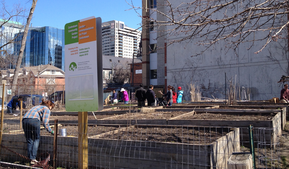
The annual Spring clean up of the Centretown Community Garden Project took place this morning so I rode over to lend a hand. Lot’s of fantastic folks all getting together to clean up the site and yack about what to plant this year.
I then biked over to Théâtre de l’Île with my talented assistant Mika to get some set work finished up. Short jaunts but energizing none-the-less on day 27 of 30 Days of Biking.
The Centretown Community Garden is located at the corner of Lisgar and Lyon St N. To get there I followed the same route as described on Day 1 (seems so long ago) as far as Lyon St. Then it was half a block on Lyon to the garden.
Spring clean up at the Centretown Community Garden
It was a fine day for a ride to the theatre. The sky above the Chaudière dam was impressive when we biked over the Portage Bridge.
I needed to pick something up at the Museum of Science and Technology so I rode there, on Day 26 of 30 Days of Biking. Blue line on the map shows route I followed there. Red line is the one I took to get home.
One thing I like about riding at this time of year is the opportunity to notice details within the landscape less visible once the trees have sprouted leaves. Such as this pavilion, attached to the back of the slowly disappearing Sir John Carling Building presently being torn down. I hope it avoids the wrecking ball. You can take this narrow path up to take a closer look.
Up the path…….. to see the pavilion
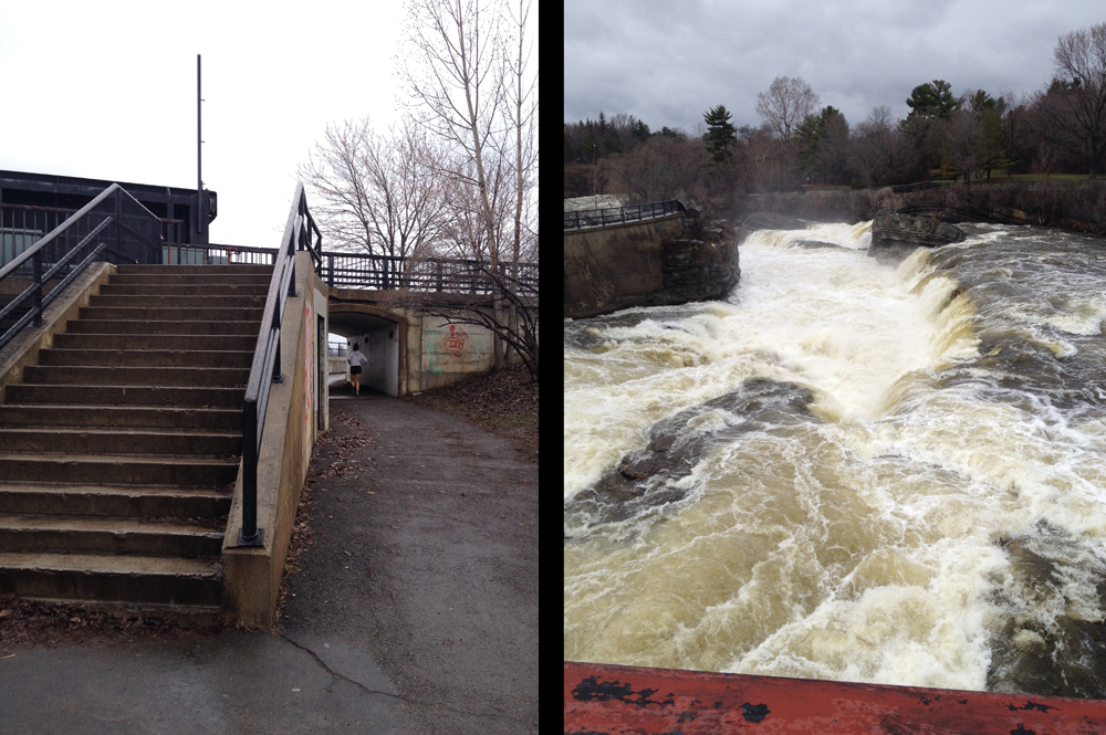
I then biked through the Arboretum, crossed the locks across from Carleton U, and rode up the bike path towards Mooneys Bay.
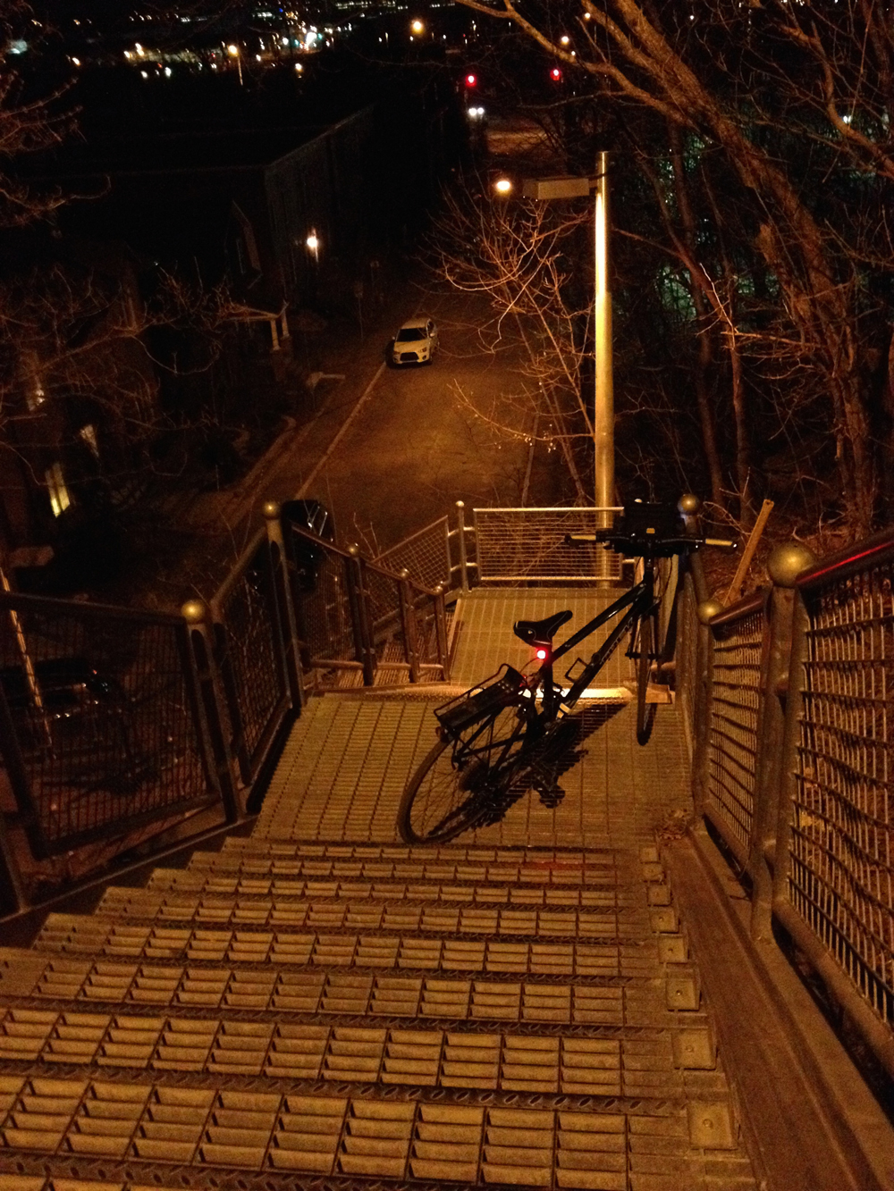
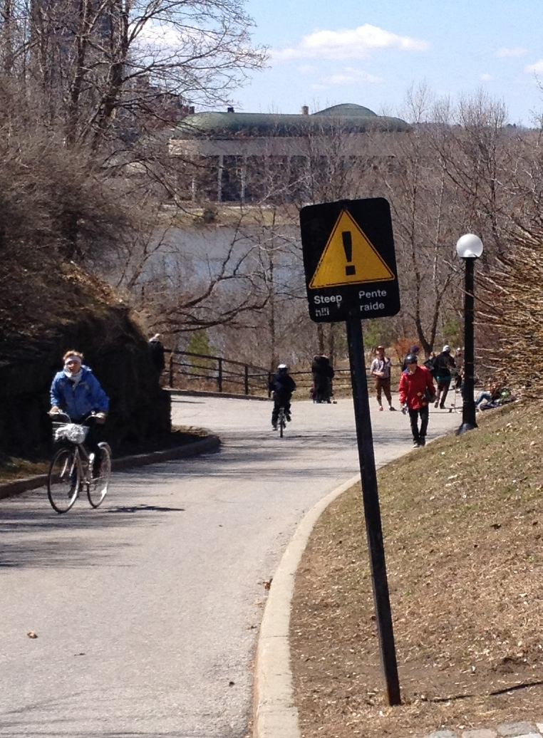
The path gets a little convoluted at Mooneys Bay. You can ride over the falls along the path on the west side of the street, but you won’t see the falls, which are pretty spectacular at this time of year. or you can cross back under the road and ride over the falls the east side, as I did and indicated on the above map, where you will catch great views of the falls. It means carrying your bike up a few steps.
Stairs to climb….. to view the falls
I rode down along the Rideau River Eastern Pathway (no more flooding) then turned up Pleasant Park Road, which around Pleasant Park Woods, isn’t so pleasant. This huge swath of trees has been cut down because of the Emerald Ash borer bug.
Sad Pleasant Park Woods
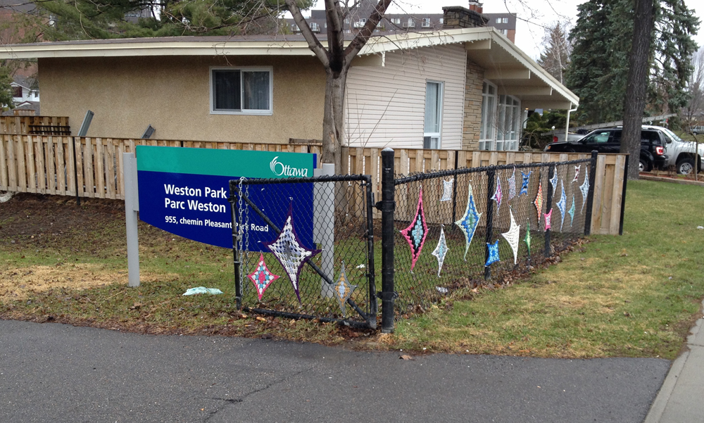
I took a short cut through Weston Park to Weston Drive. It’s the one with the colourful works of crochet stretched on the chain link fence.
South entrance to Weston Park
Weston Street is on the other side of Weston Park, which I followed to Othello St. I rode north along Othello then cut through the Elmvale Acres Shopping mall parking lot to the intersect at Smyth Road and St Laurent Boulevard.
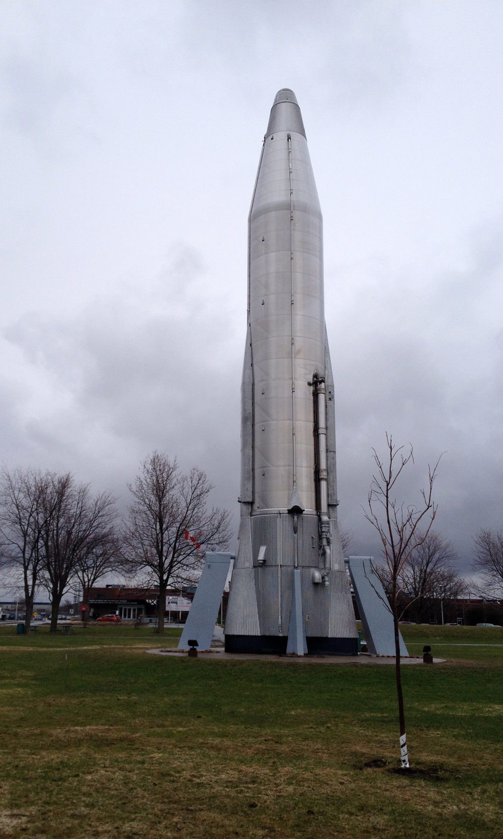
I then rode through the huge park in front of the museum, which brought me up close to a giant old locomotive and the big silver rocket.
Hello rocket!
Bike parking is located just to the north of the main entrance.
Bike rack near museum entrance. Not that white dome
On my way home I turned off Pleasant Park road onto the bike path that goes past the allotment gardens and followed the same route described in this post.
Day 25 was so crazy busy that I didn’t have a chance to hop on my bike, so to meet my 30 Days of Biking pledge I decided to go for a late night ride down to Nepean Point behind the National Gallery. It was great. I rode along the Ontario side of the river and back along the Quebec side. Here’s how.
To get down to the Ottawa River Pathway from Chinatown I took the stairs at the end of Empress Avenue. Good lighting and bike ramp.
Empress Ave stairs down Nanny Goat Hill
On a late night ride through La Capitale Nationale one is reminded of how well we light our national edifices. Take, for example, the always impressive Library and Archives Canada, as seen from the Ottawa River Pathway.
National Archives at night
And of course there’s always fabulously lit Chateau Laurier, as seen from the Rideau Canal locks.
Chateau at night
Maman, the spider sculpture by Louise Bourgeous, sits infront of The National Gallery, across the street from the elegantly lit Notre Dame Cathedral.
Maman et Notre Dame
Off the path up to Nepean Point sits this Majestic sculpture, composed of lamp posts blown over by Hurricane Catrina in New Orleans.
Majestic at night
Looking across the river from Nepean point you can see and hear the sound of the car wheels humming over the Alexandra Bridge’s metal surface. Aleaxandra Bridge from Nepean Point
It’s a fantastic place to watch summer storms roll in along the Ottawa River, or to watch the Equinox sunrise.
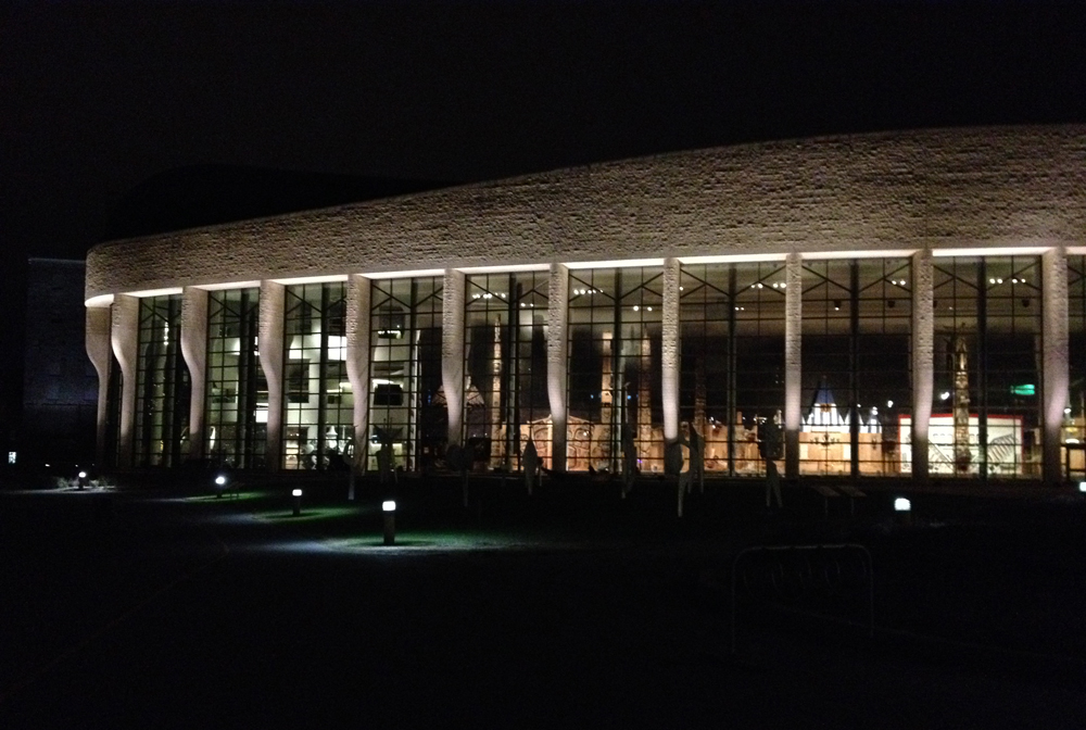
I crossed the river along the bike path and zig zagged down to the Voyageurs Pathway behind the Canadian Museum of History. It’s a great time of day to view the large impressive sculptures within the Grand Hall. Many of these works were meant to be viewed from a distance which is possible when looking through the windows from outside into the space at night.
View into the Grand Hall
I rode along the Voyageurs pathway, which was very serene, to the Portage Bridge where I crossed back into Ottawa as rider number 1044 for the day.
Today I had to bring a bunch of big painting drop cloths to Les Ateliers du Théâtre de l’Ile in Gatineau, so I stuffed them in my panniers and biked there. Now I may have driven there on this rainy day if I hadn’t taken the 30 Days of Biking pledge – a personal promise to pedal every day throughout April.
.
Good thing I did, because I would have missed an opportunity to pause and contemplate the brooding Edgar-Allen-Poe-ish beauty that hung over the region on this rainy spring day. Take, for example, the mist rising over the majestic Ottawa River, as seen from the Portage Bridge.
Mist rising over the mighty Ottawa River
Or the big old abandoned carbide mill on Victoria Island.
Carbide mill on Victoria Island
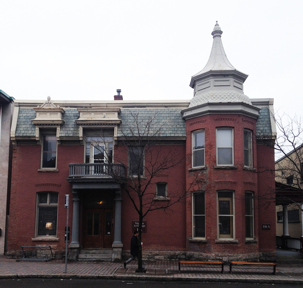
Vieux Hull has some fine examples of heritage architecture to admire while passing through.
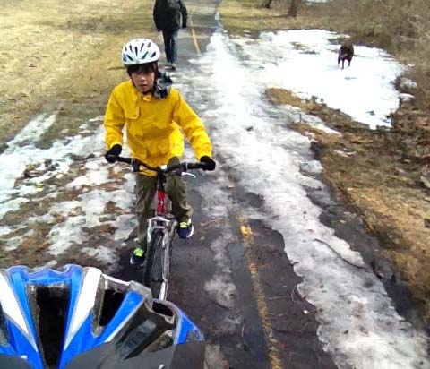
This afternoon my son and I biked downtown to do some gift shopping. Unfortunately there isn’t a safe route into the heart of the Byward Market so we parked our bikes on the outskirts of the market and walked the rest of the way. Here’s how we did so on day 19 of 30 Days of Biking.
We rode towards downtown along the Ottawa River Pathway and crossed over the locks where the Rideau Canal feeds into the Ottawa River.
Ice gathered in the canal lock.
We then climbed the steep pitch on the east side of the canal. It’s a popular descent with skateboarders and cyclists.
View from the top of the hill behind Majors Hill Park
Usually I lock my bike in front of the National Gallery but today we rode through Major’s Hill Park and locked our bikes to the fence at the entrance to the park near the U.S. embassy, bringing us closer to some of our shopping destinations.
Bikes locked to fence at the entrance to Majors Hill Park
The market is down the steps across the street from the entrance to the park.
Steps down to the Byward Market
Purchases made, we rode home the way we came. Et voila!
Hog’s Back Falls is a pretty spectacular sight at this time of year as a result of the spring melt off. The falls were created at the time of the construction of the Rideau Canal, as explained in this very interesting post. On day 18 of 30 Days of Biking, my son and I biked over to check them out, and discovered some wonderful vantage points.
To get there we followed the O-Train path as far as Young St. That’s where the path surface changes from asphalt to packed dirt. (UPDATE Spring 2019: The path is now paved all the way to Prince of Wales Drive!). We rode through the arboretum and crossed the canal locks at Carleton University. (The purple line is an alternate route should the path through the Arboretum still be snowed in).
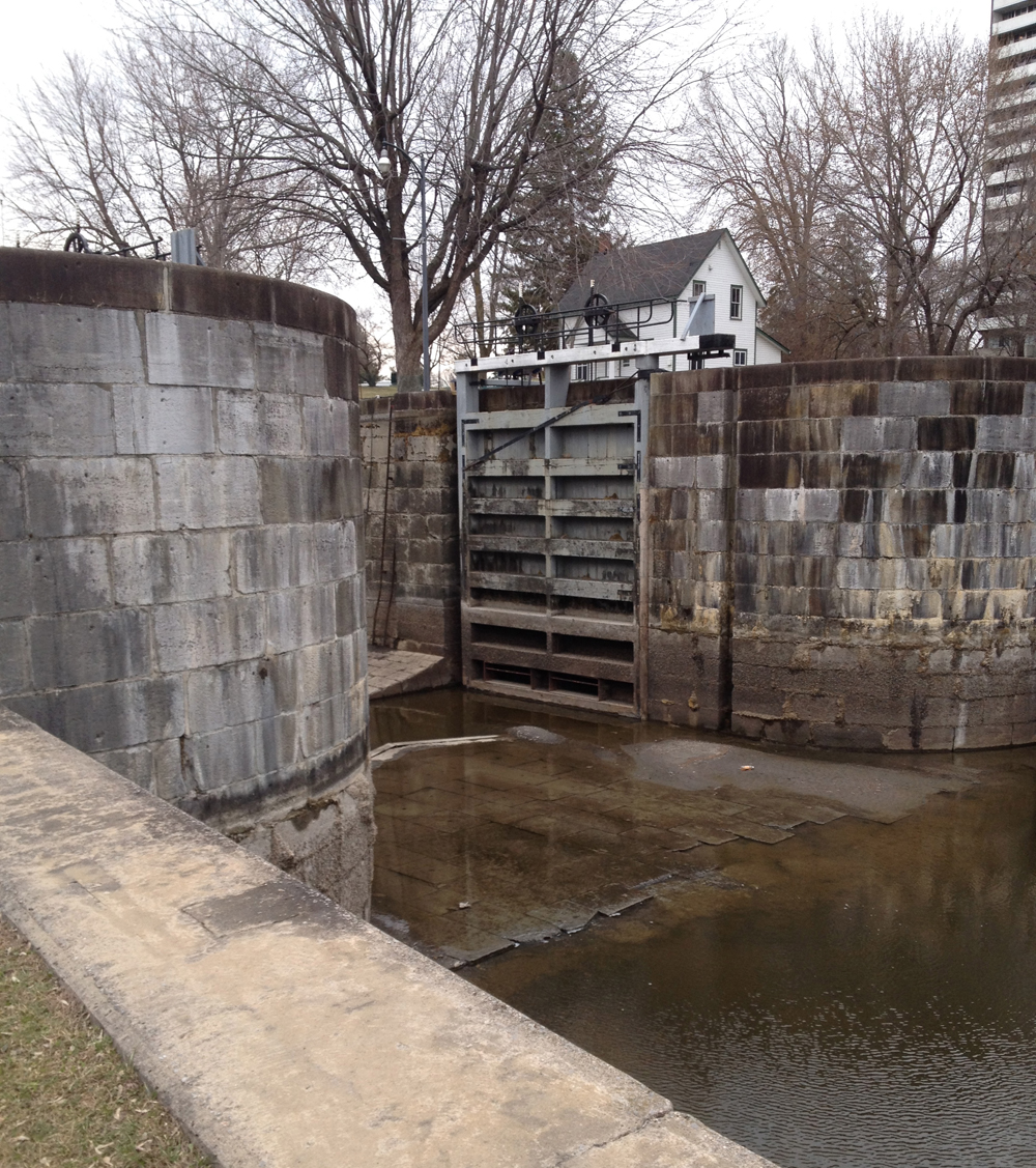
That got us on the canal pathway which we followed all the way to Mooneys Bay. The canal is still empty allowing for some great views of the locks, including this one at Mooneys Bay. The patine on the stonework is pretty fantastic. Nic says it looks like the walls of a medieval fortress!
Canal lock at Mooneys Bay
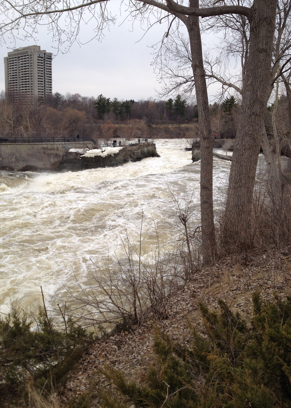
The path circles under and up onto Hogs Back Road over the falls. You can’t really see the falls from this path, but you sure can hear them. Once on the other side of the bridge the path circles under Hogs Back Road once again, which takes you into Hog’s Back Park, from where you can go right up to the edge of the falls.
View of falls from the south shore
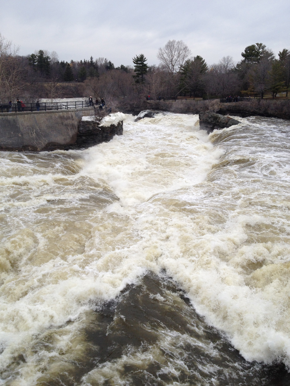
There’s a path that goes right over the falls, allowing you to stare straight down into the torrential frothing.
One point perspective of Hog’s Back Falls
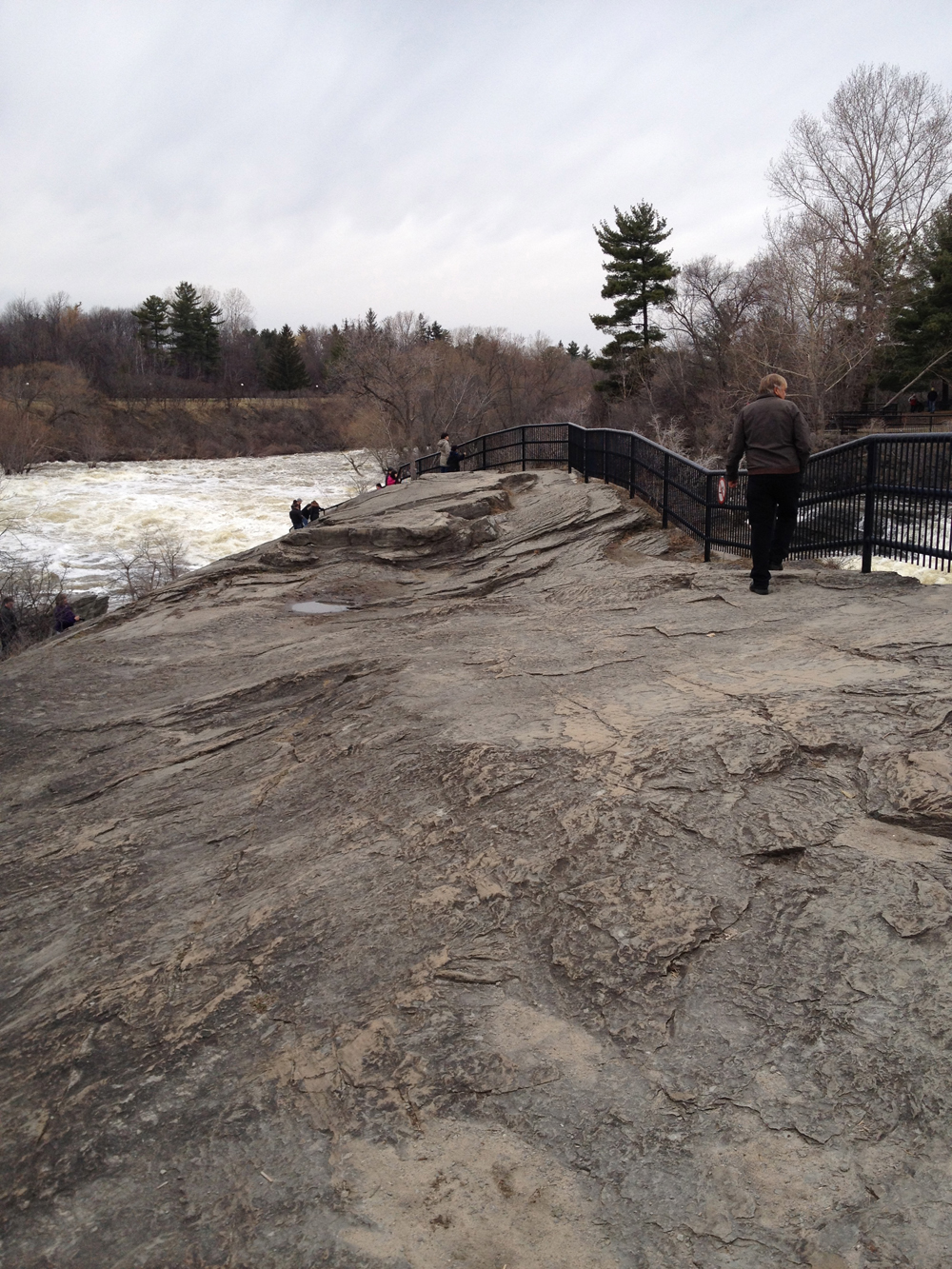
On the north shore you can follow the path down onto the exposed rock.
Exposed rock
There are a few short sets of stairs so you may wish to lock your bike on the opposite shore. We brought ours, allowing us to follow another path on the north side of the falls under Hogs Back Road. This path joins the one that continues along the canal.
Path under Hogs Back Road on the north side of the river
I know this way-finding description around the falls is confusing, so zoom in on the above map to the area around the falls and it will make more sense.
I highly recommend riding over and checking out the fury of the falls before the snow melt excitement subsides.
I had a bunch of errands to take care of at the corner of Richmond and McRae in Westboro, all do-able by bike. First, a visit to Bushtakah situated on the north/east corner, where good service and reasonable prices on bike stuff can be found. I had to exchange some tire levers. On the south/west corner I stopped in to the Canadian Superstore for groceries, and on the south/west corner there’s an LCBO where I purchased a nice bottle of wine to go with supper. So, lot’s of good excuses to bike over to this active intersection, for the 16th instalment of 30 Days of Biking !
The route I followed there and back corresponds to the one described in more detail in this post, EXCEPT for one adjustment. Sometime in the history of Ottawa’s planning it was decided that all roads crossing Wellington between Huron and Island park Drive should be off set. On my original route I suggest crossing at the traffic light at Caroline and Wellington, which is still quite practical, but requires that you walk your bike 100 yards or so east to get to the light. On this post I suggest crossing Wellington at the lights located at Western Ave and cutting through the parking lot of the garage to get to Mayfair Ave on the opposite side of Wellington.
view across Wellington from lights at Western Ave to Mayfair Ave
At the end of Western you can get dip down a short incline to get on the bike path that runs along Byron.
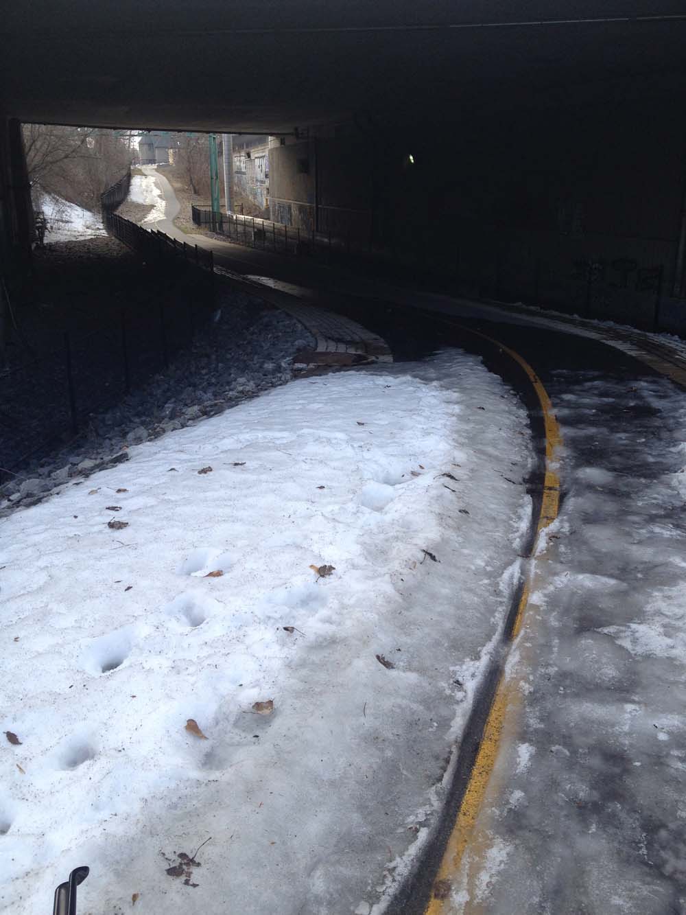
With my panniers all loaded up I followed the same route originally posted on the way back. With all the talk about spring flooding I was apprehensive about riding along the river, but was pleasantly surprised that the water has not covered the path as it did last year. The ice breakup on the river is quite beautiful.
My son is a trooper. After yesterday’s 10 km loop around town I was worried it would take quite an effort to convince him to join me on a ride over to Hog’s Back Falls. Not only was he keen, he suggested we ride even further out towards Britannia Bay to a favorite store of his called Games Workshop. It recently relocated to a mini-mall beside the Coliseum Cinemas. So, for day 13 of 30 Days of Biking we saddled up and headed off!
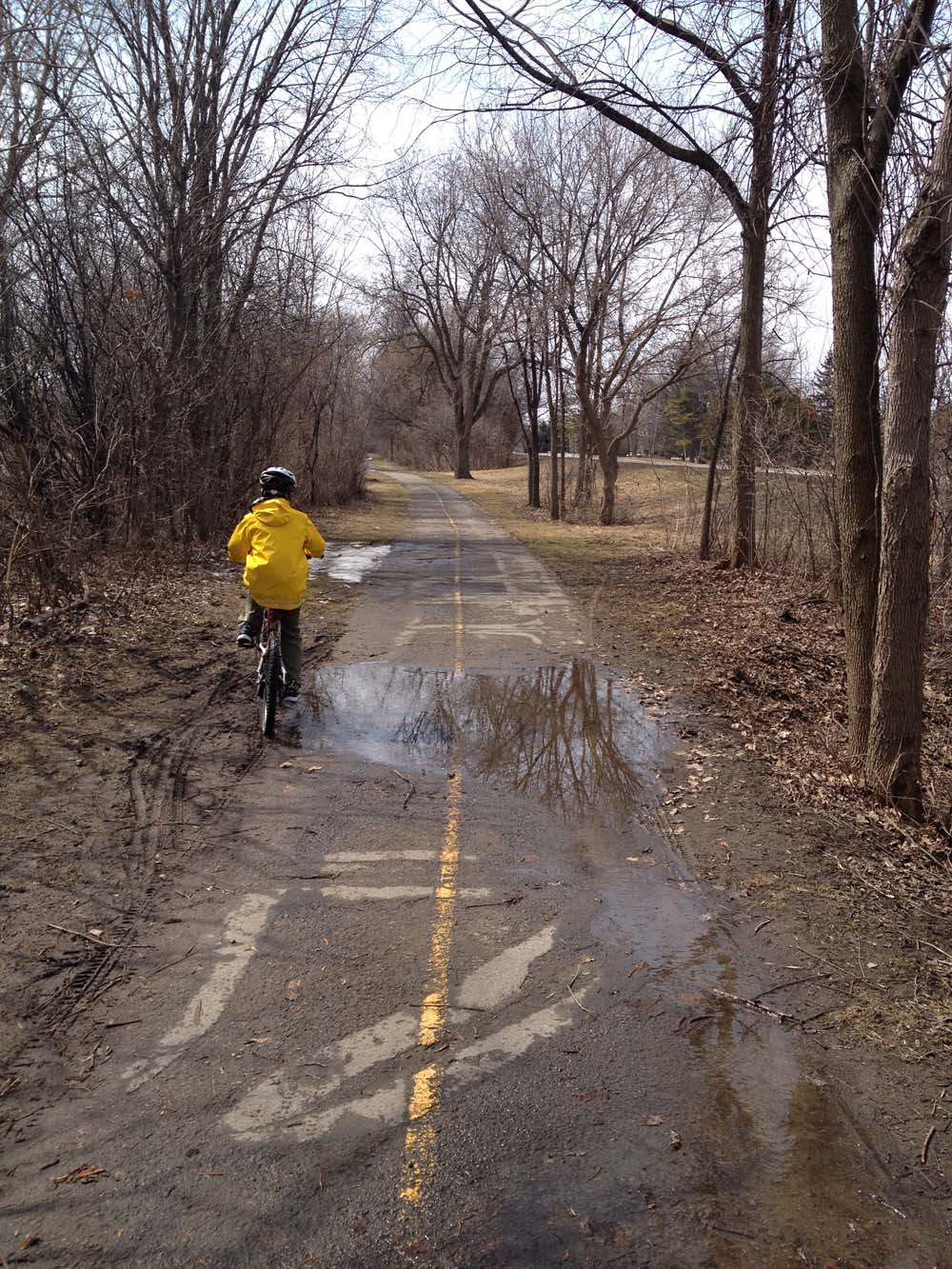
Usually we would have ridden west along the Ottawa River Pathway starting at the Portage Bridge, but with rumours of river banks flooding, and memories of how much the path was inundated last Spring I decided to cut through Hintonburg to the bike lane along Scott. Traffic is usually less frantic on the weekend, and I didn’t want to push my luck on the distance my son could ride as it’s a more direct route than riding along the Ottawa River pathway. At the western end of Scott we followed the path along the transit-way that joins the path along the south side of the parkway. This section of bike path was fine, apart for just a few muddy puddles like so.
Puddle pedalling
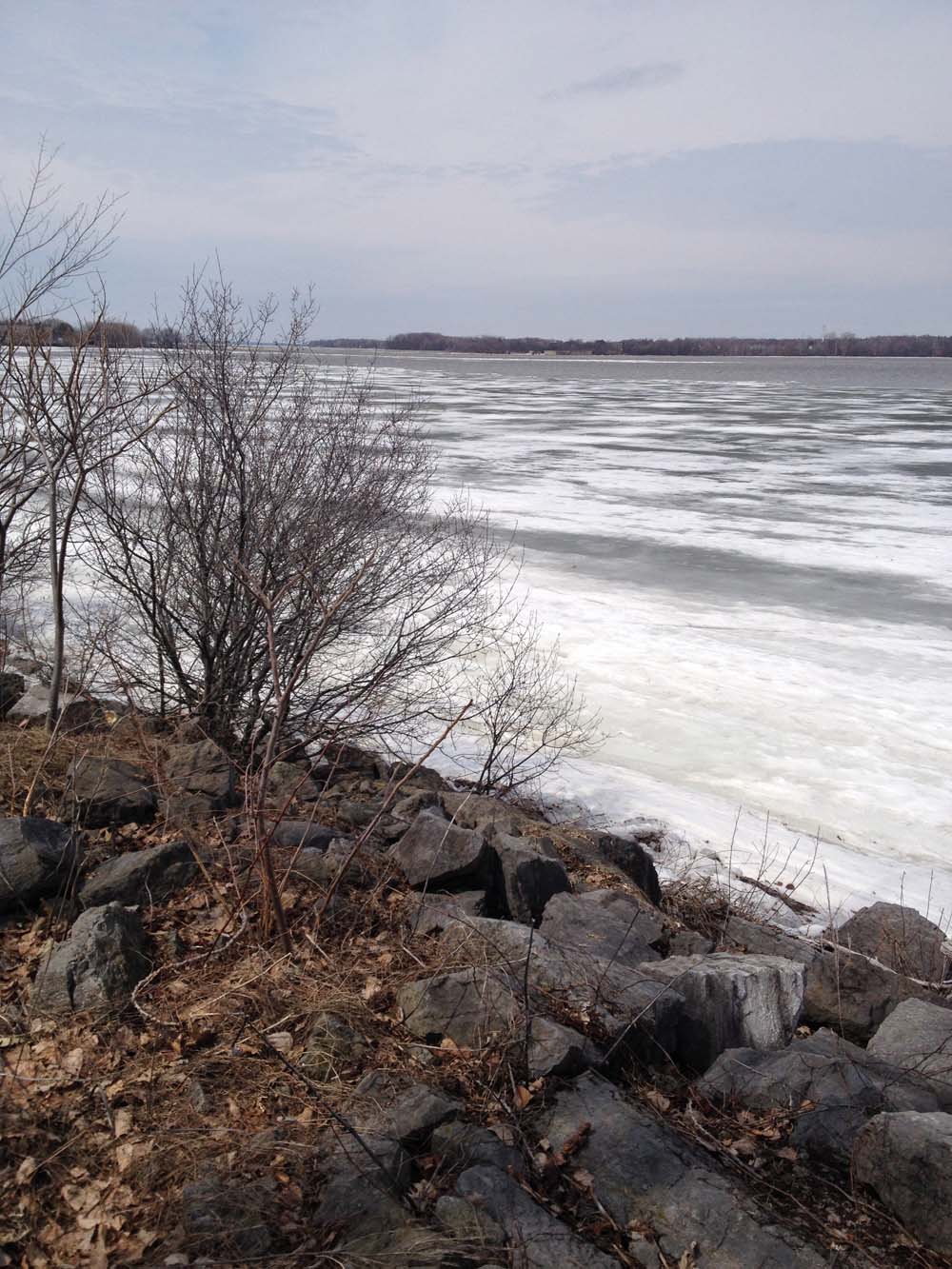
I did notice some cyclists riding along the path on the north side of the driveway, so when we arrived at the intersection west of Woodroffe I made the executive decision to take the parkway underpass and continue along the north side. It was great. The views of the melting ice on the river are quite spectacular.
Ottawa River in Spring
There was only one slushy patch around Mud Lake, but otherwise the path was very rideable.
Just a bit of slush
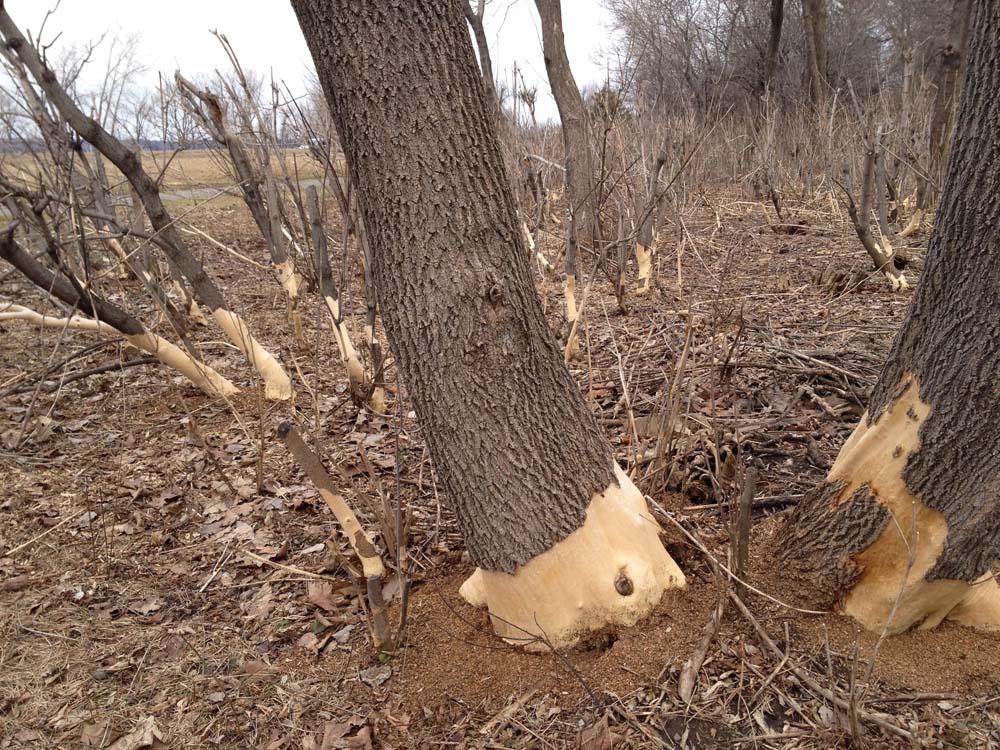
We accessed Carling from Burland St, which was a bit of a mistake. We should have done so one block west at Kempster where there is a traffic light. On the ride home I was reminded of how windy it can get along the river, particularly in the spring when there are no leaves to dampen the wind. It was really strong, but still the boy braved on. On the way back we also noticed patches of trees with the bottom portions of the bark freshly chewed off. Hope they survive.
Chomped tree trunks
So, all in all, a fine outing indeed. I am very proud of my lad.
For day 10 of 30 Days of Biking Carla and I rode to the Canadian Museum of History in Gatineau. On the way back I scoped out the snowiness of the Voyageurs Pathway between the museum and the Portage Bridge along the Ottawa River.
To get to the museum we rode over Portage Bridge and along Rue Laurier on the north side of the museum (blue line on the above map).
On the way back I got on the Voyageurs Path along the river (red line), which is cleared….
Oooh goodie – no snow!
… until just west of the museum, where you will encounter this pile of mush, then patches of slushy ice beyond.
BUT, I predict, it will be all gone by the weekend. UPDATE – Spring 2018: This section of the Voyageurs Pathway is closed until at least the Fall of 2018 as the NCC has not finished repairing the damages caused by last Spring’s flooding.
Pile of mush….. and icy patch.
I took a peek under the Portage Bridge on the Quebec side and am pleased to confirm that it is good to go, apart from this little bit of slush, but it’s manageable and minutes away from disappearing.
Path under Portage on Quebec side
No such luck for the path under the bridge on the Ontario side. It’s still mucky and filled with broken glass under the bridge.
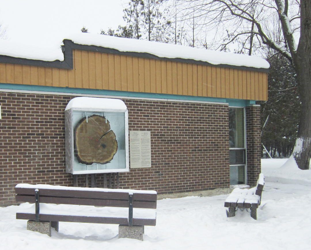
The neighbourhood of Champlain Park, located just west of Tunney’s Pasture, is home to some of the oldest forest born trees in Ottawa, including a number of magnificent bur oaks that are more than 200 years old. A recently installed interpretive exhibit on the exterior wall of the Champlain Park field house, titled ‘Trees as Witness to History’, displays a section of one Champlain Oak that grew along Northwestern Ave up until 2011. I highly recommend riding by and checking it out.
Here’s a winter ride to get there from Chinatown. Once beyond the Somerset bridge over the O-train tracks, the route weaves it’s way along quiet residential streets.
Trees as Witness to History display
Clicking on this link takes you to a map showing the location of surviving trees from the bur oak forest in and around Champlain Park.