Biking to Hockey One, or Figure 8, From Centretown for Skate Sharpening

One of the finest places in the city to get your skates sharpened is at Figure 8, or Hockey One, on Industrial Avenue. They do a great job and keep track of how you like them done. Hockey season has started up for hundreds of kids around town and my sons skates needed sharpening. Blue line on the map is the bike route I took to get there from Centretown. Purple lines an alterations I took on my way back.

.
I rode along the Laurier Bike Lane which extends east of Elgin in front of the Provincial court house and City Hall.

Laurier Bike Lane extension
Laurier Bike Lane extension from Elgin St

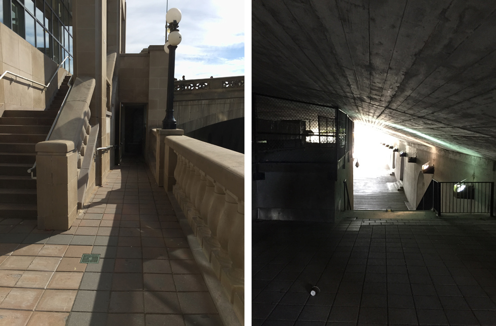
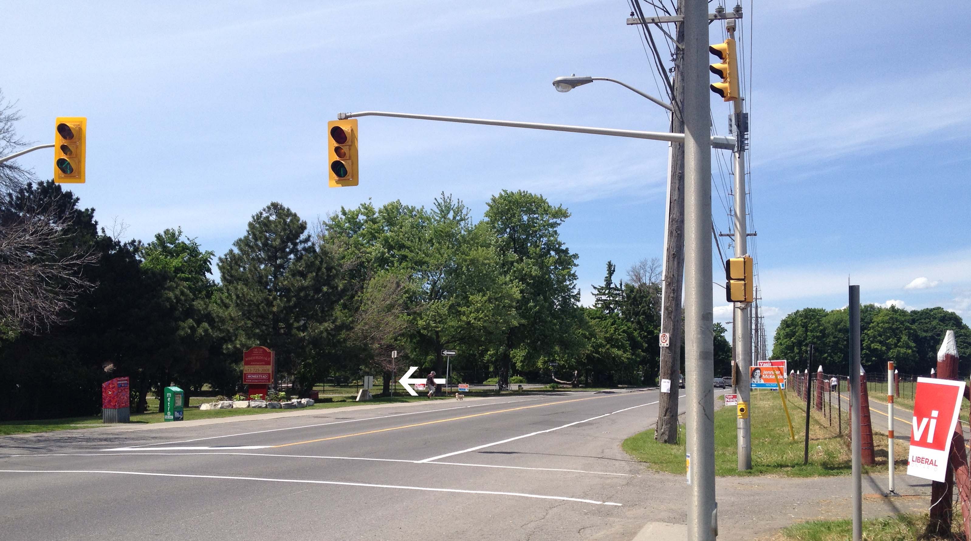
There’s a short bike lane just beyond City Hall to the right along the exit from Laurier to the Queen Elizabeth Driveway, as shown in the photo below, however there’s a sign at the opposite end suggesting the lane is for cyclists riding towards oncoming traffic. All a bit confusing, so if you do take this bike lane watch out for cyclists heading your way along with cars exiting off Laurier. A safer bet would be to cut through the plaza in front of City Hall (See green line on above map that I followed on my winter ride, crossing the Driveway at Somerset). UPDATE – Summer 2018: There is presently a bi-directional multi-use path on the right side of this exit (not shown on the photo) making this exit much safer. 

Exit to the right off Laurier towards the canal

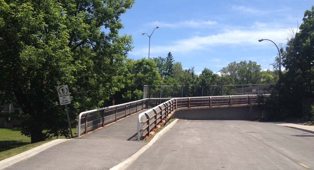
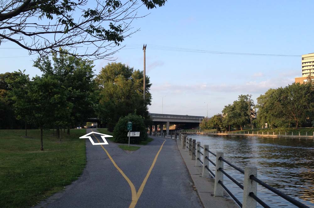
I rode along the canal, crossed over the pedestrian/bike bridge at the end of Somerset, and continued along the canal until I turned off at the exit up to Pretoria Bridge.

Turn off towards Pretoria Bridge

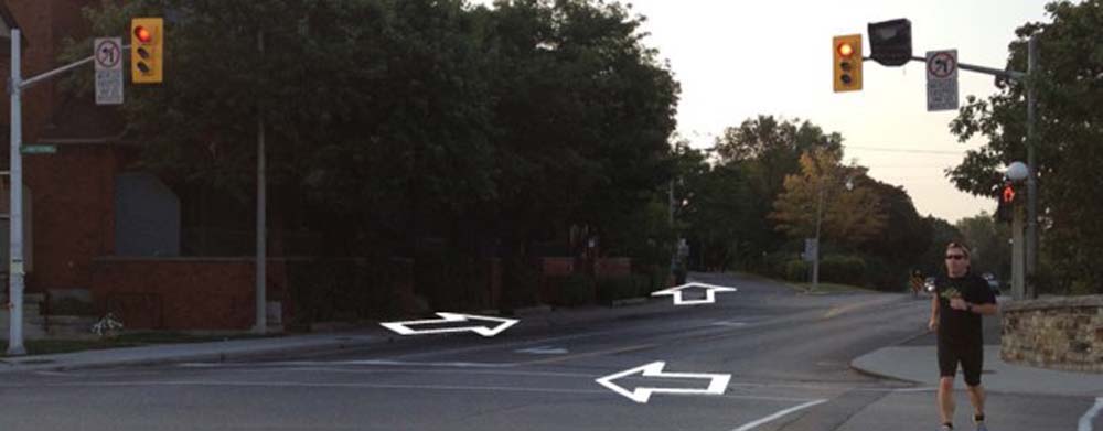
That took me to the intersection of Hawthorne Avenue and Colonel By, on the east side of the bridge. Things get a little tricky at this spot. If traffic is bad I recommend crossing to the opposite corner and walking your bike for a short distance along the sidewalk to where it veers left along Echo Drive, like so.

Making your way over to Echo Drive

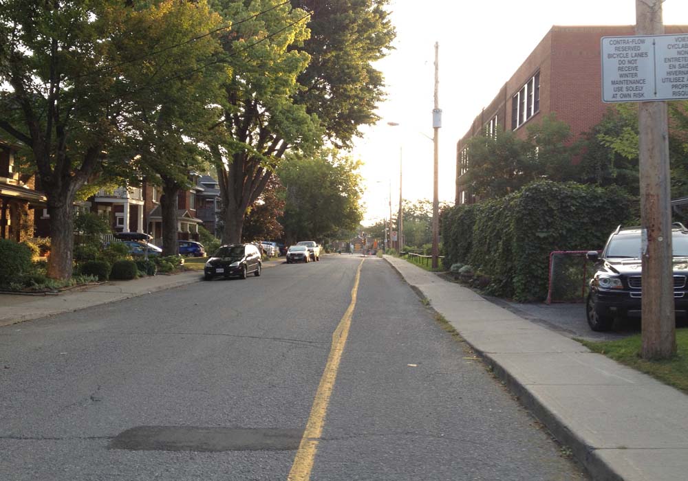
I then turned down the first street on the left which is Graham Avenue. It has a bike lane.

Graham Ave
Graham Ave

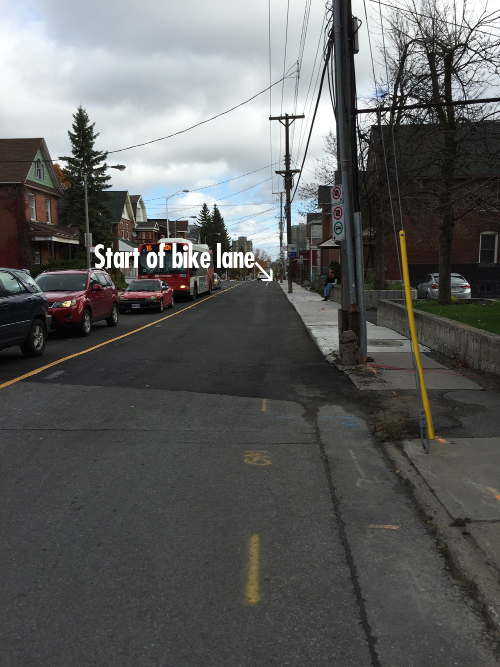
Graham ends at Main Street, and continues as Lees Avenue across the intersection. There is a bike lane along Lees heading east, but it doesn’t start for a hundred yards or so east of Main. Depending on the amount of traffic, it may be safest to walk your bike along the sidewalk to where the bike lane starts. UPDATE – Summer 2018: The east bound bike lane now starts at Main St.

Lees Avenue bike lane

The Lees bike lane abruptly ends at Chestnut Street. Drivers always speed along Lees Avenue. Without a bike lane it’s extremely dangerous. The ‘Share the Road’ sign partially obstructed by trees does nothing to alleviate this danger. I turned right onto Chestnut. UPDATE – Summer 2018: The east bound bike lane now extends to the bridge over the Queensway.

UPDATE January 8: Bike lane wasn’t cleared so I took the first opportunity to get off Lees and turned on to Rosemere Avenue.

Corner of Lees & Chestnut where the Lees bike path ends

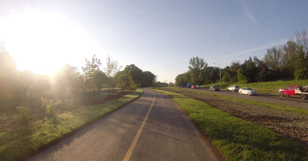
This took me to Springhurst Ave where I turned left and followed it to the path that brought me to the Rideau River Nature Trail.

Path at the end of Springhurst

UPDATE – January 8: The Rideau River Nature Trail is not cleared in the winter, but it is packed down by pedestrians. I managed to ride along the path for half the distance and pushed my bike the rest of the way. A day or more without a snowfall and it most likely would be entirely bikeable.

Rideau River Nature Trail in the winter

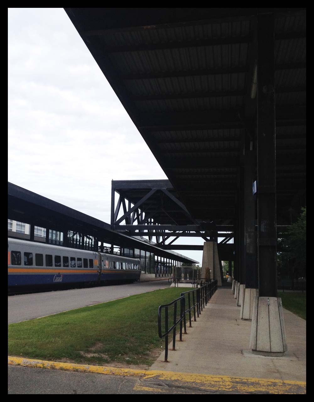
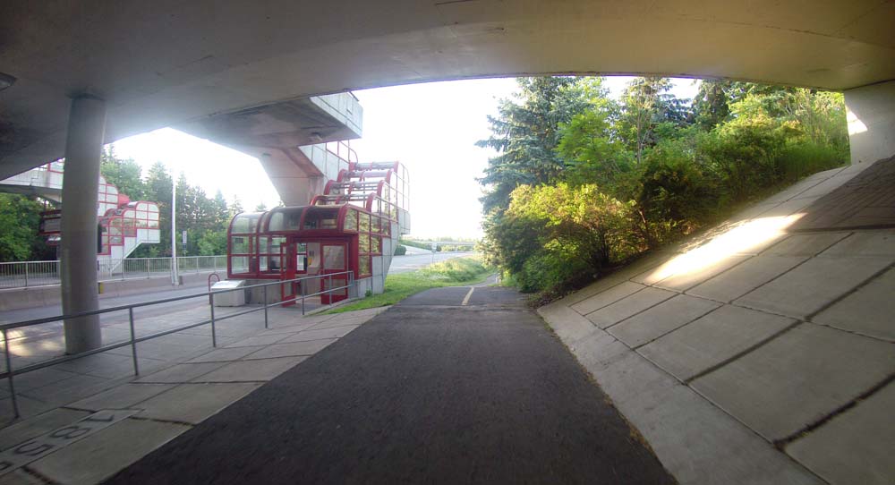
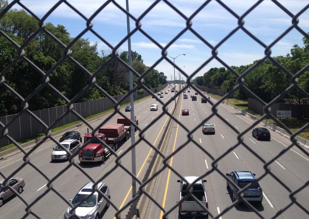
I took the path along the transitway bridge over the river, like so.

Bridge over the Rideau River

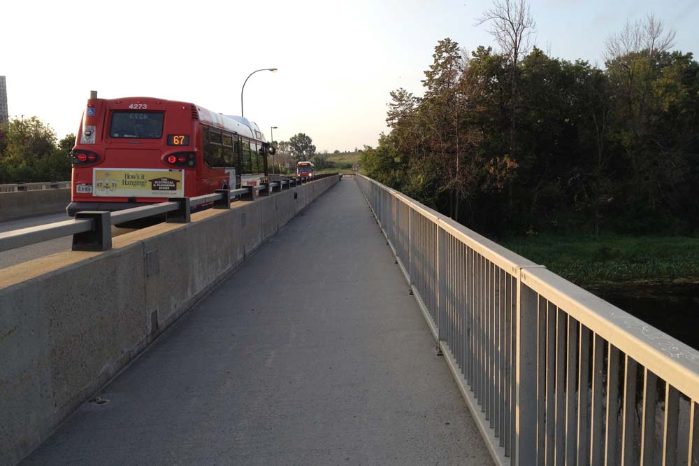
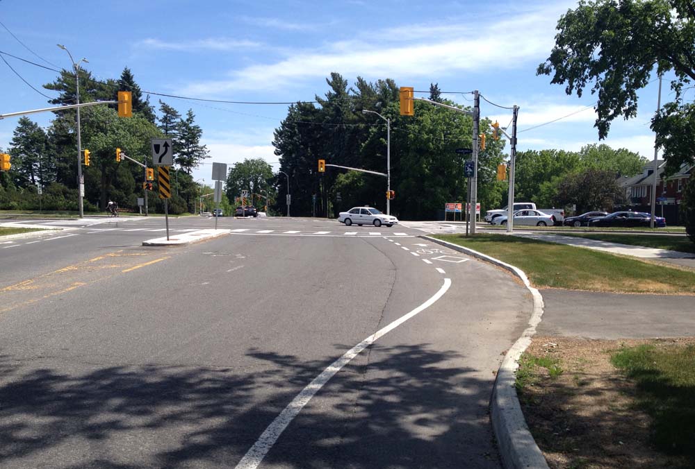
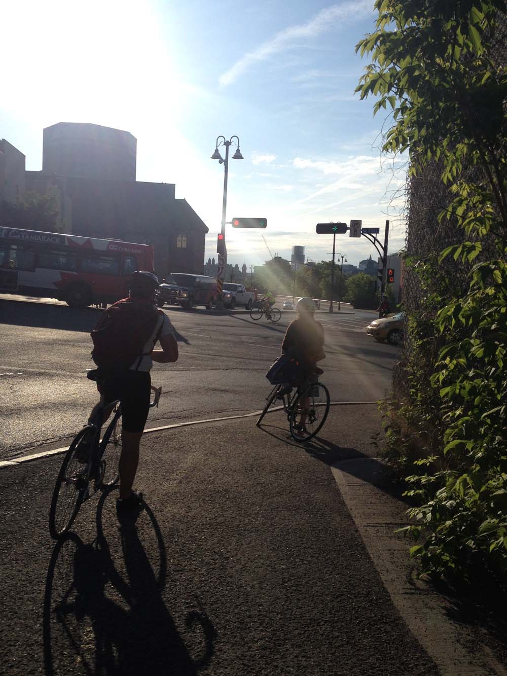
I continued past the OC Transpo hub to the intersection at Riverside Drive. I won’t deny this is a spooky major intersection, however don’t let it intimidate you. There are usually many other pedestrians and cyclists crossing at this spot and the path does continue on the other side of Riverside Drive along Industrial Avenue.

Path continues in the distance on the other side of Riverside Drive

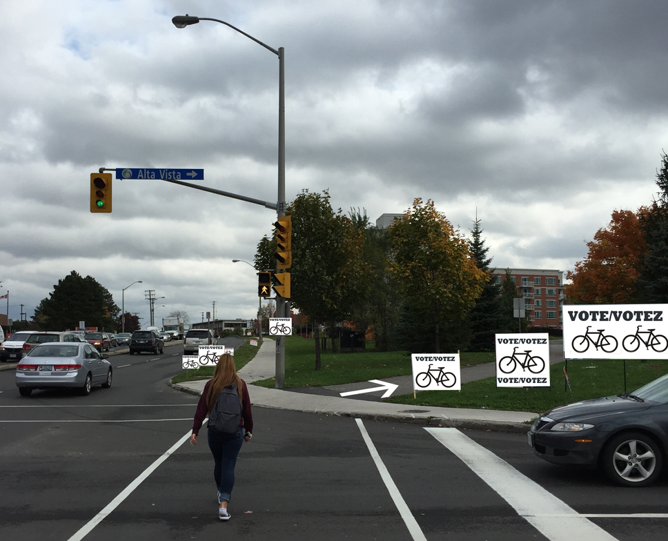
Hockey One / Figure 8 is a bit further down Industrial Avenue, however the bike path veers away diagonally at Alta Vista Drive. True to it’s name, Industrial avenue has industrial quantities of cars and trucks desperately jockeying amongst themselves for lane position, so I followed the path off to the righ at the south east corner of Alta Vista and Industrial, and circled back behind Hockey one via neighbourhood Way. This adds just a few seconds to the ride and is definitely worth the safety factor.

Bike path turn off at Industrial and Alta Vista

Et voila!

UPDATE: Fall 2015 – They have installed a bike rack just to the right of the front door under the overhang and told me they would leave it there throughout the year. A fine and encouraging initiative.

Hockey One

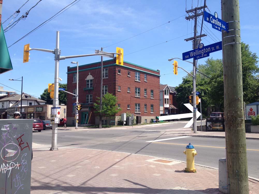
On the way back, rather than get back on to Lees, which hasn’t any bike lane heading west, I rode up Evelyn Avenue where I crossed Main. I then cut through the school parking lot to Graham Avenue.

A Second Tour of Insulbrick Covered Homes Around Ottawa & Gatineau

After posting the first OttawaVeloOutaouais tour of local Insulbrick covered homes I discovered a few more examples throughout the region, so here is a follow up tour for those of us with a soft spot for this mid-century faux-wunder-cladding.

N.b. – Insulbrick has become a popular generic term to describe the tar impregnated exterior covering first patented in 1932 as Inselbrick and includes Inselstone, Inselwood and a few other imitations. Lots more on Insulbrick to be found on links at the bottom of this post.

.

First stop – 187 Rochester, where you’ll find this interesting multicoloured extended brick pattern. Note the top portion is covered with fiberglass siding. Because Insulbrick is flat, stable, and easy to nail through, much of it has been covered up with whatever subsequent siding was fashionable. I’m guessing there is a lot of Insulbrick covered up in this manner all over the region. UPDATE March 2021 – The Insulbrick has been ripped off and the whole exterior is undergoing a big reno.

187 Rochester St
187 Rochester St

Carla and I rode south on Rochester St towards our next stop at 28 Breezehill South, which could very easily be mistaken for a brick house, but it’s Insulbrick! The clearest  indication is how the pattern does not reproduce the 2 to 1 overlapping stacked brick pattern on the corner where the walls meet. Ivy helps. Very clever.

283 Breezehill South

The next two stops are located on the Gatineau side of the river. To get there we rode along the O-Train path to the Ottawa River Pathway, then along the path over the Portage Bridge. This example is located along Rue de l’Hôtel-de-Ville at the corner of Rue Helene-Duval. The Insulbrick was applied to the side of the building only. The original brick structure pre-dates the invention of Insulbrick which, in this case, is really showing it’s age.

Rue de l'Hôtel-de-Ville
Rue de l’Hôtel-de-Ville

We wove our way eastwardly along paths and quiet roads to get to 289 Rue de Notre-Dame-de-l’Ile where we found another example of the red Inselbrick pattern. The owners are in the process of adding an addition at the back, It will be interesting to see whether they preserve the Insulbrick covering on the front, or cover it all with whatever siding they put on the back extension.

289 Rue de Notre-Dame-de-l’Ile

On our way back to Ottawa we rode along the boardwalk over the Alexandra Bridge. We then cut through Majors Hill Park where there’s a little known passageway at the end of the park that accesses the patio overlooking the canal and continues under Sappers Bridge beside the Chateau Laurier. It isn’t always open, so worst case scenario would require carrying ones bike up the stairs beside the Chateau BUT if you can access the passageway it’s worth it! It includes a couple of short flights of stairs that are equipped with bike ramps wide enough for your tires to push your bike along. My Grandmother used to describe riding the train into Ottawa along the canal and taking an elevator up to the Chateau Laurier lobby. I’m guessing this is where she would disembark.

Access to passage way under Sappers Bridge beside the Chateau Laurier

Further south at the corner of Grenfield and Havelstock sits our next stop but it may not be there for long. At the time of our visit (April 2017) there was a plywood panel describing how the lot is up for zoning review with plans to build a new condo in its place. UPDATE – 2020 It’s gone, replaced with the condo.

IMG_7190
Corner of Greenfield Avenue and Havelock Street

Next it’s over the Pretoria bridge and along quiet streets to our following stop – 28 Florence St. Love it.

28 Florence St
28 Florence St

Florence turns into a one way heading east halfway between Bank and Kent. To get to James St which is one way heading west, we cut through the service alley behind the businesses that front on to Bank Street.

Alleyway between Florence & James St

Our final destination is 642 MacLaren Street, and what a beauty it is! So well preserved, one has to take a really close look to see that it is in fact Insulbrick. As mentioned at the Breezehill stop, corners are where the truth is told. To hide how Insulbrick patterns don’t correspond to real brick at corner junctions, a corner strip is often applied, as was in this case.

IMG_7202
642 MacLaren

There are two other buildings located in Centretown that I didn’t include in this tour as it would have required some convoluted navigating to avoid biking down busy streets, however I have included photos. The first is this abandoned leaning house on Somerset between Lyon and Kent. Probably won’t be there for long as it and the lot it is sitting on is up for sale. UPDATE April 2017 – It’s been knocked down.

Leaning house of Somerset

Another example is located two blocks north on Lisgar also between Lyon and Kent St. The Insulbrick was added to the front portion of an already existing building. It is really showing it’s age, especially in contrast to the original brick still visible on the back portion of the building.

Insulbrick on Lisgar

Here are a few links to stories involving Insulbrick:

– A short history of Insulbrick (click)

– A stop along the Lincoln Highway where Insulbrick has been preserved to maintain it’s heritage feel (click)

– An example of Insulbrick being covered up with more contemporary siding. (click)

Signing off with this image of an Insulbrick home I passed on Concession Road 7 while riding to the Blue Skies Festival near Sharbot Lake.

Concession Rd 7

An Ottawa bike tour of designs by architect Francis Sullivan

A number of interesting buildings around town were designed by Francis Sullivan, an adherent/colleague/disciple of the famous American architect Frank Lloyd Wright and the Prairie School of architecture. The following bike route visits a number of Sullivan’s surviving works within Ottawa. This ride is approximately 14km long.

.
Our tour begins in Rockcliffe Park at 108 Acacia Avenue where sits this grand old house, one of Sullivan’s early designs upon his return from working with Frank Lloyd Wright in 1907. The Prairie School aesthetic is not as evident in the exterior detailing of this majestic home as they are in Sullivan’s subsequent designs.

108 Acacia Avenue
108 Acacia Avenue

Next stop – The Francis Sullivan House in Sandy Hill at 346 Somerset St E.

n 1911 Sullivan started up his own successful independent practice from which he designed this home for himself in 1914. Here the influence of the modernist Prairie School style is on full display.

Sullivan House - 346 Somerset Street E.
Sullivan House – 346 Somerset Street E.

To get to our next stop I rode up Somerset, through the Ottawa U campus, and over the pedestrian/bike bridge across the canal. I then pedaled along the Rideau Canal Western Pathway in the direction away from Parliament Hill as far as Patterson Creek, crossed Queen Elizabeth Drive and followed the creek to our next destination, the O’Connor St Bridge. Another example of his early works (1907), It’s a solid looking little bridge that has withstood the test of time.

O'Connor St Bridge
O’Connor St Bridge

A short distance up Patterson Creek at 6 Allan Place sits the following Sullivan house design.

6 Allan Place
6 Allan Place

Our next Sullivan building is located at the corner of James and Bay. To get there I rode over to Percy St which has traffic lights and a bike lane to help cyclists ride safely under the Queensway and across busy Chamberlain and Catherine Streets. I rode over to Bay St which is a one way heading north WITH a bike lane, that brought me right to the Patrick J. Powers House. It was originally built around 1887 but transformed by Sullivan in 1915 in to the beauty that it is now.

Patrick J. Powers House - 178 James Street
Patrick J. Powers House – 178 James Street

Over to Arthur St where once stood the No. 7 Fire Station which Sullivan designed in 1912. The exterior has been greatly modified since the mid-1960s when it was acquired by the Bukowinian Greek Orthodox Holy Trinity Church, as per a land and property transfer described in this Urbsite post. Only a few of Sullivan’s details remain, most notably the corners of the building. The rest have been smothered or altered.

No 7 Fire Station (drastically modified) - Arthur Street
No 7 Fire Station (drastically modified) – Arthur Street

The final two buildings are located on roads just off Wellington St, a busy street I consider to be one of Ottawa’s most dangerous stretches to ride down resulting in the constant threat of cyclists being doored or squeezed off the road by impatient drivers. The sharrows painted on the road (bike logos with two chevrons) are meaningless to most drivers and ignored. I avoided Wellington by following the route described on the above map, which includes carrying my bike down the stairs at the end of Primrose ave to the bottom of Nanny Goat cliff.

Next destination is École Sacré-Cœur at 19 Melrose Avenue in Hintonburg, which is no longer a school, but a residence, as one of the residents explained to me as I was taking the photo below.

École Sacré-Cœur - 19 Melrose Avenue
École Sacré-Cœur – 19 Melrose Avenue

Final stop – the Edward P. Connors House at 166 Huron Ave North. Some wonderful Prairie Style detailing and proportions to be seen in this example as well.

Edward P. Connors House - 166 Huron Ave N
Edward P. Connors House – 166 Huron Ave N

So there you have it. Thank you Francis Sullivan!

Biking to Blue Skies Music Festival from Ottawa – Route #2

The Blue Skies Music Festival near Clarendon, Ontario takes place on the first weekend of August, as it has every year since the early 70’s. It’s a great big gathering where folks come for a day, or camp out over the 3 day long weekend.

This year was the third time I’ve been. Last year I biked to a friend’s cottage close by on Sharbot Lake, then rode up to the site on the following Friday morning. You can read all about that adventure here. This year I did the same, however I chose a different route, identified by the blue line on the map below.

I rode back to Ottawa on the following Monday along the red line shown on the map, similar to the route my friend François rode to get there this year, which you can read about by clicking here.

.

Last year’s ride took me much longer than I had anticipated, so this year I tried to streamline my route to shorten the time spent in the saddle. To get out of Ottawa I headed straight down Wellington/Richmond/Robertson Road. Now most cyclists familiar with that stretch of road might not consider it the safest option. Few sections of it are safe most hours of the day, however there is a narrow window of opportunity early in the morning before traffic starts to build. I left the house at 5:30 am. Things went smoothly, until Richmond turned in to Robertson Road, just west of Baseline. That’s where any semblance of a paved shoulder disappears and the surprising number of cars, buses & trucks that early in the day flew by at highway speeds. I was very relieved to get on the Trans-Canada Trail west of Moodie Drive.

Calm & minimal traffic along Richmond....but narrow & speedy traffic along Robertson Rd
Calm & minimal traffic along Richmond….but narrow road & speedy traffic along Robertson Rd

The Trans-Canada Trail between Bells Corners and Carleton Place is an old railway line that has been converted to a packed stone dust path, as described in a bit more detail in the middle of this post. I’ve travelled it a few times now, so in search of a little variety, and to speed things up, I rode along Abbott Street for a short stretch through Stittsville, which runs parallel to the Trans-Canada Trail. Traffic was calm, and there was a generous shoulder for most of it’s length.

Packed stone dust Trans-Can Trail....& paved shoulder along Abbott Street through Stittsville
Packed stone dust Trans-Can Trail….& paved shoulder along Abbott Street through Stittsville

Stittsville went through a growth period in the 1870’s when the railway line connecting Ottawa to Carleton Place was introduced. There are a few surviving examples of buildings from that period near the intersection of Main and Abbott Street where the train station was located, including this fixer upper sandwiched between the Trans-Canada Trail and Abbott St.

Old house in Stittsville

The rail-to-trail section of the path ends on the edge of Carleton Place. From there I headed south-east along a path that runs parallel to McNeely Ave to where it crosses Highway 7. At the end of McNeely there is a wonderful network of short trails called the Beckwith Trail, that meanders through a varied mix of wooded area and old farmland. I followed the McGregor Branch and the Shady Branch to get to 9th Line road.

Sections of the Beckwith Trail

I then headed southwest along 9th Line, a two lane road where I encountered minimal traffic. Saw some beautiful big old brick farm houses. I also road through a thunderstorm. I passed this family of bovines just as the rain let up, staring at me as if to say, ‘What the heck are you doing way out here in this weather?!’

Befuddled bovines
Befuddled bovines

9th Line turned into Tennyson Road which I followed for a bit before turning on to Concession Road 7. It too was a nice quiet paved two laner through farm country. On the other side of the 511 it became a very smooth white stone dust road.

White stone dust surface along Concession Line 7

Road 7 morphed into McVeigh road, which I followed to where it ended at Doran Road. Now Doran Road was the trickiest stretch along this year’s ride to Blue Skies. It narrowed down to one lane with a loose stone gravel surfacing that went up and down through the woods for quite a ways.

Loose gravel along Doran Road

The road surface became smoother once it turned on to Fagan Lake Road, and then paved once more on the other side of the Elphin-Maberly Road, along Zealand Road.

I am always amazed by the cedar post fences that weave their way through this whole area. The manner in which they are stacked and arranged in a zig-zag pattern allows for great flexibility in negotiating the rough rocky terrain. Here’s an example, perched up on the edge of a stone cut along Zealand Road.

Cedar post fence
Cedar post fence

For the rest of the ride I followed Bell Line Road and the A&P trail to my friends cottage on Sharbot Lake, and then up to the festival site the following morning, as described at the tail end of last year’s post.

Et voila – ’twas another wonderful Blue Skies festival full of music galore!

Early morning mist rising on a farmers field near Clarendon

Biking over the Strandherd Bridge!

The long awaited opening of the Strandherd Bridge has happened. (Update Nov 2014 – now officially renamed the Vimy Memorial Bridge) Early Saturday morning I took the opportunity to bike over and test it out!

The route I followed to get to the bridge was the same as the one described in this post, as far as Leikin Drive. Mid way along Leikin I turned east and worked my way along paths and residential streets to get to the Chapman Mills Conservation Area which lies just north of the bridge. There’s a pedestrian boardwalk that meanders through the Conservation Area along the edge of the river, with lookouts and interpretive panels that describe the area’s natural environment.

Boardwalk through Conservation Area
Boardwalk through Chapman Mills Conservation Area

I walked my bike along the boardwalk to the southern edge of the Conservation Area where the path opens up onto this impressive side view of the bridge.

Side view
Side view

The path circles under the bridge, which affords some great views of it’s ribbed underbelly and massive footings.

Strandherd underbelly

Crossing under the bridge
It’s all under the bridge

This path leads up to the sidewalk along Strandherd Drive which runs alongside the bike lane over the bridge. I decided to video the momentous occasion, so without further ado, here is the Ottawa Velo Outaouais Peddle Powered Crossing of the new Strandherd Bridge!

Et voila!

Once on the other side of the river I cut through a residential area along paths and roads, rode along Spratt then Limebank to Leitrim Road, then along High Road beside the airport. From here on in I followed the same route described in this post.

n.b. Prince of Wales Drive is a busy street which I don’t recommend biking along at anytime other than early mornings on weekends, as described in this post. Hopefully this will be improved upon as soon as possible, because Manotick could be a great bike tourism draw if there was a safer way to get there from downtown along the west shore of the Rideau River.

Architects on Bikes Checking Out Buildings: Episode 2 – Sarah Gelbard

For the second instalment of Architects on Bikes Checking Out Buildings I asked Sarah Gelbard to recommend buildings she admires within our region, and she accepted! Sarah is a graduate of architecture at Carleton, and is heading off to McGill to do her doctorate on Urban Planning in the Fall. She’s very active within the local design community, as evident in her YOWLAB initiative. She’s also one of this year’s organizers of Architecture Week AND she loves to cycle! My architect-sister-Sue had so much fun on our first instalment of Architects on Bikes Checking Out Buildings, she jumped at the occasion to come along for the ride.

Sarah’s first choice was The Sister’s of Notre Dame campus off Heron Road, while her second choice was The Old City Hall on Sussex Drive. We met up at Art Is In Bakery in City Centre early Saturday morning and headed off. Here’s the route we followed.

We wove our way south-east along bike paths and quiet streets until we reached the Sister’s of Notre Dame campus. This series of buildings were designed by Tim Murray of Murray and Murray Associates, and completed in 1965 for the Sisters of the Congregation of Notre-Dame. The Sisters operated it as an educational facility up until the 1970’s, at which time it was purchased by Canadian Government and renamed the Federal Study Centre. We were able to meander our way through the campus and admire the various buildings.

View across campus, bell tower to the left (photo by Sarah Gelbard)
View across campus, bell tower to the left (photo by Sarah)
Pavilion K
Pavilion K
Pavilion A
Pavilion A
Sarah riding past Pavilion D
Brick screen (photo by Sarah)
Layered surfaces & brick screen (photo by Sarah)

The brick work was interesting. In contrast to smooth glazed finishes popular in the ’60’s when these buildings were constructed, these bricks were roughly poured resulting in wall surfaces of richly varied textures.

Brick wall
Brick wall

We then worked our way over to Pleasant Park Road, and biked north to the Rideau River Eastern Pathway, which we followed down river all the way to our second destination: The Old City Hall on Sussex Drive. We approached the site from the back, via the Minto Bridge. The arch to the right in the photo below was designed by Moshe Safdie and added to the site along with a number of other additions when the original building was expanded upon in 1992-93.

Minto Bridges & Old City Hall Arch
Minto Bridges & Old City Hall Arch (photo by Sarah)

To get to the front of the building on Sussex we rode along the contour of these additions on the northern perimeter of the building, also introduced by Safdie, that bulge out into the Rideau River. I love how they appear to float on the river’s surface.

North side of Old City Hall

Sarah mentioned being particularly fond of the original building,designed by John Bland of the office of Rother, Bland and Trudeau, 1955-58, as seen in this shot she took of the front facade. She also mentioned a great Urbsite Post that includes original photos of the original building designed in the International Style in 1958, which you can check out by clicking here.

Front of the original Old City Hall (photo by Sarah)

We then rode along a path on the south side of the building. There are many wonderful nooks and architectural details to be discovered throughout this site – definitely worth a visit.

South Side of Old City Hall

Architectural exploration complete, we rode back across town for well a deserved break at Raw Sugar Cafe. UPDATE 2017: Hélas, Raw Sugar closed down a couple of years ago.

Architects on Bikes Checking out Buildings: Episode 1 – Susan Smith

Jerry Seinfeld has a popular online series called Comedians in Cars Getting Coffee whereby he invites other famous comedians to ride around town (mostly L.A.) in a fancy automobile très à propos for his guest. Then they stop and have coffee. While this region does have it’s fair share of fine comedians, we also have a great collection of architects with an appreciation for various buildings within our metropolis, so I came up with this mini series called Architects on Bikes Checking out Buildings. I will be asking various members of the profession to choose three edifices within the region that they admire, then I’ll plot a safe bike route to each one and go check them out.

My first guest is Susan Smith Architect, who designed our third floor studio addition. Not only is she a fine architect, she has also spent her entire career in Ottawa sans automobile(!), using her bike and public transportation since graduating from Carleton University School of Architecture many moons ago. She’s also a stellar older sister. We headed off early Saturday morning and checked out her picks.

First stop: 30 Sims Avenue in Hintonburg, where sits this new house. Sue noticed it while biking to her office nearby on Gladstone. She appreciates it’s elegant simplicity and detailing.

New house on Sims Ave.

After admiring this little gem of a dwelling, we bicycled over to Dows Lake and along the Rideau Canal Western Pathway, then cut across the Golden Triangle to get to Sue’s second choice: The elliptical Public Service Alliance of Canada Building, completed in 1968 and designed by architect Paul Schoeler. In 2000 the Royal Architectural Institute chose it as one of the top 500 buildings built in Canada over the last millennium. The curved forms of the outer walls are so seemingly perfect that we double checked with a folded piece of paper to make sure the brown bricks were actually flat – and they are.

Sue 2

Public Service Alliance of Canada Building

We then rode through Sandy Hill and crossed the Rideau River over the old train bridge before heading towards our final building, the Ottawa Train Station. Designed by John P Parkin & Associates in 1966, it too was chosen by the Royal Architectural Institute as one of the top 500 buildings built in Canada over the last millennium. Sue likes how the dominanting truss roof structure extends right through the building, allowing for a great open space inside, as well as an extended covering at the entrance and at the opposite end between the terminal and the trains.

Sue 3

Ottawa Train Station

So there you go – a fine first architect inspired bike adventure!

Biking along the Sawmill Creek Pathway

The Sawmill Creek Pathway extension is completed and it’s fantastic! It now connects to the Brookfield Path at it’s northern end and runs south as far as Hunt Club Road. I’ve hi-lited the pathway in green. The blue line is the route I followed to get to and from Centretown.

Here’s where the Sawmill Creek Pathway begins along the Overbrook Path, just east of the train tracks.

Northern end of the Sawmill Creek Pathway

Below are a few images of the pathway.

Fresh pavement and fresh planting!
Alongside Airport Parkway for a short spell.
Under Walkley beside the Transitway Station, where the pathway used to end.
Under Walkley beside the Transitway Station, which was the northern end of the path before the extension.

The path runs through the Sawmill Creek Constructed Wetland, described extensively on this Quadracycling in Ottawa blog page

The path ends at Hunt Club. Unfortunately the transition from here to anywhere else is pretty rough.

On a previous occasion I turned east on Hunt Club to get to South Keys mall. To do so I stayed on the sidewalk for a short distance before cutting left through the parking lot just beyond the train bridge.

UPDATE, Summer 2015 –  The Airport Parkway Bridge opposite South Key Mall opened in 2014. See this post for more. An access to South Keys Mall has been created via a short pedestrian tunnel under the O-Train tracks a bit south of the pedestrian bridge. Signs are confusing but I checked with OC Transpo – bikes are allowed through the tunnel but walked, not ridden.

On this occasion, I chose to head west along Hunt Club. the transition across the transit way and Aviation Parkway off ramps was rough. Once beyond these spots there is a bike lane, however it doesn’t start for a few hundred yards. All very complex, so I prepared this little video to help explain. The video starts where the Sawmill Creek Pathway ends.

So apart from this nasty little section, the extension of the Sawmill Creek Pathway and the bike lane further along Hunt Club allows for a fine link over to Uplands Drive and areas south of the city.

Biking from Hintonburg to Merivale Road

Evan enquired about a safe bike route he could take from the corner of Hamilton Ave North & Spencer Street in Hintonburg, to Merivale Road & Capilano Drive. No problemo! Here’s how.

UPDATE – July 2015: Pink line is a more direct shortcut behind the Food Basics to Capilano Drive, as described at the bottom of the post.

Headed east on Spencer
And away we go….

I rode east on Spencer, crossed Holland at the lights, then turned left on Caroline and headed up the hill towards Wellington. There are lights across to Harmer, which doesn’t line up precisely with Caroline, so I walked my bike 10 feet or so along the sidewalk to the lights.

Slight jog to the lights across Wellington to Harmer Ave

I rode up Harmer to this pedestrian bridge over the Queensway. No stairs.

UPDATE July 29, 2018: The Harmer pedestrian bridge is no more! They ripped it down this weekend and are building a new one that won’t be ready for 2 years. The city has installed a very controversial detour along Holland that will be fixed before the school year starts. I have adjusted the route on the above map accordingly.

Path up & over the Queensway
Path up & over…
.... the Queensway.
…. the Queensway.

Continued along Harmer and turned left onto Island Park Drive, which has bike lanes, and followed it to the lights across Carling.

Lights at Island Park Drive & Carling Ave

I was pleased as punch to discover the path continue on the other side of Carling. I believe this link between Carling and Holland is recent. Last time I rode across I had to contend with sharing this mini-off-ramp with cars.

New bike path link from between Carling and Holland Ave

The path continues along the National Capital Commission Scenic Driveway on the other side of Holland. There’s a split in the path just as the Scenic Driveway veers east. I turned to the right which took me along a path through the patch of woods beside Fisher Avenue.

Right turn through the patch of woods

The woodsy section of path ends where it intersects the Experimental Farm Pathway. I turned right.

Turn right onto the Experimental Farm Pathway

The path follows along Fisher for a bit before coming to lights across Fisher. Things get a little convoluted here. The continuation of the Experimental Pathway on the other side of Fisher is a short distance north along Fisher. It’s barely noticeable from the lights.

White arrow shows where the path continues on the other side of Fisher

I continued along the Experimental Farm Pathway and took the left exit just before the path veers right a short distance beyond Merivale, like so.

Left tine off the Experimental Farm Pathway

The path crosses Whtestone Drive right through to Madison Park.

Path across to madison

Once the path reaches Central park Drive it does a dipsy-do over to Celebration Park, like so.

Path link from Madison park to Celebration Park

I stayed right on the path through Celebration Park which brought me to the other side of Central Park Drive. I then turned on to Scout Street and followed it to a path that cuts through to the Supercentre mall parking lot.

Path off Scout St.
Path off Scout St.

This path eventually merges into the mall entrance street that I followed to the traffic lights across Baseline.

Riding along mall entrance towards traffic lights across Baseline

Immediately across the intersection on the north side of Baseline, there’s a short ‘desire line’ path that links to the Loblaws mall parking lot.

Well trodden desire line path to the Loblaw's parking lot.
Well trodden desire line path to the Loblaw’s parking lot.

I followed a lane that goes behind the Loblaws to avoid having to ride amongst folks frantically parking their cars. This brought me around to the lights at Merivale. Once through the lights there’s a path just a short distance along that turns off to the left.

Entrance to path off of parking lot

This path took me to Eleanor Drive. I then worked my way up Leaver Ave to the turn off through Gilbey Park.

Entrance to Gilbey Park

I turned left onto Gilbey Drive on the other side of Gilbey Park which brought me to Capilano Drive. Right on Cailano brought me to Merivale. Don’t know why, but my camera switched to an old-photo filter for this shot of our final destination, the corner of Merivale and Capilano.

Corner of Merivale & Capilano

UPDATE – July 2015: There’s a more direct shortcut from behind the Food Basics to Capilano Drive, that was recommended by a cyclist who regularly rides through the neighbourhood. I’ve hi-lited it in pink on the above map.

Shortcut from road behind Food Basics

Et voila!

Biking from Gatineau Park to Ottawa

Alexandre wrote, “Just moved into Gattawa from Montreal and biking routes will be a challenge. For one thing, what’s the best way to safely bike from Gatineau Park to Ottawa? Or to Aylmer?”.

Thanks for asking! Here’s a safe route from the park to Ottawa.

.
Our adventure begins at the P3 parking lot along the Gatineau Parkway, also referred to as the Gatineau Park Welcome Area. There one can find a big interpretive map panel showing paths that lead into the rest of the park. There is also an interpretive kiosk with helpful information officers. I joined the Gatineau Park Pathway just to the left of these very well designed interpretive panels.

Gatineau Park Pathway heading south

A hundred yards or so further along, the path crosses another path that runs east-west (it used to be Rue Gamelin). I continued south.

Gatineau Park Pathway continuing along Gatineau Park Driveway
Gatineau Park Pathway continuing along Boulevard du Parc de la Gatineau

The path follows the road for a bit before dipping left through a beautiful wooded area.

Woods
Woods

It The path continues alongside the road over Boulevard des Allumetières before heading back through the woods.

Heading over Boulevard des Allumettières

The path ends at the southernmost tip of the park, at Boulevard Alexandre-Taché. I continued across the intersection down quiet Rue Belleau.

Across Alexandre-Taché down Belleau

At the end of Belleau there’s a path that turns off to the left.

Path at the end of Belleau

A bit further on there’s a fork in the road. This is the Voyageurs Pathway. By turning right you’d be heading west, which will take you all the way to Aylmer. It’s a great ride, described in more detail in this post.

I turned left and headed towards Ottawa.

Sign a the intersection of the Voyageurs Pathway

The path eventually meets up with Boulevard Alexandre Taché once again, just beyond some train tracks, and turns right alongside Boulevard Alexandre Taché.

Over the tracks, and right

The only spooky bit along this route is at the corner of Boulevard Alexandre-Taché and Rue Eddy. I keep further back and closer to the wall while waiting for the light to change than these fine cyclists ahead of me because I’ve witnessed cars and trucks clip the corner of the sidewalk in their rush to turn onto Eddy and over into Ottawa. I’ve also seen cyclists turn on to Eddy, which I would never have the guts to do as that bridge is very narrow with afore mentioned impatient car & truck drivers. Instead I cross through the intersection and continue along the path on the opposite side.

Corner of Eddy and Alexandre-Taché

The path continues east, eventually going under the Portage Bridge before popping out in front of this sculpture by Phyllis Kurtz Fine. Turning left takes you behind the Museum of History and the opportunity to cross over to Ottawa on the Alexandra Bridge. I turned right and made my way along the bike path over the Portage Bridge.

Alexandra Bridge towards the left..... Portage Bridge to the right.
Alexandra Bridge towards the left….. Portage Bridge to the right.

Once on the other side of the bridge there are a myriad of options, depending on your final destination. I went left, just like this guy, and headed west along the Ottawa River Pathway. Et voila!

Ottawa