Benches are inviting. They welcome passers-by to relax, if only for a short respite. There are examples of artists sculptural installations around town incorporating benches that play upon their special appeal. This bike tour visits a few of them.
Joshua’s Bench
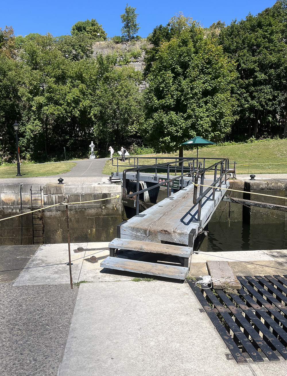
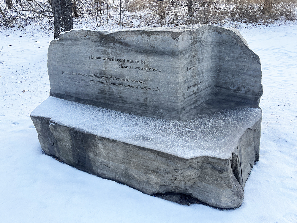
We begin our tour at Joshua’s Bench by Harley Swedler, located on the east side of Colonel By Drive, facing the Rideau Canal.
The accompanying interpretive panel reads,
‘This bench was carved from a limestone boulder quarried in this region. The artist was inspired by memory of his sister, Ina, who loved this city and often enjoyed this same view. It bears the name of her cherished so, Joshua’.
Engraved into the back rests are the followng lines,
i know we will continue to be
as close as we are now…. forever
je sais que nous continuerons d’être aussi proches
que nous le sommes aujourd’hui, et cela, pour toujours
Oscar Peterson
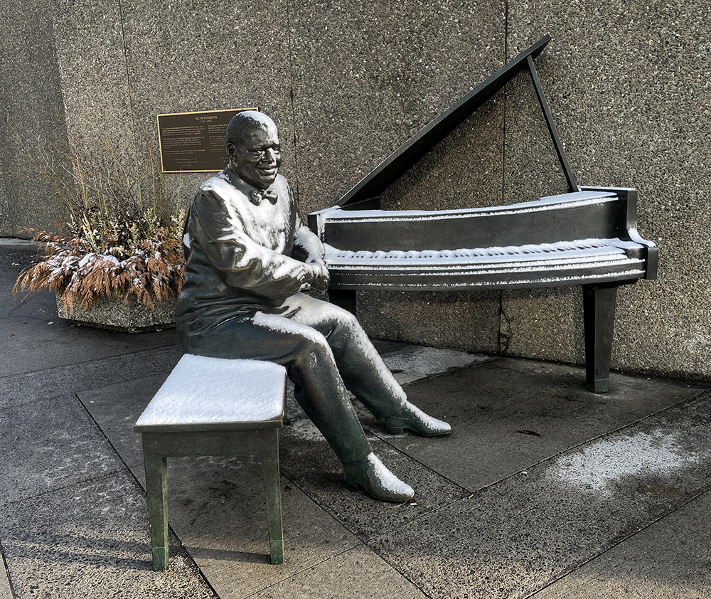
Our next stop is the sculpture of Oscar Peterson located at the south-west corner of the National Arts Centre. To get there I biked north along the path on the east side of Colonel By Drive and crossed the Corktown Footbridge. I then rode along the Rideau Canal Western Pathway and then cut through Confederation Park. One might consider walking your bike the few meters along the sidewalk from the corner of Slater and Elgin to the sculpture located at the corner of Elgin and Albert St, as there is no bike lane along Elgin.
The accompanying interpretive plaque reads,
OSCAR PETERSON
1925-2007
Oscar Peterson emerged from the Montréal working class neighbourhood known as Little Burgundy to become one of the world’s greatest piano vituosos. His place in the international jazz pantheon is universally recognized.
With this sculpture by Ruth Abernethy, Canada’s National Arts Centre proudly commemorates the masterful contribution Oscar Peterson made during his 65-year career as a musician, recording artist, composer and mentor.
There is a generous section of bench to sit beside Oscar and listen to some of his music playing from an overhead speaker.
The Secret Bench of Knowledge
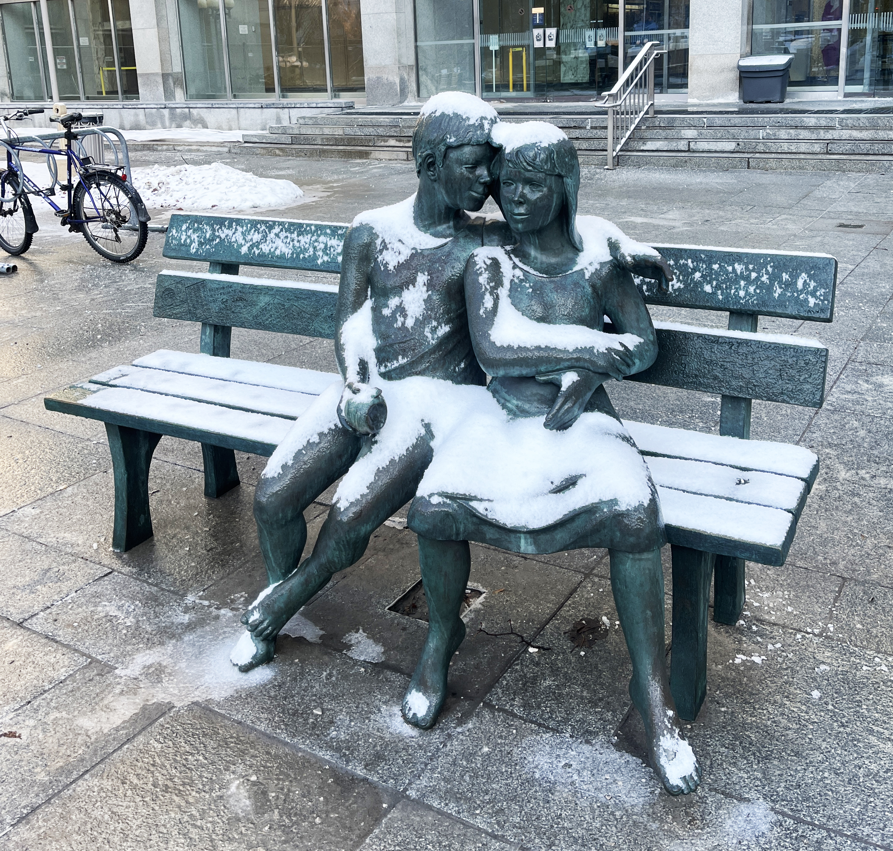
Our next sculpture is located in front of the National Library and Archives along Wellington Street. To get there I crossed Confederation Square and followed Sparks Street all the way to Bay St. I turned right on Bay and crossed Wellington which brings you right to our destination, The Secret Bench of Knowledge.
Heritage Canada’s website describes the work as follows,
This sculpture, created in 1993 by Lea Vivot, can be found in front of Library and Archives Canada, in Ottawa.
The artist came one night and put this work in front of the building. She later removed it, but not before the public had seen and liked it. A copy of the same work was later donated by businessman and philanthropist Eugene Boccia.
The sculpture is engraved with close to 100 handwritten messages about the joy and value of reading, contributed by both writers and ordinary people from across Canada.
Homeless Jesus
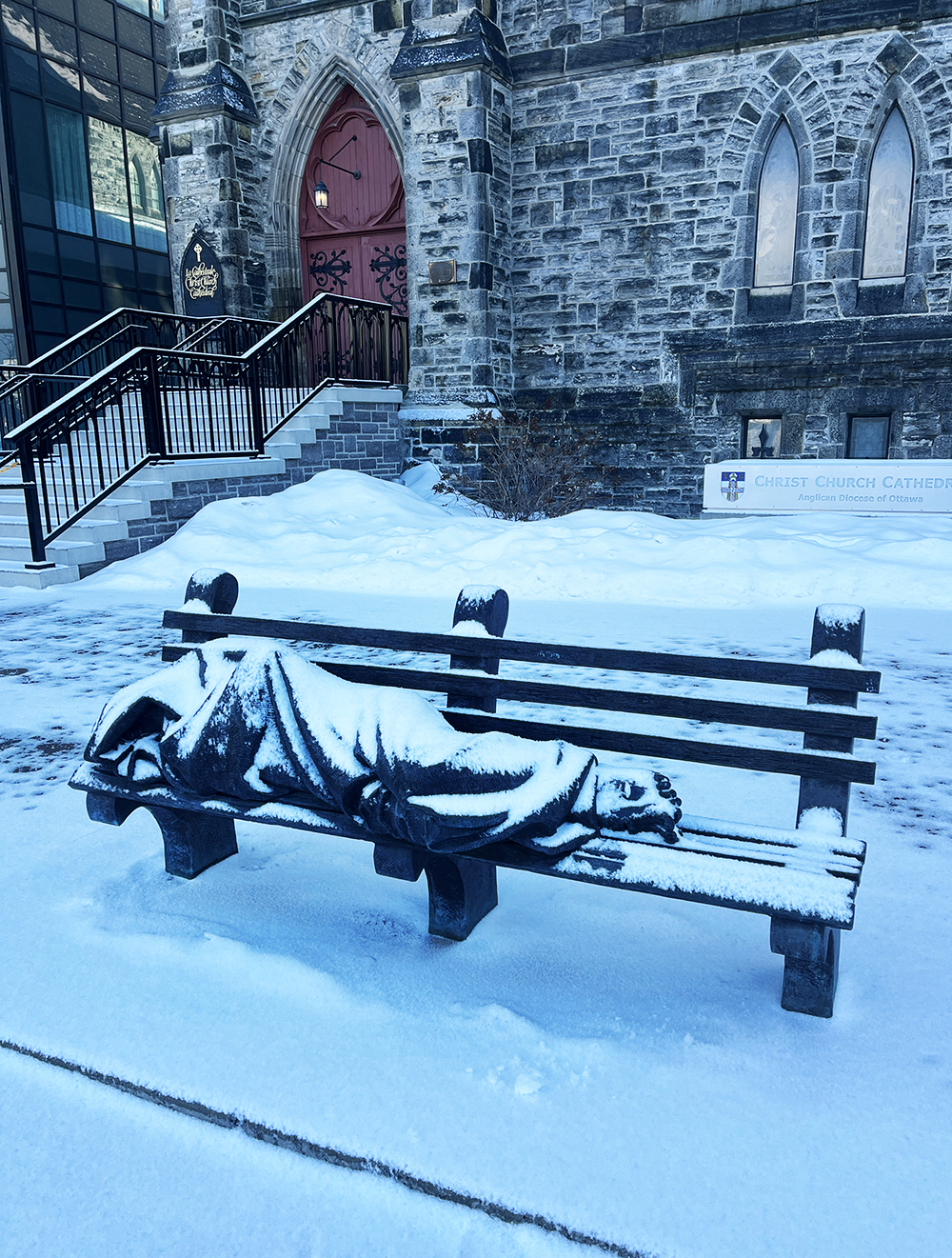
Our final stop is across the street and one block south on Sparks Street in front of Christ Church Cathedral.
Here’s how they describe this bronze sculpture on their website:
Recently, the Cathedral welcomed a new addition to the forecourt, a life-size bronze statue titled “Homeless Jesus.” In January, Cathedral Council gratefully accepted Bishop John Chapman’s offer to have the statue installed there.
The Bishop had arranged to have the statue given to the diocese by generous donors, and felt that the forecourt of the Cathedral was the very best place to install it— on the one hand to reflect the diocese’s extensive involvement in ministry with those who are homeless or at risk of homelessness, and, on the other hand, because the statue represents the voice and presence of people who are homeless or street-engaged.
The statue, created by Tim Schmalz, shows a person huddled under a blanket on a bench; only the wounds on his feet give an indication of who he is. “I saw this homeless man, and it was just a human form wrapped up in a blanket. And I thought, ‘That is Jesus.’ And I was so moved spiritually by thinking about this sensitive human being that is looking like a lump on the street,” said Schmalz. “Really, it’s a visual translation of Matthew 25, where Jesus says that whenever you see the most marginalized, broken people in our society, we should think of him.”
The installation will make Ottawa one of many cities across the world which feature the statue. There is room on the bench for passers-by take a seat and reflect quietly for a few moments, rather than quickly passing by, as we do too often with street-engaged women, men and youth. After the installation his spring, the Bishop presided at a special service of dedication, including representatives from our community ministries and participants who face homelessness.
So there you have it. Through the shared bench motif, all of these sculptures provide a clear invitation to physically engage in the works by proving room to sit within the piece.
Happy trails.