
by François Dumas
Like Brian, I have been going to Blue Skies for two years; actually I met Brian there last year when he had biked his way to the festival. I’m a bike tourer myself so this was the cue I needed to try it out this year.
I usually plan my routes the old-fashioned way, I use Google Maps. Now there is one geographical obstacle to biking to the Blue Skies festival in Clarendon and that is Mississippi Lake starting at Carleton Place. It means you either go north or south of the lake. I chose the north route while Brian took the south route to get to the festival.
Not wanting to rush the full 116 km ride in one day, I tapped into what I believe is the greatest thing about bicycle touring, the bicycle touring community. And the best tool around has got to be the web site warmshowers.org. Their web site showed me that there were two members in Lanark, north of Mississippi Lake so I let Mr. Google plot my route through that town.
I could tell by the squiggly lines on Google Map that this would involve small dirt roads around some uneven terrain. This is the Hastings Highlands after all. Here is a map of my route: https://goo.gl/maps/0Zyqq
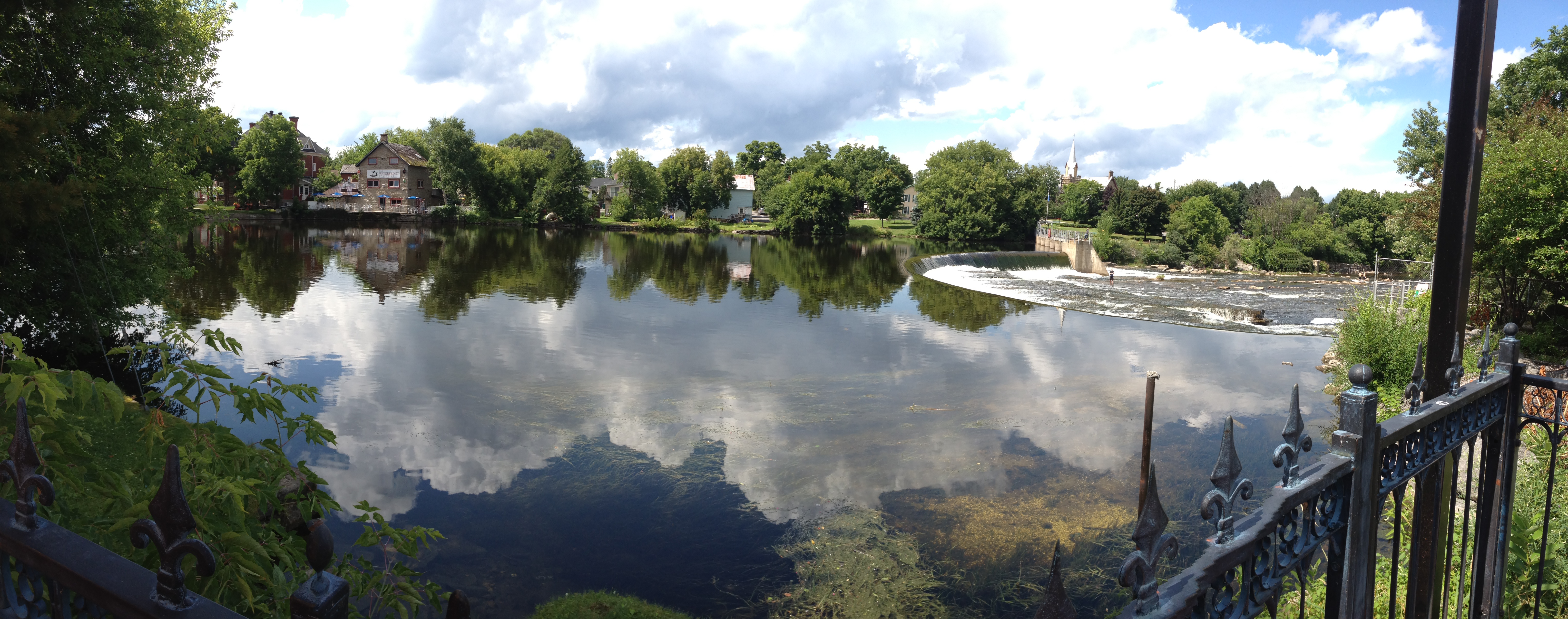
So, same Trans-Canada Trail from Ottawa to Carleton Place as Brian but I then headed north across Bridge St. which becomes a dirt road called Quarry Rd. I was now deep into Ontario backcountry on a beautiful sunny day. Concession roads 4A, Old Perth Rd, Concession road 3A led to Wolf Grove, a fast-paced paved road that had me yearning to get off asap onto the next turn. Purdy Rd. was that road and that quickly became Rosetta Rd., turning from pavement back to gravel and an equally slower pace with fewer cars. That brought me right into Lanark when I crossed the Clyde River. A good first day and a delightful evening with my hosts there.
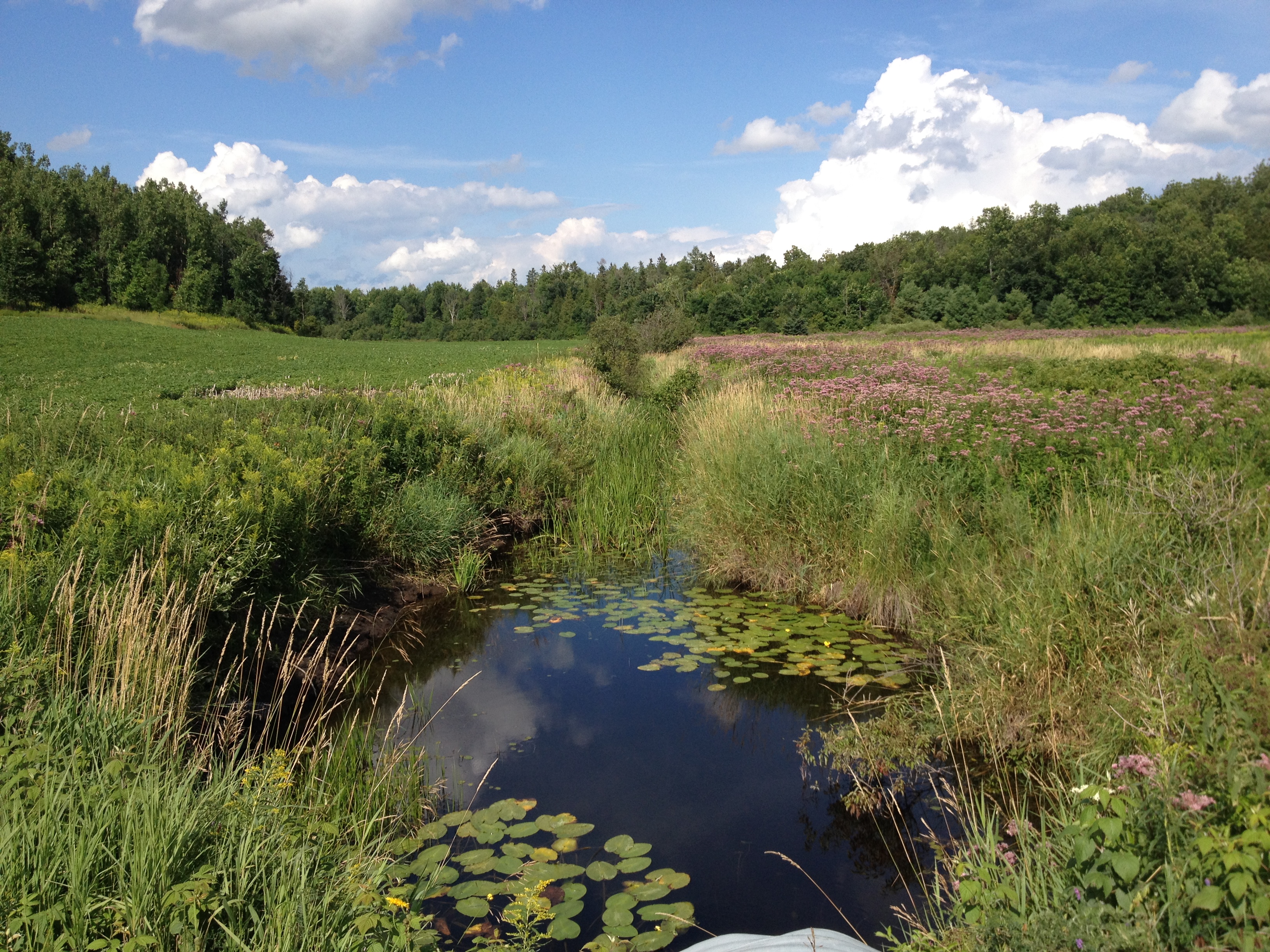
Next day’s journey was relatively simple as far as navigation was concerned; I had to follow route 12, also called Macdonald’s Corners Rd., turn on Robertsville Rd. right down to Clarendon Rd. where the festival was. Turns out I took a wrong turn (natch!) and ended up on Clarendon quicker than I anticipated. Clarendon Rd. is a country lane that turns, climbs and weaves through lush small remote farms; just a gorgeous ride. The slower pace meant I also got pursued relentlessly by deer files. It turned out to be a game of tag where the swarm caught up with me on the climb and my losing them down these inclines; a welcome relief.
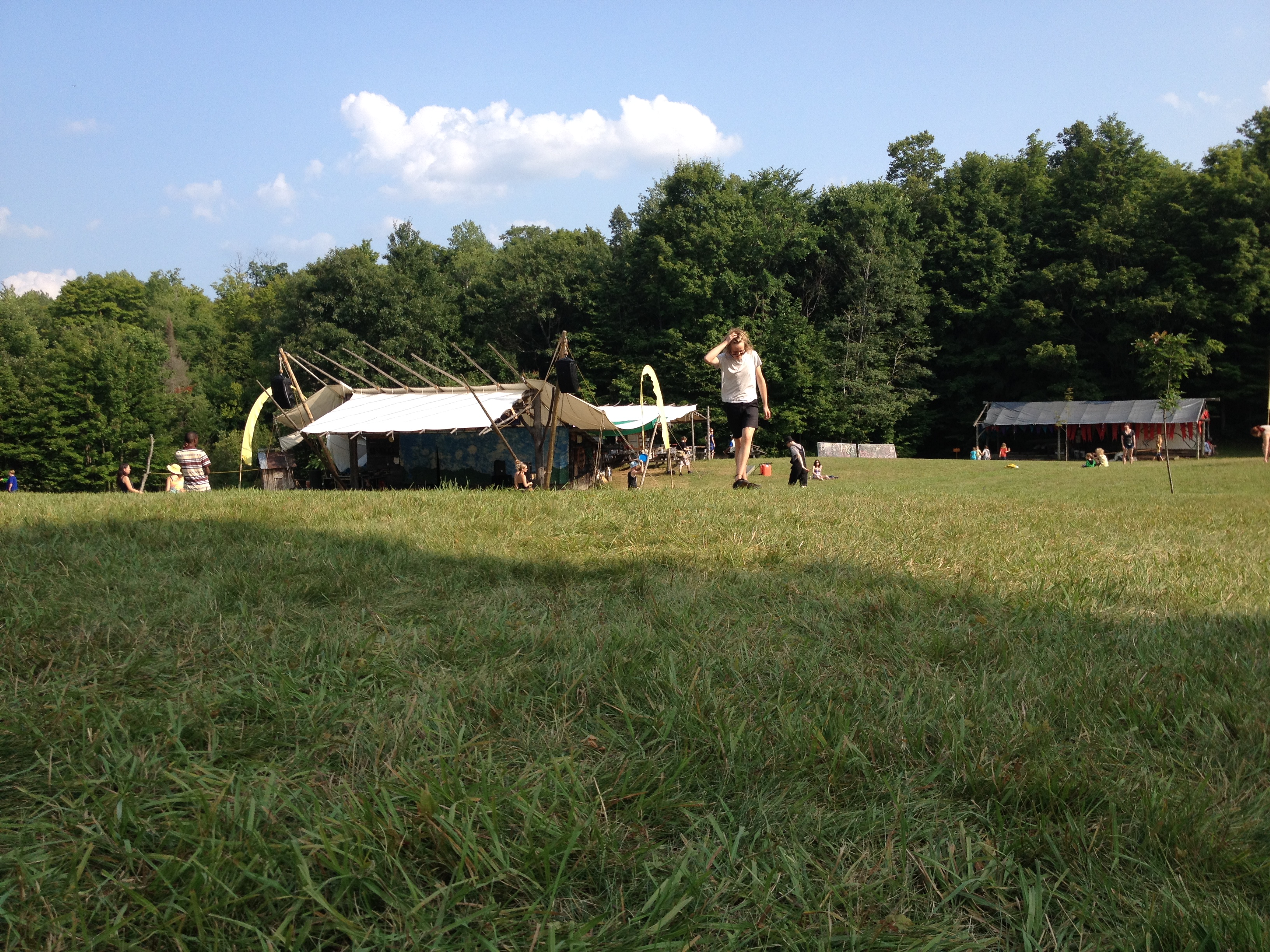
When I started seeing temporary “No Parking” signs along the gravel road, I knew Blues Skies was just around the bend.
I would do that same route again next year. I still prefer splitting the 116 km route into two days. It’s beautiful country roads and backwoods Ontario nature and it really is a hop and a jump from Ottawa. Let’s get a group together next year and make it a trip, shall we?
